Tag: Microsoft Azure

  • Trimble and Microsoft partner on industry cloud for construction

    Trimble and Microsoft partner on industry cloud for construction

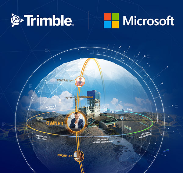
    Companies to develop an industry cloud to enable construction organizations to harness digital construction data across the project lifecycle

    Trimble and Microsoft have entered a strategic partnership to advance technology adoption and accelerate the digital transformation of the construction, agriculture and transportation industries.

    By leveraging the Microsoft cloud, Trimble and Microsoft will collaborate to develop, build and deliver industry cloud platforms and solutions that connect people, technology, tasks, data, processes and industry lifecycles. The collaboration represents a significant milestone to advance Trimble’s Connect and Scale 2025 strategy, which centers on building cloud platforms.

    Initially, Trimble and Microsoft will focus on building the Trimble Construction Cloud powered by Microsoft Azure.

    Image: Trimble
    Image: Trimble

    The construction process is fragmented, which can result in lost productivity, rework and a lack of transparency. According to a McKinsey & Company article*, the construction industry is lagging with only 1 percent productivity growth over the last 20 years — significantly lower than the 2.8 percent for the total economy.

    Digitization of products and processes is expected to drive change in the industry. The ability to link technologies, tasks, processes and multiple stakeholders — general contractors, subcontractors, designers, engineers and owners — across the construction project workflow can transform and significantly improve productivity, quality, safety, transparency and sustainability, according to Trimble.

    The partnership expands Trimble and Microsoft’s existing relationship to combine the Microsoft cloud with Trimble’s construction solutions and industry domain knowledge. Trimble’s construction solutions include on-machine and field technology, modeling and collaboration software, project and resource management, and all underlying analytics.

    The Trimble Construction Cloud, expected in 2022, will be fully enabled for 3D constructible models that will reduce risks, drive speed and increase efficiency and accuracy across the construction project lifecycle, including designing, building and operations.

    The companies will also partner on go-to-market strategies and solutions to enable continued support of infrastructure investment cycles, and be used for large-scale projects, on which multiple stakeholders work in parallel to deliver connected construction projects.


    * McKinsey & Company
    The next normal in construction: How disruption is reshaping the world’s largest ecosystem

  • New HxGN Connect enables seamless, citywide collaboration

    New HxGN Connect enables seamless, citywide collaboration

    Hexagon AB has launched HxGN Connect, a software-as-a-service (SaaS) workspace for citywide collaboration enabling government agencies and other organizations to share data and coordinate action for ad-hoc, routine and emergency situations.

    Hosted in Microsoft Azure, HxGN Connect provides a networked workspace and unified view of information within and between entities. Participants can actively collaborate and securely share data as events unfold, overcoming technical and political barriers that result in missed opportunities, conflicting actions, errors and delays.

    With HxGN Connect, organizations can move beyond basic cooperation to true collaboration, where all participants gain mutual value. HxGN Connect is easily implemented and scaled — whether between multiple departments in a single agency or multiple organizations across cities and regions.

    “The future of smart cities lies in connected data communities that enable users to work with people and information irrespective of organizational and geographical affiliations or technology limitations,” said Hexagon President and CEO Ola Rollén. “HxGN Connect reimagines collaboration, breaking down barriers and bridging gaps between vertical sectors, organizational types and operational functions, which means safer cities, more effective services and happier residents.”

    HxGN Connect brings a city’s public safety, transportation, utilities and other related organizations together seamlessly. While users can visualize people, places and activities, and send messages and assign tasks to each other, all participants retain full ownership and control of their own data (nothing is stored in a central repository).

    The HxGN Connect dashboard. (Screenshot: Hexagon AG)
    The HxGN Connect dashboard. (Screenshot: Hexagon AG)
  • HERE offers location services for Microsoft Azure customers

    HERE offers location services for Microsoft Azure customers

    HERE-Azure logo

    Microsoft Azure customers now have access to HERE Location Services within its self-hosted Azure environments. HERE is providing a new set of application programming interfaces (APIs) for developers to build location-aware applications.

    Microsoft Azure is a cloud computing service for building, testing, deploying and managing applications and services through Microsoft-managed data centers.

    According to HERE, HERE Location Services such as Routing, Geocoding and Map Tiles APIs offer developers useful tools while ensuring high performance for an application’s most critical processes.

    Software developers rely on the accuracy and scale of HERE Location Services to incorporate core location-oriented components into the enterprise-grade applications they build and manage, the company said.

    The HERE Location Services available for self-hosting in Azure Virtual Machine environments are:

    • Routing – provides access to and use of global, real-time and historical traffic information.
    • Forward Geocoder and Reverse Geocoder – provides comprehensive coverage in 196 countries and several territories with a high-precision mapping of geo-coordinates or addresses.
    • Map Tiles – shows fresh day-time map tiles in multiple styles (for example, base and aerial) including rendered live-traffic tiles for flow overlay.

    Applications for HERE Location Services include the following.

    Fleet management and emergency services

    • Create safe and efficient routing solutions for multiple vehicle types
    • Provide the most efficient routing options based on real-time traffic conditions

    Seamless mobility

    • Provide routing options for pedestrians and public transportation
    • Help cities run more smoothly with improved traffic flow and transportation network usage

    Business intelligence:

    • Understand trends and behavior of citizens in relation to their location and mobility patterns
    • Understand shifting market dynamics to inform real-estate investments
    • Verify insurance claims and authenticate transactions

    HERE Location Services are available to Azure customers who want to manage and deliver highly available location-based services. The self-hosted architecture ensures maximum availability and resiliency for Azure customers running critical business applications that rely on “always-on” location services.

    “Location anchors our connected world and HERE Location Services enable industries to solve complex challenges while delivering valuable new products and experiences,” said Mithun Dhar, General Manager, Developer Relations at HERE Technologies. “Demands on business require flexibility in software architecture, and HERE is proud to offer robust and high-quality location services to customers operating across public cloud, self-hosted or hybrid environments.”

    HERE Location Services are also available as Serverless Functions on the Azure Marketplace. For the latest Azure developer content, go to HERE | Azure Marketplace.

  • Esri, Microsoft join on location, spatial services

    Esri Inc. is working with Microsoft to integrate location services and spatial analytics to the Microsoft Azure IoT (Internet of Things) Suite.

    The collaboration will rapidly enable IoT scenarios by offering customers and partners a set of highly capable platform services as ready-to-use, preconfigured solutions. The forthcoming integrated offering is the next step in Microsoft’s and

    Esri’s long-standing alliance to spatially enable the enterprise, Esri said in a press release.

    Smart city concepts and innovations in the automotive industry are examples of how data from many sources increases understanding. Governments and businesses use that data to improve safety features, reduce air pollution, and mitigate traffic congestion.