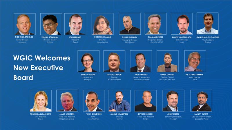
The World Geospatial Industry Council (WGIC) at its annual general meeting announced the members of its board who will serve from May 2023 to April 2025. The board is comprised of 20 senior geospatial industry professionals drawn from WGIC’s patron, corporate and associate member companies. The board will provide strategic guidance to WGIC in pursuing its mission and achieving its programmatic goals during the next two years.
WGIC Executive Board Members
Theo Agelopoulos, Senior Director (Autodesk)
Zubran Solaiman, Director (Bentley Systems)
John Renard, President (Cyient)
Bushra Zaman, Director (Deep Spatial)
Elshan Musayev, EKM Global
Dean Angelides, Corporate Director — international (Esri)
Robert Hoddenbach, Global Director (Fugro)
Jean-Francois Gauthier, Vice President (GHGSat)
Adina Gillespie, Vice President (Hexagon)
Steven Sawdon, Director (IIC Technologies)
Paul Granito, Senior Vice President (Maxar Technologies)
Harsh Govind, Principal Product Manager (Microsoft)
Jayant Sharma, Senior Director (Oracle)
Agnieszka Lukaszczyk, Vice President (Planet)
James Van Rens, Senior Vice President (RIEGL International)
Willy Govender, CEO (Terra Analytics)
Marius Swanepoel, Director (TomTom)
Bryn Fosburgh, Senior Vice President (Trimble)
Joseph Seppi, Senior Vice President (Woolpert)
Sanjay Kumar, CEO (Honorary Member) (Geospatial World)
The bi-annual election for the office of WGIC president has witnessed a unanimous vote for Bryn Fosburgh, Senior Vice President, Trimble. Brian Nicholls, Vice President — Asia Pacific, Woolpert, was elected unopposed as the treasurer. To ensure business continuity, John Renard, President, Cyient — Europe, will continue as secretary general till April 2024.
Companies to develop an industry cloud to enable construction organizations to harness digital construction data across the project lifecycle
Trimble and Microsoft have entered a strategic partnership to advance technology adoption and accelerate the digital transformation of the construction, agriculture and transportation industries.
By leveraging the Microsoft cloud, Trimble and Microsoft will collaborate to develop, build and deliver industry cloud platforms and solutions that connect people, technology, tasks, data, processes and industry lifecycles. The collaboration represents a significant milestone to advance Trimble’s Connect and Scale 2025 strategy, which centers on building cloud platforms.
Initially, Trimble and Microsoft will focus on building the Trimble Construction Cloud powered by Microsoft Azure.
Image: Trimble
The construction process is fragmented, which can result in lost productivity, rework and a lack of transparency. According to a McKinsey & Company article*, the construction industry is lagging with only 1 percent productivity growth over the last 20 years — significantly lower than the 2.8 percent for the total economy.
Digitization of products and processes is expected to drive change in the industry. The ability to link technologies, tasks, processes and multiple stakeholders — general contractors, subcontractors, designers, engineers and owners — across the construction project workflow can transform and significantly improve productivity, quality, safety, transparency and sustainability, according to Trimble.
The partnership expands Trimble and Microsoft’s existing relationship to combine the Microsoft cloud with Trimble’s construction solutions and industry domain knowledge. Trimble’s construction solutions include on-machine and field technology, modeling and collaboration software, project and resource management, and all underlying analytics.
The Trimble Construction Cloud, expected in 2022, will be fully enabled for 3D constructible models that will reduce risks, drive speed and increase efficiency and accuracy across the construction project lifecycle, including designing, building and operations.
The companies will also partner on go-to-market strategies and solutions to enable continued support of infrastructure investment cycles, and be used for large-scale projects, on which multiple stakeholders work in parallel to deliver connected construction projects.
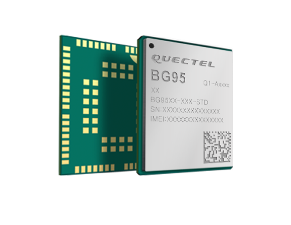
Quectel Wireless Solutions is collaborating with Microsoft and Qualcomm Technologies to integrate its new LPWA module BG95 with Microsoft’s Azure Device SDK.
The integration will provide direct and secure connections to Azure IoT Hub and provide full support for Azure device management capabilities.
Targeting global markets, the BG95 module is a cost-optimized, highly-integrated variant supporting integrated GNSS, Cat M1, Cat NB2 and EGPRS (also called EDGE). The module complies with 3GPP Release 14 and delivers improved capabilities in power consumption, data rates and hardware-based security.
The BG95 cellular module is based on the Qualcomm 9205 LTE modem, to be integrated with Microsoft’s Azure Device software development kit (SDK). As a result, customers can connect their BG95 devices to the Microsoft Azure cloud where they can build, manage and deploy internet of things (IoT) solutions at scale, significantly accelerating time to market.
By integrating RAM/flash, an ARM Cortex A7 processor supporting ThreadX, the BG95 is engineered to reduce power consumption significantly in idle mode.
By doing this, the BG95 has the potential to support decade-plus battery life, which is critical for IoT devices serving long life spans, such as asset trackers, smart meters, smart city sensors, home security and wearable trackers.
Additionally, Azure IoT is built for security. It simplifies the complexity of IoT security solutions with built-in protection at each stage of deployment (including cloud services and devices) and minimizes security weaknesses wherever they exist. Leveraging Azure IoT security features, Quectel BG95 will offer IoT devices end-to-end security capability in order to prevent potential risks.
“We’re excited for the Azure edge device ecosystem to continue to grow. Our partnership with Quectel and Qualcomm Technologies will deliver what our customers need — bringing together ultra-low power cellular modules and Azure to drive their digital transformation,” said Roanne Sones, corporate vice president at Microsoft.
“The BG95 module is the first Qualcomm 9205 platform to support IoT Plug and Play, accelerating LPWAN solution deployments like smart meters and asset trackers that connect seamlessly to our IoT Central offering,” Sones said.
“With its cutting-edge performance and power-saving capabilities, the Qualcomm 9205 LTE Modem is the gold standard for multimode IoT modules looking to offer NB-IoT, Cat-M1, GPRS, and GNSS connectivity,” said Jeffery Torrance, vice president, business development, Qualcomm Technologies, Inc. “We are proud to continue our long-standing collaboration with Quectel to jointly drive the IoT forward.”
“We are happy that the BG95-M3 has been verified on Microsoft Azure IoT Plug and Play. This validates our ability to jumpstart customers’ IoT projects with pre-tested modules and operating system combinations. Leveraging our close relationship with Microsoft and Qualcomm Technologies, we will jointly provide more integral ‘Device-Cloud’ solutions to customers,” said Doron Zhang, Chief Operation Officer, Quectel. “As one of the first wave Azure IoT PnP partners, Quectel has worked with Microsoft on LTE Mobile Broadband (MBB) modules, which have been widely adopted by top laptop OEMs. In the future, we will extend the partnership to more fields, such as Artificial Intelligence (AI) and Intelligent Edge, in order to help the Microsoft partner ecosystem connect their devices even more intelligently.”
Can artificial intelligence fly a drone? Can a drone catch thermals the way birds do?
Microsoft researchers are partnering with the Nevada Governor’s Office of Economic Development (GOED) and the Nevada Institute for Autonomous Systems (NIAS) to find out.
The artificially intelligent UAS being tested at the Nevada UAS Test Site is a 16 ½ -foot, 12 ½- pound sailplane. The sailplane relies on a battery to run onboard computational equipment and controls such as the rudder, plus radios to communicate with the ground.
It also has a motor so that a pilot can take over manual operation when necessary.
But once it’s up in the air, the UAS demonstrated its ability to operate on its own, finding and using thermals to travel without the aid of the motor or a person.
Simple and complex UAS testing was conducted at the Hawthorne Advanced Drone Multiplex (HADM) Test Range located at Hawthorne, Nevada. HADM is a 230-square mile area where a variety of UAS applications can be tested, including artificial intelligence (AI).
NIAS manages the FAA-designated Nevada UAS Test Site, which includes HADM and other UAS test ranges across Nevada.
The Microsoft operation was based at the Hawthorne Industrial Airport where preliminary tests were made. Subsequent tests were conducted at an area east of Walker Lake around six miles from the airport.
The team flew three different sailplanes that reached an altitude of approximately 1,700 feet flying almost two dozen Nevada UAS Test Site Certification of Authorization (COA) flights Aug. 7-11.
“Innovative AI technology like what Microsoft tested with NIAS is clearly where the most dramatic global UAS Industry disruptions will occur,” said Chris Walach, test site director. “When you think of artificial intelligence or AI, there are many perspectives on the value-add to the UAS industry. Very evident to me, developing and testing AI, or machine learning technology, is going to have multiple applications that will significantly benefit the UAS Industry and the American way of life. This is one of the most exciting developments I have seen over the past several years in Nevada and globally.”
“Microsoft researchers have created a system that uses artificial intelligence to keep the sailplane in the air without using a motor, by autonomously finding and catching rides on naturally occurring thermals, like how wild birds stay aloft,” said Ashish Kapoor, a principal Microsoft researcher. “Birds do this seamlessly, and all they’re doing is harnessing nature and they do it with a peanut-sized brain.”
“Nevada wholeheartedly supports the growth of the Unmanned Aerial System industry, and teaming with global technology leader Microsoft to perform these Nevada-based tests speaks to our leadership role with the global community,” said Tom Wilczek, industry specialist for the Nevada Aerospace and Defense Industry for the Governor’s Office of Economic Development. “Governor Sandoval and our Legislature expect us to engage in the growth of transformative technologies and I am grateful for the opportunity afforded by Microsoft to team and to do just that.”
Esri has awarded Microsoft Corporation with the New Technology Integration Award at the Esri Partner Conference in Palm Springs. The award honors a company in Esri’s Partner Network for taking map visualization and location analytics to the next level by integrating ArcGIS in a new or innovative way.
Microsoft was recognized for integrating Esri’s ArcGIS Maps into Microsoft Power BI, a set of business analytics tools. Power BI allows users to share insights in the form of interactive maps layered with authoritative data in one process. Users can access valuable geographic information in order to make better business decisions more efficiently without having to export data from numerous sources online, Esri said.
Power BI enables users to create dashboards, reports, and visualizations of data through a cloud-based service. This allows anyone in an organization to use Power BI’s powerful analytical capabilities anywhere, and access them via an application that can be downloaded to mobile devices. For instance, a retailer surveying a new location can use ArcGIS Maps within the Power BI mobile app from the field to determine its proximity to potential affluent consumers.
“We’re excited and humbled to receive the 2017 Esri Partner Conference New Technology Integration award,” said Kamal Hathi, general manager, Power BI, Microsoft Corp. “Thanks to the dedicated team across Esri and Microsoft, we delivered a sophisticated solution in record time. This was made possible by the open and extensible Microsoft Power BI platform which makes it easy for partners such as Esri to plug in and add value to our mutual customers. ArcGIS Maps for Power BI continues to iterate and improve based on customer feedback, reflecting the agility and customer oriented approach of both companies.”
Armed with what Esri calls The Science of Where, a transformational way to unlock data’s full potential, Power BI users can create informed location-based analyses for everything from allocating resources to the best places to start a new business.
Trimble has launched its SketchUp Viewer for Microsoft HoloLens. The new mixed-reality solution allows users to virtually inhabit and experience their designs to improve quality, communication and efficiency in the design, construction and operation of buildings. SketchUp Viewer is the first extensible commercial HoloLens application available in the Windows Store.
SketchUp a widely used 3D modeling software for architects, engineers, design and construction professionals as well as members of the global maker community.
The announcement was made at Trimble Dimensions. During the Trimble Dimensions keynote, Trimble, Microsoft and architect Greg Lynn demonstrated how the SketchUp Viewer solution could improve design and construction processes. Using HoloLens, architects were able to experience SketchUp models in mixed reality, as holograms placed in the real world — enabling them to quickly analyze various “what if” design scenarios in the context of the physical environment. The demonstration also illustrated how using Trimble solutions with HoloLens holographic technology enables remote teams to effectively review and collaborate in order to resolve constructability issues in real time.
Greg Lynn leveraged Trimble’s mixed-reality solution and Microsoft HoloLens to re-imagine the Packard Plant—a historic, abandoned automobile factory in Detroit. The architectural project was commissioned as part of the U.S. Pavilion at the 2016 Venice Biennale exhibition in Italy.
“Trimble mixed-reality technology and Microsoft HoloLens bring the design to life and bridge the gap between the digital and physical. Using this technology I can make decisions at the moment of inception, shorten the design cycle and improve communication with my clients,” said Greg Lynn.
The emergence of mixed-reality technology is enabling new workflow processes for the Architecture, Engineering, Construction and Operations (AECO) market. Trimble’s mixed-reality solution gives users the ability to understand and communicate complex spatial conditions in one comprehensive and immersive experience. The combination of SketchUp with mixed reality ushers in a new paradigm: Experiential Design Review—the ability to inhabit and experience design and construction projects in the most natural way possible.
“Empowering people to design and communicate better in 3D is part of our DNA. Across the SketchUp platform, we are dedicated to the idea that technology should get out of the way of our users,” said Chris Keating, general manager of Trimble’s SketchUp. “With SketchUp Viewer, we are taking another big step toward delivering the ultimate experience for designers and their clients—the experience of inhabiting their own work.”
Microsoft HoloLens is a self-contained, holographic computer that provides a mixed-reality experience for a range of commercial and consumer applications. HoloLens extends interaction with 3D models beyond the confines of a 2D computer screen, creating new ways for the many stakeholders of complex, multi-phase construction projects to visualize, collaborate, share ideas and manage change.
“We are thrilled to work with Trimble to deliver new innovation to SketchUp, one of the most widely used applications in the architecture, engineering, construction and operations industry,” said Lorraine Bardeen, general manager of Microsoft HoloLens and Windows Experiences. “SketchUp Viewer for Microsoft HoloLens can dramatically improve collaboration, decision making, efficiency, quality, and safety by giving users the unique ability to bring digital content into the real world, real-time as part of their current workflow.”
With SketchUp Viewer, users can view models that have been published to their HoloLens device via the newly launched AR|VR Extension for SketchUp Desktop; they can browse and download models from Trimble’s 3D Warehouse or they can pull project files down from Trimble Connect, a cloud-based collaboration platform. Users then have the option to place a model within their physical environment.
In Tabletop mode, models can be scaled as needed to best fit the available space or specific design review requirements. While the experience is intended to mimic viewing a physical scale model, it maintains the flexibility and the dynamic nature of a digital model. Users can re-scale, move and rotate the model as desired. Models can be anchored and re-anchored in the physical environment, so designers and engineers can walk around the project and examine it from any vantage point.
Users can transition seamlessly to an immersive experience. Mixed reality enables unique opportunities to overlay physical models in real world environments; and as a completely untethered device, HoloLens allows users to move freely as they inhabit their digital surrounds.
In both Tabletop and Immersive mode, SketchUp Viewer allows users to do more than just look at the model. The application provides access to the most critical pieces of information for making vital project decisions and gaining consensus among project stakeholders. The Entity Info feature gives users access to important Building Information Modeling (BIM) data embedded within project components; and with the Tape Measure functionality, users can pull up dimensional information from the model. Users can also control the visibility of various aspects of the model by toggling layers on and off.
Real-time, remote and co-located collaboration are key elements to the experiential design review process in SketchUp Viewer. With multiple HoloLens devices, a group of users can load the same model, engaging a “see what I see” collaboration mode. Remote collaborators can communicate via real-time audio and use mixed-reality visualization “sight-guides” to better understand who in the group is looking at what.
Uber has made big moves implementing location technology by signing a deal with TomTom, buying Microsoft’s mapping technology, and outright purchasing deCarta this year. The company is working with Carnegie Mellon University in Pittsburg to develop autonomous vehicle technology. In other location news, distinct technology is cropping up in the indoor location market to make widespread implementation possible.
Kevin Dennehy
Uber is becoming a big player in the location industry with its announcement this month that it will use TomTom’s maps and traffic data for its ride-hailing service. The deal’s financial terms were not disclosed.
While Uber unsuccessfully made a $3 billion bid for Nokia’s mapping business, it also acquired Microsoft’s mapping technology and the key personnel that came with it. The San Francisco-based company, currently operating in 300 cities worldwide, also acquired veteran location industry deCarta earlier this year.
The mapping data will be key in Uber’s strategy to be a major force in autonomous vehicle development. To research driverless cars, Uber has leased a 53,000-square-foot facility in Pittsburgh.
The question is, what market segment will be first for major autonomous vehicle rollout? At least one executive believes such technology companies as Uber have the advantage. “Because the continued success of [Uber’s] business depends on it, and they have the money to spend on it to gain a competitive advantage,” explained Scott Frank, Airbiquity vice president of marketing. “If ride share companies can reduce the variability and expense of physical drivers, they can reduce the cost of their services — even while improving their margins, and compete more effectively for market share versus private ride services, like taxis/limousines and public transportation, which is more limiting in terms of availability and comfort.”
Frank says his company sees the market differently than others when it comes to autonomous vehicle development and rollout. “Google has been clear since the beginning about their automotive end goal, which takes a very long-range view — produce fully autonomous vehicles connected to public infrastructure with everything connected by Android and enabled by Google computing, data management, service delivery and advertising capability,” he said.
Apple and Tesla’s ambitions are more in close and short-term, in that they want to produce electric vehicles that are better than what the traditional automakers are able to churn out, Frank said.
“Uber is a recent entry into the fray, so it’s a bit premature to put them in the ‘build a vehicle platform’ class, although it’s becoming evident that they are very interested in developing underlying technologies that autonomous cars will certainly rely on,” he said. “In the last couple of months we’ve seen public statements from large traditional automakers referencing their autonomous vehicle ambitions, so they are definitely going to step up and not simply concede the autonomous opportunity to Google — or any another automotive industry newcomers.”
Frank believes there are distinct areas in the United States where autonomous vehicle rollouts make sense. “[Companies are looking at] transportation pain points that autonomous will solve like urban traffic and lack of easy and affordable parking, public transportation infrastructure that can more easily accommodate the necessary changes to integrate and support autonomous, and metro sizes that aren’t so large that it would impossible and/or too costly to get anything done,” he said. “So cities like Portland, Minneapolis, Austin, Raleigh and [such areas as] Silicon Valley come to mind, to name just a few.”
Either way, autonomous vehicles will present huge societal and business changes and such questions as will the public trust the new technology and get them where they need to go, safely and reliably, Frank said. “As with all new technologies there will be an adoption curve at play here with early adaptors taking the lead ahead of the mainstream,” he said. “We saw the same thing with horseless carriages, by the way. People placed more trust in their horses before they began to understand and allow themselves to realize the benefits of motorized transportation.”
In other autonomous vehicle news, Ford said last week it was ramping up its driverless car efforts by being the first automaker to test its self-driving cars at Mcity, a 32-acre prototype town with private roads in Ann Arbor, Mich.
Indoor Location Market Finds Low-Cost Technology
Recent advancements in chip-based indoor location position technology are allowing developers to find a low-cost way to get the capability into multiple devices, said Bruce Krulwich, Grizzly Analytics founder.
“The most exciting aspect of recent advances in chip-based indoor location positioning technologies is that indoor positioning is being added to the next generations of chipsets already being used in today’s smartphones,” said Krulwich, who recently released a new study, Chip-Based Indoor Location Technologies, which profiles GPS, Wi-Fi and sensor processing chips. “This means that the chips that device makers already include in their designs will soon include indoor location capabilities.”
The biggest advantage of chip-based approaches is that they can integrate data from GPS, Wi-Fi and MEMS motion sensors at a very low level, using data direct from the chips, without requiring work by the CPU to enable more efficient and continuous location positioning, Krulwich said.
“While there are many approaches being taken by the chip makers, the one that I’m most excited about is the combination of motion sensing with GPS. In this approach, the same chips that process GPS signals also use data from MEMS sensors, such as accelerometers, gyroscopes and magnetometers, to track locations when GPS signals are unavailable,” he said. “Motion-sensing approaches don’t work forever, since errors in the sensors accumulate over time, but should be able to give reasonable location estimates for 10-15 minutes after a person walks inside. This should be long enough to be a very valuable source of location positioning in between GPS or Wi-Fi signals.
Krulwich said this positioning approach can work anywhere, without Wi-Fi hotspots, BLE beacons or even maps of the site. “This is the closest to ubiquitous location positioning that I’ve seen,” he said.
Krulwich believes the new chip technology will allow the first large-scale incorporation of location technologies into electronic devices, appliances, wearables, Internet of Things (IoT) and others. “A cool example is a camera that tracks an athlete’s location automatically as they run around the basketball court.”
In other location news:
A new agenda is out for Driverless, which will be March 22-23, 2016, at the Crowne Plaza Hotel, San Francisco Airport. The autonomous vehicle conference will feature more than 30 speakers and 15 exhibitors. Go to www.driverlessmarket.com for more information.
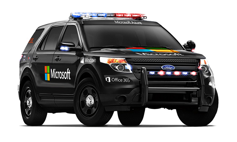
Aeryon Labs is partnering with Microsoft on its new Microsoft Advanced Patrol Platform (MAPP) vehicle. Microsoft has chosen Aeryon’s SkyRanger UAV to demonstrate aerial image and data capture for MAPP.
Aeryon Labs is a provider of small Unmanned Aerial Systems (sUAS) for military, public safety and commercial operators worldwide.
“Law enforcement organizations throughout the world rely on Aeryon sUAS to collect aerial intelligence wherever and whenever they need it,” said Dave Kroetsch, president and CEO of Aeryon Labs Inc. “Including SkyRanger within the MAPP vehicle rounds out the comprehensive suite of technologies and highlights the value of aerial intelligence for ground-based personnel.”
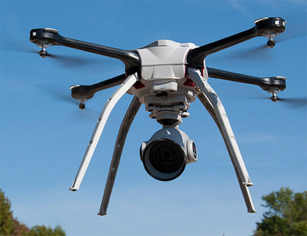
Aeryon Labs’ SkyRanger UAV provides real-time intelligence to law enforcement. (Photo: Aeryon Labs Inc.)
MAPP will connect its drivers to helpful and easy-to-navigate information, Aeryon said. Currently, patrol officers spend vast amounts of valuable time bound to their cars, clicking between windows on bulky, often dated laptops. MAPP will consolidate the many elements officers must keep track of — providing dispatch information, driving directions, suspect history, a voice activated license plate reader, a missing persons list, location-based crime bulletins and statistics, a feed of shift reports and more.
For first responders, surveillance teams and investigators, high-quality aerial imagery provides the real-time intelligence needed to assess a situation immediately, ensure safety on the ground, and capture detailed evidence and forensics. By integrating aerial images from Aeryon sUAS with other cutting-edge hardware and software solutions, the MAPP program sets a new technological standard in policing and helps officers operate with better awareness, efficiency, mobility and safety.
Aeryon Labs is showcasing the integrated solution at the IACP 2015 law enforcement and public safety conference, being held Oct. 25-27 in Chicago.
LAS VEGAS — About 30,000 attendees sweltered in Las Vegas for CTIA’s Super Mobility show this past week. Attendance was flat from last year, but the exhibit floor and meeting rooms bustled. The energy of the show focused on M2M and Internet of Things (IoT). In past years, the connected vehicle was a highlight, but not so this year. Wearable technology was scant. Those looking for the big product introductions of the past were disappointed. However, CTIA’s keynote speakers added focus and vision into the show, reminding us of the drive and vigor that built the industry.
In the past, the network operators (we once called them carriers) and device manufacturers owned the CTIA show, where they made their biggest product reveals. This year, AT&T had a flurry of announcements, including a partnership with car manufacturer Jaguar Land Rover North America. AT&T will supply connectivity to the cars for features such as Wi-Fi hotspots, connected navigation and a suite of apps. Customers will be able to share wireless data between phones, tablets and vehicles on its Mobile Share Value plan for an additional 10 dollars per month access fee. AT&T previously signed agreements with Audi, BMW, GM, Ford, Tesla, Nissan, Volvo and Subaru.
AT&T and Telogis announced a collaboration to offer solutions for companies with mobile workforces, a combination of AT&T’s network and Telogis’ telematics, compliance and navigation fleet solutions. AT&T was showing off ZTE Mobley, AT&T’s first plug-in vehicle Wi-Fi hotspot, which has just appeared in stores. Smaller announcements from AT&T included the formation of a dedicated smart city organization and a personal security app that provides live, OnStar-type professional monitoring (video and audio).
Verizon unveiled Go90, a streaming-video, social media service that works across carriers. Go90 is a free, ad-based service accessed only on a mobile phone and focused on short clips, viral videos and a social element, with crowdsourced recommendations and the ability to join groups. Go90 is targeted at Millennials, people younger than 30 years old. Although this seems like a minor announcement, obtaining the loyalty of Millennials and Generation Z (those still in their teens) is critical. With two-thirds of Millennials considering smartphones as their most important device for video, the strategy behind Go90 makes sense.
New Sprint CEO Marcelo Claure is never boring and used his time at the podium to continue trash- talking the competition. With cocky confidence, he pronounced that under his leadership, Sprint will enjoy “one of the biggest turnarounds in telecom history.” In July, Claure used Twitter to declare T-Mobile’s aggressive “uncarrrier” promotion to be “bullshit and a fake show.” He continued his rant at CTIA. “We spent the first year cutting AT&T or Verizon’s bills in half, which was fun. We’ve moved on today to offering all the DirecTV customers the choice to not be stuck with AT&T.”
One of the most pressing industry issues is spectrum. With wireless data forecast to grow ten-fold by the end of 2020, the industry is concerned that the 2016 spectrum auction will not be sufficient. Keynotes appealed for more spectrum to enable the U.S. to lead in 5G, just as it led in 4G. U.S. company-run operating systems are currently on nine out of ten smartphones, worldwide. FCC Chief Tom Wheeler was at CTIA to give assurances that the spectrum auction slated for March 2016 will be successful and occur as scheduled. He countered CTIA’s CEO Meredith Baker’s assertion that the FCC has no added plans beyond this auction for freeing up spectrum.
Freetel mobile products of Japan was one of several international companies participating in CTIA this year.
Location Players, M2M, IoT
TeleCommunication Systems (TCS), a stalwart of location-based services, beefed up its indoor location capabilities with the purchase of Loctronix. The platform, Sensorvision, aggregates and integrates location-positioning technologies, like Bluetooth, beacons and Wi-Fi, as well as content, such as mapping. Sensorvision is currently in beta testing and is aimed at wireless operators. With more stringent rules for 911, including indoor location requirements, TCS is positioned for both public safety and commercial needs. What’s next? In five years, Michael Mathews of TCS predicts, “We’ll be talking about the huge amount of information available from the road and the great impact on apps, including vehicles that are informing other cars of their actions, such as when they initiate traction control or start windshield wipers.”
u-blox, the maker of wireless and positioning modules and chips, announced a portfolio of new LTE low data rate cellular modules for IoT and M2M applications in the industrial and automotive markets. The portfolio consists of multi mode, multi carrier and of LTE only modules specific for large North American carriers. u-blox expects LTE Cat. 1 technology to become the future norm for M2M applications. And when asked about long-term success, Sven Etzold of u-box says, “The challenge for our industry is picking the right partners and being part of successful consortia. We need to partner with the right network operators and play with sensors’ companies.”
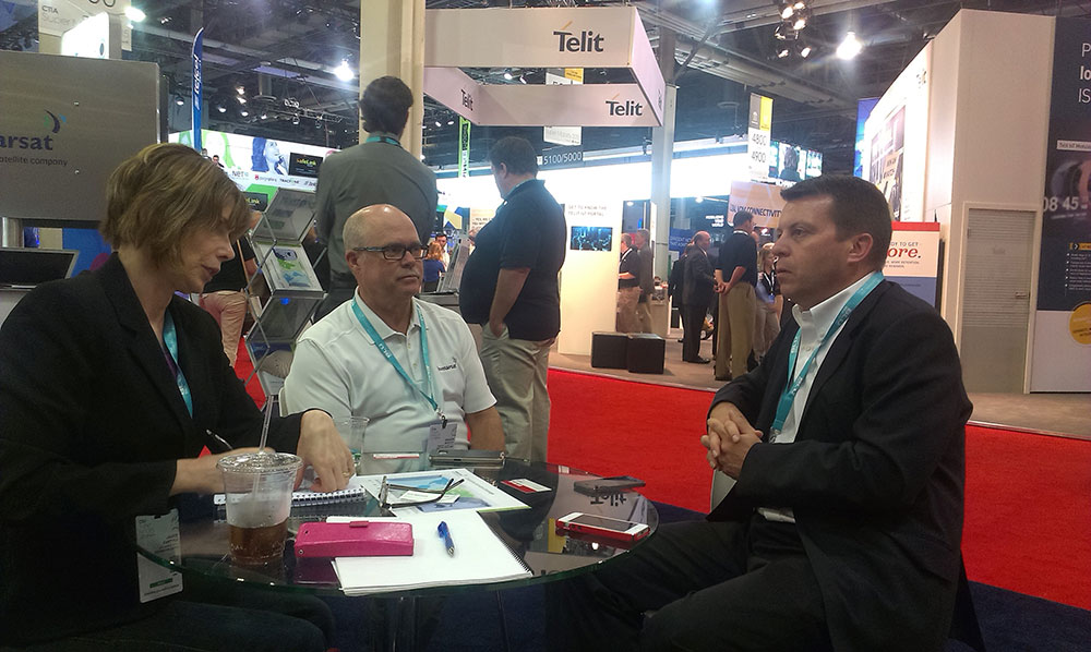
Janice visits with Chuck Moseley (center) and Don Wigglesworth (right) of Inmarsat.
Inmarsat unveiled its new machine-to-machine (M2M) and its IoT strategy, the “Internet of Everywhere.” The company is increasing use of VARs and OEMs to enable solutions that will provide more visibility and control of mobile assets throughout the world. “We are empowering existing and prospective VAR partners to offer unparalleled worldwide connectivity to their M2M and IoT customers through a single network and a single SIM,” said David Wigglesworth of Inmarsat. The company’s dedicated M2M services are IsatData Pro, a low-data-rate messaging service, and BGAN M2M, a two-way IP data service for monitoring and control of assets that require higher bandwidth capabilities.
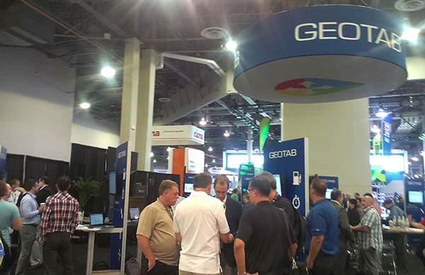
Geotab, with one of the exhibit floor’s most crowded booths, showcased the development platform of a small form-factor GPS tracking device. The Geotab GO7 device plugs directly into a vehicle’s OBDII port. Developers create applications that are available on the Geotab Marketplace. The booth was crammed with developers who offer M2M and IoT solutions.
Geotab’s booth was crowded with developers interested in the Geotab Marketplace for M2M and IoT solutions.
Microsoft’s Start-Up Alley contained interesting ventures from the Microsoft Accelerator. One young company, Parknav, offered an app for finding parking spaces based on predictive modeling, and not sensors. Users are guided to street blocks with the highest probability of available parking spaces. The app uses a number of sources, including number of parking spaces, traffic flow and undisclosed data. Parknav enables searches for free, paid and permit parking in 30 cities in Germany and a few cities in the U.S.
On a charitable note, Jimmy Whales of Wikipedia fame was at CTIA to promote his phone business, a Sprint-based MVNO cellular service. Like Wikipedia, The People’s Operator (TPO) is not a profit driven enterprise. Ten percent of a subscriber’s monthly bill goes to a charity of her choosing, and 25 percent of the company’s profits are donated to non-profits. In talking about Wikipedia, Whales cited China’s current ban of the website. Wikipedia has recently made changes to its website that make it impossible for censors to ban specific Wikipedia pages, although the entire site can be blocked, as it currently is in China.
I have parting advice for the organizers of CTIA. This year’s show was disrupted by competing events that included the iPhone 6 announcement in Cupertino. Shame on Apple, who is a member of the CTIA board. Also, CTIA had organized a virtual co-conferencing with Internationale Funkausstellung Berlin (IFA), one of the largest trade shows for consumer electronics and home appliances. The IFA event was held in Berlin the prior week and stole attention from CTIA. It isn’t all about location. Timing matters.
Microsoft will no longer collect its own map data, according to the website re/code. As part of the change, Microsoft is selling some of its assets to rideshare company Uber, including a data center, cameras, intellectual property and roughly 100 engineers. Uber is also buying a data center near Boulder, Colo.
Microsoft plans to continue to offer Bing Maps using data licensed from partners.
Microsoft already gets much of its map data from Nokia and other partners, but had been collecting its own aerial, 3D and street-level maps. It will now source those images from partners, focusing its Bing Maps work on the user experience that overlays the map data and imagery.
Industry watchers suggest the cameras might soon end up on the roofs of Uber vehicles. Uber already has hundreds of thousands of cars being tracked around the world every day.
It’s been two years since I wrote a column entitled Mobile Device Operating system wars: Android vs. iOS vs. Windows Mobile. After traveling and attending countless conferences and listening to a large number of mobile device users in the geospatial user community, I think it’s time to touch on this subject again, and what a crazy and confusing landscape it is. First of all, let’s frame the discussion in terms of the geospatial users, because that’s the soup we swim in.
At the end of the day, we are driven by the geospatial software we use, so this limits the type of mobile device we can select from. For example, Esri’s ArcPad runs on Windows Mobile and Windows desktop. If that’s the software you want to use, then you can’t use an Android device, an iPad, or a Windows Phone device. In another example, AutoCAD 360 for mobile, which I used a few weeks ago in the field, runs only on Android and iOS devices, not on Windows Mobile devices.
Chart Source: The Wall Street Journal, Gartner
While it appears Android is the dominant mobile operating system of the future, it depends on who you talk to. Right or wrong, some (maybe a lot of) enterprise organizations are scared of Android. They are scared because of one word: security, or more specifically, the perception of the lack of security. Android is open source, and it scares the heck out of enterprise IT (information technology) departments. It scares some to the point that they are shutting down projects that are proposing to deploy Android devices in the field. Is the fear justified? It’s probably more hyped up than it deserves, but IT folks are pretty conservative these days.
Where does that leave the enterprise organizations? iOS or Windows?
Some organizations are going with iOS, but the number of enterprise geospatial apps for iOS is very limited, and most of those that exist aren’t very powerful. They can’t even deal with datum transformations. That means the hardcore iOS enterprise users are left developing their own software, which some are doing. The other limitation of iOS is the hardware device selection. Since Apple doesn’t license iOS to anyone, you have the iPad and the iPhone and that’s about it. Not much selection.
That leaves us where we started…Microsoft Windows.
Dell Venue Tablet
My gut tells me that Windows is making a comeback among geospatial users, even though Windows operating system market share is minuscule compared to Android and iOS on mobile devices. Part of the reason is a plethora of high-quality, Windows-based tablets and pads. Recently, I’ve had the chance to handle some Windows-based tablets such as Dell Venue tablet and Panasonic ToughPad. They are nice tablets for field use. Thank Apple for driving manufacturers to produce good quality tablets at a reasonable price. The other part of the reason, and the major driver, is security. IT departments simply trust the security features that Microsoft provides more than iOS and Android. In the age of security breaches such as the recent Heartbleedbug, the emphasis on computer security is at an all-time high.
Panasonic ToughPad
Security may be the catalyst that pushes Windows back into the forefront of operating systems for the enterprise geospatial user. That’s good news for geospatial software developers. Pressure has been mounting for geospatial software manufacturers to introduce Android- and iOS-compatible versions of their software. Now, with the security issue at the forefront and the availability of high-quality Windows-based tablets at reasonable prices, developers may have some breathing space.
But wait: Which version of Windows?
Windows Mobile? Windows Phone? Windows Embedded Handheld? Windows Desktop? Windows RT?
They aren’t all the same, and they all don’t run the same software. For example, software built for Windows Mobile won’t run on Windows Phone or Windows Desktop.
Microsoft’s mobile operating system strategy has been confusing at best. In past years, it’s been clear that mobile devices run Windows Mobile. It’s not so clear any longer. Microsoft discontinued mainstream support for Windows Mobile 6.1 and 6.5 in January 2013. It’s not as bad as it sounds because in the three years I’ve owned a Win Mobile 6.5 Pro device, an update was never issued. But what it does say is that Microsoft is done with it. No new devices will be designed with Windows Mobile 6.5. However, that’s not to say that Windows Mobile devices are going away. Microsoft just renamed it to Windows Embedded Handheld 6.5, which Microsoft says it will provide extended support for until January 2020. So, all is well, just a different name.
Microsoft’s mobile strategy has turned off manufacturers, and it shows. Given that Microsoft has stopped supporting new devices running Windows Mobile since January 2013, how many devices have you seen introduced since then that support Windows Embedded Handheld? The answer is, not that many, and the ones that do support it are handhelds selling at a premium price, upwards of $1,500 or more. That’s tough to justify when you can buy a tablet or pad for equal or less. And…..the tablets and pads are running full Windows, not the mobile, handheld or phone version so they’re able to run a greater number of off-the-shelf software programs.
Given the above, I feel the tide is turning, at least for the geospatial user community. Windows is going to make a comeback and be the go-to operating system for mobile devices, at least for tablet and pad devices. Don’t misunderstand me though: Android and iOS will still dominate the market share numbers by far, but that’s the consumer user community, not the enterprise geospatial user community. Windows Mobile devices will still have a niche place in the geospatial user community, but I have to wonder if software makers will continue to support that environment if the sales aren’t significant enough.
Sidebar: For those of you who feel I’ve errantly left out the discussion about ruggedized devices vs. non-ruggedized or semi-rugged consumer devices, I’ll say this. Whenever I’ve encountered an enterprise that has deployed consumer mobile devices in an industrial environment (such as iPad), it invariably answers the question about device reliability with “We’ve had very few problems.” The reality seems to be that enterprise users are taking special care of these devices in the field. Program managers are saying, “Even if each person breaks one per year, it’s still half the price of industrial devices.” The reality is that small percentages are failing.
However, one can’t ignore the outdoor usability issue. The displays on some consumer devices don’t handle sunlight very well, and if the display isn’t sunlight readable, the device is severely limited in the field. The same can be said for wide temperature ranges. Both extreme heat and extreme cold can torture a mobile device that isn’t built to withstand that environment. Test before you deploy. Heat it up in your oven, cool it down in your freezer, and see how it behaves.
There’s certainly a niche market for ruggedized mobile devices, but the significant price difference between those devices and consumer devices are making enterprise organizations think twice about where to spend their money. Lastly, many consumer devices are trending towards semi-rugged as manufacturers are discovering this is one way to differentiate them from the ultra-price-competitive mobile device market.
In the wake of Microsoft’s recent purchase of Nokia’s mobile phone business, the Nokia unit formerly known as Navteq, and now know as HERE, has opportunities, but also a hard-to-guess future. At least one industry analyst believes that Navteq/HERE was not included in the Microsoft deal because it was too expensive.
“While much ado has been made of the Nokia/Microsoft deal in the press, I was interested in why Mr. Softy did not acquire Navteq/HERE with the other assets of interest. There are several possibilities to explain this omission,” said Mike Dobson, TeleMapics president. “First, it could be the case that Nokia did not want to sell Navteq/HERE. Second, it is possible that Microsoft had no interest in acquiring its current map database supplier. Third, maybe the price for Navteq/HERE was too high. My vote is for number three.”
Dobson said that Nokia clearly would like to sell HERE, as it does not fit with the company’s profile, growth strategies, or competencies, on a going-forward basis. “Just as Navteq was not a good fit for Nokia in 2007, it is now a less comfortable fit for the reconstituted company, which is being focused on network infrastructure services,” he said. “Conversely, I suspect Microsoft was ambivalent about a deal that included [Navteq/HERE].” Under the proposed Nokia/Microsoft deal, Nokia’s mapping assets are to be licensed for a four-year term by Microsoft, which gives them time to firm up their future strategy for spatial data. Note that the price of the license for the mapping products was not part of the $7.1 billion transaction, Dobson said.
“Why was Mr. Softy gun shy? First, I suspect that Microsoft concluded that owning a mapping company was not core to any of Microsoft’s current initiatives, including its bumbling approach to location and connected car services,” Dobson said. “Next, Microsoft has enough problems competing with companies in its distribution chain, without adding another business that would serve to complicate its relationship with manufacturers and resellers. Of course, all of these objections could have been overcome if the price was right, it wasn’t, but that does not mean it won’t be in the future.”
Where Does Navteq Go from HERE?
Dobson says Navteq, Nokia and HERE are in a world of pain. “While the ‘new’ Nokia will have the ability to fund all of the development to enhance the Navteq database that it has deferred over the past five years, I think it is unlikely to do so. Nokia does not appear to understand the fundamentals of the location market, the automotive navigation market, or the connected car market,” Dobson said. “Perhaps most importantly, they have lagged Google in evolving their map compilation process into a modern, synergistic, information sourcing engine. The Navteq approach to crowdsourcing hinders their potential speed to market with updated map information and has allowed Google to reach parity with Navteq in some areas, while exceeding it in quality in other markets.”
The future battleground in the location markets will devolve into a scarp for ownership of the last mile, Dobson said. “The type of thinking that believes that the ‘last mile’ is all about road geometry, simply does not understand the problem. People want to know that the map will support their journey to a destination, but they are focused on the destination and the various opportunities that it presents,” he said. “For example, the mobile phone has promoted an egocentric view of the world focused on ‘what’s around me?’ Providing the spatial detail of the total environment that surrounds the user is key to winning the last mile battle and I do not see Nokia having the assets to participate in this market.”
Nokia announced that HERE, at the recent Frankfurt Motor Show, partnered with Mercedes Benz, Continental Corporation and Magneti Marelli to offer connected products and services beyond navigation. Nokia believes that connecting the car to the cloud is one of the biggest opportunities for the automotive industry.
“Whether the concept of the connected car offers Nokia a lifeline is unclear. Connectivity may suck the spatial data out of the car and into phone based systems,” Dobson said. “Others would argue that smart cars will require a detailed, highly accurate database of spatial information to manage the safety systems in the automobile of the future. I’m not wise enough to predict the future, but I think the Nokia is going to have a rocky road with Navteq/HERE.”
Dobson said that it is interesting that Microsoft has loaned Nokia 1.5 billion Euros in three tranches of convertible bonds. “The bonds will be redeemed and netted against the deal proceeds, although the loan is not conditional on the deal closing, nor is Nokia obligated to exercise its option,” he said. “However, it would appear that Mr. Softy and Nokia are not quite through with each other: if Nokia exercises these options, Microsoft will become a shareholder in Nokia.”