Tag: MIL-STD

  • Oscilloquartz series provides timing for mission-critical harsh environments

    Oscilloquartz series provides timing for mission-critical harsh environments

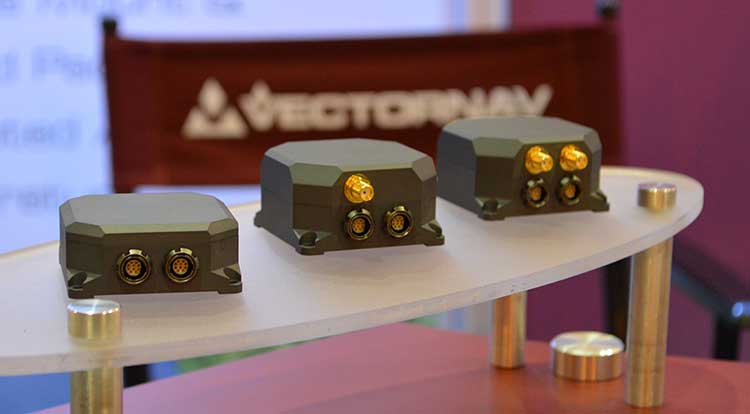
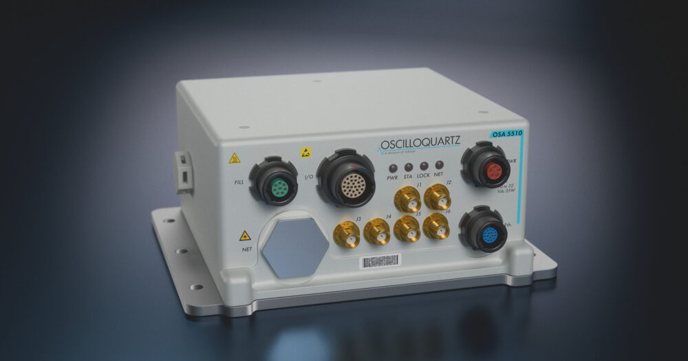
    Oscilloquartz has launched its ruggedSync Series OSA 5510, a ruggedized timing and synchronization platform engineered for defense and other harsh, mission-critical environments.

    The OSA 5510 is designed for deployment in tactical communications networks, mobile command centers, aviation systems and other highly demanding operational environments. It combines PTP grandmaster and NTP server functionality with synchronization assurance and resilient holdover in a compact military (MIL)-qualified platform.

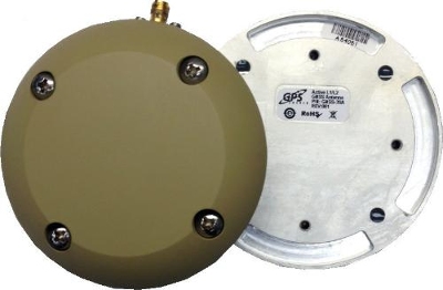
    Multi-band GNSS support, encrypted and authenticated timing options, and environmental protection enable operation in contested and GNSS-denied environments where trusted synchronization must be maintained.

    Built to support resilient defense timing architectures, the OSA 5510 integrates advanced synchronization technologies and flexible mission-critical interfaces within a hardened platform compliant with MIL-STD-810H and MIL-STD-461G. The solution supports IEEE 1588v2 PTP, SyncE and secure NTP services, while programmable I/O and timecode interfaces, including STANAG, Have Quick, IRIG and PPS/CLK distribution, support diverse defense payloads and operational requirements. Optical and copper SFP/SFP+ 1G/10G interfaces and dual power feeds further enable deployment across modern high-bandwidth defense networks.

    The ruggedSync Series OSA 5510 strengthens multi-source resilience through zero-trust architecture, with support for M-code, Galileo PRS and Iridium STL. Extended holdover, low phase-noise outputs, and jamming and spoofing detection and mitigation help maintain continuity during GNSS degradation or disruption, while White Rabbit readiness supports advanced timing distribution use cases.

    The launch also builds on Oscilloquartz’s expanding global aerospace, defense and government partnerships, including regional representative and VAR relationships supporting resilient timing and assured PNT deployments across the Americas, EMEA and Asia-Pacific.

  • Mil-spec GPS/GNSS antennas released by Pasternack

    Mil-spec GPS/GNSS antennas released by Pasternack

    Image: Pasternack
    Image: Pasternack

    Pasternack has released a series of GNSS antennas that meet military specifications for use in several small form factor and mobile applications.

    The mil-spec GNSS antennas are engineered for environmental performance according to the MIL-STD-810G standard and include multi-standard GPS L1, Galileo E1 and GLONASS options.

    The MIL-STD-810G GNSS antennas are IP67 rated. They are available in passive and active versions and provide coverage from 1,597 MHz to 1,607 MHz. The GNSS antennas feature linear polarization for cross-polarized isolation, nominal gain options of -3 dBic and 10 dBic, and SMA mounts.

    Pasternack’s mil-spec GNSS antennas are available now.

  • VectorNav tactical series earns MIL-STD and DO-160 certifications

    VectorNav tactical series earns MIL-STD and DO-160 certifications

    VectorNav Technologies’ tactical series line of inertial measurement units (IMUs) and GNSS-aided inertial navigation systems (GNSS/INS) have completed independent testing for MIL-STD-810G, DO-160G, MIL-STD-1275E and MIL-STD-461.

    Completion of the MIL-STD and DO-160 qualification tests proves the robustness of the tactical series to a range of temperature, shock, vibration and other environments, as well as conformance to numerous electrical interface and EMI standards.

    The testing demonstrates an advantage of the tactical series for defense and aerospace applications. Other advantages are the modules’ SWAP-C (size, weight, power and cost) and performance characteristics.

    “There is high demand for dependable, tactical-grade navigation solutions that perform in challenging environmental and operating conditions,” stated VectorNav Director of Sales and Marketing Jakub Maslikowski.

    VectorNav’s tactical series includes the VN-110 IMU/AHRS, the VN-210 GNSS/INS and the VN-310 GNSS-compass aided GNSS/INS.

    VectorNav's new Tactical Series includes the VN-110 IMU/AHRS, the VN-210 GPS/INS and the VN-310 dual-antenna GPS/INS. (Photo: GPS World)
    VectorNav’s new Tactical Series includes the VN-110 IMU/AHRS, the VN-210 GPS/INS and the VN-310 dual-antenna GPS/INS. (Photo: GPS World)

    The products include an onboard tactical-grade IMU (<1˚/hr in-run gyro bias stability), along with VectorNav’s proprietary filtering, INS and GNSS-compass algorithms.

    The products offer 1 to 2 mrad attitude performance in compact, rugged enclosures and include a 10-pin auxiliary port for integration with external real-time kinematic and SAASM-based GNSS receivers, as well as higher-performance IMUs.

    Testing for the MIL-STD and DO-160 standards was performed by independent, certified testing companies in Plano, Texas, and Huntsville, Alabama.

  • Handheld’s Nautiz X8 Field Computer Gets Add-ons

    Handheld’s Nautiz X8 Field Computer Gets Add-ons

    Photo: Handheld Group

    Handheld Group is offering expansion pack features for its Nautiz X8 rugged field computer. The new functionalities will make the Nautiz X8 more versatile for field workers in a number of market segments, including forestry, surveying, construction, field services, warehouse projects and logistics.

    The Nautiz X8 was built to enable efficient and reliable data collection in the toughest of environments. Ultra-rugged with superior processing power, screen size and sunlight visibility, the X8 is used in the GIS, land surveying, public safety, forestry and military sectors.

    Handheld now offers three expansion packs for the Nautiz X8:

    • Nautiz X8 Long Range Bluetooth (LRBT) Expansion Pack features a LRBT u-blox module, which allows long-range communication up to 300 meters. This option is especially well-suited for advanced forestry solutions, surveying and construction work.
    • Nautiz X8 Barcode Expansion Pack features an imager module (Zebra SE4750SR) with an LED aimer, which allows for competitive scanning performance without sacrificing design, ruggedness or user experience. This option is ideal for workers in field service, warehouse projects and logistics.
    • Nautiz X8 Basic Expansion Pack is an empty add-on cap for an extension of your choice. It increases the Nautiz X8’s customizability and flexibility for specific customer requirements. It also allows users to install custom accessories under the cap using the proprietary interface.

    The new Nautiz X8 expansion packs will be available in September. All cap versions are designed to retain the Nautiz X8 IP67 classification.

    “The Nautiz X8 is the world’s best rugged handheld computer, with an outstanding screen and exceptional durability, connectivity, processing power and battery life — without compromising ergonomics or design,” said Jerker Hellström, CEO of Handheld Group. “These new expansions will make it even more versatile, customizable and attractive for field users in a number of industry segments. We take pride in always working with our partners and customers to understand their specific needs and create solutions they actually want and will benefit from.”

    The Nautiz X8 has an IP67 ingress protection rating and is protected against dust, sand and water immersion. It also meets MIL-STD-810G military test standards for overall durability and resistance to humidity, shock, vibrations, drops, salt and extreme temperatures.

  • DT Research Rolls out Mapping and GIS Tablets

    The DT391GS tablet.
    The DT391GS tablet.

    DT Research Inc. has launched a new line of rugged tablets with the GNSS modules for surveying and mapping applications. The DT391GS, DT395GS and DT307GS rugged tablets feature integrated high-accuracy GNSS receiver modules with built-in antenna for seamless data capture, the company said.

    Built to travel and provide reliable operations in the real world, the tablets are designed for field work in mapping, geographic information systems (GIS), and accurate synchronization, tracking and networking.

    The DT391GS combines a 9-inch sunlight-readable, capacitive touch display with an energy-efficient Intel dual-core processor in a compact, durable package. With the high-accuracy GNSS module options (Hemisphere or Trimble), the foldable antenna, and Windows or Android operating system. The DT391GS also offers protection in demanding environments with IP65 and MIL-STD-810G ratings for dust and water, and shock and vibration resistance.

    The DT395GS tablet.
    The DT395GS tablet.

    The DT395GS offers a 9-inch sunlight-readable capacitive touch screen, an energy efficient Intel dual-core processor, and a choice of Windows or Android operating systems. The GNSS positioning module has u-blox GNSS module. The IP65 rating, and military-standard MILSTD-810G and MIL-STD-461F ratings, as well as wide temperature range, make the DT395GS reliable even in harsh, mission-critical environments.

    The DT307GS GNSS tablet features a brilliant 7-inch capacitive touch screen and a quad-core, energy efficient processor with a built-in, high-accuracy u-blox GNSS module. The size and weight of the DT307GS make this tablet portable for long-term handling in the field, DT Research said.

    The DT307GS tablet
    The DT307GS tablet

    All of the DT Research Rugged GS Tablets offer hot-swappable batteries for continuous operation, enabling real-time project efficiency between staff in the field and in the office. With wireless support for Bluetooth, 802.11, WCDMA and HSPA+ connectivity and optional GSM networking, the tablets keep staff connected from any location.

    The DT391GS and DT395GS have Trusted Processing Module (TPM) encryption for security support, and a choice of Microsoft Windows Embedded Standard 7 or 7 Professional, or Android operating system making these tablets flexible to integrate with existing applications.

    An optional 5-megapixel camera offers another data capture tool to record visual information, and an optional 3G cellular data module provides data connectivity for navigation and real-time data transfer, DT Research said.

    The DT391GS, DT395GS, and DT307GS are available now, form more information, contact DT Research at [email protected].

  • DT Research Rolls out High-Accuracy GNSS Tablets

    DT Research Rolls out High-Accuracy GNSS Tablets

    The DT391GS tablet.
    The DT391GS tablet.

    DT Research Inc. has launched a new line of rugged tablets with the GNSS modules for surveying and mapping applications. The DT391GS, DT395GS and DT307GS rugged tablets feature integrated high-accuracy GNSS receiver modules with built-in antenna for seamless data capture, the company said.

    Built to travel and provide reliable operations in the real world, the tablets are designed for field work in mapping, geographic information systems (GIS), and accurate synchronization, tracking and networking.

    The DT391GS combines a 9-inch sunlight-readable, capacitive touch display with an energy-efficient Intel dual-core processor in a compact, durable package. With the high-accuracy GNSS module options (Hemisphere or Trimble), the foldable antenna, and Windows or Android operating system. The DT391GS also offers protection in demanding environments with IP65 and MIL-STD-810G ratings for dust and water, and shock and vibration resistance.

    The DT395GS tablet.
    The DT395GS tablet.

    The DT395GS offers a 9-inch sunlight-readable capacitive touch screen, an energy efficient Intel dual-core processor, and a choice of Windows or Android operating systems. The GNSS positioning module has u-blox GNSS module. The IP65 rating, and military-standard MILSTD-810G and MIL-STD-461F ratings, as well as wide temperature range, make the DT395GS reliable even in harsh, mission-critical environments.

    The DT307GS GNSS tablet features a brilliant 7-inch capacitive touch screen and a quad-core, energy efficient processor with a built-in, high-accuracy u-blox GNSS module. The size and weight of the DT307GS make this tablet portable for long-term handling in the field, DT Research said.

    The DT307GS tablet
    The DT307GS tablet

    All of the DT Research Rugged GS Tablets offer hot-swappable batteries for continuous operation, enabling real-time project efficiency between staff in the field and in the office. With wireless support for Bluetooth, 802.11, WCDMA and HSPA+ connectivity and optional GSM networking, the tablets keep staff connected from any location.

    The DT391GS and DT395GS have Trusted Processing Module (TPM) encryption for security support, and a choice of Microsoft Windows Embedded Standard 7 or 7 Professional, or Android operating system making these tablets flexible to integrate with existing applications.

    An optional 5-megapixel camera offers another data capture tool to record visual information, and an optional 3G cellular data module provides data connectivity for navigation and real-time data transfer, DT Research said.

    The DT391GS, DT395GS, and DT307GS are available now, form more information, contact DT Research at [email protected].

  • GPS Source Offers Antenna for Harsh Environments

    GPS Source Offers Antenna for Harsh Environments

    GPS-Source-MIL-STD-antenna

    GPS Source has released a new GNSS antenna that is robust, lightweight, and suitable for harsh environments. It is designed for long-term, high-precision applications worldwide, the company said.

    The antenna was engineered for the demanding aviation environment, in both commercial and military applications. Built to military standards (MIL-STD), it is impact resistant, tolerant of exposure to dust, chemicals and jet fuels, and has the ability to withstand shock and vibration.

    Signal reception is unaffected by antenna placement. Designed to operate in the most extreme and demanding applications, it gives outstanding results, enabling maximum satellite reception, with ultra-low Dilution of Precision (DOP), GPS Source said.

    “We are very excited about the new GNSS antenna,” said Robert Horton, CEO of GPS Source. “Our advanced technology provides superior performance in both GPS L1/L2 and GLONASS L1/L2. This is the best solution for technically demanding users.”

    The antenna is available in multiple colors and with multiple connector options.


  • Automated Pile Driver from Orteco Uses Altus APS-U for Machine Control

    Automated Pile Driver from Orteco Uses Altus APS-U for Machine Control

    Orteco is an Italian manufacturer of pile-driving equipment.
    Orteco is an Italian manufacturer of pile-driving equipment.

    Orteco, a specialized manufacturer of pile driving machines based in northern Italy, has introduced a series of robotic pile drivers using APS-U GNSS RTK receivers from Altus Positioning Systems. The products are being supplied to Orteco by Altus’ parent company, Septentrio NV.

    The driverless tracked crawler maneuvers automatically under control of the APS-U, which provides centimeter-level position coordinates and heading information within 0.3 degrees, following a project map loaded into the machine’s computer. It automatically drives itself to each location, positions the mast and drives the post in a perfectly vertical position, stopping the installation at exactly the desired height, then moves automatically to the next spot.

    The Altus APS-U-HDG is a high-precision 272-channel GPS/GLONASS/SBAS receiver with dual antennas designed to provide highly accurate heading and position for machine control applications. Cased in a rugged MIL-STD-810C aluminum housing, the instrument is built to the most rigorous standards for waterproofing, humidity, dust, shock, vibration and extreme temperatures.

    The Altus APS-U-HDG.
    The Altus APS-U-HDG.

    Orteco is building the GNSS-controlled pile driver in various configurations for applications such as photovoltaic farms, fences, roadside barriers and agriculture. It makes pile driving jobs faster, safer and more accurate with fewer workers, increasing productivity and reducing costs, Altus said.

    “The Orteco machines provide a perfect demonstration of the ruggedness, power and performance of the APS-U as a highly accurate heading and positioning sensor in one of the most demanding environments imaginable,” said Altus CEO Neil Vancans. “In extensive tests conducted by Orteco, the APS-U receivers proved themselves up to the task, performing reliably under the constant heavy pounding and vibration of the pile driver.”

    Based in Bologna, Orteco is a specialized manufacturer focused on pile driving with a 40-year history. In 2011, the company reached a milestone of 1,000 pile drivers produced and distributed all over the world. The company’s GNSS-controlled agricultural pile driver, designed to install posts in large vineyards, was recognized as a winner of the Innovation Challenge Enovitis in campo 2014 by Unione Italiana Vini and Veronafiere.

  • Rextorm Rugged Tablet Designed for Field Work

    RuggON-tablet
    Photo: RuggON 

    Taiwan-based company RuggON is launching the Rextorm series of rugged tablets. With an ultra-bright 1000 Nit optically bonded display, high speed 802.11ac connectivity, hot swappable dual-battery design, and capacitive glove touch capability, the 10.1-inch fully ruggedized tablets are ready for use in the field.

    With the latest communication technology including GNSS Positioning (GPS/GLONASS/Beidou), 802.11 ac, Bluetooth 4.0 and optional 4G LTE, mobile workers can experience precise positioning, fast processing, broad coverage and more stable data transfer even around buildings or trees, RuggON said. For in-vehicle usage, a dual pass-through port allows users to connect via vehicle dock for improved GNSS, WLAN, or WWAN reception. Standard I/O ports include USB 3.0, 2.0, RS232, RJ45, Micro-HDMI, and Micro-SD.

    The Rextorm series is a fully ruggedized tablet that meets and exceeds MIL-STD-810G standards for shock and vibration, offers IP65 rating, wide operating temperature range and superior drop resistance of 5 feet on to a concrete surface.

    Using the Intel Core i5 Haswell processor, the PX-501 has the fastest processor of the series and is a rugged workstation that can be taken to the field. High-capacity 120GB or 240GB SSDs are available, as well as 4GB or 8GB of DDR3 RAM. A precision digitizer allows accurate input for illustrations and technical work in the field. Windows 7/8 Pro as well as Windows Embedded 7/8 are available.


  • Spectracom Offers Master Clock/GPS/Inertial Module for Intelligence

    Spectracom Offers Master Clock/GPS/Inertial Module for Intelligence

    Spectracom's Geo-PNT Photo: Spectracom
    Spectracom’s Geo-PNT integrates precision references for position, attitude, and timing. Photo: Spectracom

    A new combination master clock and GPS-aided inertial navigation system is now available from Spectracom to reduce redundant subsystems in mobile applications. The Geo-PNT integrates precision references for position, attitude, and timing all in one box. Applications include radar, optoelectronic sensing, electronic warfare, satcom on the move, and mobile test platforms.

    Geo-PNT benefits any mobile intelligence, surveillance, and reconnaissance (ISR) platform because signal/electronic intelligence applications require precision positioning, navigation, and timing references. Electro-optic sensors and other imaging technologies, antenna steering, and encrypted communications always need a combination of precision motion compensation, geolocation, time stamping, and frequency reference.

    The high degree of integration within the Geo-PNT supports the goals of low size, weight and power (SWaP) and cost optimization while achieving a high level of performance for ISR platforms and mobile communications systems. A single subsystem for all PNT functions in a volume of about 40 cubic inches is about three times less than the traditional approach of deploying dedicated devices.

    The Geo-PNT is a highly configurable platform to provide the capabilities needed for the mission:

    • Single-box solution combining precision local oscillator, inertial motion unit (IMU), and GPS receiver.
    • Configurable output interfaces for timing and navigation.
    • Standalone or RTK/differential GPS, commercial (non-ITAR) or SAASM GPS receiver.
    • Choose from a variety of IMUs to meet performance specifications.
    • NTP server, precision 1PPS, 10 MHz with low phase noise.
    • Rugged and tested to MIL-STD-810G.
    • Low SWaP (< 0.7 liters, <0.8 Kg, <10 watts).

    “Our time and frequency technology, combined with geodetics positioning and navigation capability in the same module, provides an opportunity for platform designers to lower SWaP requirements while staying within the limits of today’s demanding system specifications,” said Rohit Braggs, Spectracom’s sales and marketing VP.

    Geo-PNT is the latest example of Spectracom’s flexible configure-to-COTS approach. The use of commercial technology reduces lead time and offers the lowest cost of ownership for both standard and semi-custom configurations. Hardware and software can be adapted to meet the needs of the application.

  • Handheld Group Launches Nautiz X8 Rugged Device

    Handheld Group Launches Nautiz X8 Rugged Device

    handheld-nautiz-x8-ultra-rugged-ip67-mapping-W Photo: Handheld Group
    Photo: Handheld Group

    Handheld Group, a manufacturer of rugged mobile computers, has launched the Nautiz X8 rugged PDA. The Nautiz X8 is a handheld computer with superior processing power, screen performance and battery life, the company said. It is built for tough field conditions primarily in GIS, land surveying, public safety, forestry and the military.

    handheld-nautiz-x8-ultra-rugged-military-rugged-W Photo: Handheld Group
    Photo: Handheld Group

    The Nautiz X8 is built to enable efficient and reliable data collection in tough environments. It has an IP67 ingress protection rating, which means it offers complete protection against dust and sand and can withstand immersion in water. It also meets stringent MIL-STD-810G military test standards for overall durability and resistance to humidity, shock, vibration, drops, salt and extreme temperatures.

    The Nautiz X8 features a high-performance Texas Instruments 4470 dual-core 1.5 GHz processor. It has 1 GB of RAM, 4 GB of iNAND Flash and a 5200 mAh Li-ion battery that lasts up to 12 hours on a single charge. It comes with a choice of operating systems — Android 4.2.2 or Windows Embedded Handheld 6.5.3.

    The device has a large 4.7-inch ultra-bright capacitive multi-touch screen with chemically strengthened Asahi Dragontrail glass, offering users brightness and protection in any field condition. The unit has an ergonomic design and weighs 490 grams (17.3 ounces).

    The Nautiz X8 has a dedicated u-blox GPS receiver, Bluetooth 2.0 and 802.11b/g/n WLAN functionality, as well as connectivity through GSM/UMTS or CDMA phone data transmission. A built-in 8-megapixel camera with autofocus and an LED flash lets users capture visual data quickly and easily. This handheld also features an open architecture and an extension cap system that allows for additional hardware connections such as sensors, radios and other add-ons.

    Orders for the new Nautiz X8 can be placed immediately. First deliveries will begin in November.

    The Nautiz X8 rugged handheld will be shown first at WEFTEC in New Orleans, followed by InterGeo in Berlin.

  • Carlson Software’s MINI2 Offers Land Surveyors Performance in a Compact Size

    Carlson Software’s MINI2 Offers Land Surveyors Performance in a Compact Size

    The rugged, lightweight Carlson MINI2.
    The rugged, lightweight Carlson MINI2.

    Carlson Software’s newest data collector, the Carlson MINI2, packs a punch for its compact size. The new handheld computer is taking the place of its predecessor, the Carlson MINI.

    With an IP68 rating (better than the original MINI), the MINI2 is waterproof and dustproof, and is tested to MIL-STD-810G to meet the environmental demands of the surveying industry. The MINI2 also has several advancements over the MINI, including a bright display, a custom battery that lasts 20+ hours on one charge, and a scratch-resistant capacitive touchscreen with glove-friendly numeric keypad, for faster and more accurate data entry.

    The Carlson MINI2 was designed and manufactured by Juniper Systems, which specializes in building ultra-rugged handheld computers. Juniper Systems also manufactures the Carlson Surveyor handheld computer. Carlson Software packages these rugged handhelds with its own software to provide a total solution for surveying professionals.

    “Carlson Software has been a great partner of Juniper Systems for many years now,” said Debbie Trolson, Geomatics Market Manager at Juniper Systems. “Their high level of service as well as their attention to customer needs has made them not only an excellent company, but also a leader in the surveying market. I believe our cooperation with Carlson in providing the MINI2 to surveying professionals will continue to strengthen our partnership for years to come.”

    “Working with the team at Juniper Systems has allowed Carlson to offer our customers the kind of rugged and reliable hardware they need out in the field,” said Butch Herter, director of Hardware for Carlson Software. “The Juniper-produced MINI2 and Surveyor are the perfect complement to Carlson’s popular and efficient data collection software choices.”