Tag: National Coordination Office

  • Who runs GPS?

    Who runs GPS?

    Who Runs GPS

    Nearly 50 years ago, in December 1973, the Defense Systems Acquisition Review Council approved the Navstar Global Positioning System for entry into Phase I of development. Since then, through its development, deployment and continuing modernization, GPS has grown into a complex program. It is operated by the Department of Defense based on legislation from Congress, executive orders from the White House, and policies established jointly with the Department of Transportation. It supports U.S. military missions as well as myriad scientific, commercial and consumer applications around the planet. Of course, the last category, with its billions of users, now dwarfs all the other ones combined.

    The GPS program, with an annual budget of nearly $2 billion and no user fees, is a gift from U.S. taxpayers to the world. It has staff in Washington, D.C.; at the Pentagon in Arlington, Virginia; at Schriever Space Force Base, Colorado; at the Space Systems Command at Los Angeles Air Force Base, California; at Cape Canaveral, Florida; at the U.S. Coast Guard Navigation Center in Alexandria, Virginia; and at GPS ground antennas in additional locations around the world. From the White House to Congress to aerospace companies, from military officers to civilian civil servants, from policy makers to engineers, from the East Coast to the West Coast to remote islands in the Pacific, Indian  and Atlantic Oceans, GPS is a vast enterprise — most of which is little known even to people in the industry and virtually unknown to the public.

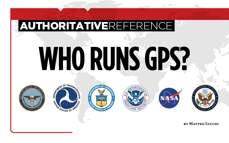
    The Global Positioning System is a vast and mostly unknown enterprise. This section — the first in an occasional series of authoritative reference pieces in this magazine — aims to clarify who does what to maintain GPS as a fantastic global utility. The relevant missions of agencies or units are in italics.

    After I researched and drafted the piece, I asked the experts listed below to review it and provide corrections and additions. While grateful for their substantial feedback, I take sole responsibility for any remaining errors or omissions.

    Thank you to the following experts:

    • Harold W. Martin III, Director, Space-Based Positioning, Navigation & Timing, National Coordination Office
    • Michael J. Dunn, Capability Area Integrator for PNT, Space Systems Command, United States Space Force
    • Lt. Col. Robert O. Wray, Commander, 2nd Space Operations Squadron, United States Space Force
    • Scott R. Calhoun, Commanding Officer, Navigation Center, United States Coast Guard
    • Paul Benshoof, Technical Director, 746th Test Squadron (AFMC), Central Inertial and GPS Test Facility
    • Bernard Gruber, Senior Director, Northrop Grumman

    Please return to this page periodically to read corrections and updates to this special section. If you spot any significant inaccuracies or omissions, please bring them to my attention by writing to me at [email protected].

  • Editorial Advisory Board Q&A: Do we need a new PNT office?

    Given that space is increasingly a congested and contested arena, should the U.S. government establish a new office to manage both space-based and terrestrial-based PNT systems?

    Photo: Orolia
    John Fischer

    “The U.S. government already has the National Executive Committee for Space-Based PNT (see gps.gov), which coordinates policy among all the branches of government. There is also a PNT Advisory Board, which includes some international members to inform the committee, and a National Coordination Office to execute the policies. This is in addition to the new U.S. military’s Space Command under which GPS operates. So, space-based issues are being addressed, but maybe more could be done to coordinate terrestrial-based PNT systems with space-based ones.”
    — John Fischer


    Ellen Hall
    Ellen Hall

    “As new technology advances, government, along with its policies and laws, struggles to keep pace. This was certainly true of the internet and cybercrime. This is also true of terrestrial-based PNT, where new technology emerges in areas not currently covered. Policy gaps and overlapping technologies need to be addressed and coordinated. It certainly seems that this would be one of those areas that could benefit from oversight. Space-based PNT is currently addressed by the National Executive Committee for Space-Based PNT, among others.”
    — Ellen Hall


    Bernard Gruber
    Bernard Gruber

    “The threat to U.S. space-borne assets and the signals they generate is very real. Both commercial and military users of GPS continue to seek independent alternatives to current PNT systems that are diverse and robust. The National Coordination Office supports the National Executive Committee (NEC) for Space-Based PNT. I believe the role of the NEC should be broadened to include terrestrial and alternative PNT as a first step to charter/secure a new or expanded program office.”
    — Bernard Gruber


    Editorial Advisory Board

    Tony Agresta, Nearmap 

    Miguel Amor, Hexagon Positioning Intelligence

    Thibault Bonnevie, SBG Systems

    Alison Brown, NAVSYS Corporation 

    Ismael Colomina, GeoNumerics

    Clem Driscoll, C.J. Driscoll & Associates

    John Fischer, Orolia

    Bernard Gruber, Northrop Grumman

    Ellen Hall, Spirent Federal Systems

    Jules McNeff, Overlook Systems Technologies

    Terry Moore, University of Nottingham

    Mitch Narins, Consultant

    Bradford W. Parkinson, Stanford Center for Position, Navigation and Time

    Stuart Riley, Trimble

    Jean-Marie Sleewaegen, Septentrio

    Michael Swiek, GPS Alliance

    Julian Thomas, Racelogic Ltd.

    Greg Turetzky, Consultant

  • DOT holds first GPS backup technology demonstration

    DOT holds first GPS backup technology demonstration

    Notes from DoT GPS Backup Demos – Part I

    Government officials, advisors and congressional staff gathered at NASA’s Langley Research Center on March 13. They were there to discuss the Department of Transportation’s (DoT’s) GPS Backup Technology Demonstration program and view the offerings of six different companies.

    A second event to view and discuss technologies offered by the other five companies in the program is scheduled (as of this writing) for Friday, March 20, at Joint Base Cape Cod, Massachusetts.

    View from Washington, D.C.

    The day began with remarks by Karen Van Dyke from the U.S. Department of Transportation, as well as remarks prepared by Colonel Joseph Frankino, deputy director of the National Coordination Office, a multi-agency staff that supports the National Space-Based Positioning, Navigation, and Timing (PNT) Executive Committee, whose members were unable to attend.

    Van Dyke provided an overview of the program and pointed out the increasing importance of resilient PNT. As just one example, improvements in autonomy and self-driving cars are entirely dependent upon consumers having confidence in the entire system, much of which is underpinned by PNT.

    Col. Frankino’s remarks reflected the Defense Department’s commitment to and support of DoT’s resilient PNT efforts. He pointed out that the nation’s military depends upon the defense industrial base, which depends upon uninterrupted PNT.

    Volpe Transportation Systems Center

    The technology demonstration effort is being coordinated by Andrew Hansen from DoT’s Volpe Center. Dr. Hansen pointed out that the ongoing effort, the analysis and assessment of which is expected to be concluded in May, is a series of demonstrations vice tests. This means that the companies involved were showing what their systems could do, vice being measured against set criteria.

    He also mentioned that the maturity of all the systems involved seems to have improved significantly over the last year. All are at Technical Readiness Level 6 or better. Also, that things so far had gone very smoothly with no need for any “re-dos.”

    GPS and a cesium clock were being used as reference standards for the demos. Two of the systems, NextNav and Skyhook, were also demonstrated on a drone at Langley’s 150 acre open air site.

    Report and Transparency

    Data from the demos is not proprietary and belongs to the government which intends to make “as much of it available as possible.” DoT representatives mentioned several times their desire for maximum transparency.

    Admiral (ret.) Thad Allen (left), chair of the National PNT Advisory Board, was among the attendees learning about DoT’s GPS Backup Technology Demonstration project at NASA’s Langley Research Center. (Photo: RNT Foundation)
    Admiral (ret.) Thad Allen (left), chair of the National PNT Advisory Board, was among the attendees learning about DoT’s GPS Backup Technology Demonstration project at NASA’s Langley Research Center. (Photo: RNT Foundation)

    Attendee Observations

    After a day of viewing and discussing the six different technologies with their vendors, the group reconvened to offer feedback. All agreed the day was very worthwhile and complemented DoT and NASA on the event.

    Kicking off the discussion, the DoT hosts remarked that the department is fully committed to GPS and its modernization. That said, there is broad recognition of the importance of other PNT systems. This is evidenced by the recent White House Executive Order on PNT.

    Also, that there is no single solution that will fill the PNT needs of everyone. In fact, GPS does not serve the PNT needs of everyone. The need across sectors for a wide variety of sources to “backup” GPS is why the demonstration project includes some systems that only provide time, or only positioning.

    Feedback from attendees included:

    • The reason for this project is that we have a 20th-century GPS and 21st-century threats. New technologies need to be examined for vulnerabilities. Security must be “baked in” from the beginning. Moderators commented that the DHS Conformance Framework was one of the tools that would help with this.
    • Rural and other underserved areas (such as wilderness, remote transportation networks, maritime) need PNT and should be a part of the government calculus.
    • Many systems depend upon infrastructure provided by others versus being self-sufficient.
    • In the view of many in Congress, it is good to see the demos going well. Overall, though, things are about two years late. Members and staff are very interested in when there will be an RFP and schedule for implementing the timing system mandated by the National Timing Resilience and Security Act of 2018.
    Monty Johnson of OPNT demonstrates precise time transfer through 100 kilometers of spooled fiber-optic cable. (Photo: RNT Foundation)
    Monty Johnson of the company OPNT demonstrates precise time transfer through 100 kilometers of spooled fiber-optic cable. (Photo: RNT Foundation)

    Systems Demonstrated at NASA Langley

    During the course of the day, attendees had the opportunity to interact with representatives from the following companies and their systems.

    Vendor Service Technology
    TRX Positioning Inertial Measurement Units
    NextNav Positioning & Timing Metropolitan Beacons
    Skyhook Positioning WiFi, cell ranging, very large proprietary database of site locations
    Echo Ridge Positioning & Timing Uses Global Star LEO constellation of 24
    OPNT Timing Timing Fiber & White Rabbit protocol
    Seven Solutions Timing Timing Fiber & White Rabbit protocol