With great sadness we must report that Per Enge passed away on April 22, at home and surrounded by family. Per was a genial friend and colleague to many, and a pillar of the PNT community. He is greatly missed by all.
At the culmination of his long, fruitful career he served as the Vance and Arlene Coffman Professor of Engineering at Stanford University, where he also directed the Stanford Center for Position Navigation and Time.
For many years he conducted research funded by the Federal Aviation Administration, directed at safe and secure air navigation and leading to development of the Wide Area Augentation System (WAAS) and Local Area Augmentation Systems (LAAS). WAAS became fully operational for aviation in the United States in 2003 and is currently carried by more than 110,000 aircraft; similar systems have been deployed in Europe, Japan and India.
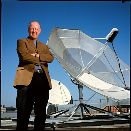
Per Enge at National Cheng Kung University (courtesy Shau Shiu Jan).
He received the Kepler Award from the Institute of Navigation in 2000 and was inducted into the GPS Hall of Fame by the U.S. Air Force in 2012. He served as a member of the Space-Based Position Navigation and Time Federal Advisory Committee since 2007. In 2013 he received the GNSS Leadership Award for Signals from this magazine, for signal design including national differential GPS, satellite-based augmentation systems, and alternative positioning, navigation and timing sources. He co-wrote Global Positioning System: Signals, Measurements, and Performance.
Always an educator, Per served as instructor, mentor and gentle encourager of many, many Ph.D. and other graduate-level students at Stanford who have gone on to distinguished careers of their own. In a lifetime marked by great achievements, this is perhaps his greatest and ultimately will be the most far-reaching.
Born in Norway and brought to the U.S. at age 2, he received a B.S.E.E. from the University of Massachusetts and M.S.E.E. and Ph.D. degrees from the University of Illinois.
Speaking at GPS World dinner, accepting Signals Leadership 2013 award. (Photo: GPS World file)
In remarks on accepting the GNSS Leadership Award for Signals, Per cited Faflick’s theorem, “that you will never ever work on any projects that are both interesting and important.” After calling out both GNSS and WAAS as exceptions to the theorem, he identified a third outlier: spoofing.
“Today’s e-security is based on three security factors: what we know (passwords), what we carry (key fob), and what we are (fingerprints, iris scan). And it is not enough. To meet this challenge, we need to rejuvenate the original security factor: location. In the past, transactions were secured by our presence. In the world of e-commerce, this factor has disappeared, and we must use GNSS to approximate this ancient and effective security factor.
“All of this will require the best effort of this precious community of ours.”
Further biographical details are available in an article published by the Stanford News. Among the tributes included there is this one by Brad Parkinson, who recruited Enge to Stanford in the early 1990s. “Anyone who works in GPS is aware of Per and his influence. He was just an intellectually talented person who could understand many scientific nuances and integrate them in ways others could not.”
Teaching the massive online open course.
The article also reminds us that he co-originated and co-taught, with Frank van Diggelen, a massive open online course to share GPS knowledge with a worldwide audience, far beyond Stanford’s walls. Titled “GPS: An Introduction to Satellite Navigation, with an interactive Worldwide Laboratory using Smartphones,” it enrolled 31,000 people from 192 countries. It is available here.
Per’s Stanford colleagues Sherman Lo, Todd Walter and Sam Pullen assisted GPS World with this article and provided these photos from personal archives. The Stanford group is working on setting up a scholarship in Per’s name. More information on it and how to support it will be on the SCPNT website once it becomes available.
Frank van Diggelen has sent further photos, below.
At the Stanford GPS Lab with colleagues from Stanford and DLR (German aerospace agency).
Dinner discussions with US-EU bilateral group.With Alan Chen, Sherman Lo and an early spectrum image of GIOVE-A (or Galileo).Visiting Neuschwanstein Castle in Bavaria after 2005 European Navigation Conference.At the Stanford Center Position, Navigation and Time, which he co-founded in 2005.Team China Consumers at GPS World dinner 2010. The winning team in the Grand Game of GNSS.Fierce “opponents” (examiners) for Ph.D. defense of Ignacio Fernández Hernández of EC/Galileo. Aalborg University, Denmark.Prepared to come aboard in Kobenhavn.The co-authors of Global Positioning System: Signals, Measurements, and Performance (with Pratap Misra).
A road warrior for GNSS.
Faculty of the GNSS Summer School at Svalbard, Norway (Arctic Ocean, 78.7° N).
Heartland Corrections Services Now Commercial or WAAS-only
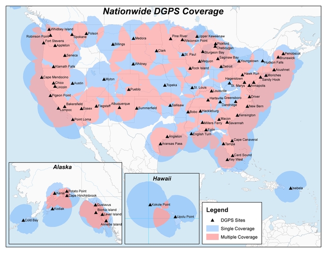
Original NDGPS coverage.
The U.S. Coast Guard, Department of Transportation and Army Corps of Engineers have reduced the number of Nationwide Differential Global Positioning System (NDGPS) sites that will be decommissioned. The course correction keeps a coastal and Mississippi River network of stations largely intact, while discontinuing inland services.
Last year at this time, the agencies sought public comment on a proposed shutdown of 62 of 84 NDGPS sites.
“After a review of the comments received, we have reduced to 37 the number of NDGPS sites to be shut down, nine of which are USCG Maritime sites and 28 of which are DOT inland sites,” the notice reads. “The NDGPS system will remain operational with a total of 46 USCG and USACE sites available to users in the maritime and coastal regions.”
Graphic depicting NDGPS coverage after site reductions. (U.S. Coast Guard)
Public use of NDGPS, never robust, has declined in large part due to limited availability of DGPS receivers. Many users and applications, particularly in precision agriculture, have shifted to commercially provided services or Wide Area Augmentation System (WAAS) corrections instead.
NDGPS coverage is maintained in major maritime ports and waterways. See www.federalregister.gov for a list of sites to be decommissioned. Termination of the broadcast signal is scheduled to occur by Aug. 5.
OCX Deep Dive Finds Progress, Need for Funds
The Pentagon seeks $39.2 million from Congress to speed the next-generation GPS ground control system (OCX) towards completion. Without the infusion, OCX would be delayed an additional four months and cost $90 million more to complete, the Pentagon said.
The embattled OCX showed progress in its July 7 quarterly review, according to an Air Force statement. DOD officials and Lt. Gen. Samuel Greaves, Space and Missile Systems Center commander, concluded Raytheon has made progress implementing critical changes.
On June 30, OCX exceeded baseline cost estimates by at least 25 percent, triggering a Nunn-McCurdy breach and potentially halting all work. Further OCX review will wind up in October. The Pentagon announced in 2015 that it was delaying initial OCX operations for the ground system until July 2021.
GPS III satellites. which may first launch in 2017, cannot use their full capabilities with the current ground control system, but the Air Force plans to use a retrofit to work with the GPS III designs until OCX is operational. See gpsworld.com/updatesyndrome for more details.
Galileo and the Brexit Effect
Tension Grows over the Public Regulated Service
By Tim Reynolds, European editor
UK involvement in the European Space Agency (ESA) should be unaffected by Brexit — the UK leavetaking, as yet undetermined in its details, from the European Union. ESA is a separate institution from the EU. However, one could argue that non-EU-membership might diminish the UK voice and could require a higher financial contribution.
Bids for the next Galileo satellite purchase contracts were due in mid-July, and the European Commission indicated that it will consider them purely on commercial terms. Airbus Defence and Space and Thales Alenia Space were expected to bid, as was the incumbent supplier of the first 22 satellites, OHB SE of Bremen, Germany, with Surrey Satellite Technology Ltd. (SSTL) of Britain as OHB’s satellite payload developer.
The EU has historically been averse to non-EU companies taking major roles in Galileo, and the immediate question is whether the EC could accept an SSTL-built payload that would not be launched until after Britain’s exit is complete.
Paul Verhoef, ESA’s director of navigation, said he will manage the competition as if Brexit had not occurred, with no discrimination against British bidders. Marco R. Fuchs, chief executive of OHB, said OHB would continue the front-line role for SSTL.
Britain could negotiate a security similar treaty similar to one reached by Norway and the EU, that could become effective on the date of Britain’s departure.
If I were a betting man, I’d still wager the house on the incumbent consortium winning the contract to provide the remaining satellites required to provide a sustainable, 24/7 operational constellation for first-generation Galileo. There would, in my opinion, be an unwarranted technical risk in doing anything else.
However, for the next generation it is open season, of course.
PRS at Risk. The real worry must be for the Public Regulated Service (PRS). This is the unique feature of Galileo that is of great interest to civil and military authorities in Europe and beyond, due to its more robust encrypted signal and its potential anti-jamming and spoofing characteristics. Currently, PRS will only be available to EU Member States. However, other countries, including the U.S. and Norway, have indicated that they would love to be able to use it as well. No final decision on this has yet been made.
The loss of the automatic right to access PRS would be damaging to the UK, and potentially to the full Galileo deployment timetable, as the country is currently host to the back-up Galileo Security Monitoring Centre (GSMC) — an essential part of PRS infrastructure — and I cannot see any part of the PRS infrastructure being left in a non-member state. If the centre must be relocated, then deployment of the full service could be delayed.
In addition, UK involvement in research and innovation activities around PRS may be curtailed, even if other work on Galileo projects is not.
UK a PRS Leader. The UK has been a leader in developing PRS applications. Nottingham Scientific Limited (NSL) recently demonstrated cloud-based PRS applications including implementation of PRS authentication for an offender tag, done using live Galileo (and GPS) signals. The demonstration provided real-time authentication flag generation, release and delivery to users. A second demo used cloud-based PRS in a proof-of-concept remote, unattended timing station where the primary user requirement was 100-percent confidence for the validity of signal. A third demonstration illustrated the use of cloud-based PRS on a drone.
Dual-Use Debate
PRS was also a major talking point at the European Space Solution event in The Hague in May. A panel on Space and Security noted that despite the fact that Galileo is marketed as a civil controlled GNSS, “dual use” is becoming a potentially divisive area for debate.
Rini Goos from the European Defence Agency (EDA) said that the EU needed space systems to be able to “intervene successfully,” and that space strategy needed to support Member State defence capabilities. This meant that the next generation of EU space systems must have dual-use capability. NATO is entrusted with external defence of the EU, but the commission also needs to be able to provide defence, not just consume it, he concluded.
The current chairman of the Galileo Security Accreditation Board is a UK citizen, Jeremy Blyth. He said: “Space and security, security and space. Whichever way we say it, what is clear is that the two are inextricably linked together.” He believes that to ensure security, it must be “designed in from the beginning.” Security is an enabler, rather than a barrier, he claimed.
He also believes that PRS gives the EU a real and competitive edge in secure positioning.
However, he indicated that there is a need to think deeply and have a rational debate about dual-use systems and, in particular, about the interface between civil and military use.
Clearly, there is a growing tension with regard to overtly military use of Galileo both now and in future generations of the system. Although a largely philosophical debate, given who in reality will be controlling and using PRS within many Member States, many European and national policy makers will want to retain the “purity” of Galileo as a global positioning system under fully civilian control.
PRS Workshop
Security was also a key feature of the PRS workshop organised by the Netherlands EU Presidency toward the end of European Space Solutions. Ger Nieuwpoort, director of the Netherlands Space Office (NSO), reminded the audience that “For civil authorities, PRS provides the same level of security for Member States as the military in GPS.”
Bart Banning of the Netherlands Institute of Navigation asked “How will we use PRS?’” In terms of its use for protecting critical infrastructure, what if the owner of the infrastructure was a private company? Should it be granted access to PRS or have to make do with the Galileo Commercial Service, a.k.a. PRS-lite?
He also pointed out that PRS was no more protected against jamming than any other GNSS. And, currently, it was “not good for in-building, underground or underwater.”
He thought PRS could be a great time provider, but probably also needs ground transmission, possibly via legacy radio towers. However, he saw the “killer app” for PRS being asset tracking, such as for diamonds, VIPs or prisoners. He also agreed that for many EU countries, the ministry of defence will be overseeing PRS services. “PRS is a good and unique addition to GNSS — but not the answer to all our needs.”
The United States Coast Guard, Department of Transportation and Army Corps of Engineers have issued a notice that reduces the number of Nationwide Differential Global Positioning System (NDGPS) sites that will be decommissioned.
The agencies published a notice on Aug. 18, 2015, seeking public comments on the proposed shutdown and decommissioning of 62 the then-existing 84 NDGPS sites.
“After a review of the comments received, we have reduced to 37 the number of NDGPS sites to be shut down, nine of which are USCG Maritime sites and 28 of which are DOT inland sites,” the notice reads. “As a result of this action, the NDGPS system will remain operational with a total of 46 USCG and USACE sites available to users in the maritime and coastal regions.”
Over time, a number of factors have contributed to the declining public use of the NDGPS, including lack of a carriage requirement, technological advances in GPS and limited availability of consumer-grade DGPS receivers.
The Federal Register Notice reduces the number of Differential GPS sites throughout the country, while maintaining coverage in major maritime ports and waterways.
Read the full notice at the Federal Register website, including a list of sites to be decommissioned. Termination of the broadcast signal is scheduled to occur within the next 30 days.
Graphic depicting NDGPS after site reductions. (U.S. Coast Guard)Graphic depicting NDGPS coverage after site reductions. (U.S. Coast Guard)Original NDGPS coverage.
On March 4, Raytheon successfully passed the first formal qualification test milestone for the U.S. Air Force’s GPS Next Generation Operational Control System (GPS OCX). The new system offers significant improvements to the GPS on which the U.S. military and millions of civilians rely, including enhanced availability, accuracy and security.
The event was the Configuration Item Qualification Test (CIQT) milestone for the Launch and Checkout System (LCS). The system provides launch and early orbit checkout capabilities for the modernized GPS III satellites and implements 77 percent of the cybersecurity capabilities for the overall OCX program. The testing was successfully conducted in a representative operational environment with a government-provided GPS III satellite simulator.
The LCS CIQT Run-for-Record was completed more than one month ahead of the plan established in mid-2015, clearing the way for LCS to proceed toward the Factory Qualification Test, the next major qualification event. The FQT test will be at the integrated system level and will take place this summer.
GPS OCX is being developed by Raytheon under contract to the U.S. Air Force Space and Missile Systems Center, which is replacing the current GPS operational control system. The OCX Launch and Checkout System provides an early delivery of a large subset of the overall OCX capability, and will support the GPS III satellite launches.
Congressmen Seek Delay to NDGPS Closings
Four U.S. congressman sent a letter to the Department of Transportation, asking the DoT to delay shutting down Nationwide Differential GPS (NDGPS) sites, a proposal that was posted in the Federal Register.
The congressmen are asking for a delay until the “administration has decided upon and implemented a resilient national positioning, navigation and timing (PNT) architecture.”
“We do not dispute,” they wrote, “the administration’s determination that NDGPS is sufficiently like the Wide Area Augmentation system (WAAS) in its phenomenology and services such that it provides only an incremental benefit to the nation’s PNT architecture. However, some or all of the 62 NDGPS sites (and associated equipment) proposed for elimination could play an important role in achieving the PNT architecture America needs.
“Ceasing transmissions, decommissioning, and disposing of them before we are assured they are not useful to future systems is against our national interest and would not be the best use of government assets and funds.”
Signers were John Garamendi of California, Peter DeFazio of Oregon, Frank Lobiondo of New Jersey, and Walter B. Jones of North Carolina. Read the full text of the letter.
IRNSS Completing
At press time, India was expected to put into orbit its seventh and final navigation satellite on April 28, thus completing the Indian Regional Navigation Satellite System (IRNSS).
IRNSS-1G is expected to launch aboard a Polar Satellite Launch Vehicle (PSLV) rocket from India’s spaceport at Sriharikota in Andhra Pradesh.
IRNSS is designed to provide accurate position information service to users across the country and region, up to an area of 1,500 kilometers.
Jamming on the Borderline
South Korea issued a warning in late March after detecting satellite signal disruptions that appeared to be coming from North Korea. The capital city of Seoul appeared to be the target.
Officials said North Korea discharged a large amount of radio waves to jam GPS signals in the region.
“We’ve detected signs that North Korea has been sending radio waves to the capital area since a month ago to disrupt GPS signals,” a senior government official said, speaking on condition of anonymity. “North Korea had been sending test waves since last month, but today, they discharged the largest amount.”
The disruptions could cause mobile phones to malfunction and affect planes and ships that rely on GPS for navigation. No damage has so far been reported in the military or among civilians, officials said.
Since 2010, GPS disruptions have occurred three times in South Korea, and all have been blamed on the North.
Southern Counter. On April 7, the U.S. State Department confirmed the jamming in a public communique, stating the the jamming was causing signal disruptions to airplanes, ships, and buoys in the area “surrounding Gyeonggi and Gangwon provinces out to about 100 nautical miles.” On April 8, the South Korean government said it would “beef up its system to protect GPS signals” but did not explain how.
South Korea is developing an eLoran system, which would be far more difficult to jam than GPS.
A Long March-3A carrier rocket carrying the 22nd BeiDou satellite lifts off March 30.
22 BeiDou
China launched the 22nd BeiDou satellite into orbit on March 29. BeiDou-22 (or BeiDou-2 I6) was launched at 20:11 UTC (4:11 local time) by a Long March-3A rocket from the Xichang Satellite Launch Center.
China launched the 21st BeiDou satellite on Feb. 1, the second in a series of BeiDou launches scheduled for 2016. The BeiDou constellation is planned to be completed in 2020.
The new satellite, the sixth BeiDou-2 IGSO, will be used to replenish the current operating regional system.
The satellite, after entering its designed work orbit and finishing in-orbit testing, will join others already in orbit and improve the stability of the system, preparing for BDS to offer global coverage.
After landing in French Guiana, the 13th and 14th Galileo satellites, still within their canisters, were unloaded to be taken by road to the Guiana Space Centre. (Photo: ESA)
Next Pair Prepped for Galileo
The latest pair of navigation satellites has reached Europe’s Spaceport in French Guiana, according to the European Space Agency (ESA). This starts a new Galileo launch campaign that will culminate in a May 24 launch of the 13th and 14th satellites in the constellation.
A second launch is planned for this fall, with four satellites carried aloft on a customized Ariane 5 for the first time, bringing the count to 18 Galileo satellites in orbit by the end of the year.
The pair of satellites left ESA’s technical centre in Noordwijk, the Netherlands, on April 4, cocooned within protective air-conditioned containers. They were then driven to Luxembourg Airport, where they were loaded aboard a Boeing 747 cargo jet for a dawn takeoff the following morning.
The satellites touched down at Cayenne — Félix Eboué Airport in French Guiana at 11:15 a.m. local time on Tuesday. Still within their canisters, they were driven to the Guiana Space Centre and unboxed that evening within the cleanroom environment of the centre’s S1A payload preparation building. A fit check is scheduled next, to ensure the satellites can be attached to the dispenser.
ESNC 2016
The largest international competition for the commercial use of satellite navigation once again seeks outstanding ideas and business models, with prizes worth a total of €1 million in more than 25 categories.
The deadline for submissions to the European Satellite Navigation Competition (ESNC) is June 30. The official website provides all relevant information on prizes, partners, and terms of participation. The ESNC is geared toward individuals and teams from companies, research facilities and universities around the world.
Let us not exaggerate — nor prematurely announce — the death of a subsystem. However, the demise of the U.S. Nationwide Differential GPS (NDGPS) network can be confidently foretold. Although a Federal Register notice dated Aug. 18 merely seeks public comment on plans to shut down a large portion of NDGPS, the handwriting is on the wall. Once having writ, the hand of fate moves on.
We should neither lament nor applaud. NDGPS, like many other technologies, has seen its time come and go, while competitors have arisen to perform its role and take its place. Such is evolution in the industrial world as well as in the biological kingdoms.
In 2016, three quarters of the currently operating NDGPS reference stations will be taken down and decommissioned. That’s not what the federal notice states, but that’s what it effectively says. The document’s comment period ends on Nov. 16. It is difficult to conceive of a public outcry that might reverse the intended course of the U.S. Coast Guard, Department of Transportation and Army Corps of Engineers.
The NDGPS network had its birth in the 1980s, as a tool to provide real-time positioning accuracy for harbor entrances and coastal navigation. Inland components were added over the years to improve river navigation, NDGPS use in precision agriculture began to grow, and a role in railroad positive train control (PTC) was much discussed. But all these efforts could not gather enough momentum to firmly establish the network’s viability. Meanwhile, satellite-based differential services from both commercial providers and the U.S. government’s own Wide Area Augmentation System (WAAS), and a network of continuously operating reference stations (CORS) from the National Geodetic Survey continually nibbled away at NDGPS’s potential customer base. Consequently, industry fielded a meager range of radiobeacon DGPS receivers.
The real death blow came in 2013, when the Federal Railroad Administration (FRA) eliminated an NDGPS requirement from its PTC program. The railroads, never a nimble industry nor one receiving the governmental support it enjoys in other countries, had by that time become the last hope of NDGPS. Ag users had already for the most part moved over to WAAS and commercial SBAS providers. Marine users did not by themselves form a sufficiently large constituency, and even they were not fully equipped nor wholesale adopters of the system.
The story of Loran bears some similarities to NDGPS, but Loran now enjoys a resurgence that NDGPS will never see. It is destined for the technological graveyard. There is an ecosystem of positioning, navigation and timing (PNT) tools and applications. Operating in a free market, with some measure of governments’ interference and manipulation, it has its own patterns of natural selection. We will continue to see the rise and fall of species. NDGPS has now been branded a dinosaur. It will be interesting to see how other technologies, competing for the same finite range of resources, will interact, thrive, or decline.
Twenty-two NDGPS sites that serve coastal areas would remain operational under the proposal.
An Aug. 18 Federal Register notice proposes shutting down the Nationwide Differential Global Positioning System (NDGPS) in January 2016 because of a decline in its use, except for sites in coastal areas.
The notice, issued by the U.S. Coast Guard (USCG), Transportation Department (DOT) and Corps of Engineers (USACE), reads:
The Nationwide Differential Global Positioning System (NDGPS) service augments GPS by providing increased accuracy and integrity using land-based reference stations to transmit correction messages over radiobeacon frequencies. The service was implemented through agreements between multiple federal agencies including the USCG, DOT, and Army Corps of Engineers, as well as several states and scientific organizations, all cooperating to provide the combined national DGPS utility.
However, a number of factors have contributed to declining use of NDGPS and, based on an assessment by the Department of Homeland Security, DOT and USACE. DHS, DOT and USACE are proposing to shut down and decommission 62 DGPS sites, which will leave 22 operational sites available to users in coastal areas.
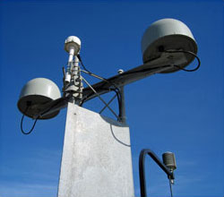
A DGPS reference station antenna.
Contributing factors cited in the decision are:
USCG changes in policy to allow aids to navigation (ATON) to be positioned with a GPS receiver using Receiver Autonomous Integrity Monitoring (RAIM), which assesses the integrity of a GPS signal within the receiver;
increased use of Wide Area Augmentation System (WAAS) in commercial maritime applications, which uses ground-based reference stations and satellite communications to improve accuracy;
limited availability of consumer-grade NDGPS receivers;
no NDGPS mandatory carriage requirement on any vessel within U.S. territorial waters;
the DOT Federal Railroad Administration’s determination that NDGPS is not a requirement for the successful implementation of Positive Train Control (PTC), which provides the railway system the capability to positively enforce movement authorities along railroad systems.
In April 2013, announced that DHS and DOT were in the process of analyzing the need for NDGPS. “The response to the 2013 notice was limited, but the responses received were well informed on the NDGPS system, its use, and current and potential applications,” the notice reads. “While a limited number of responders found the broadcast of corrections to be beneficial, no respondents reported the discontinuance of DGPS broadcast to be detrimental or harmful. Ship pilots in particular noted that DGPS can be critical in confined waterways for precise ship-handling maneuvers.”
Public comments on the proposed shutdown and decommissioning of 62 DGPS sites are being accepted until Nov. 16. Termination of the NDGPS broadcast at these sites is planned to occur on Jan. 15, 2016.
Full details on how to submit public comments can be found on the Federal Register page.
The 2014 Federal Radionavigation Plan, just released from the U.S. Department of Transportation, touches on funding for the Nationwide Differential GPS and the use of eLoran as a precision timing alternative.
The plan is signed by the Secretaries of Defense, Transportation and Homeland Security, and released by the DOT Office of the Assistant Secretary for Research and Technology. A PDF of the document has been posted to the NAVCEN’s website.
Nationwide Differential GPS (NDGPS). The nationwide differential GPS (NDGPS) service augments GPS by providing increased accuracy and integrity using land-based reference stations to transmit correction messages over radiobeacon frequencies. The service has been implemented through agreements among federal agencies including the Coast Guard, DOT and the Army Corps of Engineers, but a decision has not yet been made on funding beyond FY2016:
“The Department of Homeland Security, in coordination with the Department of Transportation, is analyzing the future requirements for the NDGPS to support investment decisions beyond Fiscal Year (FY) 2016. Future investment decisions might include maintaining NDGPS as currently configured, decommissioning NDGPS as currently configured, or developing alternate uses for the NDGPS infrastructure. Contributing factors to these decisions are: (1) the U.S. Coast Guard change in policy to allow aids to navigation (ATON) to be positioned with a GPS receiver using Receiver Autonomous Integrity Monitoring (RAIM), and to allow USCG navigation in all waters using the WAAS receiver; (2) limited availability of consumer grade NDGPS receivers; (3) no USCG DGPS carriage requirement on any vessel within U.S. territorial waters; (4) the Presidential Directive turning off GPS SA; (5) continuing GPS modernization; and (6) the Federal Railroad Administration’s determination that neither NDGPS, nor High Accuracy NDGPS, are requirements for the successful implementation of Positive Train Control.”
eLoran for Timing. eLoran is mentioned in the plan only briefly, in the following excerpt about precision timing alternatives:
“For precise timing applications, chip-scale atomic clocks are now available from at least one company, and others have active research and development programs in the United States and abroad. The U.S. Coast Guard has established a Cooperative Research and Development Agreement to assess a high-power wireless alternative for providing precise time using U.S. government facilities such as mothballed Loran-C sites, upgraded to eLoran capability. If successful, this effort would offer another solution suitable for integration with GPS, or use as an independent complement to GPS, that could together provide highly available and precise timing for many applications.”
There’s something I’ve been wanting to write about since the ION-GNSS conference a few weeks ago. However, a nasty cold, a 10-day trip to Europe (INTERGEO conference), and some jet lag have kept me from it until now.
Here goes.
First of all, most of the presentations from the CGSIC meeting are available on the USCG Navigation Center website. You can view them by clicking here. There’s some very good reading and most of it is pretty light-weight and in PDF format.
One of the presentations at the CGSIC (Civil GPS Service Interface Committee) meeting during the ION-GNSS conference was “Integrating NDGPS and SBAS —
An Optimal Real-time GPS Mapping Solution,” presented by Jean-Yves Lauture of Geneq, Inc.
I’m publishing two of the slides from his presentation in order to:
Show the accuracy potential of WAAS and NDGPS given a high performance L1 receiver.
Discuss the statistical names/values used to express GPS accuracy.
First of all, each of the slides below are at the same scale. Each ellipse is 20 cm with the outside limit (radius) being one meter.
I’ve known for quite sometime that SBAS (WAAS in this case) is capable of sub-meter precision with a single-frequency GPS receiver. These results are a bit better than what I’ve seen personally, and keep in mind it’s a limited data set of 1,800 continuous epochs, but impressive none the less. Also, keep in mind that the WAAS Performance Analysis Report published quarterly by the FAA’s National Satellite Test Bed shows the 95% horizontal accuracy value for Denver, Colorado, (near where this data was collected) being .547 meters for the quarter ending June 30, 2010 (7,856,354 samples collected over three months).
30 minutes of WAAS-corrected data (each ellipse represents 20cm)
The results I didn’t expect were the slide below, which shows NDGPS-corrected results using the same receiver/antenna. Keep in mind this is a GPS L1 receiver using phase-smoothed pseudorange measurements, not a GPS L1/L2 receiver using a carrier-phase float solution. If you look closely, you’ll see it states the baseline distance is 200 km. Granted, this is a limited data set, and I’ll be interested in seeing further results. If this was a dataset presented by a manufacturer or other party with some sort of interest, I wouldn’t publish it, but this is data collected by an objective entity (a credible U.S. government agency) so that earns, in my mind, a level of credibility.
The results are pretty impressive. All data points fall within ~20 cm.
30 minutes of NDGPS-corrected data (each ellipse represents 20cm)
Keep in mind that this data was collected recently, and we are currently in a period of low ionospheric activity. In other words, data was collected under near-ideal conditions. At the end of the day, my point is that GPS L1 accuracy using SBAS and NDGPS has gotten pretty darned good.
Accuracy Statistics
The second reason I’m publishing the slides is to discuss accuracy statistics.
Look at the small box inside each slide showing 99%, 95%, 68%, and 50% accuracies.
If you look at the data points, it might not be immediately apparent how those values were arrived at. For example, how could a group of data points all within ~20 cm have a 95% confidence of 37 cm?
To explain this, there was a good article published in GPS World in 2007 titled “GNSS Accuracy: Lies, Damn Lies, and Statistics” by Frank van Diggelen. It does a good job explaining statistical expressions (RMS, 2DRMS, etc.).
Keep in mind that most manufacturers express horizontal GPS accuracy specifications based on 68% confidence. When the specification sheet states “sub-meter” HRMS (horizontal RMS) precision, that means 68% of the time; the horizontal accuracy will be less than a meter. In reality, that “sub-meter” receiver won’t consistently deliver sub-meter precision. If you convert the 68% HRMS value and express it with 95% confidence (2D HRMS), the actual horizontal precision for that same receiver will be well over one meter. That’s the precision you can expect from the receiver, not the 68% confidence value.
The U.S. Department of Transportation (DOT) has approved a decision to continue the inland component of the Nationwide Differential GPS (NDGPS), based on the results of a user assessment conducted by the Research and Innovative Technology Administration (RITA).
RITA assessed the current user needs and systems requirements for the inland component of NDGPS. It gathered information through public responses to a notice in the Federal Register (including responses from state and local governments, the private sector, and the non-profit sector), and through quantification of the mission requirements of other federal agencies using inland NDGPS, according to DOT.
But this doesn’t mean that funding of inland NDGPS is not still up in the air. Earlier this year, DOT included in its fiscal 2009 federal budget request a $4.6 million line item in the RITA budget for NDGPS operations and maintenance of the current system through October 2009.
Discussions are ongoing regarding the program’s future funding mechanism, and will be addressed in future budget submissions, DOT said. The National Space-Based Positioning, Navigation and Timing Executive Committee endorsed DOT’s decision at its meeting in March.
As we look forward in the modernization of GPS, and we’re looking at the spectrum of other systems that are coming online, GPS today has fundamentally the preeminent position in terms of positioning and navigation. If we don’t shoot ourselves in the foot in the transition from the GPS we have today to GPS III, which is 10 years out, GPS will probably remain the fundamental standard, because the only way non-military uses of these additional systems will get early use is by receiver manufacturers putting in dual-reception capability and using the new satellites as they go up, fundamentally as additional ranging signal augmentations. It’s the only way you get early use out of getting a few satellites in the sky.
A lot of whether GPS will retain its standard position has to do with worldwide confidence in the system. We’ve done a pretty good job of maintaining a level playing field for everyone in the world with regard to GPS. There haven’t been the problems that were experienced with Loran systems which were occasionally turned off, creating consternation in Europe. But the possibility, currently under consideration, of actually dropping an important accuracy augmentation element of GPS — the Nationwide Differential GPS (NDGPS) — before alternatives are available would certainly undermine worldwide confidence in the U.S. commitment to continuing to provide service equal to or better than what is already there.
The key issue here: You can have all the paper designs in the world you want, but fundamentally the question is once you have a given level of capability, how well is that maintained — and is it improved over time?
With all the machinations that have gone on, the United States has done a pretty good job. It basically delivers a set of signals that are better than promised. The system, especially with its augmentations, is clearly better today than it was 10 years ago.
Now, the U.S. from a policy standpoint does need to transition from where we are to GPS III. We simply need to do it in a wise manner. The problem that I see with zeroing out the budget for NDGPS is that we save very little money — about $10 million a year to maintain the system. For any accountancy firm, this would fall below the line of relevance in the budget. And the effect, in undermining international confidence in GPS and in direct costs to state and local governments, would far outweigh any such savings.
Until we have something in GPS III that provides accuracies in the half-meter range, which is what’s required for civil Geographic Information Systems (GIS) work, it would be foolish to turn NDGPS off. We would be degrading a system without any real alternative.
Furthermore, you’re probably going to cost state and local and federal governments, who use NDGPS extensively for local mapping, far more than $10 million by turning the system off.
I believe the main commercial use of NDGPS, outside of the GIS realm, is precision agriculture. The arguments to put it in originally were to provide the people on the interior of our continent the same sort of services that the coastal regions are provided. The issue we have is we don’t have a strong vocal constituency, and frankly state and local governments can’t provide much of a hue and cry for degradation of service.
And losing confidence, undermining international confidence in the U.S. to maintain a stable system, is not a party to the table, either.
Granted, international users do not actually use NDGPS itself. But they have invested the money to put in comparable base stations in their countries. For the U.S. to discontinue NDGPS undermines and brings into question whether their investment was a good investment — and whether, as an international user, you can comfortable continue to rely on GPS.
It’s a confidence issue. There is no economic damage to foreign users. But it’s a perception of undermining GPS credibility across the globe if we pull back support from a system that just a few years ago we deemed to be important and almost essential.
Some precision ag and other potential NDGPS users have switched over to WAAS, the Wide Area Augmentation System. There’s no question that WAAS is a good system, but you’re not going to get below a couple of meters, and you’re certainly not going to be able to farm above buried water tape. There’s clearly a market and I believe it’s part of the mix. It turns out it’s really tough to get at the 20-centimeter accuracy level over large distances, and WAAS will not give you that.
At some point in our transition — I don’t know whether it’s five years from now or 10 years from now — the world is going to be a different place in terms of satellite services and the level of satellite services. It may very well be at some point in the future, this space of 20–50 centimeter accuracy can be very well delivered by a private service (without interference in the RF spectrum), or let’s just say, can be delivered by satellite.
At that time, when there are truly other alternatives, I’m not going to be beating my shoe on the desk to maintain a legacy system. The issue in this whole positioning and navigation field is that as people are starting to get economic value out of information, introducing hiccoughs into the user stream of productivity enhancement is not a good thing.
We say that until there is a viable alternative for the 20–50 centimeter space, we ought to continue sending out the signals. Once there is a viable alternative, then you can certainly transition; look at the cost of transition, and you will probably transition.
But it turns out this is a relatively cheap way of providing information in this space and, frankly, we’re a long ways away from using GPS in automated systems that are directly related to safety of life. To get that, you have to play the game that the FAA plays, and worry about seven nines of reliability [99.9999999 percent]. GPS in its augmentation is probably at the one to two nine level. But as the usage increases, by having multiple augmentation systems and using them, there is no reason that reliability can’t be increased.
Fundamentally, the word to government is it’s premature to shut off the lights. It may be the right decision at some point in the future, but I think it would cause a lot more problems than the $10 million it would save if it’s done now.
CHARLES R. TRIMBLE is chairman of the U.S. GPS Industry Council.
RITA and the Coast Guard have a tough job ahead. Between them, the Department of Transportation’s (DOT’s) Research and Innovative Technology Administration and the multi-mission maritime service are trying to save a national differential GPS (NDGPS) program that faces termination next year.
History. The U.S. Coast Guard (USCG) implemented the concept in the mid-1990s. Their requirement was for marine navigation, and the system now provides service for coastal coverage of the continental United States, the Great Lakes, Puerto Rico, portions of Alaska, Hawaii, and a greater part of the Mississippi River Basin. In a testament to NDGPS’s success, many countries around the world have duplicated the concept.
Since the DGPS signal is broadcast in a 360-degree radius, inland users close enough to the USCG broadcasting station can receive and use the corrections. All of this happened before SA (Selective Availability) was turned off, so the accuracy improvement was staggering; from 100 meters down to 1-3 meters. Once inland users tasted the sweetness of the USCG DGPS system, a groundswell of support arose for expanding the system inland. The NDGPS system was born.
Manufacturers began to integrate “Coast Guard” DGPS receivers into their products. Companies like CSI and Starlink offered after-market DGPS receivers to enable virtually any GPS user to receive the free DGPS signal, whether it was a $200 consumer GPS unit or a $10,000 submeter mapping receiver. Since then, tens of thousands of “Coast Guard” DGPS receivers have been sold around the world.
Between the USCG, the Army Corp. of Engineers (USACE), and the DOT, 86 stations now blast out DGPS corrections free of charge that cover more than 90 percent of the U.S. landbase.
Trouble. The program ran smoothly through the first half of this decade. Each year, a few new stations were added to expand coverage. The HA (High Accuracy)-NDGPS concept to provide decimeter-level positioning was proven to work. However, the rug flew out from under NDGPS last year when DOT’s Federal Railroad Administration (FRA) announced it would no longer sponsor NDGPS. NDGPS supporters had long hung their hats on Positive Train Control (PTC) as the killer application for NDGPS, as it would save the railroad industry billions per year and justify the cost of installing and maintaining the NDGPS. The DOT says the PTC doesn’t need NDGPS any longer.
Two significant developments have reduced the need for NDGPS since the program began. The first is that autonomous (standalone) GPS accuracy is very good these days, on the order of a few meters. The second is the maturation of the Federal Aviation Administration’s Wide Area Augmentation System (WAAS).
RITA to the Rescue. Last summer, with no FY07 budget for NDGPS, the scrambling began. The FRA washed its hands of NDGPS so the DOT transferred the program to a little-known agency called Research and Innovative Technology Administration (RITA). At the eleventh hour, RITA scraped up $5 million for NDGPS for FY07 — enough to operate and maintain the system until October 2008. $400,000 of that is allocated for “needs assessment.” In other words, they need to understand who is still using NDGPS and determine if the usage justifies future funding.
The USCG (39 sites), USACE (9 sites), and DOT (38 sites) fund the 86 stations. USCG has said it would take over 12 of the DOT-funded sites if DOT decides not to fund the program. So the debate only involves about a third of the U.S. land mass. The USCG and USACE sites are not in jeopardy, as their requirements are considered safety-of-life for maritime navigation.
Is there is a significant enough user base in the areas above to justify the roughly $7 million a year it takes to operate and maintain them? If there are only 1,000 users in those regions who use it regularly, that’s $7,000 per year, per user. That scenario doesn’t make sense. And it doesn’t even consider the cost of complete system build-out. Even at 10,000 users (a very unrealistic number), that’s still a cost of $700 per year, per user to the taxpayer.
Who still uses NDGPS, anyway? That’s the magic question, and the DOT doesn’t know the answer. Presumably, determining that is part of the needs assessment, to be
finalized in September 2007. I’ve heard speculators talk about agriculture being a big NDGPS user. While this might have been true five years ago, WAAS now dominates the ag market. Even CSI (now Hemisphere GPS), the largest producer of after-market “Coast Guard” beacon receivers and the leading GPS supplier to the ag market, has shifted its focus from NDGPS receivers to high-performance WAAS receivers.
The forest products industry comprises some big users of GPS, but they’ve been post-processing for years, and some have even stopped doing that because autonomous GPS is sometimes good enough.
What’s left is a fragmented group of utilities, federal/state/local government, engineering, surveyors, universities. and various -ologists. Honestly, as much traveling, conference attending, speaking engagements, and training as I do, I can’t recall the last person who told me they use NDGPS. That’s the fundamental problem.
The Federal Railroad Administration has relinquished responsibility for national differential GPS (NDGPS), saying that it no longer supports NDGPS for positive train control. DOT’s Research and Innovative Technology Administration (RITA) now has sponsorship of NDGPS, and will hold a meeting on October 4 to assess.
The outlook for NDGPS appears bleak. “Without funding, the system faces tough choices.” Options reportedly under consideration include moth-balling the system for $2 million or shutting it down for $10 million. NDGPS supporters claim that a large mass of users of NDGPS have not yet been heard.