Harris Corporation has expanded a collaboration with Boundless to further extend its capabilities in open-source geospatial technology. This partnership makes it easier and more cost-effective for customers to access, manage and share the huge amount of location-based data available from devices, sensors and satellites, the companies said.
Most recently, Harris has developed a geospatial data warehouse called One Object One Time (1O1T), which eliminates redundant data and stores the most current representation of geospatial objects such as a lighthouse or communications tower. This capability ensures data currency and significantly reduces the time required for processing and delivering content and products compared with traditional methods.
Harris is using 1O1T to provide content management services and create high-quality data and products for use by a wide variety of government and commercial customers.
Boundless’ OpenGeo Suite is an open-source enterprise geospatial software bundle. It expands Harris’ existing offerings like 1O1T. Boundless experts support and consult around the implementation of OpenGeo Suite components including GeoServer, PostGIS, Open Layers and QGIS.
“We like Boundless’ savvy and nimble approach to providing open-source geospatial software and services,” said Tim Ellis, director of Harris’ IntelliEarth geospatial business. “This is a very productive collaboration for both companies and most important, our customers.”
“Harris provides top-notch, responsive products for some of the most important geospatial initiatives in the world,” said Boundless CEO Andy Dearing. “Together, we are extending the possibilities of the open-source geospatial platform.”
When I was the GIS manager of the Atlanta Regional Commission, the most rewarding and important work we did was geospatial support for our first responders. The culmination of this effort was creation of a portable GIS that we could set up in the field on short notice anywhere in the region to provide situational awareness for first responders.
The system consisted of two laptops, external hard drives, a HP “E”-size plotter, foam-board laminator and an LCD projector — all housed in a portable tent. We used ArcInfo and ArcView to build and overlay vector data on ortho/oblique aerial imagery to aid visualization.
We found that police and firefighters especially liked our large laminated plots of imagery overlaid with street data, because the aerial images were easy to understand and the GIS data provided needed location references. The hard-copy plots required no computer and could be marked up with grease pencils.
Helping in our small way, we provided the same kind of large plots of New Orleans to the Louisiana National Guard days after Hurricane Katrina hit. We later learned that the plots were used by National Guard headquarters to keep track of search-and-rescue efforts by marking up neighborhood blocks with grease pencils and recording search results. They crossed off buildings that had been searched and recorded urban rescue information such as who did the search, and the date and number of live or deceased bodies found. The hard-copy plots were a low-tech embodiment of higher tech GIS data and imagery.
Nine years later, the National Geospatial-Intelligence Agency (NGA) developed a similar but higher tech and more robust system called GeoQ.
GeoQ: Geographic Work Queueing and Tasking System
GeoQ is an open-source geographic tasking and management system that facilitates collection and display of diverse geographic and geographically tagged data across large areas to provide situational awareness for all involved. As needed, the large areas can be broken down into small grid squares and assigned to teams or team members for detailed analysis or tasking.
The system is designed to be very transparent so all involved can view the workflow and assist as needed, while avoiding duplication of effort. This NGA video is a well done and rapid overview of GeoQ.
GeoQ software was developed by NGA and the MITRE Corporation to leverage NGA tools and data to the benefit of Homeland Security personnel. In 2013, the leadership at NGA made a gutsy decision to share some of their unclassified geospatial tools with the nation’s first responders through GitHub, an open-source software developers’ online collaboration environment. With more than 2 million participating programmers, GitHub hosts more software source code than any other single service in the world.
GeoQ was the first NGA product shared through GitHub, and was in keeping with a change in philosophy at NGA to take advantage of feedback and improvements generated by the huge and diverse talent pool available through GitHub. NGA was the first intelligence agency to share some of its work in this open-source environment, and the results have been extremely beneficial to all involved.
The Huntsville Connection
With more than 70 geospatial firms and agencies, Huntsville, Ala., has always been an early adopter of geospatial technology. Several years ago it was again a Huntsville team that developed a first-ever Google Earth Enterprise-based emergency response system called Virtual Alabama. The system was so effective that eight other states adopted the model. Work was underway to build a national version when Google announced the phasing out of Google Earth Enterprise. We now know that Google was not motivated to build authoritative geospatial systems, but was focused on building products and services that attracted customers so it could accomplish its primary business of selling advertising.
Fortunately, the work of the Virtual Alabama team was not wasted. Team members became experts regarding first-responder operations and their unique situational awareness requirements. They learned that first responders needed much more than just a GIS. The best analogy I can think of is that one could use PowerPoint as a word processor, but that wouldn’t be a very efficient system. Likewise, MS Word could be used for presentations, but not as elegantly as PowerPoint. The same holds true for rapid dissemination, communication and perception of a common operational picture. Geospatial tools and analysis are part of situational awareness, but the work flow and many components are different, not necessarily spatial and need to be assembled and processed at their own pace.
The timing was almost perfect, since GeoQ was released as Google Earth Enterprise was being phased out. Huntsville again seized the opportunity to build on its experience, and GEOHuntsville became a prime GeoQ testbed. I recently met with Chris Johnson, one of the early Virtual Alabama leaders and president of A Visual Edge, Inc., a Huntsville geospatial firm. She demonstrated GeoQ and Huntsville’s role in advancing the technology.
GitHub has a very thorough description of GeoHuntsville, a non-profit 501c6, and its role with NGA to test and share lessons learned through a “Blueprint for Safety” pilot project involving other cities to improve rapid disaster response. The sharing of lessons learned, code sets and documentation through the multi-city collaboration is called “Exemplar City.”
Another aspect of the Blueprint for Safety is support of rapid sensor deployment in support of first responders through common standards. Sort of a “plug-and-play” for complex devices. (See the GeoQ projects page and the OpenSensorHub.)
There is quite an extensive collection of material on GitHub regarding GeoQ and other NGA, projects including support of FEMA and GeoQ technical specifications. NGA doesn’t directly support these efforts, with legal language such as “NGA assumes no responsibility for the use of the software by any parties, and makes no guarantees, expressed or implied, about the software quality, reliability, or any other characteristic.” Still, NGA is behind the creation of the software and is working on other tools and support that will expand the capabilities. Participation of both GeoHuntsville and the Federal Emergency Management Agency (FEMA) bodes well for future use, since I don’t envision the same situation we ran into with Google and Virtual Alabama/USA.
Update on What3Words
In February, I wrote about what3words. The simple what3words system is now available as a locator, accessible via the Esri ArcGIS platform.
Boundless, a provider of spatial IT solutions, has released OpenGeo Suite 4.6, the newest version of its powerful enterprise geospatial software platform.
OpenGeo Suite 4.6 is open-source geospatial software that powers web, mobile and desktop maps and applications across large and small organizations. New capabilities and enhancements in Version 4.6 include:
Enhanced OpenGeo Suite Composer, which allows anyone to build and style maps by making it easier to add data to GeoServer, style layers, and publish to the Web. Originally released in OpenGeo Suite 4.5, the latest release of OpenGeo Suite Composer improves layer management, allows publishing to OpenLayers3 templates for easy website embedding, and makes it even simpler to use the YSLD syntax for styling. OpenGeo Composer is available to all OpenGeo Suite Enterprise customers.
Improved reliability, handling and security when executing geospatial analysis.
Multiple updates to rendering and tile design capabilities.
Numerous updates and bug fixes to all components to improve stability and reliability across the entire software stack.
OpenGeo Suite Enterprise from Boundless is open source geospatial software designed for users with complex deployment requirements who want to build robust solutions for demanding production environments that often require features such as connections to enterprise databases, advanced runtime environments, or sophisticated clustering solutions in support of scalability requirements. Organizations with complex enterprise needs should no longer feel locked in to proprietary software with significant license costs in order to accomplish sophisticated projects, Boundless said.
“Boundless is committed to making geospatial software that is open, readily available and easy to use for all business applications,” said Ann Johnson, CEO, Boundless. “OpenGeo Suite 4.6 is the next step in our continued efforts to add features, functionality and usability to meet the demands of our customer base.”
Boundless offers a host of service packages and training to help customers and free users get the most from their OpenGeo Suite deployment. Boundless also supports a variety of deployment options, including on-premise and cloud environments such as AWS and Microsoft Azure.
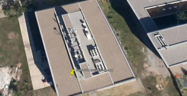
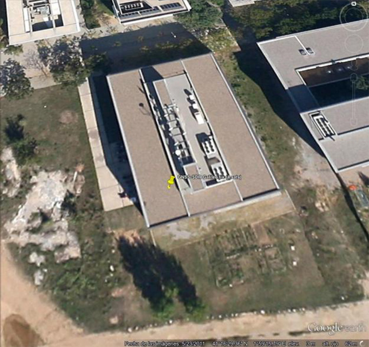
First GNSS-SDR Galileo standalone position fix using the four available satellites (Position obtained at the CTTC headquarters on 2013-Nov-10 15:52:14 UTC).
For the first time, position fixes in real time using signals from Galileo have been achieved with an open source software receiver. The milestone was achieved by a research team from the Statistical Inference Department at the Centre Tecnològic de Telecomunicacions de Catalunya (CTTC), which manages the development of the open source project GNSS-SDR.
Professional, full-featured receivers are expensive, and even in those cases the users have limited access (if any) to know exactly how position and time information were computed, CTTC said. In addition, these receivers exhibit very few upgrading capabilities. A software receiver allows all kind of modifications and inspections. “GNSS-SDR unleashes the full potential of the signals and, best of all, it is open and for free,” said Carles Fernández-Prades, GNSS-SDR project manager and Head of the Communications Systems Division at CTTC.
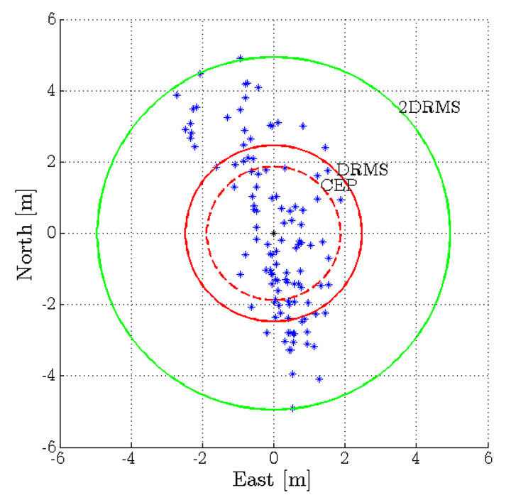
GNSS-SDR 2D ENU coordinates precision for the Galileo position fix.
A GNSS software receiver is a computer program that performs all the signal processing from raw satellite signals to the computation of position, velocity and time, just as is done by the GPS chips that are embedded in smartphones and other devices with satellite-based positioning capabilities. The key difference relies on the great flexibility in the design, upgradability and the experimentation possibilities that the software version allows, in opposition to integrated circuits, true black boxes with inputs and outputs but with no accessible information about what is going on inside of them.
“With GNSS-SDR, researchers and technology enthusiasts can easily change the implementation of a certain functional block and assess the impact of that change on the whole receiver performance,” said Pau Closas, GNSS-SDR scientific advisor and Head of the Statistical Inference Department at CTTC. “This paves the way to innovative mass-market, industrial and scientific applications that could make use of Galileo signals but require non-standard features which are not present in mass-market receivers nor in costly professional equipment.”
The first Galileo-based positioning fix, obtained by Javier Arribas using a general purpose GNSS antenna and a RF front-end connected to a commodity PC running GNSS-SDR represents an important milestone in the research on GNSS receiver design. “Next steps will be devoted to provide outputs in standard formats that will allow the application of geodesic-grade tools for extremely precise positioning (on the order of centimeters) and higher degrees of reliability,” Arribas said.
GNSS-SDR is the first open source solution that offers this possibility, CTTC said. The source code released under the GNU General Public License (GPL) secures practical usability, inspection, and continuous improvement by the research community, allowing the discussion based on tangible code and the analysis of results obtained with real signals. The source code is complemented by a development ecosystem, consisting of a website, as well as a revision control system, instructions for users and developers, and communication tools.
With GNSS-SDR, researchers from CTTC (with the aid of an open community created around the project, such as the students participating in the Google Summer of Code program in 2012 and 2013 Luis Esteve, Mara Branzanti, Daniel Fehr and Marc Molina) are offering a tool that fosters the use of GPS and Galileo signals in unexpected new ways, making possible applications with unforeseen benefits in a wide range of fields, such as geodesy, robotics, unmanned vehicles and safety-related systems.
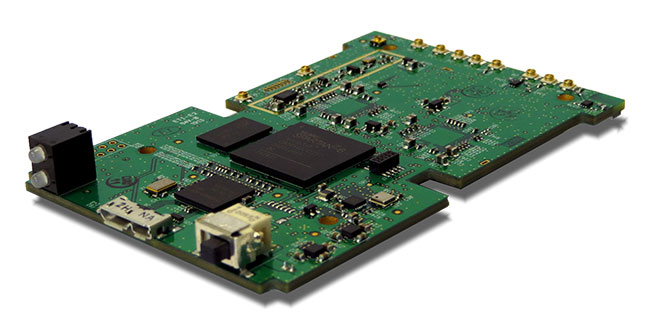
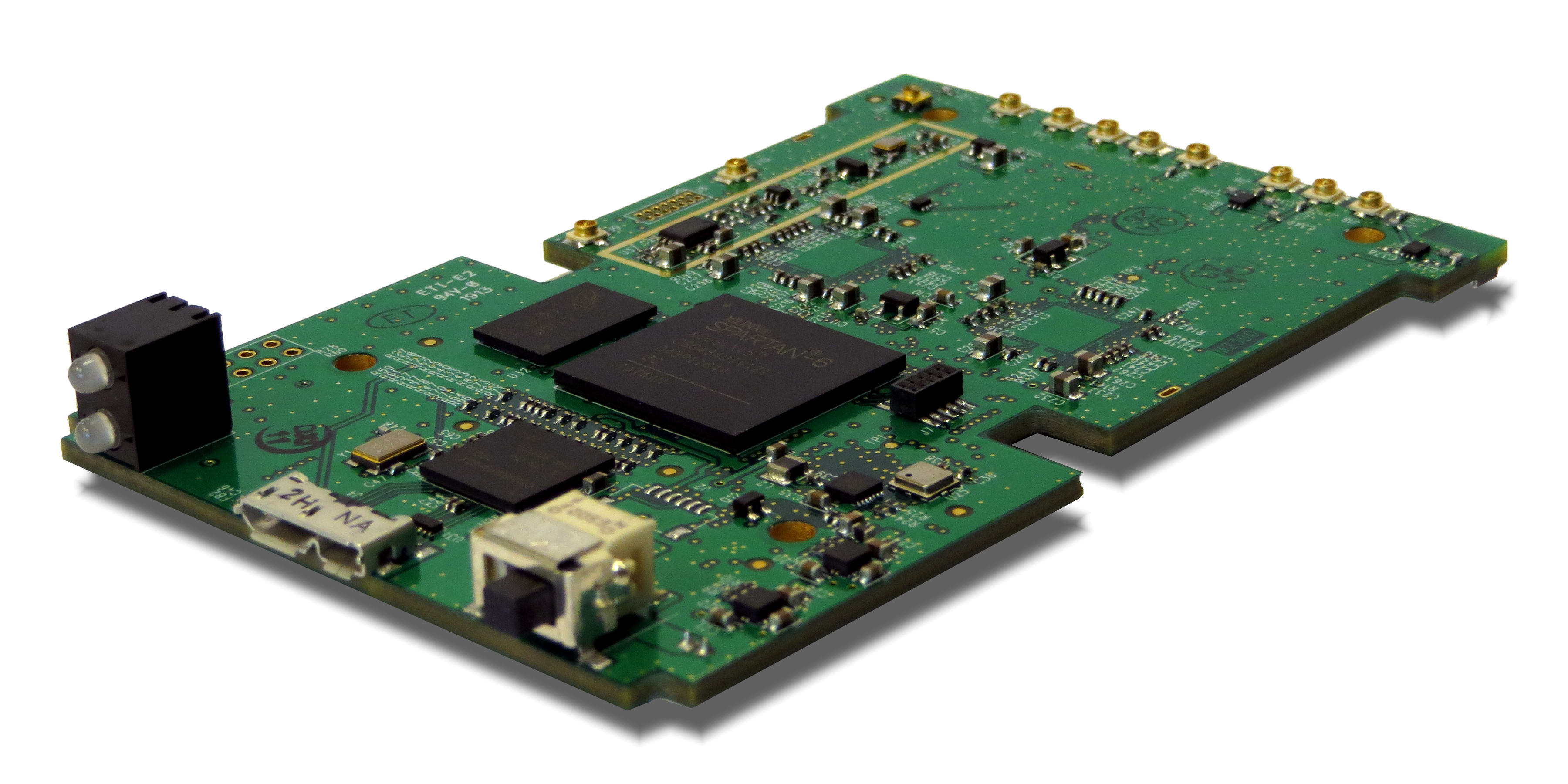
Loctronix Corporation, a provider of unified positioning solutions for GNSS-challenged environments, is making available its new software-defined radio (SDR) module, the ASR-2300, for developing high-performance positioning, navigation and timing, and communication applications.
The ASR-2300 will be on display September 16-19 at the Institute of Navigation annual meeting, ION GNSS+ 2013, in Nashville, Tennessee.
“The ASR-2300 delivers advanced SDR capabilities in a small, mobile form-factor enabling developers to readily create and field complex SDR-based solutions. The module moves SDR out of the lab and into production, providing the critical piece for tapping advanced, multi-sensor/signals of opportunity for high-performance PNT,” stated Michael Mathews, Loctronix’ CEO and founder.
According to Mathews, “The ASR-2300 is unique amongst the growing number of SDRs, having multiple, fully-integrated RF paths supporting reception of GNSS, cellular, ISM band, and UHF signals of opportunity. The ASR-2300 will benefit SDR developers working on demanding scientific, military, aerospace and commercial/industrial applications.”
The ASR-2300 is a multiple-input and multiple-output (MIMO) transceiver module incorporating two wideband Field Programmable RF (FPRF) transceivers (300 MHz to 3.8 GHz) from Lime Microsystems, 10-axis accelerometer/gyro/compass/barometer sensors, and a large programmable FPGA capable of over 300 MiB/sec sustained communications with a host processor via USB 3.0 interface. The module’s nine integrated RF path options and low size, weight, and power characteristics contribute to ease of integration and portability. Accommodating both internal 1 PPM TCXO or external frequency reference, multiple ASR-2300s can be inter-connected via an expansion port and/or UART interface, supporting real-time reception / transmission of 4, 6, 8 or more signals without the need for significant additional hardware.
With on-board flash for storing developer customizable firmware and FPGA logic, the ASR-2300 can be configured to operate in a variety of different power profiles, maximizing battery life without requiring a host processor. The modules will be factory-programmed with only the RF receiver capabilities enabled. Developers can enable transmit functionality by modifying the firmware and waveforms.
The A2300 Open Source Project at Myriad RF
To encourage innovation in PNT and communications applications, Loctronix has partnered with Lime Microsystems to provide the source materials for the ASR-2300 module under open source licensing at the Myriad RF project.
“The broad utility of the ASR-2300 makes it an ideal platform for prototyping and developing advanced applications in the communications and PNT markets. Developers can make their own boards using the documents and design database contained in the A2300 project and/or purchase hardware, development kits, support services, and licensed waveforms directly from Loctronix,” Mathews said.
“Encouraging collaboration between the open source community and industry is a natural way to promote innovation and accelerate growth of SDR technology. We are delighted to partner with Loctronix to make their innovative ASR-2300 SDR design available to open source developers for creating advanced SDR applications,” said Lime Microsystems CEO Ebrahim Bushehri, Ph.D.
The open-source software package includes basic drivers for Linux and Windows environments enabling both GNU Radio and embedded C/C++ developers to interface with the ASR-2300 module. Developers can obtain source code and design documents for modifying the ASR-2300 to suit their own applications.
The ASR-2300 will be available from Loctronix this November. Adaptors, antennas, and a housing kit will also be available that provide a variety of configuration options supporting bench-top testing to wearable, battery-operated field demonstrations.
RTKLIB, a developer of open source software for standard and precise GNSS positioning, has released its latest RTKLIB software (version 2.4.2), which fully supports NVS Technologies’ BINR proprietary binary protocol and the NV08C GNSS receiver series.
The use of RTKLIB, in conjunction with NVS Technologies’ NV08C GNSS receiver series, including the highly integrated NV08C-CSM surface mount module with geodetic grade raw data output, enables GNSS system designers and OEMs to develop highly accurate, low cost and compact precision-grade positioning and navigation equipment.
RTKLIB features include:
Full compatibility with NVS Technologies’ NV08C Series GNSS Receivers.
A portable program library and several APs.
Standard and precise positioning algorithms using GPS, GLONASS, Galileo, QZSS, BeiDou and SBAS.
Supports various GNSS based positioning modes, both for real-time and post-processing, including: Single, DGPS/DGNSS, Kinematic, Static, Moving-Baseline, Fixed, PPP-Kinematic, PPP-Static and PPP-Fixed.
Positioning mode for real‐time and post‐processing, including Single, SBAS, DGPS, RTK, Static, Moving‐base and PPP.
Supports many standard formats and protocols for GNSS, including RINEX 2 & 3, RTCM 2 & 3, BINEX, NTRIP 1.0, RTCA/DO-229C, NMEA 0183, SP3-c, ANTEX 1.4, IONEX 1.0, NGS PCV and EMS 2.0.
External communication via Serial, TCP/IP, NTRIP, local log file (record and playback) and FTP/HTTP (auto download).
Contact NVS Technologies for specific features compatibility. Visit www.rtklib.com for RTKLIB’s latest (ver. 2.4.2) software package download, release note, information, tutorial, manual and support.
A sold-out crowd of more than 650 people filled the Kossiakoff Conference Center at the Johns Hopkins Applied Physics Laboratory on Wednesday, 30 May 2012 to participate in the Open Source Industry Day co-hosted by the National Security Agency and the Open Source Software Institute.
“The Open Source Industry Day event could not have gone better,” said event volunteer co-chairman John Farrell of HP Enterprise Security. “We had a sell-out crowd, fantastic speakers and packed panel discussions that kept audience and panelist engaged all day. Our thanks go to the many volunteer supporters and government participants who worked together to make this event successful.”
According to the day-long, unclassified event featured senior-level government leaders, tech industry representatives and open source community experts who participated in interactive panel discussions covering a range of topics identified by government users as specific areas of interest.
“We worked closely with our government partners to choose topics that were timely and relevant to helping meet their interest and mission needs,” Farrell said. “After we agreed on a set number of primary topics, we reached out to the top-level experts in each field and were flooded with responses from speakers and subject-matter experts. The overwhelming success of this event helps to demonstrate the level of interest for open source software solutions by government agencies.”
A list of discussion topics and participating speakers is available at the OSSI website: oss-institute.org.
The event also featured highly-regarded keynote speakers from the Defense and Intelligence Communities. Keynote speakers included John A. Marshall, Chief Technology Officer at US Joint Chiefs of Staff, J2 Intelligence Directorate; Charlie Stein, Program Executive Office for Information Assurance at the National Security Agency; Don Davidson, Chief Outreach & Standardization (Trusted Mission Systems & Networks) at US Department of Defense; and Dan Risacher of the Office of CIO at US Department of Defense.
As follow up to the Industry Day, OSSI is using the feedback from the event to prioritize follow up discussions at their regular monthly meetings and there will be a “Call for Papers” shortly.
“The event attracted leaders and senior level professionals from nine government agencies and more than 300 corporations in what can only be described as an open and honest discussion,” said OSSI Regional Director Carl Livesay. “OSSI leveraged resources in the open source community to organize, manage and provide speakers for the event. The results were a tremendous value to attendees and a collaboration from contributors. We thank those who attended and those who contributed.”
OSSI is in discussion with several other government agencies to hold similar events focused on their individual missions.