Tag: PND

  • TMW Systems Certifies Integration with Rand McNally Devices

    Rand McNally has announced that its mobile communication systems are now certified and integrated with two applications from TMW Systems, Inc. As a result, fleets that use TMWSuite or TL2000 now can pull data from Rand McNally’s TND 760 and TruckPC in-cab devices through their TMW products.

    “Rand McNally has been a TMW Business Alliance Partner for decades,” said Scott Vanselous, CMO of TMW Systems. “By certifying integration with Rand McNally’s mobile communication and management systems, our customers have ready access to a full suite of Rand McNally solutions.”

    One customer is Freight Exchange of North America (F/X), a Chicago-based, North American full truckload carrier that operates nearly 300 power units from its terminals in Southern California, El Paso, Dallas, and Chicago. F/X has integrated information from Rand McNally’s TND 760 (Fleet Edition) with TMWSuite. For F/X, the integration allows for the use of real-time information from the in-cab device to dispatch trucks, receive automatic arrival and departure notification, match loads with available drivers, and track the progress of the driver’s daily workflow.

    “TMWSuite has been a tremendously successful tool to manage our operation. Rand McNally’s integration allows us to leverage our investment even further,” said Fred Alaimo, V.P. of Operations at F/X. “The TND 760 offered more functionality than other solutions we reviewed, and it’s priced significantly more competitively. The icing on the cake is that the drivers love the new device and have been quick to adopt and use the technology, making everybody a winner.”

    The TMW certified integration pulls critical data from Rand McNally’s in-cab systems via Rand McNally Connect software. The data provided by Rand McNally’s devices enable TMW products to deliver the following:

    • Automated and standardized driver daily workflows;
    • Notification of vehicle arrival and departure via Rand McNally’s automated geofencing capability;
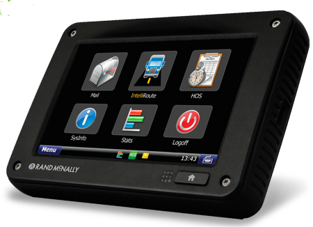
    • Integrated turn-by-turn navigation, provided by Rand McNally’s IntelliRoute TND GPS software;
    • Automatically linked information — such as bill of lading numbers — from one form to another further simplifying the driver experience;
    • Integrated Hours of Service information into load planning and dispatching operations.

    “Having a certified solution with TMW’s industry-leading enterprise transportation management systems enables customers to confidently integrate the benefits of mobile communication, award winning navigation and fleet management,” explained Dave Muscatel, CEO of Rand McNally. “In particular, our TND 760 Fleet Edition device offers fast ROI recognition due to its cost effectiveness, ease of use and driver acceptance.”

  • Have Apple and Google Killed Personal Nav Devices?

    Two prominent tech magazines are tolling the death knell for portable GPS devices today, spurred in large part by Apple’s announcement of Maps, its own mapping and GPS navigation service.

    “Apple made a number of significant announcements at its Worldwide Developer Conference (WWDC) yesterday, but one of the most insidious was its widely expected move to launch Maps, the company’s homespun mapping and GPS navigation service,” reads PC World’s article “Apple Moves to Kill GPS Devices, Reduce Dependence on Google.

    “The updated app marks the first time the iPhone will have free, voice-enabled GPS navigation. It also includes real-time traffic, Yelp integration, crowd-sourced traffic data (hello Waze), Siri support, and the ability to work in the lock screen. In a move to match Google, Apple is also working on 3D modeling for buildings and terrain data, which it will acquire by flying planes over U.S. cities.

    Wired Magazine was even more dire; its article titled “Apple, Google Just Killed Portable GPS Devices,” begins, “If it wasn’t obvious before, it’s crystal clear today. The dedicated portable GPS device is dead, with Apple and Google playing pallbearer to Garmin, Magellan and TomTom’s hardware businesses.

    “Between last week’s hastily organized Google Maps event, where the search giant showed off a new interface, new features and — most importantly for Android users — offline map downloading, and Apple’s new Maps app announcement at WWDC, a dedicated device for mapping and navigation comes across as superfluous. Or even worse, incredibly low-tech.

    Meanwhile, Apple signed TomTom for mapping services over Google Maps for its new operating system. Also read LBS Insider editor Kevin Dennehy’s latest column on Google’s plans to enhance its maps on Android.

  • GPS for Truckers

    Magellan, maker of innovative GPS devices for vehicles, outdoor and mobile navigation, has announced the newest addition to its Magellan RoadMate Commercial GPS family for truckers and commercial drivers providing improved safety and productivity before, during and after their on-the-road trips. The compliance-ready Magellan RoadMate Commercial 9270T-LM GPS device is specifically designed for the needs of truckers including an extra-large GPS display, customizable truck-specific routing, hands-free communication, and trip logging.

    To prepare for their trips, truck drivers can use the Magellan RoadMate Commercial 9270T-LM to set up customizable routes based on the height, weight, width, and length of the vehicle, as well as applicable hazmat restrictions. Multi-destination routing allows drivers to plan their stops and optimize routes to help them save time and gas, Magellan said.

    While on-the-road, the Magellan RoadMate Commercial 9270T-LM helps drivers navigate on an extra-wide 7-inch high-definition touchscreen display that adjusts color and contrast for easy night-viewing. The large display also makes maps and other content easy to read when the GPS Navigator is mounted in large vehicles with deep dashboards. The integrated Bluetooth wireless technology, when paired with a compatible Bluetooth phone, enables drivers to safely talk hands-free while keeping their eyes on the road.

    At the end of their trip, the Magellan RoadMate Commercial 9270T-LM facilitates preparing required compliance reports including hours and state mileage for IFTA fuel records. A comprehensive log of trip information by each driver is retained in the Magellan GPS device for easy exporting into reports.

    “We expanded our family of Magellan RoadMate Commercial GPS Navigators to further meet the unique navigation needs of commercial and truck drivers who need a comprehensive solution to efficiently perform their jobs from the initial trip planning stage to their on-the-road requirements and managing required log reporting after their trip,” said Stig Pedersen, Associate Vice President of Product Management for Magellan. “The Magellan RoadMate Commercial series of GPS Navigators are designed to make drivers’ jobs safer and less stressful plus improve productivity, reduce costs and ultimately increase profits.”

    The Magellan RoadMate Commercial 9270T-LM functions as an “information dashboard” that not only navigates, but provides elevation and truck speed limit warnings. The 9270T-LM GPS device includes several valuable safety and convenience features:

    • Highway Lane Assist that shows realistic highway signs and guides truck drivers towards the correct lane when approaching complex highway interchanges and exits;
    • Free Lifetime Traffic Alerts that help drivers avoid traffic incidents on their route by offering an alternative solution;
    • Spoken Street Name guidance that announces the street name and gives turn-by-turn directions;
    • Highway Exit Points-of-Interest and a Truck Stop Directory help drivers find services including gas stations, restaurants, ATMs, rest areas and showers, truck services, Wi-Fi availability;
    • OneTouch lets truckers bookmark and assign a button to their favorite destinations or searches for faster access;
    • Heavy-duty extended windshield mount, designed for deep dashboards, is included to provide fully-adjustable, personalized comfort and safe viewing;
    • An A/V input for easy connection to external devices such as the Magellan Wireless Back-up Camera or a DVD player;
    • Free downloadable Lifetime Map Updates keep the pre-loaded maps of the United States, Canada and Puerto Rico up-to-date.

    The Magellan RoadMate Commercial GPS family now includes two models — the new 7-inch Magellan RoadMate Commercial 9270T-LM ($399.99 MSRP) and the 5-inch Magellan RoadMate Commercial 5190T ($379.99 MSRP). Both models are available in June at truck stops and through Magellan’s consumer electronics and online partners.

  • Rand McNally Upgrades TND 760 Mobile Comm/Fleet Management System

    Rand McNally Upgrades TND 760 Mobile Comm/Fleet Management System

    Photo: Rand McNally

    Rand McNally has announced a new pricing plan, new features, and a new warranty program for its single-box compliance solution for fleets. The TND 760 Fleet Edition is a next-generation in-cab electronic on-board recorder (EOBR) device that installs in less than 30 minutes, is low cost, and is easily adopted by drivers, the company said.

    For as little as $649 for the hardware, and $19.95 per month for service, trucks can be equipped with a fully compliant EOBR solution. For $799, the device also comes loaded with Rand McNally’s navigation. Lease options are available for as low as $39 per month for qualifying fleets.

    Among the new items announced today, three monthly service plan options are now available. The EOBR plan, offering electronic hours of service and vehicle inspection reporting, for $19.95/month; the Basic plan, which layers on vehicle positioning and online mapping, text and form messages, driver email and attachments, as well as integration access via Rand McNally Connect, for $29.95; and the full Enterprise plan that layers on a driver scorecard, vehicle performance, critical event reporting and vehicle maintenance, for $39.95. These service plan prices are based on a three-year commitment.

    A three-year warranty is now standard on the TND 760 hardware, providing customers peace of mind for the term of the agreement that their hardware is covered under warranty. This is an upgrade from the standard one-year warranty typically offered in the industry.

    And, Rand McNally announced a group of new features coming on stream in the next few months. By the end of June, a new back-end mapping portal with upgraded geofencing, alerting, and route replay will be up and running. This feature will be part of the Basic and Enterprise monthly plans. Also in development are significant enhancements to the IntelliRoute TND GPS navigation software, including the ability for fleets to send, and for drivers to receive, routes on the TND 760.

    “As we roll out the TND 760 to more fleets and transportation companies, we’re finding that there are a number of items they’re responding to,” said Dave Muscatel, CEO of Rand McNally. “The low cost, the quick installation, and the fact that Rand McNally is well regarded among professional drivers is key. When drivers accept the device, they use it.”

    The Rand McNally TND 760, Fleet Edition, first available Q4 of 2011, integrates with a truck’s on-board computer and sends and receives information via both Wi-Fi and cellular modes. The TND 760, manufactured in the U.S.A., is designed to be set up in less than 30 minutes and does not require the installation of a separate “black box” monitoring unit like traditional mobile communication systems.

    Despite its compact design, the TND 760 features a broad array of capabilities including fleet communications via email, driver and vehicle performance monitoring, electronic hours of service (HOS) compliance, and truck-specific navigation. Information on fleet activity is managed via Rand McNally’s significantly enhanced FleetWatcher web-based portal.

    For more information and product demonstrations, potential customers should call 1-800-641-RAND (7263) or go to randmcnally.com/tnd760.

  • Leap Year Confuses TomTom PNDs

    A leap-year bug caused some TomTom satellite navigation devices to malfunction, reports BBC News.

    TomTom posted an information page on its website, offering a software update. “Some customers have been experiencing GPS positioning issues since 31st March,” TomTom said. “The issue is caused by a ‘leap year’ bug in the software of the GPS receiver provided by a third party.”

    TomTom said that a problem with its global positioning system firmware had caused models worldwide to fail to identify their location, BBC News said.

    The TomTom devices affected are:

    • Start 20/25
    • Via 110/120/125
    • Via LIVE 120/125
    • GO LIVE 820/825
    • GO LIVE 1000/1005/1005 World
    • Blue & Me TomTom 2
    • TomTom Connect

    To download the firmware to their device, users will need to set up an account at the TomTom site if they don’t already have one.

    Users are discussing the issue on the TomTom message board.

  • Out in Front: Ten Big Ones in Five

    At the opposite end of this book, my esteemed colleague Eric Gakstatter gives you his Top Five news stories of the recently passed year, from a system point of view. Spend five minutes here in this column, and I’ll toss up the Top Ten for GNSS business, as reported in this magazine.

    Not the biggest money deals or revenue generators, at least not in the short term. But the most significant in terms of breaking new ground, pushing out frontiers, integrating with other technologies — the modes through which industry grows and prospers.

    I’m leafing through my back copies in reverse order. This listing goes not by prominence, but by reverse chronology.

    PNDs Up, Then Down By 2015. When you are doing well, rest assured that someone is gaining on you. Smartphones will gradually take over the personal nav market. Stay flexible, innovate, and be prepared to change horses in midstream.

    Rockwell Delivers New MUE. While military user equipment gave this industry its start, the receivers themselves have always lagged behind product available to civil users. Still, security features in the GB-GRAM-M foreshadow what all receivers may eventually require.

    Triumph V.S. from JAVAD. Supercharged with capabilities, a veritable surveyor’s arsenal, and probably a gamechanger — whether or not it makes it in the marketplace. A visionary product.

    NovAtel OEMV-1DF. Almost every month, another smallest-yet consumer-grade GPS receiver emerges. But when high-precision, dual-frequency receivers grind down their footprint and power requirement, you know this is a future wave that will sweep everything along. Not the only tiny high-performance OEM receiver, mind you, just the latest.

    LLC Rusnavgeoset. The joint venture between Trimble and a Russian company will help drive the commercialization of GLONASS, an aspect that system has not yet truly seen. We all talk about the second GNSS of choice, but the second commercialized GNSS is what we really want.

    Smartphone Explosion. The flipside to the first story. This year’s models from Apple iPhone, Google Android, Blackberry, Windows Phone 7, and all their kin, if not built around location as Apple claimed, certainly have it as core feature. The flip of the flipside: pricing for the GPS component is cut-throat. Absolutely the worst you’ve ever seen.

    GPS-Enabled USB Drive. That’s all it takes — well, download some software and buy a contract — to make a laptop location-aware.
    Spirent Assisted-GLONASS Testing. One more sign that the Russian system, against betmakers’ odds, may yet become the trusty sidekick. Soon, if your mobile doesn’t have it, it’s not 
top-of-class.

    One-Chip Receivers-Plus. Hardly breaking news, since it’s been talked about and even done, sort of, for years. TI, Broadcom, Qualcomm, CSR, and silent runners like Sony and Panasonic are all adding some communication transceiver(s) to GPS and squeezing them onto a single piece of silicon.

    No News Is Big News. Actually not reported here or anywhere, because neither party wants to reveal anything, but some of the biggest deals are cut by chip manufacturers (such as STMicroelectronics, to name just one), with automobile makers around the world. Like it or not, the car/truck is the dominant mechanical paradigm of our age. And if location is in it . . .

    We are indeed fortunate to be part of, and partners in, such a vital scene. Best wishes for this New Year.

  • TomTom – Tele Atlas Merger a Done Deal

    Following the announcement that Tele Atlas was making management changes in light of the pending merger, TomTom says that it has completed the merger of digital map supplier Tele Atlas.

    TomTom and Tele Atlas jointly announced Thursday, June 5, that TomTom “declares the recommended public offer for all issued and outstanding shares with a nominal value of €0.10 each in the capital of Tele Atlas unconditional.” TomTom said it will grant shareholders who have not yet tendered their shares under the offer to tender their shares in a post-acceptance period lasting until June 26; these shares are less than 3 percent of the total Tele Atlas shares.

    TomTom has been pursuing a merger with the digital map data supplier for nearly a year, outbidding rival Garmin in the process, in a deal worth approximately €2.9 billion ($4.5 billion). After a lengthy review by European anti-trust officials, TomTom and Tele Atlas received approval for the merger in May.

    Earlier this week the companies announced that during the acceptance period, which ended May 30, some 63,625,232 shares had been tendered for acceptance. Together with the 27,235,651 shares already held by TomTom and 1,685,000 shares to be delivered by Tele Atlas board members, the shares totaled 92,545,883, or 97.48% percent of the total issued and outstanding shares of Tele Atlas capital.

    As soon as legally possible, TomTom intends to remove Tele Atlas’ listings on European financial markets. The company also reiterated that it may initiate any of the reorganization measures as set out in the terms of its offer, which includes the possibility of a squeeze-out procedure.

  • Europe Takes Closer Look at Navteq/Nokia Merger

    While European regulatory authorities are closely scrutinizing the proposed TomTom/Tele Atlas merger, they have also turned their eyes to the proposed Navteq/Nokia deal.

    Navteq Corp. said today that the European Commission has initiated a second-phase review of Nokia’s pending acquisition of Navteq. The company stressed in its announcement that this is part of the commission’s review process and does not signal the ultimate outcome. Nevertheless, it is a rare, if not extraordinary step for the commission; in the past 10 years it has only initiated a second-phase review in about 3 percent of European mergers of publicly held companies.

    The Commission now has 90 working days to make a final decision on the transaction. However, the review period may be extended to 125 working days. Such has been the case with the TomTom/Tele Atlas deal, also under a second-phase review. Those two companies are anticipating a commission decision on their merger by May 21.

    Both Navteq and Nokia said they remain committed to their merger plans, noting that the deal has received all the other necessary regulatory approvals, including anti-trust approval in the United States.

    Meanwhile, TomTom said March 27 that it was extending the period of its offer for Tele Atlas. It was clear the European Commission wouldn’t reach a decision by the end of the previous time frame attached to the offer to acquire Tele Atlas for €30 per share, or about €2.9 billion, which would have ended March 31, TomTom said. As result, it has extended its offer to May 30. The Commission originally announced that it was initiating a second-phase review of the merger in November of last year.

  • TomTom-Tele Atlas Merger Falls Under Scrutiny

    The European Commission (EC) is taking a closer look at TomTom’s planned acquisition of TeleAtlas; it looks as if it might have a tough European road to hoe.  The EC only initiates a second review in about 3 percent of the mergers it reviews, so it’s a bit of an extraordinary step. The probe will examine whether the deal would push up the price of digital maps for rival portable navigation device makers or limit their access to these maps, the EC said. It set an April 17 deadline for the probe to end.

    TomTom and Tele Atlas said in a joint statement they expect to have a clearer idea about whether the deal can go through by early next year. TomTom extended its offer for Tele Atlas shares until March 31, assuming it would know the outcome of the probe by then.

  • Navteq Schedules Stockholder Vote on Nokia Merger

    Navteq Corp. said Monday that it has scheduled a special meeting of stockholders next month to consider approval of the previously announced merger agreement between the company and Nokia.

    Finnish mobile phone maker Nokia and digital map supplier Navteq first announced on October 1 that they had reached a definitive merger agreement to the tune of $8.1 billion (€5.7 billion). In the meantime, PND rivals Garmin and TomTom became involved in a bidding war over Tele Atlas, a Navteq competitor.

    Navteq stockholders of record at the close of business on November 13, 2007, are entitled to notice of the special meeting and to vote on the adoption of the merger agreement, according to the company. The special meeting will be held on December 12 in Chicago. Proxy statements and the accompanying proxy card were mailed to Navteq stockholders earlier this month, the company said.

    Completion of the merger is subject to the adoption of the merger agreement by Navteq stockholders at the special meeting and the satisfaction of the other closing conditions set forth in the merger agreement. Navteq currently expects to complete the proposed merger in Q1 of next year.

  • Trimble Introduces Handheld Data Collection Device

    Trimble has introduced the Juno ST handheld, a portable data collection solution supported by the company’s field and office software. It comes standard with a built-in GPS receiver, Microsoft Windows Mobile version 5.0 software, and Wi-Fi/Bluetooth for wireless connectivity to office networks, cameras, and mobile phones.

    The Juno ST handheld’s low price point facilitates large-scale deployment, according to Trimble, allowing a company or organization to equip a significant number of its employees; it is especially practical for use in applications where high productivity is most important. Examples include natural resources organizations, utility companies, and government agencies conducting inspection and permitting tasks. The Juno ST handheld is also fully compatible with other Trimble data collection systems, utilizing the same software and workflows as the entire range of Trimble Mapping & GIS solutions.

    Delivering a range of 2- to 5-meter positioning, real-time or postprocessed, the unit incorporates a high-sensitivity GPS receiver and has been designed to maximize yield of positions in hostile environments, such as under forest canopy and up against buildings. For use in a vehicle, an external antenna can be added.

    “The Juno ST handheld is ideal for companies and organizations that need to deploy a large number of data collection systems in the field,” said Doug Merrill, general manager of Trimble’s Mapping & GIS Division. “Small and light enough to fit in your pocket, the Juno ST can easily complement an existing field operation and can be added into your current workflow.”

    The unit weighs 4.8 ounces (133 grams) and measures approximately 4.3 in X 2.4 in X 0.7 in (10.9 cm X 6.0 cm X 1.9 cm). The handheld has 128 MB of non-volatile Flash data storage and a Secure Digital (SD) card slot for additional data storage. The removable Li-Ion battery is rechargeable and lasts for up to eight hours.

    The Juno ST provides flexibility with Windows Mobile 5.0 software and includes Microsoft productivity tools such as Word Mobile, Excel Mobile, Internet Explorer Mobile, and Outlook Mobile.