Tag: Point One

  • Point One Navigation launches new features for Polaris Network

    Point One Navigation launches new features for Polaris Network

    Photo: Point One Navigation
    Photo: Point One Navigation

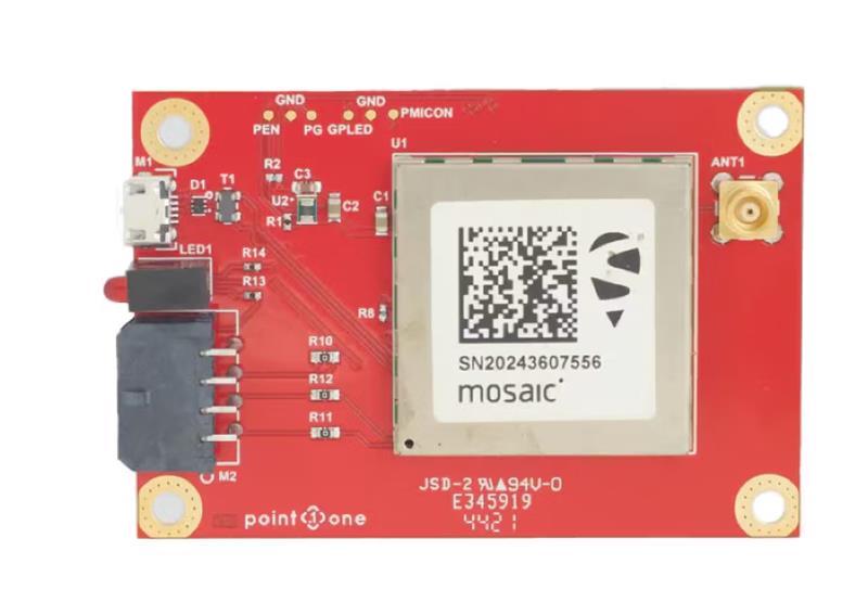
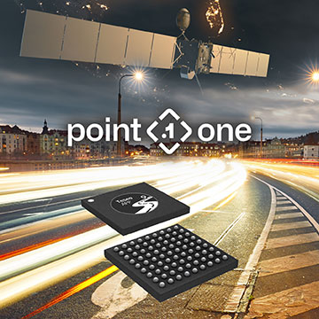
    Point One Navigation has released a new “Tags” feature for its precise positioning Polaris network.

    The Tagging feature aims to simplify building and using positioning networks and systems for a wide range of applications including surveying, construction, fleet management, AgTech, robotic devices, UAVs and autonomous vehicles.

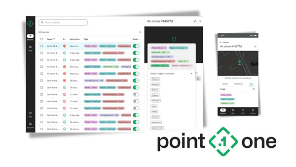
    With this upgrade, users can access streamlined searchability, precisely defined analytics and the ability to control devices at scale. According to Mark Wilkerson, Point One Navigation’s Product Manager, “The most powerful aspect of our tagging system is that it fundamentally changes the way customers can integrate their systems with ours.”

    Users can now work with P1’s API as if it were one of their native applications. The tagging features allow users to query data in the system using their native IDs, model numbers, regions and more.

    It now supports real-time operations with Point One’s GraphQL subscriptions API and features a device search UI in the web app. This allows users to filter and query their devices by tags, connection status or attributes. By using the new search feature, support teams can quickly pull up all active devices and display them on a map in real time. Changes made in either the web app or the API update in real-time.

  • Point One Navigation expands Polaris RTK location network to South Korea

    Point One Navigation expands Polaris RTK location network to South Korea

    Image: Point One Navigation
    Image: Point One Navigation

    Point One Navigation has expanded its Polaris real-time kinematic (RTK) location network to South Korea.

    The network is set to provide comprehensive coverage throughout the country. Existing Polaris customers can use the South Korean integration to enhance the precision and efficiency of their location-based projects.

    Polaris offers centimeter-level accurate GNSS positioning with accuracy ranging from 1 cm to 10 cm, which makes it ideal for challenging environments, such as urban areas with limited sky view. Unlike standard GNSS systems — which face position uncertainty due to atmospheric signal delay, satellite orbit variation, clock drift and signal multipath — the Polaris network counters these issues using additional information from compact base stations.

    Point One’s FusionEngine software further integrates inertial measurement, wheel odometry and additional sensors to achieve the desired level of precision in the complete absence of satellite signals.

    The Polaris network with FusionEngine software can be used as a precision location service for autonomy and robotics applications. Polaris supports all major GNSS constellations and has an extremely dense global network of base stations that cover the United States, Europe, New Zealand, South Korea, and parts of Canada and Australia.

    Developers can integrate the Polaris RTK network and FusionEngine software using GraphQL API. The network can be built into demanding applications such as industrial autonomy, precision agriculture, logistics and delivery, robots and advanced driver-assistance systems (ADAS).

  • Point One Navigation expands location solutions to cover Great Britain

    Point One Navigation expands location solutions to cover Great Britain

    Image: Point One Navigation
    Image: Point One Navigation

    Point One Navigation has integrated Ordnance Survey base stations into the Polaris Network, which is designed to improve accuracy, precision, reliability and interoperability in the UK. The solutions aim to aid in applications such as advanced driver assistance (ADAS), robotics, mapping and more.  

    Polaris is a real time kinematic (RTK) corrections network that offers cm-level accurate GNSS positioning. Polaris’ global RTK network now includes the entire United States, EU, Australia, Canada and the UK. 

    Existing Polaris customers can utilize the UK integration immediately, at no additional cost. 

    This technology is complemented by the company’s FusionEngine software, which further integrates inertial measurement, wheel odometry and additional sensors to achieve the desired level of precision, even in the absence of satellite signals.  

    Polaris supports all major GNSS constellations and has a dense global network of base stations, which offers improved precision acquisition time in more places, the company says. The network supports all modern navigation signals across all mobile networks. 

    According to Point One, it is the first localization service with a modern GraphQL-based API, which aims to improve the integration of Polaris RTK into developer-built applications. It can be used by software developers to integrate RTK into demanding applications, including industrial autonomy, precision agriculture, logistics and delivery, robots and ADAS.  

    It will support State Space Representation (SSR) corrections delivered by L-band satellites in early 2024, the company says, which will allow for operations to continue in the absence of cellular networks or in bandwidth constrained applications.   

  • Point One Navigation launches real-time INS

    Point One Navigation launches real-time INS

    Image: Point One Navigation
    Image: Point One Navigation

    Point One Navigation has introduced the Atlas inertial navigation system (INS) designed for autonomous vehicles, mapping and other applications.

    Traditional INS solutions have typically relied on extensive post-processing to reach the high precision levels needed for accurate mapping and observability applications. In contrast, Atlas can provide users with ground-truth level accuracy in real-time, which can streamline engineering workflows, significantly reduce project costs and improve operational efficiency.

    Atlas is designed to be used in large fleets. It integrates a highly accurate, low-cost GNSS receiver and IMU with the Polaris RTK corrections network and Sensor Fusion algorithms. The company aims to make it easier for businesses to equip their entire autonomous fleets with high-accuracy INS.

    The system features a user-friendly interface, on-device data storage and both ethernet and Wi-Fi connectivity. Field engineers can easily configure and operate Atlas using smartphones, tablets and in-car displays.

    Atlas aims to drive innovation across a variety of sectors, including autonomous vehicles, robotics, mapping and photogrammetry. Its real-time capabilities and affordability can enhance the widespread deployment of ground truth-level location in fleet operations.

  • Point One Navigation joins STMicroelectronics Partner Program

    Point One Navigation joins STMicroelectronics Partner Program

    Image: Point One Navigation
    Image: Point One Navigation

    Point One Navigation has joined the STMicroelectronics Partner Program. The program aims to deliver reliable navigation and positioning solutions to a diverse spectrum of ST customers in the U.S. and Western Europe.

    Because of Point One’s navigation software and real-time kinematic (RTK) network, developers using ST Teseo GNSS solutions now have a more efficient path to create precise navigation solutions in industries such as agriculture, construction, last-mile delivery, and autonomous vehicles.

    Point One’s Polaris Cloud is a GNSS correction network that enables GPS based localization, while allowing users to choose the performance and price point that best fits their application. With coverage across the U.S. and most of Western Europe, Polaris Cloud provides a readily available solution for precise localization.

    FusionEngine software, developed by Point One, further enhances precision navigation by integrating additional sensors like IMUs and wheel speed sensors. This allows users to achieve a desired level of accuracy, even in situations where satellite signals are absent or in challenging urban environments. The software also offers automatic calibration, fault detection and compatibility with a range of host processors.

  • Septentrio and Point One Navigation partner to expand portfolio across Europe

    Septentrio and Point One Navigation partner to expand portfolio across Europe


    GNSS interface board – mosaic. (Image: Point One Navigation)
    GNSS interface board – mosaic. (Image: Point One Navigation)

    Point One Navigation and Septentrio have partnered to expand upon the companies’ precision location solutions throughout Western Europe. The new developer compatibility is suitable for demanding applications, including industrial autonomy, precision agriculture, logistics and delivery, robots and autonomous vehicles.

    Point One’s Polaris is a correction network that enables high-precision GPS and computer vision-based localization. Polaris has recently extended coverage to now include Western Europe, further expanding the reach of the network. This solution is powered by Septentrio’s GNSS receivers, including the mosaic compact multi-constellation GNSS receiver.

    The mosaic module — a multi-band, multi-constellation receiver in a low-power surface-mount module with a wide array of interfaces — is designed for mass market applications such as robotic and autonomous vehicle guidance systems. The module integrates GNSS and RF ASIC technology, as well as the robust positioning engine from Septentrio.

    Septentrio real-time kinematic (RTK) receivers can be used directly with Polaris to provide centimeter-level accuracy in seconds.

    This technology is complemented by Point One’s FusionEngine software, which further integrates cameras and additional sensors to achieve the desired level of precision — even in the complete absence of satellite signals.

    FusionEngine has the accuracy and the resilience to inclement weather required by Level 2 applications, such as highway lane keeping and V2X, while offering the robustness necessary for mission-critical Level 4 and Level 5 robotaxi and full autonomy applications.

  • Septentrio launches agnostic corrections program

    Septentrio launches agnostic corrections program


    Image: Septentrio
    Image: Septentrio

    Septentrio, a leader in high-precision GNSS positioning solutions, has launched the Agnostic Corrections Partner Program.

    The program facilitates the use of Septentrio receivers with high-accuracy services that provide varying levels of accuracy, coverage and delivery methods. This also allows users to select the service that suits specific applications and business models.

    The Agnostic Correction Partner Program, which includes Polaris from Point One, Skylark from Swift Navigation, and PointPerfect from u-blox, provides documentation for the use of Septentrio receivers with these high-accuracy services.

    Agnostic GNSS corrections refer to correction services that are not specific to a particular GNSS receiver or device. It provides correction data that can be used by any receiver that can process the correction signal. Agnostic corrections are useful in situations where multiple types of GNSS receivers are being used, such as in a large-scale surveying project or in a fleet of vehicles that use different types of navigation systems.

  • Point One Navigation launches positioning engine for autonomous vehicles

    Point One Navigation launches positioning engine for autonomous vehicles

    Photo:
    Image: Point One

    Point One’s FusionEngine software, which is rated for automotive safety integrity level (ASIL), is now compatible with STMicroelectronics’ Teseo ASIL Precise Positioning GNSS chipset (TeseoAPP). This assures functional safety as ASIL-B, a requirement for Level 3+ advanced driver assistance systems (ADAS).

    FusionEngine can be integrated into several different host processors that are used for enabling high level ADAS and autonomous driving systems. The combination of TeseoAPP’s receiver and the STA5365S external RF front-end provides dual-band measurement data for all visible GNSS satellites to the main host processor into which FusionEngine is integrated.

    FusionEngine software is a precise location solution for automotive applications. For accuracy and to ensure the safety and integrity required for high level autonomous vehicles it combines data from multiple sensors, including the TeseoAPP multi-band GNSS receiver. It also enables developers to complete the functional safety concept phase for host system software integration.