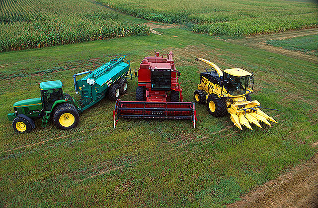
Precision agriculture (PA) — which uses electronic information to better manage spatial and temporal variability in crops, livestock, forestry and other biological systems — is profitable, as proven by the rapid and widespread adoption of GNSS guidance for mechanized agriculture. Other enablers of PA include variable rate technology (VRT), remote-sensing using satellites and unmanned aerial vehicles, geographic information systems (GIS) and soil sampling.
In my introduction to our January cover story, I requested pointers to any “independent, reliable and comprehensive study” as to PA’s return on investment. In response, Professor Won Suk Lee, of the Department of Agricultural and Biological Engineering of the University of Florida Gainesville, introduced me to Professor James Lowenberg-DeBoer, who has more than 30 years of worldwide experience in agricultural research, teaching, outreach and leadership and was the president of the International Society of Precision Agriculture. His research focuses on the economics of agricultural technology.
Dr. Lowenberg-DeBoer wrote to me that “thousands of studies of profitability of precision agriculture” using “a wide range of methods and assumptions” arrive at “a relatively consistent set of conclusions.” He detailed them in a chapter on the economics of PA he wrote for a book published in 2019 (Precision agriculture for sustainability, edited by Dr. John Stafford, Silsoe Solutions, UK and published by Burleigh Dodds Science Publishing) and pointed out to me that additional studies of the topic conducted since then have not altered its conclusions.
Lowenberg-DeBoer used adoption of PA as a proxy for its profitability, because, he wrote, “Farming is a business and technology is adopted if it provides benefits for the farmer and farm household.” He focused on PA for crops on relatively large-scale mechanized farms, but the same principles and general conclusions apply to livestock, forestry and other biological production systems and to medium and small farms.
“Since GNSS guidance was introduced for ground-based agricultural equipment in the late 1990s,” he wrote, “almost all economic studies have shown positive economic benefits which could be quantified and substantial qualitative benefits which were more difficult to measure.”
He reported that within about 10 years of the introduction of both lightbars and autosteer, GNSS was used by about 80% of the dealers. Adoption of PA sensors, on the other hand, was slower. “While GNSS guidance is being adopted quickly almost wherever agriculture is mechanized, VRT is more likely to be found in ‘hot spots’ where the profit potential and soil variability combine to motivate adoption.”
Advances in autonomous robots will further revolutionize agriculture, Lowenberg-DeBoer predicted. “Implementing cropping tasks with swarms of small robots will change agronomic practices and the geography of agriculture. For example, with robotic pesticide application, it might be possible to spray each pest individually instead of broadcast application. This could reduce the amount of pesticide applied by [more than] 90% and reduce the negative effects on beneficial species.”
Industry experts noted in our November 2022 issue that heavy equipment autonomy may be a distant future. However, the steady innovation in machine-control technology to get there is yielding substantial value. To drill deeper into those technologies, we interviewed additional industry experts with a focus on the key role of GNSS in such systems.
1D, 2D and 3D
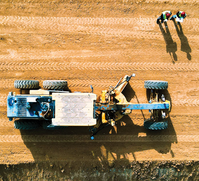
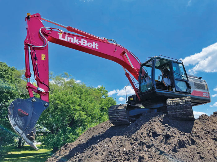
There is currently a sharp growth in the adoption of 3D systems, according to Jordan Van Wie, product specialist with SANY America, a prominent manufacturer of construction equipment. “The fact is that many jobs are requiring this. They’re more efficient in their bidding process. They know exactly where they need to cut and where to fill — this means being more productive in less time.”
SANY America is based in Peachtree City, Georgia, where many of its construction equipment systems are manufactured, including the SY225C, a popular medium excavator.
The process of automating to the levels the operators desire is a matter of which sensors are added and how they sense the active geometry of the equipment in use.
For an excavator, SANY installs four sensors, then measures the machine, said Mukesh Selvaraj, product manager, medium and large excavators, SANY America.
“We know the distance between the bucket pin and the stick pin, up through the boom, and the angles on the sensors. We can compute in the system and report where the tip of the bucket is in relation to the body, and construct a 3D model in real time. This reporting can be as fast as 200 Hz.”
Among the machine-control systems implemented on SANY construction equipment are those from Hexagon | Leica Geosystems. Leica produces precision guidance and control sensors and systems for construction, agriculture and mining that are integrated onto various heavy equipment brands.
While 3D is becoming more popular, systems need to be scalable. Hexagon | Leica Geosystems has variants for different levels of guidance and automation, said Kert Parker, U.S. channel development manager for the company.
“For instance, if you start with our PowerDigger Lite, it has a control box, a display, a boom sensor, an angle sensor for the stick (which includes a laser catcher) and a 360° bucket sensor. This lets you know where the bucket tip is in relation to the model — call it a 1D system.” The cost of such a system might only be 5% or 10% of the cost of the machine on which it is installed — a modest investment for the productivity gains it can deliver.
To upgrade and run automatics, users could add a machine control panel and docking station with just 2D software. “That will give you a semi-automatic solution even on 2D. Then you can upgrade and add the GNSS receiver and antenna — or antennas — and 3D software to make it 3D, semi-automatic,” Parker said.
Two-thirds of the price of the base system is for the sensors on the boom, stick, bucket, the pitch and roll sensor, and the wires that communicate throughout the system, Parker explained.
“So, it’s completely scalable. You can start with a low-cost system upgrade to do GNSS fully and semi-automatic. We can automate any pilot-controlled machine, then we set the pressure. And when we sense the stick pressure, if the system is going automatic, then we automate the boom and the bucket.”
Third ‘D’ Options
“When you’re using something to give the machine a northing, an easting and a height at all times — that is when it becomes full 3D,” Parker said.
3D systems can be configured with a single GNSS receiver, with dual GNSS receivers, or off of a robotic total station. “The only difference between single and dual is that, with single, every time you move the machine you have to do a calibration swing, about 90° to get your heading again.”
“You can dig curves and complex designs working in 2D,” Van Wie said. “But every time you move the machine, you have to re-bench to a known reference, either by pinching with a bucket’s teeth, or hit the stick sensor that has an incorporated laser catcher. When you move the machine, you catch the laser beam again, and you use that for your known reference to dig back from the 3D model.”
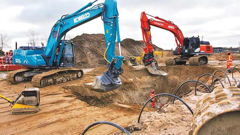
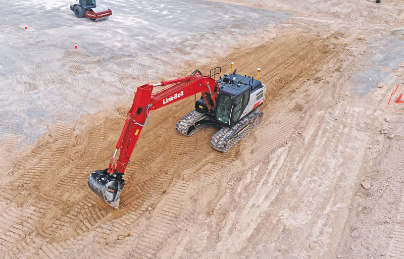
Excavators are a high-growth class of heavy equipment for machine-control adoption, with many excavators ready for system integration. Shown here, Leica iCON iXe3 systems on a Kobelco SK210 (left) and Hitachi 300-02 (right). (Image: Hexagon | Leica Geosystems)
For certain operations — such as excavating in a straight line or moving materials to the side —higher levels of automation may not be needed, so some users appreciate the option of starting with a cheaper system.
“For the small operator, of course, but even for a large operator, it’s a big investment to go full 3D,” Van Wie said. “They don’t want to go full 3D right away, or not on all equipment at once. They start off with just the basics and get familiar with it. Then when they want to upgrade, they have some of the stuff that they’re going to need for their machine already on it.”
System Examples
eSurvey GNSS manufactures GNSS-based equipment, software and systems for surveying, mapping, agriculture, UAV and construction. Better known in other global markets than in North America, the company has seen a steady rise in the market for construction automation — outpacing other sectors utilizing heavy equipment automation such as agriculture and mining combined. For construction, in many parts of the world excavators are the prime focus for automation.
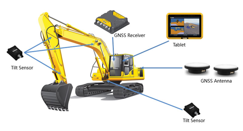
Figure 1. A common configuration of sensors for excavators: GNSS receiver, dual antennas, control tablet and tilt sensors on the body, boom, stick and bucket.(Image: eSurvey GNSS)
Their eME10 system for excavators includes a dual-antenna GNSS receiver, three single-axis tilt sensors, one dual-axis tilt sensor, a tablet and software (Figure 1). “The eME10 does not support a rotating bucket at this time,” said Edward Zhang, product manager for machine control technology. “We support standard excavators, excavators that reach into the water (for instance on dredging barges), and with different bucket tools such as quartering hammers and milling tools.”
Another popular system for compactors is the eMC10, with a single-antenna GNSS receiver, tablet and software, and optional temperature and vibration sensors.
Managing Positioning
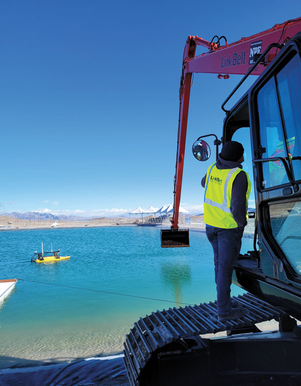
Both the excavator and hydro survey boT have dual GNSS antennas for position and orientation, ensuring fidelity between the 3D model and operation of the excavator for dredging. (Image: Gavin Schrock)
High-precision GNSS, as implemented for architecture, engineering and construction (AEC) applications, can yield centimeter-grade results. However, as many AEC professionals and practitioners know, achieving repeatable and consistent results requires an experienced and skilled GNSS operator. Is the operator examining the results for statistical consistency? How have the observations been constrained to the desired reference framework? Have sources of error such as multipath and space weather been considered?
However, Nick Fifarek, general manager at SITECH Pacific LLC, a construction technology provider, said that equipment operators only need to learn the user interface.
“They are mostly concerned with how the grade is shown in the model, and what actions are required to meet the grade. They should not need to be concerned with the working of the GNSS receiver.”
A larger firm with multiple systems will usually have a technician or surveyor on board, Fifarek explained. This expert would have the experience needed to set up a GNSS site base, ensure corrections are received, and troubleshoot causes of anomalies and poor results.
To be efficient, an operator should not have to deal with a complex set-up.
“It should be more like Google maps in your car,” Fifarek said. “They do not need to know how the model was created, and how the GNSS delivers positions to the interface. All the sensors should work seamlessly, like tilt sensor and IMUs [inertial measurement units] and how they work together with the GNSS to put positions on the blade or bucket. Once this is all working well and the model is applied, they should just be able to take directions.”
Nevertheless, sometimes this expert will need coaching, or a small firm may not have an expert at hand.
“We may need to teach them about some fundamentals, such as signal-to-noise ratio, PDOP [positional dilution of precision], and other quality indicators — especially when setting up the site base station,” Fifarek said.
Additionally, he pointed out, the control must be set up — this is mostly done by engineering or surveying firms along with site calibrations — and operators need to know how to check it.
Multipath Issues. Fifarek has not experienced problems with short masts for GNSS antennas, saying that the height of the cab is sufficient. Modern multi-constellation receivers, have improved multipath mitigation, and are able to work in sites with limited sky view or obstructions. Equipment such as excavators and dozers typically have dual-antenna GNSS systems, or two receivers and antennas. This provides not only position, but orientation and heading. These are usually installed on the body or cab, although some systems have a GNSS antenna on each end of the blade. Some systems use a method that only fixes one of the antennas/receivers, and then performs a fixed baseline solution for orientation.
The Chain of Components
Much like autonomy in vehicles, machine control implementation can be defined as various levels.
Level 1: GNSS-assisted guidance. The most basic level of implementation provides the equipment’s location and heading. It acts the same way as a navigation device or phone in your car. The technology has been around for decades for precision agriculture and construction. Level 2: Implement Control. Control of the blade or bucket. Level 3: Assist. Implement control plus a level of automation where the operator moves the control stick to initiate an action the machine completes by moving the blade or bucket to meet the design model geometry. This can include steering for various types of equipment. Level 4: Autonomy. More on that later.
The power of tilt-compensated GNSS+IMU smart antennas may be the key to reducing the number and complexity of synchronizing a “chain of sensors.” In this example, a Trimble R780 smart antenna has been added to the stick of an excavator. (Image: Trimble)
For levels 2 through 4, continuously updating a position on the blade or bucket requires a chain of sensors to work in tightly controlled harmony. An excavator could be equipped with one or two GNSS receivers and antennas and a tilt sensor on the body, explained Geoffrey Kirk, product manager, autonomy and assist for Trimble. The GNSS will provide the position and orientation of the body, or rotating section of the body, on an excavator, and the tilt sensor reads how level it is. Another option is positioning with a total station and prism on the body, such as when GNSS is not available. “Either way, you need to know where you are in 3D space to be able to work on any 3D model,” Kirk said. “Today there are usually about 30 satellites in view. We can do so much more now compared to the days when we had fewer satellites, things that would have been impractical,” Kirk continued.
Sensors on the boom, stick and bucket can be likened to an upper arm (boom), forearm (stick) and hand (bucket), with rotating buckets acting like a wrist.
“We put a six-degrees-of-freedom IMU at each of these locations,” Kirk said. This is a chain of highly dependent geometry extended out to the bucket. However, Kirk said there may be a better way.
Reducing the Links
In recent years, a new technology has been implemented for GNSS smart antennas (rovers), like those that surveyors and grade checkers use, which tightly couples IMUs and movement of the GNSS antenna for calibration-free tilt compensation. Examples include the Trimble R12i (for surveying) and R780 (for construction), Leica GS19 T, and many more — few high-precision rovers made today lack tilt compensation. The observed acceleration and direction of the antenna adds orientation to the tilt angle (from the onboard tilt sensors), so the position of the tip of the survey rod can be computed precisely and in real time.
At the Bauma construction trade fair held in November 2022 in Munich, Germany, Trimble gave participants a peek at something new: putting a tilt-compensating GNSS smart antenna out on the stick of an excavator.
“With current systems, every time you hit one of those joints on an excavator, you need to understand what it is doing, calculating angles along the way,” Kirk said. “By mounting a tilt-compensated GNSS receiver on the stick, this becomes a lot easier to do.” Such innovations dovetail well with another trend in construction equipment: a move from purely hydraulic steering to drive-by-wire. This trend makes for more simplified and often less costly processes for adding implement control and automatics, but may also be key in implementing autonomy.
The Path Toward Automation
“One of the big changes in the industry is understanding what tasks operators are trying to do, so that we can help them do those tasks,” said Kirk. “We want to help people be more productive. We know autonomy is a thing. We’re actively working on autonomy; it’s going to be a while. In the interim, we want to make sure that we are providing value to the manual operators for the tasks that we can’t do autonomously.”
Key foundational components of what would go into autonomous systems are already in place.
“With automatics, you already have implement control, and in some implementations, you even have steering,” Kirk said. “What is missing in terms of the mechanics is speed control — that may be the easy part.” Adding the crucial situational awareness, other sensors for feedback, and the brains for automation is what might take a lot of time to work out.
“Autonomy for cars is where you are trying to avoid hitting things,” said Kirk. “For construction, we are in the business of hitting piles of dirt and spreading them around.” For a car, the sensors see something, recognize it, know how far away it is, and can issue such commands as “stop” or “slow down” — which is not so simple for construction.
Three key technologies you’ll see being used for situational awareness are radars, cameras and lidar, mostly used in combination. “Radars have some really nice behaviors,” explained Kirk, but cautioned that they cannot tell what they are doing.
A demonstration implementation of an autonomous excavator.(Image: Trimble)
For instance, adaptive cruise control in cars, which is nearly always done with radar, works very well and reliably. Most such radars are now solid state and safety certified. Unfortunately, he points out, while radar is very good at alerting drivers that there is something in front of them, it is not very good at telling them what it is.
“That’s why developers put in cameras, so that you can see whether what’s in front of you is a person, another vehicle, or something else. That’s why you have those combinations of sensors.”
One of the reasons it will take longer to automate construction, Kirk explained, is that operators need to know much more about the nature of other objects in the construction environment than cars do on the road. The operators need to know not only what people, equipment and materials are around them, but also whether there is something or someone standing in front or on top of the pile of dirt.
“For situational awareness, you need to be able to do real-time mapping,” Kirk said. “Lidar and cameras, such as stereographic cameras, can be used as classifiers. Lidar can have limitations, such as when driving directly into the sun.”
“The smarts for autonomy are knowing what the task is and how to perform that task,” Kirk said. “However, from the standpoint of a machine’s sensor and setup, we’re not controlling speed, though we do on agricultural machines. So, machines are matched really well for autonomy — you can make them do whatever you want today.”
Examples of autonomous conduction systems were demonstrated in the off-site “sandbox” exhibit of Trimble Dimensions+ held in November 2002 in Las Vegas. There was an autonomous excavator, a compactor and a remote-control dozer.
Yet these were operating in a controlled environment. Kirk said that for safety reasons, early adoptions of autonomy might be confined to sites that are not along roads and highways.
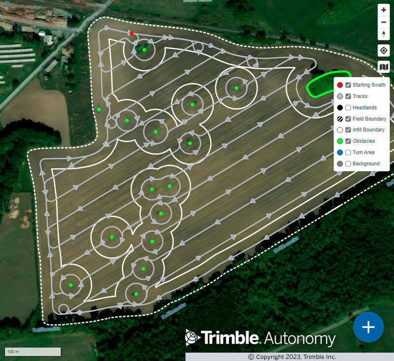
Trimble has released advanced path planning technology, which enables end users and equipment manufacturers to optimize and automate the trajectory, speed and path design of industrial equipment to increase efficiency.
The technology allows plans to be created in the office and adjustments made in the field or worksite. In addition, it is optimized for complex fields, unique site shapes, obstacles and avoidance zones. The software capability enables a broad range of autonomous applications across a variety of industries, including construction and agriculture.
The path planning technology gives users an easy-to-integrate, automated solution that works with Trimble systems and with equipment manufacturers’ existing systems. The technology will also be available within Trimble Connected Farm and Trimble Construction Cloud, offering a seamless, end-to-end experience to Trimble end users.
Trimble field tested the technology with Horsch, a company that specializes in agriculture, by integrating path planning technology into its self-propelled PT and VL sprayer series to provide an autonomous, four-wheel-drive solution. Trimble is also field testing this technology with Dynapac as part of its autonomous compactor for paving.
“Our new path planning technology is the next step in Trimble’s vision of making fully autonomous solutions available across industries, regardless of brand, type of equipment or use case,” said Finlay Wood, general manager, Off-Road Autonomy, Trimble. “With this easy-to-integrate solution, we’ve taken another significant step towards full autonomy.”
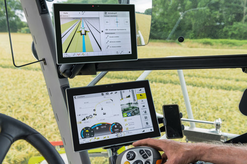
As part of a strategic alliance, Trimble and CLAAS have developed a next-generation system for CLAAS tractors, combines and forage harvesters.
The precision farming system includes the new CLAAS CEMIS 1200 “smart” display, GPS PILOT steering system and the SAT 900 GNSS receiver.
The CEMIS display uses Trimble’s new embedded modular software architecture for positioning, steering and ISOBUS technology for a seamless connection to control and monitor implements in the field. ISOBUS is an international communication protocol that sets the standard for agriculture electronics.
Trimble’s new architecture accelerates the development of a customized precision agriculture system by linking CLAAS’ machine interface and Trimble’s guidance capabilities into one common in-cab user experience.
“We understand the operators’ complexities of using separate displays with different user interfaces in the cab running the machine and performing precision farming tasks,” said Jim Chambers, vice president of Trimble Agriculture. “Working in tandem with CLAAS, we have jointly developed a next-generation precision farming system designed around one common user interface to provide CLAAS operators the best customer experience.”
“As an experienced, innovative and global provider of precision agriculture solutions, Trimble was our first choice as a technology partner,” said Carsten Hoff, managing director, CLAAS E-Systems. “Precision farming systems from Trimble have been field proven worldwide over the course of two decades. In addition, Trimble, supported by its subsidiary Müller-Elektronik, brings outstanding expertise in ISOBUS technology, which allows a display to control the machine and implement.”
The CEMIS 1200 display connects with the GPS PILOT system and SAT 900 GNSS receiver, based on the Trimble NAV-900 guidance controller, for positioning and steering capabilities. This solution provides sub-meter repeatable accuracy suitable for tillage, broad-acre seeding, spraying and harvest operations.
For even greater accuracy, users can subscribe to CLAAS-branded correction services from Trimble, called SATCOR, to achieve up to 2.5 centimeter pass-to-pass accuracy without a base station.
The precision farming system is already available for CLAAS TRION and is now expanding into LEXION, ARION, AXION and JAGUAR.
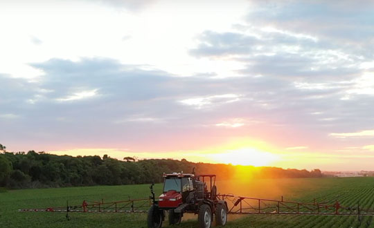
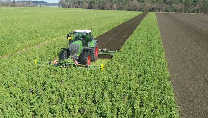
Precision agriculture — which promises to reduce inputs of water, fertilizers and pesticides by matching them to variations in soil conditions, thereby reducing environmental impacts, while increasing yields and productivity and reducing fuel consumption —has been around for a long time. This magazine published a few issues of a special supplement on the subject more than 20 years ago. In recent years, the convergence of enabling technologies — including improved satellite-based sensors, unmanned aerial vehicles, ground-based sensors, and GNSS corrections services — and greater demand has made agriculture one of the largest users of GNSS.
Compared to autonomous vehicles on public roads, autonomous tractors, sprayers, combines, and other farming equipment pose much lower safety concerns, because they need not deal with the vagaries of traffic, accidents and construction. They also are not subject to the kind of signal occultation and multipath that is the bane of GNSS navigation in urban canyons and, at least for now, they are not at significant risk of jamming or spoofing. However, they face other challenges, including severe roll and pitch due to bumpy terrain, some multipath from silos and other tall structures, occasional signal interference, occasional dense tree canopies, the requirement to maintain exact heading at very low speeds, the need to receive corrections over very large areas, complicated weather conditions (including rain, fog and dust clouds) and, like every other sector, cost constraints.
Despite this, guidance for farm vehicles must be consistently accurate at the decimeter-level, lest the machines damage the valuable crops that they are designed to service.
In the following articles, seven companies briefly describe their advancements in precision agriculture:
Farmers rely on their GNSS receivers to keep their machines on track, their maps accurate, and their rows straight in demanding environments. GNSS receivers on agricultural equipment need to continue to perform at a high level when faced with extreme weather, temperature and vibration while navigating varying terrain. In addition, farmers rely on the correction services that provide them with the high accuracy needed to keep them operating. Still, they face challenges with outages and interruptions from obstacles blocking satellite signals.
Hexagon | NovAtel’s SMART7 GNSS receiver and TerraStar Correction Services together create an accurate, robust and reliable solution for farmers. These products undergo extensive testing to ensure a high-performing and dependable solution. The SMART7 accesses all four GNSS constellations (GPS, GLONASS, BeiDou and Galileo), providing the best availability in variable terrain and environmental conditions. To compensate for the pitch and roll in the field, the receiver includes terrain compensation — keeping farmers at centimeter-level accuracy when using TerraStar-C PRO, TerraStar-X or RTK corrections.
Photo: Hexagon | Novatel
TerraStar Correction Services are based on a global network of advanced and proprietary GNSS control centers to ensure 99.999% signal availability to farmers. By delivering quality satellite corrections without the need for base stations, farmers can get the accuracy needed for their operations in a scalable format that moves with their equipment.
Jacob Van Den Borne is a potato farmer in the southern region of the Netherlands. He has been working with precision farming for more than 10 years and recently switched his Fendt tractor to NovAtel’s SMART7. Throughout his last season, Jacob noticed a substantial improvement in signal reception while passing along the edges of his heavily treed field. Previously, his GNSS equipment would lose reception, causing his rows to wander. After using a SMART7 for one season and experiencing its high precision and reliability, Van Den Borne plans to switch all receivers on his farm to the SMART7.
Evolving advanced driver-assistance systems (ADAS) and developing safe perception and positioning systems in the agriculture industry are top priorities for NovAtel. With the challenges faced by farmers, finding new ways to support a sustainable increase in their production and productivity will help ease the pressures of a growing population.
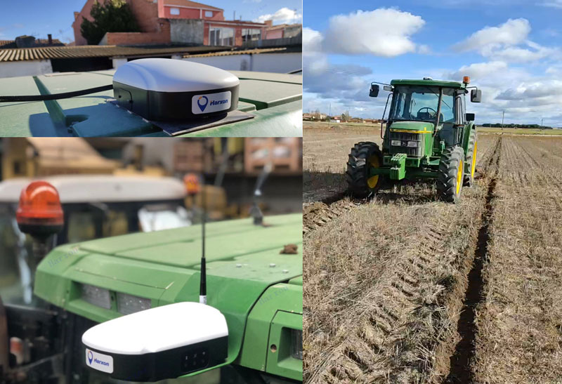
Today, many field operations — sowing, tilling, planting, cultivating, weeding and harvesting — rely on satellite-based autonomous guidance technology for agricultural machines. Yet farmers are still challenged by poor signal tracking, signal interference, communication instability and heading inaccuracy in tough environments, such as on uneven ground or slopes or under dense tree canopy. Because of insufficiently advanced navigation technology, ordinary machines fail to achieve the high efficiency expected and might even cause safety hazards. Therefore, the market has been awaiting a high-performance smart antenna with centimeter-level accuracy.
Harxon’s Smart Antenna TS112 PRO provides scalable and reliable positioning solutions for tough agricultural environments, such as uneven ground or fields with underground cables, as well as complicated weather conditions, including rain, fog and dust clouds.
The TS112 PRO integrates in one compact enclosure Harxon’s four-in-one GNSS/4G/Bluetooth/Wi-Fi antenna and a Hexagon | NovAtel OEM GNSS module. The multi-constellation GNSS antenna is designed with Harxon X-Survey technology and features multi-point feeding with high gain and wide beam width, which ensures high phase-center stability for ultimate RTK centimeter-level positioning accuracy. This is realized by subscribing to the Ntrip service via the LTE network to receive corrections or by setting up a local base station to broadcast corrections by radio.
The Hexagon | NovAtel OEM GNSS module is default-enabled for RTK, offering precise positioning and advanced interference mitigation for space-constrained applications and challenging environments. Additionally, users can achieve globally available centimeter-level positioning accuracy by using TerraStar satellite-delivered L-band correction services, with no need to set up an expensive network infrastructure.
TS112 PRO guarantees pass-to-pass accuracy down to 20 centimeters, where relative positioning is critical. It can also provide smoother steering and straighter rows by reducing positioning jumps that might occur during RTK signal outages or when a smart antenna changes positioning modes. Its terrain compensation algorithm is capable of correcting deviations caused by a vehicle’s roll and pitch while working on uneven ground or slopes.
UP42 has partnered with Vultus, which specializes in precision farming technologies.
According to UP42, its customers can now use Vultus Fertilization Zoning Maps algorithms to fine-tune crop management — with more agricultural technologies coming soon.
Founded in 2016 in Lund, Sweden, Vultus AB provides a geospatial infrastructure for precision farming. Vultus analyzes Earth observation satellite data with advanced artificial intelligence algorithms to give farmers insights into the health of crops within small sections of their fields, enabling them to apply fertilizers variably across the field.
“Growers reduce nitrogen-based fertilizer use by up to one third while increasing yield by three to five percent with the Vultus technology,” said Robert Schmitt, Vultus CEO. “This results in lower operating costs and significantly less environmental harm.”
Fertilization Zoning Maps — the first in a series of proprietary algorithms Vultus brings to UP42 as a partner — shows farmers which parts of their fields need more or less fertilizer. Fertilization Zoning Maps divide fields into five zones that are classified according to the variable fertilization rate the soil requires, Vultus said.
By partnering with Vultus, UP42 also brings precision farming technologies to the users of its geospatial developer platform and marketplace for Earth observation data and analytics. With the addition of Vultus technologies, UP42 customers can now pick and choose combinations of data and processing algorithms for their area of interest and retrieve results on a single scalable platform.
“We’re very happy to announce a new partnership with Vultus, an emerging leader in the agritech industry,” said Sean Wiid, UP42 CEO. “Our partnership is a key step towards providing UP42 users with a simplified way of building precision agriculture solutions. We look forward to launching new capabilities and supporting the agritech industry together.”
The precision farming market is set to grow from its current market value of more than $4 billion to more than $12 billion by 2025, as reported in the latest study by Global Market Insights, Inc.
The market growth is attributed to the rising adoption of smart agricultural practices to increase productivity. The use of Big Data along with information and communication technologies will provide farmers with more accurate insights into the existing crop conditions.
Another factor contributing to the precision farming market growth is the popularity of drones and IoT for greater production capabilities and analytics. The IoT plays a substantial role in increasing productivity and providing insights about the recent trends of crops. The technology provides an interconnected and multidimensional view of farming activities and offers actionable insights about the environment.
The government agencies worldwide are making efforts to spur innovations in the agriculture sector. For instance, in 2017, the Dutch government invested USD 1.5 million in the agriculture sector to allow the use of satellite technology to collect crop data for precision farming.
In the component market, the hardware segment is expected to hold a major market share of over 70% in 2025 due to the rising usage of several hardware devices such as drones, sensors, GPS systems, and smartphones for capturing aerial data. In precision farming, these devices enable farmers and researchers to monitor and optimize their crops and assist in conserving resources such as soil and water in a better manner.
In the precision farming services market, the managed services segment is expected to exhibit a growth rate of over 27% from 2019 to 2025. The market growth is attributed to the rising applications of IoT and cloud computing in precision farming solutions.
The agriculture decision support systems are being increasingly hosted on cloud platforms to take advantage of the IoT through internet-connected devices. For enabling improved security and availability, the demand for managed services has to increase to efficiently handle the complexity of running hardware and maintaining different types of middleware.
Geomapping technologies are expected to hold a share of over 20% of the precision farming market in 2025. The technology proves to be immensely beneficial in agriculture as it offers a cost-effective alternative for localized and wide-scale monitoring of the crop output.
With the evolution of the technology, 3D geo-mapping techniques have emerged in the market that are particularly useful for the timely detection of existing inefficiencies in the fields, allowing farmers to take immediate corrective measures.
The irrigation management application segment is projected to grow at a CAGR of over 15% between 2019 and 2025. Using precision farming technologies, the site-specific management of irrigation activities can significantly improve the overall water management.
Farmers can monitor and control their irrigation pivots from any location using precision irrigation solutions. These solutions enable accurate and uniform water delivery to crops throughout their lifecycle.
The Asia Pacific precision farming market will witness a growth rate of over 20% during the forecast period. The factors augmenting the market growth are increasing the awareness about the precision farming technologies and several initiatives taken by the government to improve sustainable agriculture.
For instance, in June 2017, the state government of Haryana in India adopted climate-smart agricultural practices to transform the agricultural systems. This also enabled the regulatory bodies to achieve three objectives such as adapting to climate changes, achieving agricultural productivity, and reducing greenhouse gas emissions.
The rising adoption of drones and UAVs for capturing crop-related data is also leading to precision farming market growth. For example, in March 2019, the Agriculture Ministry of Japan promoted the use of drones in the agriculture sector. This will help in increasing productivity and improving crop health by closely monitoring the crop condition.
The companies in the precision farming market are entering into strategic partnerships and acquiring companies to gain more market share. For instance, in September 2018, Topcon Agriculture entered into a licensing agreement with Raven Industries. Under the agreement, Topcon Agriculture’s Slingshot Application Programming Interface (API) was used in Raven’s software platforms.
The software-to-software interface help users to share data between software systems. Some companies are concentrating on new product developments to enhance the capabilities of their existing offerings and to expand their product line up.
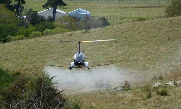
UAVOS has added the R22-UV unmanned helicopter to its agriculture unmanned aircraft portfolio for spraying for diseases, weed and pest control, and vegetation control.
The R22-UV is a manned Robinson-22 helicopter converted by UAVOS to an unmanned aircraft. (Photo: UAVOS)
The Agro-Drone R22-UV is equipped with a specially developed utility to deliver liquid chemicals — the spray system Simplex model 222.
The R22-UV drone is provided with a 100-liter tank for chemicals and can stay airborne for two hours. Weight of the system is 42 kilograms, boom span is 7 meters, and swath width is 14 to 16 meters.
UAVOS listed several advantages that could maximize the value of such a heavy UAV for farmers:
The R22-UV can be operated in the regions without airfields, under severe weather conditions and during night-time, in conditions with a high probability of risk for the pilot.
UAVs are excellent for operations in conditions of high humidity, where the use of ground equipment is impossible or difficult. Unlike heavy machinery, which cannot go into a field immediately after a heavy rain, UAV has no impact on the ground. Drone sprayers don’t touch the ground so there will be less soil compaction. This is when heavy machinery like tractors roll over the soil, pressing it down and damaging it. Farmers can fix this with plowing, but it can be harmful to the soil over a long period of time.
UAV implementation eliminates manual spraying with backpack sprayers, so workers don’t come into contact with hazardous chemicals.
UAVs also enable growers to spray their crops precisely and at will, which is critical for fighting herbicide-resistant weeds. Spraying is better. The rotor of an agricultural drone produces a huge downward rotation force, which promotes the pesticide droplets to penetrate the crop from top to bottom, which is conducive to the pesticide droplets evenly scattered in all parts of the plant, so that the spraying is accurate.
Unmanned aircraft can be used for spot spraying weeds with herbicides and are useful for spraying crops with pesticides. A spot-oriented approach based on preliminary analysis of digital images from robot cameras minimizes the cost of agrochemicals, reducing the chemical impact on soil, water, culture and, ultimately, on the consumer’s body, while achieving higher results of crop cultivation than with traditional approaches. The aircraft can be set on a predetermined GPS-defined route to fly over a field, dropping doses of pesticides, herbicides and fungicides as it flies.
“Precision agriculture is based on the use of valuable metrics to make farmers’ crop management efficient and optimized,” said Aliaksei Stratsilatau, CEO of UAVOS. “Validating-of-damage reports used to be on paper. So, unmanned aircraft help our customers to validate the veracity of reports so that we could come up with a comprehensive solution. Generally, agriculture is very complex and there are a lot of problems, but there are solutions available through the new technology.”
Farmstar, a service of Airbus Defence and Space and ARVALIS – Institut du végétal for precision farming based on satellite information, has been further improved.
New images acquired by the SPOT 6 and SPOT 7 satellites will make it possible to issue intra-field recommendations for areas as small as 1 hectare. Also, new interactive advice is provided for nitrogen input at the 1-centimeter ear stage.
Automatic and manual modulation files are accessible to all farmers via the Farmstar web portal. An additional advice for calculating the nitrogen input at the 1-centimeter ear stage enables this input to be broken down and adjusted for wheat, barley and triticale crops. The nitrogen fertilization recommendations now take into account the objectives of the Proteins Plan for wheat quality thanks to new nitrogen requirement specifications for soft wheat, to optimize how this two-fold yield–protein content objective is addressed.
These new developments come at the right time: after an extremely difficult year, due to exceptionally poor meteorological conditions, French farmers are looking to save on farm inputs while continuing to manage their crops sustainably and with a focus on environmental protection.
The number of farmers signed up for the service has constantly risen over the past 15 years. Nearly 800,000 hectares of plots were monitored by Farmstar last season, enabling more than 18,000 farmers to save time and money through precise management of the exact needs of their crops.
Farmstar is a service distributed by the cooperatives, chambers of agriculture and traders dedicated to precision agriculture and crop management developed by Airbus Defence and Space and ARVALIS – Institut du végétal, in partnership with Terres Inovia.
Throughout the season, the service provides reliable information that can be directly used by farmers to help them quickly make relevant decisions. This advice, combining satellite, UAV and aircraft imagery with agronomic expertise, exposes the real need of plants within each plot at different key stages in the crop growth and allows the right amount of inputs to be added in the right places at the right time.
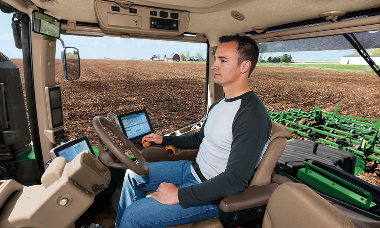
Google and the big automakers might get the lion’s share of attention when it comes to autonomous road vehicles, but John Deere has been making self-driving tractors for more than 15 years.
Among them is the 9RX tractor, which can steer itself, freeing the farmer to focus on business. The 9RX, introduced in August, features an articulated steering system and an optional Active Command Steering (ACS), which improves maneuverability in the field and line-holding ability at transport speeds.
Hands-free driving: Ag companies take the wheel. (Photo: John Deere).
Farmers don’t need to navigate other traffic, just make optimal use of fields. Before farmers began using GPS to plan routes, a few feet would get reworked in every row. With GPS-based auto-driving accurate down to the inch, missed spots and repetition are avoided, saving farmers time, fuel and money.
With a tractor the only moving object in a vast acreage, collisions are highly unlikely. Still, a driver still needs to be at the tractor’s wheel. Unlike consumer vehicles being developed for autonomous operation on public roads, the tractors don’t have external sensors on all sides to prevent collisions. A fully autonomous tractor, which doesn’t require a driver, probably won’t hit the market before 2025, according to John Deere.
Inside the cab, farmers can equip their tractors with a variety of modular systems that allow computers control over operations, starting with a basic satellite guidance system and a touchscreen interface. From there, an add-on lets the tractor make precise turns autonomously, and another uses radio base stations set up around fields to supplement navigational accuracy. Besides the high-tech features, cabs of the 9RX have luxury touches such as an integrated refrigerator and high-quality sound.
Laser Navigation
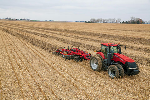
Other companies that offer auto-steering include Case IH and Autonomous Tractor Corporation.
Case IH offers guidance and steering for use on tractors, such as its Magnum 340 Tractor. (Photo: Case IH)
Case IH provides steering and guidance tools for tractors, combines and sprayers. Its AFS AccuGuide auto guidance enables repeatable accuracy down to sub-inch levels. AFS RowGuide works with AFS AccuGuide to provide accurate, hands-off steering for corn harvests. Two mechanical touch sensors mounted on the corn-head dividers sense row position and provide guidance input in concert with GPS.
Autonomous Tractor bills itself as a non-GPS system without dead spots or signal interference. Instead, it uses a proprietary laser-radio navigation system (LRNS) for sub-inch positioning data, along with its own FieldSmart software that allows farmers to “train” the tractor without programming.
Sonar systems provide full perimeter safety, and pan-tilt cameras communicate via cellular to allow the farmer to monitor progress and remotely resolve issues.