Tag: precision guidance

  • GNSS Vulnerable: What to Do?

    Brad Parkinson
    Brad Parkinson

    Too Much Sensitivity, Not Enough Robustness, Says Parkinson

    Brad Parkinson, the founding architect of GPS, told a UK conference that the system needs to be made more robust to ensure worldwide availability of services to users. His concerns over GPS availability relate to threats such as the loss of authorized frequency spectrum (implicitly creating licensed jammers), space weather due to hyperactive ionospheric conditions, and deliberate or inadvertent jamming of GPS signals.

    He warned that GPS is more vulnerable to sabotage or disruption than ever before, and charged that politicians and security chiefs are ignoring the risk. Western governments are “in their infancy in recognizing the problem,” he remarked further in an interview with London’s Financial Times. “[In the United States] I don’t know anyone that is really in charge of it. The Department of Homeland Security should be [but] … they don’t have any people that understand it very well. They’ve got one person without any budget to speak of.”

    He also warned that Europe’s €5 billion Galileo system is equally at risk.

    Parkinson proposed a three-stage program to:

    • Protect (legally) the signal and physically eliminate jamming sources;
    • Toughen the GPS/Galileo receiver’s resistance to interference;
    • Augment the GPS signals with other satellites or with ground-based transmitters such as eLoran.

    To support his proposal, Parkinson stated, “The number one need for all GPS or Galileo users is availability. Over the years, manufacturers of signal receiver technologies have focused too much on sensitivity and not enough on resilience or robustness. The maritime industry is a particular concern where users have taken GPS for granted. They must increase preparedness and backups as they do in aviation or other GNSS using industries.

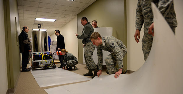
    “Even today, most ships have only GPS and the vision of their crew to guide them when approaching harbours. As you can see from today’s conference there are a wealth of solutions to toughen and backup GPS, many of which are not technologically difficult nor expensive, but still their adoption in sectors such as global shipping is certainly not adequate.”

    As part of his protection program, Parkinson urged that penalties for jamming GPS networks be coordinated worldwide. “In Australia, if you cause interference likely to cause prejudice to the safe conduct of a vessel, it’s five years in the jug [jail] and $850,000.” Contrasting this with a U.S. case that may simply impose a forfeiture of the culprit’s jamming device, Parkinson added, “I’m calling for the community of nations to move to the Aussie-type penalties.”

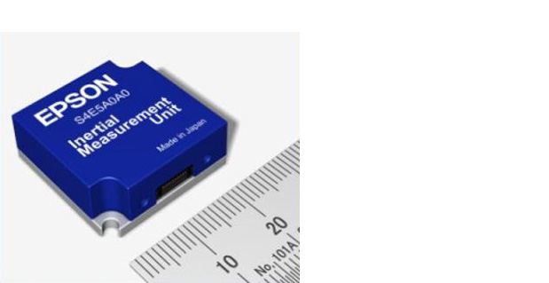
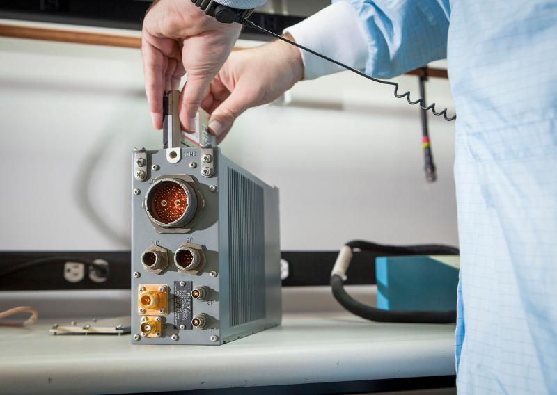
    In the toughening regard, Parkinson alluded to integration of GPS data with information derived from an inertial positioning system. “If you combine all of these things, a good set should be able to fly within 1 kilometer of a jammer with a 10-kilometer range,” said Parkinson. “That’s what I call toughening.”

    Parkinson made his remarks as the keynote speech at GNSS Vulnerabilities and Resilient PNT 2014, hosted by the Royal Institute of Navigation. He will also deliver the keynote address, “Assured PNT: Assured World Economic Benefits,” for the European Navigation Conference on April 15 in the Netherlands.

  • Next-Generation Clock Increases Stability to 300 Picoseconds

    Next-Generation Clock Increases Stability to 300 Picoseconds

    Personnel with the U.S. Naval Observatory-Detachment Colorado and 2nd Space Operations Squadron move the rubidium fountain clock into its new home Tuesday at Schriever Air Force Base. The USNO monitors the GPS constellation and provides time offsets to the 2nd Space Operations Squadron for their daily navigation uploads to each individual GPS satellite. (U.S. Air Force photo/Christopher DeWitt).
    Personnel with the U.S. Naval Observatory-Detachment Colorado and 2nd Space Operations Squadron move the rubidium fountain clock into its new home Tuesday at Schriever Air Force Base. The USNO monitors the GPS constellation and provides time offsets to the 2nd Space Operations Squadron for their daily navigation uploads to each individual GPS satellite. (U.S. Air Force photo/Christopher DeWitt).

    The U.S. Naval Observatory’s Alternate Master Clock on Schriever Air Force Base received its second rubidium fountain clock February 4 to ensure it has the most precise time in the world.

    Both the USNO’s Washington D.C.-based primary and its local Alternate Master Clock facility serve as the Department of Defense’s common time reference. Additionally, the USNO monitors the GPS constellation and provides time offsets to the 2nd Space Operations Squadron for its daily navigation uploads to each individual GPS satellite.

    “With the new rubidium fountain clock, we are going from the time standard of 1 to 2 nanoseconds down to 300 picoseconds,” said Bill Bollwerk, Head of USNO Detachment Colorado.

    One nanosecond is equivalent to one billionth of a second, while a picosecond is equal to one trillionth of a second. Though these small slices of time may not sound important, every nth of a second is significant, especially in GPS operations.

    “A nanosecond matters because it is equivalent to a 1-foot of error for GPS,” Bollwerk said. “If the GPS satellite clocks were off by 3 nanoseconds, you have 1-meter of error introduced into GPS.”

    Designed and produced by physicists at the USNO laboratory in Washington D.C., the powered rubidium fountain clock traveled by dedicated truck to Schriever. Once the fountain clock arrived at Colorado base, with the help of members of the 2nd Space Operations Squadron, the 50th Security Forces Squadron and 50th Civil Engineering Squadron, the USNO team moved it to a climate controlled chamber in the USNO’s laboratory via an airsled hover lifter.

    “The 2 SOPS men and women are able to operate and provide accurate instantaneous reliable support to U.S. military forces around the world, thanks to our partnership with the U.S. Naval Observatory,” said Lt. Col. Thomas Ste. Marie, 2 SOPS commander. “We are happy to be able to work together to support their upgrade. Our relationship allows 2 SOPS to continually reach our goal of record breaking time-transfer performance and navigation accuracies.”

    Although 2 SOPS was happy to support the move, it’s not as easy as one might think.

    “The process of moving the rubidium fountain was very complicated,” said Ken Dreiling, USNO Detachment Colorado. “We had to ensure the fountain clock was not actually in contact with the floor or the walls as we moved it from the loading dock through the hallways and elevator into our facility.”

    The careful transport of the fountain was essential to prevent damage that could affect the clock’s performance.

    “The fountain clock collects billions of rubidium atoms, encased in a spherical vacuum chamber and laser-cooled to a millionth of a degree above absolute zero degrees Kelvin, approaching the coldest temperature anything can be,” Bollwerk said. “The reason we do that is because we want to observe and measure the atoms for long time in an environment that minimizes unwanted noise like the Doppler Shift.”

    Though the Alternate Master Clock provides precise timing for several communication and space systems, Missile Defense Agency, DOD facilities and several civilian infrastructures around the world, the new system was installed primarily to support GPS operations.

    “It is great to have the most precise time standard in the world but it is useless unless you can get it to the user, not everyone can come to the facility and set their watch,” said Bollwerk. “GPS is USNO’s primary means of providing global precise time to the warfighter. It is a great partnership between the Navy and the Air Force.”

    Dreiling said the new fountain clock will help improve GPS operations.

    “The new rubidium fountain clock is the next-generation new frequency standard,” Dreiling said. “This will boost the GPS’s timing by 10-fold.”


  • Exelis Reaches GPS OCX Milestones for Navigation and Encryption Software

    GPS-OCX-Logo-TExelis has successfully completed several software upgrades for the new Global Positioning System Next Generation Operational Control System, or GPS OCX.  Integration and testing were recently conducted on iteration 1.5 of the OCX navigation, encryption and Mission Upload Generator, or MUG, software.

    The new version of GPS software will help ground controllers better understand the satellites’ exact positioning in space. The encryption software is also designed to automatically code and decode GPS signals, facilitating the exchange of user information by securely transmitting navigation payload data between the OCX ground system and the orbiting constellation of satellites.

    The MUG software is responsible for creating spacecraft payload updates to refresh the navigation data transmitted to all GPS users. This data is typically generated for each satellite multiple times a day and  helps to consistently minimize user error.

    “These software milestones demonstrate a clear path to improved GPS accuracy and integrity,” said Drew Trainor, OCX program manager for Exelis Geospatial Systems. “Civilian and military users will have more accurate and secure GPS signals, and these milestones bring us one step closer to GPS modernization.”

    Under a February 2010 contract award from Raytheon, Exelis is providing software that will simulate the behavior of GPS signals in space. In addition, Exelis is building high-precision receivers for use in ground monitoring stations placed strategically around the world. Exelis is also providing data encryptors that help ensure secure information exchange between the ground and space segments of the system.

    Once the new operational control segment is implemented, GPS will improve a variety of business and economic practices, including air traffic control, crop management, and environmental monitoring, among others. The new capabilities offered by GPS modernization will also provide military users increased accuracy, availability, anti-jam power and international interoperability.

  • Epson Teams with Geodetics for Inertial Navigation Systems

    Epson Teams with Geodetics for Inertial Navigation Systems

    EpsonIMUEpson Electronics America has announced a strategic partnership with Geodetics Incorporated of San Diego, California, for production of a new variant of its Geo-iNAV product.

    According to the announcement, Geo-iNAV is a fully-integrated GPS-aided inertial navigation system that provides real-time, high-precision positioning and navigation for manned and unmanned air, sea and ground vehicles. It combines GPS and proprietary sensor fusion technologies to achieve centimeter-level real-time positioning and navigation for dynamic platforms. Geodetics will offer Geo-iNAV integrated with Epson’s new G362 and G352 IMU modules. The G362 and G352 are the world’s highest performance IMUs on the market in their size, weight and power class, the company said.

    “Geodetics has the high-precision navigation expertise necessary to integrate IMU and GPS technologies, producing Inertial Navigation Systems (INS) that meet the performance requirements of very demanding applications,” said David Gaber, EEA’s IMU product line manager. “The combined solution, called Geo-iNAV Tactical, is a cost-effective, tactical-grade INS in a compact package with no EAR or ITAR export control restrictions.”

    Geodetics President and CEO Lydia Bock added, “Epson has established a new benchmark for MEMS IMU performance, enabling Geodetics’ products to reach new applications and customers by delivering high performance for a significantly lower cost than competing devices.”

    Epson says that with recent advances in unmanned vehicle technologies, the GNSS ecosystem has expanded to support mission-critical applications, which require more accurate navigation. Geo-iNAV Tactical delivers this capability with  features to support reliable and precise navigation with a low SWaP (size, weight and power) profile for autonomous vehicles and payloads on manned vehicles. Geo-iNAV Tactical is offered in several configurations designed to meet a wide range of requirements and is available in commercial as well as SAASM configurations.

  • Raytheon Receives $16M Contract for Miniaturized Airborne GPS Receivers

    Raytheon Receives $16M Contract for Miniaturized Airborne GPS Receivers

    The open architecture design of MAGR 2000-S24 allows modernization and upgrade of GPS functional capabilities through replacement of a single electronics module.
    The open architecture design of MAGR 2000-S24 allows modernization and upgrade of GPS functional capabilities through replacement of a single electronics module.

    Raytheon Company has received a $15.8 million contract order for its MAGR 2000-S24 miniaturized airborne GPS receiver. The order, which includes new production and sustainment of existing systems, is the first under an Indefinite Delivery-Indefinite Quantity (IDIQ) contract awarded to the company in September 2013 by the U.S. Air Force Space and Missile Systems Center.

    Raytheon recently completed its 2,000th delivery of MAGR 2000 systems to the U.S. military and its allies in Europe, the Middle East and the Asia Pacific region. Flown on 20 types of fixed- and rotary-wing platforms, the MAGR 2000-S24 provides unparalleled navigation accuracy and resistance to interference and jamming. Its open architecture design allows for insertion of future GPS modernization enhancements, such as the new military code signal, without having to replace the unit itself.

    “With the increasingly sophisticated threats posed by potential enemy nations, our customers recognize Raytheon as the gold standard for highly secure, highly adaptable GPS receivers for the airborne military environment,” said Sharon Black, director of GPS and Navigation Systems for Raytheon’s Space and Airborne Systems business. “Our innovative MAGR 2000-S24 design makes future unit replacement virtually unnecessary. Capability enhancements are as simple as swapping out the electronics module card, providing a highly cost-effective path for keeping fleets up-to-date with the latest GPS technology.”

    The current MAGR 2000-S24 IDIQ contract extends through September 2017. The first order of 323 production units is scheduled for completion in June 2015.

  • New Report on Global Military GPS/GNSS Market Looks at Next Decade

    Reportstack has announced a new report on The Global Military GPS/GNSS Market 2013-2023.  This report offers the reader detailed analysis of the global military GPS/GNSS  market over the next 10 years, alongside potential market opportunities to enter the industry, using detailed market size forecasts, Reportstack said.

    A satellite navigation system provides GPS positioning from a global perspective, and is therefore of utmost importance for modern-day military operations, which rely on accurate real-time data on hostile forces in order to carry out precision attacks, Reportstack said. It is here that GPS/GNSS devices assume an important role, as they are imperative to transfer signals from these satellites back to earth.

    The U.S. is the highest spender on military GPS/GNSS navigation, and is responsible for 42.9% of the global military GNSS devices market. Others major spenders in this sector include Russia, the UK, China and India. In July 2013, India launched the IRNSS-1A, the first of seven satellite constellation to be deployed under the Indian Regional Navigation Satellite System (IRNSS) program to be completed between 2015-2016. And China’s BeiDou is scheduled to be operational by 2020.

    Another factor driving the market is the integration of satellite navigation technology with other navigation systems, such as the inertial navigation system (INS) and gyro, as GPS devices are to be used in order to decipher data correctly, Reportstack said.

    The increasing demand for satellite navigation and communications is driven primarily by the desire of militaries to monitor more areas and derive accurate information by a range of GNSS receivers/sensors in the shortest time possible. Major military aircraft and helicopters are dependent on GPS embedded INS systems for effective navigation. Similarly, naval vessels and guided munitions are increasingly relying on the collaboration of laser, gyro, INS, and satellite navigation technologies to derive accurate real time data.

    Furthermore, it has been observed that the usage of standard positioning services/open service receivers, which use unencrypted signal for non-combat purposes has increased, and is expected to drive demand and encourage expenditure, Reportstack said. The military GPS/GNSS technology is expanding its horizon beyond the basic characteristics of navigation and tracking. The use of GPS, in conjunction with a number of software applications, has expanded its use in military operations. A number of new technologies are now embedded with GPS receivers to produce a more sophisticated military tool.

    Recently, a Swiss-based company developed a device called GPS Log Book based on u-blox technology. The new device has extended the scope of GPS technology to the administrative side of military operations. It provides an easy way for military drivers to automatically keep an accurate travel log book which can be securely accessed later from anywhere via a web interface. Information logged includes route, speed, and distance traveled. It also keeps a close record of fuel used by the vehicle, based on the distance traveled at various speed levels.

    The advent of Differential GPS (DGPS), an enhancement to GPS, which provides improved location accuracy, from the 15-meter nominal GPS accuracy to approximately 10 cm, has further expanded the scope of GPS in missile technology. The intercontinental ballistic missiles, which are capable of hitting targets across thousands of miles navigation, use inertial navigation with DGPS receivers. The advent of DGPS is expected to be one of the most significant steps in accurate missile targeting for militaries across regions.

    The companies mentioned in this report are Northrop Grumman, Raytheon, Rockwell Collins , Lockheed Martin, ITT Exelis, Thales, and BAE Systems. More details and table of contents about this report can be found by visiting The Global Military GPS/GNSS Market 2013-2023 report.

  • Northrop Grumman Demonstrates Micro-Gyro Prototype for DARPA Program

    Northrop Grumman Demonstrates Micro-Gyro Prototype for DARPA Program

    Photo: Northrop Grumman Corporation
    Photo: Northrop Grumman Corporation

    Northrop Grumman Corporation has developed and demonstrated a new micro-Nuclear Magnetic Resonance Gyro (micro-NMRG) prototype for the Defense Advanced Research Projects Agency (DARPA), providing precision navigation for size- and power-constrained applications.

    The development of a hermetically sealed micro-NMRG that meets precision navigation requirements along with a successful prototype demonstration marks the fourth and final phase of DARPA’s Navigation-Grade Integrated Micro Gyroscopes (NGIMG) program. The culmination of the eight-year program is a micro-NMRG that offers near navigation-grade performance for the next generation of high-precision inertial sensors.

    Northrop Grumman’s micro-NMRG technology uses the spin of atomic nuclei to detect and measure rotation, providing comparable performance to a navigation-grade fiber-optic gyro in a small, lightweight, low-power package. Additionally, the gyro has no moving parts and is not inherently sensitive to vibration and acceleration. The technology can be used in any application requiring small size and low power precision navigation, including personal and unmanned vehicle navigation in GPS-denied or GPS-challenged locations.

    “Our miniature gyro technology offers unprecedented size, weight and power savings in a compact package, exceeding program requirements,” said Charles Volk, vice president of Northrop Grumman’s Advanced Navigation Systems business unit. “This important technology can help protect our warfighters by offering highly accurate positioning information, regardless of GPS availability.”

    The NGIMG effort is part of DARPA’s Micro-Technology for Positioning, Navigation and Timing program that aims to develop technology for self-contained, chip-scale inertial navigation and precision guidance. Northrop Grumman began the first phase of the NGIMG effort in October 2005 and has consistently met or exceeded the performance goals of each program phase.

  • Lockheed Martin’s Paveway II with GPS/INS Successfully Employed In Navy Exercises

    Lockheed Martin’s paveway II Dual Mode Laser Guided Bomb (DMLGB) was successfully employed in recent U.S. Navy Tactics Development exercises at the Naval Strike and Air Warfare Center in Fallon, Nevada.

    During four missions over a two-day period, F/A-18C/D Hornets and F/A-18E/F Super Hornets released 36 GBU-12F/B bombs fitted with recently upgraded paveway II DMLGB guidance kits. The weapons were used in tactically representative engagements against fixed targets and met all mission success criteria, demonstrating the increased operational utility of the enhancements.

    By adding the GPS/Inertial Navigation System (INS) guidance to standard laser-guided paveway II weapons, the U.S. Navy and Marine Corps can execute precision-strike missions against stationary and relocatable targets in all weather conditions. The kits can operate in laser mode only, INS/GPS mode only or dual mode to provide pilots with the flexibility to engage various types of targets in a single mission. The most recent paveway II DMLGB upgrade to Block II Operational Flight Program software improves overall weapon performance and effectiveness in all three release modes.

    “We worked closely with our U.S. Navy and Marine Corps customers to develop the Block II Operational Flight Program software upgrade to the paveway II DMLGB guidance kits,” said Joe Serra, precision guided systems manager at Lockheed Martin Missiles and Fire Control. “Delivered to the fleet earlier this year, the enhanced fire-and-forget technology of our DMLGB kits provides naval warfighters with a mature and highly maneuverable all-weather direct-attack capability.”

    Aircrews from the Naval Strike and Air Warfare Center, along with Air Test and Evaluation Squadron Nine (VX-9) “Vampires” from Naval Air Weapons Station in China Lake, California, participated in the exercises.

    “The same company-wide discipline that provides customers with affordable single-mode LGB targeting capability is applied to our current and future dual-mode weapons to provide U.S. and international customers with the most affordable and reliable precision capability,” said Serra.

    Lockheed Martin has upgraded more than 7,000 paveway II LGB guidance kits with dual-mode, all-weather capability for the U.S. Navy. Additionally, the company has delivered more than 65,000 LGB kits and over 125,000 Enhanced Laser Guided Training Rounds to the U.S. Navy, Marine Corps, Air Force and international customers. Lockheed Martin is the sole-source developer and provider of the paveway II DMLGB kits to the U.S. Navy and U.S. Marine Corps.

    Lockheed Martin Missiles and Fire Control is a 2012 recipient of the U.S. Department of Commerce’s Malcolm Baldrige National Quality Award for performance excellence. The Malcolm Baldrige Award represents the highest honor that can be awarded to American companies for achievement in leadership, strategic planning, customer relations, measurement, analysis, workforce excellence, operations and business results.

    Headquartered in Bethesda, Maryland, Lockheed Martin is a global security and aerospace company that employs about 116,000 people worldwide and is principally engaged in the research, design, development, manufacture, integration and sustainment of advanced technology systems, products and services. The Corporation’s net sales for 2012 were $47.2 billion.

  • ION Joint Nav Conference 2014 Accepting Abstract Submissions

    Abstract submissions are now being accepted for the Institute of Navigation (ION) 2014 Joint Navigation Conference (JNC) to be held June 16-19, 2014.

    For Official Use Only (FOUO) U.S.-only sessions will be held June 16-18 at the Renaissance Orlando at SeaWorld, Orlando, Florida; and the 4-EYES CLASSIFIED sessions will be held June 19 at Shades of Green Walt Disney World.

    The conference, sponsored by the ION’s Military Division, is the largest U.S. military positioning, navigation and timing conference of the year with joint service and government participation. The event will focus on technical advances in guidance, navigation, and control (GN&C) with emphasis on joint development, test and support of affordable GN&C systems, logistics and integration.

    The 2013 Joint Navigation Conference was canceled, so this will be the first time the conference has been held in two years.

    From an operational perspective, the conference will also focus on advances in battlefield applications of GPS; critical strengths or weaknesses of fielded navigation devices; warfighter PNT requirements and solutions; and navigation warfare.

    The ION JNC features more than 200 operational presentations on a diverse array of topics including:

    • Advanced Security Technologies/SAASM
    • Alternate Navigation Technologies: I, II & III
    • Atomic Clocks and Timing Applications
    • Autonomous Navigation
    • Aviation Applications
    • Battlefield Smart Phone Applications
    • Celestial Navigation and Star-Tracker Technology
    • Collaborative Navigation Techniques
    • GPS Constellation Performance
    • GPS in Military Applications/NAVWAR
    • GPS Modernization
    • Land Applications
    • Marine Applications
    • MEMS Inertial Measurement Unit
    • Micro Navigation Applications
    • Military GPS Receivers and Military GPS Receiver Technology
    • Military GPS Use and Experiences
    • Military GPS/Antenna Technologies and Interference Mitigation
    • Missile Applications
    • Modeling and Simulation
    • Multi-GNSS Receivers for Military Applications
    • Multi-Sensor Solutions for Guidance, Navigation, and Control
    • Navigating in Challenged Environments (e.g. Urban, Indoor and
    • Sub-Surface Navigation)
    • Precision Azimuth Sensing
    • Precision Navigation Capabilities for Test and Training
    • Robust Navigation Systems/Solutions
    • Space and Satellite Applications
    • Warfighter Requirements and Solutions

    Abstracts are being accepted through March 4, 2014.

    Technical Exhibit and Operational Product Demonstrations. JNC also features a technical exhibit and showcase of Guidance, Navigation and Control technology products and services and Operational Product Demonstrations. For more information on exhibiting and product demonstrations at the ION Joint Navigation Conference, call ION at 703-366-2723 or go to www.ion.org/jnc.

    Attendance Restricted. FOUO U.S. ONLY. JNC conference attendance (June 16-19) will be controlled by the Joint Navigation Warfare Center and will be restricted to U.S. ONLY.  The classified sessions will have 4-Eyes access (June 19) for citizens of U.S.A., Australia, Canada, and the United Kingdom. All participants must establish a need to know and be approved by the Joint Navigation Warfare Center security office.

  • NovAtel SAASM to See First Action in Aerial Drones

    The new OEM625S Selective Availability Anti-Spoofing Module (SAASM) GNSS receiver from NovAtel, launched in a cooperative effort with SAASM expert L-3 Interstate Electronics Corporation (IEC), will get its first applications in the unmanned aerial vehicle (UAV) sector. NovAtel has brought forth the new product in part to meet requirements of UAV manufacturers who are now mandated to have SAASM onboard as well, for in-theater operations in areas of military activity.

    “The new SAASM regulations meant that integrators were looking at having to incorporate another receiver alongside their NovAtel unit, complicating user interface factors and increasing onboard space requirements,” said NovAtel Product Manager Neil Gerein. “The OEM625S gives our customers a drop-in form factor that easily replaces their existing NovAtel OEM receiver.”

    “NovAtel has supplied UAV integrators on the civil scientific side almost since our inception,” Gerein said, adding, “the military has become more and more involved in this market in recent years for budget and various other strategic reasons.” He mentioned that in its 20-year history selling GPS products, for the last 17 years NovAtel has provided receivers and expertise to U.S. and Canada defense contractors, and to defense research labs in Allied countries. Antcom, a wholly-owned NovAtel subsidiary specializing in antennas and microwave products, makes the majority of its sales into military areas.

    Examples of such products in this area — not necessarily from NovAtel customers, who remain unidentified — include hand-launched mini-UAVs like the Aerovironment RQ-11 Raven and Elbit Skylark I, and runway-capable tactical UAVs such as Textron RQ-7 Shadow, Aeronautics DS Aerostar, IAI Searcher II, and InSitu’s ScanEagle UAV system, quickly evolving into a mainstay with the U.S. Navy and its allies thanks to a partnership with Boeing.

    The InSitu ScanEagle was first developed to track dolphins and tuna from fishing boats, to ensure that fish labeled “dolphin-safe” actually are so. The same characteristics needed by commercial fishing boats — low infrastructure launch and recovery, small size, 20-hour long endurance, automated flight patterns — are key for naval operations from larger vessels, and for battlefield surveillance.

    At present the OEM625S, combining a commercial dual-frequency NovAtel GNSS receiver with an L-3 IEC XFACTOR SAASM, provides single-point positioning with SAASM for authorized defense customers. The SAASM position is provided via a dedicated communication port, as well as through NovAtel’s software command protocol, allowing for maximum flexibility. The small form factor and low power consumption expands range of potential defense applications requiring robust SAASM GPS positioning.

    The OEM625S measures 60 x 100 x 9.1 millimeters, and runs on field-upgradeable software. NovAtel will accept orders for the OEM625S from authorized customers starting in Q3 2012.