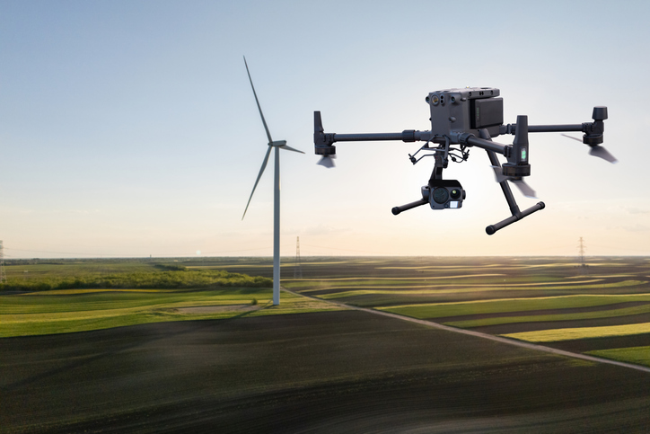
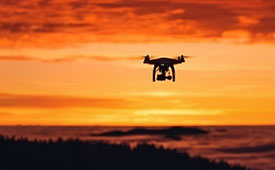
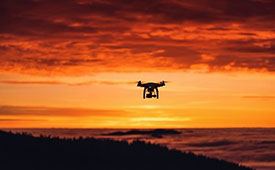
The U.S. Federal Aviation Administration (FAA) has issued a proposed rule that would allow specific categories of critical infrastructure sites to apply for restrictions on drone operations around their facilities.
The restrictions would be submitted and approved via a new FAA web portal. Approval will be based on safety or security criteria. Sixteen sectors would be eligible for restrictions including energy production, transportation systems, chemical facilities, water treatment plants, and defense industrial complexes.
The rule would establish two types of restrictions:
Standard Unmanned Aircraft Flight Restriction (UAFR): A general restriction that bars unmanned aircraft operations within a specific boundary, except for operators who have previously met rigorous safety and security standards.
Special Unmanned Aircraft Flight Restriction (UAF): A much more severe restriction that bars unmanned aircraft operations within a specific boundary for all operators unless they have the express prior approval from both the FAA and the sponsoring agency (for example, the Department of Homeland Security).
The restricted area would have clearly defined horizontal and vertical boundaries. Violators could face civil or criminal penalties.
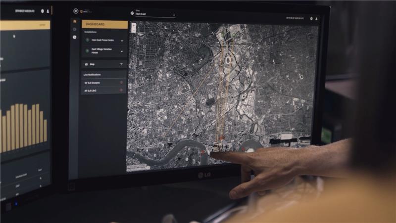
The rule would also allow site operator to contact law enforcement if a drone flew in a restricted area, after which authorities can use Remote ID to locate the control station or operator. Pilots could face license suspensions, revocations, fines and criminal charges for entering these no fly zones.
Drone operators are encouraged to check B4UFLY for the latest breakdown on where pilots can and cannot fly.
Additional Information:
Restriction criteria includes impacts to aviation safety, protecting people and property on the ground, national security, or homeland security.
The full list of eligible site categories are:
Chemical
Commercial
Communications
Critical manufacturing
Dams
Defense industrial base
Emergency services
Energy
Financial services
Food and agriculture
Government services and facilities
Healthcare and public health
Information technology
Nuclear reactors, materials, and waste
Transportation systems
Water and wastewater
The comment period on the proposed rule will run until July 5, 2026.
DroneShield and Pierce Aerospace have partnered to integrate Pierce Aerospace’s Flight Portal ID remote ID technologies into DroneShield’s counter-unmanned aerial system (C-UAS) and command and control systems (C2), which includes DroneSentry-C2. The integration will provide enhanced situational awareness to end users.
The inclusion of Flight Portal ID’s remote ID data feeds into DroneShield’s DroneSentry-C2 system enables end users to correlate and positively identify UAS. This enhances security operations and provides a holistic air picture with target discrimination.
Flight Portal ID remote ID technology consists of remote ID receivers, broadcast modules, software, integration capabilities and remote administration services. It has an integration service record with several commercial unmanned traffic management (UTM), detect and avoid, Department of Defense C2 and C-UAS systems.
“The integration of Flight Portal ID and DroneSentry-C2 provides users with the comprehensive picture needed to deconflict their airspace, maintain safe flight operations for both crewed and uncrewed aircrafts, while also having the real-time intelligence and means necessary to protect that airspace,” said Matt McCrann, CEO of DroneShield.
The combined technology has a wide range of end user applications, as UTM C-UAS solutions continue to merge for several user segments, across civilian government, military and private use cases.
The joint capabilities will be available to customers in 2023.
It’s hard to pick out an outstanding story or two this month from the dozens of new or related drone initiatives that bombard my inbox. But there’s always some that stand out, needing emphasis. This month, we look at these developments:
NEC Laboratories Europe introduces a potential drone solution for finding disaster victims
The FAA issues its remote ID rule, which also enables flight over people and nighttime operations
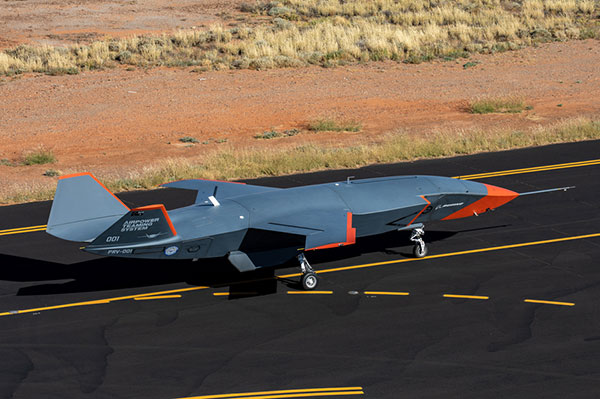
The Boeing Loyal Wingman succeeds with its maiden flight in Australia.
Search-and-rescue drone
Finding survivors is a primary task for first responders in disaster situations, so if a feasible approach using drones looks possible, its something we should prove out and implement quickly. Researchers at NEC Laboratories Europe, based in Germany, have come up with a drone shown to be able to locate a person’s cell phone — it works better in open situations, but takes longer and is less accurate when there are obstructions.
The Search-and-Rescue Drone (SARDO). (Photo: NEC Labs/Antonio Albany)
The concept of the search-and-rescue drone (SARDO) is basically to hang cellphone-tower electronics on the drone, and then let it self-triangulate on the return signal from the victim’s phone. So if you know where you are and estimate distance by pinging the victim’s phone and measuring the transit time, then move a known distance and repeat, eventually you converge on the phone’s location.
Putting all that into reliable flying algorithms is something; proving that your design works is significantly more tricky. Overcoming signal blockage due to debris brings another level of complexity, as does tracking the victim if he or she is moving.
But this looks like a great initiative which should be developed further — a possible boon for finding people in earthquakes and other building-collapse situations.
FAA Remote ID Rule issued
Image: ConceptCafe/iStock/Getty Images Plus
On Jan. 15, the U.S. Federal Aviation Administration (FAA) finally issued its rules for remote ID: All UAVs greater than 0.55 pounds must transmit unique identifications. Although, it appears that even these lighter drones might also have to be capable of remote ID if operated commercially. The broadcast message has to include “identification, location, and performance information of the unmanned aircraft and its control station.”
The good news is that there are now several potential suppliers of these broadcast modules. The rules allow for an implementation period that stretches out another 18 or 30 months — UAV manufacturers have 18 months to comply, while drone operators have 30 months.
The rules also allow drone operators to fly their UAVs over people. There are four categories of drone, each with appropriate restrictions — all seemingly related to the injuries an out-of-control or falling drone could cause to a person. All such operations require that the FAA approve a written statement of compliance with these safety rules.
The rules will certainly help with coverage of spectator sports such as the Super Bowl and regular outdoor events like PGA golf tournaments. It would appear that the Golf Channel and CBS have already begun to broadcast drone coverage of recent golf events. Such operations needing to verify their compliance now, rather than over the implementation period.
And, of course, if you can fly over people, transiting over vehicles is now allowed. With an anti-collision light installed, night operations are also permitted once compliance is approved.
The UAV/UAS is also referred to as the Airpower Teaming System (ATS), and should likely be considered a contender for the U.S. Air Force Skyborg manned-unmanned teaming program. At least two other companies involved with the Skyborg program are already flying similar vehicles — Kratos Unmanned Aerial Systems and General Atomics Aeronautical Systems.
Summary
Anything that helps first responders find survivors in disasters is a good idea to take to users in the field as soon as possible, so the NEC Laboratories Europe initiatives is a welcome opportunity.
After more than two years to get the final rules published, the FAA is finally coming online with its Remote ID rule — even though it entails significant work on operators’ parts over the next several months for them to implement. But the window now seems to be significantly wider for them to be able to take on more viable commercial business ventures.
Finally, it’s good to see the Boeing ATS get into the air — the first aircraft in 50 years to be wholly built in Australia, with interest not only from the Australian RAAF, but also with potential participation in the USAF Skyborg program.
Altitude Angel, a London, U.K.-based unmanned traffic management (UTM) technology provider, is releasing an open-sourced project, Scout.
Scout’s hardware and firmware enable drone manufacturers, software developers and commercial drone pilots to quickly connect to its global UTM.
Primarily intended for use in commercial and industrial drone applications, Scout provides the capability to securely obtain and broadcast a form of network remote ID, widely seen as a necessary step for enabling routine drone use and flights beyond visual line of sight.
Because it is open source, both the hardware and the firmware can be enhanced and incorporated into a virtually limitless set of scenarios, according to Altitude Angel.
Altitude Angel also has made available a surveillance API that allows integrators to both share and receive flight data from a variety of sensors and devices in near real time, providing a comprehensive real-time picture of the airspace.
While many remote ID systems are broadcast only, Scout offers two-way communication and is fully open-sourced. The ability to talk back to the drone enables the Altitude Angel UTM service to help the drone avoid collisions with other aerial vehicles, or restricted airspace.
From launch, Scout will use identifiers obtained freely from Altitude Angel’s GuardianUTM platform. It will work in combination with a pre-flight (flight-plan sharing) service and is supported through integration with Altitude Angel’s Tactical Conflict Resolution Service.
Scout will enable the drone to report its real-time location using GPS-type sensors and relay this data via a secure, encrypted mobile communications link across 3G, 4G and 5G networks to Altitude Angel. It is powered by an internal rechargeable (via micro USB) lithium battery.
Altitude Angel has also provided reference design plans for the case that can be 3D printed. Scout has been designed to satisfy emerging network remote ID standards, such as ASTM.
Because the firmware is open source, the telemetry can be sent to other systems as required by the implementor.
A two-wire I2C upgrade to the circuit schematics, plus version 2 of the firmware (both scheduled for June), will subsequently enable the full two-way communication between the Scout device and the drone’s onboard systems, allowing the drone to respond directly to information received from the UTM.
In the interim, early adopters will have the opportunity to begin to integrate with Altitude Angel’s UTM services, test the hardware and test communication. Position data Altitude Angel receives from Scout is then automatically used by its Flight Information Management System (FIMS) to help provide traffic deconfliction.
Plans, firmware and schematics can be accessed via the Altitude Angel GitHub repositories.
The U.S. Department of Transportation’s Federal Aviation Administration (FAA) announced the eight companies that will assist the federal government in establishing requirements for future suppliers of Remote Identification (Remote ID).
Remote ID will enable unmanned aircraft systems (UAS), commonly called drones, to provide identification and location information while operating in the nation’s airspace.
The FAA selected the following companies to develop technology requirements for future Remote ID UAS Service Suppliers (USS):
“The FAA will be able to advance the safe integration of drones into our nation’s airspace from these technology companies’ knowledge and expertise on remote identification,” said U.S. Transportation Secretary Elaine L. Chao.
This initial group will support the FAA in developing technology requirements for other companies to develop applications needed for Remote ID. The applications will provide drone identification and location information to safety and security authorities while in flight.
The technology is being developed simultaneously with the proposed Remote ID rule. Application requirements will be announced when the final rule is published. The FAA will then begin accepting applications for entities to become Remote ID suppliers. The FAA will provide updates when other entities can apply to become qualified Remote ID USS on FAA.gov.
Drones are a fast-growing segment of the transportation sector with nearly 1.5 million drones and 160,000 remote pilots now registered with the FAA. The agency’s ability to develop Remote ID technology simultaneously with the rule enables the FAA to continue to build on a UAS Traffic Management (UTM) system that has demonstrated global leadership through the small UAS rule and the implementation of the Low Altitude Authorization and Notification Capability (LAANC), which automates the application and approval process for most UAS operators to obtain airspace authorizations.
Drone-maker DJI has filed an 89-page formal comment urging the U.S. Federal Aviation Administration (FAA) to allow drone pilots to choose which method of remote identification to use with their drones.
DJI’s filing includes an independent economic study that concludes the FAA’s Remote ID proposal would prove nine times as costly as the FAA’s estimates, imposing $5.6 billion worth of burdens on society over the next decade. The analysis finds many of those costs could be obviated if drone pilots could choose between two different methods of compliance, rather than doing both as the FAA proposed.
The economic analysis was prepared by Christian Dippon, Managing Director at NERA Economic Consulting, who considered the societal costs of the FAA’s proposed rule. He concluded the average monthly cost of a remote ID network-based service for a drone user would be $9.83, rather than the FAA’s $2.50 estimate; that demand for drones would fall 10 percent if the FAA’s proposals were imposed as written; and that total costs over 10 years would be $5.6 billion instead of the FAA’s $582 million estimate.
“We have known for years that Remote ID will be required by governments worldwide and will provide members of the public with confidence in productive drone uses, but the FAA’s deeply flawed proposal poses a real threat to how American businesses, governments, educators, photographers and enthusiasts can use drones,” said DJI vice president of Policy & Legal Affairs Brendan Schulman. “We hope our detailed economic analysis and comments, as well as tens of thousands of comments from other concerned parties, will encourage the FAA to develop a more risk-based, balanced and efficient remote ID rule, so our customers and the entire industry are not hurt by the final outcome.”
Remote ID allows authorities to identify and monitor airborne drones in near-real time, so they can see the location of the drone as well as a serial number to identify its owner. Congress tasked the FAA in 2016 with exploring consensus-based technology standards that could lead to Remote ID regulatory solutions.
In late 2019, the FAA proposed that almost all drones should broadcast that information directly to nearby receivers, as well as transmit it over wireless networks to a service provider’s database, with an anticipated monthly subscription fee for that service.
DJI and many other drone stakeholders have instead said the FAA should let drone operators choose whether to use broadcast or network solutions for Remote ID. Any new Remote ID rule is unlikely to take effect before 2024.
The U.S. Department of Transportation’s Federal Aviation Administration issued a proposed rule that would require unmanned aircraft systems (UAS) to be identifiable remotely.
The rule, deemed the “Notice of Proposed Rulemaking for Remote Identification,” would apply to all drones that are required to register with the FAA (recreational drones weighing under 0.55 pounds are not required to register), as well as to persons operating foreign civil UAS in the U.S.
“Remote ID technologies will enhance safety and security by allowing the FAA, law enforcement and federal security agencies to identify drones flying in their jurisdiction,” said U.S. Transportation Secretary Elaine Chao.
According to the FAA, nearly 1.5 million drones and 160,000 remote pilots are registered with the administration. Equipping drones with remote identification technologies would build on previous steps taken by the FAA and the UAS industry to safely integrate operations, including the small UAS rule, which covers drones weighing less than 55 pounds, and the Low Altitude Authorization and Notification Capability, which automates the application and approval process for most UAS operators to obtain airspace authorizations, the FAA added.
“As a pilot, my eye is always on safety first,” said FAA Administrator Steve Dickson. “Safety is a joint responsibility between government, pilots, the drone community, the general public and many others who make our nation so creative and innovative.”
The proposed rule will be accompanied by a 60-day comment period to receive public feedback and help the FAA develop a final rule to enhance safety in the skies over the U.S.
Guest column by Brian Wynne AUVSI President and CEO
Brian Wynne, AUVSI president and CEO
A recent analysis found that just 10 percent of the unmanned aircraft systems (UAS) included in the Unmanned Systems and Robotics Database maintained by the Association for Unmanned Vehicle Systems International (AUVSI) can operate beyond the visual line of sight (BVLOS) of its operator.
While the technology for BVLOS operations has existed for years, under current federal regulations, only the military is permitted to use it. The absence of federal regulation allowing BVLOS operations hinders the full value and benefits that the UAS industry has to offer.
Regulations that provide guidance and rules for operating unmanned systems are necessary for the industry’s advancement. Earlier this year, the Federal Aviation Administration (FAA) issued a proposed rule for UAS operations over people, and the UAS community is eagerly anticipating the agency will offer an additional rule requiring UAS to be equipped with remote identification.
“Remote ID is a crucial next step to gain the confidence of federal defense and security agencies, manned aviation users and the public.”
However, the rulemaking process for remote ID has been delayed by the FAA twice this year and is now slated to be released in December. The need for remote ID cannot be overstated, as the advancement of the UAS industry depends on identifying and tracking UAS flying in the airspace.
Furthermore, remote ID is a crucial next step to gain the confidence of federal defense and security agencies, manned aviation users and the public. With this confidence, UAS can further integrate into the national airspace to perform important BVLOS operations such as inspection of utility rights of way, widespread search-and-rescue missions, and package delivery.
A clear, national regulatory framework and the support of the federal government is needed to drive the adoption of unmanned systems technology and its applications. Currently, the UAS industry is working with our government partners on remote ID and tracking standards, but we recognize that more needs to be done and at a faster pace than the regulatory process allows. That is why the UAS industry is stepping up to explore near-term solutions before remote ID regulations are finalized and published.
In May, AUVSI and the Airports Council International-North America commissioned a Blue Ribbon Task Force on UAS Mitigation at Airports. The task force is working to refine procedural practices and provide a policy framework to address the timely and critical issue of incursions by unauthorized UAS at airports and how best to mitigate this threat, including industry and government recommendations for remote ID. The task force will release a report this year.
Applications of unmanned systems aren’t limited by technology or imagination; they’re only limited by regulations. We need a streamlined regulatory environment that allows for the safe deployment of unmanned systems into our nation’s transportation infrastructure so we can begin to reap the full benefits of this technology.