The 1,174 page set of reports are comprehensive and document the first phase of what is intended as a multi-phase effort.
Graphic: RIN and RNTF
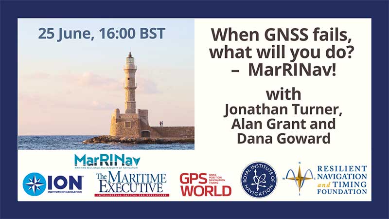
The webinar will present how maritime positioning requirements were systematically developed; an assessment of current and future positioning systems to deliver the required performance and integrity; rigorous gap analysis, showing where performance falls short, as well as options to solve these issues; and a roadmap of steps needed to take — and by whom — toward maritime resilient positioning.
Webinar speakers will include Jonathan Turner of the MarRINav project team, Alan Grant of the Royal Institute of Navigation and Dana Goward of the Resilient Navigation and Timing Foundation.
Signing the letter were Senators Mike Lee, Brian Schatz, Ron Johnson, Edward Markey, Ted Cruz, Mark Warner, John Thune and Chris Coons. All except for Senator Coons serve on the Senate Committee on Commerce, Science and Transportation, which oversees the FCC. Senator Coons serves on the appropriations subcommittee that funds the FCC each year.
The letter referred to the hearing held by the Senate Armed Services Committee on the issue, and stated that only parties opposed to the FCC’s action were heard. The senators were concerned that the public also hear from the FCC.
Thirteen specific questions covered topics including:
How long the proceeding was on the docket
What notice given federal agencies of the proposed final order
Which agencies were consulted and how input was considered
The adequacy of the guard band and how the FCC has used the 1-db interference standard in the past
The 13th question asked the FCC why it believed granting the application was in the public interest.
A copy of the letter is available on the Resilient Navigation and Timing Foundation website.
Professor Last was one of the first members of the foundation and had served on its International Advisory Council since its inception. He perished in the crash of a small plane he was piloting on the Nov. 25, 2019.
The foundation and three of its members have begun the drive with pledges totaling $24,000.
The fund will be administered in the United Kingdom and is envisioned to pay student expenses for attendance at navigation-related conferences and symposia.
Individuals and organizations wishing to contribute to the scholarship fund should contact the foundation at [email protected]. Donations can also be made through the foundation’s website.
The U.S. Department of Transportation’s most recent document preparing for the future of self-driving cars almost entirely ignores positioning, navigation and timing (PNT) needs, according to the Resilient Navigation and Timing (RNT) Foundation. And when it does address GPS, it gets things wrong. A Dec. 3 deadline looms for interested parties to file their comments with DOT.
The comment period is open until December 3. Interested parties can make their own comments and read those already submitted at the website for Docket DOT-OST-2018-0149.
The cited comment from the RNT Foundation states that, while most self-driving cars are being designed to navigate without external inputs, GPS/GNSS will still be required to initialize location information for vehicle cold startups. Also, most vehicles will reference GPS/GNSS when communicating their positions to other vehicles and traffic control systems.
Much of the benefit of automated vehicles will come from their participation in Intelligent Transportations Systems. This means wireless networks. The RNT Foundation also urges the department to consider these networks’ critical dependence on GPS timing synchronization in their plans going forward.
(Image: Pavel Vinnik/Shutterstock.com)
The Secretary of Transportation has had a mandate to provide a backup capability for GPS since 2004 that has not been acted upon. The RNT Foundation comments observe that doing so could greatly mitigate all of the concerns mentioned.
Dana Goward is president of the Resilient Navigation and Timing Foundation, based in Washington D.C.
Dana Goward President, Resilient Navigation and Timing (RNT) Foundation
An apparent mass GPS spoofing attack in June involved more than 20 vessels in the Black Sea and suggests that Russia may be aggressively experimenting with signal disruption and spurious substitution.
“GPS equipment unable to obtain GPS signal intermittently since nearing coast of Novorossiysk, Russia. Now displays HDOP 0.8 accuracy within 100m, but given location is actually 25 nautical miles off…”
Subsequent dialog with the ship’s master and examination of various documents and screen grabs he furnished enabled navigation experts to conclude this was a fairly clear case of spoofing: sending false signals to cause a receiver to provide false information. Other vessels in the vicinity experienced the same problem.
The RNT Foundation has received numerous anecdotal reports of maritime problems with the automatic identification system (AIS), a tracking system used for collision avoidance on ships, and with GPS in Russian waters, though this is the first well-documented public account.
Russia has very advanced capabilities to disrupt GPS. More than 250,000 cell towers in Russia have been equipped with GPS jamming devices as a defense against attack by U.S. missiles. And there have been press reports of Russian GPS jamming in both Moscow and the Ukraine. In fact, Russia has boasted that its capabilities “make aircraft carriers useless.”
The U.S. director of National Intelligence issued a report on May 11 that states that Russia and other actors are focusing on improving their capability to jam U.S. satellite systems.
Assuming Russia is behind this, why would they do such a thing? Possibly to encourage use of GLONASS or their terrestrial loran system, Chayka, instead of GPS. Possibly for some security reason known only to them.
Whatever the reason, it reminds us of the vulnerability of GPS signals, and of the plethora of motives that “bad actors” — governmental or private criminal interests — may have to disrupt and deceive GNSS users.
And of the U.S. Coast Guard’s advice about GPS and all satnav: “Trust But Verify.”
Dana Goward is president of the Resilient Navigation and Timing Foundation. He is the proprietor at Maritime Governance LLC. In August 2013, he retired from the federal Senior Executive Service, having served as the maritime navigation authority for the United States. As director of Marine Transportation Systems for the U.S. Coast Guard, he led 12 different navigation-related business lines budgeted at more than $1.3 billion per year. He has represented the U.S. at IMO, IALA, the UN anti-piracy working group and other international forums. A licensed helicopter and fixed-wing pilot, he has also served as a navigator at sea and is a retired Coast Guard Captain.
Space maps of some of 13,986 satellites, below, and some navigation satellites, above (courtesy Esri).Alan Cameron
Advocacy in the U.S. capital urges augmentation of GPS/GNSS with eLoran and other “complementary terrestrial PNT services to increase resilience.” See the Resilient Navigation and Timing Foundation’s website, rntfnd.org. This is assuredly a good thing, a worthy cause.
I’ve come to believe, however, that true resilience goes beyond what we normally think of as position and timing sensors. Stimulus comes from a keynote lecture by Dawn Wright, Esri chief scientist, at the 2015 American Geophysical Union Fall Meeting. I hope Esri or the AGU will publish the lecture or post the video. For now, bear with my limited rendition.
In “Toward a Digital Resilience, with a Dash of Location Enlightenment,” Wright describes the new science of big data: the flood of info from satellites, sensors and other measuring systems; the issues inherent in large data sets; and the insight discovered through their manipulation and exploration. She talks to geographic information systems professionals, software makers and users, but her remarks resonate beyond that associated industry sector and well into that of PNT hardware, where we live.
Integrate, integrate, integrate! Interoperability and crosswalking with other systems and data sets. To make it reproducible, make it virtual — as in virtual, living journals. These are three of the eight ideas toward digital resilience that she espouses, making communities more resilient with tools and data.
I’ll return to this in a later editorial; there’s much around which still to wrap my head. But here’s the moral: resilient PNT will ultimately mean more than complementary sensors. It will entail a seamless mesh of hardware and software, of pre-existing and new data, much of it from sources we don’t currently consider PNT-relevant, of input from amateur app makers and users and more.
A bi-partisan group of legislators led by Congressman John Garamendi (D-Calif.) has introduced a bill that would require the U.S. Secretary of Defense to establish a backup for GPS within three years using eLoran.
The National Positioning, Navigation, and Timing Resilience and Security Act of 2015, H.R. 1678, was co-sponsored by Congressmen Duncan Hunter (R-Calif.), Peter DeFazio (D-Ore.), and Frank LoBiondo (R-N.J). Garamendi is the ranking member of the House Transportation and uInfrastructure Subcommittee on the Coast Guard and Maritime Transportation.
H.R. 1678 would require the secretary of defense, in coordination with the commandant of the Coast Guard and the secretary of transportation, to establish and sustain a reliable, land-based positioning and navigation system that will complement and backup America’s GPS for military and civilian uses by using eLoran.
eLoran is the government’s existing and underused long-range navigation system infrastructure. The backup system would step in when GPS signals are corrupted, degraded, unreliable, or otherwise unavailable. A terrestrial-based system, eLoran wouldn’t be affected by atmospheric interruptions such as solar storms, or jamming or spoofing aimed at GPS.
The bill directs the secretary of defense to incorporate the expertise and contributions of the private sector to quickly establish system architecture, as well as build and operate the system.
“GPS is much more than a LCD screen on your dashboard. It’s a technology used for much of our nation’s critical infrastructure and by almost every major industry in America, as well as the military, law enforcement, and first responders,” Garamendi said in a press release. “We are increasingly reliant on the precision, navigation, and timing services that GPS provides. From land navigation on cell phones to a timing source for our national infrastructure, we need a reliable backup system to GPS.”
Garamendi said the bill would make the nation’s geopositioning infrastructure more resilient to “threats both natural and nefarious.” “A backup system could also reach places that GPS currently cannot, such as inside many buildings. This would help first responders and law enforcement more effectively protect the public,” he added.
Other members of Congress are expected to sign on as co-sponsors after Congress returns from its spring recess, according to Dana A. Goward, president and executive director, Resilient Navigation and Timing Foundation.
The eLoran PNT system would use enhanced long-range signals (eLoran) from 19 towers around the country, each with approximately a 1,000-mile range providing overlapping fields from which a device can derive its location. The back-up system would use the remaining Loran infrastructure and provide a secure and reliable cybersecurity insurance policy, said the press release.
The U.S. atomic clock, accurate to one second in 300 million years, also serves as the base timing source for this backup GPS capability. This exceeds the timing needs of modern cell phones, creating an infrastructure backbone that is prepared to handle the evolution of consumer and industry electronic communications in the years ahead, the press release said.
The bill sets out numerous requirements for the system, saying that it shall:
Be wireless, terrestrial, and wide area
Provide a precise, high-power 100 kilohertz signal
Be resilient and extremely difficult to disrupt or degrade
Be able to penetrate underground and inside buildings
Take full advantage of existing, unused Loran infrastructure
Work in concert with and complement any other similar positioning, navigation and timing systems, including eLoran.
Since 2004, the federal government has recognized that the absence of a reliable backup system for GPS is a glaring economic and security threat to the United States, and has reaffirmed its interest in developing an eLoran as a reliable, land-based backup for GPS signals, the press release said.
In January, the United States Army began soliciting information for eLoran receivers for the warfighter, either stand-alone or integrated with GPS, for use in Army and other Department of Defense maritime, aviation, or vehicular platforms, and for position and timing.
The United Kingdom began using eLoran in October 2014 to protect its shipping lanes, which carry 95 percent of UK trade, in case of GPS signal loss.
At the ENC-GNSS Conference in Rotterdam, we delved into actions necessary to officially use EGNOS (giving me déjà vu from WAAS’s early days), heard sage words from Brad Parkinson, the father of GPS, and, on the last day, saw amazing proof of a claim many of us initially thought was outrageous — that differential (DLoran) with modern monitoring can result in consistent horizontal accuracies approaching five meters on a moving platform.
When I was asked if I could cover the European Navigation Conference 2014 (ENC-GNSS) in Rotterdam, The Netherlands, it took me about two seconds to answer in the affirmative. Let’s see… Travel to Europe in the spring, visit The Netherlands — my old stomping grounds where my daughter was born — see miles and miles of beautiful Tulips in bloom, and visit with some old friends. Gee, what a tough decision. Oh, and of course, cover the ENC. Almost forgot that
Seriously, my primary purpose, of course, was to cover the ENC and associated events such as the Resilient PNT Forum and a meeting of the European Maritime Radionavigation Forum (EMRF), but literally miles and miles of brilliant red, white, and yellow tulips interspersed with ancient windmills are hard to ignore. But I digress.
In past years the ENC, with approximately 400 attendees, has been naturally dedicated to European PNT matters, and in reality it concentrated almost exclusively on Galileo with a slight mention of EGNOS. That was about it. This year, the venue was the same, but the program was more open, with presentations on PNT augmentations such as EGNOS and DLoran, and maritime navigation to include radar and inertial systems.
For those of us that have been in the PNT (positioning, navigation and timing) or merely the navigation business, say, for the past 40+ years or so, in some respects it was more than slightly reminiscent of times past. As the great American octogenarian baseball philosopher and malapropism aficionado extraordinaire, Yogi Berra, once said, “It was déjà vu all over again.”
European Maritime Radionavigation Forum
The Port of Rotterdam today (2014).
The EMRF was the first official function to kick off in Rotterdam. When you consider that Rotterdam is one of the busiest ports in Europe and had been around since 1340, you would naturally expect one of the main conversations at the EMRF to concern the port of Rotterdam and navigating in less-than-perfect conditions. The Netherlands is known as the Low Country, and that is as an apt description since most of the country is below sea level — hence the persistent fog, dikes, sea walls, and windmills that pump water and grind grain and all those good things. Today, the modern versions of those windmills are huge — twenty stories tall — and generate electricity. Many of them are close to shore so precise navigation in foggy conditions is even more critical than in times past.
The main topic of conversation at the EMRF revolved around the actions necessary to officially use EGNOS (the European Geostationary Navigation Overlay Service) as a precision and official safety-of-life augmentation for GPS (similar to WAAS, Wide Area Augmentation System) and Galileo.
During those discussions, I swear when I closed my eyes, except for the accented English, I was propelled backward almost 20 years to discussions of WAAS as a safety-of-life system, not for maritime but for aviation purposes. Still, the dialogue and heated discussions echoed down through the years almost verbatim. The main difference, of course, being that in the U.S. it was 20 years earlier, we were embarking on virgin territory, and we had only ourselves, one nation, to debate. Whereas the Europeans are fighting the same battles two decades later, with a system that is purposefully almost an identical copy of WAAS technically, and they are working for maritime and aviation certifications simultaneously. And not with just one nation but the entire European Union. A truly daunting task.
The EMRF website is sponsored by Trinity House in London, which is responsible for the safety of [English and European] shipping and the well being of seafarers, which have been their prime concerns ever since Trinity House was granted a Royal Charter by Henry VIII in 1514. I planned to list the EMRF website for your further edification, but since the latest news on the site concerns the upcoming January 2011 EMRF meeting in Paris, I thought it was best left to molder in obscurity. The website, not the EMRF.
The bottom line for the EMRF is that while it fills an important role where EGNOS and maritime navigation are concerned, it still has a lot to learn and could benefit greatly by lessons learned from WAAS. However, I personally see no indication that will happen, so we wish them luck. Many of us are standing by to assist if asked. Even if it is only, “Been there, tried that, and here is why it did or did not work.” Quod homo non sit Island.
Resilient PNT Forum
I was happy to see Dana Goward (USCG Ret), the head honcho at the Resilient Navigation and Timing Foundation, which conducted the Resilient PNT Forum at ENC 2014. Dana’s forum, which took place just before the official ENC 2014 kickoff, concentrated on the need for and strategies to achieve resilient position, navigation and timing (PNT) services. The event was well attended, and was jointly hosted by the European Group of Institutes of Navigation, the International Association of Institutes of Navigation, and the International Association of Marine Aids to Navigation and Lighthouse Authorities. There was no charge to attend the event, and the collaboration proved interesting, especially since Dana really wanted to talk eLORAN and GPS/Galileo augmentations.
Dana is retired U.S. Coast Guard and worked many years supporting LORAN-C and the USCG Navigation Center. Dana showed a brief video of his recent testimony before the U.S. Congress, where he lobbied for a cessation of the destruction of LORAN-C towers and their associated infrastructure. If recent congressional actions are any indication, he has been somewhat successful in that regard. Now all that is left is to help the U.S. Congress, services, and agencies realize how badly the United States needs LORAN as a backup, enhancement, and augmentation to GPS and other space-based PNT services on a global basis. No small task, but it is a task that Dana Goward and the Resilient Navigation and Timing Foundation have strapped on, and we wish them the best. Plus, as you will see later, a surprise presentation at ENC-GNSS may have given Dana and his cause just the boost they need. Keep reading.
As it turns out, many others thought these non-Galileo presentations were timely topics as well, and the discussions were enlightening, especially the Resilient PNT Forum keynote address by Professor David Last. Among many other titles he holds, Last is a consultant engineer and expert witness specializing in radio navigation and communications systems. He is a professor emeritus at the University of Bangor, Wales, and past president of the Royal Institute of Navigation. He acts as a consultant on radio-navigation and communications to companies and to governmental and international organizations and is active as an expert witness, especially in forensic matters concerning GPS.David and I are old friends, and it is always enlightening and entertaining to hear him speak. On this occasion, Professor Last spoke eloquently and authoritatively concerning the ubiquity of GPS/PNT and the resultant and inherent vulnerabilities of space-based systems. David made the essential point that while GPS remains the sine qua non of PNT, it is still vulnerable and subject to failures as are all space-based PNT systems, the recent GLONASS debacles being prime examples. More on these unfortunate Russian examples of PNT vulnerability at a later date.
David pressed the issue, as he has many times, that we desperately need a ground system or many different ground-based augmentations, backups, and enhancements to ensure that the user is never without navigation and timing data at a critical juncture, such as navigating through an insanely busy commercial port in thick fog.
This theme was carried forward in the ENC-GNSS very adroitly by none other than Dr. Bradford Parkinson, the Father of GPS. Dr. Parkinson spoke at length on the need to “Protect, Toughen, and Augment GNSS” against all enemies, be they manmade or natural. Brad made the point, with all due credit to Will Rogers, that “Rumors of GPS’ death are greatly exaggerated.” Indeed, the GPS constellation has never had more satellites on orbit, in residual status, and spares in the barn than we do today. The SIS or Signal In Space has never been more accurate, and the GPS atomic reference systems have never been more stable than today, and yet GPS remains incredibly vulnerable. But take heart, as Dr. Parkinson is convinced “There are actions such as PTA that can be taken to safeguard PNT for all users.” We will cover Dr. Parkinson’s 60+-slide presentation in depth at a later date.
Surprise! Loran Is the Answer
The big surprise came on the last official day of the conference during a group of alternate PNT presentations co-chaired by Dr. David Last. The rather startling enhanced differention LORAN (eDLoran) presentation was given by Professor Durk van Willigen, representing his colleagues René Kellenbach and Cees Dekker of the Dutch consulting firm Reelektronika, and Wim van Buuren of the Dutch Pilots’ [ed. maritime] Corporation, who helped with the DLoran research and authoring of the paper for the ENC presentation.
Professor van Willigen made what many of us initially thought was an outrageous claim, and then amazingly went on to prove that enhanced differential Loran with modern monitoring produced consistent horizontal accuracies approaching five meters on a moving platform. Needless to say, Professor van Willigen, who teaches at the Delft University of Technology in The Netherlands, was mobbed at the end of his presentation, but I did manage to catch him for a few minutes afterwards. Since then, GPS World Editor-in-Chief Alan Cameron has spoken with Professor van Willigen at length, and the result is the first of what I am sure will prove to be numerous articles on eDLoran in GPS World.
Shipboard DLoran receiver installation (orange boxes on rails).
One would hope that with this rather startling improvement in differential Loran accuracy and the decision by the U.S. Congress to halt the destruction of Loran-C infrastructure in North America, that there might once again be a future for Loran, especially eLoran and/or DLoran in North America, and hopefully globally as well.
As Professor David Last in his best imitation of John Cleese might say, “It is the answer to a maiden.s prayer.”
Until next time, happy navigating. I hope to see you all at the 30th Space Symposium May 19-22 in Colorado Springs at the Broadmoor Resort. More than 10,000 attendees are expected, and I hope you will be one of them. Stop by the GPS World booth and say hello.