Australia-based Aptella is offering free access to its AllDayRTK high-accuracy positioning service for volunteers and organizations involved in bushfire and flood recovery efforts.
Reliable positioning aids in coordinating recovery operations, assessing damage and restoring essential infrastructure. However, extreme weather events often disrupt permanent GNSS base stations due to power outages and loss of internet connectivity.
To address this challenge, AllDayRTK has developed a Synthetic Base Station system, enabling high-accuracy positioning even when permanent bases are offline. This technology creates a virtual reference station network that ensures continuity of service in disaster-affected regions, supporting emergency response teams and volunteers where traditional infrastructure cannot.
Key Benefits:
Free access for registered volunteers and recovery organizations.
High-accuracy GNSS positioning for mapping, surveying and logistics.
Synthetic Base Station technology ensures service continuity without reliance on damaged or offline permanent bases.
“Aptella is always willing to do what we can to support volunteer services with high-accuracy positioning that assist with recovery after natural disasters and extreme weather events,” said Greg Macklin, CEO at Aptella. “Our commitment is to ensure that those on the front lines have the tools they need to rebuild communities quickly and safely.”
BDStar Navigation subsidiary TruePoint has introduced the TruePoint.CM network real-time kinematic (NRTK) service across Europe, the latest in BDStar’s expansion into international high-precision positioning markets.
Supporting all major GNSS and QZSS, the service is designed to improve signal reliability in complex European environments. TruePoint.CM is built on the company’s chip-cloud integration architecture and works with both BDStar’s Unicore and third-party GNSS hardware through standards-based interfaces.
The service provides wide-area coverage throughout Europe, the company said, offering centimeter-level accuracy with fast convergence times. Before launch, TruePoint conducted extensive validation testing in more than 40 cities across 12 European countries, including more than 300,000 kilometres of dynamic field trials.
The platform uses an adaptive data protocol to reduce bandwidth consumption by up to 70% while maintaining full positioning accuracy, a feature aimed at helping customers reduce operational data costs. Remote diagnostics and over-the-air firmware updates are incorporated to support more efficient device management in the field.
TruePoint.CM operates on a fully redundant cloud infrastructure spanning data sources, data centers and service-delivery interfaces. The system is designed to ensure continuous uptime, backed by a stated service availability of 99.9%.
At launch, the company reported that it has already secured commercial adoption in the European robotic lawn mower market, with additional opportunities expected in autonomous robotics, UAVs, precision agriculture, automotive and consumer IoT.
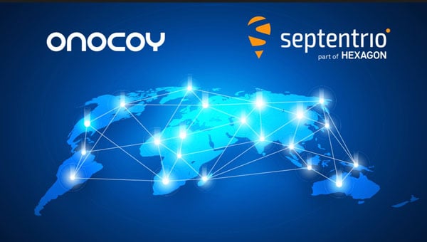
Septentrio, part of Hexagon, has added the onocoy GNSS correction service to its Agnostic Corrections Partner Program. The program is designed to give users the ability to select from multiple high-accuracy correction services, supporting a range of application needs and geographic requirements.
The onocoy service operates as a decentralized, crowdfunded RTK network, providing reliable and cost-effective high-accuracy positioning. This approach is intended to benefit sectors such as agriculture, mining, drone operations, robotics, autonomous vehicles, geodesy and more.
Onocoy operates a community-driven GNSS RTK network powered by Web3 and blockchain technology, to offer secure, transparent and efficient data sharing and transactions, according to the company. Although privately operated, this network actively monitors its base stations to maintain service reliability and quality. Onocoy is joining Septentrio’s Agnostic Corrections Partner Program, which already includes several leading correction services such as GEODNET‘s RTK Service and Swift Navigation’s Skylark Precise Positioning Service.
Case New Holland (CNH) has selected the Tallysman Wireless VeraChoke antenna for modernization of its high-precision European GNSS real-time kinematic (RTK) network.
“The objective of the GNSS antenna update is to enable the tracking of all GNSS constellations and signals, thus improving the robustness, convergence time, and accuracy of positioning within CNH’s European RTK network,” said Michiel Jochims, CNH Industrial RTK manager EMEA. “At this stage, with only 25 stations updated, we are delighted to observe a significant performance improvement. We look forward to continuing the network update and bringing enhanced positioning to all of our European customers.”
The VeraChoke antenna provides excellent multipath suppression and repeatability of PCV and group delay variation (GDV), making it suitable for GNSS reference networks, explained Temo Wubbena, CEO of Geo++. “After detailed analysis, we have recommended Tallysman’s VeraChoke antenna to CNH Industrial.” Geo++ is supporting the upgrade of CNH Industrial’s European RTK network.
The patented VeraChoke has a very tight phase center variation (PCV), strong multipath mitigation and excellent performance across the full GNSS spectrum. Its PCV and phase center offsets (PCOs) are repeatable from unit to unit, making suitable for network RTK applications.
The John Deere StarFire 6000 RTK receiver operating in the field. (Photo: John Deere)
Precision agriculture — the practice of optimizing inputs of seed, water, and fertilizers while maximizing yields by mapping variations in soil characteristics and guiding machinery accordingly — began in the United States in the early 1980s and has been growing steadily. Key components include soil mapping based on sampling and remote sensing, proximal sensing of soils and crops, variable rate irrigation and variable rate spraying of fertilizers and herbicides, and automatic tractor navigation.
“GNSS-based guidance is probably the most highly adopted precision ag technology, followed by variable rate and section control,” said John Fulton, associate professor at The Ohio State University. “I suspect that somewhere around 40% of those GNSS receivers use RTK-level corrections — which provide sub-inch accuracy — and that number is increasing.”
Need for sub-inch accuracy
Water runs downhill, of course, which makes vertical accuracy critical for hydrology. “AgLeader builds a plow to put tile in soil to drain water,” said Bill Cran, AgLeader Technology’s GNSS product specialist. “It might only be 4 inches round; so, if we are off by 2 or 3 inches vertically, that affects where water can run.” To get the best vertical accuracy possible, he recommends farmers install a base station in the field where they are operating.
Sub-inch accuracy also enables farmers to determine where to plant each seed, rather than monitoring planters at the row level. “That may not be a requirement today, but it is certainly coming,” Cran said.
Market demand for RTK in agriculture is increasing, an important factor for drone guidance or machine control, said Gustavo Lopez, market access manager at Septentrio. “The robots are very close to the crops. When small robots are working in a corn field, the corn plants are causing multipath or shadowing GNSS signals,” Lopez said. “You need either a good RTK or GNSS-INS, because if you lose satellite lock you can still coast for a while with an IMU.”
Services and options
AgLeader’s displays have a built-in networked transport of RTCM via internet protocol (NTRIP) client that enables it to connect to NTRIP networks and CORS networks, as well as other free and subscription-based networks. “That allows us to get RTK from the internet for customers that want to go that route,” Cran said. Alternatively, the company offers NovAtel GPS receivers, including Satel- or Freewave-based RTK options with 400 MHz and 900 MHz radio options that can communicate with a similar base station. This spring, it will begin to offer NovAtel’s TerraStar-X service. “We are calling that ‘RTK from the sky,’” Cran said. “The expectation is sub-inch accuracy, with a convergence time of less than one minute. Many of our customers and dealers are very excited about that option.”
Septentrio’s GNSS modules for agriculture are used mostly in mapping drones, Lopez said. The modules mitigate interference and spoofing. “We have also been quite successful in robotics for agriculture,” Lopez said. Septentrio is working closely with the French agriculture robotics company Naïo Technologies, which integrates its robots with Septentrio’s smart antenna GNSS products, providing a full RTK solution as well as autonomy.
For areas without RTK networks, some farmers buy and install Septentrio base stations that provide corrections to their robots or UAVs. Septentrio provides agricultural mapping software for post-processing data gathered without RTK. Also on offer are L-band receivers — while not as accurate as a local RTK network and possibly with higher convergence time, the relative accuracy of L-band corrections is more than good enough for many ag robots, Lopez explained.
On the baseline
The vegetable weeding robot Dino — shown here operating in Yuma, Arizona — uses a Septentrio GNSS receiver. (Photo: Septentrio/Naio Technologies)
Most RTK users are on a short baseline — under 5 miles from the base station to the rover, according to Al Savage, manager of John Deere’s StarFire network. Medium baseline is about 5–8 miles, and long baseline is up to 12 miles. In 2015 John Deere released its Base Station Manager, which enables dealers to remotely upload firmware, upkeep the rover access list, and monitor their base stations.
As dealerships and their RTK networks merged and farms expanded, it became difficult for farmers to keep track of which base station to use. So, in 2019 John Deere released an Automatic Base Station Switching feature that links the RTK radio configuration to the field boundary in its Generation 4 display.
Also new: A John Deere StarFire receiver can continue to operate if it loses connection to a base station using the RTK Extend feature. The StarFire SF6000 rover receiver can continue operating with RTK-like accuracy for up to 14 days without connecting to an RTK base station, compared to only 14 minutes for a previous receiver, Savage explained. The increase “was very well received by customers, especially those operating in areas challenged by line of sight or trees and foliage on field boundaries.”
In South America, John Deere’s RTK Flex feature, “will automatically switch between RTK and SF3 during a time in the day when scintillation causes the greatest interference,” Savage said, enabling farmers “to continue working with similar accuracy when RTK is unavailable due to scintillation.”
Remaining obstacles to adoption
Despite’s RTK’s growing popularity, there are a few remaining obstacles to its adoption.
Cost. “Though the cost has been greatly reduced over the years, RTK is still more expensive than other correction signals out there,” Fulton said. Part of the cost is due to the hardware, Cran pointed out. “There are rover and base station radios, there are towers to put up. On the NTRIP side, there are cell modems to put in vehicles, and they require keeping a data plan active.” The agriculture market traditionally has been very cost-sensitive and conservative, Lopez said. “Farmers expect to implement very low-cost solutions. They want to know whether they will have an ROI (return on investment) on these solutions.”
Satellite services offer a cheaper alternative to RTK. TerraStar-X, for example, gets rid of the cell modem hardware and the requirement for base station hardware, Cran said. “At a lower accuracy level, there are other satellite-based TerraStar signals: TerraStar-C and TerraStar-C Pro, which get an accuracy maybe under 5 to 20 cm. Those are less-expensive alternatives that growers are using without making the leap to RTK.”
Lack of Internet Connectivity. While most RTK services, including NTRIP, require an internet connection, many rural areas have limited broadband and even cellular connections. Some areas lack support for RTK, Fulton said.
Lack of cross-platform compatibility. Farmers with a mixed fleet want to run a mix of receivers. “For example, John Deere and Trimble RTK do not work together,” Cran said. “It is still very manufacturer-specific. I cannot take a NovAtel receiver that is AgLeader branded and use it with a John Deere RTK network.” NTRIP partially enables cross-platform mixing and matching. “We’re excited about TerraStar-X, too, because, while it is specific to NovAtel receivers, it is not tied to any base station hardware,” Cran said. “So, a John Deere guy can put an AgLeader receiver on their vehicle and use TerraStar-X and still get that accuracy without being tied to the Deere RTK network.”
Liability. While safety is not nearly as big an issue as it is with autonomous vehicles on the roads, liability questions will soon loom. “If, for example, a robot destroys a whole plantation, someone must be liable,” Lopez pointed out. “Was it the robot? The GPS receiver? Other sensors? The farmer? What if there is a spoofing attack and the robot goes to a neighbor’s field?” Such challenges are slowing adoption. “That is where the reliability of the GNSS is becoming important,” he said.
The future
Soon, satellite-based internet connections could make RTK correction more widely available and give more growers the option of using NTRIP, though at a cost. WAAS, a free service of the U.S. government, is broadcast by satellites but does not achieve the accuracy level of RTK. “RTK is still a localized correction,” Fulton said. “We may see that shift to satellite, but it will more likely be an online or some other type of communication.
“Once farmers start using RTK, it is very unlikely that they will ever revert to another type of correction,” he added.“RTK is a very addictive correction service for folks.”
Savage concurs. “RTK is addictive because of its accuracy, efficiency and repeatability.” Ultimately, however, to achieve universal adoption, RTK solutions will need to work everywhere, with little intervention by the farmer.
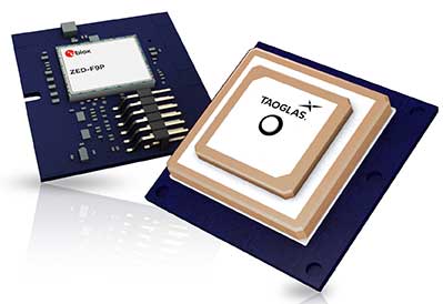
Taoglas, a provider of next-generation internet of things (IoT) solutions, has launched Edge Locate, a GNSS L1/L2/E5 module that combines antenna, RF electronics and receiver technology to deliver reliable centimeter-level positioning.
Taoglas, in partnership with u-blox, created a smart antenna that uses multi-band GNSS technology, providing between 1- to 3-centimeter-level accuracy.
With Edge Locate, manufacturers can quickly and effectively build devices with centimeter-level positioning technology, without having to invest in costly and lengthy RF design, integration and testing processes.
The device features multiband GNSS positioning that can be used in conjunction with cost-effective real-time kinematic (RTK) positioning capability.
Traditionally, most IoT devices use single-band GPS technology, delivering on average 10-meter accuracy with existing GPS modules and antennas, Taoglas said in a press release. This enables location-specific, mission-critical services such as emergency response, smart infrastructure, precision agriculture and microbility mobility applications where precise location provides critical value to the IoT application.
Taoglas can also consult and install the RTK network in any global location for any IoT use case.
“Centimeter-level positioning is absolutely key to the next-generation of IoT enabled applications,” said Ronan Quinlan, Co-CEO of Taoglas. “Take an example from the burgeoning micro-mobility industry. When granting licenses from a trial, the city authorities would like to monitor the riders of e-scooters, ensuring riders are staying off footpaths, or parking in designated areas. The problem is that today’s legacy GPS solutions don’t often know which side of the road a scooter is on. Whereas with our solution, fleet operators can pinpoint within just a few centimeters where a device is located. We do this by working with our customers to enable the whole solution and we make sure it works reliably in real life.”
Edge Locate can greatly accelerate the latest GNSS multiband product launch plans by offering a plug-and-play product that uses a common connector for integration into any electronics device. It also connects directly to the Taoglas Edge board for immediately connectivity options.
Taoglas is exhibiting at Mobile World Congress Americas, Booth 2602 in the South Hall of the Los Angeles Convention Center.
At the 2014 Esri User Conference, Altus Positioning Systems is unveiling a new GNSS RTK receiver designed and developed specifically for the Esri user community.
According to Altus CEO Neil Vancans, the new Altus APS-NR2 provides a new combination of performance and features that make it ideal for Esri users:
Light weight – At 1.5 lbs., the APS-NR2 weighs the same as a dozen glazed doughnuts.
Dual-cellular antennae – With automatic switchover, users will minimize downtime due to signal loss.
Unlimited flexibility – It works on virtually all RTK networks.
Built-in Wi-Fi – Users can configure and monitor the unit and stream data directly to their own tablets.
Supercharged – It runs all day on hot-swappable batteries and recharges from any USB port.
Esri Compatible – It communicates seamlessly with Esri cloud-based platforms.
Open architecture – Users can choose their own data collector software or interface directly with Esri ArcGIS Online.
“It all adds up to the world’s most versatile RTK rover that provides more productivity and less downtime in the field,” said Vancans. “The APS-NR2 raises the bar and sets a new standard for the state-of-the-art in high-precision surveying and geolocation, leveraging the power and convenience of mobile tablet platforms.”
The APS-NR2 will be commercially available by September, according to Vancans.
In addition to the APS-NR2, Altus will show the APS GeoPod, a compact GNSS module that adds high-precision RTK positioning to any USB-compatible tablet PC. “This unique product gives users the convenience of adding RTK precision to any on-board application on their own mobile devices,” said Vancans.
Altus is showcasing the APS-NR2 and APS GeoPod, along with the full range of Altus products, in Booth 1218 at the 2014 Esri Users Conference, July 14-18, in the San Diego Convention Center.
First of all, let me wish a Happy New Year to all my friends around the world and a prosperous 2014. I’m as excited as I’ve ever been about GNSS technology.
If I may ask for forgiveness from you if you live outside of the United States, I’d like to start out answering a question I’ve been asked about for several years. The question is:
Do you have a list of free sources of RTK base station data in the United States?
What is RTK? In a nutshell, RTK is 1-2cm real-time positioning. Some refer to it as “survey-grade”. Historically, RTK users have been required to setup and maintain their own RTK base station. This is expensive and inconvenient. Many federal, state and local government agencies have setup RTK bases to increase RTK efficiency for their employees. Many of them make the RTK base data available to the public for free or for a nominal cost. If you work in an area that offers one, all you need is internet access in the field and a RTK-capable GPS L1/L2 receiver.
I’ve tried to keep track of the public RTK bases I know of, so I’ll list them here. If I’ve missed one you know of, please feel free to send me a quick email at [email protected] or list it in the Comments section at the end of this article. Furthermore, if you live outside of the U.S., I’d love to hear from you if you know of a source of free RTK base data.
Please note that in the following list there are four types of RTK bases:
I’ve used an RTK rover on all three of these services. Each of them has several mount points supporting different data formats. I typically use RTCM3 format because it’s an open standard and supported by all services I’ve used. For the Leica Spider network, you’ll be presented a choice of iMAX or MAX. Choose iMAX if you’re not running a Leica rover.
To use any of the services, you’ll need Internet connectivity. In the past, I’ve accomplished this in a few ways:
SIM card inside a data collector.
MiFi device.
Wi-Fi from a work vehicle.
You can also use a commercial RTK Bridge or Repeater such as Intuicom or Base-n-ABox. Or you can create your own RTK bridge system with a notebook computer that has internet access.
No matter how you do it, you’ll need a reliable Internet connection (speed is not important).
You’ll also need some sort of NTRIP software utility. Several data collector software packages have this built-in. For software like ArcPad, DigiTerra, gvSIG, etc. that don’t have it built-in, there are some freeware utilities on the market that run on Windows and Windows Mobile and Android (for example, SXRTN or Lefebure) that handle the NTRIP tasks in the background.
Following is a list of RTK bases in each U.S. state, along with the associated website. Please note that I only list the public (government-operated) services. Also note that while most are free, some of the public operators charge a user fee. At one point or another, I’ve used a fair number of these in various states. Once you’ve used one of each (Trimble, Leica, PBO), the rest are pretty much the same.
The difference between the Trimble and Leica networks and PBO is that the Trimble and Leica networks provide a network solution that utilizes several RTK base stations in the computation. Distance-dependent errors are reasonably modeled so the user can be farther from individual RTK bases. The PBO RTK bases provide a single baseline (like everyone used to use before RTK networks were invented) so the further you are from the RTK base, the more error is introduced into the solution (roughly 1 cm + 1 ppm).
Lastly, there are a number of commercial RTK networks in most of the states listed. I’ll save that list for another day. Again, these are just the publicly run RTK bases.
This is Part 2 of the discussion I started in March with this article. It frames this discussion.
I ended Part 1 of this discussion with a statement from Michael Dennis of the U.S. National Geodetic Survey. He said while people understand that the 14-parameter transformation algorithm is important in transformations between horizontal datums, the step people are leaving out is reconciling epoch dates of the data.
What is an epoch date?
The epoch date is simply the date in which geospatial data is referenced. It can be the date the data was collected or a standardized date. For example, the current NAD83 (North American Datum of 1983) datum has a standardized epoch date of 2010.0 (January 1, 2010).
Why do we care about the epoch date of geospatial data?
It can be overwhelming to think about trying to populate and manage a centimeter-level GIS, and even more unfathomable when one considers the fact is that the land we occupy is moving. Some refer to it as continental drift. Scientists refer to it as tectonic plate movement. Geodesists refer to it as velocity. No matter which term you use to describe the phenomenon, it’s something that we, as geospatial practioners, need to reconcile. For example, the islands of Hawaii “move” horizontally about 6 cm/year. If you collected GPS data in 2005 using WAAS as a source of GPS corrections, WAAS base stations were referenced to ITRF00 epoch 1997.0. In 2013, WAAS is now referenced to ITRF08 with an epoch of 2013.5. If you collected data today and compared the two coordinates, you would introduce 99 cm of horizontal error (16.5 years x 6 cm/yr) if you did not take into account the movement and epoch date. Other geographic regions don’t move as much, but even the most stable plates still move. Following is a map of the tectonic plates of the world.
Worldwide Map of Tectonic Plates. Source: University of Kentucky
Each tectonic plate moves, and with the large number of stationary GPS/GNSS receivers (CORS) located around the world, scientists can closely monitor (and model) the movement. Following is a general map of worldwide velocities. Higher resolution velocity maps for many geographic regions are available from local agencies:
Rough, Worldwide Velocity Model. Source: University of Kentucky
Finally, if you’re looking for further reading on tectonic plate theory, take a look at these websites:
In order to properly capture a location of a point on the Earth and be able to accurately (within centimeters) return to that location in the future, it’s critical that the “epoch date” of the location be recorded along with the x, y and z. In the future, when you’re preparing to relocate or return to the location, you’ll need to bring the coordinates to the same epoch date prior to comparing them. Perhaps it’s best to use an example to explain.
A few weeks ago, I was in Colorado and wanted to test the accuracy of a free CORS Streaming service (RTK) using a dual-frequency GNSS receiver. I was just outside of the city of Boulder. I located a nearby survey mark that had recently been surveyed using a high-precision GNSS receiver and adjusted to the National Spatial Reference System (NSRS). Following is a photograph of the survey mark I found:
National Geodetic Survey Mark KK2060.
I downloaded the survey mark datasheet from here on the National Geodetic Survey website. What pieces of information do I need in order to accurately compared the NSRS coordinates of the survey mark with the coordinates being determined by the GNSS receiver? Certainly, I needed the coordinate and the datum the coordinate is referenced to. In this case, the following datasheet tells me the datum is NAD83/2011 (North American Datum of 1983 Ver. 2011). The other critical piece of information is the epoch date, which is clearly noted on the datasheet as highlighted below, epoch 2010.0 (January 1, 2010).
National Geodetic Survey (NGS) Datasheet for KK2060.
Since I have all the information about the survey mark that I need, I turn my attention to the GNSS receiver. Actually, the GNSS receiver doesn’t determine which datum/epoch date the GNSS receiver provides. In reality, it depends on the datum the GNSS base station data is referenced to. For example, if you’re using a state-government-operated RTK Network, the datum is likely NAD83/2011. If you’re using OmniSTAR real-time corrections, the datum is ITRF08/epoch 2010.0. If you’re using Starfire real-time corrections, the datum is ITRF05, and the epoch date is updated nightly. WAAS (SBAS) uses ITRF08 and updates the epoch approximately annually, so the current epoch is 2013.5. These are just a few examples. There are many possible datum that the GNSS base station can be referenced to.
In my case, I was using a streaming RTK data (over the Internet) from a public RTK base station 18 km away. I was able to connect to the RTK base station over the Internet and obtain a real-time, centimeter-level coordinate in ArcPad:
ArcPad GPS Data Quality Tab. In the ArcPad screenshot, the EPE, HPE, VPE values show 0.0, but that’s only because there aren’t enough digits of precision to show the 1-cm estimated accuracy.
In speaking to the administrator of the public RTK base station, I learned the RTK base station was referenced to ITRF00, epoch 1997.0. That means the coordinate my GNSS receiver was displaying in ArcPad was referenced to ITRF00, epoch 1997.0. If I’m going to accurately compare the coordinate of the NGS survey mark and the GNSS data I’m collecting, I going to need to adjust the ITRF00, epoch 1997.0 coordinate data to NAD83/2011. If I only adjusted the ITRF00 datum to NAD83/2011 and ignored the epoch date of the data, I would be ignoring 14 years of tectonic plate movement. If the tectonic plate movement is 2 cm/year, not reconciling the epoch date could introduce 28 cm of error, which is a lot considering I’m using RTK GNSS equipment capable of 1-2 cm precision.
Which software tool should you use to reconcile the datums and epoch dates? That’s the biggest challenge our industry faces today.
Very few GIS software and data collection software handle datums and epoch dates correctly. That’s a subject for the next article in this series.
If you’ve been interested in my two articles on this subject, you might want to attend a webinar I’m conducting to be held June 20, 10:00am Pacific time. I’ve lined up world-class panel members to join me in an in-depth discussion on this subject.
An introduction to the challenge of dealing with disparate horizontal datums in your GIS. We are moving into a new era in dealing with datum transformations. Geodata 2.0 is coming, and it creates big headaches when imported into existing geospatial databases. Sensors such as GPS receivers and satellite imagery provide much more accurate (centimeter-level) data, setting up a collision with outdated and mismatched legacy horizontal datums.
Moderator: Eric Gakstatter
Speakers:
Kevin Kelly, Geodesist, Esri
Michael Dennis, National Geodetic Survey
Craig Greenwald, Mobile GIS Consultant, GeoMobile Innovations Inc.
Leica Geosystems Inc. has announced it has significantly upgraded and expanded the coverage of its Leica SmartNet RTK Network in California, making real-time GNSS correction available to 82 percent of the state’s population. A GPS/GLONASS reference station network, Leica SmartNet gives GNSS users access to differential correction for any measurement application without the use of a base station.
“Leica Geosystems has upgraded the SmartNet California network to improve both the quality and geographic coverage of GNSS correction throughout the state,” said Wendy Watson, Director, Reference Station Operations. “All SmartNet California stations are now GPS and GLONASS capable with additional enhancements being made to accommodate future positioning satellite constellations.”
A Real-Time Kinematic (RTK) network is a series of permanent GPS and/or GNSS receiver stations whose combined data is used to generate corrections for rover GNSS receivers operating in the coverage area. The rover GNSS unit uses this correction data to improve the native accuracy of its measurement and location calculations. Strategic installation of SmartNet stations throughout California provides wireless RTK data access to nearly every GNSS user in the major population centers of the state.
In the past six months, Leica Geosystems has installed six new stations and upgraded eight more to strengthen the geometry of the California network. Most new installations have included the Leica GR10 next-generation GNSS reference station receiver and Leica AR10 antenna with integrated radome. New stations have been installed in North Hollywood, Santa Monica, Half Moon Bay, Santa Cruz, Santa Rosa, and Yuba City. Total population coverage in the state with SmartNet now exceeds 30 million.
“Wireless access to RTK data without a base station is an enormous time savings for surveyors, GIS professionals or other GNSS users who need to improve the native accuracy of their location measurements,” said Wendy Watson, Director, Reference Station Operations. “For any measurement application in California, SmartNet makes this data accessible instantly and affordably.”
Available through several subscription plan options, SmartNet California is relied upon by GNSS users in surveying, mapping, construction, engineering, agriculture and GIS.
Geodetics Inc., in cooperation with Exelis, has announced the availability of a new Selective Availability Anti-Spoofing Module (SAASM) high-accuracy real-time kinematic (RTK) GPS capability. The new capability is based on a collaborative effort between the two companies.
It incorporates proven RTK technologies and products from Geodetics integrated with the high-precision and GPS security features of the Exelis SAASM.
The new Geodetics/Exelis offerings provide high-accuracy GPS capabilities using the military Precise Position Service (PPS) Y-code on both L1 and L2. The Exelis SAASM produces pseudorange and integrated carrier-phase observables at a selectable output rate. These observables are fully integrated into Geodetics' high-accuracy GPS technologies and is compatible with a full line of turn-key positioning and navigation products including inertial navigation (GPS/INS) and relative navigation systems, GPS-based attitude determination, GPS reference network/survey and post-processing tools.
The result is a cost-effective SAASM capability, integrated with a solution suite designed to support a wide range of positioning and navigation applications for manned and unmanned air, sea, and ground vehicles, the companies said.
"Geodetics is delighted to be working with Exelis. Our collaboration provides the authorized military user with turn-key solutions providing unprecedented centimeter-level position accuracy with full SAASM compliance," said Lydia Bock, Geodetics president and CEO.
Leica Geosystems has released version 4.2 of its Leica Spider software suite for GNSS RTK networks and reference stations. Leica Spider software is an integrated suite of programs for GNSS networks, consisting of Leica GNSS Spider, Leica SpiderWeb and Leica SpiderQC. With its scalability and modularity, it can be tailored to suit various GNSS surveying, machine control, GIS, seismic and structural monitoring applications, Leica Geosystems said.
One of the major enhancements is the added support for the Leica GR25 reference server. The newest member of Leica Geosystems’ GNSS Spider family is designed for numerous permanent and semi-permanent GNSS network installations and monitoring applications, which include RTK and static networks, single base station, field campaigns, structural monitoring, atmospheric and seismic studies and offshore positioning.
“The suite of Leica Spider software programs now perfectly complements this new device for use in RTK networks with comprehensive remote control and advanced data quality analysis,” said Frank Pache, senior product manager at Leica Geosystems.
Leica Geosystems has enhanced the SpiderNET processing strategies and algorithms to best cope with the current significantly increasing solar activity,” Pache said. “Within the 11-year cycle of solar activity we are currently approaching, the next sunspot maximum is expected in early 2013. During these times, reliable fixing of ambiguities becomes more difficult due to the increasing impact of the ionosphere on the signal propagation. This is particularly relevant to GNSS networks that typically have large station separations of up to 70 km. Therefore, an optimum handling of the ionosphere effects is required. With this new version of GNSS Spider, we are now minimizing the impact of the ionosphere disturbance to the data processing and optimizing the quality, availability and reliability of network correction information provided to the rover.”
In addition, the updated Leica SpiderQC features an improved version of the Leica Geosystems patented Network Online Visualisation of Accuracy (NOVA). “This unique feature allows visualization of the spatial and temporal quality of single base and network RTK positioning across a customer’s network. Real time maps show the distribution of residual ionosphere and troposphere/orbit error, enabling our customers and their clients to monitor the network status and identify problem areas in the network, or get an indication of expected field performance,” Pache said.