Tag: sensefly

  • What to expect at this year’s AUVSI Xponential drone show

    Tony Murfin
    Contributing Editor, Professional OEM & UAV, GPS World

    As the days tick down towards the always-anticipated Association for Unmanned Vehicle Systems International (AUVSI) Xponential convention in Denver May 1-3, the unmanned vehicle industry is preparing once more for one of its largest exhibitions.

    More than 750 exhibitors will be spread over a huge 370,000-square-foot exhibit floor at the Colorado Convention Center and 8,500 visitors from unmanned systems and robotics are expected to come to share ideas, gain insights and carefully examine the unmanned innovations on show.

    STEM Outreach. This year the show will not only feature industry innovation and growth, but will also highlight resources for potential science, technology, engineering and math (STEM) graduates with interactive and engaging content, including:

    • A buildathon/hackathon to conceive, design and build inventions during a timed competition prior to Xponential. Final projects will be displayed on the Xponential show floor as a representation of innovation and collaboration.
    • A dedicated area in the Xponential exhibit hall will describe the STEM education programs and services supported by AUVSI and the AUVSI Foundation to foster and cultivate the next generation of innovators and leaders.
    • An area of the show floor will also showcase the winners of student robotics competitions.
    • Denver area high school students will be invited to tour the exhibit area to introduce them to emerging unmanned technologies and applications.
    • A reception at the show promises to mix young professionals in unmanned systems with seasoned industry leaders, and finally,
    • The Women and Diversity in Robotics forum will feature speed networking with leaders to review STEM opportunities for career-focused women and girls.

    Survive and Thrive. Meanwhile, the Denver exhibition will demonstrate how the rapidly evolving world of UAVs has encouraged “survive and thrive” for those new entrants who together seem to have adapted to address almost any and all opportunities. We’ll mention a couple of examples here, and attempt to provide a better cross section of the huge number of companies and products present following the actual show.

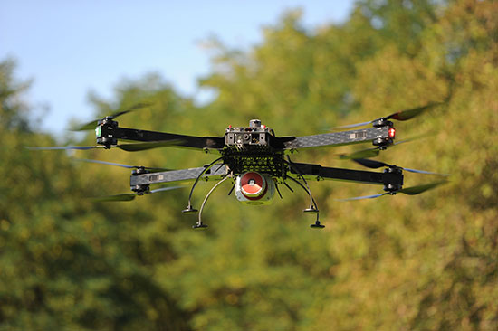
    For instance, one of the drawbacks for small, predominantly electric-powered, multi-rotor UAVs is that their endurance is limited. Providing longer duration operations may be outside their envelope — for such longer term things as providing temporary mobile-phone signal coverage, or police/agency reconnaissance/search, or for larger vertical inspection jobs.

    Presumably, floating one of several available models of lighter-than-air, blimp-type UAVs might be more expensive or cumbersome than using a multi-rotor unmanned vehicle, so overcoming power-supply issues would seem to be key. One way to do this is to attach a strong tether bringing power up from the ground.

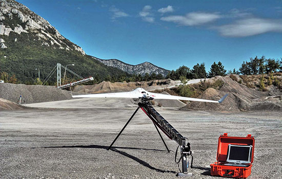
    Orion UAS. The Elistair (France) Orion UAS will no doubt be featured on the company’s booth. This multi-rotor UAV has been developed for longer term aerial surveillance and telecommunications operations. Typical users include law enforcement, private and public safety, national security, asset protection, emergency communications and crisis management, so these tethered drones are deployed by police forces, public security departments, public and private security companies, and governments in more than 30 countries.

    Photo: Elistair
    Photo: Elistair

    The Orion UAS uses industrial components and system redundancy, including autopilot sensors, motors, power distribution and logic controls, and has an emergency parachute system. The patented micro-tether system ensures a stable platform supplied with continuous power from the ground to enable up to 10 hours of endurance. The mechanical structure of the drone is designed to sustain strong winds with maximum stability. With system redundancies and automated emergency procedures, the user is able to focus on safety-critical missions and data collection, while the risk of human mistakes is reduced.

    The onboard camera has both FLIR and optical, enabling night/day surveillance with gimbal stabilization and low latency — the 30x optical zoom makes it possible to detect a moving person from kilometers away. And the tether system provides high-speed, interference-free data transmission so the system is also virtually undetectable. It’s easy to see why tethered drones are becoming more popular for security applications.

    Identifying UAVs. At the FAA Unmanned Aircraft Systems (UAS) Symposium last week in Baltimore, a key issue discussed concerned remote identification and tracking of drones. It would seem that the FAA is about to announce a new rule that could eventually clear the way for drones flying over people and beyond line-of-sight of their operators — and this may be a key topic of discussion at Xponential.

    The FAA rule appears to mandate that every drone should in some way communicate its identification — presumably its FAA registration ID — so that its operator could also be known.

    One well-known company, Ford, has already announced that it has a concept using onboard collision lights on a drone to optically signal the 10-digit FAA registration number to the ground for capture and decoding. Maybe other exhibitors at the show will have other solutions — perhaps radio based? We’ll see.

    Sensefly eBee drone.

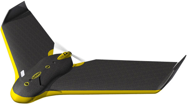
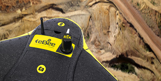
    Sensefly’s eBee. At the sensefly booth, we may also hear about several interesting announcements on recent drone applications:

    • Products on display will include the RTK/PPK-enabled eBee Plus professional mapping drone, the eBee SQ drone for agricultural applications and the albris mapping and inspection drone, as well as the senseFly S.O.D.A camera and GeoBase.
    • In addition, senseFly sales manager and GIS scientist Briton Voorhees will deliver a presentation titled, “Comparing workflow and point cloud outputs of the Trimble SX10 TLS and senseFly eBee Plus drone,” on Wednesday, May 2, at 11 a.m. in the Mapping and Surveying Track.
    • Booth visitors can also find out more about senseFly’s comprehensive 360 solutions, which are designed to improve operational efficiencies and support decision-making in the surveying, mining and quarries, agriculture and inspection sectors.

    And many more. GNSS players also expected to be at the show include Hemisphere GNSS, NovAtel, Rockwell-Collins, Septentrio, Tersus, Trimble, Accord/Aspen Avionics, Comnav, Navtech, Swift and Topcon, as well as GNSS chip manufacturers u-blox and Intel — although Intel may likely focus on its UAV/communications offerings at this show.

    There will also be a number of antenna suppliers, inertial sensor manufacturers, UAV autopilot manufacturers and several ancillary electronics and mechanical systems suppliers — all trying to solidify their positions in the UAV vehicle and systems integration supply chain.

    The major focus, as usual, will be on UAV/UAS vehicle manufacturers and system integrators and their products — there is always a great exhibition of actual UAVs from all sectors of the industry.

    So, along with a parallel program of educational presentations on a wide range of industry aspects, the AUVSI Xponential convention promises to have plenty of opportunities to find things of interest to almost anyone, and many areas to focus on for experts already in the industry.

    Tony Murfin
    GNSS Aerospace

  • senseFly presents 360 solutions at Intergeo 2017

    senseFly’s Matthew Wade discusses the company’s 360 solutions at Intergeo 2017, which took place Sept. 26-28 in Berlin, Germany. According to Wade, these solutions are end-to-end packages designed for specific industries.

  • Business benefits of high-precision GNSS in UAV surveys

    Business benefits of high-precision GNSS in UAV surveys

    Francois Gervaix
    Francois Gervaix

    A fourth speaker has joined the panel of the free April 20 webinar, “From Flying Drones to Doing Business,” addressing UAVs in business applications. Francois Gervaix, product manager of surveying for senseFly, will address the business benefits of high precision GNSS, covering: high precision in photogrammetry drones, survey-grade accuracy, workflow flexibility and time/cost savings.

    Webinar attendees will have the opportunity to ask direct questions of the speakers, both upon registration and during the live event. Register for free at env-gpsworld-integration.kinsta.cloud/webinar.

    Gervaix joins a panel consisting of Gustavo Lopez, product manager GNSS solutions for UAV applications for Septentrio; Jan Leyssens, 
managing director of sales and business development for Airobot; and Zak Kassas, assistant professor in the Department of Electrical and Computer Engineering at the University of California, Riverside.

    Other subtopics to be covered include the integration of various surveying and mapping sensors aboard a UAV platform; meeting safety demands for UAVs by providing intelligent safety components, specifically designed for drones, and in facilitating end-users’ success in completing their missions; and exploiting long-term evolution cellular signals for accurate and resilient autonomous vehicle navigation in the absence of clear GNSS signals.

    Gervaix is a qualified geomatics engineer who has worked for Leica Geosystems and as a professor at the Technical University for Applied Sciences Western Switzerland. In 2010, he launched project R-Pod, Photogrammetry on Demand, before founding Easy2map, a drone-based photogrammetry service provider. He joined senseFly in February 2016. He is also president of the Swiss Society of Photogrammetry and Remote Sensing.

  • UAV manufacturer senseFly joins April 20 webinar panel

    UAV manufacturer senseFly joins April 20 webinar panel

    A speaker from UAV manufacturer senseFly will appear on the free April 20 webinar, “From Flying Drones to Doing Business,” addressing ease of use for the user in business applications. The Switzerland-based company specializes in professional-grade UAVs for survey, mapping, precision agriculture and asset inspection. The company recently became the first drone operator to be granted anytime Beyond Visual Line of Sight (BVLOS) authorization in Switzerland.

    ebee copy 2
    Photo: senseFly

    The webinar will cover a broad range of issues concerning sensor integration aboard a flying platform, and in particular their use for commercial purposes. Webinar attendees will have the opportunity to ask direct questions of the speakers, both upon registration and during the live event. Register free at env-gpsworld-integration.kinsta.cloud/webinar.

    The senseFly speaker (name to be announced soon) will join a panel that consists of:
    Gustavo Lopez, Product manager GNSS solutions for UAV applications, Septentrio; Jan Leyssens
, Managing Director, Sales & Business Development, Airobot; and Zak Kassas, Assistant Professor in the Department of Electrical and Computer Engineering, University of California, Riverside.

    Further speaker details:

    Lopez: Septentrio is an leader in bringing high end GNSS technology when accuracy and reliability matters. Gustavo Lopez is Product manager for UAS applications at Septentrio. Since joining the company, he has held a number of R&D and product management roles. Gustavo holds a Bachelor of Computer Science degree from Monterrey’s Technology Institute and an MBA from United Business Institute

    Leyssens: Airobot specializes in meeting safety demands for UAVs by providing intelligent safety components, specifically designed for drones, and in facilitating end-users’ success in completing their missions. Leyssens has Masters’ degrees in avionics, electrical engineering and business administration.

    Kassas will present the research material from his cover story in the April issue of GPS World: “LTE Steers UAV — No GPS? No Problem! Signals of Opportunity Work in Challenged Environments.” Long-term evolution cellular can be exploited for accurate and resilient autonomous vehicle navigation in the absence of clear GNSS signals. Simulation and experimental results demonstrate that GPS-like performance can be achieved in the absence of GPS signals when cellular pseudoranges aid an inertial navigation system.

  • First Day at INTERGEO: UAVs and RTK GNSS Receivers

    Every fall thousands of geospatial professionals are drawn to Germany, like bees are to honey, for the largest geospatial exhibition on Earth. This year in Stuttgart, more than 17,000 attendees from 92 countries are flooding the halls of the Stuttgart Exhibition grounds located adjacent to the Stuttgart International Airport. Attendees are being treated to a vast array of geospatial technology treats from 500+ exhibitors representing 30 countries.

    Unmanned Aerial Vehicles

    I recall a few short years ago, there were only a handful of UAV vendors at the entire exhibition. Now, there is hardly an aisle that does not contain a quad-copter, fixed-wing aircraft or a UAV-related accessory. The growth of UAVs into the geospatial market growth has been the most explosive geospatial technology introduced in the past 25 years, the span of time that I’ve been involved in the geospatial industry. It’s over the top — there is so much hype surrounding UAV technology that there might be more sellers than buyers. It’s become so crazy that there are vendors presenting UAVs that haven’t even been built yet! It reminds me of the days that Atari would announce a new game system nine months before it was ready to ship.

    In the UAV space, I wonder which companies are actually making money. My guess is very few. A few of the big players like DJI, Parrot (owns senseFly) and 3D Robotics are doing well, plus a few others. But it’s an unhealthy buyer/seller ratio. Something’s going to give.

    The sensefly eXom UAV in flight.
    The sensefly eXom UAV in flight.

    Today’s winners in the UAV market are companies like Pix4D, Agisoft and others who make mission planning and image-processing software for UAV-collected data. They are smart in that they aren’t competing against the hundreds of other UAV airframes on the market; they work with data from most of them. Following is a 3D example of what the Agisoft software can create given a bunch of images shot with a $1,500 DJI Phantom at 200-foot elevation.

    3DModel-W

    The resolution is very good, and you’re able compute material volume such as the piles of aggregate on the west side of the river.

    Inexpensive RTK

    NVM_L1RTK-WIn the past, I’ve written a lot about inexpensive RTK GNSS receivers. At the InfoAg Conference a couple of months ago, Swift Navigation announced it is testing its $500 RTK receivers. At INTERGEO, CHCNav introduced L1 RTK GNSS in a mobile phone (check our website for a video on that). It’s not capable of centimeter accuracy yet, but quickly heading in that direction. NVS Tech is also pushing sub-$500 L1 RTK GNSS modules.

    It’s interesting because L1 RTK is nothing new. That technology was first introduced almost 10 years ago, and wasn’t accepted very well. Now, the UAV phenomena is breathing new life into L1 RTK receiver technology because it’s driving the requirement for low-cost, high-precision GNSS receivers. L1 RTK GNSS are finally getting the love they were looking for nearly 10 years ago.

    In case you weren’t able to make it to INTERGEO this year, Joelle, Michelle and I are shooting a bunch of short (~2-minute) videos at various exhibition booths while we are here. We hope to give you a flavor of the geospatial technology being offered this year in Stuttgart.

    See you next time.

    Following me on Twitter at https://twitter.com/GPSGIS_Eric

  • INTERGEO 2015: senseFly eXom Drone Capable of Millimeter Accuracy

    senseFly has published a white paper named “Generating highly accurate 3D data using a senseFly eXom drone” which presents the results of two photogrammetric land surveys of a construction site. The project was completed earlier in September using two senseFly eXom close mapping and inspection drones, and the announcement was made during INTERGEO, held Sept. 15–17 in Stuttgart, Germany.

    Figure 8 - Check point results for flight 1, taken from Postflight Terra 3D's Quality ReportThe results demonstrate that 3D point clouds produced with an eXom quadcopter can reach a global precision comparable to that of a total station survey and meet the typical accuracy requirements of construction projects, according to a news release from senseFly.

    The first eXom survey (figure 8) achieved 2.1 millimeter accuracy in X, 1.9 millimeter in Y and 0.1 millimeter in Z (RMSE). The second eXom survey (figure 9) achieved 0.8 millimeter (X), 0.5 millimeter (Y) and 4.2 millimeter (Z).

    “This degree of absolute accuracy from a drone is unparalleled and positions the eXom as a surveying instrument that is comparable in performance to standard total stations,” said Andrea Halter, senseFly’s co-founder. “These results were due, in part, to the high 38 MP resolution and sharpness of the flight’s images, captured by the main camera inside eXom’s TripleView head. Add to this image quality the ability to operate close to the terrain and the introduction of highly precise ground controls and you have a recipe for exceptionally accurate 3D data.”

    Figure 9 - check point results for flight 2, taken from Postflight Terra 3D's Quality ReportTwo eXom drones flew separate survey missions at an altitude of 14 meters above the site, achieving an average ground sampling distance (GSD) of 2.2 millimeters, senseFly says. All the flights were completed using the drone’s Interactive ScreenFly flight mode, whereby the UAV (unmanned aerial vehicle) is controlled using a handheld ScreenFly controller connected to senseFly’s eMotion X flight planning and control software.

    This flight mode’s “cruise control” feature, combined with its auto-trigger function, enabled each of the eXom drones to survey the 1,100-square-meter site in a single flight. Meanwhile, the live on-screen feedback from the drone’s five different navcams and ultrasonic proximity sensors helped the operator ensure that no contact was made with either the on-site crane or any the trees surrounding the complex site, senseFly says.

    “This project’s flights took place at 14 meters above the ground, but with the eXom’s Distance Lock feature we are able to safely fly just 4 meters away, so it isn’t unrealistic to think that the accuracy we achieved could be improved still further.”

    To download the eXom accuracy white paper click here.

  • Hey, AU! — Autonomous Unmanned News

    Hey, AU! — Autonomous Unmanned News

    In this special section, GPS World focuses on automous positioning and navigation technology, including unmanned aerial vehicles (UAVs), unmanned aircraft systems (UAS) and unmanned ground vehicles (UGVs).


    Sensefly-eXom-UAV-inflight-W

    SenseFly Launches Intelligent Mapping and Inspection Drone

    SenseFly launched the eXom, a quadcopter for mapping and inspection, at the AUVSI Unmanned Systems show, held May 4–7 in Atlanta.

    The 3.7-pound quadcopter offers professionals such as civil engineers and land surveyors the situational awareness, imaging flexibility and durability they need for challenging tasks, senseFly said. The sensors — GPS, inertial measurement units, barometers, magnetometers and magnetic encoders — maximize stability and safety.

    Septentrio Launches UAS Receiver, Software for Drones

    The AsteRx-m UAS by Septentrio.
    The AsteRx-m UAS by Septentrio.

    Septentrio has launched the AsteRx-m UAS, an RTK-accurate GNSS receiver solution specially designed for the drone market. The AsteRx-m UAS provides high-accuracy GNSS positioning with low power consumption, according to Septentrio.

    The launch of the AsteRx-m UAS board is complemented by the release of GeoTagZ software suite. The GeoTagZ suite works with the UAS camera and image-processing solution to provide centimeter-accurate position tagging of images without the need for a real-time data link.

    Despite being Septentrio’s smallest receiver, the AsteRx-m UAS provides consistent, robust and accurate positioning from Septentrio’s in-house GNSS+ algorithm technology. The receiver delivers cm-level accuracy at less than 600 mW with GPS and less than 700 mW with GLONASS.

    Kairos Kit Makes Vehicles Unmanned

    Kairos Autonomi’s Pronto4 robotic applique kit is an add-on vehicle autonomy system that provides unmanned capabilities to current manned vehicles, rendering them optionally unmanned. Pronto4 delivers the torque needed to control traction, braking, throttle and implements in heavy vehicles and equipment, as well as smarter robotic functions such as GPS path following and supervised autonomous behaviors. The kit can be installed in any heavy vehicle or machine, rendering that vehicle optionally unmanned, and the equipment can still operate manually.

    Applications include government and academic research and development; military training and testing; range clearance; mining; and tactical military uses.

    Kairos Autonomi produces solutions that can be retrofitted or "strapped-on" to any existing optionally unmanned vehicle or vessel.

    Kairos displayed its Pronto4 unmanned kits at May’s AUVSI show.


    Exelis, FAA Test Sites to Research Safety

    Exelis has signed agreements with four FAA-designated UAS test sites for airspace situational awareness and research. The research will use the Exelis Symphony RangeVue sense-and-avoid tool to aid in safe integration of unmanned aircraft into the national airspace. The test sites will gain situational awareness of the range airspace via Symphony RangeVue, while Exelis gains product feedback. Symphony RangeVue enables UAS operators to access real-time and historical surveillance information via a web-hosted platform, helping to manage mission operations across multiple locations.

    FAA Names MSU as Its Center of Excellence

    The FAA has selected a Mississippi State University team as its Center of Excellence for Unmanned Aircraft Systems (COE UAS). The COE will focus on research, education and training in areas critical to safe and successful integration of UAS into the nation’s airspace.

    Bipartisan Bill Would Expedite Exemptions

    Sen. Cory Booker (D-N.J.) and Sen. John Hoeven (R-N.D.) have introduced the Commercial UAS Modernization Act, which would set temporary rules for those who want to fly commercial unmanned aircraft systems before the FAA establishes permanent laws regarding drone use. The senators believe the U.S. is falling behind other countries when it comes to creating rules for commercial drones.

  • UAV Product Showcase

    UAV Product Showcase

    BramorRTK-C-Astral-W

    GNSS Post-Processing UAS

    The Bramor RTK GNSS Post-Processing UAS is designed for surveying and remote-sensing applications that need a quick, high-precision set of results down to sub-centimeter level in the absence of a grid of ground control points. It is equipped with C-Astral high-rate GPS and IMU precision data-logging electronics. The system has both air and ground segments, consisting of a GNSS onboard receiver and ground base station. It has an L1 and L2 GNSS reciever (GPS, GLONASS, BeiDou and Galileo-ready), plus a survey-grade antenna.

    C-Astral, www.c-astral.com


    QuestUAV-water-W

    Aqua Drone for Offshore Missions

    The QuestUAV Aqua Pro is designed for offshore/onshore data-gathering in fields such as environmental, gas and oil, coast guard and security. It is a fixed-wing waterproof UAV based on the QuestUAV 200 airframe.

    The Aqua Pro is capable of offshore missions and recovery in both fresh- and salt-water environments. It can withstand pressure differentials induced by rapid temperature changes, and overcome complexities of waterproofing/marine-grade electronics, sensors and avionics. It uses a GPS unit from SkyCircuits.

    QuestUAV, www.questuav.com


    GAJT-AE-34-W

    Electronic Warfare System

    NovAtel’s GAJT-AE GPS anti-jam technology is designed for military and security weight- and size-constrained airborne and ground unmanned platforms, including UAVs. GAJT-AE provides the null forming antenna control electronics for a four-element controlled reception pattern antenna.

    NovAtel, www.novatel.com


    RIEGL_RiCOPTER_W

    High-Accuracy Laser Scans

    The Riegl RiCopter is an unmanned multirotor UAS, integrating a high-performance and complete LiDAR system, the RIEGL VUX-SYS. The VUX-SYS comprises the VUX-1 LiDAR sensor, the Applanix AP20 IMU/GNSS system, a control unit, and up to four high-resolution cameras.

    The Riegl RiCopter can acquire high-accuracy, high-resolution laser scan and image data. The excellent measurement performance of the VUX-1 in combination with a precise fiber-optic gyroscope and GPS/GLONASS receiver results in survey-grade measurement accuracy in fields such as precision farming, forestry and mining. The IMU/GNSS unit provides roll and pitch accuracy of 0.015 degrees and heading accuracy of 0.035 degrees. Riegl is a maker of laser scanners, and using a high-end unmanned airborne platform allows data acquisition in dangerous and hard-to-reach areas.

    Riegl, www.riegl.com


    eBee-RTK-over-mine-W

    Survey-Grade Mapping Drone

    The eBee RTK by senseFly is a fully autonomous survey-grade mapping drone with a built-in L1/L2 GNSS receiver capable of receiving corrections from most leading brands of base station. This ensures high positional accuracy without the need for ground control points, so the aerial photography can produce orthomosaics and 3D models with accuracy down to 3 centimeters. It has 226 channels and tracks GPS L1, L2, L2C; GLONASS L1, L2, L2C; and SBAS.

    Sensefly, www.sensefly.com

  • SenseFly Launches Intelligent Mapping and Inspection Drone

    SenseFly Launches Intelligent Mapping and Inspection Drone

    Photo: SenseFly

    Swiss professional drone maker senseFly has launched the eXom, its new quadcopter UAS for mapping and inspection. The eXom is available to pre-order immediately and ships this summer.

    SenseFly made the announcement at the AUVSI Unmanned Systems 2015 show being held May 4-7 in Atlanta, Ga. (Hall B2, Booth 519).

    The eXom is a sensor-rich system, sensefly said. Developed by experts working across numerous fields of robotics, this lightweight quadcopter offers professionals such as civil engineers and land surveyors the situational awareness, imaging flexibility and durability they need to complete challenging tasks safely, accurately and efficiently.

    “We believe the eXom’s level of application-focused technology is unique in the civilian drone market,” said Antoine Beyeler, CTO and co-founder of senseFly. “This platform tightly integrates several one-of-a-kind features, such as TripleView imaging, advanced situational awareness and full flight mode flexibility — to provide inspection and mapping professionals with the functionality they desire from a rotary system.”

    eXom is a future-ready platform with a quad-core computer onboard, senseFly said. Like senseFly’s fixed-wing drones, it offers users evolving performance through regular software updates, adding the latest drone tech innovations to keep the eXom at the cutting edge for years to come, the company said.

    eXom’s low take-off weight of 1.7 kg (3.7 lb) ensures its users will, in many countries, have less flight authorization paperwork to deal with than those who use heavier systems.

    The eXom’s advanced integrated sensors work together to provide the user with full situational awareness and support obstacle avoidance:

    • Five navcam vision sensors allow the operator to see in the direction the drone is moving, automatically via its flight control software, without needing to turn the system’s TripleView camera head. This technology is similar to the visual parking sensors in modern cars, but brought into a 3D flight environment.
    • Five ultrasonic proximity sensors work in harmony with eXom’s navcams to ensure the operator always knows the drone’s distance from nearby objects. (The drone’s shock-absorbent carbon fibre shrouding is also always on hand to protect its rotors in case of surface contact.)
    • Numerous other sensors, including inertial measurement units, barometers, magnetometers, GPS and magnetic encoders, maximize the drone’s stability and safety.

    eXom’s autopilot-controlled TripleView camera head enables the user to view and record three different types of imagery during a single flight without needing to land to change cameras:

    • HD video
    • Ultra high-resolution stills
    • Thermal still/video

    Because the TripleView head faces forwards, eXom can fly up close to target structures such as building walls and dams to achieve sub-millimeter data resolutions. Plus, with the head’s 270-degree vertical field of view, users can document objects positioned directly above and below the drone — crucial for tasks such as bridge and roof inspections.

    eXom offers various flight modes:

    • Autonomous mode — for mapping projects. First, create a flight plan using eMotion X’s mission blocks. eXom then launches, flies, acquires geo-referenced imagery and lands itself.
    • Interactive ScreenFly mode — this streaming video mode is for live inspection tasks. Use the supplied joypad to navigate and orient the drone via computer screen. This mode includes flight assistance features such as cruise control and distance lock.
    • Create a flight plan, launch in autonomous mode, then go live on demand.
    • No matter which mode is activated, RC-based manual control always remains available as a backup function and for experienced pilots.

    Full technical specifications can be downloaded on this PDF.

    Visit senseFly at Unmanned Systems 2015: Hall B2, Booth 519. The eXom will be demonstrated in flight at the senseFly booth at at the show’s Air & Ground Demo Area (demo timings: May 6, 12:15 and 14:15, May 7, 11:45 and 14:15).