Tag: SimActive

  • SimActive’s Correlator3D used to assess Hurricane Michael damage

    SimActive’s Correlator3D used to assess Hurricane Michael damage

    Aerial imagery of the devastation from Hurricane Michael in Mexico Beach, Florida. (Image: SimActive)
    Correlator3D was used to process large format imagery collected by Midwest over Mexico Beach, Florida. (Image: SimActive)

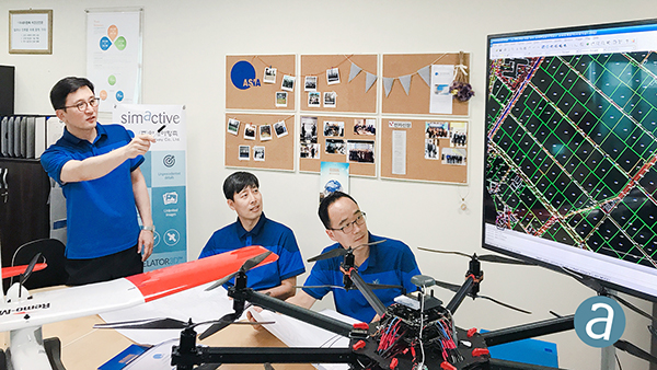
    SimActive Inc., developer of photogrammetry software Correlator3D, has partnered with Midwest Aerial to perform damage assessments of Hurricane Michael.

    Correlator3D was used to process large format imagery collected by Midwest over Mexico Beach, Florida. The joint effort resulted in highly precise geospatial data, including a digital surface model (DSM), an orthomosaic and a 3D model, the company said.

    “This is a terrible disaster for the people affected and we hope they can benefit from geospatial technologies available,” said Philippe Simard, president of SimActive.

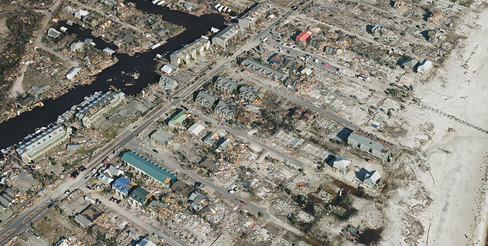
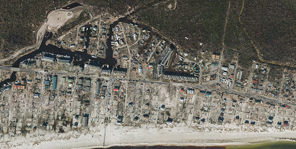
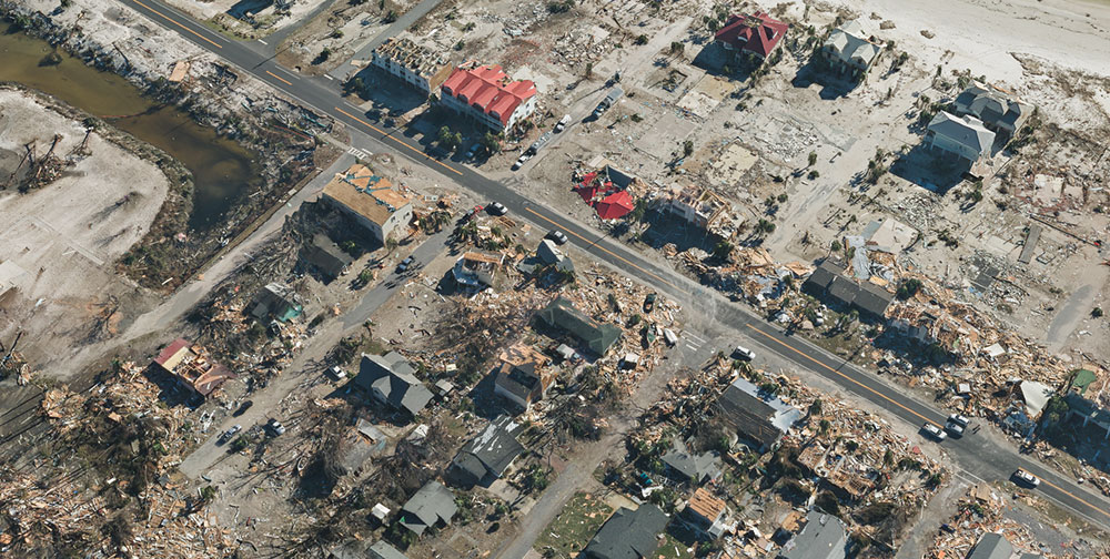
    The gallery below shows samples of the imagery collected.

    SimActive’s Correlator3D is a patented end-to-end photogrammetry solution for the generation of high-quality geospatial data from satellite and aerial imagery, including UAVs. Correlator3D performs aerial triangulation and produces dense DSM, digital terrain models, point clouds, orthomosaics, 3D models and vectorized 3D features.

    Powered by GPU technology and multi-core CPUs, Correlator3D ensures high processing speed to support rapid production of large datasets, the company added.

    Midwest Aerial Photography focuses on acquiring high-quality aerial imagery and companion data in support of photogrammetric mapping projects across the United States and Canada. Midwest partners and clients include federal, state and local government agencies, as well as photogrammetric firms and architectural and engineering companies.

  • First South Korea government drone project completed with SimActive

    First South Korea government drone project completed with SimActive

    Photo: SimActive
    Photo: SimActive

    SimActive Inc., a developer of photogrammetry software, has enabled the first government drone mapping project in South Korea.

    Asia Aero Survey (AAS), a SimActive regional partner, used Correlator3D for the public survey delivered to the Korean National Geographic Information Institute (NGII) and the Korean Association of Spatial Information, Surveying & Mapping.

    While such projects were previously conducted using manned aircraft, a drone was preferred because of the difficulty in accessing the area of interest through traditional aerial and ground surveying methods.

    The NGII officially published guidelines for public surveying and mapping with drones in March 2018, with the AAS project being the first delivered and accepted as adhering to the new guidelines.

    AAS is also deploying UAV solutions with hyperspectral and lidar for other projects in conjunction with SimActive software.

  • SimActive updates Correlator3D for mining

    According to SimActive, users can now process raw data, produce point clouds and digital surface models, and perform volumetric calculations with the Correlator3D workflow. (Photo: SimActive)
    According to SimActive, users can now process raw data, produce point clouds and digital surface models, and perform volumetric calculations with the Correlator3D workflow. (Photo: SimActive)

    SimActive has updated its Correlator3D end-to-end photogrammetry software to include tools for users to generate precise statistics on mining activities, with improved volumetric calculation.

    The integrated tools allow users to generate precise statistics on mining activities.

    The Correlator3D software performs aerial triangulation and produces dense digital surface models, digital terrain models, point clouds, orthomosaics and vectorized 3D features.

    Applications like mineral extraction monitoring can be done seamlessly within the software.

    Users can process raw drone data, produce point clouds and DSMs, and perform volumetric calculations in the same Correlator3D workflow.

    “Our clients often require project delivery within 24 hours”, said Jennifer Waugh, principal at Alietum Ltd., a Canadian company using unmanned technology to support construction, consulting and government clients. “SimActive enables us to meet this demanding turnaround time.”

    Based in Montreal, Quebec City, Canada, SimActive has been a developer of photogrammetry software since 2003.

  • SimActive launches free data-processing service using Correlator3D

    SimActive Inc., a developer of photogrammetry software, is offering a new free data-processing service using Correlator3D.

    New users can upload their first UAV, satellite or aerial image project to obtain digital surface model (DSM), digital terrain model (DTM), point cloud and orthomosaic outputs.

    Along with optimal results, users also receive tailored feedback, recommendations and training from SimActive experts.

    The service requires no obligation, and is based on Correlator3D software, building on more than a decade of innovation on computer vision algorithms, a subfield of artificial intelligence. Quick turnaround is also possible due to the speed of the software and extensive use of GPU.

    “Our new offer is unique to get the best possible results from the very first project onward,” said Philippe Simard, president of SimActive. “Following this, users are trained with industry-leading technology, custom advice and necessary knowledge for successful mapping.”

  • South Korea defense agency selects SimActive's Correlator3D

    The Republic of Korea Agency for Defense Development (ADD) has selected SimActive’s Correlator3D software. The agency’s use of the software will include processing UAV and satellite imagery.

    SimActie-Correlator3DThe transaction was facilitated through a SimActive partner in the region, GeoFocus Inc.

    “The software was originally developed for military clients, which is reflected in the processing speed and rigorous mapping standards the technology adheres to,” said Philippe Simard, president of SimActive. “We are proud to welcome ADD as they join governments worldwide using Correlator3D.”

  • SimActive introduces new technology for true orthophotos

    SimActive Inc., a developer of photogrammetry software, has released Correlator3D version 7.1 with new technology for true orthophotos.

    Users can now automatically generate enhanced true orthomosaics through a technological breakthrough that significantly minimizes artifacts, the company said.

    This major release successfully addresses the industry-wide challenges of generating true orthophotos without artifacts, such as distortions around buildings and vertical structures. Along with the enhanced output quality, the overall mosaicking speed of the software has increased five-fold, furthering the gap with competing tools.

    “While DTM-based orthophoto generation has been the norm for decades, we observe a shift toward true orthos,” said Louis Simard, CTO of SimActive. “The advancement provides consistent quality of results without any manual intervention.”

    For a live demonstration at the Geospatial World Forum (Jan. 17-19, Hyderabad, India), send an email to [email protected].

    To register for an online training session on how to generate high-quality orthomosaics with Correlator3D (Nov. 30, 10 a.m. Eastern Time, sign up at the website.

  • SimActive automates direct georeferencing

    SimActive-drone-image-O

    SimActive Inc., a developer of photogrammetry software, has launched an automated solution for direct georeferencing from real-time kinematic (RTK) positioning.

    Within the new workflow feature, users can achieve get high accuracy in projects without the use of ground control points (GCP), saving time in collecting and processing data.

    Martin Instrument, a reseller of SimActive and surveying equipment, is benefitting from the automation. “Direct georeferencing greatly helps reducing cost for applications like corridor mapping,” said Mike Minick, vice president of sales at Martin Instrument. “The new automated option within SimActive software for direct georeferencing greatly facilitates the user workflow.”

    “With RTK GPS available on drones, the use of direct georeferencing is growing within the industry,” said Louis Simard, CTO of SimActive. “Correlator3D allows users to maximize their hardware and software investment.”

    For a live demonstration at the Commercial UAV Show (Nov. 15-16, London, United Kingdom), visit SimActive’s booth or send an email to [email protected].

  • Kenya maps mines with Correlator3D

    The Kenyan government will be using SimActive’s Correlator3D to map mining activities. The software will be used to generate orthomosaics, contour lines and digital terrain models of fluorspar mines in the Kerio valley in Kenya.

    The Directorate of Resource Surveys & Remote Sensing (DRSRS) under the Ministry of Mining in Kenya chose the software.

    “The DRSRS provides the Ministry of Mining with spatial information, processing hundreds of images to visualize settlements affected by mining activities to advise the Government of Kenya on compensation plans,” said Charles Situma, deputy director of the project. “SimActive’s availability of experts internally allows us to receive tailored solutions to our requests, further expediting our processing.”

    “We are proud to have Kenya as another of our many government users,” said Dr Philippe Simard, President of SimActive. “Correlator3D provides the diverse tools and processing power required for intensive mining applications.”

  • SimActive enables processing in the cloud

    Correlator3D photogrammetry software is officially supporting processing in the cloud. Users can subscribe to an online computing service, such as Amazon EC2, and run Correlator3D on a virtual machine, according to developer SimActive Inc.

    The main advantage is the capability to use multiple licenses as required. It permits an on-demand deployment of the software on several processing machines, without any computer hardware.

    “The new option allows our customers to continuously adjust their processing power,” said Louis Simard, CTO of SimActive. “Combined with our monthly subscription plan, clients have the cloud’s flexibility, while maintaining full control of their production workflow.”

    SimActive is offering a free trial as well as a webinar on Correlator3D in the cloud, to be held Tuesday, Dec. 6, 10 a.m. Eastern Time.

  • SimActive offers subscription UAV software

    SimActive Inc., a developer of photogrammetry software, has announced a new subscription-based offering for Correlator3D UAV. The rental option allows users with a dynamic workload to access a high-end product at minimal cost.

    “Correlator3D UAV was developed for leading mapping firms, military and government organizations, with a constant emphasis on ease of use,” said Philippe Simard, president of SimActive. “The subscription model now makes the only professional UAV processing tool available for all.”

    To download a free trial and view different pricing options, visit www.simactive.com.

    To see the latest version of Correlator3D, sign up for SimActive’s next webinar on Tuesday, Oct. 18, at 2 p.m. Eastern Time.

  • SimActive releases new version of Correlator3D for photogrammetry

    Photogrammetry software company SimActive is releasing a new version of Correlator3D with a redesigned aerial triangulation (AT) module.

    Correlator3D is a patented end-to-end photogrammetry solution for the generation of high-quality geospatial data from satellite and aerial imagery, including UAVs.

    The tie point extraction and bundle algorithms have been enhanced, along with the added capability to address problematic input data (such as low overlap projects).

    The release features an alignment tool that automatically registers new projects to older mosaics and DEMs. It removes the need for recollecting ground control points (GCPs). In addition, a new semi-automatic workflow was developed for GCP tagging.

    “Our significant R&D efforts on the AT are due to its substantial impact on all subsequent results,” said Louis Simard, CTO of SimActive. “As such, the release vastly improves and simplifies the entire production chain.”

    For a live demonstration at AUVSI’s Xponential 2016 (May 2-5 in New Orleans), visit booth 260 or send an email to [email protected].

  • U.S. Environmental Protection Agency to use SimActive’s Correlator3D

    SimActive’s Correlator3D has been selected by the United States Environmental Protection Agency (EPA) to create 3D datasets of vegetation for input into biophysical models. The software will also support generation of urban landcover maps for the agency’s GIS, EnviroAtlas.

    “Correlator3D has been serving governments globally, encompassing a wide spectrum of requirements,” said Philippe Simard, president of SimActive. “We are proud to be working with the EPA and supporting their environmental mandate.”

    Correlator3D software is a patented end-to-end photogrammetry solution for the generation of high-quality geospatial data from satellite and aerial imagery, including UAVs. Correlator3D performs aerial triangulation and produces dense digital surface models, digital terrain models, point clouds, orthomosaics and vectorized 3D features.