GNSS has had a major impact on many different industries and market segments, but I believe that the incorporation of GNSS into cell phones has impacted more people around the world than any other. It’s almost hard to remember back in the last millennium when the idea of putting a GPS receiver into a cell phone was first contemplated. Back then, we were just starting the transformation from 1G phones (analog) to 2G phones (digital), and the whole idea of 911 for mobile phones was a huge hurdle facing the entire industry. Three small startups (SiRF, SnapTrack and Global Locate) were all founded with the seemingly impossible dream of putting GPS into every cell phone to provide location information for E911 and other commercial applications. Back in those days, we were trying to convince operators and the FCC that GPS could provide location accuracy better than the 150-meters 67% of the time that the cellular industry was leaning toward with other technologies.
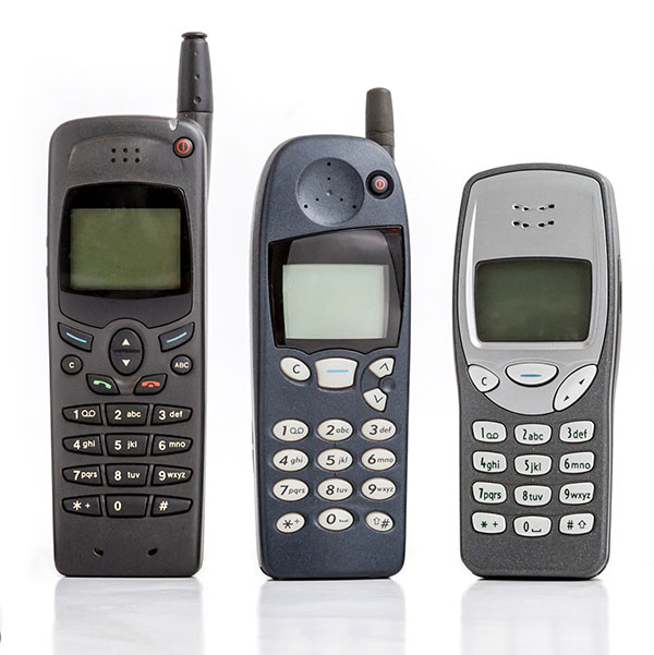
Can you hear me now? A sampling of early cell phones. (Photo: yktr/iStock/Getty Images Plus/Getty Images)
Fortunately for everyone, we were able to convince the industry that GNSS was an answer that should be considered. Today, we see billions of phones around the world with embedded GNSS. Those early phones from Motorola, Nokia, Ericsson and RIM (Blackberry) were truly marvels of engineering development to tightly couple GPS and cellular. Interestingly, none of those phone makers — nor any of those three pioneering companies — exist today, having been subsumed into larger entities due to their success in solving this incredibly complex problem. Those early GPS L1 C/A-only phones have added GLONASS, Galileo, QZSS and BDS, and we are now starting to see support for L5 showing up in smartphones. This has all led to improved availability and accuracy — now not only can we locate E911 calls to the correct civic address for emergency responders, but commercial applications rely on <10-meter accuracy for driving directions, ride sharing and social media applications. Every time I think there is nothing new to do, something always comes along. I’m excited to see what’s next.
Of the hundreds of papers researchers presented this year at the Institute of Navigation’s annual ION GNSS+ conference, which took place virtually Sept. 21–25, the following three focused on navigation in urban environments. Papers are available at www.ion.org/publications/browse.cfm.
Low-Cost Single-Frequency PPP System
Featuring multi-constellation global availability, fast convergence and continuous navigation solutions, Instant PPP (IP3) was developed as an ideal precise positioning solution for mass-market applications in urban environments. The low-cost single-frequency PPP system demonstrates 50-cm accuracy in open-sky and suburban environments, and is further enhanced to support precise positioning in urban environments. The IP3 library is uniquely designed and enhanced. For instance, the instant receiver velocity based on the Doppler observations and the coordinate changes calculated from the carrier-phase differences between two consecutive epochs are integrated for the one-step prediction of the receiver positions in the Kalman filter.
Meanwhile, the weight of carrier phase, pseudorange and Doppler observations are smartly tuned as a function of signal-to-noise ratio (SNR) respectively. Additionally, quality control adapts to different scenarios, such as open-sky or urban environments. The receiver clock drifts for different constellations are specifically modelled in the velocity estimation to increase the degrees of freedom, which further enhances the solution availability in these extreme challenging situations.
To evaluate the IP3 library in urban environments, real-time vehicle-based field tests were carried out with an IP3 evaluation kit in Calgary, Canada. Results indicate the IP3 library can provide 50-cm accuracy in suburban areas with 100% solution availability. In an urban environment with numerous high buildings, the positioning root-mean-square error (RMS) of IP3 degrades to meter level while the solution availability remains 100%. IP3 can provide precise positioning solutions with low-cost GNSS receivers even in urban environments.
Citation. Hongzhou Yang, Fei Liu and Yang Gao, Profound Positioning Inc., Canada, “Precise Positioning into Urban Environments: A Low-Cost Single-Frequency PPP System.”
A Sub-Meter Real-time Positioning Service for Smartphones
A real-time positioning service for smartphones that meets a target threshold of 50 centimeters in urban environments is evaluated. The evaluation is possible through the Flamingo service, an API library for smartphone developers that enables higher accuracies than standard Google location services. The API is offered in a format that simply replaces Android location, streamlining its integration into new and existing applications that require better positioning. The service provides reference station infrastructure and correctional data products through a modified version of traditional NTRIP services. Duty cycling, low-quality clocks and high RF interference are common in a smartphone, so pre-filtering algorithms have been designed and calibrated to reject and de-weight poor measurements.
Based on proximity to a local base station, the service decides whether to use RTK or PPP-like processing. Performance is assessed on positioning accuracy, reliability and availability. Different operational environments are tested, such as pedestrian navigation in a congested area, and cycling scenarios. These are chosen to closely correspond to various applications. Rather than proving ideal test conditions and post-processing to optimize performance, the study focuses on realistic, real-time processing inside a smartphone.
Results are collected through a simple logging app that uses the Flamingo API. A target is set for 50 cm or better accuracies, where current smartphone positioning is within only a few meters. This enables mass-market location services to be applied in new markets such as augmented reality, lower accuracy surveying, GIS asset collection, and navigation assistance applications.
Citation. Joshua Critchley-Marrows, William Roberts, Malgorzata Siutkowska, Maria Ivanovici, NSL, UK; Valentin Barreau, Soufian Ayachi, Laurent Arzel, Telespazio, France, “A Sub-Meter Real-Time Positioning Service for Smartphones.”
The Path to Robust Municipal PNT
This research identifies where municipal governments fit in the positioning, navigation and timing (PNT) ecosphere, their awareness of PNT-related issues, whether and how they are approaching these issues, and actions they can take to improve their services to citizens and travelers. Lessons from other areas are applied, such as the resource typing construct used in FEMA’s National Incident Management System, to develop best practices for city PNT activity. This work will guide cities in addressing this important area and assist policy makers in efforts to involve cities in the development and implementation of PNT processes.
Citation. Steven Polunsky, Alabama Transportation Policy Research Center, University of Alabama, “The Path to Robust Municipal PNT.”
GNSS Underground Coverage for Tunnels, Stations, Car Parks, Bus Stations and Airports in the U.K.
Syntony GNSS and Chronos Technology have formed a partnership to deliver underground GNSS positioning, navigation and timing (PNT) solutions for critical infrastructure applications in the United Kingdom.
Syntony GNSS is a leader and expert in the design and manufacture of GNSS systems, and Chronos Technology is a resilient GNSS system integrator.
GNSS coverage has become fundamental to many services from emergency services to asset tracking for example. Yet when entering an underground area such as a metro/subway, tunnel, car park, airport, or bus station for example, the GNSS signal is lost.
Syntony’s SubWAVE solution expands the GNSS coverage to underground areas, enabling the localization of any equipment with a standard GNSS chipset. Examples include standard smartphones and the TETRA Emergency Services Network handset used for security and services. Security and services applications include locating emergency calls, keeping track of staff, locating faults in tunnels, managing assets, locating trains and providing guidance.
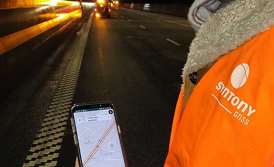
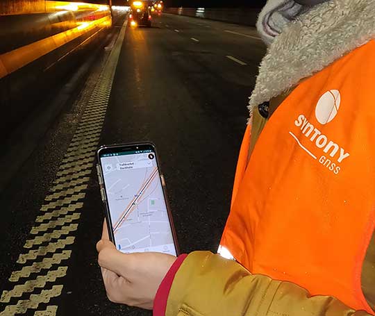
A Syntony team member in a Swedish road tunnel during SubWAVE testing shows the positioning in an underground environment on a smartphone. (Photo: Syntony GNSS)
By emitting a perfect emulation of the “real” GNSS signal, SubWAVE offers underground operators, their staff, emergency services and the general public the benefit of full GNSS coverage in all underground areas for both operational and safety reasons.
One fundamental aspect is the user only needs a standard GNSS receiver (a smartphone or TETRA radio) — no new handsets, receivers or apps are required. The system operates by broadcasting synthetic location specific GNSS signals through existing or new leaky feeder cables in the tunnels.
Accuracy levels vary with leaky feeder and system complexity options; however, 2-meter accuracy is possible with a standard smartphone. The system is widely installed in the Stockholm metro and is in active trials throughout Europe and America.
“We are pleased to form a partnership with GNSS specialists Chronos,” said Joel Korsakissok, president of Syntony GNSS. “Their knowledge and experience, together with their dedicated installation, commissioning and support teams complement our sophisticated solutions.”
“Since its first general availability, one of the well-known shortcomings of the GPS system was lack of indoor or underground coverage,” said Charles Curry, managing director with Chronos. “Many have tried to solve this with various technologies over the years. Syntony’s innovative technology offers underground GNSS coverage for PNT applications. We are very excited by the possibilities and pleased to be partnering with them to offer their solution for critical infrastructure applications in the UK.”
In addition, Chronos will also supply Syntony’s sophisticated GNSS simulators used in the aerospace and defence industries for product testing.
No, I’m not talking about the line at the grocery store to buy toilet paper and hand sanitizer. Or the line at the doctor’s office. I’m talking about that gray privacy line invisible to the naked eye, but all too accessible on our mobile devices.
On March 16, Israeli Prime Minister Benjamin Netanyahu and his cabinet approved using citizens’ smartphones to track the locations of people infected with the novel coronavirus (COVID-19), as well as anyone they might have had contact with.
Such a strategy might work — some citizens reported receiving smartphone alerts when they were near an infected person. However, it does raise the ubiquitous privacy concerns of allowing your government to know your every move.
Some may think this an acceptable use of tracking, except that the Israeli Knesset — the citizenry’s representative legislature — was not involved in the decision. The tracking didn’t require a court order, and records were to be kept until the new regulation expired.
A few days later, Israel’s top court put a stop to the program, saying there would be no tracking of Israelis by the Shin Bet without Knesset oversight.
Of course, Israel is a democracy, and Netanyahu’s move is nowhere near the draconian measures undertaken by the Chinese government in response to the virus. Those actions included forcibly removing people from their homes and placing them in quarantine.
Yet China’s actions worked. As of press time, the outbreak there is under control, with no new cases reported on March 19. That’s impressive, if one can trust the state news. After all, this is the same country that warned the doctor who discovered the virus not to talk about it. Dr. Li Wenliang died in February of the disease.
Privacy versus public health: Something to think about while social distancing at home.
UPDATE: Israel’s High Court of Justice put a stop to the tracking on Thursday, March 19. The court declared that the Shin Bet security service may not track confirmed and suspected coronavirus patients if a Knesset panel to oversee this practice isn’t set up by noon Tuesday, according to Israel news agency Haaretz.
Israel’s internal security agency Shin Bet is using citizens’ smartphones to track the locations of people infected with the novel coronavirus (COVID-19) as well as anyone they might have had contact with, news agencies are reporting. Some citizens report receiving smartphone alerts when they have been near an infected person.
Privacy concerns. The tracking doesn’t require a court order and records will be kept until the regulations expire, according to Israeli news source Haaretz. The regulation can be renewed, and the country’s Health Ministry can keep the location records for 60 days after the regulation expires.
Israeli Prime Minister Benjamin Netanyahu told The New York Times that the government would approve the plan Monay night. “We have to maintain the balance between the rights of the individual and needs of general society, and we are doing that,” he told the newspaper.
No legislature involved. The plan was reportedly approved by cabinet members without approval of the Knesset, the Israeli legislature, which has just been sworn into office and has not yet convened.
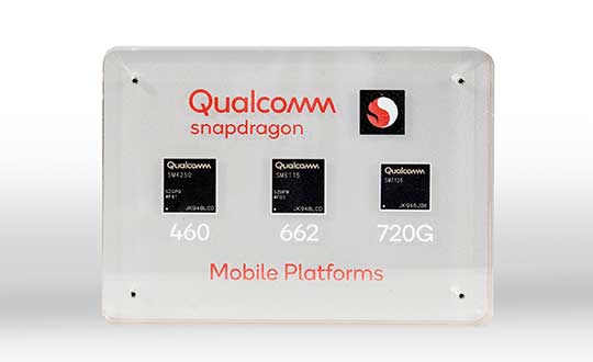
New modules enable entertainment, advanced connectivity features and next-generation artificial intelligence
Qualcomm Technologies has launched three new mobile platforms — the Qualcomm Snapdragon 720G, 662 and 460 — to enable enhanced user experiences across connectivity, gaming and entertainment.
The new mobile platforms support dual-frequency (L1 and L5) GNSS to improve location positioning accuracy and robustness. The system-on-chip solutions also support the Indian NavIC (Navigation with Indian Constellation).
Seven constellations. For the first time supported on mobile, the Qualcomm Location Suite now supports up to seven satellite constellations concurrently, including the use of all of NavIC’s operating satellites for more accurate location performance, faster time-to-first-fix (TTFF) position acquisition, and improved robustness of location-based services.
“ISRO is satisfied with the efforts of Qualcomm Technologies Inc. towards incorporating NavIC and we urge OEMs to leverage it for future handset launches in India,” said K. Sivan, chairman, ISRO. “The availability of NavIC across multiple mobile platforms will help enhance the geolocation capabilities of smartphones in the region and bring the benefits of this indigenous solution to Indian consumers for their day-to-day use.”
The new modules also enable fast 4G connectivity speeds, deliver key Wi-Fi 6 features and integrated Bluetooth 5.1 with advanced audio via the Qualcomm FastConnect 6-series subsystems.
Artificial Intelligence. Designed to deliver new and improved AI user experiences across photography, voice assistants and virtually always-on scenarios for increased contextual awareness, the new platforms also feature the Qualcomm AI Engine and Qualcomm Sensing Hub.
“While we see a fast adoption of 5G across geographies globally, we do recognize the phenomenal boost that 4G has given towards enabling broadband connectivity for Indian consumers. 4G will continue to remain a focus area for Qualcomm Technologies for regions like India, where it will stay a key technology for connectivity,” said Rajen Vagadia, vice president and president, Qualcomm India Pvt. Ltd. “Our goal is to enable our partners to continue creating solutions that offer seamless connectivity access and exceptional mobile experiences, that consumers can count on.”
“Today’s smartphone users want fast, seamless connectivity, advanced features and long-lasting battery life,” said Kedar Kondap, vice president, product management, Qualcomm Technologies, Inc. “This expansion of our 4G lineup enables our partners to offer sophisticated solutions that meet global demand and enable a remarkable gaming experience across multiple tiers and price segments.”
Photo: Qualcomm
Snapdragon 720G
Snapdragon 720G reimagines extraordinary gaming and entertainment experiences with select Qualcomm Snapdragon Elite Gaming features, striking capture capabilities, and intelligent performance. Leveraging select Snapdragon Elite Gaming features from premium-tier mobile platforms, Snapdragon 720G delivers smooth HDR game play, dynamic color range and contrast, realistic and immersive in-game environments, and high-quality, synchronized sound with Qualcomm aptX Adaptive.
In addition to gaming, users will have a “home theater in their pocket” with HDR viewing and super-smooth video streaming with the Qualcomm Spectra 350L ISP, Qualcomm said. They can also capture 4K video or snap massive 192-megapixel photos.
Snapdragon 720G also features the latest fifth-generation Qualcomm AI Engine with the improved Qualcomm Hexagon Tensor Accelerator that will enable a host of new AI experiences for gaming, photography, voice assistants and virtually always-on contextual awareness.
The integrated Snapdragon X15 LTE modem supports 3-carrier aggregation, 4×4 MIMO on two carriers and 256-QAM modulation for fast download speeds up to 800 Mbps — allowing for quick app downloads and smooth video streaming and sharing.
In addition, Snapdragon 720G, with the FastConnect 6200 subsystem, virtually doubles Wi-Fi speed and range for online gaming and web browsing, compared to single antenna devices, while also delivering key Wi-Fi 6 features such as 8×8 sounding with multi-user MIMO for up to 2x improvement over competitive Wi-Fi 6 devices, Target Wake Time for up to 67% better power efficiency and the complete WPA3 security suite, as well as integrated Bluetooth 5.1 with advanced audio capabilities.
Finally, users will experience power savings and improved performance due to the Snapdragon 720G’s 8-nm process technology and upgraded CPU architecture.
Snapdragon 662
Snapdragon 662 brings astonishing camera and AI capabilities to the 6-series for the first time. It will feature the new Qualcomm Spectra 340T, which supports triple camera configurations and smooth switching between them — a first in the 6-series. A more robust ISP will enable support for photo capture in the HEIF file format for stunning image quality at half the file size.
The addition of the third-generation Qualcomm AI Engine with Hexagon Vector Extensions and the Qualcomm Spectra 340T will enable AI-based user experiences such as avatars, night photography, and face and voice authentication.
Snapdragon 662 also features the new Snapdragon X11 LTE modem with peak download speeds up to 390 Mbps thanks to 2-carrier aggregation, 2×2 MIMO and 256-QAM modulation, along with 150 Mbps peak uploads to support a snappy web browsing and social media experience.
Snapdragon 460
Snapdragon 460 boasts a gigantic leap in performance across the board in the 4-series, as well as significant boosts in connectivity, AI and camera improvements[1] for the next-generation of mass market smartphones. For the first time in the 4-series, Snapdragon 460 features performance CPU cores and an updated GPU architecture that translates into up to 70% and 60% increase in performance, respectively.
Overall system performance, meanwhile, delivers a 2x increase compared the previous generation. The Hexagon processor with Qualcomm Hexagon Vector eXtensions (HVX) is also introduced into the 4-series for the first time, thereby equipping it with a 3rd generation Qualcomm AI Engine and the Qualcomm Sensing Hub for new AI experiences for photography and voice assistance.
The Qualcomm Spectra 340 ISP is also among the many new additions to the 4-series, enabling the platform to capture stunning photographs and support for triple cameras. An integrated Snapdragon X11 LTE modem allows for download speeds up to 390 Mbps and uploads up to 150 Mbps.
To date, more than 85 commercial devices based on Snapdragon 7-series mobile platforms, more than 1600 commercial devices based on Snapdragon 6-series mobile platforms, and more than 2,500 commercial devices based on Snapdragon 4-series mobile platforms have been announced by global OEMs. Together, the 7-, 6- and 4-series amount to over 4,000 designs — an impressive feat for these segments.
Devices based on Snapdragon 720G are expected to be commercially available in Q1 2020 and devices based on Snapdragon 662 and 460 are expected to be commercially available by the end of 2020. For more information, please visit the product details pages for the Snapdragon 720G Mobile Platform, Snapdragon 662 Mobile Platform, and Snapdragon 460 Mobile Platform.
As technological advances make GPS/GNSS devices more affordable, our lives are becoming increasingly dependent on precise positioning and timing. Industries such as survey, construction and logistics rely on precise positioning for automation, efficiency and safety.
GNSS time provides the pulsating heartbeat for the backbone of our industry by synchronizing telecom networks, banks and the power grid. A single day of GNSS outage is estimated to cost $1 billion U.S. dollars alone.
GNSS is a reliable system, and to keep it as such, professional GNSS receivers need to be wary of all possible vulnerabilities which could be exploited. Using GNSS receivers that are robust against jamming and spoofing is key for secure PNT (positioning, navigation and timing).
What is GPS/GNSS spoofing?
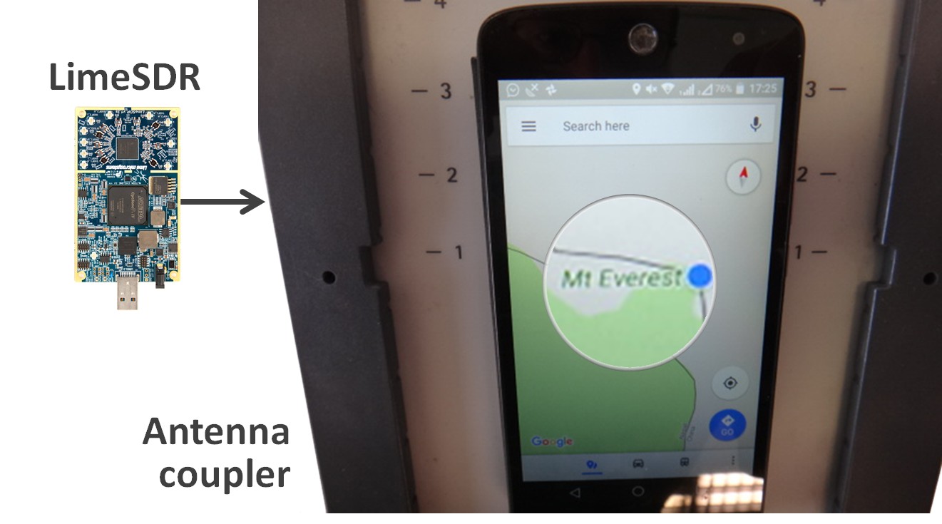
Radio interference can overpower weak GNSS signals, causing satellite signal loss and potentially loss of positioning. Spoofing, is an intelligent form of interference which makes the receiver believe it is at a false location. During a spoofing attack a radio transmitter located nearby sends fake GPS signals into the target receiver. For example, a cheap software-defined radio (SDR) can make a smartphone believe it’s on Mount Everest!
Figure 1. A cheap SDR can overpower GNSS signals and spoofs a single-frequency smartphone GPS into believing it is on Mount Everest. (Image: Septentrio)
Why GPS spoofing?
Imagine a combat situation. Clearly, the side which uses GPS/GNSS technology would have an advantage over the side which does not. But what if one side could manipulate GPS receivers of their adversary? This could mean taking over control of autonomous vehicles and robotic devices which rely on GPS positioning.
For example, in October 2018, Russia accused the U.S. of spoofing a drone and redirecting it to attack a Russian air base in Syria.
Figure 2. GNSS spoofing could be used to manipulate movement of aerial drones. (Image: Septentrio)
In the last three years, more than 600 incidents of spoofing have been recorded in the seas near the Russian border. These ships appeared to be “transported” to nearby airports.
This type of spoofing might have been introduced as a defense mechanism to ground spy drones. Most semi-professional drones on the market have a built-in geo-fencing mechanism that lands them automatically if they come close to airports or other restricted areas.
Some of the most enthusiastic spoofers are Pokémon GO fans who use cheap SDRs to spoof their GPS position and catch elusive Pokémon without having to leave their room.
Types of spoofing
Spoofers overpower relatively weak GNSS signals with radio signals carrying false positioning information. There are two ways of spoofing:
Rebroadcasting GNSS signals recorded at another place or time (so-called meaconing)
Generating and transmitting modified satellite signals
Spoof-proof: How can you protect your receiver against spoofing?
To combat spoofing, GNSS receivers need to detect spoofed signals out of a mix of authentic and spoofed signals. Once a satellite signal is flagged as spoofed, it can be excluded from positioning calculation.
GNSS receivers can offer various levels of spoofing protection. Let’s compare it to a house intrusion-detection system. You can have a simple entry alarm system or a more complex movement detection system. For added security you might install video image recognition, breaking-glass sound detection or a combination of the above.
Like a house with an open door, an unprotected GNSS receiver is vulnerable to even the simplest forms of spoofing. Secured receivers, on the other hand, can detect spoofing by looking for signal anomalies, or by using signals designed to prevent spoofing such as Galileo OS-NMA and E6 or the GPS military code.
Advanced interference mitigation technologies, such as the Septentrio AIM+, use signal-processing algorithms to flag spoofing by detecting various anomalies in the signal. For example, a spoofed signal is usually more powerful than an authentic GNSS signal.
AIM+ won’t even be fooled by an advanced GNSS signal generator: Spirent GSS9000. With realistic power levels and with actual navigation data within the signal, AIM+ can identify it as a “non-authentic” signal.
Other advanced anti-spoofing techniques such as using a dual-polarized antenna are being researched.
Satellite navigation data authentication
Various countries invest in spoofing resilience by building security directly into their GNSS satellites. With OS-NMA (Open Service Navigation Message Authentication), Galileo is the first satellite system to introduce an anti-spoofing service directly on a civil GNSS signal.
OS-NMA is a free service on the Galileo E1 frequency. It enables authentication of the navigation data on Galileo and even GPS satellites. Such navigation data carries information about satellite location and if altered will result in wrong receiver positioning computation. While currently in development, OS-NMA is planned to become publicly available in the near future. Also GPS is experimenting with satellite based anti-spoofing for civil users with their recent Chimera authentication system.
Figure 3. European Galileo satellites provide an open authentication service on the E1 signal and a commercial authentication service on the E6 signal. (Image: European Space Agency)
Recently, within the scope of the FANTASTIC project led by GSA, OS-NMA anti-spoofing protection was implemented on a Septentrio receiver.
The strongest shield: signal-level GNSS authentication
The Galileo system will be offering Commercial Authentication Service (CAS) on the E6 signal with the highest level of security for safety-critical applications such as autonomous vehicles. The signal level encryption will be based on similar techniques as the military GPS signals. Only the receivers who have the secret key are able to track such encrypted signals. The secret key is also needed to generate the signal making it impossible to fake. CAS authentication techniques are currently being prototyped at Septentrio in collaboration with the European Space Agency.
Spoof-resilient GNSS means reliable precise positioning and timing, and a peace of mind for everyone touched by this indispensable technology.
The estimated number of Galileo-enabled smartphones in use has reached one billion. This significant milestone has been achieved in the week when the European GNSS Agency (GSA), responsible for operation of the Galileo programme, celebrates its 15th anniversary.
The company BQ pioneered Galileo use in smartphones with its Aquaris X5 Plus in July 2016. Since then, market uptake of Galileo-enabled smartphones has been rapid as other manufacturers were quick to embrace the opportunities that Galileo offers.
Global annual GNSS receiver shipments are forecast to grow from 1.8 billion units in 2019 to 2.7 billion units in 2029.
Currently, 156 Galileo-enabled smartphone models available on the market. The “1 billion users” milestone is based on the number of smartphones using Galileo sold across the world. The actual number of Galileo users around the world is much larger. You can track which devices, including smartphones, are Galileo-enabled on the UseGalileo.eu site.
Today, 95% of companies that produce smartphone chips for satellite navigation make chips that enable Galileo. According to figures in the latest GSA GNSS Market Report, which is to be published soon, global annual GNSS receiver shipments are forecast to grow continuously across the next decade, from 1.8 billion units in 2019 to 2.7 billion units in 2029. Most of these shipments are for receivers costing less than €5, and 90% of receivers in this price segment are used in smartphones and wearables.
The number of Galileo-enabled smartphones in use has soared to 1 billion in just 3 years. (Image: GSA)
“Galileo is now providing high quality timing and navigation services to 1 billion smartphone users globally,” said Elżbieta Bieńkowska, commissioner for Internal Market, Industry, Entrepreneurship and SMEs. “This has been made possible by a truly European effort to build the most accurate navigation system in the world, with the support and dedication of the GSA. I am confident that our space industry will continue to thrive with more work, ideas and investment under the new EU Space Programme.”
“One billion smartphone users is a significant milestone and a major achievement for the Galileo programme and for the GSA,” said GSA Executive Director Carlo des Dorides. “The GSA has worked tirelessly to build bridges with research and industry and create a strong community of service providers who trust Galileo and understand the technological innovation opportunities it brings.
“Chipset and receiver manufacturers in particular have been quick to leverage Galileo’s outstanding performance,” des Dorides said. “These manufacturers believed in Galileo from the beginning, when Galileo was still an idea, and invested in the technology. It is thanks to them and the unique blend of expertise and knowledge of the GSA team that we are now celebrating 1 billion Galileo-enabled smartphones.”
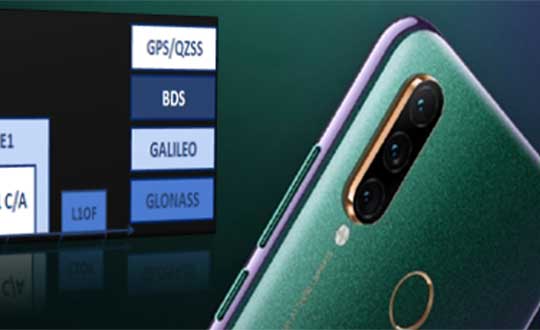
The latest Lenovo smartphone offers dual-frequency GNSS capable of tracking the latest BDS phase III signal, the Z6 SE, using an Allystar chipset.
The company says this is the first time a smartphone supports the new BeiDou signal.
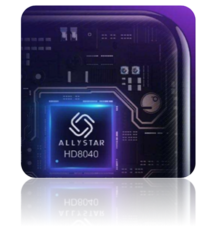
HD8040 series SoC. (Photo: Allystar)
Fitted with a Allystar HD8040 series chipset, the Lenovo Z6 youth edition provides position accuracy up to sub-meter, according to Allystar.
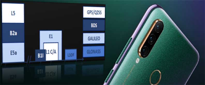
The HD8040 series chipset supports all civil signals on the L5 band. Besides GPS/QZS L5 and GAL E5a, the latest BDS phase III signal B2a has already been implemented to maximize the visible satellites in L5 band.
Dual-frequency GNSS means that the receiver tracks more than one radio signal from each satellite on different frequencies — GPS L1 and L5, Galileo E1 and E5a, and Beidou B1 and B2a.
B2a will replace B2I and broadcast on MEO and IGSO satellites. The code lengths are 10230, which have better anti-cross-correlation performance and are designed separated pilot component and data component to improve tracking sensitivity.
In general navigation scenarios, multipath error lead to positioning inaccuracy of up to several meters, caused by to signals bouncing off of higher buildings. The error caused by multipath can be nullified and mitigated by using two frequencies instead of one in urban areas. Under a relatively open-sky environment, measurement error caused by the ionosphere is usually eliminated by a linear combination of dual frequencies to easily achieve sub-meter accuracy.
“Allystar is glad to boost the smartphones and Internet of Things (IoT) applications with the latest multi-frequency GNSS SoC (system on chip) technology,” said Shi Xian Yang, the product and marketing manager in Allystar.
Lenovo smartphone Z6 SE has Allystar inside. (Photo: Lenovo/Allystar)
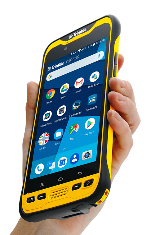
Trimble has introduced the TDC600 handheld, an ultra-rugged, all-in-one smartphone and GNSS data collector for geographic information system (GIS) and field inspection applications.
The next-generation smartphone data collector runs on an Android 8.0 operating system. It has a bright sunlight-readable 6-inch display, 2.2-GHz processor, 4-GB memory and an enhanced capacity all-day battery.
More powerful and with a longer lasting battery than its predecessor, the TDC600 handheld supports the Trimble Catalyst GNSS positioning service that delivers subscription-based accuracy on demand for Android devices.
In addition, the TDC600 can be used with external receivers such as the Trimble R2 and R1 GNSS receivers, and also features a built-in GNSS receiver that supports GPS, GLONASS and BeiDou constellations plus satellite-based augmentation system (SBAS) capabilities for real-time positioning.
The TDC600 is built for GIS users in organizations across a variety of industries —environmental management, utilities and government agencies. With Wi-Fi, Bluetooth 4.1 and 4G LTE cellular connectivity that supports data and voice calls, field workers are able to use the TDC600 as they would any consumer smartphone, communicating between the field and office, sending emails and texting.
Featuring a slim, lightweight and ergonomic pocket-size form factor, the TDC600 fits in a user’s hand with a fitted strap providing extra security. Constructed to meet military (MIL-STD-810G) specifications, the durable design absorbs drops and shocks, and works in harsh weather conditions, without the need for a protective case.
The TDC600 integrates seamlessly with Trimble’s data collection applications —Trimble TerraFlex] software and Trimble Penmap for Android software — as well as third-party apps such as Esri Collector for ArcGIS.
With its Google Mobile Services certification, users can run Google core applications and access apps on the Google Play Store to personalize their device.
“The global mobile workforce is growing, and field personnel are constantly tasked with capturing and computing large amounts of data in more places with greater accuracy, requiring powerful and reliable data collection methods,” said Rachel Blair-Winkler, business area manager for Trimble Mapping & GIS.
“A professional turnkey solution such as the TDC600 handheld running Trimble data collection apps paired with the Trimble Catalyst service fulfills this requirement,” Blair-Winkler said. “Our customers now have a powerful, comprehensive and cost-effective entry-level system to collect and retrieve highly accurate GIS data virtually anywhere in the world.”
BRING YOUR OWN DEVICE (BYOD) is not just an industry buzzword. It can change the way professional surveyors work every day. The idea of using a smartphone or tablet instead of a dedicated device is appealing. But is it good enough?
Surveyors and mappers are challenged with the arduous task of data collection that meets accuracy and precision standards and provides adequate attribute information for the project. Before the invention of the electronic data collector, handwritten notes in field books were the norm. Every note keeper’s style varied in content, neatness and thoroughness. Calculations for determining survey data values were completed longhand on paper and were very time consuming.
Like its personal computer counterpart, the electronic data collector was introduced in the late 1970s with minimal adoption by the average surveyor because of cost and complexity. Storage methods for the era included magnetic modules and tape; both forms of media were expensive and fragile with little storage for the cost.
Data collection was limited to numeric values only, with horizontal and vertical angles, slope distance, point number and point code being the extent of the information. Couple this process with the limited availability of printers and plotters capable of depicting the data for the surveyor’s use, and one can see why few practitioners invested in these systems.
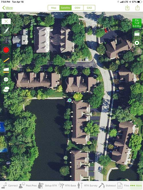
iOS aerial viewer. (Screenshot: Tim Burch)
The 1980s and 1990s brought significant changes to surveying with the advancing technology of electronic computing and measuring. The introduction of robotic total stations, various methods of GNSS, and even leveling took advantage of significant computer power and measuring processes, and the data collector stayed in lockstep with the advancing instrumentation. Almost every equipment manufacturer developed their own proprietary data collector and software system because of the unique design and programming of their systems.
In the 2000s and later, third-party manufacturers began producing data collectors with advanced computing power and the ability to connect to varying brands of equipment. Most of the programming for these collectors are still proprietary in nature to this day.
Also during the 2000s, a new wave in mobile communications was taking place. Cellular phone and data signals were now being used to transmit an abundance of information between users.
The rapid development of handheld communication devices has led to the meteoric rise of two specific mobile operating systems: one by a radical startup that concentrated on dominating the search engine market, and the other by an avant garde computer company looking to expand its unique customer base.
By the end of the decade, the world had been introduced to the Android operating system by Google, and the iOS operating system by Apple. The combined market share for the two operating systems at press time was just under 98 percent of all mobile devices worldwide.
Trending Away from Proprietary Data Collectors
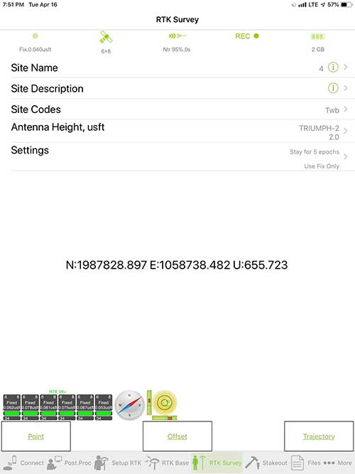
Android Point Info: Confirmation of collected data, including equipment and base station. (Screenshot: Tim Burch)
Because data collection by surveyors and mappers have traditionally been performed on proprietary systems designed and produced by equipment manufacturers for use with only their instruments, these collectors, while very powerful and robust, are costly for the equipment manufacturers to produce because of the limited market of surveyors and mappers.
Many suppliers, before the introduction of the iPhone and Android operating systems, attempted to adapt their data-collection platforms to wider recognized mobile operating systems (for example, Windows CE/Pocket PC/Mobile) on a bevy of mobile devices (HP/iPAQ, Sony Eriksson, HTC) with little success. Various versions of Windows are still being used today by GNSS equipment manufacturers’ proprietary data collectors, including Trimble, Hemisphere GNSS, Topcon and CHC Navigation.
However, the field of operating environments has become more crowded as technology continues to advance. The proliferation of Windows-based data collectors are now on the decline.
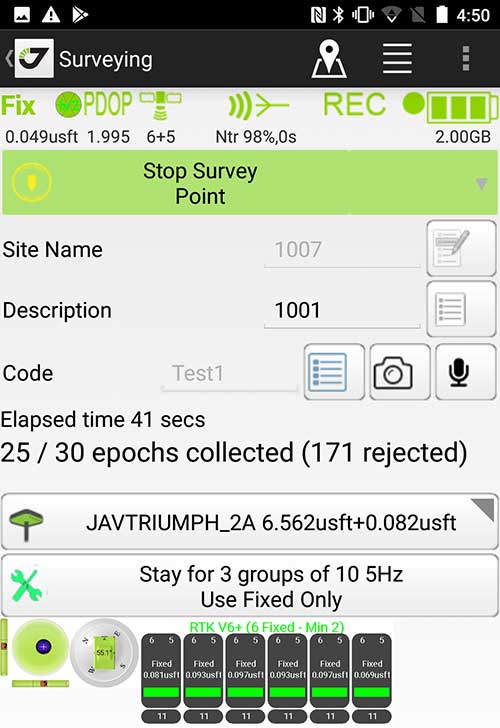
Survey Point: Status of survey data collection and GNSS engine signal reception. (Screenshot: Tim Burch)
Enter Android and iOS. Driving the decline of the previously popular Windows mobile platform is the rapid adoption of the iOS and Android operating systems. These two environments have also led to a substantial number of devices and applications for users.
Part of the reason for the speedy acceptance of the devices and operating systems has been the ease of programming. It is estimated that each operating system has more than two million applications in their respective online stores, with more being introduced daily.
Because of the proliferation of smartphones, nearly everyone is familiar with the look, feel and operation of touchscreen devices and their various applications. This familiarity is driving a new trend in data collection: the concept of “bring your own device” (otherwise known in IT security circles as “BYOD”). BYOD is being introduced by several surveying and mapping equipment manufacturers as an alternative to their proprietary data-collection devices.
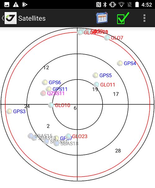
Sky Plot: Where the ‘birds’ are in the sky. (Screenshot: Tim Burch)
These manufacturers are pairing iOS and Android developers with their hardware and firmware specialists to create a user-friendly interface that will function on most of the most popular handheld devices on the market today. From Apple iPhones and iPads to Samsung Galaxy phones and tablets, these applications give the surveyor the best of two worlds — sophisticated data-collection capability on a well-known and reliable mobile operating system platform.
The Android platform is becoming especially popular in the handheld mapping market segment. Current users of this environment include Hemisphere GNSS, CHC Navigation, Tersus GNSS and Trimble.
The iOS applications, while not quite as prevalent as Android, are being embraced by several significant GNSS manufacturers, including JAVAD GNSS and Eos Positioning Systems.
These companies are creating iOS and Android apps that embrace the BYOD market, providing their users with affordability and creating a comfort level simply because of the familiarity of the device and its environment.
How Good Is It?
iOS Position. Status of survey data collection and GNSS engine signal reception. (Screenshot: Tim Burch)
For the surveyor to be satisfied with the operation, the collection process must be efficient, cost-effective and easy to use. For this explanation of key items within a well-rounded data-collection application, we are using the JAVAD Mobile Tools (now J-Mobile) application built specifically for the Android and iOS operating systems.
The Android system (Version 7.0) was installed on a rugged CAT S41 cellphone made Bullitt Group from the United Kingdom, while the iOS app was used on the author’s iPad Air 2 running Version 12.2. Both apps were utilized in conjunction with the JAVAD Triumph-2 GNSS receiver.
After putting both versions through trial testing and checking against values on known monuments, here is the results of our findings:
Receiver Setup. Visual reference for leveling and direction of GNSS receiver. (Screenshot: Tim Burch)
Data Organization. Easy to comprehend and flexible for most naming conventions.
Corrections and Sources. Easily connects to base receiver and radio or available NTRIP correction service for real-time network (RTN) capability.
Sky Plot. Because the Triumph-2 is equipped to receive most of the available satellites in service, the Sky Plot feature is beneficial to the user for assessing potential interference.
File Management, Import and Export. Covers the typical file management and transfer functions used by the surveyor.
RTK Survey Operations. Robust telemetry keeps the users informed of specific satellite data and correction status.
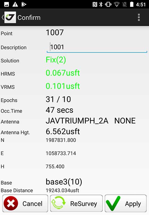
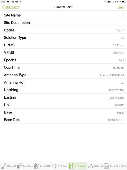
Point Confirmation. Survey point information with metadata and equipment listing. (Screenshot: Tim Burch)
Coordinate Systems. All standard coordinate systems are included with features to allow the user to customize their own systems.
Localization. Creation of a local coordinate system is a simple routine, providing strong quality checks for data integrity.
Lift and Tilt. This feature provides the user with a useful procedure to end data collection without the need to press a button. This feature significantly increases the user’s productivity.
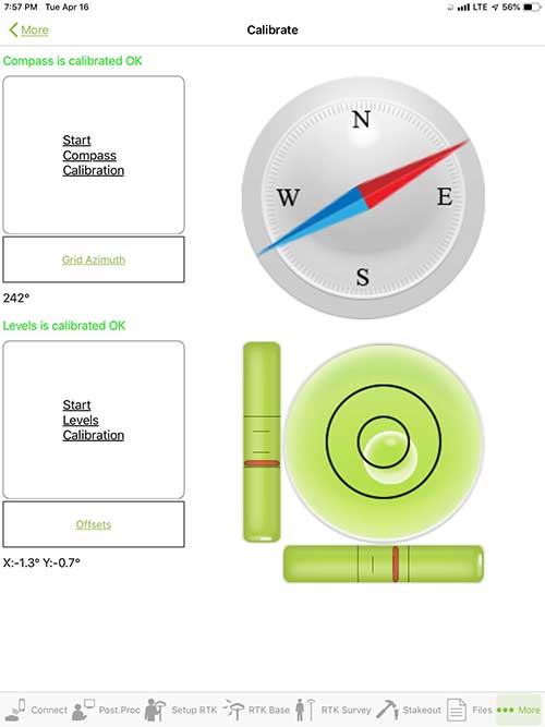
Compass and Level Calibration. With the Triumph-2 having an internal compass and level system, status of the receiver is graphically displayed to help the user keep a close watch on the accuracy of the survey point.
Survey Points and Linework. Most point naming systems and line-coding procedures are easily adapted. Total Station Point Transfer. The creation of control point files for transfer to total stations is simple and easy to use.
Stakeout. Graphical status screens provide the user with simple plotting capability of the desired stakeout point to increase efficiency and accuracy.
These apps are good at providing the surveyor with a solid tool for data collection and staking capability. They are especially good when paired with a real-time kinematic
(RTK) base station or NTRIP correction service.
But what happens when cell service is not readily available, or there are no published monument coordinates to establish site control? These apps have the surveyor covered for that situation as well.
Post-Processing (OPUS and DPOS)
Today’s surveyor works in an environment where geographic-based data is a key component to the services they render to their clients. While most of the world’s developed nations have access to cellular networks in which most GNSS receivers can communicate with an RTN providing corrective solutions, the places where this is not possible relies on other means of data correction.
In the U.S. we rely on OPUS (Online Post-Processing User System) to provide that service. But, as good as it is, it has limitations. Currently, it only utilizes GPS satellite data from the U.S. Department of Defense and is subject to sporadic government shutdowns.
Other services, from both public and private sources, are in place around the world to provide a service similar to OPUS. These include, but are not limited to:
AUSPOS. Geoscience Australia (free)
APPS. Jet Propulsion Laboratory at California Institute of Technology (free)
CSRS-PPP. Natural Resources Canada (free)
GAPS. University of New Brunswick (free)
magicGNSS. GMV (free)
Centerpoint RTX Post Processing. Trimble (free)
JAVAD Data Processing Service (DPOS). JAVAD (free, processes any JAVAD GNSS jps file)
These correction services utilize other satellite constellations (GLONASS, Galileo, BeiDou and QZSS) for their solutions and can provide additional coverage, depending on the location of the user. Because of these services, geographic-based data is at the fingertips of surveyors worldwide.
JAVAD’s DPOS system is has the ability to collect static survey data and send it to the proprietary service for establishing new coordinate values for base-station use. This process is a function of the app and can be completed in a few short steps.
Once the base station values are calculated, the surveyor can make use of this information for establishing a base station for correction broadcasting.
Do You Need a Base Station?
The establishment of RTNs has greatly enhanced surveying capability as cellular service has increased in coverage and speed. However, there are still instances and locales that do not allow for the reliable use of cell signals to provide those corrections accurately.
Various manufacturers’ tests have proven the accuracy of using an RTN subscription versus the traditional GNSS base and rover RTK setup. But cell-signal strength can be an Achilles heel, crippling those who choose not to set up a base station.
The UHF radio, even in its reduced power state from regulatory changes, is still more powerful and reliable than most cell services. 5G technology and coverage is anticipated to revolutionize cellular service, but it has yet to be realized.
Adaptation of the Industry
Other GNSS manufacturers (including NovAtel, Navcom, ComNav, Unicore, Emcore, Suzhou, TeleOrbit and Geneq) are producing receivers that can be adapted to a variety of existing data collectors and connect to iOS/Android mobile devices through various software developers.
The future of communications remains the smartphone or tablet device, with foldable units expected to be the next big thing.
As processors get more powerful, as chip memory becomes more abundant, and as more satellite constellations orbit in our sky, surveyors and their data collectors will continue to evolve. The future remains bright for technology and the surveyor has a front-row seat.
TIM BURCH is GPS World’s contributing editor for Survey. A professional land surveyor with more than 30 years of experience, he is director of surveying at SPACECO Inc. in the Chicago area. For several years he has been secretary and was recently named vice-president of the Board of Directors of the National Society of Professional Surveyors. He writes a bi-monthly column in the Survey Scene e-newsletter. Subscribe free at env-gpsworld-integration.kinsta.cloud/subscribe.
Receiver, Software Ready for Mobile
Photo: ComNav
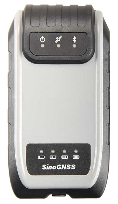
ComNav receivers offer multiple data-collection device choices via Bluetooth connection, as well as an Android app.
For instance, the G200 provides centimeter-accuracy positioning to any connected mobile devices for RTK field surveying. It is able to delivery robust survey workflows with the SinoGNSS Android-based Survey Master, so that surveyors can collect quality high-accuracy positions no matter what mobile device they are using.
The G200 is a rugged, compact, wearable GNSS receiver. Combined with the high-performance SinoGNSS OEM board tracking GPS L1/L2, BeiDou B1/B2, GLONASS L1/L2, Galileo and QZSS, the G200 enables reliable high-precision GNSS performance for land survey tasks anywhere in the world.
TerraStar Gives Assist to RTK
Photo: Leica Geosystems
NovAtel offers several levels of corrections via its TerraStar service. For surveying applications, the RTK Assist service provides correction data to bridge surveyors through any real-time kinematic (RTK) correction outages. TerraStar services work on NovAtel’s OEM6 and OEM7 receivers..
RTK Assist, available on OEM6/OEM7 receivers, provides 20 minutes of RTK assistance, enabling surveyors to maintain centimeter-level accuracy. A higher service level, RTK Assist Pro, is available on OEM7 receivers. It provides unlimited RTK assistance with stand-alone centimeter-level positioning when RTK is not available.
Trimble Offers Web-Based Post-Processing
Photo: Trimble
Trimble’s CenterPoint RTX Post-Processing Service is a free, web-based solution that provides rigorous processing of GNSS data for users around the globe.
Powered by advanced algorithms for processing static observations, CenterPoint RTX Post-Processing supports data including GPS, GLONASS, Galileo, BeiDou and QZSS. With the service, users can upload GNSS data using Trimble formats or industry-standard RINEX 2 and RINEX 3. The service supports all dual-frequency GNSS receivers and more than 400 different antennas.
The post-processing service computes single-station static observation sessions ranging in length from 10 minutes up to 24 hours, with longer observation sessions recommended to produce the highest accuracy. Using data from the global RTX tracking network, the CenterPoint RTX Post-Processing service computes the position of the observed point with centimeter accuracy.
Results are delivered via email in ITRF coordinates at the current epoch and can be transformed to a fixed epoch by use of a standard tectonic-plate model.
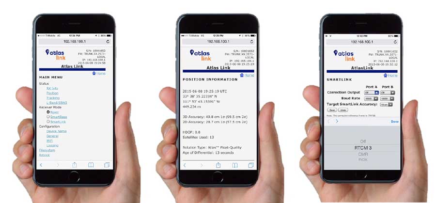
Atlas Corrections Ready for BYOD
The Atlas GNSS global correction service, offered by Hemisphere GNSS, provides correction data for GPS, GLONASS, BeiDou and Galileo constellations. Its global L-band corrections allow for accuracies ranging from sub-meter to sub-decimeter levels. The network has more than 200 reference stations worldwide and covers virtually the entire globe.
Examples of how the AtlasLink webUI looks on a smartphone. (Image: Hemisphere GNSS)
The Atlas platform was conceived to enable as many people as possible to have access to the correction service technology, either as an end-user or as part of their business. Several features are designed to enable customers who use non-Hemisphere positioning systems to have access to Atlas.
For instance, Hemisphere’s SmartLink technology allows an AtlasLink GNSS smart antenna to be used as an Atlas signal extension for any GNSS system compliant with open communication standards.
Hemisphere’s GNSS smart antennas including AtlasLink, A326, C321+ and S321+ offer a user-friendly web user interface (WebUI) that can be used to configure, monitor and manage the receiver from virtually any modern computing device, including computers, phones and tablets.
Following a waiver by the U.S. Federal Communications Commission (FCC) of its rules in November 2018, in which it allowed devices in the United States to access signals transmitted by the Galileo Global Navigation System, leading U.S. manufacturers are preparing to roll-out Galileo on U.S. territory.
At a meeting on Nov. 15 last year, the US FCC granted in part a request from the European Commission for a waiver of the FCC rules so that devices in the United States may access specific signals transmitted by Galileo.
This decision means that consumers and industry in the U.S. are now able to access certain satellite signals from the Galileo system, which can be used in combination with the U.S. Global Positioning System (GPS). The improved availability, reliability, and resiliency offered by incorporating Galileo capability into devices is something that U.S. chip manufacturers are eager to pass on to their customers.
“This is an important market development opportunity for manufacturers in the U.S. The FCC ruling means that industry can now benefit from the use of Galileo signals. The added accuracy and robustness offered by multi-constellation and multi-frequency capability will be a key differentiator on the market,” said Carlo des Dorides, Executive Director of the European GNSS Agency (GSA).
“We are glad to see FCC supporting Broadcom’s dual frequency GNSS vision, for which the GPS and Galileo combination is key,” said Vijay Nagarajan, VP Marketing Wireless Connectivity and Communication Division at Broadcom. “We enabled the world’s first dual frequency GNSS phone in 2018 with the simple goal of providing accurate location to the consumer even amidst the skyscrapers in a busy downtown. We are certain that consumers will benefit from this FCC ruling that will further drive the adoption of dual frequency GNSS.”
“As a leader in developing cellular technology — today, as the world launches 5G and dating back to Qualcomm’s legacy in 4G, 3G and 2G — including work to incorporate robust navigation solutions for smartphones, Qualcomm Technologies integrated Galileo across its chipset portfolio because we understand the importance and benefits of accurate, reliable, and rapid position location for consumers,” said Dean Brenner, senior vice president of Spectrum Strategy and Tech Policy, Qualcomm Incorporated. “We’re excited about the FCC allowing access to Galileo signals in the U.S. for commercial Location Based Services because it is a big step forward in improving the user experience, particularly in dense urban environments.”
Activating Galileo in the U.S.
Both Broadcom and Qualcomm Technologies, Inc. already have dual-frequency solutions that support Galileo E1/E5a signals: the world’s first dual frequency GNSS smartphone, the Xiaomi Mi-8, was fitted with a Broadcom BCM47755 chip and, in December, Qualcomm Technologies launched the newest generation in its 8 Mobile Platform Series, the dual-frequency Qualcomm Snapdragon 855 Mobile Platform.
“Approximately 100 smartphone models are already fitted with chipsets from these two manufacturers. Following the FCC ruling, we are expecting to see a significant increase in Galileo users coming from the U.S.,” said Justyna Redelkiewicz Musial, in charge of LBS and IoT market development at the GSA.
Better positioning and navigation
The FCC ruling permits access to two Galileo signals — the E1 signal that is transmitted in the 1559-1591 MHz portion of the 1559-1610 MHz Radio-navigation-Satellite Service (RNSS) frequency band and the E5 signal that is transmitted in the 1164-1219 MHz portion of the 1164-1215 MHz and 1215-1240 MHz RNSS bands.
Access to multi-constellation and multi-frequency capability means that users in the U.S. will be able to benefit from a better positioning and navigation experience particularly in urban environments where the unique shape of the E5/L5 signal makes it easier to distinguish real signals from the ones reflected by buildings, reducing the multipath effect. The simultaneous use of E5/L5 frequencies also mitigates other sources of error, such as ionospheric distortions, and makes the signal more robust against interference and jamming.