Tag: social networking

  • Facebook to Roll out Location App

    Facebook to Roll out Location App

    Kevin Dennehy
    Kevin Dennehy

    There always is a lull in news between the Consumer Electronics Show and the Mobile World Congress, which is later this month in Barcelona. However, published reports that Facebook plans to launch a location application is big news. The social network giant, with more than 1 billion mobile users worldwide, could conceivably generate huge advertising revenue through the location-based friend-finder app. Facebook has a number of competitors, but with the sheer number of worldwide users, it has to make the industry take strong notice.

    Facebook to Roll Out Location Application for Mobile Users

    Facebook is attempting to grab a big piece of the mobile location market with a new app that will track users to perhaps boost mobile advertising sales.  The news, first reported by Bloomberg, indicates that Facebook is adding location features to perhaps take a chunk of profit from 1 billion mobile users who use the social network.

    The new feature, expected to be launched in March, will work with smartphones, even when the user is not using the application, according to the Bloomberg article.  This may raise some privacy hackles, as competing services have opt-in functions. In addition, some handset manufacturers and carriers require user opt-in as part of privacy agreements.

    Facebook already purchased two location companies in Glancee and Gowalla. Glancee is a location-tracking startup Facebook bought in May 2012. Gowalla, a location-based social network, was purchased in December 2011.

    Facebook Has Competitors in Location Market

    The new Facebook location app will be an answer to Google Latitude, which was launched in early 2009. Latitude, a feature for Google Maps, is an opt-in mobile app that allows users to see the location of friends and family, who also allow the service to track them. Google’s premise, four years ago when it launched Latitude, was that many users wonder where their friends and family are — and what they are doing.

    Because it is an opt-in service, Google said users could find out where a spouse was stuck in traffic on the way home from work, knowing when a loved one’s flight landed safely, or if a buddy was in town. Although it has been around for more than four years, Latitude was innovative with the concept that not only can you see friends on a map, but you can get in touch with them via SMS, Google Talk, gmail and  updating a status message.

    “While Google quietly improved its databases, tools and location services, most other players in the location industry were slipping further behind, apparently involved in a frenzy of disorganization prompted by a lack of skills in strategic planning,” said Mike Dobson, Telemapics president, in a recent interview.

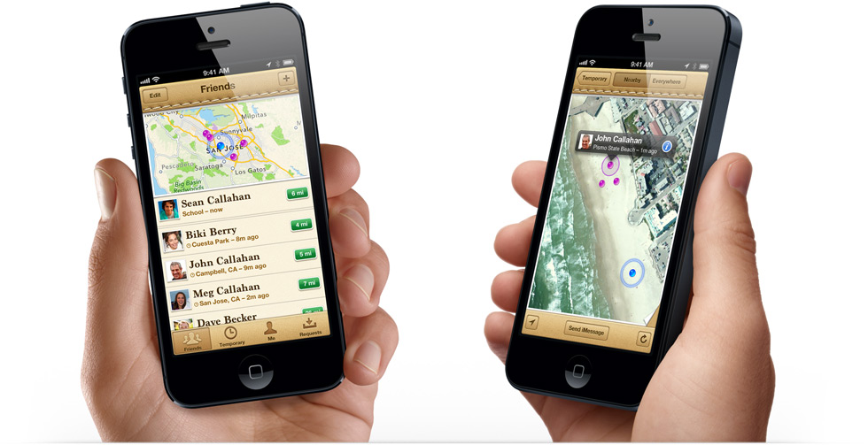
    Another similar service, Find My Friends from Apple, runs on the iOS 5 operating system.  It is another location share service that attempts to allow users to find friends in real time, according to published reports.

    Apple needs to hit a home run in the location and mapping market. Last year, the controversy surrounding Apple Maps caused a shake up at the company and industry because of faulty map data. The incident made manufacturers realize that digital maps are a very important feature for smartphones. It also made many of these giant companies, who believe that location isn’t that big of a deal, sober up to the fact it is hard to make quality maps.

    A number of other companies are offering friend and family finder apps, namely Location Labs, Life360 and Loopt.

    Still, while such companies as Facebook, Apple and Google give away maps and navigation for free, which destroyed smaller companies and caused a huge consolidation of the industry starting in 2008, some believe that maps are too hard to produce for free. Some analysts, Dobson included, think that “free” maps and navigation services may not stay that way as consumers and enterprise customers demand better accuracy.

    Tablet Owners Spend More than Smartphone Buyers

    In advance of the Consumer Electronics Show, analysts were saying not only that flatscreen TVs sales were dropping, but the champion of the previous shows, the tablet, also was to see a downward trend. Not so, says ABI Research, which estimates nearly 200 million tablets shipped worldwide since 2009, with an additional 1 billion tablets forecast to ship over the next 5 years.

    What’s interesting, or not, depending on your location company’s strategy, is that ABI says 22 percent of users spend $50 or more per month and 9 percent spend $100 or more on purchases ordered from their tablets. That’s higher amounts than from even smartphones, the company says.

    As we reported last fall, the next edition of Amazon’s Kindle Fire tablet introduced mapping services in partnership with Nokia, which snubbed technology from Google, which is funny because its mobile operating system powers the platform. But it was an indicator of how much promise companies are still seeing in adding location-based services capability to tablets.

    In other LBS news:

    • Sense Networks released the results of a location-based mobile advertising campaign for Denver-based fast food chain Quiznos. The campaign, conducted in Portland, Oregon, placed ads on mobile devices of people 18-34, who eat at competing, and similar, restaurants such as Subway. The company said Quiznos had a 20 percent gain in coupon redemptions.
    • TeleCommunication Systems, Inc. (TCS) is providing map, local search, location services and navigation applications for the new BlackBerry 10 smartphone. The TCS-based mapping application will ship with the new smartphones, which are scheduled to roll out in mid-March. TCS’ APIs are also available for Blackberry 10 developers. This leads many in the industry to believe that if this smartphone is a much-needed home run for Research in Motion, the TCS partnership could be a big deal.
    • Locaid plans to provide GTECH with secure mobile location, IP location and other LBS to include geofencing and location authentication. What’s cool about this deal is GTECH designs and sells lottery technology. Its service includes a geo-complaince engine that ensures a mobile or Internet-connected device is within state lines.

    If you have news, or tips, or gossip, please contact me at [email protected].  The Mobile World Congress in Barcelona is coming up this month, so get me your story ideas and product news.


  • Magellan Personal Nav Integrates Cloud, Social Media, Real-Time Location Data

    Magellan has announced the Magellan SmartGPS, a GPS device based on navigation integrated with social, local and mobile content, including Yelp and Foursquare, through Magellan’s cloud-enabled Smart Ecosystem. The Magellan SmartGPS navigation device wirelessly syncs the user’s navigation data, such as favorite places and contacts, with a smartphone or personal computer. The device intelligently delivers stored and dynamic location-based information to the GPS display that is personalized to the driver’s locale.

    “Magellan pioneered the GPS navigation industry, and in today’s socially driven world, we recognize that consumers want and need a much more comprehensive navigation solution that surpasses what traditional GPS devices and smartphones can offer,” said Peggy Fong of MiTAC Digital Corporation. “We engineered our cloud-based Smart Ecosystem and SmartGPS device from the ground up to deliver an innovative SoLoMo experience to consumers who desire discovery, relevance and local awareness combined with navigation. Additionally, the Smart Ecosystem is architected to integrate with automotive infotainment and mobile network service platforms.”

    The Magellan SmartGPS communicates with Magellan’s custom-built Smart Ecosystem, a cloud platform for a database of constantly-updating, location-relevant social media and navigation content that is automatically pushed to the SmartGPS display to create a unique driving experience, the company said.

    Magellan SmartGPS users can simultaneously view maps, navigate, and see reviews, tips and offers from Yelp and Foursquare for nearby restaurants, stores and services, plus navigate to those locations without needing to use an additional device or application. As a vehicle progresses on its route, the SmartGPS accesses the cloud-based Smart Ecosystem to deliver a variety of location-relevant information “squares” that are displayed on the SmartGPS screen and graphically flip between service establishments in the vicinity. When the user taps on a square, detailed profile information is displayed including the address, phone and any available special offers or consumer reviews, plus an icon to navigate to their selected destination. In addition, the SmartGPS delivers current gas prices in the vicinity, weather, traffic events and speed camera warnings.


  • Researchers Use Traffic App Data to Identify Accident Hotspots

    Researchers at Israel’s Ben-Gurion University of the Negev (BGU) say reveal that data culled from geosocial networks like the GPS traffic app Waze can help prevent traffic incidents with better deployment of police resources at the most accident prone areas.

    “Only now are we beginning to discover the potential in the huge amount of data collected daily,” explains BGU researcher and Ph.D. student Michael Fire. “Studies of this kind, which monitor events such as traffic accidents over time, can help the police identify dangerous sections of roads in real time, or alternatively, locations where few police are needed.”

    The paper, “Data Mining Opportunities in Geosocial Networks for Improving Road Safety,” was presented at the IEEE 27th Convention of Electrical and Electronics Engineers in Israel.

    Waze records location data and enables users to upload and share comments on any detail, including traffic alerts, accidents or police presence. According to its website, Waze has 30 million worldwide users and describes itself as “a community-based traffic and navigation app whose users share real-time traffic and road info, saving time and gas money.”

    Using Waze data and Google Earth, the BGU researchers determined that three-quarters (75 percent) of the locations in Israel with the highest number of accidents were intersections. They then analyzed references to a police presence to determine if the police were present at the spots that had the worst traffic accidents.

    “There were numerous instances where the police were manning quieter intersections, while busier intersections went unmonitored,” Fire explains.  “According to the data, police response time varied from 20 minutes to 40 minutes in some situations.”

    Using Waze, data from May and June 2012 was collected and analyzed on accident reports, police presence, traffic jams, and speed traps. BGU researchers identified 579 different locations in Israel that had at least five reoccurring accidents during this time where 5,156 reported accidents occurred. Police were reported at least 15 times at more than 3,500 locations.

    Other researchers involved with the study from BGU’s Department of Information Systems Engineering and BGU’s Telekom Innovation Laboratories include Prof. Yuval Elovici, head of the lab, as well as Dr. Rami Puzis, Prof. Lior Rokach as well as student Dima Kagan.

  • TI’s Wi-Link 8Q Provides Wireless Connectivity for Auto Infotainment

    Wireless connectivity is becoming a key feature in automobiles for sharing and viewing content from smartphones and tablets to in-car systems, easy pairing of devices, navigation and replacement of expensive cables for in-car communication. To answer this need, today Texas Instruments Incorporated (TI) introduced the WiLink 8Q family of wireless automotive connectivity solutions.

    “GNSS technology combines GPS and GLONASS signals with the on-chip positioning engine producing a more accurate fix of your location, making “urban canyons” non-existent,” according to the TI Behind the Wheel blog. TI is demonstrating WiLink 8Q and other technologies at the Consumer Electronics Show this week in Las Vegas.

    With its multi-radio technology, the WiLink 8Q family reaches new levels of cross platform scalability and delivers advanced features including in-car multimedia streaming video in parallel with Bluetooth hands-free calling and advanced audio distribution profile (A2DP) stereo sound. Additionally, with near field communications (NFC) for easy Wi-Fi and Bluetooth pairing, WiLink 8Q solutions enable an easy connection between a smartphone or tablet and the automobile, providing a seamless user experience, according to TI.

    The WiLink 8Q family is designed for Wi-Fi Certified Miracast operation. With an integrated power amplifier (PA) and complete software reuse across all family members, WiLink 8Q solutions provide a full range of products for wireless automotive infotainment including:

    • Super-combo SoCs with Wi-Fi, Bluetooth, Bluetooth low energy, NFC, and GNSS support.
    • Combo-connectivity system-on-chips (SoCs) with Wi-Fi and Bluetooth support.
    • More integrated combo-connectivity SoCs with Wi-Fi, Bluetooth, Bluetooth low energy and NFC.

    “Delivering the familiar experience consumers have with smartphones and the tablets into the automobile to share information and content from drivers’ and passengers’ devices is driving the need for strong wireless connectivity solutions. Wi-Fi, Bluetooth, NFC and GNSS have to work together seamlessly as integrated parts of the entire system,” said Mattias Lange, automotive connectivity product line manager, Wireless Connectivity Solutions, TI. “The WiLink 8Q family takes our expertise in wireless connectivity and automotive applications to the next level with support of four different RF technologies on one SoC – a truly integrated approach to automotive infotainment.”

  • SINA, AutoNavi Launch Social Networking Platform for China

    SINA Corporation, an online media company serving China and the global Chinese communities, and AutoNavi Holdings Limited, provider of digital map content and navigation and location-based solutions in China, have jointly announced a strategic partnership to integrate and enhance each other’s social, location and mobile offerings.

    As a result of this partnership, AMAP, AutoNavi’s mobile map application, users will be able to sign on using Weibo Connect and access content directly from SINA Weibo. SINA Weibo users will also have access to the content and functionality of AMAP. The companies expect such content and product integration will enhance the social networking and navigational aspects of each other’s mobile offerings.

    “Over 70% of SINA Weibo users access the social media platform at least partially via mobile devices,” said Gaofei Wang, vice president and general manager of SINA Mobile. “LBS (location-based services) and mapping services will play a key role in Weibo’s mobile strategy, and we are excited to be partnering with AutoNavi to leverage their expertise in these areas.”

    “In teaming up with Sina, we are proud to provide our mapping and location-based services to more than 400 million Sina Weibo users, while at the same time integrating Sina Weibo’s social content and SNS features into AMAP,” said Congwu Cheng, chief executive officer of AutoNavi. “We believe our collaboration with Sina Weibo will benefit both of our users and we look forward to future cooperation between our two companies as we continue to bring new features and functionalities to our users.”

  • GPS at the Olympics: Twitter Disrupts GPS Data from Olympic Cyclers to Broadcasters


    UPDATE: Title changed to clarify that GPS signals are not affected, but the transfer of the GPS data to the broadcasters.


    GPS is playing a role at the 2012 Olympics in London, through apps for smartphones to transportation issues, and even a clash with social media.

    Twitter Disrupts GPS Data from Olympic Cyclists to Broadcasters

    The International Olympic Committee (IOC) said that social media prevented broadcasters from getting accurate GPS data about the precise location of Olympic bicycle competitors during the155-mile men’s cycling road race.

    According to Reuters, commentators on Saturday’s men’s cycling road race were unable to tell television viewers how far the leaders were ahead of the chasing pack because data could not get through from the GPS satellite navigation system traveling with the cyclists.

    IOC spokesman Mark Adams says the Olympic Broadcasting Services service was jammed by “hundreds of thousands” of people sending texts, pictures and updates to social networks such as Twitter and Facebook, the Washington Post reports.

    To alleviate the bandwidth issue, the IOC asked users not to tweet, saying unless it’s an “urgent, urgent one, please kind of take it easy.”

    The problem arose due to lack of data bandwidth provided by telecom carriers, which did not properly anticipate demand. CNET’s Zack Whittaker reports that users send almost 10 million tweets during the opening ceremonies alone.

    The problem appeared to be solved for Sunday’s women’s road race.

    Apps Spark User Interaction, Excitement

    A number of mobile apps will help spectators at the Games keep tabs on the action.

    SoFit Mobile. A Toronto-based mobile development company, SoFit Mobile, has released a free social-gaming app that uses GPS technology to track users’ steps as they compete with friends. Users can donate money to charity or unlock medals and real-life discounts and coupons based on how far they travel. Early participants were eligible to win tickets to the games.

    The app is designed to connect users with friends virtually, regardless of geographical and cultural differences, where they can train together and take part in athletic events like the New York Marathon.

    “Using the Olympics as a way to inspire more people to get active, SoFit will engage users to take small steps to start living healthier while connecting millions to make the world a better place,” said Olympic figure skater Michelle Kwan in a press release.

    The app was developed in partnership with the Walk A Mile campaign, which was inspired by the 2012 London Games. SoFit is available for Apple and Android devices.

    Samsung Hope Relay. For every mile run while this app is activated, Samsung donates 1 pound to charities, including Kids Company and International Inspiration. The app uses GPS to track the users’ movements walking, running, or cycling, alone or as part of a team.

    TorchTracker. This app used GPS tracking to pinpoint where the Olympic Torch was as it made its way to the games, and helped fans find places to see it go by.

    American and Australian Team Buses Get Lost

    Before the games began, buses taking Australian and American athletes from Heathrow Airport to Olympic Park experienced a failure of GPS end users, sending the athletes around the city for a long tour before arriving at the Olympic Village.

    The bus driver hired by London Olympic organizers had not driven or been shown the route before, and could not operate the GPS navigation system fitted in the vehicle. Also, some of the venues, such as the village, had not been pre-loaded into the devices.

    For the Aussies, it turned into a 3½-hour marathon, accidentally taking them past central London landmarks such as Buckingham Palace and the Houses of Parliament.

    A separate London 2012 bus carrying American athletes got so badly lost it took four hours to make the 23-mile trip across the capital.

    Olympic Lanes and GPS Vehicle Tracking

    After there were problems for the athletes getting to events in 1996, every host country has had an Olympic Lane to speed the journey for Olympians. However, residents have grumbled about it and there has been some talk about defying the rule and using the lane for unofficial business.

    Blogger Oliver Ortiz posits that the conflicts could have been avoided if organizers had made use of GPS vehicle tracking. “The Olympic Lane is open from 6 a.m. until midnight both ways, and for many this is a folly. There will be certain times of the day when the Olympic Lane will be essential and it almost appears lazy on behalf of the Olympics organisers not to consider the best times for the lane to be open. If only they had thought about using GPS Vehicle Tracking to not only design the opening times, but also to monitor the Olympic Lanes during the games and make changes to when they are open. GPS Vehicle Tracking would have made these two things possible.

    “London knew they were having the Olympics way back in 2005, could the Olympic Committee not have thought about levels of traffic and travel times at various points in the day using GPS Vehicle Tracking to put forward a more practical schedule for the Olympic Lane to be open?”