Tag: software upgrade

  • Orolia releases Skydel GNSS simulation software upgrade

    Orolia releases Skydel GNSS simulation software upgrade

    Skydel 22.5 features advanced hardware-in-the-loop testing

    Orolia has released Skydel 22.5, a significant software upgrade to its Skydel simulation product line that features advanced hardware-in-the-loop (HIL) testing solutions providing very low to zero effective latency.

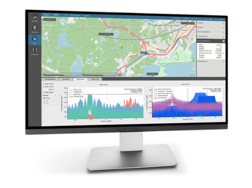
    The enhanced visualization tools can monitor internal latency through real-time curves showing when the data is generated and sent to the RF signal. Users can also review the transmission of HIL packets for optimizing the entire network’s latency, checking its stability (jitter), and that data is available and used at the right time in Skydel.

    HIL testing is an essential step in the verification process of the model-based design (MBD) approach because it involves all the hardware and software that will be used operationally. HIL verification can test a standalone device-under-test (DUT) or, more generally, an entire complex system consisting of multiple DUTs in both open- and closed-loop architectures.

    “The vast majority of problems encountered by engineers on HIL systems are related to poor control of the latency of the entire simulation chain, as they are insufficiently accessible, transparent and controlled on the competing systems,” said Pierre-Marie Le Veel, principal system architect and product manager for GNSS simulation. “Thanks to these tools, our high-end performance and well-known intuitive automation, Skydel dramatically reduces the implementation time of a HIL system (which can be very significant) and, therefore, the project’s overall cost.”

    Photo: Orolia
    Photo: Orolia

    In addition to these tools, Skydel implements modern extrapolation algorithms that achieve zero effective latency. These algorithms make it possible to keep position errors negligible, even for equipment with very high dynamics used in national defense applications such as missiles, rockets and guided shells.

    “These advanced HIL algorithms and tools are available – and with the same performance – on our Wavefront simulation systems to test controlled reception pattern antenna (CRPA) systems,” Le Veel added.

    Additional constellations, signal types and options such as real-time kinematic (RTK) and multi-instance are available along with dedicated bundled simulation starter packages for automotive.

    The upgrade is available at no additional cost for existing users operating Skydel 22.5. Application notes, support documents and tutorials are available online.

  • Topcon upgrades MAGNET Collage Web with new deliverable options

    Topcon Positioning Group has upgraded its MAGNET Collage Web, a web-based service enabling the sharing and collaboration of UAV and scanning data sets.

    MAGNET Collage Web version 1.3 is designed to allow operators to work with more types of data with greater flexibility, including the ability to import BIM models, as well as CAD and GIS data, the company said.

    MAGNET Collage Web and MAGNET Collage desktop software meet the demands of a diverse user-group. The latest update is designed to address an increasing need from the vertical building construction market segment to work in a single-software environment with BIM, scanning, and UAV datasets.

    “Now operators can view and publish BIM models, along with other data types, directly through the web browser to be sharable with more versatility,” said Alok Srivastava, director of product management. “MAGNET Collage Web can be used to overlay as-built laser scans and design data to visualize proposed changes and detect construction issues. The software supports OBJ, FBX and 3DS formats.”

    The upgrade to MAGNET Collage Web also includes new direct publishing functionality for CAD and GIS data files through the browser.

    “Operators can now overlay 3D point clouds and reality models with CAD and GIS design data, including support for DXF, SHP, KML, GML and GeoJSON formats,” said Srivastava.

    The upgrade to MAGNET Collage Web also introduces advanced sharing controls including the ability to fully customize layer visibility, appearance, window layout, feature selection, and camera position.

    “The updated customization controls allow operators to share and present their projects exactly the way they mean to with a multitude of viewing options, allowing specific features to be highlighted as necessary,” said Srivastava.

    Additionally, MAGNET Collage Web can now be accessed through the Topcon “Blue Bar” that allows direct access to the service from any Topcon website. The universal account and application management toolbar is embedded at the top of Topcon web pages.

  • Racelogic updates Labsat’s SatGen software to simulate L2C and L5

    Racelogic updates Labsat’s SatGen software to simulate L2C and L5

    Racelogic has announced a major update to its SatGen simulation software for use with the LabSat 3 Wideband simulator.

    The LabSat 3 GNSS simulator. (Photo: Racelogic)
    The LabSat 3 GNSS simulator. (Photo: Racelogic)

    The software now includes simulation of the L2C and L5 GPS signals, meaning that SatGen V3 can be used to create one scenario containing all 13 signals from GPS, GLONASS and BeiDou constellations, the company said.

    The simulation accuracy has also been improved — for example, most of the GPS pseudorange residuals are now sub-meter.

    Signals that can be simulated simultaneously with SatGen V3 Wideband include:

    • GPS:​ L1, L1P, L2C, L2P, L5I, L5Q, L1M, L2M (noise only)
    • GLONASS: L1 OF, L2 OF
    • BeiDou: B1I, B1-2I, B2I


    SatGen software allows users to create a GNSS RF I&Q or IF data file that can be replayed on a LabSat, which is based on a user-generated trajectory file. This allows simulators of almost any kind of test, at a set time and date, anywhere in the world.

    SatGen complements the LabSat range of GNSS simulators, and is available in single, dual, triple and multi-frequency/multi-constellation versions.

    LabSat showcased the upgrade at the ION GNSS+ conference, which took place Sept. 24-28 in Miami.

    Screenshot from SatGen v3. (Image: Racelogic)
    Screenshot from SatGen v3. (Image: Racelogic)
  • Galileo NAGU Announces Completion of Ground Upgrade

    News courtesy of CANSPACE Listserv.

    The European GNSS Service Centre has issued Notice Advisories to Galileo Users announcing the completion of a ground segment upgrade and system testing as of 1 April 2015. The three fully operational Galileo satellites (GSAT0101, GSAT0102, and GSAT0103) have been declared available from 1 April 2015 at 00:00 UTC.

    • GSAT0101 (ID:11) payload on PHM clock
    • GSAT0102 (ID:12) payload on RAFS clock
    • GSAT0103 (ID:19) payload on PHM clock
    • GSAT0104 (ID:20) is still considered unavailable as it only transmits an E1 signal.
    • GSAT0201 (ID:18) and GSAT0202 (ID:14), although now in improved orbits, have not been declared available.

    Meanwhile, the two recently launched satellites (GSAT0203 and GSAT0204) are slowly drifting to their assigned orbits. They are not yet transmitting standard L-band signals.

    Read more about the upgrade here.

  • Galileo Ground Segment Back Online

    Galileo Ground Segment Back Online

    Galileo's worldwide ground segment as of March 2013.
    Galileo’s worldwide ground segment as of March 2013.

    News from the European Space Agency

    The worldwide Ground Mission Segment providing all Galileo navigation messages has completed a full-scale hardware and software migration to version V2.0, and is now fully operational again.

    The Ground Mission Segment was turned off Jan. 26, allowing the migration to take place over the month of February. The following month was taken up with detailed checking by operations and system, concluding in a final “check point” on March 31 to validate the successful migration.

    “The upgrade of the Galileo Ground Mission Segment from V1.2 to V2.0 has provided better overall performance and availability, along with improved robustness, security and operability,” explained Martin Hollreiser, overseeing mission segment development for ESA, with Thales Alenia Space France as prime contractor. “The overall outcome of our check point confirmed that the new GMS V2.0 migrated to the operational chain is a major improvement and no blocking issues were identified. An overall 25 percent performance improvement is confirmed.”

    The new Papette Uplink Station in Tahiti, French Polynesia, used for uplinking navigation messages for rebroadcast to users from Galileo satellites.
    The new Papette Uplink Station in Tahiti, French Polynesia, used for uplinking navigation messages for rebroadcast to users from Galileo satellites.

    “The process began with the upgrade of the infrastructure hardware at Galileo’s control centre in Fucino, Italy, and remote sites disconnected from the system to be monitored locally,” Hollreiser said. “This physical process was followed by a software update, and then a full-scale test campaign before handing back to operations and resuming the nominal Galileo mission on 6 March. 

    “Three new sensor stations (Kiruna, Ascension and Azores) — used to monitor the satellite navigation signals — were also added to the operations chain, as well as a new uplink station (Papeete) — used to uplink corrections incorporated in the navigation message to the satellites for broadcast to the users.”

    Papette Uplink Station

    Galileo is Europe’s satellite navigation system. The accuracy of its positioning fixes ultimately comes down to accurate satellite orbit determination and timing measurements and corrections that are precise down to a few billionths of a second. A satnav receiver determines its position by calculating the time it takes for signals to arrive from multiple satellites in space.

    To keep those timings sufficiently precise, the entire Galileo system can be thought of as one gigantic planetary-scale clock, with the Ground Mission Segment at its core, determining the exact satellite orbits and synchronizing all the satellite and terrestrial elements of that clock: the relevant control center is linked to a global network of ground stations (sensor and uplink stations).

    Operated by Telespazio, Fucino in central Italy is among the world's largest satellite ground stations.
    Operated by Telespazio, Fucino in central Italy is among the world’s largest satellite ground stations.

    Each of the Galileo satellites in space carries multiple atomic clocks on board, which, although very accurate, drift slightly over time. So sensor stations on the ground extract measurements from the satellites’ signals and send these to the Galileo control center in Fucino, Italy. Here, processing takes place to derive very accurate satellite orbits and clock synchronization.

    Any necessary corrections are then built into an updated navigation message that is then transmitted to the satellites via a set of five uplink stations. The satellites themselves then rebroadcast these corrections down to the users, to be automatically interpreted by receivers to maintain service precision.

    Worldwide Galileo Ground Segment

    During the upgrade, this regular updating of navigation messages no longer took place, so the accuracy of the Galileo signals to users slowly degraded. Users were informed of this process through a flag in the signal itself, as well as through the online Notice Advisory to Galileo Users (NAGU) notification process.

    An updated NAGU has been issued to inform users that Galileo services are back. Right now the signals are being used for technical testing, with early services for the public projected for 2016.

    “A further Galileo Ground Mission Segment update is foreseen for the end of this year,” Martin said. “But this time the upgrade should be executed in a seamless manner, with no interruption of services.”