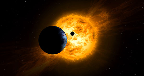
The largest source of error in GNSS positioning is the delay suffered by the signals as they pass through the ionosphere traveling from the satellites in orbit to receivers on or near Earth’s surface. That is because the ionosphere is full of free electrons stripped from atoms and molecules by ionization and this plasma refracts the signals, changing their speed. Normally, models compensate for this. However, geomagnetic storms wreak havoc on the free electrons in the ionosphere, making it difficult to accurately determine the signal delay.
That is why space weather matters for GNSS and for the myriad human activities that have come to depend on it.
So, here’s the good news. “On a scale of one to five, the geomagnetic storm on April 14 was a three,” Bill Murtagh told me. Murtagh is the Program Coordinator and Space Weather Forecaster at the Space Weather Prediction Center (SWPC) of the National Oceanic and Atmospheric Administration (NOAA). He was referring to the third rung of NOAA’s space weather scales, which were introduced to communicate to the public the current and future space weather conditions and their possible effects on people and systems.
NOAA has three space weather scales, one each for geomagnetic storms (G scale), solar radiation storms (S scale), and radio blackouts (R scale). The steps on the scales, ranging from “minor” to “extreme,” are analogous to those NOAA uses to classify hurricanes, tornadoes and earthquakes. They describe the environmental disturbances for each of these events and list their possible effects at each level.
Solar activity runs in 11-year cycles. A G5 event happens two or three times per cycle, and the last one was in October 2003, Murtagh told me. “I can only remember a handful of occasions over the past 20 years when ionospheric activity has significantly impacted users,” told me Gavin Schrock, PLS, manager of the Washington State Reference Network, a regional cooperative of GPS reference stations and data. According to Rick Hamilton, the GPS Information Analysis Team Lead at the U.S. Coast Guard Navigation Center, it “did not receive any reports of interference related to the geostorm” and “there was no significant increase in reports that we might attribute to geomagnetic activity.”
Now, the bad news. We are heading for a maximum in solar activity, expected to occur in 2025. The Sun is “already quite active,” Murtagh pointed out, and recently there has been an increase in the number of R1 and R2 storms. Solar coronal mass ejections (CMEs), which launch plasma and magnetic fields into space, also have become more frequent. When a CME hits the Earth, its collision with the Earth’s magnetic field causes a geomagnetic storm.
So, the GNSS constellations and the GNSS industry should be preparing now. Fortunately, improvements in GNSS software and receiver technology, plus corrections and integrity information and the much larger number of satellites, make us better prepared than we were during the last cycle. On the other hand, the stakes also are much larger, due to our ever-greater reliance on GNSS.
As a sailor, I rely on NOAA nautical charts and marine weather forecasts. GNSS users can thank NOAA for its space weather forecasts.
The United Kingdom’s National Timing Centre will conduct a two-phase series of funded studies and demonstrations focusing on “innovation in the dissemination and application of resilient time, frequency and synchronisation.”
The first round now being advertised is for feasibility studies of projects costing between £50,000 and £250,000. Total funding for the round is £2M. A briefing for interested parties will be held on April 20.
The second round and remaining funding will be devoted to technology demonstrations.
The UK’s National Timing Centre was established in response to several national studies and concerns about the vulnerability of space-based timing services.
Severe solar storms, called coronal mass ejections, were listed on the UK National Risk Register in 2012. While rare, these events can damage assets in space and on the ground.
Next month marks the 100th anniversary of the New York Railroad Storm. It was so powerful, telegraph offices were set on fire in the U.S. and Europe, fuses were blown, and equipment damaged. Even underwater telegraph cable traffic was affected.
Experts say if such a storm were to strike the Earth today, it would likely damage GPS and other GNSS satellites. At a minimum, it would charge the atmosphere and prevent signals from getting through for days.
Projects that will be considered for the UK competition must be technologies and application areas providing trust, assurance, security and resilience for time distribution.
While supported by Innovate UK, the National Physical Laboratory (NPL), which operates the virtual National Timing Centre, appears to be the primary agent for execution. NPL will offer applicants who are selected to participate in the feasibility study phase free technical consultation up to 12 hours, and free access to highly precise and accurate time signals from four NPL locations in the southeast of England.
Since its inception, the National Timing Centre seems to have concentrated on establishing distributed suites of atomic clocks, probably linked by fiber, as a first step to improving the nation’s timing resilience.
Industry observers have opined that future efforts are likely to focus on wireless distribution.
“Wireless requires less infrastructure and has no user limit,” said one. “It only makes sense they would go there once they feel they have a solid clock foundation.”
The competition is open to UK entities. Applications will be accepted April 19-June 9, with accepted participants notified on July 30.
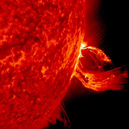
A solar flare in 2015. (Photo: Photo: Solar Dynamics Observatory, NASA)
You wake up and turn on the TV. Your usual shows aren’t airing. You flip on the radio and learn that the Paris and Tokyo stock markets have closed. Back on TV, CNN is trying to use Skype in an attempt to cover what’s happening around the world following a solar superstorm.
In a U.S. bunker, the military has lost contact with armed drones flying over hostile areas in the Middle East. Loss of global communication satellites makes it difficult to send commands and surveillance data to soldiers, ships and aircraft, rendering them vulnerable to attack.
Throughout the day, more challenges arise. First responders don’t have access to their location systems. Delays in ground and air traffic begin to develop. Systems that depend on GPS time stamps — ATMs, power grids, computer-data and cell-phone networks — begin to fail, and the cloud becomes unstable. The internet soon collapses.
These events take place just a few hours into “A Day Without Satellites” as presented by Pål Brekke, solar physicist and senior advisor at the Norwegian Space Agency. Brekke spoke at the plenary session of ION GNSS+ on Sept. 17 in Miami.
Brekke reviewed the Carrington Event of September 1859, the first documented solar superstorm. In that event, a solar coronal mass ejection (CME) hit Earth’s magnetosphere, and its effects were observed and recorded by British astronomers. The storm wrought havoc with telegraph systems.
Today, a solar storm of this magnitude would cause widespread disruptions, blackouts and damage from extended outages of the power grid, communications networks, and of course, GNSS. The solar storm of 2012 was probably as big, but we were lucky — Earth wasn’t in the ejection path.
Without more data, it’s difficult to predict how often such superstorms take place, but it’s a sure bet that the scenario Brekke presented will happen eventually. To prepare, agencies around the world are studying and planning for the phenomenon, including the United Nations Office for Outer Space Affairs (COPUOS), the World Meteorological Organization (WMO) and the International Civil Aviation Organization (ICAO). Space and emergency agencies in the U.S, European countries and other countries are also developing plans.
Good to hear in the face of a threat that would undoubtedly affect us all.
A lot of talk is being made about UAVs these days and how this technology is going to revolutionize many industries, with surveying being one of the biggest users.
I won’t deny the impact this new tool is going to have on our profession (as written in my last column). But I don’t think it will compare to the use of GNSS technology and how it modernized measuring methods for the surveyor.
I’m often asked by young surveyors what I think is the biggest improvement experienced by the surveying profession. Ironically, I asked that same question to my teachers when I was a new survey technician. My mentors will talk of the electronic distance meter, the theodolite or the total station. (Some old timers even told me the best improvement was the gammon reel for their plumb bob or the reel for a steel “chain”!)
While these were good advancements, for me the biggest improvement was the introduction of GPS into surveying, followed by the advancement to real-time network capability. Now, coupled with modern communication methods of radio or cellular transmission to permanent base stations, the GNSS rover has become one of the most valuable tools in the surveyor’s toolbox.
To understand the importance of GNSS technology and its use by the surveying community, first take a look at the history of the profession and method/devices used for measuring. Land surveyors have been measuring boundaries of parcels for centuries, dating back to Egyptian times and workers known as “rope stretchers.” Their use of rope with knots tied at specific intervals was the measuring stick of the time period.
As centuries passed and measuring units were developed, surveyors used these dimensional tools for measuring and describing land parcels. By the time the early settlers of America began traveling westward, surveyors were using a 66-foot-long Gunter’s chain made with 100 links, each almost eight inches long. Over time the links would stretch until the surveyor’s measurements were not accurate for land surveys.
By the early 1900s, tapes made from low-expansion steel became more widely used and much more accurate for surveying. The early 1960s brought new technology with measurement systems using laser light beams with the ability to travel several miles with sufficient accuracy.
A total station.
The electronic distance meter (EDM) allowed the surveyor to cover longer distances in much less time than the conventional method of the steel tape, leading to more productive field time. This technology was further refined to be installed inside of traditional theodolites to create the modern total station instrument — still used today for basic measuring of angles and distance. Almost all surveying projects can be completed using a total station, but the invention of a remotely available measuring device would be a welcome tool in the surveyor’s toolbox.
Enter the 1980s and the adaptation of the military’s satellite measuring system for civilian use. While early users and developers needed a Ph.D. in mathematics to configure its use, GPS measurement revolutionized long-distance measurement for the surveying profession. Static GPS measurement took many hours of data collection and even longer processing time, but with terrific results and with tremendous accuracy.
Further refinements with hardware and software configurations brought more affordable and user-friendly systems that gave surveying community another resource for accurate measurement. While the use of real-time kinematicc (RTK) expanded greatly in the late 1990s and 2000s, the big difference in the past 10+ years has been the introduction of real-time networks and permanent base stations. This advancement helps by eliminating the need for a base receiver and radio with an amplified repeater, and thus another employee guarding the idle base station equipment.
Depending on the surveyor’s location, real-time networks are readily available by paid subscription or through publicly funded transportation department. These systems are very reliable and don’t require a six-figure investment in equipment.
All survey data-collection methods, no matter the measuring procedure used and positional accuracy required for the project, needs to follow a strict quality-control procedure for verification of its content and position. The old adage “Measure twice, cut once” works well here, too, so let’s discuss what is involved with good measuring procedures.
Measuring procedures
Prior to any field measurements are taken, it is good practice to verify satellite availability during your planned measuring period. The U.S. GPS currently consists of 31 active and healthy units orbiting the planet and crisscrossing the sky 24/7. The geometry created by radio signals received from these satellites constantly vary in size and strength. By using mission-planning software, the user can accurately predict the best times of the day to collect positional locations with the highest accuracy and repeatability. Low numbers of satellites or strength of constellational geometry can lead to inaccurate locations and incorrect measurements between points.
The introduction and allowance of other satellite systems into our data collection system (GLONASS, Galileo, BeiDou, IRNSS) will enhance the availability and strength of constellation geometry throughout the data-collection process.
Another potential problem for GNSS data collection is solar storms, sunspots and other radio interruptions. Most manufacturers will notify the user of major atmospheric radiation events, but check the NOAA Space Weather Prediction Center (SWPC) website for updates on potential events. The key here is to plan your field collection prior to execution, in order to reduce errors in measurement or even interruptions to completing the work in a timely manner.
Survey results are only as good as the measurements, and following strict guidelines is very important. When using survey-grade GNSS equipment in a real-time function, many items need to be monitored while collecting data to ensure good quality positions. Here are items as listed by the National Geodetic Survey (NGS) in the “User Guidelines for Single Base Real-Time GNSS Positioning” manual on the NGS website:
Accuracy versus precision
Accuracy is how your collected data compares to the defined standard.
Precision is how often the solution is repeated.
Achieving both provides necessary confidence in field measurements.
Redundancy
The ability to collect similar measurements at different times, satellite constellation geometry and atmospheric conditions.
Multipath
Minimizing opportunities for measurement to be affected by reflected or misdirected signals.
Position dilution of precision (PDOP)
Higher readings usually achieved when measuring during periods of weak satellite constellation geometry.
Root-mean-square (RMS)
Statistical measurement of precision notifying the user of the positional quality of the measurement based upon quality of satellite signals.
Site localizations/calibrations
Basing the strength of survey network on the location of the base station and the accuracy of the monument it is located upon.
Typically used when real-time network connectivity is not achievable.
Latency
The delay of the received satellite signal data and correction information at the base, sent to the rover for computing correction values.
Signal-to-noise ratio (S/N)
Ratio in which burdening noise is measured versus the actual signal from the satellite.
Float and fixed solutions
Floating solutions occur when precision for survey-grade measurements is not met due to noise, lack of satellites, weak satellite geometry and latency.
Elevation mask
This setting is a filter to eliminate signals from satellites below the user-defined angle, thus eliminating opportunities for weak constellation geometry and noise interference.
Geoid model
Correction model used to improve vertical measurement with GNSS data collection by incorporating previously determined elevations across a wide area.
While all of these components are necessary for quality data collection, one of the most critical steps is horizontal and vertical verification on published or previously established control points or monuments. By checking into a known point before every data-collection session, you can eliminate errors in rod/antenna height and/or coordinate system setup. Checking a known point can also help determine if the correction signal is providing accurate information, either from the RTK base station or as part of a subscription service via cellphone or radio. It will also help discover poor PDOP or RMS due to weak satellite configurations. Also, if the rover unit takes longer than usual to initialize, a potential data-collection issue may occur to bad conditions.
The biggest complaint I get (and see) is field crews not checking the accuracy of the GNSS unit during the course of a survey. Hopping out of the vehicle, firing up the data collector, and taking a measurement multiple times without redundant measurements or verifying existing control points/monuments is a recipe for disaster.
Here are my keys to successful data collection with GNSS technology:
Keep the equipment is good working order: batteries charged, receivers and collectors in travel cases when not in use, poles kept in safe places and regularly checked for plumb.
Utilize a checklist for project startup.
a. Horizontal coordinate system to be used.
b. Vertical datum to be used.
c. List of multiple published or previously established control points for datum verification.
Once receiver has a fixed solution, verify horizontal and vertical position on known point.
Minimize loss of fixed solution times, recheck when establishing new fixed positions.
If possible, recheck main control points at various time throughout the day to establish redundancy.
Reverify at the end of the session and at the end of the day.
While GNSS has greatly decreased field time for covering large areas quickly, it must still be used correctly in order to provide accurate positional locations. The accuracy of these positions are what the measurements of the surveyor relies upon, and they must meet a high standard of confidence. Our profession prides itself on being called upon as the “expert measurer,” so our methods of measurement must be up to those standards.
While it took a little time to get the cost-effectiveness, reliability and user friendliness to a level of affordability for the surveyor, GNSS has become one of the best tools in our toolboxes. GNSS has revolutionized modern surveying, and I, for one, appreciate its ability to help me offer my services as an expert measurer.