Tag: Sony A7R2 camera

  • Atmos appoints Topcon as official distributor in US

    Atmos appoints Topcon as official distributor in US


    Image: Atmos
    Image: Atmos

    Atmos — a Dutch UAV manufacturer that develops vertical take-off and landing (VTOL) fixed-wing UAVs for mapping and surveying applications — expanded its global reseller network by signing an agreement with Topcon Solutions. Topcon will be responsible for the distribution of Marlyn Cobalt UAVs in the United States and will provide assistance and maintenance services to local UAV operators.

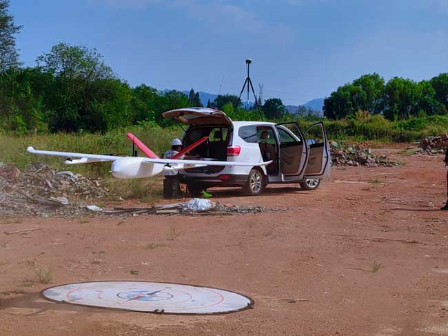
    The Marlyn Cobalt is a VTOL fixed-wing mapping UAV developed by Atmos and enables users to collect accurate geospatial information and turn it into actionable insights.

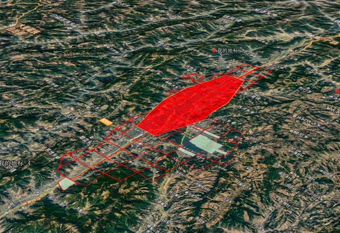
    Atmos has integrated the Sony a7R mark III and IV cameras into the Marlyn Cobalt to increase the coverage and accuracy achieved in a single flight for surveyors. When combined with Zeiss’ 35 mm and 21 mm lenses, UAV surveyors can achieve ground sample distance levels of less than 1 cm. The integration of the two cameras enables Marlyn Cobalt users to map an area of 210 ha with centimeter-level accuracy in a single flight.

  • Atmos enhances UAV with Sony cameras

    Atmos enhances UAV with Sony cameras

    Image: Atmos
    Image: Atmos


    Atmos has integrated the Sony a7R mark III and IV camera into its vertical take-off and landing (VTOL) fixed-wing UAV, the Marlyn CobaltThis will increase coverage and accuracy achieved in a single flight for surveyors.

    Both cameras have an ISO of 32,000, which is expandable to 102,400, and camera sensors with high megapixel count — 42,4 MP for the a7R III and 61 MP for the a7R IV. When combined with Zeiss’ 35 mm and 21 mm lenses, it enables UAV surveyors to achieve ground sample distance levels below one 1 cm.

    The integration of the two cameras enables Marlyn Cobalt users to map an area of 210 hectares with centimeter-level accuracy in a single flight.

  • VTOL UAV tackles difficult Sichuan survey

    VTOL UAV tackles difficult Sichuan survey

    The P330 takes off. (Photo: CHC Navigation)
    The P330 takes off. (Photo: CHC Navigation)

    The CHCNAV P330 vertical takeoff and landing (VTOL) UAV has been deployed to complete orthophoto acquisition with a resolution of 15–20 centimeters of the city of Xichang in the Sichuan Province, China. The project involved a series of technical and operating challenges: several no-fly zones, a 700-meter flight ceiling by airspace control, tricky winds, and a total area of 900 square kilometers — all within a tight schedule.

    The project involved 15 people, a fleet of four P330s and the set up of 200 ground control points.

    The hybrid P330 was selected for its ability to combine the advantages of a fixed-wing UAV with extended flight time with a rotor-based VTOL UAV, which enables aerial survey missions on complex terrain.

    Project area. (Photo: CHC Navigation)
    Project area. (Photo: CHC Navigation)

    Each P330s was fitted with a Sony A7R2 camera and high-accuracy GNSS positioning system. Because of its innovative design, the P330 can be assembled in less than five minutes without tools, saving the survey crew considerable time. Plus, basic operation training was completed in 2 hours.

    The P330 also has one-click take-off and landing, support for breakpoint flight resuming after temporary return to base, and self-diagnostic of all sensors before take off. It has dual-rotor and parachute protection in case of emergency landing.

    Other features include take-off and landing positioning accuracy within 20 centimeters and automatic return to base in case of a data communication failure. It offers survey-grade PPK accuracy.

    The P330’s battery life lasts up to 2.5 hours. It will operate safely under Class 5 wind conditions at an altitude up to 4,000 meters, providing stable attitude under bad weather conditions. It also meets imaging constraints under low-light conditions.