Raytheon UK, part of RTX’s Raytheon business, has been awarded a contract to provide orbital analysts in support of the UK’s Space Domain Awareness mission.
Under the contract, the UK Space Agency will gain access to Raytheon UK’s NORSSTrack software, which enhances orbital analysis and operational responsiveness by mapping and tracking satellites, monitoring potential collisions and debris, assessing re-entries and providing critical data for decision-making.
The analysts will be based at a National Space Operations Centre facility at Royal Air Force Base High Wycombe.
As highlighted in the UK’s Strategic Defence Review, space domain awareness is central to protecting critical space assets and strengthening resilience across government, defense and industry. It is considered a vital national capability, ensuring the UK can operate safely, securely and confidently in an increasingly contested space environment.
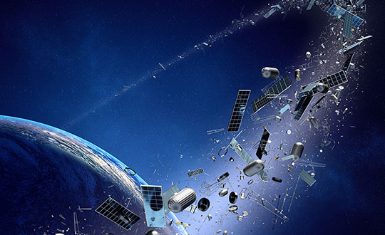
The rapid growth of satellite constellations in low-Earth orbit (LEO), the risk of orbital collisions is rising at an unprecedented rate. The increasing amount of space debris — ranging from active satellites to defunct assets and debris — poses serious challenges for operators striving to maintain the safety and sustainability of their missions. As daily data volumes grow and conjunction warnings become more frequent, the space community faces pressure to adopt more advanced and reliable collision avoidance solutions.
In response to these growing challenges, the European Space Agency (ESA) has awarded GMV a research and development contract under the ARTES Core Competitiveness program, aimed at improving collision avoidance services for large telecommunications constellations. The initiative will focus on developing advanced capabilities for FOCUSOC NXTGEN, a platform designed to deliver faster and more accurate collision risk assessments by using diverse data sources and enhanced response strategies.
As part of the project, a conjunction assessment center will be established in the United Kingdom to expand support for satellite operators both domestically and internationally. The new system architecture aims to handle higher volumes of data and provide scalable performance to match the needs of next-generation constellations, potentially exceeding 1,000 satellites per constellation.
FOCUSOC NXTGEN incorporates several features, including a dedicated database for trend analysis, a maneuver testing environment grounded in flight dynamics, API integration for efficient operations, and a redundant infrastructure to ensure continuous service availability. The system seeks to filter out false positives from daily orbital data, identify genuine threats more accurately, and deliver timely recommendations to operators for effective maneuver planning.
The service is set for launch in summer 2026 in coordination with industry partners. ESA officials note that enhancing orbital collision avoidance technologies will be crucial to maintaining safe and sustainable operations as satellite numbers continue to rise.
ESA’s ARTES Core Competitiveness program provides funding and expertise to strengthen the satellite communications sector across Europe and Canada. The program supports both technology development and efforts to bring innovative products and services to market.
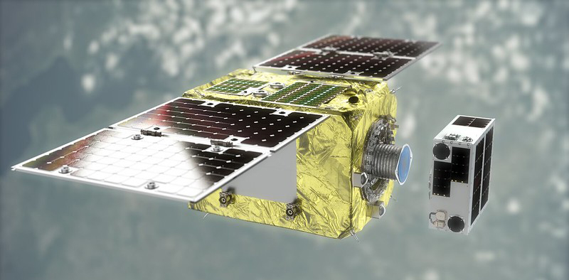
Launched in March, the ELSA-d satellite will demonstrate space-debris removal this summer. (Image: Astroscale)
RUAG Space has provided its GNSS-equipped computer to command Astroscale UK‘s ELSA-M Servicer, a spacecraft designed to remove space debris.
Space debris is a growing concern for the space industry. End-of-life services by Astroscale (ELSA) — a spacecraft decommissioning service for satellite operators — will progress to a commercialization phase this year with the ELSA-M. The M stands for multi-client servicer.
The Astroscale ELSA-M spacecraft is designed to de-orbit multiple retired satellites in low Earth orbit, which will then burn up on atmospheric re-entry.
“The ELSA-M servicer will be optimized to remove multiple retired satellites from low-Earth orbit in a single mission,” said John Auburn, managing director of Astroscale UK and group chief commercial officer. The ELSA-M servicer is specifically designed for servicing constellation satellites, such as those launched by GNSS authorities or by the global satellite communications network OneWeb.
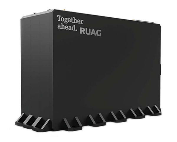
The computer from RUAG Space will include a GNSS receiver and interface unit. Based on RUAG Space’s constellation On Board Computer (cOBC), the computer controls the ELSA-M spacecraft, enabling repeated multi-debris removal maneuvers and management of equipment, reaction wheels and magnetometers linked to it. The cOBC is designed to be a flexible off-the-shelf computer with high integration and short lead time, enabling high-volume manufacturing.
The computer system developed in partnership with RUAG Space — with software from Astroscale and hardware from RUAG Space — will support the rendezvous between Astroscale’s servicer spacecraft and the client spacecraft, a retired or defunct satellite.
The GNSS receiver in the RUAG Space Computer is entirely from RUAG Space, including the NavRIX Integral antenna, which is integrated into the computer. The single-frequency GNSS receiver is capable of processing GPS and Galileo signals and offers several real-time positioning performance options ranging from 20-m 3D rms (root mean square) to better than 1-m 3D rms.
Photo: RUAG Space
Specs of the cOBC’s GNSS receiver
Tracks GPS L1 C/A or Galileo L1B / L1C signals and provides position, velocity and time
Accuracy down to a maximum error of 3.5 m RMS 3D with use of dynamic filtering
19% of tracked space objects threaten GPS and other GNSS satellites. While there are many fewer objects in MEO than in LEO, the risk in the former is arguably greater because GPS is so critical to almost all of our technology.
The Risk
GNSS satellites, especially GPS satellites, are critical to the well-being and smooth functioning of economies and national security. This is especially true in Europe and the United States, which do not have complementary terrestrial systems able to provide vital positioning, navigation and timing (PNT) services when signals from space are not available.
While the probability of debris damage to GNSS in medium Earth orbit (MEO) is much less than for satellites in low Earth orbit (LEO), the consequences of such an event would be much, much higher. The loss of one satellite would be a concern; that of multiple satellites, a major problem. The unthinkable chaos, national security damage, and severe economic impacts to the $21 trillion U.S. GDP make the risk unacceptable.
For those who think we need not worry about the low probability of collisions at MEO, the Galileo collision avoidance maneuver in March 2021 should be a wakeup call. The problem is here. We need to act now.
Background
Much like a nuclear fission reaction, the problem of space debris starts small then grows exponentially, as each collision creates more pieces that, in turn, can collide with other objects.
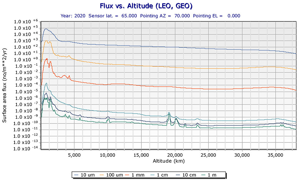
The MEO debris environment is 100 times less dense than the LEO. The spatial density of orbital debris in LEO (up to 2,000 km), shown in Figure 1, suggests that LEO is the likely location where a runaway chain reaction will initiate. This could easily result in a region of space so dangerous that it would effectively deny access to MEO, where the GPS constellation resides.
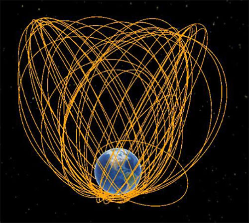
While the debris situation at MEO is much better, there are still 4,021 tracked debris objects that could impact GPS and other GNSS satellites. Because future orbital debris collisions in LEO will be responsible for more debris in MEO, the situation is guaranteed to get worse. The dead and debris objects in highly elliptical, or Molniya, orbits, shown in Figure 2, could be responsible for such collisions pushing LEO debris into MEO.
Contributions to the general MEO debris population come from launch systems and other factors. Early GPS satellites (Block II/IIA/IIR) used internal orbital-insertion motors to avoid leaving uncontrolled stages in the operational orbit range when moving from transfer orbit to MEO. For survivability reasons, they were also deployed with sufficient fuel to make several major orbital moves. Unfortunately, later versions used separate orbital-insertion stages, which were left drifting in the orbital neighborhood and carried less fuel, resulting in fewer possible maneuvers to avoid collisions.
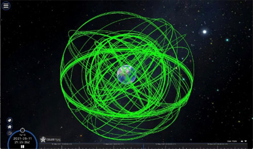
Using the CelesTrak visualization interface to extract space situational awareness data captured by the Combined Force Space Component Command’s 18th Space Control Squadron (18 SPCS) reveals a much more dire image of MEO. Of the 21,266 total tracked objects in Earth’s orbit, 157 are active GNSS satellites, as shown in Figure 3.
Figure 3. Active GNSS satellites. (Image: Celestrak)
However, a total of 4,021 objects reside or pass through MEO, which are either active (331), dead (668), debris (1,761), rocket bodies (1,100) or unknown (161) objects, as shown in this video.
These 4,021 objects represent 19% of the total number of tracked objects from the 18 SPCS space catalog. While the total 21,266 tracked objects is a far cry from the 100 million objects NASA’s Orbital Debris Program Office represents, one can imagine that a significant portion of untracked debris objects, under 10 cm in size, reside or pass through MEO as well. This is significant, according to NASA, which says that objects with a diameter of 1 cm to 10 cm are the most dangerous due to the lack of tracking data, which essentially makes them invisible.
False Sense of Security
The growing orbital-debris concern is a threat too big to ignore. Unfortunately, to date attempts to manage space traffic have amounted to passive measures, such as establishing policy, characterizing the environment, and creating orbital protection guidelines. Even the highly touted, $6 billion U.S. “Space Fence” is a passive measure that contributes nothing active to solve the problem. Not at all a “fence,” it is merely a way to detect the larger and more dangerous debris.
These efforts may, in all actuality, be counterproductive if they instill a false sense of security in the public and government leaders that the problem is being adequately addressed.
A Proactive Solution
Since 1978, the orbital debris population has been touted as our biggest space problem. It is important to do as much as we can with policies and procedures to keep the problem from getting worse faster. However, even if we humans were to completely resist our seemingly natural impulse to pollute everywhere we go, collisions with existing debris would continue to increase the number of dangerous objects in orbit.
Active debris removal (ADR) is the only solution. The sooner it begins, the safer we will all be. Like the oceans and cyberspace, orbital space suffers from the tragedy of the commons. Everyone wants to use it, but no one owns it. No one is responsible for ensuring it is cared for and maintained. As a result, user behavior is difficult to control, and the environment often suffers. Government action, presumably supporting the best interests of all users, is the default answer.
The proposed Space Debris Act of 2021 is a great start. It paves the way for persistent funding and creates an industry responsible for safeguarding humanity’s orbital infrastructure. It would introduce tax credits to incentivize non-government funding contributions and reduce the price of debris removal, so that satellite operators and the emerging space tourism industry can afford to clean up space where they plan to operate.
The bill is currently being presented by OrbitGuardians to members of Congress for sponsorship. Organizations wishing to support these efforts should contact Ken Eppens at OrbitGuardians at [email protected].
GPS/GNSS and other critical space assets are at an unacceptable level of risk from debris. It is time to safeguard orbital infrastructure to protect the interests of the United States and humanity’s future in space.
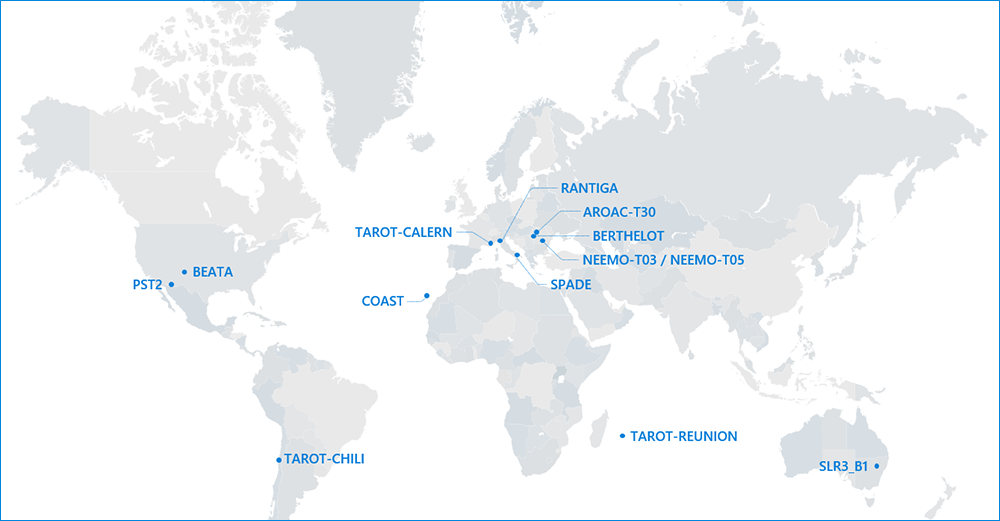
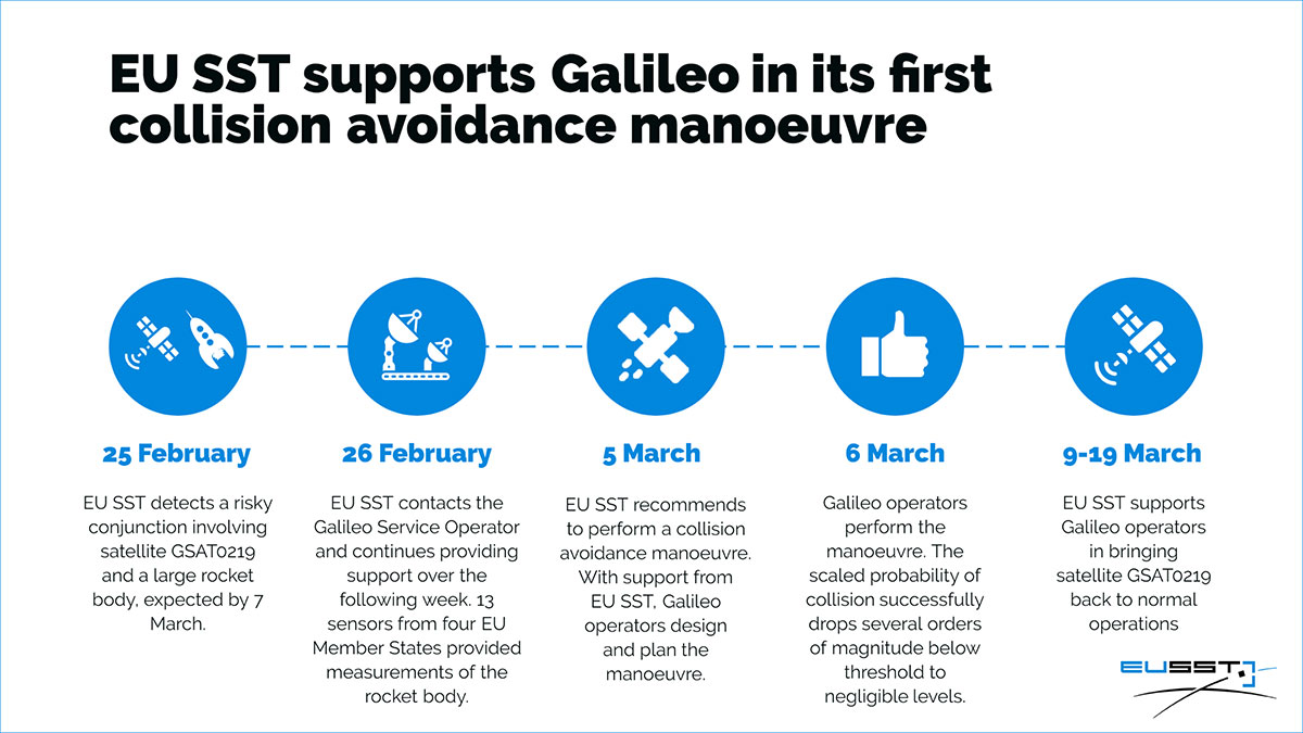
On Feb. 25, the Galileo Service Operator (GSOp) received from EUSST a collision risk alert between GSAT0219 and an inert Ariane 4 upper stage launched in 1989. Following the warning, GSOp closely monitored the risk, in close cooperation with EUSST that was refining its predictions.
In line with operational procedures, GSOp informed the GSA of the situation. In a joint effort with the European Commission, the GSA managed the follow-up activities. The effective cooperation between EUSST and the GSA/GSOp was instrumental to the success of the mission and bears testimony to the need for efficient cooperation between different organizations in the space sector.
Maneuver Authorized
Following refinement of the Ariane 4 orbit, the risk of collision was still unacceptably high. After assessment of different strategies and associated risks on the service provision, the GSA authorized the execution of an avoidance maneuver.
The satellite was taken out of service on March 5, and users were informed via NAGU #2021009. The collision avoidance maneuver was performed shortly thereafter, by temporarily relocating the satellite away from its nominal position.
Satellite GSAT0219 was reintroduced into service on March 19 after the completion of two station-keeping maneuvers to reposition it into its nominal operational orbit. A second NAGU advised users that the satellite was once again available.
Map of sensors contributing to the event. (Image: EUSST)