Tag: SPH Engineering

  • Seen & Heard: S’mores, penguins and sinkholes

    Seen & Heard: S’mores, penguins and sinkholes

    “Seen & Heard” is a monthly feature of GPS World magazine, traveling the world to capture interesting and unusual news stories involving the GNSS/PNT industry.


    Screenshot: Missing Children Society of Canada
    Screenshot: Missing Children Society of Canada

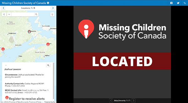
    Network Tool Helps Find Children

    Microsoft and Esri Canada have developed the Child Search Network to enhance Canada’s national strategy for missing children. The network provides police services with a quick way to share information and collaborate with others, as well as with the general public, to find missing children faster and reunite them with their families. Police can put out information on a missing child via a website and smart-phone app. Members of the public can then offer tips by downloading the MCSC rescue app to register to receive alerts and share any information they may have regarding a missing child or youth. The tool helps meet the “gap of response” for high-risk cases of missing children that do not meet the strict criteria for the AMBER Alert.


    Photo: Kroger
    Photo: Kroger

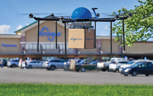
    S’more Delivery Options

    Grocery chain Kroger and Drone Express have launched a pilot delivery program in Centerville, Ohio, filling orders in as quickly as 15 minutes. Orders are sent to the customer’s smartphone location, which could include sending picnic supplies to a park or sunscreen to a beach. As part of the project, Kroger is selling bundled products within the payload weight — about five pounds, such as a S’mores bundle with graham crackers, marshmallows and chocolate.


    Photo: Photodynamic/iStock/Getty Images Plus/Getty Images
    Photo: Photodynamic/iStock/Getty Images Plus/Getty Images

    Multiple UAVs Shorten Penguin Survey

    One of the largest Adélie penguin colonies in the world was surveyed with multiple UAVs in March. Survey time was reduced from three days (with a single drone manually piloted) to under three hours. The work was led by a team of experts from Stanford University, Point Blue Conservation Science and Conservation Metrics. UgCS software by SPH Engineering was used to develop a system to autonomously survey the penguins. Thousands of high-resolution images were taken on each survey. An artificial intelligence model by Conservation Metrics is under development that will automatically identify and count adult penguins and their chicks. Using UgCS with a Stanford-provided planning algorithm, the survey team efficiently photographed more than 300,000 breeding pairs at Cape Crozier, Antarctica. The surveys will contribute to large-scale assessments of penguin populations and breeding success, key metrics for monitoring the health of the Antarctic marine ecosystem.


    Photo: Bryngelzon/E+/Getty Images
    Photo: Bryngelzon/E+/Getty Images

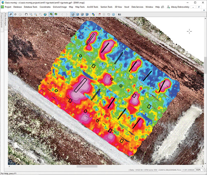
    Seeing Sinkholes with Satellites

    Synspective Inc. is offering a sinkhole-detection prediction tool using satellite imagery analysis. Part of the company’s Land Displacement Monitoring service, an algorithm uses data science and machine learning to detect spatial and temporal variations. It can identify areas where sinkholes are likely to occur, areas where cave-ins have occurred, and areas where cave-ins are in progress. The input data is automatically updated, and the platform handles the processing and analysis of the complex satellite imagery.

  • SPH Engineering’s UgCS software now supports Velos UAV helicopter

    SPH Engineering’s UgCS software now supports Velos UAV helicopter

    The Velos UAV helicopter has passed field tests to become the first single-rotor helicopter supported by UgCS software, according to UgCS maker SPH Engineering. UgCS now enables Velos helicopter professionals to use Velos for photogrammetry and lidar drone surveying missions.

    UgCS is now able to support the twin-engine telemetry providing input for a UAV. Its newly created Telemetry Viewer can handle extensive telemetry from such complex drones. This allows for optimal flying of the Velos helicopter with a fully redundant twin-motor design and double key components.

    UgCS allows for the control and monitoring of one or multiple Velos helicopters on a single mission in both single and multi-operator modes.

    Photo: Velos UAV
    Photo: Velos UAV

    The field tests were initiated and conducted by GeoInspect, the first company to use c with its Velos helicopter. The new solution allows professionals to fine-tune projects, resulting in maximum performance and very high usability. One of the projects was a fully autonomous test flight with UgCS.

    “GeoInspect has been performing lidar surveys successfully with UgCS for many years,” explained Bart Zondag, GeoInspect founder. “Having started with the M600 model, UgCS is now used to support single-rotor UAVs. We have already delivered a Velos V2 with UgCS to one of our customers to the EU Nordics to perform lidar forestry surveys.”

    Learn more about the solution by joining a free Zoom webinar on March 4, 2021.

  • SPH Engineering announces support for DJI M300

    Photo: UgCS
    Photo: UgCS

    SPH Engineering has released a UgCS update, adding support for the DJI M300 commercial drone. UgCS supports all flight planning patterns of the DJI M300, such as photogrammetry, corridor mapping and facade inspections.

    UgCS allows to manage the following route parameters: speed, altitude, heading, camera attitude, camera triggering modes (by time, and by distance), turn types (Stop & Turn or Adaptive Bank turn).

    “It also supports video recording in full-motion video format,” said Alexei Yankelevich, head of software development at SPH Engineering. “The drone is smart and safe, equipped with various cameras and sensors.

    UgCS support for DJI M300 cameras covers:

    • displaying videos from both FPV and main camera (H20/H20T) on the UgCS for DJI screen;
    • switching between main camera lenses: wide, zoom, thermal (for H20T);
    • changing general settings of the active lens;
    • manual camera triggering in all modes (wide/zoom/thermal)
    • video recording

    ‘We have tested DJI M300 in various scenarios and can confirm that it can be used in extreme weather scenarios,” Yankelevich said, “including low temperatures while battery capacities are significantly improved.”

    The most awaited improvement is Waypoints 2.0 which allows users to create up to 65,535 waypoints and set multiple actions for one or more payloads. This improvement is crucial for UgCS as it allows the drone to fly long routes in terrain- following mode with UgCS.

  • SPH Engineering provides drone-integrated metal detection

    SPH Engineering provides drone-integrated metal detection

    Screenshot: UgSC
    Screenshot: UgSC

    SPH Engineering has launched a drone-integrated metal detection system with a Geonics EM61Lite metal detector, a new product of UgCS Industrial Solutions. The same performance and robustness available for users of the standard EM61-MK2 time domain metal detector are now available for airborne use.

    The new system is capable of detecting metallic (magnetic and non-magnetic) items in the first few meters under the surface, finding metallic objects in hard-to-reach or dangerous areas.

    Applications include unexploded ordnance (UXO) search, detection of underground infrastructure and archaeology. The integrated system has been extensively tested at SPH Engineering’s test range, and has shown excellent performance and repeatability for targets such as pipes (steel, stainless steel, reinforced concrete) and steel drums.

    The system uses an airborne (less heavy) modification of the Geonics EM61-MK2 ground metal detector. The EM61 Lite airborne variant integrates with the UgCS SkyHub onboard computer and ground control station.

    Features include automatic data logging in geotagged form and automatic terrain following with radar altimeter. The use of UgCS SkyHub enables the drone to fly in true terrain following (TTF) mode with the help of the radar altimeter and to log geotagged sensor data.

    An optional RTK/PPK GNSS receiver on the drone will geotag the data with centimeter-level precision.

  • Daewoo E&C partners with SPH Engineering for AI platform

    Logo: SPH Engineering

    SPH Engineering has partnered with Daewoo Engineering and Construction (E&C). Through the partnership, SPH will support Daewoo’s data management projects through its Atlas artificial intelligence (AI) platform, which enables aerial imagery storage, map creation, change tracking, object detection and territory segmentation.

    Photogrammetry data is expected to become one of the key components for storage and processing, SPH added.

    According to the companies, Atlas will enable Daewoo Engineering and Construction to set up an online archive of drone imagery and photogrammetry products, track changes and generate reports, automate object detection and measure the identified objects of interest. The platform also will increase data availability for participants of construction workflow.

    “Atlas can be definitely used in various fields, but it will be a groundbreaking platform, especially in the field of construction survey,” said Geunmok Song (Alex), digital construction team manager at Daewoo Engineering and Construction.

    “When we introduced Atlas back in spring, first of all we wanted to support our existing UgCS customers with an easy-to-use AI tool to store and process data collected with our software integrated to a UAV,” said Alexei Yankelevich, R&D director at SPH Engineering. “We are proud that Daewoo Engineering and Construction, the representative of Korea, has opted for our solution.”

  • SPH Engineering releases bathymetric drone solution

    Logo: SPH Engineering

    SPH Engineering has launched a product designed to conduct bathymetric surveys of inland and coastal water.

    The system — an unmanned aerial vehicle (UAV) integrated with an echo sounder — is time- and cost-efficient, the company said. It is suitable for mapping, measuring and inspecting tasks as well as environmental monitoring.

    The system allows field workers to collect data with high accuracy quickly. It is easily transported, quickly deployed and twice as cost-efficient as traditional methods.

    The UAV/echo sounder system can be operated in hard to reach locations, and unsafe or hazardous environments. Locations not reachable by foot or that are dangerous for a human (steep coasts, mining pits, contaminated waters, terrain obstacles, etc.) as well as waters of ponds, lakes, and canals can be reached by the drone.

    “Since autumn 2018 we have been getting bathymetry-related requests,” said Lexey Dobrovolskiy, CTO of SPH Engineering. “Analyzing about 150 inquiries, we have come to the conclusion that a drone-based solution could open a new business opportunity for drone service companies to do bathymetry surveys of coastal and inland water, especially those for industrial needs.

    “Compared with a standard approach using a boat or an unmanned surface vehicle, a drone could save a lot for its user,” Dobrovolskiy said. “An echo sounder itself could be integrated into a client’s drone with no need to purchase additional equipment. Moreover, it is small and easy to transport and operate. At the same time, such research method guarantees data accuracy and employee safety.”

  • SPH Engineering announces bathymetric drone solution

    SPH Engineering has launched a new product to make bathymetric surveys of inland and coastal water.

    The system — an unmanned aerial vehicle (UAV) integrated with an echo sounder — is time- and cost-efficient. It is suitable for mapping, measuring and inspecting tasks as well as environmental monitoring.

    The system allows field workers to collect data with high accuracy quickly. It is easily transported, quickly deployed and twice as cost-efficient as traditional methods.

    The UAV/echo sounder system can be operated in hard to reach locations, and unsafe or hazardous environments. Locations not reachable by foot or that are dangerous for a human (steep coasts, mining pits, contaminated waters, terrain obstacles, etc.) as well as waters of ponds, lakes, and canals can be reached by the drone.

    “Since autumn 2018 we have been getting bathymetry-related requests,” said Lexey Dobrovolskiy, CTO of SPH Engineering. “Analyzing about 150 inquiries, we have come to the conclusion that a drone-based solution could open a new business opportunity for drone service companies to do bathymetry surveys of coastal and inland water, especially those for industrial needs.

    “Compared with a standard approach using a boat or an unmanned surface vehicle, a drone could save a lot for its user,” Dobrovolskiy said. “An echo sounder itself could be integrated into a client’s drone with no need to purchase additional equipment. Moreover, it is small and easy to transport and operate. At the same time, such research method guarantees data accuracy and employee safety.”