In our 11th annual Simulator Buyers Guide, we feature simulator tools, devices and software from 11 prominent companies that aid GNSS receiver manufacturers in product design.
| SPIRENT FEDERAL SYSTEMS | OROLIA | OROLIA DEFENSE & SECURITY | LABSAT |
|---|
| CAST NAVIGATION | IFEN | TELEORBIT GMBH | WORK MICROWAVE |
|---|
| QASCOM | M3 SYSTEMS | JACKSON LABS TECHNOLOGIES | SYNTONY |
|---|
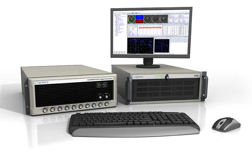
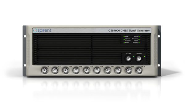
SPIRENT FEDERAL SYSTEMS
Alternative PNT, CRPA, M-code & Y-code, Non-GNSS Sensors & Anechoic Chamber Testing
New Alternative RF Navigation Simulator. Authorized users of Spirent’s alternative PNT simulation system can generate alternative RF navigation signals individually or concurrently with GNSS signals.
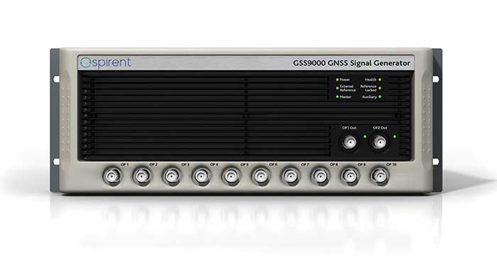
GSS9000. The GSS9000 Series multi-frequency, multi-GNSS RF constellation simulator is Spirent’s most comprehensive simulation solution. It can simulate signals from all GNSS and regional navigation systems and has an unrivaled update rate of 2 kHz (0.5 ms), enabling ultra-high-dynamic simulations with accuracy and fidelity. The GSS9000 supports M-code, Y-code, alternative PNT and non-GNSS sensors, and comes with built-in jamming, spoofing and flex power.
SimMNSA. Spirent Federal has the first fully approved MNSA M-code simulator. Authorized users of the GSS9000 series of simulators will be able to utilize the advanced capabilities of SimMNSA to create robust military GPS user equipment (MGUE) solutions.
CRPA Test System. The CRPA Test System is scalable, testing antennas from 4 to 16 elements and beyond. More than 1,000 independent GNSS, jamming and spoofing signals can be generated/simulated across a phase-calibrated precise wavefront.
SimINERTIAL. Supporting the leading embedded GPS/inertial systems (EGI) and inertial measurement units (IMU), SimINERTIAL enables the controllable generation of inertial sensor outputs, synchronous with simulated GNSS, to test integrated GPS/inertial systems in the lab.
Anechoic Chamber Testing. Spirent’s GSS9790 multi-output, multi-GNSS RF constellation wavefront simulator system can be used in both conducted (lab) and radiated (chamber) conditions.
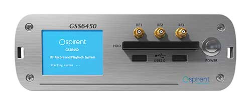
Mid-Range Solutions. Spirent offers solutions for every application and price point. The GSS7000 multi-constellation simulator provides an easy-to-use solution for GNSS testing that can grow with users’ requirements. The GSS6450 RF record-and-playback system enables replay of real-world GNSS tests in the lab.
[email protected]
spirentfederal.com
801-785-1448
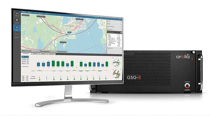
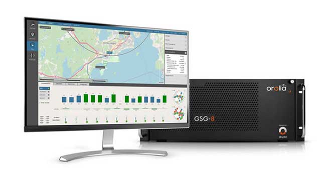
OROLIA
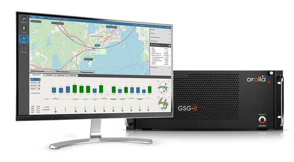
Essential to Advanced GNSS Simulator Solutions
Based on the Skydel GNSS Simulation Engine, Orolia’s advanced and essential GNSS simulators offer a wide breadth and depth of tools to test mission-critical positioning, navigation and timing (PNT) applications and scenarios.
Skydel Simulation Engine. The highly flexible, high-performance Skydel Simulation Engine transmits GNSS signals in real time to many kinds of software-defined radios. Skydel uses graphics processing units (GPUs) to compute the digital GNSS signal of all simulated satellites, easily scaling from simple to complex use cases. Skydel simulates civil signals from global and regional navigation satellite systems with a 1000-Hz update rate, many kinds of GNSS receiver trajectories with high dynamics, and advanced jamming and spoofing. The Skydel ecosystem also includes features such as open-source plug-ins and API, and the ability to create custom signals. The custom-signal feature allows users to experiment with new signals, such as navigation from low-Earth-orbit satellite systems.
GSG-8. A scalable software-powered turnkey simulation solution, GSG-8 is configurable to meet virtually any testing requirements. It can support multi-constellation, multi-frequency and hundreds of signals with a 1000-Hz iteration rate. This advanced hardware platform is suitable for space trajectories, custom PNT signals, hardware-in-the-loop, multi-antenna simulation, and more. Encrypted EU signals will be available soon.
Skydel CRPA Testing. With self-calibration, integrated advanced jamming and spoofing, and the ability to generate thousands of signals, Skydel CRPA test systems provide everything needed to test CRPA systems, with a focus on ease of use and the testing experience from the user point of view. Two flexible configurations, Skydel Anechoic and Skydel Wavefront, have been carefully designed to provide the advanced simulation features required for CRPA testing in a well-thought-out package. Both provide COTS hardware benefits: configuration flexibility and cost-effectiveness.
GSG-5 and GSG-6. Orolia’s essential simulation platform is a proven, cost-effective simulation solution. Combined with the freely available StudioView software, these simulators provide high-end capabilities in a standalone, portable system that allows operation via a front panel interface. GSG-5 and GSG-6 are available with support for multi-frequency and multi-constellation GNSS signal simulation, pre-built scenarios and test packages, and the features neded to integrate it into ATE systems.
[email protected]
www.orolia.com
Orolia defense & Security
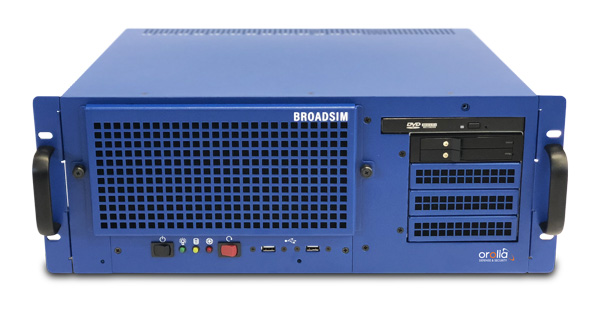
Advanced GNSS Simulation for Government & Defense
BroadSim
Powered by the Skydel Simulation Engine, BroadSim provides superior NAVWAR performance, sharing the same benefits and key features of its software-defined platform.
Key Applications
MNSA M-Code. BroadSim offers a fully flexible implementation of the Modernized NavStar Security Algorithm, giving you full control over scenario settings with the real encryption used on the M-code signal. Any aspect of your scenario can be changed, such as time, date, location, constellation, downlink data, signal configuration, and visible satellites. It is security-approved by SMC Production Corps and shipping as soon as today.
CRPA Testing. BroadSim leverages Skydel’s CRPA testing solution to up the ante for demanding NAVWAR scenarios. BroadSim Anechoic allows you to test an entire system as-is. Skydel auto- calibrates the system, maps the antennas, and is designed to streamline chamber setup and reduce hardware. Broadsim Wavefront tests the antenna electronics, prioritizing the ability to have dynamic trajectories and allowing you to model any scenario with an unlimited number of interferences. The system is scalable from 4 to 16 elements, is phase coherent, performs real-time automated phase calibration, and has built-in jamming and spoofing.
Advanced Jamming and Spoofing. With Advanced Jamming, users can add ground- and space-based emitters to scenarios, generate an unlimited number of jamming signals on 1 RF output, and simulate flight profiles where interference power levels at the UUT dynamically change depending on the scenario motion. With Advanced Spoofing, users can simulate multiple spoofers simultaneously. Each spoofer can generate any GNSS signal and has an independent trajectory and antenna pattern. Signal dynamics between each spoofer and receiver antenna are automatically determined so no time is wasted.
More Features. Inertial and alternative RF navigation, built-in Flex Power, real-time performance with ultra-low latency of 5ms, high dynamics, terrain modeling, and RMF STIG compliance.
[email protected]
www.oroliads.com
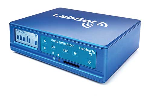
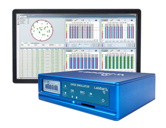
LABSAT
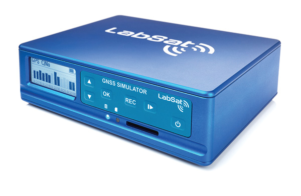
Test Anywhere with LabSat 3 Wideband and SatGen Simulation Software
LabSat 3 Wideband. The LabSat 3 Wideband is a compact yet powerful multi-constellation and multi-frequency GNSS testing solution. The easy-to-use, one-touch record-and-replay function provides an efficient way to test and develop GNSS-based technology without the cost and limitations of live-sky signals.
It is lightweight and portable, enabling easy collaboration with colleagues by sharing scenario files over the internet, and making it a suitable test partner for remote working. Additionally, the removeable solid-state drive (SSD) of up to 7 terabytes and a two-hour runtime provided by an internal battery is ready for field testing in any environment.
LabSat 3 Wideband can record and replay up to three different channels at 56-MHz bandwidth across all major constellations and signals, including:
- GPS: L1/L2/L5
- Galileo: E1/E1a/E5a/E5b/E6
- GLONASS: L1/L2/L3
- BeiDou: B1/B2/B3
- NavIC: L5/S-band
- QZSS: L1/L2/L5
- L-band correction services including SBAS
- 2x CAN and 4x digital input channels tightly synchronized with GNSS data
- future signal launches are also supported, including L2C, L5 and L1C
SatGen Simulation Software. SatGen software allows users to quickly create bespoke, accurate scenarios with their own time, location and trajectory that can be replayed via a LabSat GNSS simulator.
The latest version of SatGen can be used to create a single scenario containing all the upper and lower L-band signals for GPS, Galileo, GLONASS, BeiDou and NavIC.
[email protected]
www.labsat.co.uk
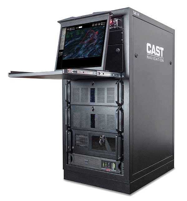
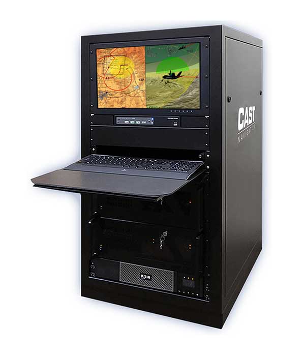
CAST NAVIGATION
Accurate, repeatable simulation solutions
When getting the job done right the first time — and every time — matters, CAST Navigation’s suite of simulator solutions delivers precision, accuracy and repeatability. From simple integration testing to complex mission simulations, CAST Navigation solutions scale to meet user requirements.
Powered by multi-frequency, multi-constellation GNSS and interference signal-generation technology, CAST Navigation simulators provide coherent, highly accurate and fully programmable signals. Advanced, configurable vehicle trajectory capabilities meet project requirements ranging from antenna testing to simulations of squadrons maneuvering in contested environments.
Intuitive Graphical Interface. A comprehensive and intuitive graphical interface unifies all simulator capabilities so users can configure complex simulation scenarios quickly. For example, CAST Navigation simulators can model many vehicle types with static and dynamic motion profiles: airborne, terrestrial, aquatic or space-based. Using configured scenario profiles or vehicle truth data, CAST Navigation simulators create high-dynamic, 6-DOF real-time trajectories.
High-Fidelity Simulations of Real-World Conditions. CAST Navigation solutions can reproduce terrain, sea-state and atmospheric effects to simulate missions with high fidelity. Jamming capabilities recreate natural, urban and hostile interference to produce precisely controlled waveforms with high output power and exceptionally low intermodulation noise.
Multi-Frequency, Multi-Constellation Simulations. The GPS/GNSS simulators generate accurate, programmable signals to each antenna element with up to 16 satellites in view from as many as four constellation types. GPS simulations can generate any positioning signal (C/A-code, P-code, Y-code, SAASM, M-code AES and M-code MNSA).
Modular, Scalable Solutions. Proprietary synchronization technology lets CAST Navigation configure customer solutions with multiple simulator capabilities — GPS/GNSS, inertial, jamming, and CRPA — to meet specific project needs. As those needs evolve, these solutions do not become obsolete. Rather than replace a functioning system, customers can rely on modular architecture to meet their new requirements.
[email protected]
www.castnav.com
978-858-0130
iFEN

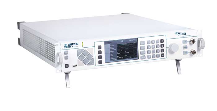
NCS NOVA GNSS Simulator
The NCS NOVA GNSS simulator is a high-end, powerful and easy-to-use satellite navigation testing and R&D device. It is fully capable of multi-constellation and multi-frequency simulations for a wide range of GNSS applications. It is one of the leading solutions on the market, providing multiple GNSS frequencies in one box.
Because of the modern and flexible software-defined radio (SDR) design of this simulator, testing requirements will be met with the minimum of equipment, facilitating logistics and reducing the cost of ownership. The innovative multi-constellation and multi-frequency simulation capability sets new standards in the field of GNSS simulation in terms of fidelity, performance, accuracy and reliability. Designed to deliver maximum flexibility, users are no longer faced with configuration limitations.
The NCS NOVA GNSS simulator is also able to coherently generate GNSS RF signals on two independent RF outputs simultaneously. The user may freely allocate GNSS signals and RF channels to each of the RF outputs. This feature allows simulation of GNSS signals at two antenna locations simultaneously (this could be two antennas on a vehicle, two separate vehicles maneuvering independently, or a static location plus a mobile unit).
A new key enhancement to the NCS NOVA GNSS simulator is comprehensive support of new Galileo OS signal message improvements on E1B. By enabling real-time simulation of the Galileo OS message improvements, the NCS NOVA expands a user’s Galileo signal capability.
In the future, the NCS NOVA also will fully support the new Galileo E1B OS Navigation Message Authentication (OS-NMA) and Galileo E6B High Accuracy Service (HAS) capabilities.
The NCS NOVA GNSS simulator is the first choice in signal simulation for a wide range of applications including space, aviation, automotive (including autonomous driving testing) and many others.
About IFEN. IFEN is a leading provider of GNSS navigation products and services. Its technology portfolio includes GNSS RF-signal simulators, GNSS software receivers, simulation and data processing tools. IFEN’s outstanding satellite navigation expertise is provided to customers for services including GNSS system studies, research and development of navigation and integrity algorithms, design and development of GNSS software and hardware, on up to engineering of turnkey facilities and systems.
[email protected]
www.ifen.com
+49-(0)8121-2238-10
TeleOrbit GmbH
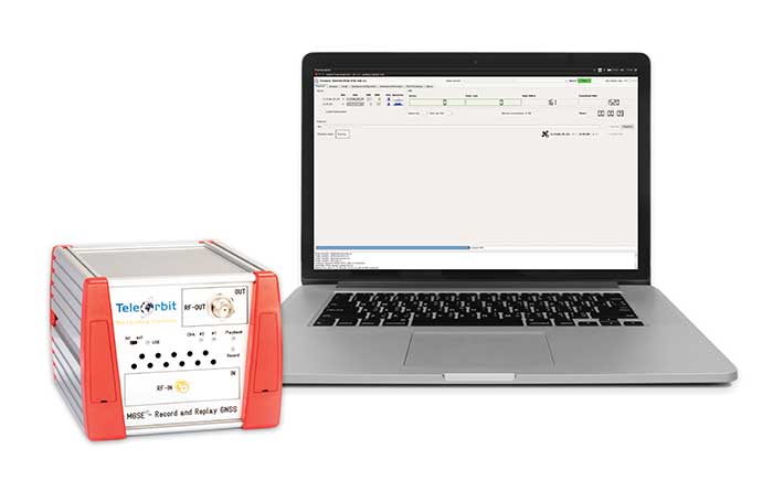
MGSE REC | MGSE REC-REP 2.0 | MGSE SIM-REP | GNSS DCP Antenna | GOOSE-OSNMA
The MGSE product family creates a versatile GNSS test and simulation environment that improves the development, qualification and certification process of GNSS receivers within development phases and for validation and certification in end-to-end tests.
MGSE enables mobile and stationary interference monitoring, for example, for protecting critical infrastructures. It can be used for interference mitigation if combined with TeleOrbit’s GNSSA-6E (six-element antenna array) or its GNSS DCP (dual circularly polarized)antenna.
With MGSE REC-REP 2.0 users can, among other tasks, record Galileo PRS signals in a real user environment and replay them for Galileo PRS receiver testing.
MGSE SIM-REP supports the development of software-defined radios/receivers or specialized algorithms by creating a simulation environment that provides the possibility and flexibility to use synthetically generated GNSS data and recorded real-world samples.
For jamming and spoofing test and evaluation, TeleOrbit offers a sophisticated solution based on the MGSE simulation, recording and replaying product family. For spoofing mitigation, the GOOSE-OSNMA receiver platform is available.
Technical Background
The multi-band RF front-end (MGSE REC) receives the GNSS RF signals in different frequency bands simultaneously to obtain digital IF data, which can be used for GNSS multi-system signal analysis and comparison. All GNSS L-band frequencies and the NavIC S-band are supported.
The MGSE Replay Unit includes a flexible multi-band RF replay device that streams simulated and recorded raw IF data to a digital baseband output or to an analog RF signal. Up to two independent RF channels and up to four GNSS signals (L1, E1, B1, G1) can be provided.
GOOSE is a powerful yet compact GNSS receiver lab and the rapid prototyping solution for leading-edge GNSS receiver development.
The GNSSA-DCP (dual circularly polarized antenna) receives RHCP and LHCP signals simultaneously (full L-band). It clearly detects signals which have been corrupted by diffraction and reflections.
Jürgen Seybold, CTO
[email protected]
teleorbit.eu/en/satnav/
WORK Microwave
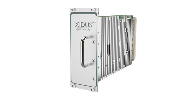
Xidus GNSS Simulator — Modular and flexible
WORK Microwave’s Xidus is well-known for meeting all requirements regarding multi-GNSS; for its multi-frequency and multi-RF signal generation; for its innovative Signal Extension and Enhancements (SEE) technology; for its advanced customization and configurability; and for world-class remote support with updates, training and even scenario execution.
Xidus Signal Module
Compact and powerful, the Xidus Signal Module provides new capabilities of signal generation. Users can perform rigorous and extensive testing of present and future positioning systems when conducting navigation research or developing products.
- Possible applications: pseudolite generation, massive multipath or navigation signal generation on various orbits.
- Extensive increase of supported channels: >250.
- Unlimited number of multipath channels with delay >3,000km.
- Interference signal generation on up to four independent frequencies.
- Acts as a software-defined radio (SDR) to replay signals.
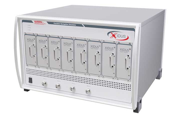
Xidus Hardware Series
Xidus-424 GNSS Simulator
- Up to 4 signal modules
- 2 RF outputs
- Wide dynamic power range
Xidus-648 GNSS Simulator
- Up to 8 signal modules
- 4 RF outputs
- 1,000 Hz update rate
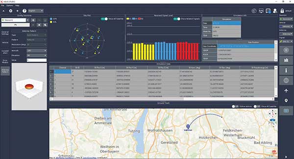
Xidus-Studio Client Software
Xidus-Studio provides a user-friendly graphical interface to configure any GNSS scenario. Its advanced and outstanding features include:
- multipath, antenna patterns, jamming/spoofing configuration.
- logging of simulation output on user-defined IP networks.
- concurrent user access to the hardware.
- visualization of shared scenarios on multiple desktop PCs.
[email protected]
www.work-microwave.com
+49-8024-6408-222
Qascom

QA707 cyber-security simulator
QA707 is the cutting-edge solution for global threat GNSS awareness and management. It is a GNSS simulator specifically designed to test cyber-attacks and authentication, and includes the simulation of GNSS interference, deception, jamming, spoofing and advanced cyber-threats such as data- and code-level attacks.
The high flexibility in the creation of the scenarios and the definition of the type of attacker allow cyber-threat and vulnerability testing for several applications,These applications may include, for example, autonomous driving and vehicle tracking, aeronautics and high dynamics applications, space GNSS receivers and timing.
OSNMA Support. The Galileo Open Service Navigation Message Authentication (OSNMA) simulation is an opportunity to test the new Galileo data protected service against several known vulnerabilities in GNSS applications. The OSNMA simulator is also available as a standalone tool, allowing the generation of OSNMA data that can be used with third party simulators.
PC-capable. QA707 runs on a standard PC. It is compatible with several third-party hardware RF up-converters, including National Instruments’ USRP. Additionally, it can support customer-specific hardware through the hardware API interface.
QA707 Main Features
- Multi constellation (currently GPS L1, GALILEO E1, SBAS L1)
- Galileo OSNMA
- RF simulation, binary file dump, signal record and replay
- Support to SDR platforms and open API for custom RF upconverters
- Runtime streaming of scenario information over UDP (motion, channel data)
- Data level cyber-attacks
- Accurate spoofing signals control, trajectory spoofing, signal replay attacks
- Narrow band, wide band, frequency modulated jamming
- Integrity threats (on request): evil waveform, erroneous ephemerides, code/carrier divergence, low satellite signal power, excessive range acceleration
- Built-in editing tools: Rinex editor, trajectory editor
[email protected]
www.qascom.it
M3 Systems

High-end multi-constellation and multi-frequency GNSS Simulator and Record & Playback
M3 Systems offers a fully integrated all-in-one testing solution for GNSS. Thanks to a versatile SDR approach, StellaNGC provides on a single HW platform GNSS simulation and GNSS record & playback functionalities. It answers user challenges from aerospace, defense, ground transportation and telecommunication fields when testing the PNT functions of their GNSS-based systems.
StellaNGC Plug & Play. This fully scalable and customizable simulator is based on a layered architecture to provide PNT data to the user at different levels (RF, IQ, GNSS raw data, trajectory).
Based on COTS platforms from National Instruments (NI), StellaNGC P&P allows the simulation of civil signals from GNSS as well as ground-based and satellite-based augmentation systems. It covers terrestrial, aerial and spatial trajectories (including high dynamics). It also enables assessment of GNSS solution robustness with jamming, meaconing and spoofing capacity.
StellaNGC P&P Main Features
- Multi-constellation, multi-frequency GNSS simulation
- Multi-antenna (CRPA applications) and multi-trajectories
- Jamming and spoofing simulation
- Cm-level positioning
- Low latency HIL simulation
- SBAS and RTK augmentation systems
- 3D multipath generation
- IMU sensors modelization
- Configuration of all scenario parameters
- Signal control during run-time
- Intuitive and easy to use GUI
StellaNGC Record & Playback. As a complement to simulation, StellaNGC RP allows test and validation of PNT functions through high-fidelity record-and-playback of GNSS signals. It allows recording by selection of a center frequency (65 MHz–6 GHz) or with a predefined list of GNSS frequencies for each of its 4 RF channelw, with a bandwidth of up to 120 MHz.
StellaNGC R&P Main Features
- Multi-bands record & playback
- Programmable center frequency and bandwidth
- Single or multi-channel (up to 4) simultaneous records
- Easy-to-use graphical interface
- Access and command through API
- Automatic gain control
- Smart I/Q recording (event-based record)
[email protected]
m3systems.eu/en/home/
Jackson Labs Technologies (JLT)
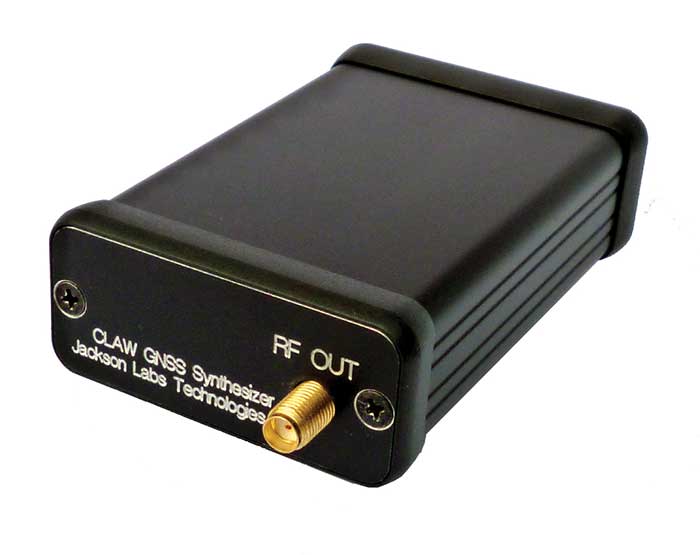
Miniature simulator and scenario generator
The 18-channel miniature full-constellation CLAW GPS Simulator is a fully self-contained, low size, weight, power and cost (SWaP-C) miniature GPS simulator. It is very popular in manufacturing environments as well as R&D applications that require consistent and repeatable local GNSS signals at low price points.
The CLAW simulator does not require external computers for processing and control — it works fully self-contained by simply applying power, and storing location/time/date data in internal non-volatile memory, or by storing complex vector data to simulate highly dynamic scenarios. The CLAW also can be used to transcode NMEA or SCPI position/velocity/time (PVT) data into GPS RF signals. For 2022, JLT added driver support for a large number of additional GNSS front-end receivers when using the hardware-in-the-loop (transcoding) feature of the unit to, for instance, transcode from one GNSS system to another.
JLT offers an easy-to-use, highly configurable and cost-free SimCon Windows application program that is downloadable from the JLT website. SimCon allows random scenario generation and is thus usable to simulate leap-second events, Week 1023 rollover events, or any other GPS live-sky scenarios, including highly complex yet easy-to-create dynamic vector simulations.
For authorized U.S. government users, a version that does not have altitude and velocity limitations is popular for low-Earth-orbit (LEO) simulations. Multipath simulation allows use of the entire 18-channel simulator capability.
The unit can be field-upgraded with an easy-to-use in-field software upgrade feature. The CLAW is also very useful in GNSS receiver sensitivity testing for R&D or mass-production assembly lines as it allows accurate control of RF output power ranging from –100 dBm to less than –130 dBm with 0.1-dB resolution and typically better than 1-dB accuracy over the controllable power range.
The CLAW GPS Simulator also has a built-in RF signal generator with sweep, CW and random noise functions that are useful in simulating GNSS jamming scenarios, as well as GPS spoofing scenarios. The simulator comes in an FCC-certified metal desktop enclosure with numerous accessories.
The CLAW firmware has been updated to allow live-sky almanac and ephemerides to be automatically uploaded from various externally connected GNSS receivers. This makes simulations using real-time live-sky constellations (such as used in simulating spoofing attacks) an easy task. A free firmware update is available from JLT.
[email protected]
www.jackson-labs.com
702-233-1334
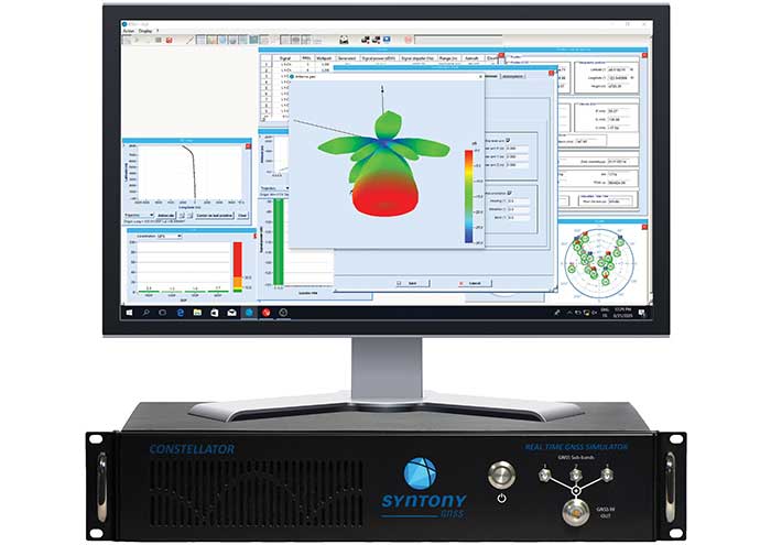
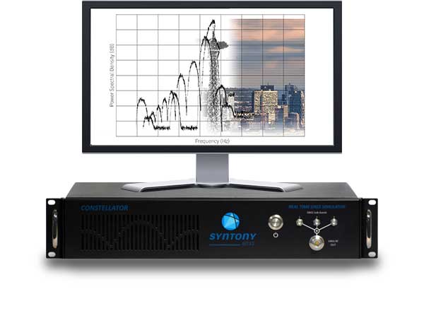
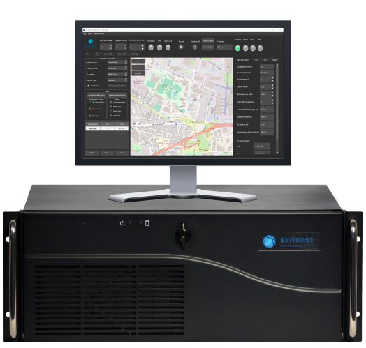
SYNTONY GNSS
High-end GNSS simulation solutions for R&D, integration and product testing
Syntony GNSS specializes in GNSS/PNT software-defined receiver (SDR) technologies, operating from receivers to test and measurements solutions. Its products and solutions address multiple markets and use cases in the space, defense and transportation industries.
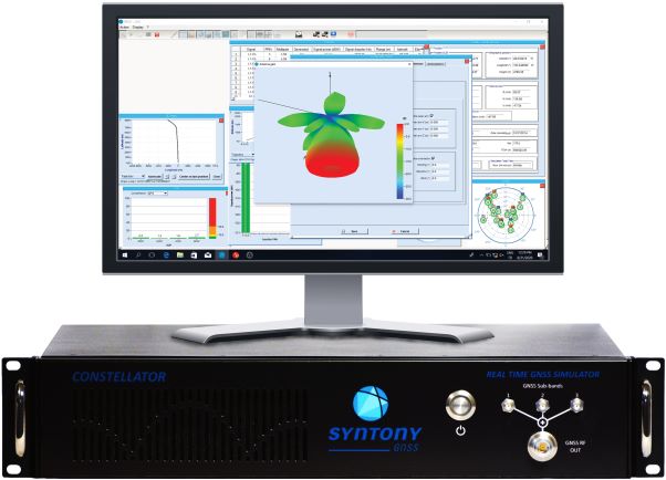
Constellator GNSS Simulator. Scalable, cost-effective, and high-fidelity SDR software-based platform supporting multi-constellation signals and frequencies (open, restricted and custom), hundreds of signals at 1-kHz iteration rate at zero effective latency, space trajectories and high dynamics. Multiple upgradable hardware configurations are available.
Constellator CRPA. Synchro-phase SDR by design, advanced jamming and spoofing, thousands of signals, 4 to 16 elements.
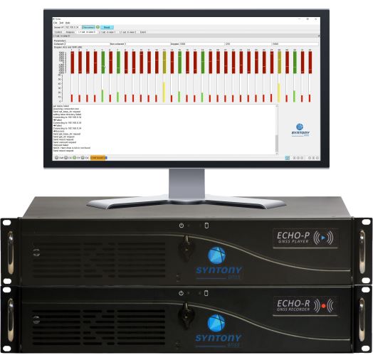
Echo Recorder & Replayer. High-fidelity record-and-replay devices characterizing group-delay, scintillation, and jamming and spoofing interference, from space to ground market segments.
- 3 RF channels of 200Mhz sampling rate
- 16 bit I/Q
- Up to 1.6 GB/s write/read speed.
SubWAVE GNSS/GPS Coverage Extension. Universal and seamless GPS/GNSS coverage extension for rail, road and mining infrastructures. SubWAVE signals are natively compatible with every GNSS-enabled device, and the solution uses existing telecom infrastructure to broadcast GNSS signals.