Tag: testing

  • Galileo’s First Two FOC Satellites Endure Simulated Space Tests

    Galileo’s First Two FOC Satellites Endure Simulated Space Tests

    The first Galileo Full Operational Capability satellite emerges from the Phenix test chamber after five weeks of thermal–vacuum testing.
    The first Galileo Full Operational Capability satellite emerges from the Phenix test chamber after five weeks of thermal–vacuum testing.

    ESA’s newest Galileo satellite has emerged from five weeks of simulated space conditions. On Friday, a hatch slid open to end its thermal-vacuum test, a milestone on the way to orbit.

    The satellite was placed in the 4.5-meter-diameter Phenix chamber in ESA’s ESTEC Test Centre in Noordwijk, the Netherlands, in late October. Once inside, the air was pumped out to create a space-quality vacuum. The  temperature extremes were also reproduced, with the six copper walls of the thermal tent cooled by liquid nitrogen down to -180°C.

    A second Galileo has  been undergoing the same rigors at the site, along with a vibration and shock test to reproduce separation from the launcher. Thermal-vacuum testing on the second model will begin early next year. The two satellites will be launched on a Soyuz rocket from Europe’s Spaceport in French Guiana midway through this coming year. They are the first two Full Operational Capability (FOC) satellites, following on from the first four  already in orbit.

    The next Galileo is expected to arrive at ESTEC in March, with further satellites following every seven weeks or so. A total of 22 FOC satellites are being built by OHB in Germany, with navigation payloads being delivered from Surrey Satellite Technology Ltd. in the UK.


  • Galileo Satellites Put to the Test

    Galileo Satellites Put to the Test

    The main antenna of the second Galileo Full Operational Capability (FOC) satellite being inspected with a flashlight in advance of mass property testing during August 2013.
    The main antenna of the second Galileo Full Operational Capability (FOC) satellite being inspected with a flashlight in advance of mass property testing during August 2013.

    Europe’s next pair of Galileo satellites have been the focus of a busy autumn at the European Space Agency’s (ESA’s) technical centre in the Netherlands, continuing a full-scale campaign to ensure their readiness for space.

    The first Galileo Full Operational Capability (FOC) satellite, FM1, seen beside the Phenix test chamber being readied for its five-week long thermal vacuum testing in October 2013.
    The first Galileo Full Operational Capability (FOC) satellite, FM1, seen beside the Phenix test chamber being readied for its five-week long thermal vacuum testing in October 2013.

    With the first four Galileos already in orbit, these new versions are the first two of a total 22 Full Operational Capability (FOC) satellites being built by OHB in Germany with a payload from Surrey Satellite Technology Ltd. in the UK.

    The second satellite joined its predecessor in mid-August at ESA’s European Space Research and Technology Centre in Noordwijk. This is the largest spacecraft testing site in Europe, with a full range of space simulation facilities under a single roof in cleanroom conditions. A wide range of tests have been performed on the two satellites.

    The first of the two satellites is now midway through a five-week immersion in vacuum and temperature extremes that mimic the conditions it faces in space. This thermal-vacuum test takes place inside a 4.5-meter diameter stainless-steel vacuum chamber called Phenix. An inner box called the thermal tent has sides that are heated to simulate the Sun’s radiation or cooled down by liquid nitrogen to create the chill of Sunless space.

    Second Galileo Full Operational Capability (FOC) satellite being prepared for acoustic testing, simulating the noise of a rocket launch, inside the Large European Acoustic Facility, LEAF, of the ESTEC Test Centre in early September 2013.
    Second Galileo Full Operational Capability (FOC) satellite being prepared for acoustic testing, simulating the noise of a rocket launch, inside the Large European Acoustic Facility, LEAF, of the ESTEC Test Centre in early September 2013.

    The newly arrived satellite first underwent a mass property test — measured to check its center of gravity and mass are aligned within design specifications. The more precisely these are known, the more efficiently the satellite’s orientation can be controlled with thruster firings in orbit, potentially elongating their working life by conserving propellant.

    Meanwhile, its predecessor left the wider universe behind in the Maxwell Test Chamber. Shielded walls blocking out all external electrical signals and spiky, radio-absorbing anechoic material lining the chamber enable electromagnetic compatibility testing. Isolated within the chamber as though floating in infinite space, the satellite could be switched on to check all its systems can operate together without interference.

    September saw the second satellite undergo acoustic testing in the Large European Acoustic Facility, LEAF, effectively the largest sound system in Europe. The first satellite submitted to this trial just a few weeks before. A quartet of noise horns are embedded in one wall of this 11-meter-wide, 9-meter-deep and 16.4-meter-high chamber, generating sound by passing nitrogen gas through the horns, surpassing 140 decibels.

    Galileo Full Operational Capability (FOC) satellite first flight model, FM1, being prepared for 'passive intermodulation testing' within the Maxwell electromagnetic test facility inside the ESTEC Test Centre at the end of August 2013.
    Galileo Full Operational Capability (FOC) satellite first flight model, FM1, being prepared for ‘passive intermodulation testing’ within the Maxwell electromagnetic test facility inside the ESTEC Test Centre at the end of August 2013.

    Accelerometers placed within the satellite checked for potentially hazardous internal vibration during this trial by sound. Then the spacecraft was vibrated on the shaker tables, simulating the violent forces of a rocket launch.

    Up-and-down vibration on the QUAD shaker followed by side-to-side shaking on the horizontal shaker, with data gathered across hundreds of channels.

    The satellite was then connected to the dispenser that will hold it during launch to simulate the separation at the end of its climb to orbit. This separation is triggered by firing a pyro device which then pushes the satellite away from the dispenser. This demonstration took place last month.

    “There will always be two Galileo satellites being tested at the ESTEC Test Centre for the next few years,” explains Giuliano Gatti, the head of the Galileo Space Segment Procurement Office.

    “As the Galileo constellation takes shape, ESTEC will remain an essential part of each satellite’s pathway to space, between the end of manufacturing in Germany and UK and the launch by Soyuz ST-B or Ariane-5 from Europe’s Spaceport in French Guiana.

    “Of course, the testing on these initial FOC satellites is especially rigorous because we are validating the overall design. The Galileo satellites to follow will undergo more streamlined ‘acceptance’ testing instead.”

    The next two satellites are in final assembly at OHB in Germany, scheduled to reach ESTEC early next year, as these first two satellites head off to French Guiana for launch.

    Galileo Full Operational Capability Flight Model 2, FM2, satellite's main L-band antenna used for broadcasting navigation messages, seen during preparation for a mass property test at the ESTEC Test Centre at the end of August 2013.
    Galileo Full Operational Capability Flight Model 2, FM2, satellite’s main L-band antenna used for broadcasting navigation messages, seen during preparation for a mass property test at the ESTEC Test Centre at the end of August 2013.
  • Galileo Spreads Its Wings in Pre-Flight Test

    Galileo Spreads Its Wings in Pre-Flight Test

    In the photo above, deployment of the solar wings on the latest Galileo satellite is being checked at the European Space Agency’s technical hub in the Netherlands. The navigation satellite’s pair of 1 x 5-meter solar wings, carrying more than 2,500 gallium arsenide solar cells, will power the satellite during its 12-year working life.

    With the first four Galileo In-Orbit Validation satellites already in orbit, this is the first of the rest of Europe’s satnav constellation.

    A counterweighted rig supports the deployment; otherwise the delicate fold-out wings — designed for the weightlessness of space — would crumple under the pull of Earth gravity.

    These Full Operational Capability satellites provide the same operational services as their predecessors, but they are built by a new industrial team: OHB in Bremen, Germany, built the satellites with Surrey Satellite Technology Ltd. in Guildford, UK, contributing the navigation payloads.

    This satellite is the first of 22 ordered from OHB. It arrived at ESA’s ESTEC research and technical centre in Noordwijk in May to begin a rigorous campaign of testing in simulated launch and space conditions, guaranteeing its readiness for launch.

    The first test performed on the satellite once it came out of its container was a System Compatibility Test Campaign, linking it up with the Galileo Control Centres in Germany and Italy and ground user receivers as if it was already in orbit.

    Galileo’s wings with 30%-efficient solar cells were fitted at the end of June, supplied by Dutch Space in nearby Leiden. Future satellites will have their wings fitted at OHB before coming to ESTEC, but this first satellite offered an opportunity for Dutch Space engineers to train their OHB counterparts in the procedure.

    “The 22 Galileo FOC satellites are being produced and tested on a batch production basis, which is a new way of working for ESA,” explained Jean-Claude Chiarini, overseeing FOC satellite procurement for the Agency. “The concept is really to set up a steady flow of satellites from OHB to ESTEC and then Kourou for launch over the next few years.

    “The first four will undergo full validation testing, checking the underlying design is correct, in order to support the formal ground qualification of the design, with subsequent FOC satellites then going through acceptance testing, concentrating on checking workmanship,” Chiarini said.

    The FOC satellites, while resembling their predecessors, are designed with this production concept in mind. Hinged modules offer easy access to internal subsystems for rapid repair or potential replacement of units.

    The next satellite is due to arrive around the start of August. The battery of simulations includes vibration and acoustic testing, as well as thermal-vacuum testing — submitting them to the airlessness and temperature extremes of space for weeks at a time.

  • Indoor Trial Results, Next FCC Chief

    The long awaited results from the independent field trial of indoor wireless location technologies are here. The FCC-chartered Communications Security, Reliability and Interoperability Council (CSRIC) tested NextNav, Qualcomm and Polaris. NextNav bested the others.

    Speakers from NextNav and Polaris, as well as test adminstrator Technocom, will take part in a GPS World webinar on April 18. Registration is free.

    Also, there is a guessing game in town and stakes are high. Who will President Obama nominate to replace FCC Chief Julius Genachowski? Tom Wheeler, popular in the telecom community, has been a front runner, but the tide may be turning against him with some charging that he is too snug with our industry.

    Developers will be even more enticed to utilize indoor location now that Apple has signaled its market intents with the purchase of indoor-GPS company WifiSLAM. Safety and security mandates around the world are spurring a wave of telematics offerings by automotive OEMs. For more, read on.

    Who Will Be the New FCC Chief? A coalition of public interest groups sent a letter to Obama warning that Wheeler is too close to the industry that he would be regulating. “You can’t have an objective chairman of the FCC that’s got 20 years of his life invested in being the head lobbyist for industry,” Sascha Meinrath of the New America Foundation said in an interview. In his past life, Wheeler was an industry lobbyist and also served as head of both CTIA and the National Cable and Telecommunications Association.

    Adding to Wheeler’s woes, 37 Democratic senators have signed a letter supporting FCC Commissioner Jessica Rosenworcel. Since she already sits on the commission, Rosenworcel would not need Senate confirmation to ascend to the chairmanship. That could be appealing to Obama, who has faced GOP opposition to many of his second-term nominees.

    However, it could also put Obama in a sticky spot, as he would have to jump over the FCC senior Democrat, Commissioner Mignon Clyburn, the daughter of Rep. James Clyburn, a member of the House Democratic leadership who has strong African-American support. Obama has been criticized for low minority leadership appointments in his second term.

    Genachowski’s term was a disappointment to people on many sides of the fence, but not the all-out disaster of his predecessor, Kevin Martin. Genachowski will be remember for the introduction of the National Broadband Plan, as well as plans for a complete overhaul of the Universal Service Fund. During his time as chairman, Genachowski took the lead on killing AT&T’s proposed $39 billion acquisition of T-Mobile. The next FCC chair will need to navigate hefty issues including media ownership, Internet rules, universal and affordable broadband, and locking of phones.

    CSRIC
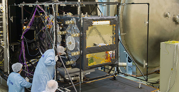
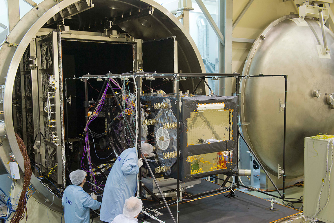
How Good Is It Indoors? The FCC chartered CSRIC to test the indoor performance of location systems across urban, suburban and rural areas in the San Francisco Bay Area. TechnoCom, an independent agent, conducted the trial with more than 13,000 test calls placed from different technologies in 75 unique indoor locations. Three vendors submitted technologies for evaluation: Qualcomm, NextNav and Polaris. They were scored for horizontal and vertical accuracy, speed of location, and reliability and consistency of results. NextNav stood out for its performance on height and horizontal accuracy. The full report is available from the FCC.

    To hear from the experts involved, tune in to GPS World’s webinar, “Indoor Positioning & Navigation: Results of the FCC’s CSRIC Bay Area Trials,” on Thursday, April 18. Speakers include Khaled Dessouky (Technocom); Ganesh Pattabiraman (NextNav); Norm Shaw (Polaris Wireless); and Greg Turetzky (CSR). Registration is free.

    Apple Goes Inside. Apple has acquired indoor-GPS company WifiSLAM, a sign that the indoor mobile location market will be heating up. Apple’s involvement is a significant move that will ignite the developer community to rush to create more innovative apps and solutions based on indoor location. WiFiSlam is a two-year-old start-up that detects a phone user’s indoor location by analyzing the strengths and IDs of Wi-Fi signals in its vicinity. WiFiSlam has been offering the technology to developers for indoor mapping and new types of retail and social networking apps. Retail has been the first adopter of indoor technology.

    Interactive Voice Ads Leverage Location. Nuance Communications unveiled Voice Ads, a new mobile ad format that enables consumers to interact directly with ad campaigns by speaking (or perhaps, yelling) into their smartphones. Voice Ads expands on voice and natural language technologies and leverages capabilities like location to deliver ads that prompt the user to ask questions. In a YouTube video, Mike McSherry of Nuance demonstrates a virtual Magic 8-Ball campaign that answers users’ verbal queries to promote a fictional deodorant brand. “Mobile has a monetization challenge,” McSherry told AllThingsD. “By introducing voice you can transcend the small screen size.”

    Telematics Boom. The telematics market is about to ride a wave of growth. Vehicle OEMS are rolling out safety telematics in advance of safety and security mandates throughout the world including Europe (eCall, 2015), Russia (ERA GLONASS, 2013) and Brazil (Contran, 2013). ABI predicts that the OEM and aftermarket safety/security telematics vendors will see the number of users rise from 72 million at year-end to more than 300 million in 2018.

    GPS Ankle Monitors Not Working. In 2012 the state of California started conducting tests on the GPS ankle devices that monitor more than 4,000 high-risk sex offenders and gang members. Officials discovered that the batteries died early and reported locations were off by as much as three miles. Tampering alerts failed and offenders could cover the devices with foil or use GPS jammers to go undetected. Many of California’s ankle monitors were replaced with devices from a different vendor, but test results of the new system were not made public.

  • Test Confirms EGNOS + Galileo = Safer Skies

    Test Confirms EGNOS + Galileo = Safer Skies

    Europe’s two satellite navigation systems could combine in the future for heightened performance, an airborne test has confirmed. A helicopter flight took place above an alpine valley in Germany, the one place on Earth where Galileo services are already routinely available.

    The test receiver. The helicopter flew a variety of manoeuvres, from fast loops to mid-air hovering, to see how satnav signals were received in practice.
    The test receiver. The helicopter flew a variety of maneuvers, from fast loops to mid-air hovering, to see how satnav signals were received in practice.

    Results of the flight test, conducted in September 2012, show that adding Galileo signals to the European Geostationary Navigation Overlay Service (EGNOS) should boost its accuracy significantly. EGNOS, which augments the accuracy and reliability of GPS signals over Europe, renders satnav usable for safety-critical applications such as aircraft guidance, as well as more general precision uses.

    Operational horizontal and vertical distance “protection levels” for safety were cut by half by combining use of GPS and Galileo within EGNOS. In addition, new integrity algorithms installed within the user receiver turned out to reliably detect and exclude reflected or otherwise faulty signals.

    The first test of real Galileo navigation fixes is scheduled for later this year from the four satellites already in orbit, with more satellites set to join them by the end of the year.

    EGEP testbed combined GPS/GALILEO
    The Galileo Test and Development Environment – GATE – is a giant outdoor laboratory where prototype Galileo receivers can be used freely without any modifications.

    As the constellation takes shape, satnav researchers and industrial developers can already try out Galileo services with prototype receivers at the German Galileo Test and Development Environment, or GATE, a giant outdoor laboratory. GATE, in and around the town of Berchtesgaden in the Bavarian Alps, is Europe’s go-to place for Galileo testing: transmitters atop eight neighbouring mountains cover 65 square kilometers of territory with simulated Galileo signals.

    ESA’s Global Navigation Satellite System Evolution program carried out helicopter-based testing here on September 24–26. The results will help to guide the development of next-generation satnav systems.

    The helicopter flew a variety of maneuvers, from fast loops to mid-air hovering, to see how satnav signals were received in practice. The test relied on ESA’s SPEED platform — Support Platform for EGNOS Evolutions & Demonstrations, co-funded by French space agency CNES and operated by Thales Alenia Space France — which enabled the receiver to receive simultaneous realtime augmentation for both GPS and Galileo.

    Europe’s next-generation EGNOS, planned for around 2020, is envisaged to operate in the same way, with augmentation of both constellations and dual-frequencies at the same time making the system much more robust.

    EGEP testbed combined GPS/GALILEO
    A helicopter flies over the Galileo Test and Development Environment – GATE – in Berchtesgaden, Germany, gathering data on how EGNOS and Galileo will work together. The promising results from the testing are now being analyzed.


  • Luch-5B Starts SBAS Test Transmissions

    News courtesy of CANSPACE Listserv.

    According to tracking data from stations of the International GNSS Service’s Multi-GNSS Experiment, the second Russian Luch satellite, Luch-5B, started transmitting GLONASS and GPS differential corrections on January 17, 2013, at around 11:07 UTC.

    Luch-5B, launched on November 2, 2012, carries a transponder for the System for Differential Correction and Monitoring satellite-based augmentation system. The satellite, occupying an orbital slot at 16 degrees west, uses PRN code 125. Transmission tests are not continuous.

  • Spirent Announces Support for BeiDou-2 Testing

    Test solutions company Spirent Communications plc today announced the availability of test systems with support for China’s BeiDou Navigation Satellite System in addition to GPS, GLONASS and Galileo.

    Spirent started shipping BeiDou-ready test systems to customers in 2012. The solution will now be upgraded to full-BeiDou capability using the information from the recently released first full issue of the BeiDou-2 Signal-In-Space Interface Control Document (ICD).

    “Spirent has successfully demonstrated BeiDou-2 in simulation systems at its offices in Beijing, China,” said Stuart Smith, product manager for Spirent’s positioning and navigation group. “Prior to the ICD release we used recorded navigation data to enable our systems to drive a full BeiDou receiver and qualify the implementation. With the release of ICD information, navigation data is generated automatically, as with the other constellations that the system simulates.”

    Spirent’s BeiDou-2 system includes testing for GPS, GLONASS and Galileo, as well as IRNSS, QZSS and SBAS along with options such as interference generation, MEMS sensor simulation and systems targeted at transport segments.

    Background on BeiDou. The BeiDou navigation system, sometimes known as Compass, is a project by China that is being deployed in three phases. BeiDou-2 (the second phase) supports regional operation from a network of geostationary, medium earth orbit and inclined orbit satellites. BeiDou-2 adds to the benefits from “Multi-GNSS” where increased accuracy, availability and integrity are possible from using separate, but interoperable GNSS systems.

    As with any other GNSS, systems using BeiDou require testing. As well as testing the BeiDou stand-alone operation, Spirent’s systems enable testing of interoperability and co-existence testing with other navigation systems and sensors.

  • Lockheed Martin Completes Environmental Test on GPS III Pathfinder

    The Lockheed Martin team developing the U.S. Air Force’s next generation Global Positioning System III  satellites has completed thermal vacuum testing for the Navigation Payload Element (NPE) of the GPS III Non-Flight Satellite Testbed (GNST). The milestone is one of several environmental tests verifying the navigation payload’s quality of workmanship and increased performance compared to the current generation of satellites, the company said.

    The GPS III program will affordably replace aging GPS satellites, while improving capability to meet the evolving demands of military, commercial and civilian users. GPS III satellites are expected to deliver better accuracy and improved anti-jamming power while enhancing the spacecraft’s design life and adding a new civil signal designed to be interoperable with international global navigation satellite systems.

    “GPS III satellites have the most advanced navigation payloads ever manufactured.  This milestone is a key indicator that we have a solid design and are on track to provide unprecedented position, navigation, and timing capability for GPS users worldwide,” said Lt. Col. Todd Caldwell, the U.S. Air Force’s GPS III program manager.

    During thermal vacuum testing, the navigation payload’s performance was proven in a vacuum environment at the extreme hot and cold temperatures it will experience on orbit to ensure it will operate as planned once in space. Following the test, the NPE will now be integrated with the GNST for final satellite level testing.

    The GNST is a full-sized prototype of a GPS III satellite used to identify and solve development issues prior to integration and test of the first space vehicle. The approach significantly reduces risk, improves production predictability, increases mission assurance and lowers overall program costs. Following integration and test at Lockheed Martin’s GPS Processing Facility (GPF) near Denver, the GNST will be shipped to Cape Canaveral Air Force Station, Fla., for risk reduction activities at the launch site.

    “The completion of thermal vacuum testing on our first navigation payload is a critical milestone for our program that demonstrates we are on a solid path to meet our commitments,” said Keoki Jackson, vice president of Lockheed Martin’s Navigation Systems mission area. “The Air Force’s early investment in our GPS III pathfinder is now paying off and will enable highly efficient and affordable satellite production going forward.”

    Lockheed Martin is on contract to deliver the first four GPS III satellites for launch. The Air Force plans to purchase up to 32 GPS III satellites.

    The GPS III team is led by the Global Positioning Systems Directorate at the U.S. Air Force Space and Missile Systems Center. Lockheed Martin is the GPS III prime contractor with teammates ITT Exelis, General Dynamics, Infinity Systems Engineering, Honeywell, ATK and other subcontractors. Air Force Space Command’s 2nd Space Operations Squadron (2SOPS), based at Schriever Air Force Base, Colo., manages and operates the GPS constellation for both civil and military users.

  • Indoor Location Tests Ahead, Mapping under Scrutiny

    Janice Partyka
    Janice Partyka

    October was a month of shows, rumors and announcements. Testing of competing indoor location positioning technologies is being planned by the FCC; prospects for some companies will ride on the public results. Apple may be turning to TomTom to save it from its mapping inaccuracy issues, dubbed Mapplegate. This month’s CTIA show was flat; attendees were wondering if it was the last chapter of the fall show. Interesting industry tidbits were heard at the MforMobile Location Business Summit. New Google Ad Word rates may be created that are also based on the distance between the handset and advertiser’s location. History can be harsh, remembering an unfortunate calculation by a location industry giant. Marketers continue to be frustrated by the mobile industry’s continued difficulty to completely measure ad results.

    The FCC sees indoor location as a critical safety concern for E911 emergency response. The commission has tasked an advisory committee to evaluate indoor location positioning technologies. TechnoCom has been chosen to conduct the independent testing as a neutral third party. The test bed is in about 20 structures of various types, in locations that range from highly dense urban to sparse landscape. The following companies are submitting technology for the testing: Qualcomm (AGPS/AFLT/Cell ID), NextNav (GPS-like terrestrial beacons), Boeing (LEO satellites using the Iridium constellation), and Polaris (RF fingerprinting). Additional companies submitted technology, but later withdrew. Test results should be made public in March of 2013. A public workshop on this testing is being held at the FCC on October 24 and can be watched online at www.fcc.gov/live.

    Indoor Mapping. At the Location Business Summit, it was clear that the retail and hospitality industries is anxious to start exploring indoor marketing based on real-time location. They seem to expect it will start out working flawlessly. It won’t. In addition to the indoor positioning being early stage, mapping quality is uneven. The gold bar of quality assurance for outdoor mapping is aerial fly-overs and street driving. In some situations crowd sourcing works. For indoor maps, it’s the Wild West. Currently there are no standards for vetting indoor mapping. Maps are being created of greatly varying quality, sometimes by way of rough diagrams found on the Internet that are then shoe-horned into the outlines of buildings.

    TomTom to the Rescue?  Shares in TomTom, maker of personal navigation devices (PNDs) and mapping, jumped to a three-week high on speculation that it may be taken private by its founders with the help of Apple. In turn, Apple could buy TomTom’s maps database to correct its mapping problems. TomTom’s founders own 47 percent of the company, but may be held back by the uptick in share value.

    Paying for Location. Reportedly, Google has location-based AdWords in beta. Advertising rates go up the closer the targeted user is to the venue being promoted. A restaurant ad is more relevant, and more likely to draw a person who is one mile away than 20 miles. Some travelers will park near a string of hotels and use a site like hotels.com to find the most competitively priced room for that evening. An ad for a hotel on the other side of town is of lesser value and would be cheaper.

    Comments Heard at the Location Business Summit by MforMobile this Month:

    “We need to build ambient intelligence into devices. Nobody needs more information, more apps, ads, logins or devices. It isn’t sustainable.”

    “Location data on the consumer side is often junky because phones are trying to conserve battery, and won’t invoke GPS.”

    “You can get better locations from the carrier network, but it is too expensive a proposition for advertisers.”

    “We find that hyper-local ad targeting leaves us with too few people to address.”

    Can I Turn Back the Clock? In an interview for Forbes in 2003, Min Kao, CEO of Garmin, puts a stake in the ground. He says he does not seek to compete in navigation with the mobile phone, the likes of Nokia and Motorola, as that is the kind of commodity business Garmin would like to avoid. The PND vendors continue to be squeezed between the OEM embedded equipment and the smartphone. It is hard to be optimistic about the PND market, commented John Canali of Strategy Analytics at the Location Business Summit. Heavy discounting has led to plummeting revenues. “The PND companies are hardware focused in a market whose foundation is software. It will be very difficult to transform PND companies,” says Canali. “They will struggle.” In 2009, Google announced that all Android phones built on OS 1.6 or higher would have free turn-by-turn directions. Nokia followed shortly after. So it began.

    A Little Slow. CTIA drew more than 5,000 people to attend MobileCon, its fall show with a new brand name. You may remember it as CTIA Enterprise and Applications. This was a significant decline from last year when 10,000 to 15,000 conference-goers attended. Activity was slow and the exhibit floor was smaller. Conference sessions were held on the exhibit floor.

    Still Can’t Close the Loop. The industry continues to be unable to provide advertisers with metrics of how many pizzas a mobile ad sold. Papa John’s Pizza will know if someone has clicked to call or clicked to map, but Papa John’s won’t know if those actions resulted in a purchase. Without this fundamental metric, advertisers complain that it is hard to build a business case for mobile advertising. The click rates that they can track aren’t always representative because of user errors that include fat fingers, fraudulent clicks and pocket dialing.