
Last year, in a massive crowdsourcing effort, eight million volunteers from around the world sat at their computers and searched high-resolution satellite imagery looking for signs of Malaysia flight 370, which had left Kuala Lumpur and never arrived in Beijing. The effort was akin to putting thousands of digital helicopters into the sky above 340,000 square kilometers of ocean. The project, organized by DigitalGlobe’s Tomnod group, didn’t find evidence of the plane. More than a year later and with wreckage recently discovered, it’s a good time to do a post-mortem of the crowdsourcing effort that involved amateur GPS citizen scientists from around the world.
Tomnod provided volunteers with images of the Thailand Gulf, Andaman Sea and areas of the Indian Ocean (West of Australia), an area that had been recommended for scrutiny by AMSA, the Australian Maritime Safety Authority. The area was organized by map tiles, each one-eighth of a kilometer. The images provided to the volunteers were still photos, a snapshot in time. The search followed the core rule of crowd sourcing — redundancy, and all map tiles were reviewed by multitudes of people.

I signed up to search images, and like others, was instructed to individually tag signs of wreckage, rafts, oil spills and interesting objects. Volunteers submitted 18 million tags for further review. Some of the tags were then inspected by analysts at Tomnod, but the vast majority were analyzed by computer programs alone. Search and rescue organizations were given the results to aid their search efforts.
With advancements in object recognition, one would think it possible for the initial search to be done by computer vision algorithms. Crowdsourcing could be used to manually clarify or further refine classifications. Tomnod believes identifying objects in the ocean is difficult and best done by humans, but has used digital object recognition in a new project. “For our project of mapping Swaziland to help eliminate malaria, Tomnod uses object recognition algorithms to locate buildings,” says Caitlyn Milton of DigitalGlobe. “Our next step is having crowdsource volunteers manually draw building footprints for each individual building. We either use volunteers or deploy our algorithm to identify the roof types (metal, wood or thatch), which are correlated with Malaria rates.”
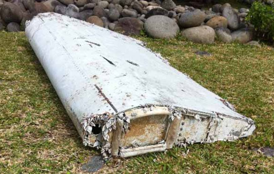
Tomnod would have needed a trifecta: the correct geographic area, visible debris and identification of the debris to yield the actual crash site. Unfortunately, even with the discovery of plane parts found last month near Réunion Island in the Indian Ocean and even with analysis of ocean currents and weather conditions, it will be difficult to ascertain if the plane crashed within the Tomnod search area.
Crowdsourcing is not new to mapping. European countries offered hefty pouches of gold in the 1500s to people who could help solve the puzzle of determining latitude for maritime navigation. The competitors were well educated — mathematicians, astronomers and watchmakers. To contribute today, all one needs is a computer, a wireless connection and free time.
Next month, I’ll be in Las Vegas at CTIA’s Super Mobility 2015 reporting on industry developments. If you have interesting news, contact me.

