With tariffs, trade wars and sanctions ruling the day, how is a self-respecting UAS manufacturer supposed to make a buck? And to whom are the manufacturers of defense UAS able to sell their wares?
To NATO and other friendly countries, comes the ready answer, but there may still be a problem selling drones with armaments and offensive capabilities. Another layer of governmental review could swing into action when a company wants to sell to friendly countries like Saudi Arabia or perhaps to allies within the old Russian USSR block.
Last year, General Atomics lost sales to Saudi Arabia and the United Arab Emirates (UAE) for Predators and/or Reapers, large-bodied medium-altitude, long-endurance unmanned aircraft systems (or MALES). The deal went instead to a competing Chinese outfit. General Atomics complained bitterly about the loss of this business, which it blamed on restrictive U.S. export rules. The Administration responded by apparently loosening the regulations, in fact easing the way for most international sales. In response, it is possible that UAV manufacturers have also undertaken some changes which make U.S. drones even more competitive for export.
Business matters appear to have improved significantly. In May this year, the State Department actually used emergency provisions within the Arms Control Act to bypass Congressional review of a proposed sale to Saudi Arabia, UAE and Jordan of a package of Insitu Blackjack drones and launchers, worth $80 million.
The competition for world-wide sales of U.S. UAS products is increasingly tough, especially against Chinese suppliers with equivalent or perhaps less capable mil-spec drones. Hence the export rule changes which now appear to be working in the right direction.
Chinese Drones in the U.S.
Meanwhile, in an effort to accommodate U.S. concerns about the potential for user data somehow “leaking” to DJI — the Chinese supplier of almost 75% of U.S. drone purchases — DJI has implemented a “Government Edition” which apparently addresses the risk of data loss.
When US-based 3D Robotics stopped supplying 3DR Solo drones, the Interior Department found itself in a bind, as it had already bought hundreds of these devices for its inspection/surveillance operations. As the department searched for a new source for UAVs, it came to the conclusion that U.S. supplied drones were much less capable or up to ten times more expensive than equivalent DJI units. So they began working with DJI to solve the issue with potential data loss, and went on to test the results extensively
Working with the U.S. Interior Department for over 18 months, DJI has equipped drones and their controllers with modified hardware and custom software that ensure that the drones only operate in local data mode: information collected in flight is stored on the UAV alone and must be manually downloaded after flight. The drone is actually loaded with custom software by the user prior to flight to ensure this mode of data collection.
Even with these modifications, for now the use of DJI drones is still restricted to non-sensitive applications.
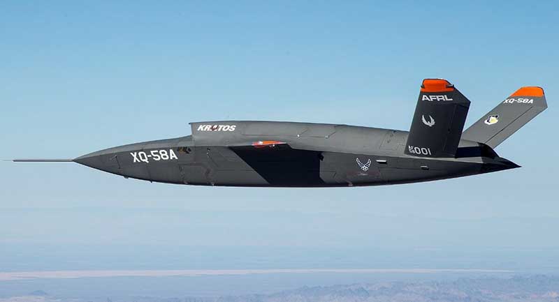
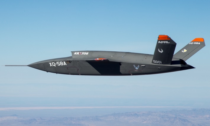
USAF/Kratos XQ-58A
The XQ-58A Valkyrie demonstrator, a long-range, high subsonic UAV completed its inaugural flight March 5, 2019, at Yuma Proving Grounds, Arizona. (Photo: U.S. Defense Department)
Kratos is working with the U.S. Air Force to develop a jet-powered UAV system that can fly alongside manned fighter aircraft to multiply their effectiveness. At much lower cost than manned aircraft, the concept appears to be that more risk can be taken with the ‘loyal wingman’ UAVs to not only support the mission of the attack aircraft, but to also keep it safe.
We reported earlier on the XQ-58A after its first flight in March of this year. Now the Valkyrie is back in the flight test program with its second flight lasting 71 minutes over the Yuma test range on June 11. In the long- erm, it is hoped that both ground controllers and flight crew would operate these extensively autonomous drones.
A parallel “Skyborg” program is also underway to develop the hardware and artificial intelligence software capability to enable this type of drone to fly and fight alongside manned aircraft.
In conclusion, trade wars and tariffs aside, let’s hope that good UAV products can still make headway on their merits alone.
AUVSI Xponential 2019 — the huge exhibition and conference built around unmanned everything — will run at the West Building, McCormick Place Convention Center, April 29 to May 2 in Chicago.
This is the premier show for the Association for Unmanned Vehicle Systems International (AUVSI) group and its many members and supporters who have interest in unmanned technology — 8,500 attendees with connection to unmanned and autonomous capability are expected to walk the exhibit hall to see the latest products, hear numerous related presentations, participate in educational courses, and mingle with other like-minded people in the industry.
I was looking for a way to provide a brief overview of the companies exhibiting; a sample cross-section to provide an insight on what to expect. But with more than 700 exhibitors, it’s a difficult thing to do. Then I realized that the company show preview emails in my inbox were from organizations that were actually quite representative of the industry, and I had my overview selection.
Flyability’s drones are adapted for inspection tasks, both indoors and out, with an exterior protective cage. Routine inspection jobs indoors, underground and around complex pipework become quicker, safer and are fully documented by high-resolution video and stills.
This all enables the reduction of costs and process-interruption downtime of industrial inspections, while also reducing to a large degree the risks for inspection professionals. Industries using these inspection drones include power generation, oil and gas, chemicals, maritime, infrastructures and utilities, and public safety.
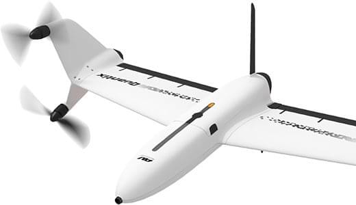
AeroVironment’s drones are used extensively by the military for surveillance and reconnaissance, and in the commercial sector they focus on tools for agriculture.
Quantix drone. (Photo: AeroVironment)
The VTOL (vertical take-off and landing) Quantix drone system is fully automated for takeoff, flight and landing, enabling mapping of farm acreage to monitor crop health to identify anomalies due to water, insect, weed and disease so their impact on yield can be minimized.
Valqari has developed a drone mailbox that is interoperable with a large number of delivery drones and enables drop-off of packages in residential neighborhoods.
The Valqari drone mailbox automatically accepts packages and safely stores them until the recipient opens the box later to retrieve them.
Cepton Technologies makes lidar systems more commonly used for automotive obstacle detection, but now customized for UAV integration and use. Its UAV lidar system provides long-range, high-resolution and low-cost mapping capabilities in a lightweight package. With a scanning range of 200 meters, high-density map-data acquisition becomes possible.
Deseret UAS is a non-profit working to bring UAS business to Utah — the organization offers information, promotes UAS companies and offers test-range access in Utah. In collaboration with Utah State University AggieAir, FAA authority for flight testing in wide open; low-risk operational areas of Utah can be accessed.
And, of course, General Atomics Aeronautical Systems (GA-ASI), manufacturer of the well-known Predator military drone, will exhibit. At Xponential 2018, GA-ASI unveiled its MQ-9B SkyGuardian certifiable drone system. Through the year, the company has progressed towards certification of the system for flight within the U.S. civilian National Airspace System and the civil airspace of other countries around the world.
GA-ASI’s latest media release recounted how an MQ-9B was flown by the company’s Certifiable Ground Control Station (CGCS) on March 9, including both take-off and landing. The CGCS architecture separates flight and mission-critical functions. Off-the-shelf avionics and flight computers are used for flight-critical functions, and mission-critical functions run alongside GA-ASI’s Advanced Cockpit payload and weapons equipment.
Meanwhile, High Altitude Pseudo-Satellite (HAPS) unmanned aircraft are back in the news with what appears to be a crash during the sensitive take-off/climb-out regime. The Airbus Zephyr aircraft — with an 82-foot wingspan, but weighing less than 75 pounds — was engaged in a test campaign in Western Australia when the ground abruptly intervened on March 15.
Airbus is working with the UK Ministry of Defence to demonstrate the operational capabilities of the UAV and its anticipated payload options. Once airborne, Zephyr is intended to climb out to upwards of 65,000 feet into the stratosphere — previously achieving a maximum altitude of 74,000 feet — and has so far been able to remain airborne for almost 26 days. The object is to create a commercial, reusable, reconfigurable satellite-like capability for communications and surveillance applications.
Airbus and MoD are undertaking a crash investigation to determine what exactly happened and how to prevent future recurrence. The incident occurred about four hours into a demonstration flight, and (reading between the lines) may have been related to rapid weather changes that destabilized the UAV while in the take-off and climb-out phase. An automated launch system is in the works — currently Zephyr is man-handled for take-off.
Other HAPS programs include AeroVironment and Japan’s Softbank, Astigan and the UK Ordnance Survey, BAE Systems and Prismatic, and Boeing’s Aurora Flight Sciences. Thales, meanwhile, is apparently focusing on an approach using an autonomous airship.
So some good news, some not so good. Lots of attendees are expected in Chicago for the AUVSI Xponential show, with new developments in unmanned aircraft, robotics, and unmanned ground and water systems anticipated in the exhibition hall. There will be lots of people in the industry with whom to exchange ideas and conduct business to conduct, hopefully just as spring arrives in the windy city.
Meanwhile, over the coming months Airbus will no doubt continue to work out how to overcome the latest problems in HAPS technology and operations.
Few commercial UAV operations would be able to inspect transmissions lines, pipelines or train tracks without beyond visual line-of-sight (BVLOS) capability, but these key pieces of infrastructure often situate close to or transit across population centers. Further, many population centers have airports and low-level air traffic. Any tools to keep drones away from air traffic during BVLOS operations will significantly inspection companies. We review three promising solutions here.
Pipeline Inspection
Kongsberg Geospatial in Ottawa, Canada has developed location visualization software tools that are used for air-traffic control, command and control, and air defense applications. The company has several decades of experience in these applications. Its IRIS software was used to support recent UAV oil pipeline inspection operations in Nigeria, providing safety critical airspace deconfliction, supervised by the Nigerian Civil Aviation Authority (NCAA).
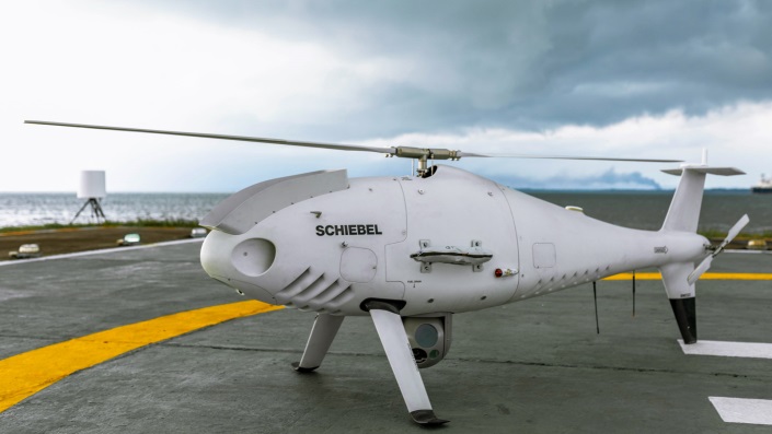
The pipeline project was undertaken by Aerial Robotix, a UAS services provider in Nigeria, who used adapted Kongsberg software in its control center to demonstrate safe BVLOS operations, and was then able to obtain the necessary permits. A Schiebel Camcopter S-100 UAV with a 200-kilometer BVLOS capability was used for flight inspection, operating both day and night, with real time high-definition payload imagery sent back to the control station.
Camcopter S-100 prior to BVLOS pipeline inspection flight in Nigeria. (Photo: Schiebel)
Nigeria has a major problem with gasoline theft from pipelines similar to those lines inspected during this project. Recently, 105 people perished in a blast from a ruptured pipe 30 miles north of the city of Umuahia, possibly during scavenging for leaking fuel. It has been claimed that the pipeline had been ruptured by saboteurs earlier, and for the following six weeks villagers had been collecting fuel. Pipeline vandalism is common in Nigeria, even given the risk of fire or explosion, or the risk of prosecution, or even the possibility of being shot on sight.
Unmanned Companion Fighter Aircraft
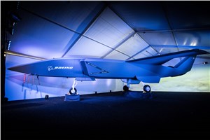
Boeing just unveiled a concept UAV which is apparently aimed at providing an airborne team-partner for manned aircraft.The concept was introduced at the Australian International Airshow by the Australian Minister for Defense, the Hon. Christopher Pyne MP. The project is slated for a significant R&D investment by the Australian Government and Boeing Australia.
Boeing Airpower Teaming System. (Photo: Boeing Company)Boeing Airpower Teaming System. (Photo: Boeing Company)
The concept model has fighter aircraft lines with a projected 2,000-mile range, autonomous capability, and significant intelligence, surveillance and reconnaissance sensor capability. Flying alongside manned fighter/attack aircraft with artificial intelligence simplifying control, the Airpower Teaming System is designed as a low-cost force multiplier.
The concept includes a pitch for international collaboration offering significant customization so countries can add local content, a key element for any aircraft program designed for off-shore sales.
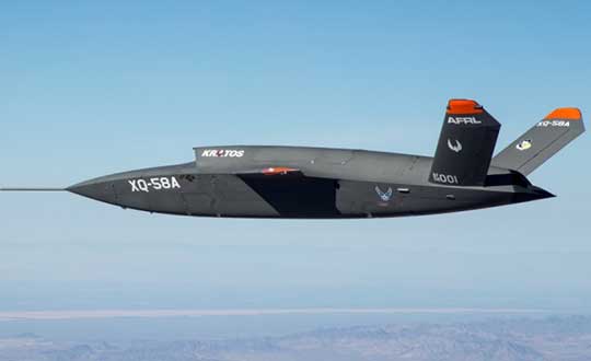
XQ-58A demonstrator in flight. (Photo: U.S. Air Force)
A day or so after the Airshow (maybe not wanting to be upstaged by Boeing’s announcement?) a release showed up about the first flight of the previously secret XQ-58A Valkyrie demonstrator. This is apparently a program by the US Air Force Research Laboratory (AFRL) partnered with Kratos Unmanned Aerial Systems to develop a UAS which looks to have very similar capabilities to that of the Boeing concept, perhaps at a significantly further advanced stage, with a much more mil-spec UAV sounding name.
The AFRL indicated that the XQ-58A is part of a Low Cost Attritable Aircraft Technology (LCAAT) (guess that means they don’t much mind losing a few) effort to come up with low-cost force multipliers which can be built quickly using commercial technology and operating from unprepared runways.
(From the Air Force: “The thought is to develop an inexpensive, configurable and producible on demand air vehicle. A number of military applications can be envisioned for an air vehicle with such a capability. One potential application is to use hundreds or thousands of such units in a campaign to overwhelm an enemy’s air defenses and “punch a hole” to enable higher value, less replaceable [aircraft] to engage or monitor enemy systems. Another potential application is to augment the capabilities of high-value intelligence, surveillance and reconnaissance, systems which may be limited in a specific campaign by distances, quantities, or threats. For all applications, the weapon system is expected to be an air vehicle that would return to base or to a separate location to be recovered. However, because of the mission and because of the low cost, the air vehicle would be attritable, meaning the Air Force would expect and could afford to lose many of the assets.”)
The current program took 2½ years to get to this flying prototype, which still seems pretty lengthy in terms of today’s commercial UAVs. The first flight from Yuma Proving Grounds in Arizona lasted an hour and a quarter and all went as expected. Five test flights are planned to check out functionality, aerodynamics, and launch and recovery systems. Kratos is perhaps better known for its family of target drones which have been in use by the US and internationally for some time.
Kratos BQM-177 Navy drone declared operational. (Photo: Naval Air Systems Command)
Kratos Defense & Security Solutions, Inc. announced in early March that its BQM-177A Subsonic Aerial Target (SSAT) has achieved Initial Operational Capability as reported by the US Navy. A Navy statement said “The first site the BQM-177A will be operated from is Pt Mugu, California. The target is capable of speeds in excess of 0.9 Mach and a sea-skimming altitude as low as 10 feet which provides sea-skimming anti-ship cruise missile threat emulation for the US Navy.”
Parachute System for DJI Phantom 4
Recent testing of the descent rate of a Phantom 4 equipped with a SafeAir parachute system indicated that this UAV/parachute combination may well meet the FAA’s recently published draft rules for flight over people. The parachute system uses on-board indicators to trigger parachute deployment. ParaZero (manufacturer of the SafeAir UAV parachute system) has developed standards, and promises to provide customers with certification data to support waiver applications for flight over people.
Wrap-up
So now we have intuitive software using terrain data and sensor inputs which can provide a visual overlay to supports BVLOS flights, concepts designs and prototypes to support the ‘Loyal Wingman’ approach – flying UAVs alongside existing defense aircraft as force multipliers – and advances towards UAV flight over people using certified parachute safety systems. Just a flavor of the flurry of recent new developments in the world of unmanned aircraft.
Changes to the Federal Aviation Administration (FAA) operational drone restriction were recently proposed in order to allow some flights over people. This proposed rulemaking appears to be a major step forward. Mail-order delivery flights, newsgathering, real-estate sales movies and building inspection, to name a few markets, all begin to make more sense, maybe even become viable.
Some night operations could also be possible.
Risk assessment methodology appears to be logical; a number of UAV categories are proposed, and there is a way to assess if operators are in compliance.
The Alliance for System Safety of UAS through Research Excellence (ASSURE) undertook a ground impact study to determine the possible risk of injury to people from drones falling out of the sky. Assessments were made using existing automotive standards and a military standard for debris impact, plus there was testing using automotive crash dummies.
It was a lot of work, but the bottom line appears to be that possible injuries to people are more likely to be minor than major. Bear in mind that UAS fly at relatively low altitude, are made with materials that make them somewhat elastic in nature, and that it may be possible for people in a crowd to see a flailing, falling UAV and move to avoid an impact.
Nevertheless, I do have a picture in my mind of a wayward drone crashing to the pavement after hitting a skyscraper in San Francisco, and I’m really glad I wasn’t down on the sidewalk below.
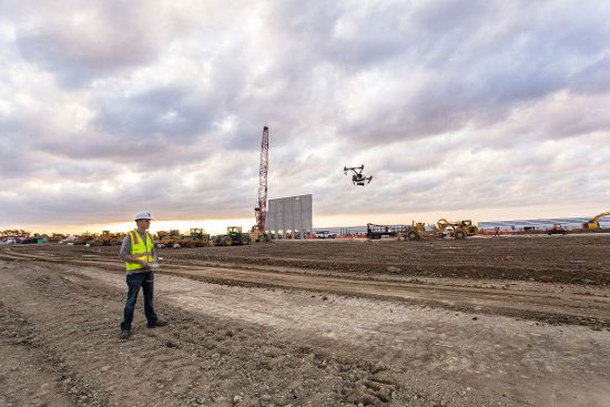
Urban building inspection using drones. (Photo:AeroSIM RC)
Then I read an article by James Poss, a retired military major, who seems to suggest that although the conclusion of the ASSURE assessment was that 2,000 grams was an OK weight for an sUAV to avoid serious injury to anyone, the FAA appears to have proposed limitations for sUAS which are only 1/10th of this weight. This is more in line with the weights in the mil-spec standard that are based on small, fast, solid-metal blast fragments.
It might help us to also consider how often or badly people are injured by golf balls, baseballs, tennis balls or squash/racket balls — for instance, I’ve survived several golf ball impacts and even an impact with a squash racket during play without major damage. These are things we all take in our stride as part of (almost) normal human activity. I wonder how often recreational enthusiasts have actually been injured during model-aircraft flying gatherings?
FAA restricts flights over government facilities
In cooperation with the Department of Justice (DOJ) and the Department of Defense (DOD), the FAA has just established temporary restrictions on drone flights within 400 feet of the lateral boundaries of a number of sensitive federal facilities. This is in addition to previous restrictions over prisons, NGA facilities, DoD ships and other facilities.
The most recent proposed Notice to Airmen (NOTAM) lists federal correctional facilities in almost half of the states in the U.S., several medical centers, U.S. Army facilities, ammunition plants and Pearl Harbor in Hawaii. It’s hard to understand why there aren’t already permanent UAV prohibitions over all such sensitive facilities across the whole U.S. I tried to check status, but the FAA UAS Data Display System didn’t list this proposed NOTAM which apparently goes into force on Feb. 26.
Think it’s probably a question of preventing bad guys from planning or doing harm rather than being shy to be caught on video — but, for sure, these places should be as secure as possible.
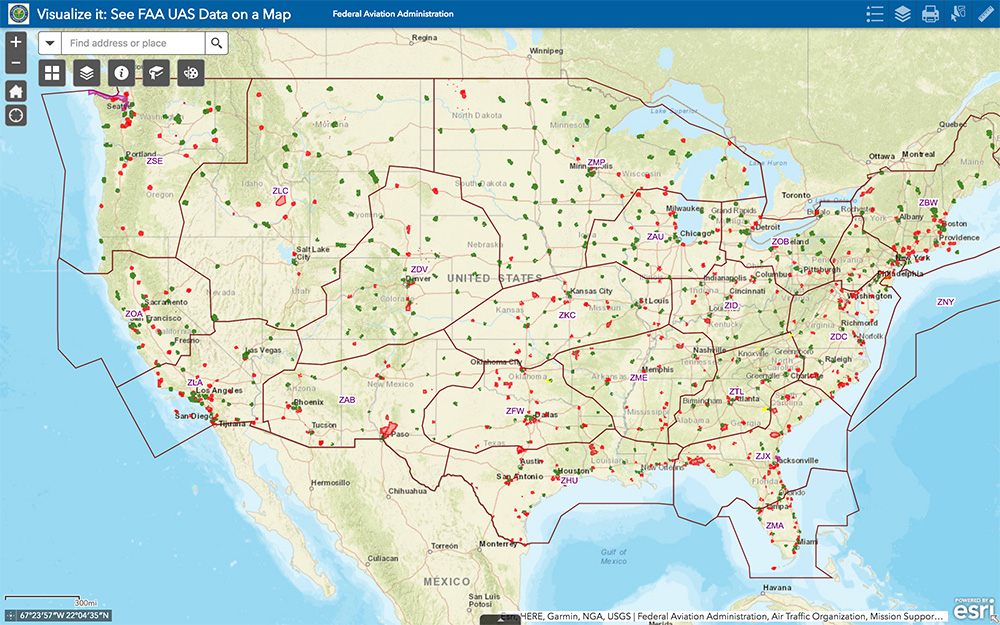
The FAA UAS data map shows all drone-restricted areas, once updated. (Screenshot: FAA)
Security at the Super Bowl
Well the game wasn’t the most exciting, with New England doing all that was needed to win in the fourth quarter, but the security for the event in Atlanta was humongous.
The area around the stadium was cleared of threats even before the game, attendees were screened for prohibited items and the airspace within 30 miles was restricted for general aviation and drone access. There were even Defense Department F-16 airspace patrols, and the Customs and Border Patrol had a Black Hawk helicopter available to intercept any aircraft penetrating the exclusion zone.
Nevertheless, the FAA still approved the operation of two tethered drones. One was flown close to the stadium by security personnel to provide live images of crowd movements in and around the stadium. The second system was operated at 45 meters above the rooftop of the CNN building facing the Mercedes Benz Stadium. CNN used it to provide aerial imagery of the scene before and after the game.
Elistair base station and DJI M200 at Super Bowl. (Photo: Elistair)
The tethered drone setup included two DJI M200 drones and two Elistair Ligh-T base stations, with monitoring, control and power provided to each drone by lightweight tethers. The security system was continuously operationed for 10 hours of captive flight during the Super Bowl, and for 14 hours total over two days — all while tethered to the Ligh-T control station. Security officials expressed their interest in using this solution more often because of the ability to follow a subject continuously without having to switch from one fixed camera to another, which risks losing the subject.
To sum up, new pending FAA regulations that support operations over people may have a few flaws. Other new FAA rules are aimed at protecting DOD and DOJ facilities from drone overflights, and tethered drones were used at the Super Bowl for crowd security and by CNN for color coverage.
New applications, new opportunities and preventive controls to maintain security at sensitive facilities — all moving in the right direction.
This report covers a number of UAV topics, including the news of another U.S. Federal Aviation Administration (FAA) program to advance drone integration in the U.S. National Airspace System (NAS); an initial effort towards Type Certification for a larger UAV/UAS; cautious steps to protect U.S. Navy and Coast Guard ships from unwanted drone overflight; and what would appear to be a surge in the number of acquisitions across the industry.
FAA Integration Pilot Program
There are signs of growing momentum to get UAVs flying in the U.S. NAS. The FAA Integration Pilot Program (IPP) website indicates that this latest initiative is spread across a number of different applications, locations and supporting organizations. The FAA cites the following objectives for IPP:
Connecting local and national UAS integration interests
Improving local, state and tribal communications
Addressing security and privacy risks
Speeding up special authorizations.
So it’s perhaps more about getting organizations at the local level into the picture, and fostering cooperation with national interests. But, at the same time, pilot projects will feed knowledge into the hopper of how to get UAVs into the U.S. NAS.
Operational concepts to be investigated include night operations, flights over people, flights beyond visual line of sight, package delivery trails, testing detect-and-avoid technologies and verifying the reliability and security of UAS data links.
Certification Program underway for Insitu ScanEagle3
Along the same lines, Insitu is working with FAA staff towards certification of the commercial ScanEagle3 drone system to enable flights in U.S. controlled airspace. A recent three-day Type Certification Board meeting held between FAA and Insitu included launch-to-capture flight tests, plus review of applicable standards, flight training and technical publications and manuals to determine Insitu’s basis for the proposed UAS Type Certification of the ScanEagle3 in 2019.
Once an aircraft or UAS gains Type Certification, it should be possible to fly that model on a regular basis, without the need for special FAA authorization of individual operations, as is currently the requirement for drones — other than for small UAS (sUAS), which already have FAA approved operational regulations. This effort could also clear the way for certification of larger drones to regularly operate in the NAS. Filing a flight plan with local FAA controllers prior to each flight would then typically be required, as is standard for all manned aircraft.
FAA review teams examine Insitu’s ScanEagle3 at a type certification board meeting in Bingen, Washington (Photo: Insitu)
At the recent review meeting with FAA team members from various certification groups, Insitu discussed its internal culture of safety, which is in line with the FAA’s extremely strict safety standards. The design and technology of ScanEagle3 was demonstrated, and the maturity of Insitu as an aircraft manufacturer was emphasized.
The FAA teams participated in an overview of Insitu’s Project Plan for Certification, examining Insitu’s detect-and-avoid (DAA) capability planning, safety management system and model-based engineering processes.
Insitu is hopeful that Type Certification will enable ScanEagle3 to be applied quickly to all types of operation, which could include data collection, analysis and delivery; aerial infrastructure survey; disaster recovery; and wildfire suppression – without the delay currently associated with seeking permits and overcoming temporary flight restrictions.
FAA restricts drone operations near sensitive U.S. facilities
Meanwhile, the FAA flexed its legal muscles to restrict drone flights near U.S. Navy (USN), U.S. Coast Guard (USCG) and Department of Energy (DoE) facilities and assets. Growing concerns with potential malicious drone flights over sensitive, high-priority facilities and ships apparently prompted the FAA to issue two NOTAMs (Notice to Airmen). The first notification describes the locations and the assets – in this case, ships operating from two bases — and includes the form of restrictions that are being applied.
Drone flights have been restricted around USN and USCG vessels operating near Naval Base Kitsap in Washington state and Naval Submarine Base Kings Bay in Georgia. Drones are not allowed to get closer than 3,000 feet laterally and 1,000 feet vertically from vessels. And the NOTAMs carry the dire warning that these ships have the authorization and ability to take whatever action they feel necessary to protect themselves from such threats.
In other words, if the nut-case flying an unwelcome drone penetrates the restricted area around a Navy or Coast Guard ship, the target ship might well take out the unwanted drone. And the FAA may also pursue civil penalties and/or criminal charges against the operator for disobeying the restrictive notice.
The second NOTAM warns drone flyers to remain clear of all national Department of Defense (DoD) and DoE facilities and mobile assets, as well as USCG vessels. With UAVs carrying explosive devices becoming more common in areas of conflict or political unrest (in Venezuela, for instance), it’s not surprising that U.S. DoD is concerned this could soon start to happen closer to home.
Industry consolidation continues
Finally, following a letter of intent from Textron Systems to buy Howe & Howe Technologies a land mobile robotics defense outfit, drone industry consolidation also seems to be gaining momentum.
Howe & Howe’s land vehicles are built and proven for extreme environmental conditions, and U.S. government customers have selected Howe & Howe’s small, highly mobile Ripsaw Super Tank for its speed, mobility and off-road performance, while the RS2-H1 SMET was down-selected to compete to be the U.S. Army’s first platoon load-carrying robot, after completing a 60-mile test through swamp and jungle terrains.
Textron Systems continues to position itself as a global leader in autonomy applications in air, land and sea.
In addition, Delair has just announced an agreement to acquire the key assets of Airware — a developer of software analytics tools for data collected by drones. The acquisition quickens Delair’s growth and increases options for the commercial UAV market. Delair provides end-to-end solutions, including fixed-wing drones, cloud-based data processing and analysis, local customer support and custom consulting services.
Delair UX11 mapping drone (Photo: Delair)
The acquisition is through an asset purchase of Airware’s technology, including proven software, related personnel in Paris, existing customer relations and established distribution channels. Airware’s data management and data analysis tools will be highly complementary with Delair’s existing solutions and will also expand Delair’s U.S. market presence, providing access to additional key industrial markets.
Airware, based in California, has provided a cloud-based software solution to large companies in the construction, mining and insurance industries. Its software solution was developed with support from Caterpillar and has been distributed by Caterpillar dealers to more than 50 countries to improve the productivity and safety in mines, quarries and construction sites.
Delair, with more than 180 employees worldwide, has customers in a number of industries including mining, construction, energy, utilities, oil and gas, transportation and security.
PrecisionHawk has also announced the purchase of Uplift Data Partners, which provides turnkey inspection services for construction, building information management (BIM) and real-estate. This is PrecisionHawk’s fifth acquisition during 2018 — earlier acquisitions have included Droners.io, Airvid, HAZON and InspecTools. These acquisitions have created dynamic synergy, and provided enhanced airborne intelligence with strengthened data value for PrecisionHawk.
Uplift’s commercially trained drone pilots will join PrecisionHawk’s network of more than 15,000 drone pilots, one of the largest networks of its kind. Suzanne El-Moursi, CEO of Uplift, will join PrecisionHawk’s executive team and will manage the company’s construction business.
The intent is for customers to receive best-in-class aerial data and analytics for complex construction and facility inspection projects, through combined PrecisionHawk’s advanced products and services, and Uplift’s industry experience and training standards.
PrecisionHawk and Uplink will combine products for construction projects. (Photo: PrecisionHawk)
Uplift Data Partners has been an integrated subsidiary of Clayco, an architecture, engineering, design-build and construction firm, with more than $2 billion in annual revenue. Following the spin-off, Clayco will still source its construction projects exclusively to PrecisionHawk, and will support PrecisionHawk’s board of advisors.
The construction industry has rapidly adopted commercial drone technology — transforming construction processes by decreasing the need for protracted visual inspections, shortening planning time, improving worker safety and quickly identifying problems.
And finally — Microdrones, a provider of professional UAV solutions, has announced that it has acquired geomatics service provider Navmatica Middle East (ME) with an office and team in Dubai, UAE. Navmatica ME supplies services and custom software development for geodetic positioning, airborne mapping, mobile mapping and indoor mapping.
Microdrones md4-3000 drone. (Photo: Microdrones)
The acquisition establishes a foothold in the Middle East market for commercial drones, and adds an experienced team of geomatics engineering specialists, software developers and systems engineers who have a proven track record of providing customers with high-quality geomatics services and technology.
Summary
We have FAA efforts to move further forward with UAV integration with its IPP program, first steps down the lengthy and somewhat arduous path towards the certification of larger UAVs to enable less restrictive flight in the U.S. NAS, notifications to operators to improve protection of Navy and Coast Guard ships from unwanted overflight and potential drone attack, and plenty of signs of drone service and manufacturer business consolidation — lots of what we may think of as positive indications of greater maturity and progress for the UAV industry.
The attack seems to have been mounted by those operating two small six-rotor UAVs similar the DJI Matrice 600 — one was certainly carrying explosives because it was videoed exploding. These drones showed up somewhere near Maduro and disrupted not only the president’s speech, but also broke up the parade with participants running for cover.
One drone seemed to collide with an apartment building, fell to the ground, and then fire broke out in an apartment on the first floor. Firefighters apparently disputed a drone explosion saying that a propane gas tank had exploded inside an apartment, but images show a significant hole blown in the wall below the apartment window.
A number of discrepancies could suggest that the incident was staged, but there were injuries to several in the parade below where the first drone exploded, and the apartment fire was only 400 meters from Maduro’s review stand. The “apartment drone” appeared to behave as if control had been lost, possibly due to anti-drone jamming. Check out pictures, a video and a comprehensive analysis of these events on Bellingcat here.
Zephyr-S launched for flight test. (Photo: Airbus)
Meanwhile, on a more drone-positive note, the Airbus Zephyr S pseudo-satellite, solar-powered UAV achieved a world endurance record flight which was just 3 minutes short of 26 days, eclipsing a previous record of 14 days set by a Zephyr prototype. The ultra-lightweight UAV took off July 11 July and landed Aug. 6. This is likely the longest ever flight by an air-vehicle without refueling (balloons and spacecraft excepted).
The Zephyr S is the first of three such vehicles built by Airbus for the U.K. Joint Forces Command. The Zephyr-S flies around 70,000 feet in the stratosphere, powered solely by sunlight, and is aimed at providing short turn-around, satellite-like communications and observation services for both commercial and military customers. The potential exists to support disaster monitoring of fires, earthquakes, oil spills and the like, and to connect almost everywhere in the world that doesn’t already have established communications.
Following evaluation of the flight test results, further flights are planned from a new base at Wyndham airfield in Western Australia. The aircraft is extremely light and does not have an undercarriage, so it’s hand launched and retrieved under minimal wind conditions.
Joe Lee and paramedics UAV pilot Scott Mcleod confer before a simulated medical rescue scenario. (Image: Kongsberg Geospatial)
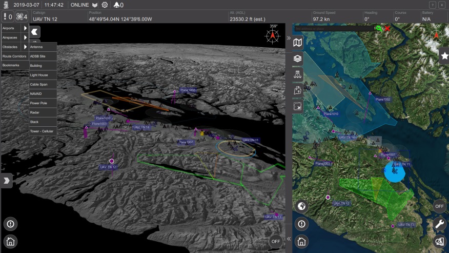
Meanwhile, at a deserted airfield near Pembroke, Ontario, Canada, a simulated disaster exercise, led by a Royal Canadian Mounted Police (RCMP) incident commander and supported by personnel from Transport Canada and the National Research Council, was evaluating a new air traffic management system supplied by Kongsberg Geospatial from Ottawa.
Integrating drones with disaster management air traffic is one aspect of the Emergency Operations Airspace Management System (EOAMS), a situational awareness system which provides first responders with situational awareness of the airspace around a disaster scene. The system integrates real-time data from a number of sensors, including 3D airborne radar, ground radar, ADS-B (Automatic Dependent Surveillance — Broadcast) sensors, video and GPS. Real-time information was presented to participants on regular computer displays and through a Microsoft HoloLens “mixed reality” visor.
Drones were flown beyond visual line-of-sight (BVLOS) at up to 2 km away from the airfield while the trial emulated emergency scenarios including a plane crash, a medical emergency, and the protection of a VIP threatened by an approaching, unauthorized drone. Drones were operated by the RCMP and local paramedics.
The EOAMS system displayed ground tracks and the identity of a variety of emergency aircraft, and emergency ground vehicles, and enabled safe flight of UAVs within the same airspace. Non-participating drones in the area of the disaster were also identified as possible threats to police and medical aircraft involved in the recovery efforts.
The RCMP and paramedic pilots flew consumer-model drones including the DJI Mavic to test the system’s capacity to detect small drones. Position outputs from these drones were used to verify the accuracy of the EOAMS-displayed plots. A light aircraft was also used to simulate different airborne assets, including a water bomber.
What was learned in the trials will be useful in further development of future emergency airspace management systems for use by first responders, police services and other government agencies in Canada.
RoboTiCan, an Israeli start-up, has developed a unique way of dealing with unwelcome, unidentified drones that intrude into sensitive airspace. With ground-based radar detecting and tracking an incoming UAV, its large, robust drones use machine vision and artificial intelligence technologies to identify threats and then physically attack them.
This video provides — complete with dramatic accompanying music — an insight into how their “Goshawk” drone engages, attacks and by brute force, disables smaller drones in flight.
At first encounter, the Goshawk octocopter appears to also be disabled by an intentional collision with a small UAV, but subsequent encounters demonstrate how it hones in on, collides with, and disables its target and recovers to attack again.
Compared to bird behavior, especially in the spring when nesting birds use similar tactics to defend their eggs or chicks, it does seem that its mode of operation could be very much like a hawk attacking smaller birds — hence its name.
The Goshawk uses strong, fiber reinforced blades to enhance impact survival, while its smaller drone victims may have plastic props. Overall, it’s large, has multiple blades, seems to use an attack move just before impact, and it recovers well. So control algorithms appear to have been enhanced for collisions and recovery. Its targets seem to immediately lose lift and control before they hurtle towards ground impact.
Not surprisingly, RoboTiCan appears to be positioning its marketing towards military customers, but combining this aggressive take-down capability with a high-quality drone detection/location system might also be a winner for civilian/government drone intrusion defense — Mr. Maduro, take note!
To sum up, we have more bad press for UAVs being used as offensive weapons, interesting progress towards pseudo-satellites as Zephyr-S completes 26 days aloft in the stratosphere, another UTM (UAV Traffic Management) system trial aimed at better air traffic control for disasters, and another way to bring down unwanted drone threats.
This last solution might be a better deterrent for negligent or intentional operators who stray into inadvisable airspace. The potential destruction of the drone might just get some recreational flyers to think twice and perhaps reduce these problems.
After a couple of good hours of progress, we suddenly ran up against a massive “tail-back” — as the English call road-blocks — on the A303. We eventually crawled along further and discovered that all the rubber-neckers were slowing to grab a glimpse of Stonehenge, which you can see on the left, not far from the road. A little further on I saw a sign for Farnborough and thought that its surely around this time of year for that huge aerospace show known as the Farnborough International Airshow. So when I arrived home after almost three email-less weeks, it was not surprising that my inbox was crammed with lots of European aerospace news.
SkyGuardian MQ-9B
General Atomics (GA-ASI) seems to have come out tops in UAV public relations, flying its MQ-9B company-owned SkyGuardian from Grand Forks, North Dakota, to Royal Air Force (RAF) Fairford in Gloucestershire, U.K. on July 10-11 — that’s a 3,760 nautical mile flight in a fraction just over 24 hours. The RAF has operated the MQ-9 Reaper for over 10 years and the RAF configuration of the MQ-9B will apparently be called PROTECTOR RG Mk1. It just so happens that the RAF is celebrating its 100-year anniversary, so GA-ASI took the opportunity to drop in and say hello at a much smaller airshow at Fairford July 13-15.
Then they announced last week at Farnborough that GA-ASI had been selected to provide UAS to the Royal Netherlands Air Force (RNLAF) following consideration by the Ministry of Defence for the Netherlands. Doesn’t sound exactly like a contract yet, but its close enough to say that the Netherlands will take delivery of the Predator B/MQ-9 Reaper Medium Altitude, Long-endurance UAS. They also reminded us that the Spanish Air Force is to take delivery of MQ-9 systems in 2019.
From a SatNav point of view, we might also be interested that the GPS receiver on this UAV has also been upgraded to add Galileo signal capability — a requirement for what seems to be an expanding number of government forces in Europe. No luck yet in securing better information from GA-ASI about this upgrade, but Farnborough has likely kept them hopping, so hopefully more news later.
Zephyr S High Altitude Pseudo-Satellite UAV
Photo: Airbus
Fresh on the heels of taking on the Canadian Bombardier C-Series program (now the Airbus A-220) and closing the first deal with JetBlue for 60 of these aircraft, Airbus has committed to production of the Zephyr S HAPS (High Altitude Pseudo-Satellite) solar–electric, stratospheric UAV.
Zephyr has an 82-ft. wingspan and is designed to operate on solar power in the stratosphere at an altitude of around 13 miles emulating equivalent services provided by satellite. This is well above clouds, the jet stream and the ozone layer, and importantly well away above regular air traffic. Airbus anticipates the drone flying for up to 100 days without landing (its currently record is 14 days) and to travel up to 1,000 nautical miles per day. It weighs 165 pounds, but can support a payload up to five times its own weight.
The Zephyr aircraft began its maiden flight in Arizona a few days ago — the “qualification flight” is being supported by both the U.K. and U.S. governments — and the U.K. Ministry of Defence is the launch customer for Zephyr. The aircraft has so far logged around 1,000 hours total flight time. The test flight will conclude once engineering objectives have been met. Other solar-cell powered aircraft have struggled with landing or take off due to the large wing, light weight and hence stability under wind gusts, so several projects have not progressed past the R&D stage. Airbus & RAF’s commitment to production indicates their faith in the aircraft design.
Staying with the U.K. theme, the Goodwood Estate in Chichester, England — famous for the Goodwood car racing circuit — has recently hosted the Goodwood Festival of Speed, which apparently included drone racing. And at the same time, a Guinness World Record drone speed record was established.
Wingcopter XBR
The Wingcopter XBR is a tilt-rotor UAV with two lift props and two horizontal velocity props, and the drone flown by teenage drone racer Luke Bannister reached an average of 240.6kmph (~150m/h) over a Goodwood 100 meter track, flying over the measured track in both directions to account for wind. This set the world record for the fastest ground speed by a “remote-controlled tilt-rotor aircraft.” A previous record of 179.6 mph has been achieved by a quadcopter drone rather than a tilt-rotor UAV like the Wingcopter, but there is apparently more drag with type of drone, so its classified as a different category of UAV.
Northrop Grumman Triton High Altitude UAV
Northrop Grumman Triton High Altitude UAV. (Photo: Northrop Grumman)
Meanwhile, Northrop Grumman released a statement at Farnborough on their continuing discussions with Germany towards the sale of its high-altitude Triton MQ-4C unmanned surveillance drone, but apparently a lot of work still remains. In April the U.S. State Dept. authorized the sale of up to four drones worth up to $2.5 billion, and the German government has since been working closely with the US Navy towards a deal.
People may recall the previous cancellation of the “Eurohawk” program back in 2013 — under which Germany had planned to buy a version of Northrop’s Global Hawk drone — after escalating estimated costs for civil certification of the vehicle hit 600 million euros ($702 million) — not a minor task in any way.Subsequently, Northrop and Airbus Defense and Space have teamed up on a new ‘Pegasus’ program, which will add UAVs to Germany’s surveillance capabilities — drones flying autonomously as high as 60,000 feet to gather a wide array of intelligence data.
The German government plans to buy three of the drones, equipped with sensors and a mission system now to be engineered by Airbus. Preparations for certifying equipment to enable the drones to operate in civil airspace are moving more smoothly this time, but with deliveries to only start in 2025. Northrop developed the Triton, a marine-based variant of the Global Hawk, under a U.S. Navy contract awarded in 2008. And Australia last month said it plans to buy six Triton aircraft for maritime patrol, initially expected to cost A$1.4 billion ($1 billion U.S.).
So, lots of military drone stuff this month — not unusual given the nature of the Farnborough U.K. airshow, even though Boeing and Airbus also use the show to one-up each other’s announcements of commercial aircraft contracts and options. Lots of good news for General Atomics, not so much yet for Northrop Grumman, and some light relief with high speed drone records at Goodwood. Back to more North American UAV news hopefully next month.
As the dust from this year’s AUVSI Xponential show, which took place May 1-4 in Denver, begins to settle, we complete the overview we began last month and wrap up our coverage of the show.
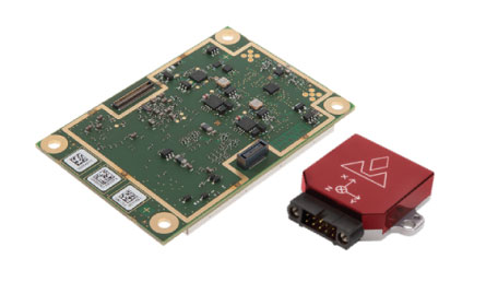
Septentrio
Septentrio introduced its AsteRx-i V product series of integrated GNSS/inertial receivers, based on the Septentrio m2 GPS/GLONASS/Galileo/BeiDou/QZSS/SBAS receiver and a high-end VectorNav MEMS IMU. Providing:
AsteRx-i V receiver & IMU. (Photo: Septentrio)
Reliable, accurate IMU-enhanced GNSS positioning down to the cm level
Full attitude — heading pitch and roll
Lightweight, low power <50 grams, typically 1.5 W — suitable for UAV applications
AIM+ interference monitoring and mitigation system
High update rate, low-latency positioning and attitude
Also introduced at the show was the AsteRx SB, a packaged version of the m2 receiver with multiple interfaces and Bluetooth wireless, targeted at machine control and other sensor fusion applications.
GSS9000 Simulator. (Image: Spirent)
Spirent Federal
Spirent offered a demo of its “flagship” GSS9000 simulator at the show — with capability to generate all constellations, all frequencies, plus L-band signals. Kalani Needham (director of sales) also mentioned the company’s sim-MNSA program with Rockwell Collins, aimed at providing support for M-code for the GNSS simulation market.
DJI
Inspire drone. (Image: DJI)
As usual, the DJI booth was extremely busy — with a demo area almost continuously flying each of the most popular DJI drones. What I learnt from my visit was that 70 percent of sales are recreational, and the balance is commercial. With quadcopters for hobbyists, using replaceable parts, auto-flight systems and data links, DJI was virtually the first drone manufacturer to market, and still one of the most successful. The Phantom now carries gimbal-mounted cameras and is finding lots of applications with business, academics and government agencies, including first adopters like the film and TV industry.
Phantom 3 drone. (Image: DJI)
DJI drones have weather resistant bodies, strong blades, swap-out easy-charge batteries, and ADS-B, RTK and heading capabilities. Set-up in the field is simple, with an SDK for lab developers, multi-spectral cameras for applications such as crop growth monitoring, real-time data available through the control uplink and infrared/visible slant-range outputs.
DJI’s approach is to keep ahead of the competition by adding more and more technology over time, and the company clearly has the sales volume to support this strategy.
CyPhy Works
PARC tethered drone system. (Photo: Tony Murfin)
CyPhy Works makes and promotes tethered drones — enabling very long endurance reconnaissance/forward observation/inspection/communications. The company got into this specific drone niche because it found customers who couldn’t live with short duration battery-restricted drone operations.
For ground forces, having a real-time video overview from higher altitude is of great benefit; similarly, they’re of great use for disaster recovery efforts, such as in the aftermath of hurricane Harvey in Texas. And if you add a Wi-Fi transducer working through one of two payload ports on its PARC (persistent aerial reconnaissance and communications) platform, you can also reconnect survivors and provide a comms network for first responders.
Ruggedized Duro receiver. (Image: Swift Navigation)
Swift Navigation
Swift is a relatively new GNSS receiver manufacturer, and its Piksi Multi receiver has a lot to do to catch up technically with the products offered by the predominant players in the market. So its approach is to use rock-bottom pricing for almost all of their offerings. Currently, the Piksi has only GPS L1/L2 and GLONASS L1/L2 plus SBAS, but Galileo and BeiDou are promised for later this year.
The new Swift capability launched at the show is Skylark, a cloud-based, hybrid PPP/RTK network currently testing in around six U.S. areas and planned for national and even worldwide coverage sometime in the future. Skylark is apparently cellular, with a large number of base sites, each equipped with a Swift Duro receiver. With a target subscription price of only $495 per year, this could be a popular GNSS assistance service, provided you use compatible Swift receivers in your application.
Swift is targeting automotive applications, and has a San Jose trial underway with Voyage at a retirement community — residents call for a self-driving taxi using a cell-phone app, and get transport anywhere in the 4,000-strong community. A similar trial at the Villages in Florida (125,000 residents and 750 miles of roads) is also apparently getting underway.
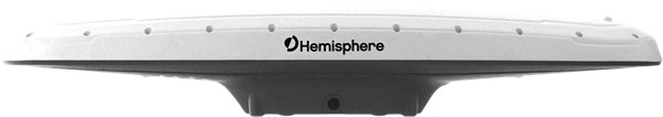
Hemisphere GNSS was also at the show with its line of GNSS receiver solutions for UAVs, Atlas Correction Service and a new V500 Heading/Smart Antenna.
The Vector V500 is an all-in-one multi- frequency, multi-GNSS smart antenna that provides RTK-level position and precise heading. The latest generation of Hemisphere’s heading antennas now appears with an integrated GNSS receiver and a rugged design sealed for the harshest environments — a design that has evolved over many years. It takes a great deal of sweat and tears to get to a reliable weather-hardened product, and Hemisphere has no doubt incorporated a lot of experience into this latest product.
Atlas corrections are derived from public JPL data and are supplied worldwide over Inmarsat L-band satellite transmissions.
Harxon Corporation
D-Helix antenna. (Photo: Harxon)
Harxon’s D-Helix antenna got lots of attention at its booth, as did the OEM frequency-hopping transceiver. The D-Helix antenna supports GPS, Galileo, BeiDou and GLONASS, as well as L-band signal reception. With low wind resistance and ruggedized IP67 protection, this antenna appeared to be very popular at the show for UAV applications.
The frequency-hopping OEM transceiver works over 840-900 MHz and weighs in at only 5 grams. With anti-jamming and wide signal capability, this miniature device is designed for complex data-intensive applications. In full duplex mode, secure data transmissions are possible over long distances with low latency. The popularity for this transceiver at the show might be connected with a recent FAA proposed rule that would require transmission of a drone’s registration ID for remote identification.
More
Other neat products and applications the GPS World team came across at the show included:
Topcon’s B111 multi-constellation GNSS receiver and the Topcon-distributed Sirius Pro fixed-wing UAV and Intel Falcon 8+ quadcopter;
the Rockwell Collins aviation Flight Management System, which is apparently being incorporated into the General Atomics commercial Flight Guardian system;
the senseFly eBee series of drones with automated mapping capability and a BVLOS (beyond visual line of sight) trial in Canada with in-flight data — more on this later.
GPS World will bring you a special UAV supplement later in the year, and we will carry more news and details on selected manufacturers and applications within this exciting and ever-expanding drone industry.
Drone operational rules have quite a few restrictions, largely aimed at keeping unmanned aircraft away from manned and commercial aircraft operations. The Federal Aviation Administration (FAA) has set a boundary limit for UAV operations to stay a minimum of 5 miles away from any airport. So it’s a little surprising that at least one airport is actually carrying on trials to fly drones within airport property.
The reason is birds. Most airports are large, open spaces where birds love to land in large numbers to seek food and to rest, so airports and aircraft have to cope with the problem of avoiding bird-strikes in the critical phases of take-off and landing.
Airports have used remotely compressed air cannons, and manually fired ordinance that “screams” or explodes making various forms of loud noise, or dogs or even hunting falcons of different species. Birds, however, become habituated to cannons and guns, and neither dogs nor hunting falcons can be relied on to actually herd birds away from runways.
All this is in an effort to drive flocks of birds away from runways and low-altitude aircraft traffic corridors. At high altitude, a bird strike is usually survivable and an aircraft still has sufficient energy to be able to glide in the event of a complete engine-out situation, giving the pilot time to find a landing place. U.S. Air’s Chesley Sullenberger was a great airman to save his passengers and aircraft, but he was also lucky to have the Hudson right there to ditch into. He was some cool dude when he put his Airbus A320 down on the river, once losing both engines at low altitude on take-off after flying through a flock of Canada Geese.
Enter Robird, a drone that looks — and behaves, in the right operator’s hands — like a female peregrine falcon, with flapping wing propulsion and attack moves emulating the predatory bird. Flown by a pilot and accompanied by an observer whose primary job is to ensure the UAV “bird” stays away from runways, the pair seeks resting flocks of birds that pose risk to aircraft within the boundaries of an operational airport.
https://youtu.be/-gc8kBmzOOI
Clear Flight Solutions in Holland has recently undertaken a trial at Edmonton airport in Alberta, Canada, where it obtained special flight clearance to fly within the airport grounds to demonstrate how its mechanical falcon could clear birds away from airport danger zones.
Of course, drones and aircraft don’t mix either, so flight rules within the drone systems (GPS/autopilot?) apparently include geofenced no-go areas corresponding with runways and approach areas, and there is a shutdown mode in case of loss of signal or other failure — avoiding runway incursion is all important.
Registration is back on
Since U.S. Federal Aviation Administration (FAA) regulations requiring registration of small UAVs (sUAV) and model aircraft were struck down last spring by the appeals court, the need to register has been in abeyance. However, Congress has rolled a new requirement back into the recently signed $700 billion National Defense Authorization Act, making registration of any sUAS or recreational model aircraft a legal requirement, subject to fines for lack of compliance.
The FAA has continued to advocate registration as a means to track wayward operators and to enforce separation of drones from manned aircraft. AUVSI has also continued to support the FAA position. A 2012 law, on the other hand, was said to prevent the FAA from making rules covering “model aircraft,” defined as “unmanned aircraft” flown for recreational purposes.
The new regulation within the Defense Authorization Act has now apparently clarified and overcome any contradictions — recreational model aircraft and drones all have to be registered.
DJI claims and counter-claims
The U.S. Immigration and Customs Enforcement’s (ICE’s) recent claims that manufacturer DJI could be spying for the Chinese Government have been refuted by DJI.
DJI has responded that allegations are wrong and that ICE should consider withdrawing or correcting unsupportable assertions. But claims persist that the Chinese government may be using information gathered by DJI UAVs to target potential assets for purchase.
A large wine producer in California used DJI UAS to survey its vineyards and monitor grape production, but soon afterwards a number of Chinese companies apparently purchased vineyards in the same area. So it’s being alleged that the companies appear to somehow have used DJI data.
DJI UAVs collects reflective images of leaves to calculate the nitrogen levels of plants using a specialized infrared scanner. The scanner enables growers to deduce how much nitrogen to add to the soil to optimize plant growth. Information on the location and stages of crop growth can also be collected. As of May, it’s been reported that DJI’s only customers using this particular scanner were wine producers along California’s Pacific Coast.
Most UAVs would seem to be capable of collecting location and geographic information data; however, these claims are being leveled at manufacturer DJI. In a website statement, DJI denied any wrongdoing but hinted that some of its data storage may have been compromised.
This story may be far from over.
Potential new aircraft control systems?
I recall climbing around in the fuselage of a Jet Provost training jet back in my apprenticeship years at BAE in the UK — I was wiring in auxiliary systems. But the thing I remember most was the mass of control cables running down the top center of the aircraft and winding their way to control surfaces via pulleys, with in-line tensioners and rubber lined holes to pass through bulkheads. I thought, How reliable could this be? Of course, it’s the way almost every aircraft control system has been constructed since Wilber, Orville and wing-warping. Up until we got fly-by wire and electrical actuators, that is — then mechanical cables became less prevalent, except for reversionary back-up.
But making surfaces pop up into the airstream around an aircraft is how we’ve been able to take off, maneuver and land aircraft/UAVs — up to now. Elevators, rudders, ailerons, leading and trialling edge flaps, speed brakes — all of them control pitch (up and down), yaw (left to right), roll and manage lift. These mechanical control surfaces sprout out of the wings and horizontal and vertical stabilizers, and provide control for the pilot, autopilot or onboard flight computer.
Now BAE Systems and Manchester University (MAN U) in the UK have come up with a different way to control a flying vehicle without using moving control surfaces. If the smooth surfaces of a stealth aircraft were to be never disturbed, the stealth radar signature of the vehicle would remain unchanged even during maneuvering — a handy enhancement to have to keep an aircraft as invisible as when it’s “clean” in level flight.
The BAE/MAN U innovation, incorporated into a new MAGMA drone, uses internal, redirected air from the engine to “blow” the aircraft into a different direction. The small demonstration UAV has apparently completed a successful first flight.
These innovations could both reduce mechanical complexity and improve the integrity of a stealth signature, by removing conventional control surfaces. Wing circulation control redirects supersonic air from the engine and blows it through the trailing edge of the wing. Thrust vectoring changes the direction of the aircraft’s exhaust.
When used together, these control the direction of the aircraft by manipulating the air around it. Hydraulic and electrical actuators have been replaced by air redirecting ducts and air blowers, which may simplify build and flight controls without making the air vehicle more visible to radar. Of course, taking additional airflow from the engine means the engine has to be more powerful to provide the additional airflow, so this doesn’t come for free.
The technologies being developed may enable cheaper, higher performance, next-generation aircraft. Its hoped that R&D will contribute towards technological improvements for advanced military aircraft. These trials are an important step forward in the exploration of adaptable airframes — along with other work to improve the performance of UAVs in collaboration with the University of Arizona and NATO Science and Technology Organization.
MicroPilot adds sense and avoid
MicroPilot in Manitoba, Canada, is a leading supplier of autoflight solutions for the UAS industry. The latest MicroPilot autopilots include integrated control datalinks, and they are small, lightweight and interface with a wide range of sensors. MicroPilot has now integrated its UAV autopilot with the FLARM sense and avoid system, adding an essential element for autonomous and beyond-visual-line-of-sight (BVLOS) operations.
FLARM is a traffic awareness and collision avoidance technology used by light aircraft and UAVs. When integrated with MicroPilot’s autopilot, the system alerts the autopilot of any close-by, suitably equipped aircraft. FLARM outputs the velocity and altitude of these detected targets, and the autopilot then decides how to avoid them.
FLARM collision avoidance systems, used by manned aircraft for more than a decade, now come with an ADS-B out option that broadcasts the UAV’s position to alert other aircraft to its location. Together, the MicroPilot autopilot and integrated FLARM system offer a unique combination of automated flight control and sense-and-avoid capability for UAS developers.
Summary
So bird-hunting, wing-flapping, bird-like UAVs being used to clear airports to prevent collisions between birds and aircraft; you will need to put down your $5 registration fee with the FAA if you want to fly your own UAV because new legislation has replaced that previously struck down in the courts; DJI and the U.S. ICE seem to be on some sort of a collision course; BAE and MAN U appear to be on the verge of a potentially revolutionary system with which to affect flight control of aircraft and a combined system for autoflight and collision avoidance — just a few of the many things happening this month in the UAV industry.
It’s been a couple of months since we ran an update on unmanned aircraft, so there are lots of news items to dust off and maybe look at more closely.
I suppose we’ve all seen those futuristic movies with masses of orderly air traffic traveling rapidly down invisible roads hundreds of feet above cities — maybe the Jetsons first got us thinking about this vision of tomorrow? Well, unmanned flying taxi demos in Dubai certainly caught my attention. Could this be the launch of the first phase of “airborne street traffic”?
Demo UAVs in Dubai, China
The two-seater UAV built by Volocopter demonstrated in Dubai has 18 rotors, and during the five-minute demo for the media, Crown Prince Sheikh Hamdan bin Mohammed was flown at around 200 meters over sand, rather than over a populated city. There surely could be a number of safety elements yet to be implemented before we see this become operational — but you have to start somewhere.
The Volocopter demo was preceded at the beginning of this year by the appearance of a single-seat Chinese demo vehicle. This smaller eight-rotor drone by EHang took a shot at being a future “over-city” cab.
Urbain Air Project
In the meantime, Airbus and HAX, a start-up investor, are seeking innovators to participate in a four-month program to advance developments in urban-air mobility — innovations which could speed-up development of “flying cars.”
The project is looking for technologies already being developed in:
Urban air transport vehicle technology
UAV sense and avoid technology
Airport runway and landing detection systems
Emergency safety systems for airborne vehicles
Required infrastructure for airborne transport vehicles
Autonomous airborne vehicle technology
Aerial maneuver decision making and support systems
Air traffic management systems
Aerial collision detection and avoidance systems
Battery packaging and management systems for airborne vehicles
Several startups could be funded with at least $100,000 each, and will be asked to spend four months in Shenzhen, China, turning their concepts into prototypes with support from HAX and Airbus engineers.
Safety Standards?
All interesting stuff, but at some stage someone has to take a serious look at the safety standards needed to protect prospective passengers. The existing designs appear to have some flight control redundancy, and there are hints of a possible loss of data-link reversionary mode, but there might be more significant work to be done before any regulatory agency such as the Federal Aviation Administration (FAA) were to validate system reliability. But good luck to these innovators and other companies who are working towards implementing this fascinating concept.
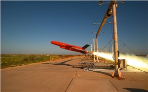
At the other end of the drone spectrum, Renishaw Canada recently showed off a drone made of titanium and produced using 3D printing.
The Firefly is a 3D-printed titanium rocket-powered drone that can fly at nearly supersonic speeds, with onboard telemetry and a spring-released wing. The Mach 0.8 drone has been produced by the Renishaw additive manufacturing group for an unnamed North American aerospace company. The drone can apparently house a number of miniaturized sensors for data collection.
Possible applications of this unique high-speed, short-duration drone could include data collection flying into storms and hurricanes, or perhaps for longer distance surveying when launched from a future Mars rover.
Boeing Acquires Aurora Flight
And on the business front, the recent news is that Boeing is in the process of acquiring Aurora Flight Sciences Corp. Adding Aurora as an independent operation alongside Insitu will probably lead to migration of technology between the two Boeing UAS units, which is presumably why Aurora is being acquired.
Aurora has focused on electric propulsion systems and automation and autonomy for robotic operations and UAVs. Aurora has also collaborated with Boeing in the past on rapid prototyping for drones, and structural assemblies for military and commercial applications.
As a unit of the Boeing Company, Aurora technologies for long-endurance aircraft, robotic co-pilots, and autonomous electric multi-rotor UAVs will have a better opportunity to make it to product level, and wider applications should be possible for these unique capabilities.
Based in Manassas, Virginia, with facilities and offices in five other states around the United States — including R&D facilities right next to Massachusetts Institute of Technology in Cambridge — Aurora employees more than 550 people. They also have an office in Luzern, Switzerland.
FAA Regulations Revisited
Finally, according to AUVSI, in the year since the FAA released the Part 107 regulations for the operation of small UAS (sUAS), users have requested more than 1,000 waivers to work outside the parameters of these regulations. The Part 107 regulations permit users to request such waivers, provided operations can be shown to be safe. The majority of these waiver requests were to operate at night — whereas the regulations only permit operation within Visual Line of Sight (VLOS) in daylight.
AUVSI argues that certain commercial operations have only been possible through the use of these waivers, and therefore the regulations should be revised to enable normal operations without the need to grant individual waivers on a case-by-case basis. The FAA’s position may be that until such operations can be proven to be safe over time, the agency wants to know who’s exceeding which parameters, and under what conditions — hence the need for individual written applications, so that analysis of safety aspects is possible. Then subsequent monitoring will show that levels of operation may be safely exceeded on a regular basis.
This is how aviation agencies have always managed aviation safety. A UAS operator might demonstrate operational capabilities, show an acceptable safety level, and thereby prove that pushing the envelope is okay. Sometimes it can take time, but with good visibility on both sides, it’s possible that progress could be made reasonably quickly.
Rockwell Collins new generation GPS-4000-100 receiver
It’s still exceptionally difficult to qualify GNSS receivers for airborne use so there are only a few existing suppliers.
They include CMC Electronics with its line of OEM and enclosure products, Rockwell Collins with a new generation of airborne receivers just entering the market, Thales in Europe continuing to offer ARINC standard and multi-mode packaged receivers, Garmin still leading the panel-mount market for business aviation, Trimble/Ashtech continuing to promote its GPS/GLONASS airborne receiver, and newer entrants including Aspen/Accord with the NexNav GNSS line, and Avidyne with a home-grown embedded receiver in its flight management systems.
It’s been a while since we reviewed the status of certified airborne receivers, and I was prompted to do so by news that Rockwell Collins has a new generation of receiver which has just received Technical Standard Order (TSO) approval from FAA.
Rockwell Collins has fielded GPS products for 20+ years, and the GPS-4000S — with SBAS capability — has been fielded for more than 8 years, so parts obsolescence may become an issue. With new constellations, and with more countries implementing Space Based Augmentation Systems (SBAS), the 10 channel + 2 SBAS design needed an update. So Rockwell Collins undertook a bold step to develop and certify a radically new architecture for airborne applications — a software defined receiver.
Some Members of the Rockwell Collins Navigation Center of Excellence, in Melbourne FL (L-R); Jeremy Kazmierczak – Senior Systems Engineer; Eyal Wilamowski – GNSS Project Engineer; De Yao – Senior Electrical Engineer; Angelo Joseph – GNSS Architect, Technical Project Manager; and Principal Systems Engineer Vikram Malhotra – Senior Systems Engineer
A multi-frequency prototype first came together during two years of intense work by a couple of individuals, led by Angelo Joseph, an ex-NovAtel Aviation Group engineer with 15 years of GNSS design experience. When this proof-of-concept receiver demonstrated the required capability, a new GNSS receiver team was put together in Melbourne, Florida, to develop a fully qualified receiver, designed and built to stringent airborne standards.
Over the next six years, hardware was proven to meet performance, environmental, electrical, safety, high-integrity and reliability standards, and software was carefully developed and tested to meet the highest aviation qualification requirements — referred to as “Level A.”
In the process, a number of patents were generated — two have so far been approved in the United States:
Low-cost high integrity integrated multi-sensor precision navigation system, US 9513376 B1
Universal channel for location tracking system, US 9702979 B1
The universal-channel technique enables the new receiver to be configured to track any satellite navigation signal on all 14 + 4 SBAS channels (ultimately, this GNSS engine is anticipated to be able to track 100+ GNSS satellite signals), so the receiver is ready for when other constellations are approved for airborne navigation — for instance, European approval for Galileo use may be high on the list of new capabilities.
CMA-6024 GPS/SBAS/GBAS sensor
The new receiver is capable of LPV (localizer performance with vertical guidance) precision approaches to CAT I (down to ~200ft height in ~1/2 mile visibility). It features combined Required Navigation Performance (RNP) and approach capability, 10-Hz deviation output computations (20-Hz outputs), plug-and-play replacement for existing Rockwell Collins GPS receivers. It is Automatic Dependent Surveillance (ADS-B) compliant and has fast cold-start (<2 mins @ low SNR).
With production spooling up in Melbourne, Florida, it is available now for installation on business and regional aircraft.
An additional TSO application is underway to enable anticipated installations on Airbus and Boeing commercial transport aircraft. Work on the Rockwell Collins Next Generation Multi-Mode Receiver, the GLU-2100, is well advanced with an estimated availability at the end of this year.
In Europe, Thales markets the TopStar-C certified GNSS receiver solution for aircraft and helicopter navigation and approach, providing LPV, RNP and ADS-B, with Ground Based Augmentation System (GBAS) capability promised in the near future. Compliant with all these latest navigation functions, TopStar-C is available as both standard fit (installed as basic fit on a new aircraft) and for retrofit on aircraft and helicopters alike.
CMA-4124 GNSSA Precision Approach Receiver
The Thales Multi-Mode Receiver (MMR) is part of the TopFlight Line, which includes comprehensive solutions for communication, navigation and surveillance. The MMR is configured with GNSS landing system (GLS) and navigation capability, Instrument Landing System (ILS) and Microwave Landing System (MLS) receivers in one package.
ILS still provides Cat III precision landing system (effectively 700 ft visibility of the runway down to 50 ft) capability at a few key airports where severe weather can really disrupt scheduled airline operations. Nevertheless, ILS may encounters integrity problems due to FM interference and multipath reflection, which may degrade landing capabilities under low-visibility conditions — just when its most needed. MLS can provide Cat. III B (effectively 600 ft visibility of the runway down to 35 ft) landing alternative to ILS, but is fielded at very few airports.
Meanwhile, GLS is part of the international strategic plan to provide precision approach capability worldwide to an increasing number of runways. So airlines may soon have a number of precision-landing options at airports around the world — ILS, MLS or GLS — and the Thales MMR provides all three capabilities.
Garmin GTN-650 panel-mount Nav/Comm System
CMC Electronics introduced the CMA-6024 GPS Satellite Based Augmentation System and Ground Based Augmentation System (SBAS/GBAS) CAT-l/ll/lll Precision Approach Solution at the National Business Aircraft Association show in November 2016. CMC has been in the business of supplying certified GPS receivers for commercial air transport, business aviation and helicopter markets, either directly or through Honeywell and other partners for over 35 years — almost as long as GPS has been around! The CMC family of airborne receivers also has another connection with NovAtel — they were developed as a collaborative effort with NovAtel and incorporate patented Narrow Correlator signal tracking technology.
The CMA-6024 aviation GPS/SBAS/GBAS sensor has an embedded VHF Data Broadcast (VDB) receiver and an integrated GPS navigation sensor, is self-contained, and fully certified Precision Approach and navigation GBAS/GLS solution, certified to Design Assurance Level A.
Garmin GPS/Nav/Comm/Multi-Function Display.
The CMA-6024 provides a navigation solution that is fully compliant with Automatic Dependent Surveillance-Broadcast (ADS-B) and Required Navigation Performance (RNP). It comes with SBAS Localizer Performance/Localizer Performance with Vertical Guidance (LP/LPV) and GBAS Global Navigation Satellite System Landing System (GLS) GAST-C/D Precision Approach guidance for all aircraft. And it meets or exceeds the most stringent environmental requirements set out in RTCA/DO-160G, meeting additional requirements for specific aircraft, such as higher vibration levels for helicopters.
CMC’s family of GPS products includes the CMA-5024 GPS Landing System Sensor that meets the requirements for Instrument Flight Rules (IFR), civil certified GNSS, and also the CMA-4124 OEM GNSSA receiver card for embedded applications.
An SBAS/WAAS-certified, 15-channel GPS with 5-Hz outputs is embedded in the Garmin GTN-650 Nav/Comm unit, enabling GPS-guided LPV glide-path instrument approaches down to 200 ft. The system also includes VHF navigation capabilities, with a 200-channel VOR (VHF Omnidirectional Range) and ILS receiver for approaches with ILS localizer and glideslope. VOR navigation using the extensive ground VOR beacon system uses radial direction and distance to each VOR beacon within receiver range.
FreeFlight FMS/GPS
In addition, course deviation and roll steering outputs may be coupled to compatible autopilots so that IFR flight procedures may be flown automatically. And, when coupled with a flight display and compatible autopilot, the aircraft can fly fully coupled missed approaches, including heading legs as well as holds and search and rescue patterns.
In 2015, Aspen Avionics acquired Accord Technology, an Indian company which claims to have developed the first GPS WAAS airborne sensor to be authorized under US FAA TSO-C145c. These receivers are now marketed as the ‘NexNav’ product line. This receiver was apparently the first to comply with FAA AC20-165A for ADS-B GPS position source and is also sold as an OEM GPS SBAS card-level receiver authorized to TSO-204.
There are currently three NexNav receiver versions:
Mini (TSO-C145c SBAS Class Beta-1 only)
Max (TSO-C145c SBAS Class Beta -1, -2, -3) and
Micro-i GPS SBAS for TSO-C199 TABS for aircraft and experimental aircraft.
SBAS/GNSS (WAAS/GPS) 1201 Sensor
All NexNav GPS WAAS receivers are compatible with other SBAS systems around the world, including the European EGNOS, Japanese MSAS and Indian GAGAN.
FreeFlight also markets two GNSS sensors and a suite of aircraft avionics.
The 1203C sensor houses a high-performance 15-channel GPS engine with advanced interference protection and quick update rates, and is designed for business, regional, airline transport and heavy rotary-wing aircraft. The 1203C is certified to TSO-C145c and meets position source requirements for ADS-B and Required Navigation Performance (RNP) and other L-NAV operations. Another 1201 Sensor GNSS is specifically for General Aviation aircraft.
Bendix/King KSN 770 Flight Information Management System
Bendix/King GNSS navigation capability, like other General Aviation avionics suppliers, is often buried within a cockpit display system that serves to tune radios, and display information from weather radar, Enhanced Ground Proximity Warning System (EGPWS), XM Datalink Weather, Terrain awareness and warning System (TAWS) and Traffic Collision Avoidance System (TCAS).
Nevertheless, the KSN 770 features Wide Area Augmentation System (WAAS) and Localizer Performance with Vertical Guidance (LPV), and is specified as a “WAAS GPS enroute and approach navigation system.”
Ashtech, now a Trimble subsidiary, still lists the venerable GG12 OEM GPS/GLONASS receiver on its website, now somewhat updated to include SBAS as the GG12W.
Ashtech is careful to describe its OEM receiver as “capable of being qualified” within a TSO-ed FMS systems — presumably the approach has been to provide all the required qualification data to integrator companies, who include this receiver within the FMS as the GNSS navigation and approach receiver. The integrator then submits the Ashtech data to FAA to support their system TSO application.
Avidyne now integrates its own in-house-developed GNSS receiver into its line of cockpit mount FMS and related GNSS navigation and approach systems. And here there is another connection with Angelo Joseph — his work at Avidyne before he went to Rockwell Collins was to develop this Avidyne receiver to replace a bought-out embedded OEM GNSS receiver. The FMS has been certified using this new receiver to TSO-C146d — Stand-Alone Airborne Navigation Equipment using GPS augmented by WAAS, including Airborne Supplemental Navigation Equipment using the Global Positioning System (GPS) — Gamma 3.
Avidyne IFD540 display
There are clearly other companies who supply avionics for GA and Commercial Air Transport aircraft, but this article has attempted to capture a cross-section of GNSS offerings. Other notables include Sagem/Safran in France, Universal Avionics in Tucson, and quite possibly several others that we will no doubt hear about shortly!
As aviation agencies move towards adding the use of other constellations beyond GPS into approved, international navigation standards, there surely has to be significant change across the board for aviation as a whole as improved integrity and availability provide more options and capability. The existing avionics suppliers should be able to maintain market by offering more capability, and there might even be more opportunity for new entrants to come into the market with disruptive products, but for sure the future looks good for the industry.
Since we’re running essentially a navigation magazine, someone had the bright idea that maybe we could bring together the monthly review of UAS/UAV activities combined with some hint of navigation content. Seems reasonable. So delving into the academic world once more, we’ve been searching for prior papers that address novel ways for divining where a UAV might be and how it might find its way about.
Promising non-GNSS approach
Turns out investigators at the Institute of Systems Optimization (ITE) at the Karlsruhe Institute of Technology (KIT) in Germany have been working on a promising approach that does not use GNSS.
The initial premise of the ITE approach is that for future autonomous flight, especially in the potentially difficult indoor environment of search and rescue (SAR) such as in a building fire, GNSS signal reception may be little to none. But most UAVs are equipped with GNSS and inertial, so aiding the inertial solution with a back-up system is preferred. ITE chose to use a monocular camera and a 2D laser rangefinder combined into a hybrid laser-camera sensor for navigation aiding.
The camera and laser-range finder were initially calibrated by focusing from multiple different adjacent locations on one object, and so determining the attitude and translation between the two sensors. Basic navigation sans GNSS is established using the acceleration and angular rate information provided by the IMU, but inertial drift rapidly decreases accuracy, so aiding is essential.
The aiding solution has several components which are first integrated together. The camera sensor provides an initial “keyframe” from which relative motion can be derived.
The next phase was to verify the initial performance of the inertial/hybrid solution, by flying the UAV down a corridor towards a wall. Horizontal position began to degrade around 67 seconds.
Corridor test.
The next more challenging demonstration involved transit down the corridor then into an adjacent room and leaving via a different exit. In addition, solutions using hybrid aiding and laser scanning aiding were evaluated.
Corridor-room test.
The hybrid approach appeared to satisfy the anticipated test constraints very accurately with a deviation of about 0.8? during the 274 second flight, while the laser scanning approach had a horizontal error between start and end point of about 3.7?. It was felt that the structured environment in the test rooms presented challenges for laser scanning and resulted in vertical variations coming from the dependence on the UAV’s attitude, while the hybrid solution overcame these problems.
The conclusion from the testing was that the hybrid sensor performance was not limited by the structured test environment. So missions in more challenging environments could be better navigated in future with the hybrid system, compared to those where existing laser-scan-matching approaches would be used. The researchers intend to now focus on better perception of the test environment. For exploration missions, not only is accurate positioning crucial but also an accurate representation of the environment is necessary, for which the hybrid sensor is a promising tool.
Acknowledgments
Both research projects covered here were presented at ION ITM 2017 in Monterey, California.
Jamal Atman and Manuel Popp, Institute of Systems Optimization (ITE), Karlsruhe Institute of Technology (KIT), Germany. Gert F. Trommer, Institute of Systems Optimization (ITE), Karlsruhe Institute of Technology (KIT), Germany & ITMO University, St. Petersburg, Russia
Improved maneuverability
Another project ITE has undertaken has been to increase the level of control of quadrotor drones by adding tiltable rotors and associated control systems. The object is to maintain a certain orientation of the UAV and its payload without altering platform attitude, to manage maneuvering more effectively and to compensate for disturbances faster and possibly enlarge the area of operation for rescue forces.
For fire disaster recovery, hovering multi-rotor UAVs can provide invaluable information within buildings, rather than risking the lives of first responders. Locating survivors or difficult to find fire sources using video transmitted by drones may save time and reduce exposure for critical personnel.
A two-part nonlinear control system has been implemented by ITE — the first part takes the measurements of the vehicle dynamics and connects these measurements to a back-stepping controller to generate the desired forces and torque to change vehicle motion.
At first the commanded signals have to be fed through a filter in order to provide smooth and continuous command signals and to produce the derivatives required by the control algorithm. The smoothed command signal is then used by an arbitrary controller to create vectors of required forces and torque to control the attitude and velocity of the vehicle.
Desired force and torque is fed into an adaptive and dynamic control allocation algorithm to generate the values for the actuators – there are four propulsion motor commands and four servo motor commands. The control allocation algorithm is an adaptive algorithm – used in order to adjust for changing situations and environments. For example, when flying in a hallway and near walls, ceiling or floor, flight characteristics change significantly due to different aerodynamic effects. On the other hand, outdoors flight behavior is usually much easier to manage as the only nonlinear behavior occurs relatively close to the ground.
3D modeled performance versus flight data. Source: GPS World
3D modeled performance versus flight data (both diagrams show the same flight).
In order to verify the performance of the system it was modeled — flight dynamics and operator control inputs were simulated. Performance was found to closely match actual recorded flight data. This novel approach could have a number of possible applications — possibly to serve as an alternative to a gimbal mount for a camera?
Acknowledgments
Both research projects covered here were presented at ION ITM 2017 in Monterey, California.
Georg Scholz, Institute of Systems Optimization (ITE), Karlsruhe Institute of Technology (KIT), Germany. Gert F. Trommer, Institute of Systems Optimization (ITE), Karlsruhe Institute of Technology (KIT), Germany.
A key feature of the tilt rotor approach is insensitivity to wind gusts; enabling successful operation in situations where standard UAVs could fail. So we might anticipate applications such as all-weather reliable delivery of goods, surveillance tasks even in storms, inspection of operational wind-generation parks, and uninterrupted searches for avalanche victims regardless of continuing stormy weather.
It’s easy to see that other applications may well want production solutions for ways to navigate when GNSS signals are blocked. It’s possible SAR in rugged mountainous terrain could also suffer intermittent GNSS signal blockage, as could UAV flight in heavily wooded forests, or anywhere where a canopy blocks out the sky. So could survey be a potential commercial application for this type of augmentation? What about mining and subways as well as indoors and outdoors search and rescue?