Broadcast Date: May 19, 2016
On-Demand Available Until: May 19, 2017
Sponsor: Septentrio
Summary: Constantly evolving, it’s no wonder keeping up on the latest in UAV design and applications can be challenging. In this webinar, speakers will engage you in discussions involving self-generated radio-frequency interference aboard UAVs; an autonomous relative navigation tool for in-air UAV refueling; sensor integration for a UAV designed for industrial environments; and considerations for multi-GNSS integration onto UAV platforms.
Speakers: Dennis Akos, Professor, University of Colorado at Boulder; Joshua Stubbs, Recent Graduate, MS, Luleå University of Technology; Jeffrey Fayman, CTO, Geodetics; Chris Miser, CEO, Falcon Unmanned; and Jan Leyssens, Product Manager, Septentrio
Tag: UAV
-
UAV Design and Applications: Autonomous Relative Navigation and GNSS Robustness for UAV Systems
-
Expert Opinions: UAV PNT commercial requirements
Q: What different requirements for UAV PNT performance will be seen as the market shifts from a military focus to commercial uses and users?

Neil Gerein, Portfolio Manager, NovAtel A: PNT accuracy, availability and assurance will increase in importance. UAV payloads for military applications routinely require precise PNT information to geolocate sensor data for intelligence, surveillance and reconnaissance missions. High-end commercial applications for survey and mapping will require similarly high levels of accuracy and availability. As commercial UAV operations enter the national airspace, PNT assurance levels will increase with the need for GNSS receivers designed for safety critical applications.

Jay Napoli, Vice President, KVH Industries A: Whether for military or commercial use, the accuracy requirements of a UAV’s positioning, navigation and timing system depend on the UAV’s size/weight, the mission duration and complexity, and the information being gathered. Commercial UAV applications such as mobile survey, mapping, surveillance and virtual imagery real-time overlays require higher levels of accuracy, particularly for UAVs in urban or heavily populated areas with tight restrictions. Many higher-end UAV accuracy requirements dictate the use of FOG-based inertial systems.

Christian Ramsey, UAS Program Manager, Harris Critical Networks A: As the growth of small UAS operations increase in the National Airspace System, it will be interesting to track how PNT standards and certifications evolve in order to adapt to a more versatile UAV aircraft certification system. Likely a tiered system will be required to map PNT requirements for lower risk, lower accuracy and lower cost applications to higher risk systems or those which require higher precision due to their mission profiles.
-
Lidar drone market will be worth US$144.6 million by 2022
According to a new market research report published by MarketsandMarkets, the Lidar drone market was valued US$16.1 million in 2015 and is estimated to reach US$144.6 million by 2022 at a compound annual growth rate (CAGR) of 35.2% between 2016 and 2022.
The full report is titled “Lidar Drone Market by Product (Rotary Wing, and Fixed Wing), Component, Application (Corridor Mapping, Archaeology, Construction, Environment, Entertainment, and Precision Agriculture), Geography — Global Forecast to 2022,” and is available through the MarketsandMarkets website.
The 125-page report includes and 66 market data tables and 42 figures.
Factors such as technological superiority, encouragement from governments and institutes for adoption of lidar drones, and its use in emerging applications such as precision farming are the key drivers for the growth of the lidar drone market. The use of lidar drones for delivering products generates further opportunities for lidar drone manufacturers.
Rotary-wing. The rotary-wing lidar drone market is expected to grow at the highest CAGR during the forecast period. The ability of rotary-wing lidar drones to take off without runways and its high degree of maneuverability are the reasons for the high growth of this market.
Corridor mapping. The corridor mapping application held the largest share of the market in 2015. Highway corridors are built after proper planning and designing to ensure that they can withstand the pressure exerted by vehicles on a regular basis.
As highway projects are constructed from a long-term perspective, it is necessary to conduct a thorough feasibility study of the terrain on which the highway is to be constructed. Lidar drones provide this information by building three-dimensional (3D) elevation models of the surveyed area.
Infrastructure development is further expected to increase in coming years, which would, in turn, lead to increased usage of lidar drones for inspecting the growth of the infrastructure project. These benefits drive the market in the corridor mapping application.
North America. The North American market held the largest share of the global lidar drone market in 2015. The increasing awareness about the benefits of lidar drones such as high accuracy and low cost is one of the reasons for the large market share of the North American lidar drone market. The use of lidar drones in precision farming is driving the lidar drone market in North America.
Major players. The major players operating in this market are Velodyne Lidar (U.S.), Phoenix Aerial Systems (U.S), Riegl Laser Measurement Systems GmbH (Austria), SICK AG (Germany), and YellowScan (France), 3D Robotics, Inc. (U.S.), DJI (China), FARO Technology (U.S.), Leica Geosystems AG (Switzerland), Optech, Inc. (Canada) and Trimble Navigation Limited (U.S.).
The research report categorizes the global lidar drone market on the basis of components, products, applications and geography. It describes the drivers, restraints, opportunities and challenges in the lidar drone market. The Porter’s five forces analysis has been included in the report with a description of each of its forces and its respective impact on the market.
Related Reports
Lidar Market by Product (Aerial, Ground-based, and UAV LiDAR), Component, Application (Corridor Mapping, Engineering, Environment, ADAS, Urban Planning, Exploration, and Metrology), Services and Geography – Global Forecast to 2022
UAV Drones Market by Type (Fixed Wing, Rotary Blade, Nano, Hybrid), Application (Law Enforcement, Precision Agriculture, Media and Entertainment, Retail), & Geography (Americas, Europe, APAC, RoW) – Analysis & Forecast to 2020
-
DJI challenge: Improve drone search and rescue
Drone-maker DJI and Shapeways, a 3D printing service and marketplace, are challenging designers to create unique 3D printed accessories for drones to improve search-and-rescue products and make it easier to help save lives.
DJI wants to encourage creativity and enable its customers to design their own products through its Software Development Kit. Since 2013, drone enthusiasts have used Shapeways to create add-ons for their personal drones and offer them for sale in the Shapeways marketplace.
DJI’s Phantom 4 with its integrated camera and long range can be used as a search drone. DJI said the challenge is to make it the “ultimate rescue drone.”
For instance, severe weather and rough waters are classic hallmarks of ocean rescue, complicating an already challenging rescue operation — finding a person or a vessel in a large area of water.
By adding 3D-printed accessories that can improve a drone’s visibility, carry payloads and land on water, first responders could cover more area, cutting response times while monitoring difficult waters.
“This challenge means more lives could be saved with fewer first responders put at risk,” said Eli Morgan Harris, DJI business development director. “The 3D-printed drone modification products developed through this challenge could make a huge difference — even save lives.”
In Europe, the POSEIDRON UAV took top honors in the 2015 European Satellite Navigation Competition with its remote-controlled multicopter built to support maritime search-and-rescue services.
-
Venom shows off drone batteries at AUVSI’s Xponential 2016
Venom Power displays numerous battery options for UAVs at the Association for Unmanned Vehicle Systems International‘s Xponential show, held May 2-5 in new Orleans.
Venom offers a line of rechargeable batteries specifically made for UAVs.
-
Harris to offer Icaros OneButton for advanced UAS image processing
Icaros Inc., a provider of aerial remote sensing services and software, has announced that Harris Geospatial Solutions, a division of Harris Corporation, will offer the Icaros OneButton family of image processing software as a front-end complement to its ENVI geospatial analytics solution for users extracting information from manned and unmanned aerial sensor data.
“Together, OneButton and ENVI create a complete image processing and analytics workflow for aerial image data,” said Tom Bosanko, Icaros CEO. “Both packages are highly customizable to meet the needs of specific vertical market applications.”
Icaros developed the OneButton family for geospatial end users to easily and automatically generate precise, fully orthorectified 2D maps and 3D models from frame-based aerial imaging systems. Originally engineered for manned aircraft sensors, the OneButton software has been modified to accommodate the collection conditions of unmanned aerial systems (UAS).
“The combination of OneButton and ENVI provide best-of-breed, application-specific image processing and analytics, that enable customers to solve challenging problems related to everything from agriculture and forestry to utilities and city planning,” said Beau Legeer of Harris Geospatial Solutions.
OneButton automatically processes raw raster imagery with onboard GPS/IMU data to stitch the individual scenes together into a seamless, color-balanced orthomosaic meeting photogrammetric standards.
Outputs include digital elevation models (DEMs), true color 3D point clouds, multispectral mosaics and controlled oblique imagery — all ready for ingest directly into the ENVI software environment.
OneButton comes in both Standard and Professional versions. The Standard package asks the end user to specify the application and terrain type for the project at hand. The software then intuitively sets parameters of the photogrammetric engine to perform the mosaicking to the level of precision required. For example, the processing algorithms would handle flat agricultural fields different from a rolling urban landscape.
“The Professional version is more customizable, allowing end users to adjust the processing parameters themselves based on the precision they need, and then edit the resulting mosaic to remove anomalies, like an airplane moving down a runway. OneButton Professional was specifically designed to generate results with the efficiency and accuracy necessary for large scale projects and survey-quality results,” Bosanko said.
OneButton is platform and sensor agnostic, and processes raster image data from small-, medium-, and large-format frame sensors capable of capturing visible RBG, multispectral, near-infrared and thermal infrared data.
The OneButton solution for ENVI is available now to existing and new customers, and both companies expect further technology integration in the near future around cloud enablement of the UAS data processing and analytics workflow.
-

Simulyze joins global group for UAS air traffic standards
Range and bearing reading using Mission Insight. Simulyze Inc., a provider of operational intelligence technology and applications that empower both federal and commercial organizations, today announced its participation as a founding member of the newly launched Global UTM (Unmanned Aircraft Systems Traffic Management) Standardization Group, based in Geneva, Switzerland.
The group’s founding members include regulators, air navigation service providers, drone manufacturers, drone operators, infrastructure service providers and academic experts from 10 nations.
A not-for-profit stakeholder organization, the Global UTM Standardization Group will work on drafting and distributing an interoperability blueprint for traffic management of unmanned aircraft systems (UAS). The global initiative is intended to provide input on a harmonized, scalable and future-proof system that can be quickly defined and implemented by regulators worldwide.
“For unmanned aircraft to be truly commercially viable, a common global architecture and set of operational standards and practices need to be developed to ensure the safe integration of drones into international airspace,” said Kevin Gallagher, CEO and president of Simulyze. “By fostering international cooperation and sharing expertise amongst UAS stakeholders, the Global UTM Standardization Group will play a key role in defining the best way forward for UAS. We are honored to be a part of this prestigious group of thought leaders around the world and look forward to collaborating closely to harmonize air traffic management systems.”
The Global UTM Standardization Group was launched on April 27 at the first European UTM Day held in Geneva, Switzerland. More than 60 organizations from the U.S., Europe and China participated in the day’s activities, which included discussions about what actions need to be taken to safely and efficiently integrate remotely piloted and autonomous aircraft into national airspace systems.
Simulyze’s proprietary operational intelligence platform powers Mission Insight, the company’s packaged, commercial off-the-shelf application that processes and analyzes large streams of data from disparate sources in real-time. It provides UAS operators with a common operating picture in a customized graphical interface.
On April 19, Mission Insight was successfully deployed in support of the National Aeronautical and Space Administration’s (NASA) Technical Capability Level 1 UAS testing. In the first and largest demonstration of its kind, NASA and operators from six UAS test sites across the country flew 22 drones simultaneously during a three-hour test to assess line-of-sight, rural operations of NASA’s UTM research platform.
Simulyze directly supported operations at two UAS test sites and provided simulated flights. Mission Insight was the only enterprise-level solution used that integrated all aspects of multiple flight operations into a single interface.
-
FAA tests FBI drone detection system at JFK
The United States Federal Aviation Administration (FAA) and its government partners are expanding research on ways to detect “rogue” drones around airports. Together, they are evaluating drone detection technology at John F. Kennedy International Airport (JFK) in New York.
Over the last two years, the FAA has received numerous reports from pilots and residents about unmanned aircraft systems — UAS, or “drones” — around some of the nation’s busiest airports, including JFK.
“We face many difficult challenges as we integrate rapidly evolving UAS technology into our complex and highly regulated airspace,” said Marke “Hoot” Gibson, FAA senior advisor on UAS integration. “This effort at JFK reflects everyone’s commitment to safety.”

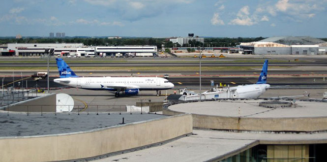
Terminal 6 at JFK Airport. (Photo: New York Photo Gallery) Beginning May 2, the FAA conducted evaluations at JFK to study the effectiveness of a Federal Bureau of Investigation (FBI) UAS detection system in a commercial airport environment. Five different rotorcraft and fixed-wing UAS participated in the evaluations, and about 40 separate tests took place.
The JFK evaluation involved extensive government inter-agency collaboration, and cooperation from industry and academia. The tests expanded on research performed earlier this year at Atlantic City International Airport.
In addition to the FAA and the FBI, the agencies combining forces in this research included the Department of Homeland Security (DHS), Department of Justice, Queens District Attorney’s Office and the Port Authority of New York and New Jersey. DHS and the FBI want to identify unauthorized UAS operators for law enforcement purposes, and the FAA’s mission is to provide a safe and efficient airport environment for both manned and unmanned air traffic.
“We applaud the FBI and FAA for their efforts to detect and track unmanned aerial systems (UAS),” said Thomas Bosco, Port Authority aviation director. “We look forward to supporting continued U.S. government efforts to identify and deploy countermeasures to neutralize the threat posed by rogue UASs.”
The team evaluating the FBI’s detection system also included contributions from one of the six FAA-designated UAS test sites. The Griffiss International Airport test site in Rome, New York, provided expertise in planning the individual tests as well as the flight commander for the tests and two of the UAS used.
The FY 2016 Appropriations law mandates that the FAA continue research into detection of UAS in airport environments. The agency is continuing to formulate an inter-agency strategy to evaluate detection systems in a variety of airport environments.
-
Systron Donner talks SDI500 tactical grade MEMS IMU at AUVSI’s Xponential 2016
David Hoyh of Systron Donner Inertial talks about the company’s SDI500 tactical grade MEMS IMU at the Association of Unmanned Vehicles International‘s Xpontential 2016 show, held May 2-5 in New Orleans. The company also featured its INS/GPS SDN500 for use in GPS-denied situations.
-
Draganfly highlights new handheld ground control system at AUVSI’s Xponential 2016
Draganfly Innovations launched its new handheld Ground Control System (GCS) at the Association for Unmanned Vehicle Systems International‘s Xponential show, held May 3-5 in New Orleans.
Ben Miller, in sales engineering for the company, talks about the system’s mission planning capability for surveying.
-
Velodyne features VLP-16 Puck mobile mapping system at AUVSI’s Xponential 2016
Velodyne‘s Frank Bertini talks about the company’s new 3D lidar VLP-16 Puck at the Association for Unmanned Vehicle Systems International‘s Xpontential show, held May 3-5 in New Orleans.
The sensor offers real-time data, 360-degree scanning, 3D distance and calibrated reflectivity measurements for the mapping, automotive, UAV, security and robotics markets.
-
Spirent Federal focuses on robust PNT at AUVSI’s Xponential 2016
Paul Crampton, senior systems engineer for Spirent Federal Systems, highlights the company’s GSS9000 Constellation Simulator and GSS6425 GNSS Record and Playback Test System at the Association for Unmanned Vehicles International‘s Xponential show, which is being held May 2-5 in New Orleans.