Tern has been named a winner of the U.S. Army’s xTechOverwatch for Unmanned Systems competition. TERN was selected from morethan 600 companies after hands-on Soldier testing at the Bush Combat Development Complex in Bryan, Texas, Oct. 27-29.
Tern developed an AI-powered Independently Derived Positioning System (IDPS) for position and navigation.
xTechOverwatch is the Army’s premiere event for accelerating autonomous systems, giving soldiers the opportunity to use emerging technologies in real-world training environments and provide critical feedback that drives iterative improvement.
The system has been tested across multiple tactical platforms in both on- and off-road environments, including active conflict zones.
Tern will now integrate IDPS directly with Army Transformation in Contact formations, where active-duty units will continue to validate the system in operational scenarios in 2026.
How IDPS works
IDPS has been proven to deliver uninterrupted, high-accuracy navigation in environments where GPS fails — tunnels, dense urban canyons, remote terrain, and GPS-denied zones. Tested by the U.S. Department of Transportation, it has sustained ±4-meter accuracy over extended distances without any satellite input, completing more than180 continuous miles GPS-free and performing flawlessly under live GPS spoofing in a conflict zone.
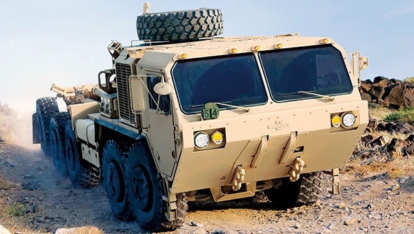
Tern’s IDPS gives the Army the ability to navigate their vehicles without the use of any satellites, signals or infrastructure, using only map data and the sensors already on board. Designed by former special operators who spent years navigating contested terrain without satellite support, and developed with AI experts behind some of the fastest recognition systems in the world, IDPS maintains precise, real-time location even when GNSS is jammed or spoofed. The system has been tested across multiple tactical platforms in both on- and off-road environments, including active conflict zones.
Base maps. IDPS has a clear understanding of the roads ahead using preloaded map data — either publicly available or proprietary. This built-in knowledge means it can follow a logical path, even in places where satellites can’t reach, keeping navigation steady from the first turn to the final destination.
IDPS can stand alone or be configured to power a location manager and integrate with widely used navigation applications such as Google Maps, Waze, OSM, ESRI, ArcGIS and Apple Maps.
Sensor data. TERN’s IDPS leverages data from sensors already built into modern vehicles, such as wheel speed, steering angle, and 3D motion data , making these existing sensors smarter. Because this information comes directly from the vehicle, it works anywhere the vehicle can operate, making it a reliable foundation for location tracking in any environment, eliminating the need for additional expensive hardware, such as LEO satellites or terrestrial beacons. With a light computing and processing load, IDPS is can be a hardware or software based solution.
Artificial intelligence. IDPS uses a proprietary AI engine to fuse map data and sensor inputs into a real-time position. TERN’s advanced adaptive weighting algorithms measure and interpret the data from vehicle sensors and recalibrates those inputs in real-time, applied against the base maps to increase accuracy. Constantly self-healing, IDPS predicts, confirms, and refines the vehicle’s location, learning from each movement to maintain pinpoint accuracy without satellites.
Honeywell has received U.S. government authorization for the remaining variants of its M-code GPS Inertial Navigation System (EGI), which will help enable more secure and precise navigation for military aircraft worldwide.
Honeywell was awarded the MSO-c145b authorization by the Precise Position Equipment Certification Office (PECO) for its smaller form factor embedded GPS EGI, known as the FALCN. Honeywell received the same authorization for its large form factor system last year.
With this new qualification, all of Honeywell’s EGI offerings are certified and approved by the U.S. government, and it can now offer solutions on platforms such as the collaborative combat aircraft and fixed-wing advanced fighters.
Reliable on-board navigation systems, such as the GPS EGI, are critical to ensuring mission success and operational safety for military and civilian operators. These systems are not just tools for determining location, but essential for strategic planning, coordination and effective execution of tasks, especially in complex and high-risk environments. Accurate navigation enables personnel to operate with precision, even in GPS-denied or contested areas, contributing directly to the safety and effectiveness of military operations.
“Our innovative EGI offerings will enable aircraft platforms to meet the latest M-code mandates and to navigate both in contested environments and off of GPS constellations with military waveforms, all while protecting warfighters with the most advanced technology in the market,” said Matt Picchetti, vice president and general manager, Honeywell Aerospace.
The advent of GPS M-code receivers is the greatest advance in military positioning, navigation and timing since GPS was originally fielded in the early 1980s. With Honeywell’s FALCN-M now upgraded with M-code capability, aviators will be protected from GPS jamming and spoofing threats, further enabling them to confidently conduct military operations in highly contested environments.
Honeywell is a leader in EGI technologies for military applications and, since the mid-1990s, has provided more than 60,000 EGI units for fighter, transport, vertical takeoff and landing, and rotary-wing aircraft — spanning more than 70 aircraft types to more than 30 allied countries. Honeywell’s EGI family includes the H-764, in use on most military aircraft, and the FALCN, providing all the features and performance of the H-764 in a smaller package. The H-764 legacy offering uses a larger chassis to maintain commonality with legacy aircraft.
A 2019 RAND report for the U.S. Navy concluded that autonomy could still be in the distant future. The Navy should take care that a number of claimed autonomy applications could be more aspirational than practical, the report stated, with the applications nowhere near to operational capability. The authors wrote that huge investments may be required to achieve autonomous naval weapon systems, not only in autonomy.
Around the world in recent years, most armed forces and many advanced technology companies, along with government agencies, have been investing in AI and automation. Perhaps now, just six years later in 2025, we already are looking foward to unmanned vehicles that display not just fundamental autonomy, but also quite advanced “auto-capability.”
In the world’s water
The U.S. Navy (USN) has been operating a number of unmanned surface vessels (USV) over the past several years. In a 2023/2024 Pacific Fleet exercise, four USV models (Sea Hunter, Sea Hawk, Mariner and Ranger) were mostly operated autonomously. Ranger has a small bridge manned only for harbor maneuvers.
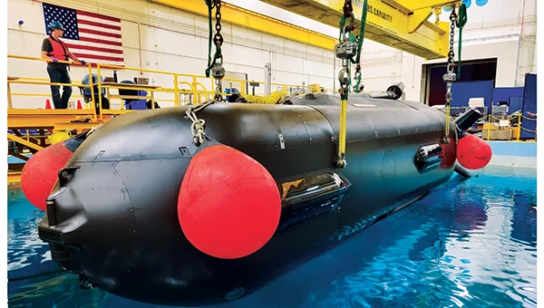
An Orca extra large UUV (XLUUV) is tested in a tank. With a range of 6,500 nautical miles, the submarine can perform long missions. Its navigation system features a Kalman-filtered inertial unit supported by Doppler velocity logs and depth sensors. Photo: Boeing
The USN has unmanned autonomy programs for large, small and underwater vehicles. The Orca submarine program is slated to consist of five 51-foot-long vehicles, and includes variants fitted with an added 30-foot payload section. To operate for several months underwater, it is likely that a similar degree of autonomy has been incorporated. ORCA surfaces regularly and can be given new routing if required.
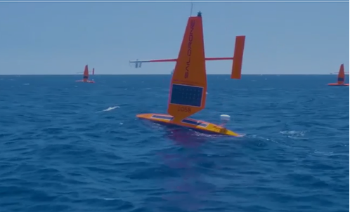
Saildrone’s autonomous research vessel (Photo: Saildrone)
Other types of vessels collect ocean and seafloor data. The environmentally friendly Saildrone can operate independently — we could say autonomously — for more than a year. The Saildrone company, based in Alameda, California, contracts out its USVs, providing its technology to agencies and governments and taking on the risks of ocean surveying to acquire valuable data. Saidrones are equipped with satellite communications, GNSS navigation, weather sensors and sub-surface sensors.
Wheels on the road
Autonomy applications on land are dominated by commercial self-driving cars, Tesla being the leading manufacturer in the U.S. However, full autonomy is still a considerable way from being ready. At the full-autonomy level, known as Level 6 in the auto industry, the vehicle does all the driving, including obstacle avoidance, under all conditions, without any geographic limitation. Nevertheless, we appear to have progressed from basic manual control (Level 0) to somewhere around Level 3, where the vehicle is largely aware of its environment, and does most of the driving. Even so, human monitoring and control are still required.
Tesla’s autopilot technology in its Model S and Model X electric vehicles could be referred to as an advanced driver assistance system — or as Tesla calls it, “Full Self-Driving (Supervised)” — and is reported to handle emergency steering and braking, autonomous steering, lane changing, vehicle following, curve negotiation, and automatic parking. Autopilot sensor inputs are provided by 12 ultrasonic sensors and eight cameras providing a 360° field of view.
Tesla Autopilot intelligence can identify more than 250 traffic signs 50 countries, including turn signs and speed limits. It can identify and interpret traffic lights and road markings, and decide what to do when coming across things such as traffic cones and pedestrians.
Nevertheless, Tesla’s have been involved in quite a few accidents, the cause of which has been analyzed to be mostly a lack of driver attention (supervision), and in a number of cases, a failure of the autonomous system to recognize unusual road conditions.
Another company, Leo Drive, specializes in providing scalable software and hardware solutions, offering an end-to-end, one-stop service for integration of autonomous systems. Its mission is to make autonomous technology more accessible and widely adopted across various industries.
For its autonomous test vehicle, Leo Drive is using the Ellipse-D, a dual-antenna RTK inertial navigation system (INS) from SBG Systems. The company chose the Ellipse-D for its accuracy, reliability, and advanced features — all essential for autonomous vehicle development and testing. The Ellipse-D INS was integrated into Leo Drive’s, a passenger car converted for autonomous operations.
Oshkosh Defense integrated autonomous technology onto Palletized Load System vehicles as part of the Expedient Leader Follower program. Photo: Oshkosh Defense
The U.S. Army has been using automation in its weapon systems for some time. How much autonomous behavior, of which these systems are truly capable, may be difficult to determine. The General Atomics Reaper unmanned aerial vehicle (UAV) is largely controlled over long-distance satellite links by operators in control stations. It’s possible that the same set up is true of most of the Army’s automated weapons — probably motivated by the need to avoid systems independently determining their own targets and firing without human confirmation.
It’s difficult to determine just what army programs are underway, other than to acknowledge that programs have been launched in the past. There doesn’t appear to be any open, clear indication of the degree of autonomy to be included. A couple of programs have produced at least visible hardware, but how much or little human control is involved is unclear.
Taking flight
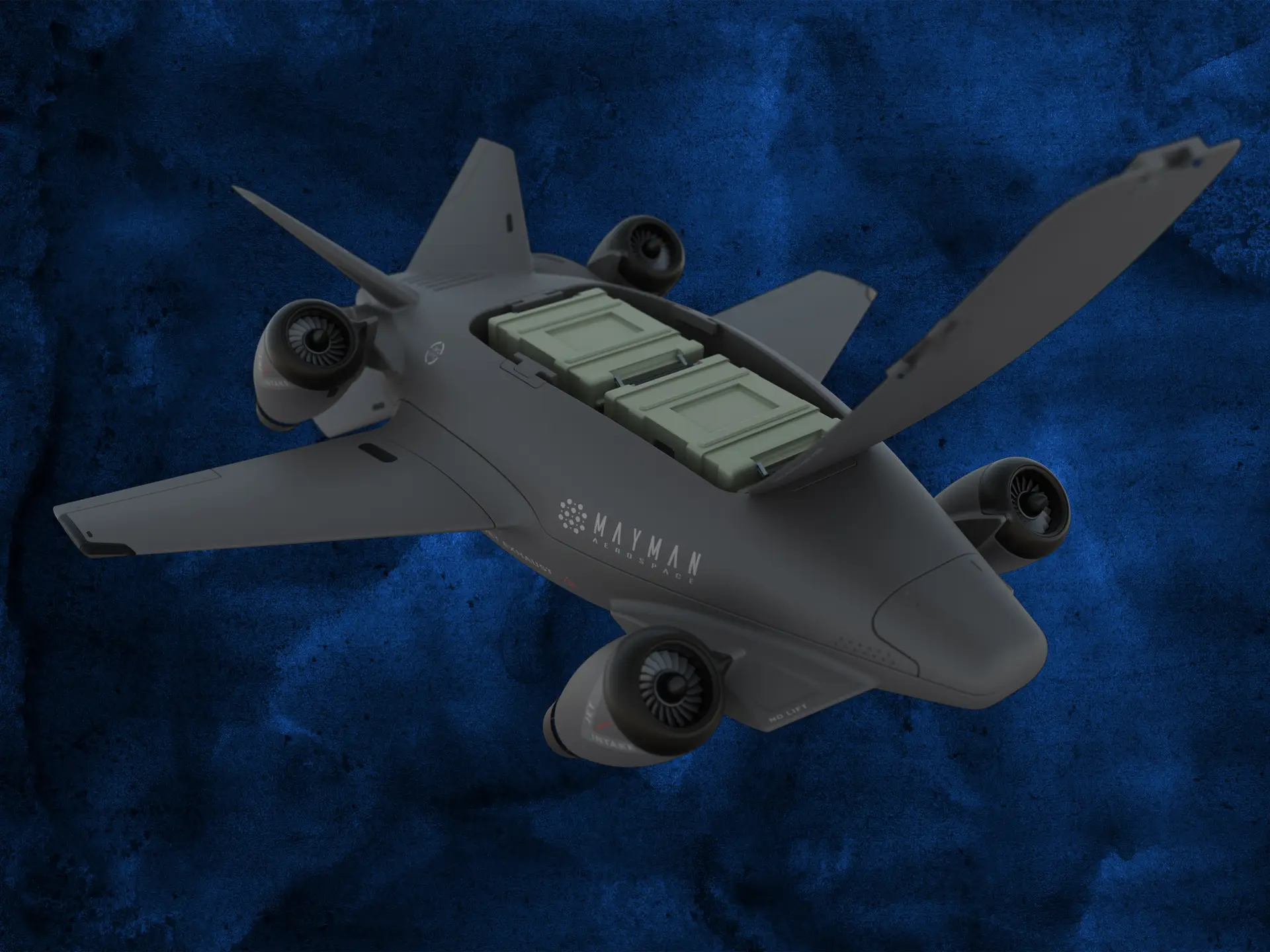
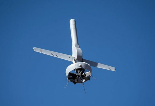
Up in the air, new autonomy contender Mayman Aerospace is offering the Razor, a jet-powered vertical take-off and landing (VTOL) UAV. Development of Razor is funded by private investment and U.S. Department of Defense contracts.
The RAZOR VTOL with gimbled jet pods passed tests at a military base in California in September 2024. Photo: Mayman Aerospace
Razor is imbued with a degree of AI that enables autonomous decision-making, as well as navigation. Its autonomous AI brain — the SkyField flight-control system — navigates independently in a GPS-denied environment, possibly involving ground beacons and eventually integrating with battlefield management systems. With a 5- to 6-foot-long airframe and sculpted shape, the aircraft presents a low radar cross section and has a degree of stealth to assist in the penetration of enemy defenses. Its top speed of 500 mph provides new options for both military and commercial applications, according to Mayman.
Razor also can aid disaster recovery, rescue operations, and the delivery of urgently needed life-saving cargo.
Many VTOL unmanned aircraft have struggled with the transition from vertical to horizontal flight. On its first vertical lift-off and climb-out on four jet engines, Razor paused briefly at altitude. Then its jet pods tilted slightly toward horizontal before the aircraft went directly into horizontal flight. An earlier flying testbed may have assisted the development of transition software, perhaps with a boost from machine learning.
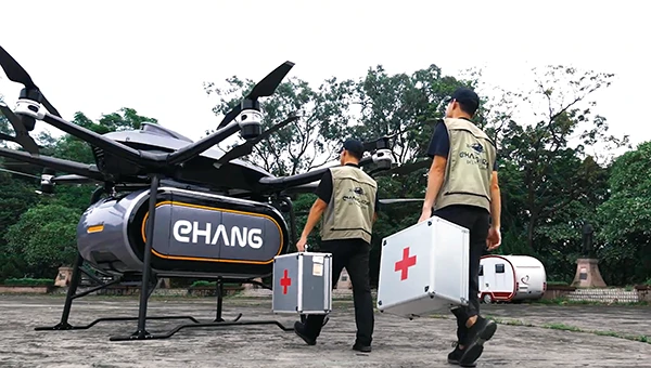
Designed for deliveries, the EHang 216 heavy cargo, 16-rotor unmanned aircraft can carry a payload of 551 pounds over almost 22 miles with a top speed of 80 mph, according to the EHang company. The UAV is fully autonomously operated while being monitored over a 4G/5G data link at a manned control center. The system has an automatic fail-safe mode in which the UAV will return to base if the communications link goes down or if battery power drops too low.
EHang also uses a redundant design, with two GPS receivers and double rotors, ensuring a low likelihood of failure during a delivery run.
More In development
So while land vehicle autonomy is moving forward — with Tesla cars and Army vehicles that apparently can take control with close human monitoring — we still have some distance to go to achieve fully independent autonomous behavior on the road.
The Ehang 216 heavy-cargo UAV EHang 216L is designed for deliveries, including life-saving ones. Photo: Ehang video screenshot
Autonomous applications on the sea are more common, with U.S. Navy applications showing substantial progress. Still, precise navigation in crowded harbors remains under human control. Humans are still watching and monitoring, ready to intervene should military or commercial UAV applications make untoward execution errors.
We will continue to follow developments of significant autonomy programs such as the U.S. Air Force Collaborative Combat Aircraft (CCA), a new type of uncrewed weapon system. The CCA and other programs are maintaining high investment levels, so it’s possible that we may see full autonomy fielded quite soon. Perhaps then our belief in its capability will become fully justified.
The U.S. Army has selected AEVEX Aerospace to participate in the Launched Effects-Short Range Special User Demonstration, an initiative aimed at advancing the Army’s integration of sophisticated uncrewed systems to improve battlefield effectiveness. AEVEX will present its Atlas Group II launched effect during the demonstration, a lightweight and agile system engineered for precision missions that directly support frontline troops. The Atlas system reflects AEVEX’s commitment to developing innovative technologies that address the Army’s evolving operational threats and mission requirements.
Throughout the demonstration, soldiers from various Army branches — including field artillery, infantry, and aviation — will operate the Atlas system to refine tactics, techniques and procedures. Their hands-on feedback will play a critical role in shaping how the Army employs launched effects in the future, influencing both requirements and operational strategies.
The Wall Street Journal has reported mysterious UAVs spotted surveilling some of America’s most sensitive military sites, leaving the Pentagon struggling to respond. These unidentified UAVs have been seen flying over military installations in Virginia and Nevada throughout the past year, including the secret base of the Navy’s elite SEAL Team Six and Naval Station Norfolk, recognized as the world’s largest naval port.
Former U.S. Air Force Gen. Mark Kelly told The Wall Street Journal he first became aware of mysterious UAV sightings in December 2023, when officials at Langley Air Force Base in Virginia reported seeing dozens of UAVs flying over the base at night.
The source of these UAVs remains unknown, leaving officials puzzled about whether they were operated by sophisticated hobbyists or potentially by Russia or China. The complexity and coordination of the flights suggested a level of sophistication beyond civilian drone operations, according to the report.
The U.S. military faced significant challenges in addressing this threat. Federal law restricts the military’s ability to shoot down UAVs over bases unless they pose an immediate threat. Aerial snooping does not qualify as a threat, though some lawmakers hope to give the military greater leeway to address these challenges in the future.
The sightings ended on Dec.23, 2023, with authorities still unsure of the UAVs’ origin or who controlled them. However, a clue emerged in January 2024 when a Chinese student named Fengyun Shi, studying at the University of Minnesota, was caught flying a UAV near Langley Air Force Base. Shi’s UAV got stuck in a tree, which he abandoned before flying to California. The FBI retrieved the drone, discovering it had taken photos of Navy ships docked at the base, which led to Shi being sentenced to six months in federal prison.
In October 2024, U.S. officials confirmed that similar drone swarms had been observed near Edwards Air Force Base in Nevada. The Department of Defense (DOD) has not publicly identified the source behind these surveillance drones.
In response to these incidents and potential threats, Langley Air Force Base is exploring new measures to safeguard its airspace. The base’s 633rd Contracting Squadron issued a notice seeking proposals for installing anti-drone nets around sunshades used for aircraft, including F-22s. These nets are designed to disable small UAVs while allowing quick retraction to ensure flight operations remain unaffected. The proposed system would withstand extreme weather conditions and prevent drones from interfering with aircraft or personnel.
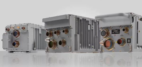
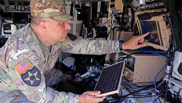
The U.S. Army has released a Request for White Papers (RfWP) to develop new C5ISR modular open Suite of standards (CMOSS) mounted form factor (CMFF) prototypes.
Through CMFF, the Army aims to easily and rapidly equip ground vehicles and aviation platforms with positioning, navigation and timing (PNT) and electronic warfare (EW), through capability cards plugged into a common chassis.
The chassis, which offers power, networks and radio frequency, allows Soldiers to “plug and play” capabilities right into the vehicle without the need to custom install and upgrade individual communication and computing systems.
In this prototype effort, the key needs are to develop, procure and furnish the Army with the CMFF chassis, also known as Mounted Common Infrastructure (MCI), plus the smart display for user interface, hardware development, software development and Plug-In Cards with the following capabilities:
Converging tactical communication waveforms.
Mission Command applications.
Assured Positioning, Navigation, and Timing (APNT.)
Force Protection capabilities.
The Army plans to award a contract using the Other Transaction Authority (OTA) with system of system and prototype integrators to provide the complete CMFF system offerings. Industry partners who respond to the RfWP will have an opportunity to showcase the fully functional CMFF system at a technology demonstration in late summer 2024.
“The power of the true concept is when you can take a chassis and put it in another vehicle and you can mix and match cards,” said Col. Shermoan Daiyaan, project manager for Mission Command. “That’s when you’re following a standard. You’re matching a standard, and it just works.”
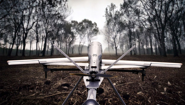
Northrop Grumman and Martin UAV (a Shield AI company) have completed successful flight testing of a V-BAT unmanned aircraft system (UAS) with new features including GPS-denied navigation and target designation capabilities.
The enhanced V-BAT’s flexible vertical take-off and landing (VTOL) capability is based on a platform deployed to address the U.S. Army’s Future Tactical Unmanned Aircraft System (FTUAS) mission. For FTUAS, the U.S. Army is seeking a rapidly deployable, GPS-denied navigation-capable, expeditionary VTOL system capable of persistent aerial reconnaissance for U.S. Army brigade combat teams, special forces, and Ranger battalions.
The offering is based on Martin’s UAV V-BAT UAS. According to Northrop Grumman, it is compact, lightweight, simple to operate, and can be set up, launched and recovered by a two-soldier team in confined environments. The V-BAT also is designed with sufficient payload capacity to carry a range of interchangeable payloads, including electro-optical/infrared (EO/IR), synthetic aperture radar (SAR), and electronic warfare (EW) payloads, depending on mission-specific requirements. Additionally, Shield AI’s recent acquisition of Martin UAV will enable rapid development of GPS-denied and autonomy capabilities for V-BAT through the future porting of Shield AI’s autonomy stack, Hivemind, onto V-BAT.
Northrop Grumman and Martin UAV conduct flight testing of Martin UAV’s V-BAT aircraft for the U.S. Army’s Future Tactical Unmanned Aircraft System effort in Camp Grafton, North Dakota. (Photo: Northrop Grumman)
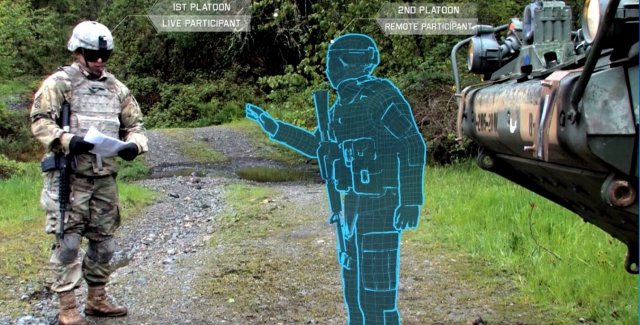
The U.S. Army considers virtual reality training as an important path ahead to prepare warfighters.
The U.S. Army awarded Bohemia Interactive Simulations (BISim) a major extension to demonstrate technologies for a cloud-enabled, virtual world training capability.
BISim is a global developer of advanced military training and simulation software.
The contract award helps meet the requirements of the Army’s Synthetic Training Environment (STE) initiative. STE aims to converge virtual, constructive and gaming training environments into a single unified architecture.
The ambitious STE project will enable simulation systems Army-wide to leverage a persistent virtual world for any imaginable training need, including support for multi-domain operations incorporating cyber and space.
Central to STE is a cloud-enabled One World Terrain (OWT) that will let warfighters conduct virtual training and complex simulations anywhere on a virtual representation of the Earth. OWT will leverage cloud technologies to deliver to the point of need, ensuring a common and high-fidelity whole-Earth terrain representation for a multitude of different simulation systems.
The Synthetic Training Environment will assess Soldiers in enhancing decision-making skills through an immersive environment. (Photo: U.S. Army)
“The U.S. Army’s vision for STE marks a monumental change in how they acquire, develop and deliver new simulation and virtual training technologies to soldiers,” said Pete Morrison, BISim’s co-CEO and chief product officer. “We’re honored to be selected to assist the Army in developing innovative solutions that will shape the future of how virtual training is used to enhance operational readiness.”
BISim has been developing its next generation of simulation technologies since 2014. The new technology suite includes a cutting-edge, military-specific whole-earth game engine, deterministic AI, an efficient geospatial terrain server and component-based development technology.
BISim technology underpins funded research and development for One World Terrain. Additionally, BISim recently demonstrated Reconfigurable Virtual Collective Trainer (RCVT) prototypes for STE. The latest OTA extension is a significant ramp up in the breadth and ambition of the technology being demonstrated.
BISim’s STE offering includes four core technologies uniquely suited to meeting future military simulation requirements (including U.S. Army requirements).
VBS Blue. A high-performance, whole-planet data ingestion and rendering engine with a very high level of procedural detail, designed to ingest any conceivable terrain data format as well as source data directly. VBS Blue will support networked (cloud) terrain paging and geo-specific insets as well as the latest graphics technologies. It provides photorealistic detail, and includes a massive vegetation library representing every region on Earth. The technology is highly applicable across all types of image generation and is optimized for many AR/VR applications.
STEWS. A geospatial data server that provides efficient networked access to the various data sources required for rendering applications. STEWS provides a curated database of terrain data layers that can be streamed into any STE-connected client application at run time (including non-BISim applications). Any application connected to STEWS can stream high fidelity terrain data in a performant manner. Both new and legacy terrain formats are supported through new STEWS plug-ins.
VBS Control. High fidelity, doctrinal and deterministic entity-level artificial intelligence that is uniquely suited to operation on whole-earth terrain. VBS Control runtime offers highly efficient real-time path planning that allows AI to move seamlessly through open, urban and interior spaces. The VBS Control Editor allows powerful new AI behaviors to be developed at both the individual entity level and at higher levels of command for land, sea and air assets.
Gears. A software development framework that defines a standard way for components to communicate through formal interfaces. Gears uses a component-based architecture to promote rapid development by building applications from self-contained systems and having them communicate via formally defined interfaces. This allows functionality to be reused and avoids the complexity of tightly coupled systems. See www.gears.studio for more information.
The Army also selected BISim for a five-year contract to support their Games for Training Program and BISim’s technology is being rolled out on CCTT (the U.S. Army’s largest ground simulator training program).
The U.S. Army’s Joint Precision Airdrop System (JPADS) has developed a new capability with a navigation alternative to GPS.
In recent tests, JPADS were dropped from planes, and immediately determined their location using optical sensors to compare local terrain with commercial satellite imagery. The new system demonstrated navigation to its intended point, using nothing but imagery to guide it.
The new JPADS also works with little knowledge of the aircraft’s location at the drop point.
JPADS, largely guided by GPS, has already proven its importance in supplying troops with necessary materials and equipment, relying less on vulnerable convoys.
Dropping critical supplies from the air has allowed the U.S. military to rely less on easily-ambushed truck convoys and helicopter resupply. Exposure to improvised explosive devices (IEDs) and ambushed convoys resulted in more than 3,000 causalities in Afghanistan and Iraq through 2007.
JPADS has proven to be an important tool in the Army’s logistics chain in many scenarios to supply troops with material and equipment in adverse terrain and remote locations when ground lines of communication are not possible or deemed too high a risk.
A JPADs pallet lands on target, followed by several others still in the air, during recent testing. (Photo: US Army)
The Army life cycle manager, Product Manager Force Sustainment Systems (PM-FSS), continues to improve the JPADS capability with technology enhancements being led by the Army’s Natick Soldier Research, Development and Engineering Center (NSRDEC), including making JPADS more robust and versatile to environment, terrain and other factors. Investments are focused on significant increased accuracy, lower cost and lower retrograde weight/volume of the reusable JPADS at all weight classes.
The U.S. Army NSRDEC, with Draper and numerous other partners, recently began testing a new version of the JPADS guidance system that takes advantage of Draper’s technology to navigate precisely to its intended ground impact point using imagery alone, and having minimal knowledge about the aircraft’s location when the package is dropped. The accuracy is critical, as payloads that stray even slightly off course can force troops to expose themselves to enemy fire, or can tumble down mountainsides in rugged terrain, explained Chris Bessette, Draper’s JPADS program manager.
“This is a huge step forward for aerial resupply,” Bessette said. “The guided airdrop system is keeping U.S. forces from the danger that has killed thousands of their fellow troops. By enabling the system to operate using imagery alone when dropped as high as 25,000 feet above Mean Sea Level and upwards of 20 miles away from the target depending on winds, we can ensure that JPADS is even more versatile so troops receive supplies like fuel, ammunition, food, and water in the safest manner possible.”
Draper’s JPADS software autonomously flies the cargo-carrying parafoil to land at a user defined location, adapting in real-time to local environmental conditions, such as varying wind. The company’s work on JPADS takes advantage of its expertise in applying position, navigation, and timing algorithms to combine the outputs of precision instruments to enable highly accurate, long-duration navigation solutions.
The recent testing demonstrated the ability to accurately navigate JPADS to a pre-selected user position, using imagery alone, with almost no information about where the package was released from the plane. During testing in Arizona, the payloads were dropped from planes, and then JPADS immediately determined their own location by comparing terrain features spotted using optical sensors with commercial satellite imagery of the area.
The Army is also supporting Draper in developing upgrades to the vision-aided navigation system to address current limitations, including cloud cover, which degrades the system’s ability to correlate vision sensor inputs with satellite imagery.
The military can leverage the same technology to help guide military free fall paratroopers and unmanned aerial vehicles utilizing imagery data alone, Bessette said.
The U.S. Army Geospatial Center (AGC) and Engineer Research and Development Center introduced the Hydrologic Data Resources Application (HyDRA) – a Web-based data survey and analysis tool created to provide the Dept. of Defense (DoD) logistics and geospatial intelligence-related water communities with information on water resources data collection, visualization and dissemination in a mobile, enterprise-enabled environment.
According to the announcement, HyDRA allows users to view, collect and edit unclassified water resources features via Android 2.2+ OS smart devices using Google Maps and Google Earth applications. Wells, water tanks, water storage points, dams, treatment plants and other features may be added, queried and edited in “connected” and “disconnected” modes; collected features may also be edited through a Web page using the same functionality. The Web page and app were created to assist U.S. Army engineers and the water community working in infrastructure and reconstruction operations with feature collection and identification. A compass feature is also included to assist the user in finding the nearest water feature and its bearings.
The mobile application may be downloaded from the AGC’s Web site. An offline version of the mobile application is under development and will allow the user to store collected data locally and sync to the server after an internet connection becomes available.