Tag: air taxi

  • Airwayz powers real-time drone tracking for safe, efficient BVLOS deliveries

    Airwayz powers real-time drone tracking for safe, efficient BVLOS deliveries

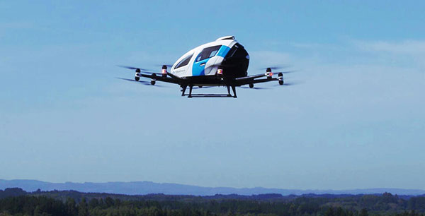
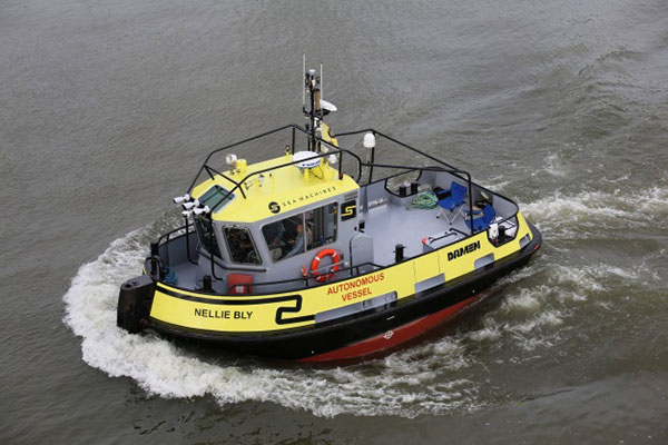
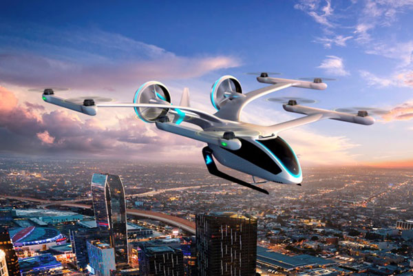
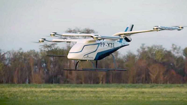
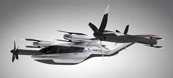
    The Federal Aviation Administration’s new Beyond Visual Line of Sight (BVLOS) framework, incorporating Part 108 and Part 146, establishes a regulatory pathway for safe and scalable drone operations. This framework is expected to accelerate the integration of both drone deliveries and air taxis into everyday transportation networks. What was once a conceptual vision has now become an actionable roadmap, supported by technology that enables safe and collaborative use of lower airspace.

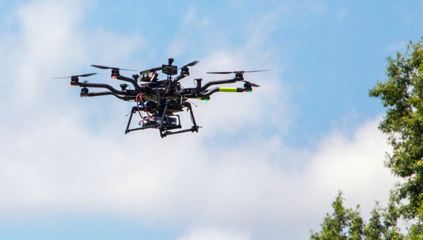
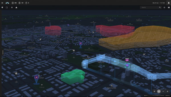
    Airwayz offers an artificial intelligence–driven unmanned traffic management (UTM) and U-Space Service Provider (USSP) system designed to coordinate multiple drone operators sharing the same airspace. Unlike static management systems, Airwayz’ platform provides fully dynamic airspace allocation and routing, allowing multiple fleets to operate simultaneously without interference. The system is capable of validating and approving flights, as well as suggesting updated routes, within approximately five seconds. This enables continuous, real-time decision-making in response to changing conditions.

    Autonomous Decision-Making and Human Oversight

    The Airwayz UTM constantly monitors the airspace for both manned and unmanned aircraft, dynamically adjusting flights to reduce the risk of collision. Using autonomous rerouting capabilities, the system can alter a drone’s course mid-flight if safety conditions change. Although much of the operation can occur without manual intervention, human operators retain the authority to override automated decisions, ensuring an added layer of accountability. This approach shortens approval times, avoids dedicating airspace to only one operator, and streamlines operations for complex missions.

    Central to the Airwayz UTM/USSP is a focus on safety. The system evaluates environmental and operational risks by monitoring nearby aerial activity, weather patterns, and other critical factors. When potential hazards are detected, it recommends the most effective course of action to avoid incidents. These recommendations can involve route changes while the drone is already in flight, ensuring that missions can be completed without compromising safety.

    By enabling fully dynamic and responsive airspace management, Airwayz UTM allows drones to travel between any two points at any time, provided flights are reported to and coordinated through the system. Continuous monitoring during both pre-flight and in-flight phases ensures that adjustments can be made immediately when risks emerge. This flexibility increases the commercial capacity of the airspace, while maintaining safety as the primary priority.

    Temporary U-Space for Specific Operations

    For short-term events or limited-duration needs, Airwayz employs a “temporary U-Space” approach. These temporary zones can be quickly established to manage high-priority or ad-hoc operations and are dismantled once no longer necessary. AI algorithms analyze and predict flight paths, assess the reliability of those predictions, and adjust the boundaries of the temporary U-Space according to risk levels. In low-risk scenarios, boundaries can be minimized to allow more concurrent aircraft, while higher-risk situations trigger expanded safety zones.

  • NASA flies UAVs BVLOS for air taxi research

    NASA flies UAVs BVLOS for air taxi research

    Image: NASA / David Bowman
    Image: NASA / David Bowman

    NASA researchers at Langley Research Center in Hampton, Virginia, have successfully flown multiple UAVs beyond visual line of sight (BVLOS) with no visual observer. The UAVs dodged one another and successfully maneuvered around obstacles before safely landing, the agency said. NASA conducted the tests to help researchers someday create autonomous, self-piloted helicopters that could carry passengers and cargo through busy aerospace.

    Researchers used multiple Alta 8 UAVs loaded with software designed to enable autonomous flights. Although monitors observed the flights from a remote-control room at Langley, the UAVs successfully operated BVLOS.

    NASA is also testing elements of autonomy using helicopters. They are designed to contribute towards the development of autonomous helicopters that can take off and land from “vertiports,” and transport passengers and cargo over both short and long distances.

    The experiments are part of the agency’s Advanced Air Mobility Mission (AAM), which is designed to enable safe autonomous flight and integrate newly developed vehicles into the national airspace. The mission will “set the stage for a flourishing industry” of electric air taxis and UAVs by 2030, NASA says on its AAM website.

    NASA will transfer the technology created during this project to the public to ensure industry manufacturers can access the software while designing their vehicles.

  • EHang to test Europe’s EGNOS for air-taxi VTOL flights

    EHang to test Europe’s EGNOS for air-taxi VTOL flights

    EHang deployed its EH216 eVTOL for flight trials in Europe including the recent Air Mobility Urban-Large Experimental Demonstration. (Photo: EHang)
    EHang deployed its EH216 eVTOL for flight trials in Europe including the recent Air Mobility Urban-Large Experimental Demonstration. (Photo: EHang)

    EHang will deploy its EH216 autonomous aerial vehicle in a European Union-funded project that is assessing how the European Geostationary Navigation Overlay Service (EGNOS) could be used for electric vertical-takeoff-and-landing (eVTOL) aircraft operations.

    The fully autonomous, all-electric vehicle will be used for flight trials at Lleida-Alguaire Airport in Spain as part of the Satellite Based Augmentation System Adoption in Multicopter VTOL Aircraft (SAMVA) program.

    As part of an initiative of the European Union Agency for the Space Programme (EUSPA), the SAMVA project is tasked with establishing how EGNOS could support planned air mobility services, including eVTOL air taxi flights. It is also intended to prepare for uncrewed vehicles to use the new U-Space concept for managing autonomous or remotely piloted aircraft.

    Aeroports de Catalunya will help China-based EHang to establish an operational center at its Lleida-Alguaire facility in the Catalonian region of northeast Spain. The EH216 will use the EGNOS technology to conduct unmanned traffic management (UTM) tasks and to demonstrate how eVTOL aircraft could operate in urban environments, including to and from airports.

    EHang is working to achieve Chinese certification for the two-seat EH216, which it intends to deploy with partners and customers for services such as air taxi and sightseeing flights. It also aims to get approval for its aircraft to operate in Europe and has been active in other air mobility partnerships in Europe, where it has provisional customers in places like Norway.

    In October, EHang completed its participation in the European Union’s Air Mobility Urban-Large Experimental Demonstration (AMU-LED) with a series of flight tests in Spain. The company — one of 16 consortium members in the AMU-LED program — demonstrated the EH216 at the Rozas Airborne Research Center, which is part of Spain’s National Institute of Aerospace Technology.

    “The SAMVA project will unleash EGNOS capabilities aboard EHang’s EH216 AAV to provide precise and integral navigation guidance and support U-Space airspace integration,” said Victoria Jing Xiang, the company’s chief operating officer for Europe and Latin America. “Our participation in this project reflects the meaningful progress we’ve made overseas with our strong technologies as our global footprint expands.”

  • Seen & Heard: Russia threatens GPS, protecting sea turtles

    Seen & Heard: Russia threatens GPS, protecting sea turtles

    “Seen & Heard” is a monthly feature of GPS World magazine, traveling the world to capture interesting and unusual news stories involving the GNSS/PNT industry.


    Photo: lindsay_imagery/E+/Getty Images
    Photo: lindsay_imagery/E+/Getty Images

    Where Sea Turtles Nest

    Florida’s Sea Turtle Grants Program — funded with proceeds from special license-plate sales — were used to purchase Trimble TDC100 and TDC600 handheld GNSS receivers for state park staff to gather data about turtle nesting activity. The staff also uses Esri’s ArcGIS Survey123 field-capture software to report on turtles using the 108 miles of beach in 40 of Florida’s state parks. Negative impacts from commercial fishing, plastic waste and climate change have become a threat to sea turtles, which are now classified as an endangered species.


    Concept of vertiport at airport. (Groupe ADP)
    Concept of vertiport at airport. (Groupe ADP)

    Paris up in the Air

    Paris has begun testing electric air taxis at a new site outside the French capital, with an eye toward creating at least two demonstration flight paths during the 2024 Olympics to ferry passengers from nearby airports. Inaugurated in November, the test site is dedicated to new sustainable urban air mobility, and will study the use of electric vertical take-off and landing (eVTOL) aircraft. Choose Paris Region, Groupe ADP and RATP Group are managing the effort with VoloCity taxis by Volocopter onboard.


    Photo: Stanislav Ostranitsa/iStock/Getty Images Plus/Getty Images
    Photo: Stanislav Ostranitsa/iStock/Getty Images Plus/Getty Images

    Russia Threatens GPS

    The Kremlin warned it could blow up 32 GPS satellites with its new anti-satellite technology (ASAT), which it tested Nov. 15 on a retired Soviet Tselina-D satellite, according to numerous news reports. Russia then claimed on state television that its new ASAT missiles could obliterate NATO satellites and “blind all their missiles, planes and ships, not to mention the ground forces,” said Russian Channel One TV host Dmitry Kiselyov, rendering the West’s GPS-guided missiles useless. “It means that if NATO crosses our red line, it risks losing all 32 of its GPS satellites at once.”


    Bali toll gate. (Photo: dwart/iStock/Getty Images Plus/Getty Images)
    Bali toll gate. (Photo: dwart/iStock/Getty Images Plus/Getty Images)

    Indonesia Goes Cashless

    Indonesia’s GNSS-based cashless toll system will take effect by the end of 2022, reports Indonesia Expat. The country’s Public Works and Public Housing Ministry plans to have its multi-lane, free-flow-based non-cash toll transaction system implemented on 40 toll roads on the islands of Java and Bali. MLFF uses GNSS plus a map-matching process and special toll road apps on smartphones to determine fees. The system is expected to increase efficiency, effectiveness, security and convenience in conducting toll road payment transactions.

  • UAVs, walking robots and an autonomous tugboat

    UAVs, walking robots and an autonomous tugboat

    In a slight expansion from our previous monthly UAV newsletter columns, we’re now looking at autonomous systems with a wider outlook, capturing the automated world as it evolves.

    The Eve air taxi. (Image: EmbraerX)
    The Eve air taxi. (Image: EmbraerX)

    News this month covers steps toward air taxi qualification, highly challenging underground UAV and robotic capers, and long-distance watercraft autonomy in Denmark.

    EVE gets order boost by Bristow

    We’ll soon be seeing them — electric powered manned and unmanned flying taxis buzzing in the city skies above us. Embraer, the Brazilian commuter aircraft manufacturer (you might have taken their EMB-1xx series turboprop aircraft on short hauls between city centers) has apparently progressed its Eve manned/unmanned aircraft development to the stage of a program for qualification/certification being scoped by EmbraerX in Florida and the Bristow Group.

    Parent company Embraer established EmbraerX in Melbourne, Florida, as a new-concept UAV developer and manufacturer, launching the Eve urban mobility vehicle as its first product.

    Eve subscale demonstrator. (Photo: EmbraerX)
    Eve subscale demonstrator. (Photo: EmbraerX)

    Although we are still only seeing concept-artist renderings of the Eve eVTOL (electric vertical take-off and landing) aircraft, and photographs of a small-scale flying prototype, Embraer has already built an impressive order book. There are reports of more than 500 orders on hand, originally led by Uber and recently joined by the Bristow Group with an order for 100. All orders are likely contingent on aviation agency approval of the aircraft for public transportation.

    Based worldwide, Bristow has been around in one form or another since 1955, and currently operates more than 250 helicopters in support of the oil and gas industry, search and rescue (SAR), and various military-related applications, including unmanned aircraft operations with the U.S. Coast Guard. This experience is expected to aid EmbraerX through a joint program to eventually gain an operating certificate for the Eve air taxi.

    An Elios drone from team CERBERUS roams a moulin in an earlier challenge. (Photo: DARPA)
    An Elios drone from team CERBERUS roams a moulin in an earlier challenge. (Photo: DARPA)

    DARPA’s Subterranean Challenge

    The U.S. Army’s Defense Advanced Research Projects Agency (DARPA) has been running a competition since 2018 to find unmanned products and technologies that can find their way around underground environments such as subway systems, sewers, mines and naturally occurring caves and tunnels. The object is to rapidly and remotely map, navigate and search these complex underground locations.

    Known as DARPA’s Subterranean Challenge, several groups of competitors were slimmed down to three very capable teams over several months through some initial selection evaluations. Then, on final competition day, teams CSIRO Data61, CERBERUS and MARBLE went at it in an array of challenging environments at the Louisville Mega Cavern — a massive retired limestone mine so large it not only hosts a ropes course and a mountain bike park, but also has tram-guided tours for visitors.

    Finalists in the competition had to navigate through elements from previous events, including simulated underground mines, a metropolitan infrastructure, and cave systems. Smoke was even used in places to increase the confusion.

    Team CERBERUS — an international consortium that included the University of Nevada Reno (UNR), ETH Zurich, the Norwegian University of Science and Technology (NTNU), the University of California Berkeley, the University of Oxford, Flyability, and the Sierra Nevada Corporation — was ultimately successful.

    The ANYmal climbs stairs. (photo: ANYbotics)
    The ANYmal climbs stairs. (Photo: ANYbotics)

    In previous phases of the competition, Flyability used its caged Elios 2 UAV with video and thermal cameras and a high-intensity LED lighting system to create accurate internal maps of underground spaces. However, in the final competition, ANYbotics four-legged ANYmal C autonomous robots were primarily employed — carrying visual and thermal cameras, lidar and a spotlight.

    In the final competition, Team CERBERUS managed to locate and identify 23 of 40 hidden “artifacts” in the allocated time and earned the $2 million DARPA first-place prize.

    Autonomous Tugboat round Denmark

    Sea Machines in Boston has been around since 2015, focusing on automating shipping control and monitoring. It hopes to bring a system to market that will enable an autonomous voyage all the way around Denmark.

    With investors who include Toyota Ventures, Huntington Ingalls, Brunswick Corporation, Accomplice and Dolby Fund, the company is not a mega-million venture, but has still successfully engaged the likes of A.P. Moller-Maersk, the U.S. Department of Transportation and the U.S. Navy in autonomous waterborne projects.

    The tugboat Nellie Bly on its 1,000 nm circumnavigation of Denmark will use an SM300 autonomous system that uses radar, inertial navigation, a depth transducer, the automatic identification system (AIS) and video cameras for obstacle avoidance. It will provide high-definition remote situation awareness to monitoring controllers in Boston, 3,600 miles away.

    Autonomous tugboat Nellie Bly. (Photo: Arie Boer)
    Autonomous tugboat Nellie Bly. (Photo: Arie Boer)

    Throughout the voyage, the Nellie Bly will have two professional pilots onboard, and will stop at ports along the way to demonstrate the technology. Sea Machines will stream the journey live on a website with updates from the ship, the crew and the command center, enabling real-time and recorded access to “The Machine Odyssey” as the project is now known.

    To sum up, lots of autonomous projects are proceeding, with progress toward getting air taxis up and running for business, DARPA sponsoring technology for underground navigating, and mapping and long-distance autonomous navigation around Denmark — lots of diversity and opportunity.

    Tony Murfin
    GNSS Aerospace

  • Uber and Hyundai release full-scale air taxi model at CES

    Hyundai is the first Uber Elevate partner with manufacturing capabilities to mass produce Uber Air Taxis

    Uber and Hyundai Motor Company announced at CES 2020 a new partnership to develop Uber Air Taxis for a future aerial ride-share network and unveiled a full-scale aircraft concept. Hyundai is the first automotive company to join the Uber Elevate initiative, bringing automotive-scale manufacturing capability and a track record of mass-producing electric vehicles.

    CES 2020, the massive annual consumer electronics show, is taking place Jan. 7-10 in Las Vegas. Hyundai Motor’s innovative smart mobility solutions including UAM, PBV, Hub and more are showcased at Booth 5431 in the Las Vegas Convention Center North Hall.

    The taxi concept was created in part through Uber’s open design process, a NASA-inspired approach that jump starts innovation by publicly releasing vehicle design concepts so any company can use them to innovate their air taxi models and engineering technologies.

    In this partnership, Hyundai will produce and deploy the air vehicles, and Uber will provide airspace support services, connections to ground transportation, and customer interfaces through an aerial ride-share network. Both parties are collaborating on infrastructure concepts to support take-off and landing for this new class of vehicles.

    The SA-1 air taxi. (Photo: Uber/Hyundai)
    The SA-1 air taxi. (Photo: Uber/Hyundai)

    “Our vision of urban air mobility will transform the concept of urban transportation,” said Jaiwon Shin, Executive Vice President and Head of Hyundai’s Urban Air Mobility (UAM) Division. “We expect UAM to vitalize urban communities and provide more quality time to people. We are confident that Uber Elevate is the right partner to make this innovative product readily available to as many customers as possible.”

    “Hyundai is our first vehicle partner with experience of manufacturing passenger cars on a global scale. We believe Hyundai has the potential to build Uber Air vehicles at rates unseen in the current aerospace industry, producing high quality, reliable aircraft at high volumes to drive down passenger costs per trip. Combining Hyundai’s manufacturing muscle with Uber’s technology platform represents a giant leap forward for launching a vibrant air taxi network in the coming years,” said Eric Allison, head of Uber Elevate.

    In preparation for this announcement, Hyundai worked with Uber Elevate to develop a PAV (personal air vehicle) model, S-A1, that uses innovative design processes to optimize electric vertical take-off and landing (eVTOL) aircraft for aerial ridesharing purposes. S-A1 previous eVTOL designs Uber Elevate has released in the following ways:

    • It is designed for a cruising speed up to 180 miles/hr (290 km/hr), a cruising altitude of around 1,000-2,000 feet (300 – 600 mt) above ground, and to fly trips up to 60 mile (100 km).
    • The Hyundai vehicle will be 100% electric, utilizing distributed electric propulsion and during peak hours will require about five to seven minutes for recharging.
    • Hyundai’s electric aircraft utilizes distributed electric propulsion, powering multiple rotors and propellers around the airframe to increase safety by decreasing any single point of failure. Having several, smaller rotors also reduces noise relative to large rotor helicopters with combustion engines, which is very important to cities.
    • The model is designed to take off vertically, transition to wing-borne lift in cruise, and then transition back to vertical flight to land.
    • The Hyundai vehicle will be piloted initially, but over time they will become autonomous.
    • The cabin is designed with four passenger seats, allowing riders to board and disembark easily and avoid the middle seat with enough space for a personal bag or backpack.

    Ushering in the era of seamless mobility, Hyundai’s exploration of future urban transportation incorporates the electric PAV concept with a new ground transportation, the Purpose Built Vehicle (PBV) concept.

    Hyundai’s vision for creating communities from future transit systems comes into focus with yet another new infrastructure concept, called the Hub. When many PBVs and PAVs are docked and connected to a Hub, they make a new public space where diverse groups of people can come together.

  • Bell Helicopter unveils full-scale air taxi at CES 2019

    Bell Helicopter unveiled a full-scale vertical-takeoff-and-landing (VTOL) air taxi vehicle during CES 2019, held in Las Vegas.

    The air taxi, named Bell Nexus, is powered by a hybrid-electric propulsion system and features Bell’s signature powered lift concept incorporating six tilting ducted fans designed to safely and efficiently carry passengers.

    Bell Nexus means the nexus of transport and technology and of comfort and convenience. Nexus captures the long-sought-after vision of quick air travel with a unique in-flight experience, keeping passengers connected to their lives and saving valuable time.

    The Nexus team consists of Bell, Safran, EPS, Thales, Moog and Garmin, who are collaborating on Bell’s VTOL aircraft and on-demand mobility solutions. Bell is leading the design, development and production of the VTOL systems; Safran is providing the hybrid propulsion and drive systems; EPS is providing the energy storage systems; Thales is providing the Flight Control Computer (FCC) hardware and software; Moog is developing the flight control actuation systems; and Garmin is integrating the avionics and the vehicle management computer (VMC).

    Autonomous Pod Transport (APT). Alongside the debut of Bell Nexus, Bell will feature the Autonomous Pod Transport (APT). The APT family varies in payload capability that can serve many mission sets such as medical, law enforcement, offshore missions and on-demand delivery services. Bell is expanding into a new industry to show the full spectrum of our capabilities and the real-world challenges APT will address, Bell said in a press release.

    Future Flight Controls. Bell’s Future Flight Controls simulator was a new experience for CES participants this year. Bell is actively collecting data to help shape the future flight controls of aviation. Data from the simulators will be used to determine what actions and interfaces are intuitive to the average potential operator and what prior experiences and abilities contribute to these opinions.

    Urban air travel is coming closer to the masses through recent advancements in technology and software. The critical last step is designing a flight-control ecosystem that allows individuals to safely and efficiently operate urban air vehicles.

    In 2018, Bell provided the world a glimpse into the air-taxi passenger experience, and this year, attendees could see the full vision.