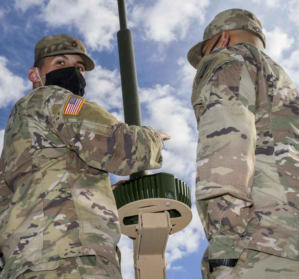
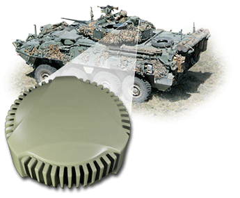
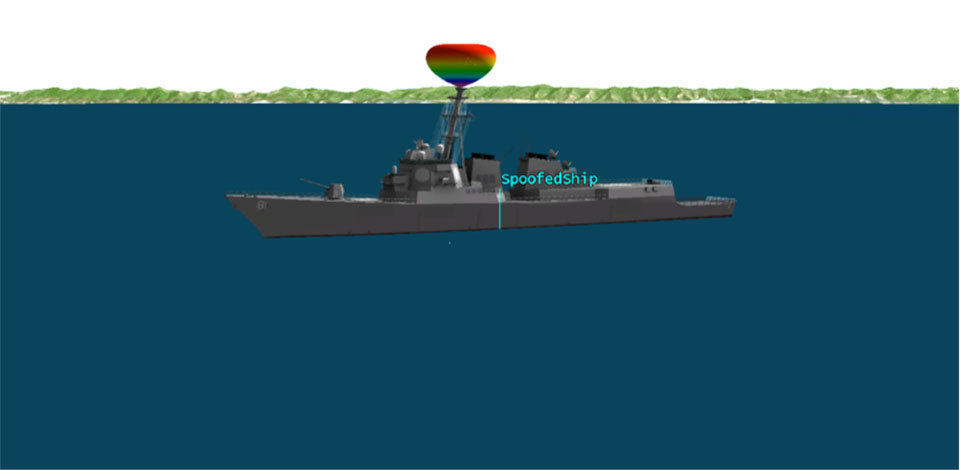
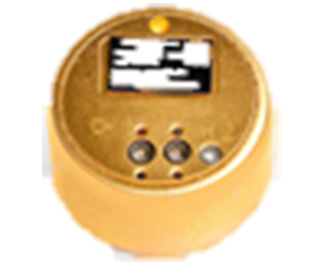
Hexagon | NovAtel’s GAJT-710ML installed on a U.S. Army vehicle. Photo: U.S. Army Futures Command
We asked Dean Kemp, Ph.D., director of Marketing, Aerospace and Defense for Hexagon’s Autonomy & Positioning division, a few questions.
How do jamming and spoofing threats change?
Jamming and spoofing methods change as new interference-causing technologies become available. As such, it’s vital for us to continuously evaluate potential sources of threats and provide the highest possible level of resiliency to interference in our solutions.
Have new threats emerged in the past six weeks in connection with Russia’s invasion of Ukraine?
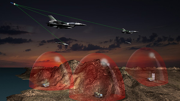
Evidence is emerging that electronic-warfare systems capable of high-power jamming and spoofing across wide areas are being used within Ukraine. Fortunately, there have been no known impacts on allied forces. However, knowing that the technology is in place and in use highlights the importance of assured positioning, navigation and timing (APNT) and our contribution to building resiliency in allied forces’ equipment against the potentially destabilizing effects of jamming and spoofing.
How do you define APNT?
We use APNT to describe measurements that are always accurate, available and reliable. Our anti-jamming, anti-spoofing and other resilience-building capabilities provide trusted and available PNT information at the level of accuracy requested.
When did you introduce GPS Anti-Jam Technology (GAJT)? How do you define it?
GAJT was introduced in 2011 and is our leading APNT solution. GAJT units are utilized worldwide across land, sea and air, with rapid deployment supported by commercial off-the-shelf solutions and short lead times. GAJT provides jamming protection of satellite-based navigation and precise timing receivers from intentional jamming and unintentional interference whatever your application. Product variants provide features to best support anti-jamming capabilities for the warfighter, national infrastructure, low-SWaP platforms and other mission-critical applications.
What are the key differences between the GAJT-710ML, the GAJT-710MS and the GAJT-410MS?
The GAJT-710 is designed for land vehicles (ML variant) and marine vessel platforms (MS variant) with up to six simultaneous nulls to protect against jamming signals and interference. The next generation of GAJT-710 includes jammer direction-finding and a silent mode to reduce its thermal signature. The GAJT-410 maintains the high levels of interference-rejection performance in the 710 but in a lower size, weight and power (SWaP) design, with three simultaneous nulls, for both land and marine variants. It also utilizes a single RF cable to provide clean power, data and protected GPS signal. The GAJT-410 enables APNT while also reducing the need for platform modifications or armor penetration.
The GAJT-AE extends jamming and interference protection to unmanned and autonomous applications. Using an external CRPA antenna, the GAJT-AE offers flexibility of integration into space-constrained platforms.
Is the GAJT-AE-N Anti-Jam Antenna receiver-agnostic?
We designed our GAJT product line to be receiver-agnostic and compatible with legacy and modern GNSS receivers. This flexibility results in GAJT being ideal for civil and military applications, including SAASM and M-code systems.
How does your GNSS Resilience and Integrity Technology (GRIT, launched in 2020 November) relate to your GAJT antennas?
GRIT is a firmware suite for our OEM7 receivers that expands their situational awareness and interference mitigation tools. GRIT includes our Interference Toolkit (ITK) along with spoofing detection to identify when your GNSS signal may be under threat. It also empowers the user to develop interference location algorithms through time-tagged snapshots of data samples to characterize the RF environment around your operations. GRIT, alongside GAJT, forms the foundation of our APNT strategy in providing accurate and always-available PNT.
Do you have any recent contracts with the U.S. Department of Defense or the militaries of other NATO countries to supply GAJT antennas?
Our GAJT product portfolio has been sold in large quantities to military and civil organizations for many years, successfully proving itself in the field. In 2020, we achieved a milestone of more than several thousand units shipped worldwide, making it one of Hexagon | NovAtel’s more successful years.
In 2019, the U.S. Air Force certified the security architecture of Raytheon Intelligence & Space’s M-code modules and receivers as providers of secure and reliable access to modernized GPS. The resilient receivers are designed for high anti-jam performance.
Raytheon’s M-code application-specific integrated circuit (ASIC) chip is either integrated into a ground-based receiver card optimized for low dynamic applications, or used as an avionics/naval receiver card to support multiple end users.
“Our focus is on taking a comprehensive approach to resilient navigation,” explained Chad Pillsbury, director for Raytheon’s Secure Sensor Solutions. “We provide the complete family of PNT solutions. We start with the fundamental components, like the ASIC chip, and tailor our solution for the platform and mission requirements.”
Open Architecture. Raytheon successfully completed testing of the first M-code receiver onboard the U.S. Air Force’s B-2 bomber in 2017. “Since then, we’ve undergone a number of tests internally and with third-parties. Our M-code receivers have standard interfaces and open architecture protocols, enabling them to work with both U.S. and allied systems. By pairing our M-code receiver with our anti-jam electronics and antenna, our systems enable warfighters to combat the most advanced threats seen in the world today,” Pilsbury said.
The receiver is planned to be incorporated into many fighters, bombers and weapons systems across the U.S. Department of Defense. “We provide enhanced anti-jam, anti-spoof GPS capabilities, as well as alternate navigation and multi-constellation support that represent a significant improvement over the systems currently used by today’s warfighters,” Pillsbury said.
Meeting Advancing Threats. “The hardest part is meeting a changing threat target,” Pillsbury explained. “The fact is the threat is advancing at a rapid rate. Because of that, challenges are constantly evolving.
“That means we had to design solutions that were simultaneously robust and secure, but also flexible and open so we can continually upgrade them. That’s not an easy thing to do.
“But, by taking a comprehensive approach that looked at the whole problem rather than just part of it, we’ve developed systems that address these challenges and have the flexibility to address future challenges.”
Raytheon’s M-code products are now available to the U.S. military and its allies in accordance with International Traffic in Arms Regulations and the U.S. State Department.
Cobham make the anti-jam GPS for the Lynx Wildcat. (Photo: U.K. Ministry of Defense)
Research contract to protect satellite signals from interference
Cobham Aerospace Connectivity will research advanced GNSS anti-jam techniques for the United Kingdom Ministry of Defense (UK-MOD). The research contract was awarded by the Ministry of Defense’s Defence Equipment and Support (DE&S) office.
Under the contract, Cobham will develop means to provide assured and resilient position navigation and timing (PNT) information derived from GNSS. The company has extensive background in advanced antenna technology and sophisticated signal-processing capabilities.
Cobham makes the conformal GPS CRPA for the Eurofighter Typhoon. (Photo: Cobham)
The research is set against a backdrop of increasing reliance on GNSS navigation signals in the nation’s critical infrastructure and national security and the frequent interruptions of the signals either accidentally or intentionally. The more sophisticated interruptions involve the falsification of the navigation signal information for nefarious reasons such as piracy, civil disruption and military advantage.
Cobham’s goal is to take already-developed anti-jam capability and develop a miniaturized system that can provide an advanced means of protection of the navigation signals received from the GNSS multi-constellation network.
Cobham beam-forming anti-jam GNSS digital antenna control unit. (Photo: Cobham)
The anti-jam system will combine the use of advanced controlled radiation pattern array (CRPA) antenna technology with intelligent digital signal-processing techniques. It will be designed to ensure reliable and assured navigation information, as well as derive important signal intelligence and domain-awareness information regarding the source and nature of the interference and the best means of mitigation.
“This contract award recognises Cobham’s status as a major UK provider of anti-jam systems as well as our long history and deep experience in the areas of navigation antennas and satellite connectivity,” said Neil Tomlinson, vice president of Sales and Business Development at Cobham. “We look forward to working with DE&S in this initial phase and subsequent work on this exciting project.”
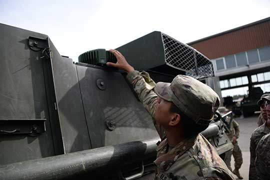
Sixty-two of the first iteration of mounted anti-jam GPS devices were equipped into light armored vehicles in Germany over the past month, with thousands more scheduled to be installed into U.S. European Command vehicles by 2028, said Army leaders in charge of location data on future battlefields.
The Mounted Assured Precision Navigation & Timing System — known as MAPS — was developed to provide trusted positioning, navigation and timing (PNT) to a platform, such as Stryker vehicles, by pairing a GPS receiver with an anti-jam antenna, said Col. Nickolas Kioutas, PNT project manager.
Read more about MAPS, along with other anti-jam systems, here. Also look for our anti-jam feature coming in the December issue of GPS World magazine.
The electronic technology comes amid the Army’s vision for 2028, to best prepare soldiers for possible warfare with near-peer competitors, who have used electronic warfare to disrupt communications vital to Western forces in recent years.
This year, more than 300 Stryker vehicles, all from the 2nd Cavalry Regiment, are expected to be fielded with MAPS technology, said Willie Nelson, the director of the Army’s Assured PNT Cross-Functional Team.
Upgraded first-generation and second-generation technology is also expected to be unveiled in the future.
The Army also plans to equip armored brigades with the technology, and put MAPS in vehicles such as the Bradley Fighting Vehicle, M1 Abrams tank, and the M109 Paladin self-propelled howitzer. After those “priority vehicles,” the Army will evaluate the mounted device in second-tier priority vehicles, Nelson said.
Soldiers from 2-2 Stryker Brigade Combat Team move out in their Stryker during their training rotation at the National Training Center on Fort Irwin, Calif., Sept. 2, 2019. (Photo: Sgt. Ryan Barwick/U.S. Army)
In the past, armored vehicles have used multiple Defense Advanced GPS receivers, known as DAGR devices.
MAPS replaces multiple DAGR devices with one “really good system,” said Kioutas. The new system uses a chip-scale atomic clock for timing, Selective Availability and Anti-Spoof Module, or SAASM, for GPS, and anti-jamming antenna to distribute PNT information.
In addition, future iterations of MAPS will include non-GPS sensors by fusing GPS with alternate navigation and timing technologies to ensure accurate PNT that soldiers can trust while operating in various threat or denied environments, according to a statement.
A single-point GPS also creates multiple practical benefits for soldiers, such as less maintenance and system key-failing, Kioutas said, adding many of his team’s decisions are based on Soldier feedback, because listening to them today helps prepare them for tomorrow.
Simply put, “MAPS continues to work whenever a GPS signal is weakened or compromised,” he said.
“This is the first technology equipping for the Assured Positioning, Navigation and Timing Cross-Functional Team, and one of the first for Army Futures Command,” Kioutas said.
Nelson noted that they’re “working in parallel with both mounted vehicles and dismounted soldier’s PNT gear.”
A soldier checks part of a Mounted Assured Precision Navigation & Timing System — known as MAPS. Sixty-two of the first iteration of mounted anti-jam GPS devices were equipped into light armored vehicles in Germany over the past month, with thousands more scheduled to be installed into U.S. European Command vehicles by 2028. (Photo: John Higgins)
Earlier this year, a requirements document for the dismounted soldier’s PNT was signed. Now, currently in the prototyping phase, the latest iteration of a dismounted GPS receiver can send secure PNT data wired or wirelessly, Kioutas said.
“A lot is happening here, a lot of good success,” Nelson said, adding, the most important thing for his team is to get the best equipment to “warfighters on the front lines and getting their feedback rolled back into the next generation.”
Nelson will host a Warrior’s Corner presentation Oct. 15 focusing on the PNT CFT’s Tactical Space Line of Effort, at the Walter E. Washington Convention center in Washington, D.C.
New initiatives from the Navigation Innovation and Support Programme (NAVISP), a program of the European Space Agency (ESA), have targeted counter-jamming and counter-spoofing efforts, as Europe’s Galileo program gains progressive foothold in the marketplace, particularly in safety-critical systems such as driverless cars.
“We are looking for new and disruptive ideas in navigation and that is why we created NAVISP,” said ESA Director General Jan Wörner.
TeleConsult Austria is working with JH Joanneum University of Applied Sciences on the GNSS Interference Detection and Analysis System (GIDAS), to automatically detect, classify and pinpoint all intentional interference sources within a given area by monitoring all civil GNSS signals in real time.The aim is to build a multi-frequency scalable system. GIDAS plans to begin commercialization at the end of 2019.
France Developpement Conseil has developed a hardened satnav module called DRACONAV, combining hardware and software to combat jamming and spoofing. Targeting intelligent transport applications, it seeks to identify cyber attacks and continue to provide authenticated positioning information as they occur.
DRACONAV would deliver a level of confidence to let users know if they can continue relying on the data the module delivers, and yield an estimate of the receiver’s true position as the attack continues. A prototype design has undergone more than 3,000 kilometers of field tests and is moving to industrialization.
o to analyze a few tens or hundreds of milliseconds of Galileo signals at a time, to tell the user whether or not the signal is authentic or spoofed.
In Romania, InSpace Engineering’ MARGOT assesses the multipath and interference impact on PNT information in maritime environments.
The Norwegian company SINTEF is developing its Advanced Radio Frequency Interference Detection, Alerting and Analysis System (ARFIDAAS) project, offering as wide a spectral coverage as possible — including all current GPS, Galileo and GLONASS signals — to identify disruptions due to intentional or unintentional interference.
UK company Helix Technologies has developed compact helical antennas, built around a dielectric ceramic core, primarily for driverless cars. The multi-frequency design aims to reduce susceptibility to interference as well as multipath. Testing will soon get underway in several European cities.
The U.S. Army will send prototype anti-jamming systems to its 2nd Cavalry Regiment, stationed in Europe, in September to aid forces under GPS jamming or spoofing conditions. The first generation of Mounted Assured PNT Systems (MAPS) and anti-jam antennas are nearly ready for integration aboard armored Stryker vehicles, and the Army is already evaluating proposals for an upgraded version incorporating an inertial navigation system (INS) for further resilience.
The shipment comes in response to widespread Russian jamming of GPS signals from the sub-Arctic to the Middle East, and in tacit, likely tardy acknowledgment of Russian superiority in electronic warfare.
An Interim Armored Vehicle “Stryker” and AH-64 Apache helicopters with Battle Group Poland move to secure an area during a lethality demonstration as part of Saber Strike 18 in June 2018. (Photo: U.S. Army/Spc. Hubert D. Delany III, 22nd Mobile Public Affairs Detachment)
Col. Nickolas Kioutas, Army project manager for positioning, navigation and timing (PNT), announced the move at the annual C4ISRnet conference in Arlington, Virginia. C4ISR stands for Command, Control, Communications, Computer, Intelligence, Surveillance, and Reconnaissance, or more broadly, electronic and other systems, procedures and techniques used to collect and disseminate information.
Three vendors are providing prototypes for the IMU-equipped second-generation MAPS, or MAPS-2, with testing to begin in September. A MAPS-3 capability, drawing on lessons learned in 1 and 2, may get underway soon. GPS Source, now a subsidiary of General Dynamics Mission Systems, made MAPS-1 and is now competing for MAPS-2.
The initiative reflects a new approach by the Army of “doing much smaller, iterative programs,” according to Col Kioutas. Traditionally, U.S. armed forces have taken years (and sometimes more years) to develop large, complex weaponry and supporting systems, and then even longer to deploy them. By the time they arrive in the operational theater, they are obsolete.
Rapid deployment of smaller, quickly designed and manufactured batches creates the opportunity for rapid feedback on what works and what doesn’t, with equally rapid return to the design board and re-manufacture. In other words, “shoot, aim, ready.”
Kioutas and crew are also flouting another U.S. military tenet, that in which previously “[we] asked for exactly what we wanted and industry built exactly to that. We don’t know exactly what we want. Tell us how we should do this the best, and then we’ll test that.” The PNT program has left requirements broad and open to change, knowing how quickly technology develops — and is shown to be vulnerable.
The Stryker is an eight-wheeled armored fighting vehicle, basically a lightly armored tank or heavily-armored troop carrier that is more road-friendly, that is, faster, than a tank. It has several variants of armament, armor and troop-carrying capacity. It saw extensive use in the Iraq counter-insurgency campaign.
The U.S. Air Force has selected an anti-jam GPS receiver from Collins Aerospace (through the division formerly known as Rockwell Collins) for Air National Guard and Air Force Reserve F-16 fighter aircraft.
The U.S. Air Force Life Cycle Management Center (USAF AFLCMC) chose Collins Aerospace to supply its latest-generation Digital GPS Anti-Jam Receiver (DIGAR), designed to prevent jamming of GPS signals.
The DIGAR receivers will provide highly reliable navigation for U.S. Air National Guard and U.S. Air Force Reserve F-16 aircraft operating in contested, electromagnetic environments.
This will be the first combat fighter aircraft to be installed with the latest version of the receiver.
“As enemies continue to find new ways to affect the ability to navigate, the latest DIGAR will provide the highest level of protection available so our warfighters can execute missions with precision and accuracy,” said Troy Brunk, vice president and general manager, Communication, Navigation & Electronic Warfare Solutions for Collins Aerospace.
Image: Collins Aerospace
Integration of the DIGAR requires no changes to existing operational flight programs or A-kit aircraft wiring, lowering the risk and cost involved to upgrade.
Built on an open systems architecture, the DIGAR is designed for use across a variety of aircraft platforms that include rotary wing, fixed-wing fighter, bomber, transport aircraft and small to large unmanned aerial systems.
DIGAR is a form, fit replacement for existing antenna electronic systems with demonstrated performance that exceeds legacy capability, the company said.
DIGAR Features
Superior digital beamforming or nulling anti-jam
Up to 16 simultaneous beams for superior jamming immunity to 125+ dB J/S performance (beamsteering mode, actual performance is classified.)
Two- to seven-element CRPA compatible
Simultaneous L1/L2 protection
Supports Y-code and M-code Anti-jam
Supports STAP/SFAP beamforming
Two form factors: DIGAR-200 (218 cubic inches) or DIGAR-300 (75 cubic inches)
NovAtel’s GPS Anti-Jam Technology (GAJT) now rides into battle and military exercises aboard the Canadian Army’s Artillery Observation Post Vehicles (OPV) that have been fitted with the GAJT‑710ML antenna.
OPVs are highly mobile vehicles that perform observation, reconnaissance and patrolling missions, surveying and acquiring strategic targets and relaying instant, accurate target coordinates acquisition to artillery fire command systems. With their exposed position on the frontlines of the battlefield, OPVs can encounter severe GPS jamming aimed at crippling their capabilities. OPVs require reliable Position, Navigation and Timing (PNT) not only to safely and effectively navigate on the battlefield, but to provide reliable information to artillery in the rear.
GAJT provides protection for GPS navigation and precise timing receivers from intentional jamming in electronic attacks, ensuring that the satellite signals necessary to compute position and time are always available.
“GAJT allows us to have confidence that the position information from the GPS constellation is assured.” said Major Mike Moulton, the project manager in the Directorate of Land Communication Systems Program Management.
NovAtel’s GAJT is a retrofittable system. A military-off-the-shelf (MOTS) product, it comes in versions suitable for land or sea applications and smaller platforms such as unmanned aerial vehicles (UAVs). The antenna works with an array of military and civil receivers, including the Army’s handheld Defense Advanced GPS Receiver (DAGR), other military receivers using SAASM and M-Code, and with civil receivers.
“GAJT scrubs off unwanted signals. It differentiates between what we can recognize as a signal coming from a satellite and something anomalous, which could be interference or deliberate jamming,” explained Peter Soar, NovAtel’s Business Development Manager for defence. “GAJT does not contain a GPS receiver, but works with the receiver that’s already installed. So GAJT faithfully passes the good satellite signals to the receiver which then operates functions such as integrity monitoring in its normal way. GAJT is in use operationally and has been shipped to 16 allied nations around the globe.”
GAJT is a null-forming antenna system that ensures that satellite signals necessary to compute position and time remain available. There is no need to replace the GPS receiver that’s already installed, as GAJT works with both civil and military receivers operating in the GPS L1 and L2 bands. It is ready for M-Code, is a non-ITAR product and is readily available to authorized customers.
Trials with the Canadian Army’s testing unit validated the technology, maintaining access to the GPS signal in an adverse signal environment. It also gave NovAtel engineers a detailed unclassified report on the trial findings and recommendations. The feedback helped NovAtel modify GAJT into a stronger product. The GAJT-710ML antennas were delivered earlier this year, and the Army worked with General Dynamics Missions Systems Canada, the prime contractor for the mission systems on the OPV, to integrate the antenna aboard the vehicle.
“GAJT is a Canadian success story. It is 100 percent produced in Canada and sourced from Canadian components. I think that the Directorate of Land Communication Systems Program Management have shown there is excellent technology in Canada that can be leveraged to meet the Army’s requirements in a very rapid manner,” added Moulton.
This story uses some quotes that first appeared in “Out of a Jam,” an article by Chris Thatcher in Canadian Army Today.
Mayflower Communications Company has delivered its Multi-Platform Anti-Jam GPS Navigation Antenna–Federated (MAGNA-F) to the U.S. Air Force Special Operations Command (AFSOC) in August 2017.
Mayflower’s MAGNA-F anti-jam antenna system.
Mayflowers’ GPS anti-jam system (MAGNA) provides protection for multiple military GPS receiver types (C/A and SAASM). The AFSOC platform has been proven in an operational environment.
MAGNA-F can provide protected GPS signals to different receivers simultaneously. It protects critical mission systems on the platform and provides unwavering position, navigation and timing (PNT).
The MAGNA-F system provides the fixed-wing platform with unsurpassed high-performance anti-jam capability.
“The MAGNA-F is easy to install as a drop in FRPA replacement, provides high-performance GPS anti-jam, and is very reliable,” said Joe Thomas, director of government programs for Mayflower.
The integration and testing of the MAGNA-F began in late January and February of 2017 and was led by the U.S. AFSOC Program Team at U.S. Special Operations Command (USSOCOM).
The flight testing proved the Mayflower MAGNA-F provides the highest level of PNT assurance for size, weight and performance (SWaP) constrained fixed-wing and UAS platforms.
The MAGNA-F is built on an open systems architecture and can be used with multiple military or civilian GPS receivers.
The MAGNA-F enables growth capabilities across a variety SWaP constrained platforms including rotary wing, fixed wing, and small to large unmanned aerial systems (UAS). The MAGNA AJ systems are also adaptable for U.S. Army ground vehicle AJAS requirements.
Over the past five years, Mayflower has delivered anti-jam systems across multiple aircraft (fixed wing, UAS) and U.S. Navy strategic-level submarine platforms.
The Mayflower family of anti-jam systems have a wealth of military live tests (flight and ground) and “real-world” operational experience. The Mayflower SAS (NavGuard 500), SAGE (NavGuard 501) and MAGNA-F (NavGuard 502) assures a Technology Readiness Level (TRL 8/9) product. Each of these systems are software upgradable with capabilities such as direction of arrival, jammer characterization, and operational with U.S. Army pseudolites.
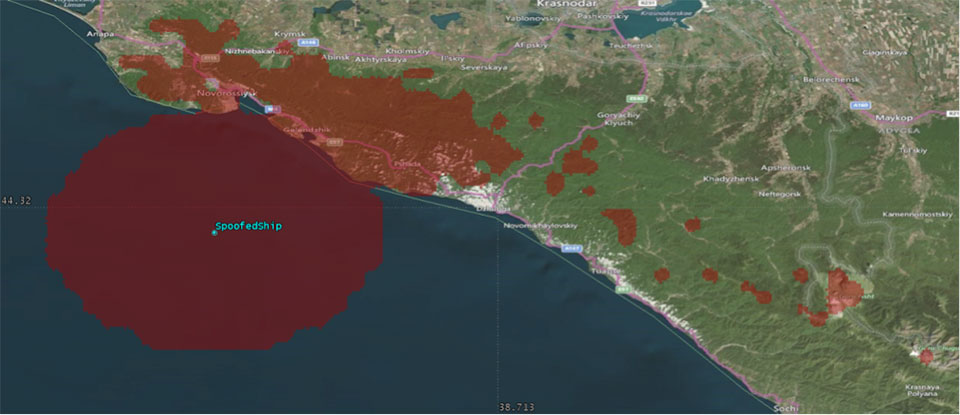
We’ve heard a lot in the news recently about GPS spoofing, mostly centred on the story of ship spoofing in the Black Sea. Between June 22-24, a number of ships in the Black Sea reported anomalies with their GPS-derived position, and found themselves apparently located at an airport.
What happened is open to educated conjecture. In this column, I’ll briefly cover the history of spoofing, its basic techniques, some spoofing tests that we conducted, and then return to the infamous Black Sea incident.
As part of my day-to-day work in navigation warfare, I do a fair amount of work in defensive anti-spoofing. Naturally, in order to test anti-spoof technology, it is necessary to also perform spoofing. It’s a delicate subject and, as with any topic involving defense or national security or critical infrastructure, there’s a balance to strike between responsible disclosure, how much information is released into the public domain, and so on.
In this article, I will stick firmly to information available in the public domain, lest I be accused of proliferating the threat, but this still gives us enough material to tiptoe around the subject for the benefit of our readers. I could have included more details about the spoofing attacks, but was advised to hold some back — it makes governments nervous. You can read some of the background in an excellent article by Norwegian broadcaster NRK and a Resilient Navigation and Timing Foundation press release. Similar GPS anomalies still continue to occur at various locations.
Let’s start with basic spoofing background, and we’ll return to the Black Sea incident at the end of the article.
A brief history of spoofing
Spoofing isn’t a new threat — it’s been around for decades. But only in recent years has it received so much public attention. As with jamming and anti-jamming technology, and most other topics in the GPS domain, spoofing finds its roots back in the days of Cold War radar. In those times, it was often known as “deception jamming,” where you would transmit fake radar returns to paint an incorrect picture on your adversary’s radar screen.
When GPS came along, it was understood at the time that the C/A code would be vulnerable to spoofing. It’s an open code, so anyone is free to reproduce it. That is, after all, what a GPS simulator is: a GPS spoofer. We legitimately test our GPS receivers by fooling them with fake signals from a GPS simulator.
Of course, this is precisely why legacy GPS satellites also transmit the military P(Y)-code, and continue to do so. The P-code offers improved accuracy, and some other benefits, but more importantly, it is modulated with the W encryption sequence to give us the encrypted P(Y)-code. Ever since the anti-spoofing module was set to the “on” state, unless you have the key, you are unable to directly spoof the P(Y)-code. (You can still perform a meaconing attack, though, where you simply record the transmitted satellite signals and retransmit them again. Although this kind of attack can’t be used to impose a particular scenario on a GPS receiver, it might still cause havoc in unwary receivers).
So. in the early days it can be argued that the spoofing threat was solved. It wasn’t until GPS became ubiquitous in the commercial and civilian domain that spoofing really raised its head again. The fact that the vast majority of GPS receivers in the world relied solely on the unencrypted C/A code became a cause for concern — especially where those GPS receivers were essential to critical infrastructure.
The threat of GPS spoofing was discussed at many conferences and behind many closed doors and, although most people agreed that spoofing was a theoretical threat, some people argued that in reality it was “simply too hard” to conduct a realistic spoofing attack. And therefore we should not worry ourselves about it.
It wasn’t until a couple of high-profile demonstrations were carried out by the University of Texas Radionavigation Laboratory that spoofing became front-page news once again. In 2012, the lab staff carried out an exercise at White Sands Missile Range where a GPS-guided drone was spoofed from a distance. The drone was fooled into thinking its altitude was increasing, causing it to compensate by dropping straight down. Then in 2013, the same team demonstrated how an $80 million yacht could be steered off course by means of a spoofing attack.
These exercises publicly demonstrated that spoofing was indeed a real threat, and could be done. But many people still believed that it was very hard to build the complex equipment necessary to perform the attack, and thus spoofing was out of reach for most potential criminals or terrorists.
Fast forward another two or three years, to when a new mobile phone game appeared. Pokemon GO became the game craze of the moment, where players would travel around the country with their phones, getting points by collecting creatures in an augmented reality world. It didn’t take long for people to dream up new ways of earning points in the game, without having to go to the effort of traveling around the world.
What if you could make your phone think it was somewhere else, without ever having to leave your bedroom? And thus, bizarrely, it was a mobile phone game that brought GPS spoofing into the mainstream.
The rise of the low-cost software-defined radio (SDR) has enabled “spoofing for everyone.” Today, the tool of choice for the casual user is often the HackRF or bladeRF. Couple small SDRs that cost around $200 with open-source GPS simulation software, and you have a basic spoofer. Plenty of websites detail how to perform basic spoofing, and at hacker gatherings, people can present how they spoofed a drone. These may not be the most sophisticated setups, but it’s good enough to do the job in many cases. With a better setup, which I won’t describe here, it’s possible to achieve a much more realistic attack, which will fool even the most shrewd and wary GPS receivers.
Spoofing basics
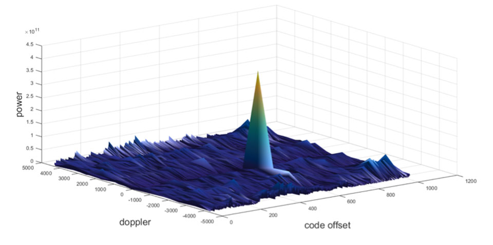
Let’s take a quick look at what it means to spoof GPS. A receiver searches for a satellite over a two-dimensional surface to find a correlation peak, and it must examine a range of Doppler frequencies and code offsets. An example is shown in Figure 1. Once the receiver finds the peak, the satellite is acquired, and it will then track the satellite as it moves and can demodulate the navigation data message.
When a spoofer comes along, it tries to recreate this peak. By doing so, and usually with little more power than the real satellites, the receiver will begin to track the spoofed signal. Once the spoofed signal is being tracked, the spoofer can begin to manipulate reality by slowly modifying the properties of the signal.
Figure 1. GPS correlation surface. (Image: Michael Jones)
A poor spoofer doesn’t always align itself very well with reality, which essentially creates a second peak on the correlation surface. But a gullible receiver can still be fooled by this, and may lock on to false peaks.
The reality of spoofing and anti-spoofing
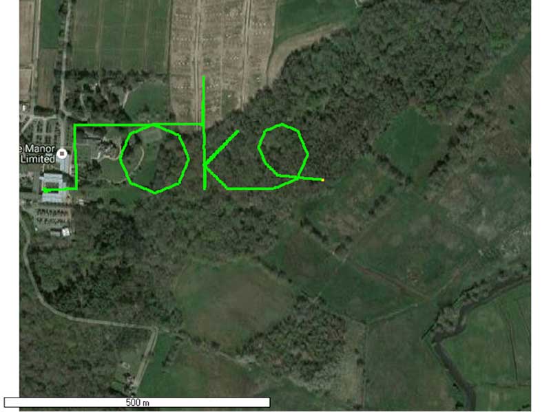
To understand the reality of spoofing and anti-spoofing, we carried out outdoor experiments at one of the Roke Manor trials areas (thanks go to my colleague Mike Wells for letting me use some of his results here).
In the first experiment (Figure 2), we spoof a commercially available mass-market receiver. The receiver is outside, reporting its correct location at Roke Manor. When we commence the spoofing attack, we are able to take control of the receiver. Once captured, we can then make the receiver appear to follow an arbitrary course. Here we make it wander off into the forest, spelling the word “roke” as it goes.
Figure 2. Spoofed GPS receiver appears to follow a course, whilst in reality being stationary. (Image: Michael Jones)
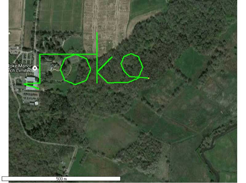
In the next experiment (Figure 3), we place a conventional anti-jam antenna (a CRPA) on the receiver. What we observe, as you might expect, is that the basic CRPA offers no protection against the spoofing attack.
Figure 3. A GPS receiver is still successfully spoofed when protected by a conventional CRPA. (Image: Michael Jones)
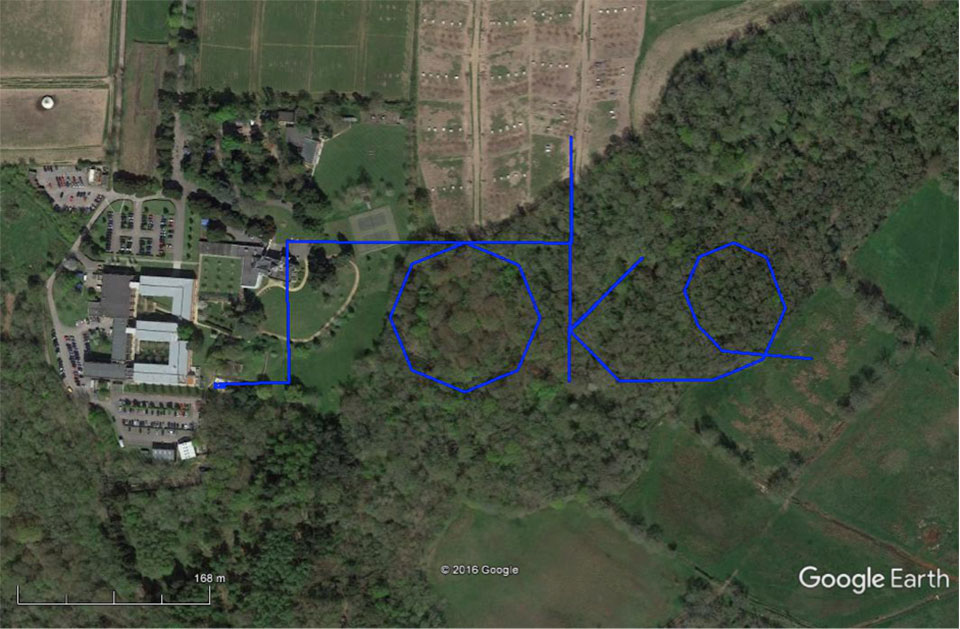
Now let’s make the experiment more interesting. We’ll move away from the basic commercial receiver, and replace it with a unit that contains not only a GPS receiver, but also a 3-axis accelerometer, 3-axis gyro, 3-axis magnetometer and a barometric sensor. An Extended Kalman Filter (EKF) performs an optimal fusion of the various sensors to yield the position solution.
The result, when we again try our spoofing attack, is shown in Figure 4. In short, the receiver is still successfully spoofed, despite the additional sensor inputs it offers.
Figure 4. A GPS receiver with integrated inertial sensors is still spoofed. (Image: Michael Jones)
Before everyone gets too depressed by the ease at which GNSS, and even GNSS fused with other sensors, can be spoofed, there are answers to this problem. Some decent, modern GNSS receivers contain a whole host of algorithms for detecting and ignoring spoof signals. The issue is that many legacy receivers are still in the field, and these can be extremely vulnerable indeed.
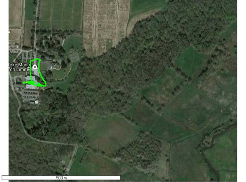
Another option is to use a more advanced CRPA, which offers anti-spoof capabilities. These adaptive antennas are able to correlate on the spoof signals, and then remove them based on direction of arrival. So, in our final experiment here, we use our commercial mass-market receiver again, and protect it with an anti-spoofing CRPA.
The result is shown in Figure 5. You can see that the receiver is briefly spoofed, and starts to wander off course. When the anti-spoof is enabled and kicks in, the position quickly drifts back to the true location and stays there. Good job.
Figure 5. With an anti-spoof CRPA, the GPS receiver detects the spoofer and quickly returns to its true location. (Image: Michael Jones)
Back to the Black Sea
Let’s finish by returning to the hot topic of the day. Did spoofing occur in the Black Sea back in June? Or was it a different form of interference? Could it have been a low-level jamming incident, causing the GPS receivers to report misleading information?
Without resorting to SIGINT (signals intelligence) data, and basing this discussion solely on public domain information and anecdotal evidence, I would say this was almost certainly a spoofing incident. A number of factors lead to this conclusion, and I’ll share some of them.
Firstly, it didn’t happen to one ship – it happened to over 20 separate vessels. So it wasn’t a malfunctioning GPS unit; it was an external incident of some kind.
Secondly, a large number of ships in the area reported identical or very close locations. This is a symptom of a large-scale spoofing attack. If it was a low-level jamming attack, then any misleading positions reported by vessels would typically have some randomness to them.
Thirdly, ships reported that their positions would periodically “jump” from the true location to the incorrect location. Again, this is very typical behavior in some spoofing experiments: For various reasons, GPS receivers may temporarily lose lock on a spoof set of satellites, and then reacquire the real ones, and vice versa. This causes the characteristic random flipping between two well-defined locations.
If we accept that a GPS spoofing attack did occur, it brings us to the million-dollar question.
Who did the spoofing, and why?
What I’ll do here is a bit of a lightweight analysis exercise using public information and basic physics, and you can formulate your own conclusions.
Let’s start by placing a ship, located in the Black Sea at 44°14.0’N 037°43.1E, which is the actual position of one of the reported spoofed vessels. For this example, I have placed a representative GPS antenna on the ship’s mast, with its antenna pattern shown.
Figure 6. Victim ship in the Black Sea, with GPS antenna pattern shown. (Image: Michael Jones)
To get a rough handle on the scenario, consider the possible propagation of the spoofing signal. As a first-order approximation, let’s assume a standard 4/3 Earth refraction model, with obstruction by terrain. That’s a reasonable assumption at this frequency: Any obscuration by terrain will block the spoof signal. Let’s also initially assume that our GPS antenna on the ship is mounted 38 meters above sea level, and our spoofing equipment is mounted on a mast 20 meters aboveground. From this information, we can plot a map of possible spoofer locations for this particular incident (Figure 7).
Figure 7. Possible spoofing source locations. (Image: Michael Jones)
The first thing we might conclude from this is that the spoofing indeed originates from Russian territory, close to the Black Sea coast. To spoof the ship from further afield would require a much higher antenna, or even an airborne antenna. Which, of course, is possible, but then we would also expect vessels over a much wider area to report interference.
To me, it’s fairly conclusive that spoof GPS signals are being transmitted from this area, to make GPS receivers in the area think they are at an airport. The final question is: “Why would someone do this?” To answer this question, we must resort to educated speculation. Why would you want to spoof GPS receivers into thinking they are at an airport?
There’s one explanation that fits very nicely: drone defense. Many drones, especially those operated by casual users, have geofencing rules that prevent flights over airports and other restricted areas. So, if you were trying to perform aerial surveillance of the Russian border, your drone may suddenly think it was over an airport, and take action accordingly. The action taken depends, of course, on how the drone is programmed, but often includes “land immediately” or “return to launch point.” Certainly some of the drones we operate will immediately attempt to land if they find themselves in restricted airspace.
So if your drones are falling into the sea, you now have one idea why.
The system provides significant immunity to jamming compared with a conventional GPS antenna, allowing the platform to operate over 100 times closer to the jammer whilst maintaining its GPS reception, the company said.
The system will be available to view on Cobham’s stand, hall 2b, stand E156, at the International Paris Air Show, which is taking place June 19-25.
The compact size and modularity of the DACU and CRPA, as well as being receiver independent, means that the system can be installed in land and marine applications. (Photo: Cobham)
“Cobham has been a global leader in development of anti-jam technology for over 20 years, and we are delighted to be launching launch our next generation anti-jam GPS system at Paris Air Show,” said David Bulley, vice president of Cobham Antenna Systems. “The system provides significant immunity to intentional or unintentional jamming compared with a conventional GPS antenna, thereby protecting mission critical systems that require assured position, navigation and timing information from GPS.”
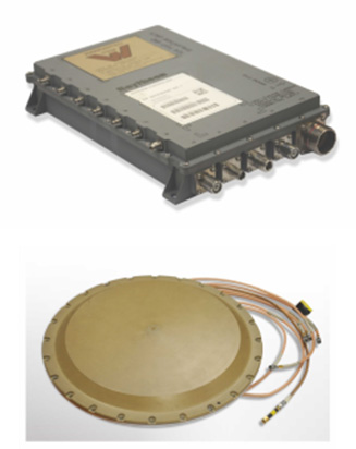
The system consists of a 7-6005 anti-jam GPS digital antenna control unit (DACU) and a four-channel 20-7009 anti-jam GPS controlled reception pattern array (CRPA) antenna. Both units meet stringent airborne requirements making them ideal for new installations and retrofitting to fixed-wing, rotary-wing and UAV platforms.
The compact size and modularity of the DACU and CRPA, as well as being receiver independent, means that the system can also be installed in land and marine applications so offering a single solution for all platforms.
The high-performance, four-channel antenna and electronic system, offers the optimum balance between size, weight, power and cost. Intelligent, dual-band protection is provided with processing optimized to combat the threat environment.
In my April column, I introduced the basic concepts behind GPS anti-jam technology, along with a bit of history around its evolution. I knew this was a popular topic, but I didn’t anticipate the enormous amount of positive correspondence I’ve received since, including many inquiries about where to buy this technology and who is entitled to have it.
So this month we return to the controlled reception pattern antenna (CRPA) topic, to look specifically at the major suppliers of GNSS anti-jam technology in a bid to help you select the best fit for your requirements.
As mentioned in April, CRPAs can trace their roots back to military radar developments in the 1970s and 1980s. It’s no surprise, then, that the main players in the CRPA market tend to be large defense primes. But there are many smaller companies, universities and research institutions that also play in the CRPA arena these days.
What about export?
When GNSS jamming was a little-known military problem, the situation was simple: anti-jam was a military technology for military applications only. Later, as GPS evolved into a dual-use technology, critical infrastructure and civilian applications brought a new demand for anti-jam in non-military domains.
Confusion then abounded about who exactly is entitled to make use of anti-jam technology. There are two distinct factors here: security classification, and export control. Let’s clear these up.
Security classification is simple: If a product is classified, it is only available to customers who hold the appropriate level of security clearance. Usually it is the performance and vulnerabilities of a product that would attract a classified status. As you might expect for in-service military products, the military would not wish everyone to know the performance and weaknesses of its deployed technology. This is why many datasheets for CRPAs omit performance information.
The second issue is export control. This, of course, varies by country. In the U.S., a CRPA developed towards a defense program is likely to have International Traffic in Arms Regulations (ITAR) restrictions attached to it. In Canada, CRPAs are subject to the Controlled Goods Program. In the UK, CRPAs sit on the “dual-use” export control list, which recognizes that CRPAs have both military and non-military application. An export license is usually required.
Before I go any further, a little disclaimer: I am not making any product recommendations in this article. There are many things to consider when choosing anti-jam technology, and you should always consult a navigation warfare expert and carry out appropriate evaluations prior to choosing a product. You should also seek guidance from your own government regarding any restrictions on export or import.
With that out of the way, let’s look at the offerings of a few suppliers. This is by no means a complete list, but I did manage to catch up with a few of the major players to ask them about their anti-jam technology offerings.
NovAtel
I spoke with Peter Soar, business development manager, Military and Defence, at NovAtel about NovAtel’s offerings.
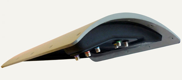
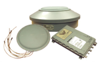
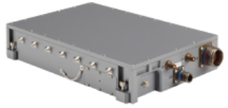
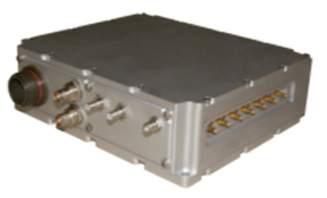
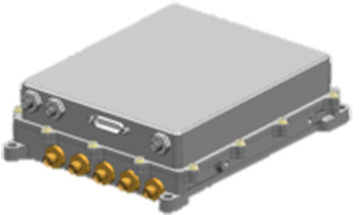
Peter Soar: “The GAJT-710 series are retrofittable GPS anti-jam products that combine a seven-element controlled reception pattern antenna (CRPA) and the antenna electronics in a single unit. The GAJT-AE-N is a GPS anti-jam antenna electronics system that supports a separated four-element antenna.”
Photo: NovAtel
Photo: NovAtel
Photo: NovAtel
Main features: “All three products protect the GPS L1 and L2 bands simultaneously, and are suitable for military (SAASM) receivers as well as open-signal receivers, normal civil receivers and ‘survey grade’ receivers. The wideband design means that the units are ready for M-code. In the GAJT-710, there are seven antenna elements for up to six independent nulls on both frequencies, and the GAJT-AE-N supports four antenna elements, for up to three independent nulls. All products use space-frequency adaptive processing for increased degrees of freedom. System messages provide an indication of jamming presence, even when the nulling is defeating the jamming.”
Intended market: “GAJT-710ML is optimized for land use, while GAJT-710MS is used for maritime and littoral applications. Both types are currently in use on mobile platforms and fixed installations. The GAJT-AE-N is optimized for smaller platforms such as unmanned air vehicles, and is currently in use on a variety of platforms. GAJT products have been shipped to customers in 16 countries to date.”
Example customers: “The GAJT-700ML (a predecessor to the 710ML) was selected for trials by the Canadian Army through the Build in Canada Innovation Program, with exercises performed on the Artillery Observation Post Vehicle (LAV III OPV). Both GAJT variants were selected for field testing by the U.S. Army Communication-Electronics Research Development and Engineering Center (CERDEC) through the U.S. Army Rapid Innovation Fund. The United States Naval Observatory (USNO) selected the GAJT-710ML to satisfy a requirement at sites throughout the Department of Defense Information Network (DoDIN). The GAJT-AE-N is deployed on the Schiebel Camcopter S-100, and was also selected for testing on the M777C1 Howitzer by the Canadian Army.”
Situation with regards to export: “All GAJTs are designed and built in Canada. As such, they are subject to the Controlled Goods Program of Canada, but they are free from ITAR for non-U.S. customers.”
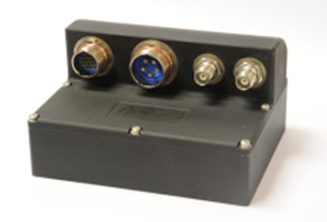
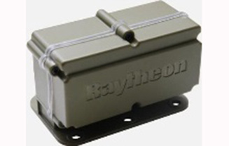
Raytheon UK
Some Raytheon products were mentioned briefly in the April column; I caught up with Alan Wright, business development executive, Force Protection, to get the latest information.
Alan Wright: “Raytheon UK offers a range of anti-jamming products ranging from high-performance products with multiple-element CRPAs to low size, weight and power products. Our current product lines utilize either analog or digital technologies to suit specific end-user requirements.”
Product
Image
Key Features
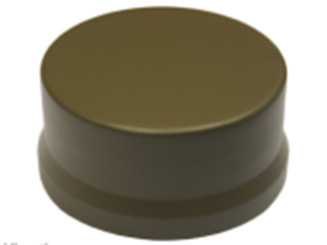
GAS-1
Analog technology, 7 antenna elements, switchable L1/L2 protection, minimal quiescent time delay, nulling, J/N, M-code signal bandwidth, AE/antenna integrated variant, fiber optic output variant.
Digital technology, 5 antenna elements, simultaneous L1/L2 protection, low size, weight & power, STAP, nulling, J/N, direction finding, anti-spoof, jamming flag, M-code signal bandwidth.
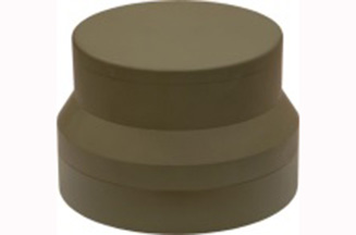
Landshield
Digital technology, integrated 4-element antenna, simultaneous L1/L2 protection, low size, weight and power, STAP, nulling, J/N, direction finding, anti-spoof, jamming flag, M-code signal bandwidth, switched antenna variant.
MiniGAS
Analog technology, integrated 4-element antenna, simultaneous L1/L2 protection or L1 with L2 passthrough, low size, weight and power, minimal quiescent time delay, nulling, jamming flag.
MicroGAS
Analog technology, integrated 2-element antenna, simultaneous L1/L2 protection, very low size, weight and power, minimal quiescent time delay, nulling.
Intended market: “With over 25 years’ experience, Raytheon UK is a world leader in the development, production and supply of GPS Anti-Jamming (GPS-AJ) systems to the majority of the world’s military forces (including the U.S. DoD and UK MOD), with solutions developed and certified for air, maritime and land applications. Raytheon UK has designed and manufactured in excess of 10,000 GPS anti-jam units for the worldwide market.”
Situation with regards to export: “GAS-1, ADAP and SAS are subject to U.S. ITAR restrictions. Landshield, MiniGAS and MicroGAS are free from ITAR and subject to UK export control.”
Rockwell Collins
I spoke with Al Simon, business development for navigation products/solutions, to get the latest on Rockwell Collins’ offerings. Rockwell’s portfolio includes some CRPA products aimed specifically at weapons. Al kindly provided the following table to summarize:
Product
Image
Platform
Key Features
Integrated GPS Anti-Jam System (IGAS)
Weapons (Embedded)
GPS receiver + AJ, nulling and beamforming, spatial, 20 in3, <2 lbs, up to 4 RF antenna inputs, 90+ dB J/S performance *, GPS (simultaneous L1 & L2), path to M-code
Strategic Anti-Jam Beamforming Receiver (SABR)
Weapons (Embedded)
GPS receiver + AJ, nulling and beamforming, STAP, 46 in3, <3 lbs, up to 7 RF antenna inputs, 120+ dB J/S performance*, GPS (simultaneous L1 & L2), path to M-code
NavStorm+
Weapons
Nulling, spatial, 6.9 in3, <.6 lbs, up to 5 RF antenna inputs, 20,000 G shock, 90+ dB J/S performance*, GPS (simultaneous L1 & L2), path to M-code
NavFire
Weapons
Nulling, spatial, 2 in3, <.2 lbs, 1 or 2 RF antenna inputs, 25,000 G shock, 85+ dB J/S performance*, GPS (L1 or L2), path to M-code
DIGAR-200
Airborne, Maritime, Ground
Nulling and beamforming, spatial, 218 in3, <11 lbs, up to 7 RF antenna inputs, 110+ dB J/S performance*, GPS (simultaneous L1 & L2), path to M-code
DIGAR-300
Airborne, Maritime, Ground
Nulling and beamforming, STAP/SFAP, 69 in3, <5 lbs, up to 7 RF antenna inputs, 125+ dB J/S performance *, GPS (simultaneous L1 & L2), path to M-code
Small Platform AJ (Pre-Production)
Ground, Airborne
Nulling and beamforming, STAP/SFAP, 45 in3, <3 lbs, up to 7 RF antenna inputs, 95+ dB J/S performance*, GPS (simultaneous L1 & L2), path to M-code
STAP (Space Time Adaptive Processing); SFAP (Space Frequency Adaptive Processing)
* Beamsteering mode. Actual performance is classified
Situation with regards to export: All listed products are unclassified, but are subject to U.S. ITAR restrictions.
Roke Manor Research
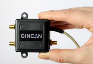
This column wouldn’t be complete without a few words on my own organization. Roke has been developing anti-jam CRPAs since the 1980s, but rarely offers its own products. Typically Roke develops bespoke anti-jam and anti-spoof technology for other defense organizations, including for some products already listed above. Examples of bespoke developments for more specialist markets include Gincan and the Helium antenna.
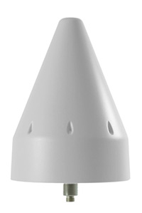
Photo: Roke
Photo: Gincan
Main features: Both these products are aimed at the commercial civilian market, but do also have defense interest. The Gincan is a very basic low-cost CRPA, with just two antenna elements. The Helium is a conical spiral design, using four antenna elements, and is primarily aimed at protecting GNSS in critical infrastructure. The Helium has excellent low-elevation performance. Both antennas feature very low latency, making them particularly suitable for timing receivers.
Intended market: The Gincan is primarily aimed at providing a basic level of anti-jam capability to the automotive mass market, including cars and trucks, but also has been adopted by some lightweight UAV platforms. The Helium is aimed directly at timing receivers for critical infrastructure, including mobile base stations, digital TV networks, stock exchange and financial institutions, and power and utility grids.
Example customers: Gincan has been delivered to 42 countries, with a mixture of commercial, defense and national security customers. Helium is a relatively new product, and is being trialed on infrastructure in two countries.
Situation with regards to export: Both products are unclassified and suitable for commercial use. They are subject to UK export control as dual-use items, and are ITAR-free.
Others
There are many other suppliers of CRPA technology — unfortunately, too many to cover in this column. Mayflower Communications offer a good range of CRPA products in the form of their NavGuard range. Some other suppliers include Cobham Antenna Systems, BAE Systems Rokar, Thales, Harris Corporation, L-3 Interstate Electronics and Lockheed Martin. I encourage you to contact these companies for the latest information if you are contemplating a CRPA product. If you’re a CRPA supplier and I’ve missed you, please feel free to post a link to your products in the comments section below.
So, that was a bit of a whirlwind tour through some of the products currently around. CRPAs come in all shapes and sizes, and they all have their own particular characteristics and subtleties.
I conclude by reiterating my earlier point. Always conduct a threat analysis, seek the help of a navigation warfare expert if necessary, and properly evaluate your choices. Happy choosing!