Tag: beacons

  • Orolia receives Cospas-Sarsat certification for distress locator

    Orolia receives Cospas-Sarsat certification for distress locator

    The approval paves the way for Orolia’s ELT-DT to play essential roles in meeting the aviation industry’s advanced safety mandates worldwide

    The Ultima-DT emergency locator. (Photo: Orolia)
    The Ultima-DT emergency locator. (Photo: Orolia)

    Orolia is the first company to receive certification from Cospas-Sarsat and the European Union Safety Agency for its new-generation distress tracking emergency locator transmitter, the Ultima-DT.

    The approval verifies Orolia’s continuous advancements in global beacon technology, including securing a single source, multi-year program contract to supply ELT-DTs for all Airbus aircraft programs.

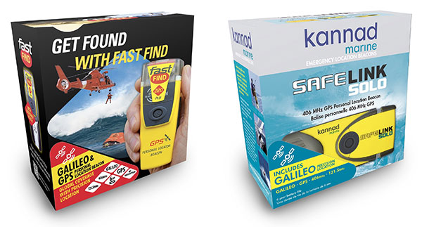
    Cospas-Sarsat is an international, humanitarian search-and-rescue system that uses space-based technology to detect and locate model 406 emergency beacons carried by ships, aircraft or individuals venturing into remote areas, often inaccessible by GNSS signals. The system consists of a network of satellites, ground stations, mission control centers (MCCs), and rescue coordination centers (RCCs) that work together when a 406 beacon is activated.

    “Being the first company to certify a distress tracking ELT shows again Orolia’s unique ability to provide the industry with the most innovative safety solutions,” said Jérôme Ramé, Orolia’s aviation and military product line director. “With Ultima-DT, we address the EASA-mandated requirement for the location of aircraft in distress, but also the market need for an ELT meeting the most recent safety standards.”

    Orolia developed the Ultima-DT in response to aviation safety mandates to improve global aircraft tracking. As per the ICAO Global Aeronautical Distress and Safety Systems (GADSS) recommendation and European Union mandate, all new aircraft delivered from January 2024 shall be able to autonomously report their location anywhere in the world and determine the end-of-flight location to help rescue teams rapidly locate the aircraft and recover flight recorders.

    Unlike traditional automatic fixed ELTs and stand-alone units, the Ultima-DT is tightly connected to the avionics system. It activates upon detecting a potential distress condition and starts transmitting automatically while the aircraft is still in flight. This next-generation ELT autonomously acquires the aircraft’s location and sends a 406-MHz message in real-time, including the accurate location, to the Cospas-Sarsat distress alert organization.

    The Ultima-DT is also the first ELT to fully comply with the latest EASA/FAA safety requirements for non-rechargeable lithium battery-powered equipment through (E)TSO-C142b. As part of its efforts to support airlines in their regulatory compliance projects, Orolia is also offering its portable Ultima-S ELT, which aims to meet these special conditions.

  • ESA funds fail-safe navigation system for drones

    ESA funds fail-safe navigation system for drones

    Ampyx Power logo

    The European Space Agency (ESA) has funded Ampyx Power, developer of a next-generation wind energy technology, and Omnisense, developer of locating and tracking solutions, to develop a robust fail-safe navigation system.

    The positioning solution will be used for automated take-off and landing of Ampyx Power’s wind-energy aircraft when applied offshore or over rugged terrain. The technology will be enabling as well for other drones in critical applications.

    Ampyx Power develops airborne wind energy systems (AWES) using autonomous tethered aircraft as a means for generating electricity on the ground. The launch and land deck is smaller than the wing span of the aircraft. High accuracy, availability and integrity of the relative positioning between aircraft and platform is required during the final horizontal approach to ensure safe landing of the aircraft in the case of GNSS outage.

    The funding will cover the integration into the navigation solution of a local positioning system that seeks to provide 10 centimeters of relative positioning accuracy with 100-Hz update rate and an operating range up to 1 kilometers. Ultra-wideband positioning techniques will be used to make this happen.

    “The project allows us to integrate a backup local positioning system into the existing high-end navigation solution,” said Michiel Kruijff, head of technology at Ampyx Power. “This novel navigation technology will ensure that our aircraft can overfly the platform with great accuracy, even in case of GNSS failure. This solution is particularly relevant for use cases in rugged terrain or offshore where other affordable means of relative positioning would be too costly or would offer insufficient performance or availability. We seek such a high level of system robustness both for commercial reasons and for safety reasons, in line with our certification approach with the European Aviation Safety Agency (EASA).”

    “We are pleased to offer our innovative local positioning system (LPS) to this project,” said Andy Thurman, CEO at Omnisense. “The closely time-synchronized fusion of ultrawideband (UWB) signals exchanged between landing deck and aircraft mounted Omnisense beacons, will allow highly accurate range measurements to be provided to the drone autopilot, enabling continuous operation in the safety critical landing phase. The enhanced capabilities which arise as a result of this project will enable Omnisense to extend the market reach for our flexible LPS offering from the industrial asset and animal tracking markets in which we currently operate, to more dynamic applications such as GNSS denied drone control, autonomous vehicles in smart cities and sports performance analysis.”

  • Orolia launches Galileo-enabled personal locators in Europe

    Orolia launches Galileo-enabled personal locators in Europe

    The upgraded McMurdo FastFind 220 and Kannad SafeLink Solo Personal Location Beacons. (Photo: Orolia)
    The upgraded McMurdo FastFind 220 and Kannad SafeLink Solo Personal Location Beacons. (Photo: Orolia)

    Orolia’s McMurdo FastFind 220 and Kannad SafeLink Solo personal location beacons (PLB) now operate with the Galileo GNSS system.

    The PLBs are the first of a series of new solutions coming from the European Union-funded Helios project, led by Orolia, which has been set up to leverage the power of the new satellite system.

    With Galileo, the upgraded multi-constellation PLB receivers offer increased global coverage and support accelerated rescue missions. Location detection is enhanced and can be more precise as the PBLs receive coordinates from the Galileo satellite network in addition to GPS. Signals can even be detected in high-sided locations, such as canyons.

    “We are thrilled to be launching our upgraded PLBs in the European and U.S. markets,” said Chris Loizou, vice president of maritime at Orolia. “The combination of both Galileo and GPS GNSS capability means that our customers will benefit from coverage that spans from the North to the South Pole. We work tirelessly to push the boundaries of product innovation and, ultimately, to give people the best chance of being rescued in an emergency situation.”

    The McMurdo FastFind and Kannad SafeLink PLBs are part of Orolia’s comprehensive search-and-rescue ecosystem and join the McMurdo SmartFind G8 and Kannad SafePro series EPIRBs as Galileo-capable rescue beacons.

  • NASA program for UAVs in cities turns to NextNav

    NextNav’s Metropolitan Beacon System (MBS) service has been accepted for use by NASA. NASA will use NextNav’s MBS network as part of its CERTAIN (City Environment for Range Testing of Autonomous Integrated Navigation) facilities at NASA’s Langley Research Center in Hampton, Virginia.

    CERTAIN supports, among other programs, Urban Air Mobility (UAM), an air transportation system with myriad applications from small package delivery drones to passenger-carrying air taxis.

    The Federal Aviation Administration (FAA) believes that by 2022 there will be more than 700,000 drones delivering packages, monitoring traffic and aiding in search and rescue operations. NASA’s role is to provide research findings to reduce technical barriers associated with integrating unmanned aircraft systems into the national airspace system.

    NextNav’s MBS system facilitates urban drone operations where satellite-based GPS signals may not be available. The need to reliably know a drone’s location horizontally and vertically is critical to ensure safe operations in urban air traffic corridors.

    Uber in the Mix. Uber and Bell (formerly Bell Helicopter) plan to launch an on-demand mobility venture, or flying taxis, nationwide by 2023, so the need to precisely track vehicles moving throughout city airspace is imminent.

    The move to such flying taxis would require a change to current FAA-controlled airspace separation requirements, according to Tom Prevot, Uber’s director of airspace systems. He stated that the Uber venture foresees takeoffs and landings from city vertiports every 24 seconds, requiring a considerable reduction in the minimum-distance standards of 1,000 feet vertically or 3 to 5 nm horizontally, as currently mandated in FAA order JO 7110.65.

    Metro Beacons. “NextNav’s MBS system provides us with new tools for the development of navigation systems in environments where GPS has traditionally been challenged,” said Evan Dill, Safety-Critical Avionics Systems Branch of NASA. “We’re looking forward to working with MBS as we develop new approaches to the operation of unmanned systems in urban environments.”

    NextNav’s wide-area terrestrial positioning network provides accurate and secure location services, critical for unmanned aircraft navigation. In addition, MBS complements and integrates seamlessly with GPS and provides a level of geo-redundancy ensuring a safe and efficient system for future air transportation in cities and urban areas, with particularly difficult challenges at low altitudes where solutions such as radar, GPS and ADS-B are unreliable or insufficient.

    Delivered over a managed network on nationwide licensed spectrum with carrier-grade dependability and metropolitan-wide coverage, NextNav said its services are designed for public safety applications, E911, critical infrastructure, as well consumer, Internet of Things (IoT) and commercial applications that require reliable 3D geolocation indoors and urban areas or precise timing.

    Future city airspace filled with drones and passenger aircraft. (Image: NASA)
    Future city airspace filled with drones and passenger aircraft. (Image: NASA)

    “We are proud to work with NASA and integrate MBS into its urban drone operations,” said Ganesh Pattabiraman, co-founder and CEO of NextNav. “The MBS system is designed for secure, reliable and consistent 3D geolocation capabilities, which are important for autonomous systems such as drones. NASA’s acquisition of the MBS system is an exciting milestone for MBS technology and a great partnership with NASA to address the key challenges in urban drone navigation and make it possible to explore new opportunities in unmanned operations.”

  • Racelogic introduces VBOX indoor positioning system at ION GNSS+

    Racelogic introduces VBOX indoor positioning system at ION GNSS+

    VBOX indoor positioning beacon atop a car. (Photo: Racelogic)
    VBOX indoor positioning beacon atop a car. (Photo: Racelogic)

    Racelogic demonstrated a new VBOX solution for accurate position and velocity in the absence of any GNSS signals, such as indoors, at the ION GNSS+ exhibition.

    VBOX data acquisition systems are used for measuring the speed and position of a moving vehicle. Based on a range of high-performance GPS receivers, VBOX dataloggers can record high-accuracy GPS speed measurements, distance, acceleration, braking distance, heading, slip angle, lap times, position, cornering forces and more.

    VBOX indoor positioning beacon in a bracket. (Photo: Racelogic)
    VBOX indoor positioning beacon in a bracket. (Photo: Racelogic)

    The new VBOX Indoor Positioning System consists of a network of fixed beacons communicating with a small receiver mounted on the roof of the vehicle, which is connected to an existing VBOX. The receiver computes its position 100 times a second to around 5 centimeters real-mean-squared (RMS) accuracy. The system can be used on its own or with an internal inertial measurement unit (IMU) to improve the velocity accuracy.

    Racelogic engineers worked closely with its VBOX customers to develop a solution that allows the same test equipment and software that has traditionally been limited to outdoor use to be used anywhere that satellites coverage is limited or completely unavailable, such as in a parking garage.

    (Image: Racelogic)
    Beacon placement. (Image: Racelogic)

    The VBOX seamlessly switches between outdoors and indoors, allowing testing to continue whatever the environment and VBOX users to make use of their original hardware and software applications.

    Racelogic will demonstrate the system at the ION GNSS+ exhibition at the Hyatt Regency in Miami, Sept. 26-27. Racelogic will also be showcasing its new, upgraded version of SatGen simulation software for the Labsat 3 Wideband simulator.


  • McMurdo wins $34M U.S. Army contract for warfighter locators

    The U.S. Army has awarded to Orolia subsidiary McMurdo a $33,986,800 contract to manufacture Personnel Recovery Devices (PRD) for warfighters. The contract is for indefinite-delivery/indefinite-quantity, with an estimated completion date of March 6, 2022.

    The PRD is a dual-mode, MIL-SPEC locator beacon that will be integrated into the Army’s Personnel Recovery Support System (PRSS). It will be capable of transmitting both open and secure signals to alert and notify that a soldier has become isolated, missing, detained or captured.

    The positioning device will optimize a successful rescue operation for soldiers in a distress situation through secure enhanced capabilities. It has been designed to meet military standards and specifications, and has improved accuracy, decreased size, weight and power (SWaP) requirements.

    “We are extremely proud and honored to have been selected by the US Army as the provider of this critical positioning device for the safety of U.S. warfighters,” said Jean-Yves Courtois, CEO of Orolia. “Easy to incorporate into Personnel Recovery operations, the PRD is based on Orolia’s new rugged and small PNT platform dedicated to dismounted soldier Assured PNT applications.”

    “This award, which follows the 2016 contract from the U.S. Coast Guard to produce 16,000 FastFind 220 personal locator beacons, is a testimony to Orolia’s world leadership in Resilient Positioning, Navigation and Timing,” he said.

    The Personnel Recovery Support System Personnel Recovery Device contract was awarded by the U.S. Army Contracting Command, Aberdeen Proving Ground, Maryland, on behalf of the Army Air Warrior Product Management Office at Redstone Arsenal in Huntsville, Alabama.

  • Singapore to test camera, location system for traffic

    The Singapore Land Transport Authority (LTA) has begun testing an Automatic Number Plate Recognition (ANPR) camera system with Dedicated Short Range Communications (DSRC) beacons at various locations along expressways and major thoroughfares.

    The testing started March 26 and will conclude in 2019.

    An example of the equipment that will be mounted on existing roadside infrastructure. (Image: LTA)
    An example of the equipment that will be mounted on existing roadside infrastructure. (Image: LTA)

    The use of ANPR technology will facilitate enforcement, while DSRC beacons will also be installed in some areas to enhance positioning accuracy in Singapore’s highly urbanized environment.

    The tests will enable LTA to determine the performance and reliability of such technologies under various real-life environmental and traffic conditions for future traffic management systems that will leverage GNSS technology.

    The technologies being tested do not require heavy physical infrastructure and will be mounted on existing roadside infrastructure such as overhead bridges, overhead gantry signages and lamp posts, as well as EMAS gantries.

    Testing equipment will also be mounted onto vehicles, which will be deployed at localized areas such as Tuas South from April 2018, before expanding island-wide for testing.

    In 2016, LTA awarded a S$556 million contract to the consortium of NCS and Mitsubishi Heavy Industries Engine System Asia to build a next-generation electronic road pricing system based on GNSS technology, reports Channel NewsAsia.

    The new system will allow motorists to be charged according to distance traveled on congested roads, removing the need for physical gantries.

    An example of the equipment that will be mounted onto vehicles. (Image: LTA)
    An example of the equipment that will be mounted onto vehicles. (Image: LTA)
  • Target your in-store shopping list

    Target is installing app-based indoor mapping in its stores, making it easier for customers to find what they’re looking for.

    Following a 2015 test, the U.S. retail chain is integrating beacon and Bluetooth technology with its mobile app. The app will show the shopper’s location in real time as they move about the store (with a familiar blue dot), and display nearby sales and deals.

    Shoppers will also be able to find an item on the map through their digital shopping list.

    Target describes the new technology as “a GPS for your shopping cart.”

    “Just click on an item from your list and the app will indicate on a store map the precise aisle where you can find your item,” said Target chief information and digital officer Mike McNamara.

    The beacons are a function of new, energy-efficient LED lighting that Target is installing in its stores.

    Another mobile enhancement is Target’s integration of its savings app Cartwheel within its main store app. (Cartwheel is more popular than the primary Target app.) Target will use the beacon technology to highlight which of its Cartwheel deals are near a shopper’s current location. In the months to come, the app will support mobile payments at checkout.

    The new indoor location technology will be live in across half of the chain of 1,800 stores in time for the 2017 holiday season.

  • Wyzelink IoT workflow app now on Geotab Marketplace

    Wyzelink Systems’ IoT workflow-automation application, WyzeTask, is now available in the Geotab Marketplace. WyzeTask is the newest application in the marketplace and is a complement to the MyGeotab platform, which serves more than 14,000 Geotab customers.

    WyzeTask maximizes employee productivity by automating task tracking and job completion processes, freeing workers from paperwork and manual data entry. Automation also maximizes record accuracy by avoiding the errors that come with manual entry.

    The WyzeTask solution includes the WyzeBeacon, a wearable device that uses Bluetooth Low Energy (BLE) to transmit data to a nearby BLE scanner, which can be a Geotab IOX-BT hub or a smartphone/tablet running the WyzeTask application. Employees simply click a button on their WyzeBeacon to have it log and share information such as their task status, time and GPS location.

    Designed for field workers in public works, construction and manufacturing, WyzeTask leverages Geotab’s IOX-BT hub to reliably transmit data even when they’re away from their smartphone or IOX-BT-enabled vehicle.

    WyzeTask includes an easy-to-navigate Geotab webAdd-in with an interactive map that allows administrators to view task progress and other key information. A mobile app also lets supervisors assign and change worker’s tasks from the job site or remotely.

    “Wyzelink creates intelligent solutions for workforces outside of a typical office building with wireless IoT technology, smart sensors and wireless applications,” said Brian Barry, Wyzelink Systems CEO. “By closely tracking workforce tasks, businesses can cut through the tedious paperwork process and focus on core responsibilities while improving efficiency, productivity and workplace safety.”

    “The addition of Wyzelink provides increased IoT capability as we continue to create an impressively connected ecosystem for Geotab’s Marketplace customers,” said Joey Marlow, Geotab executive vice president of U.S. operations. “Through Geotab’s IOX Bluetooth hub, telematics tracking and data collected from WyzeTask, management now has the ability to collect and analyze workforce data to deliver business intelligence.”

    The Geotab Marketplace provides an extensive ecosystem of valuable business focused applications and Add-Ons, helping customers add value to their Geotab fleet management solution. Launched in 2015 as a complement to the MyGeotab platform, the marketplace is used by more than 14,000 Geotab customers.

  • Fathom enters tech alliance with beacon maker Gimbal

    Fathom, a Bluetooth real-time location system (RTLS) asset tracking company, has signed an agreement with Gimbal, a manufacturer for enterprise-grade mobile engagement and location intelligence.

    The partnership presents customers with the combined strengths of each company: Gimbal’s reliable beacons and over-the-air security and Fathom’s high-accuracy indoor location platform, the companies said in a joint press release.

    The agreement includes joint marketing and sales referrals to common prospective enterprise customers. It also enables Fathom to distribute Gimbal beacons and leverage Gimbal Secure Mode functionality.

    “With Fathom to monitor and locate their beacons, both existing and new Gimbal deployments will enjoy the best each company offers,” said Fathom CEO Guylain Roy-MacHabée. “We are building a partner ecosystem with the best global beacon vendors and we are proud to work with Gimbal. Fathom’s asset tracking customers can now purchase Gimbal beacons directly from us, including the popular coin-sized Gimbal S10 — an ideal form factor that enables exciting and secure asset tracking scenarios.”

    Fathom offers next-generation indoor location technology, utilizing Bluetooth to enhance asset tracking systems. Fathom complements asset tracking systems by providing greater coverage than RFID, greater accuracy than Wi-Fi and at a lower cost than other real-time location systems like ultra-wideband (UWB).

    “Fathom’s location expertise and ability to accurately locate beacons indoors without the need for a mobile app is a natural fit for the asset tracking market,” said Brian Dunphy, general manager for Gimbal’s enterprise business. “We are delighted to be working with Fathom to expand the reach of each other’s products in the marketplace.”

    Gimbal harnesses the power of location and proximity to drive value and create personalized experiences for customers, using location-specific events, geofences and beacons to access deep data analytics via a sophisticated location management platform.


  • Galileo search-and-rescue service officially launched

    The European Union's SAR zone.
    The European Union’s Galileo search-and-rescue zone.

    The Galileo Search And Rescue (SAR) service, made possible by the Galileo satellite constellation, is now active.

    Galileo SAR is Europe’s contribution to the COSPAS-SARSAT network, a distress alert detection and information distribution system best known for detecting and locating emergency beacons activated by aircraft, ships and hikers.

    By providing COSPAS-SARSAT with the coverage capacity of the Galileo constellation equipped with SAR transponders, Europe is helping to reduce the detection delay of a distress signal from up to several hours to 10 minutes.

    A return link, a signal informing the person in distress that the signal has been received and localized, will be added to the system by the end of 2018.

    Beacon Awareness Day

    The Galileo SAR launch day, April 6, is Beacon Awareness Day in the United States. It’s also named 406 day. 406 stands for 4/06 — the date in U.S. format — and the 406-MHz frequency of the SARSAT beacons.

    For Twitter and social media, special hashtags #406day, #406day17 and #savedbythebeacon already exist. The program has added the hashtag #getabeacon to complement it.

    The following video about the program focuses on maritime operations, which account for 75 percent of the alerts.

    Coming to the Rescue

    With Galileo, the time to identify the location of a beacon signal is reduced from several hours to a few minutes. At sea, this makes SAR rescue operations easier thanks to a narrowed “search box,” since the vessel in distress has less time to drift.

    On land, the quick acquisition of a precise position enables rescue teams to more quickly reach the operation zone and assist the victims.

    In the air, Galileo contributes to fulfilling International Civil Aviation Organization (ICAO) requirements for implementing the next-generation emergency management system Global Aeronautical Distress and Safety System (GADSS). In particular, it enhances location of an airplane in distress, which will be mandatory on Jan. 1, 2021.

    The Search And Rescue transponders on Galileo satellites can pick up signals emitted from any 406-MHz distress beacon anywhere in the service coverage area and transmit this information to the dedicated ground stations (MEOLUTs). The SAR/Galileo infrastructure is interoperable with GPS and GLONASS SAR transponders.

    Once the beacon is located by the MEOLUTs, the location data is sent to the COSPAS-SARSAT mission control centre (MCC), which distributes it to the relevant rescue centres. The rescue centres, under the responsibility of national competent authorities and administrations, then coordinate the required rescue efforts.

    Improving COSPAS-SARSAT

    Galileo plays an important role in the Medium Earth Orbit Search And Rescue system of COSPAS-SARSAT (MEOSAR), and provides a ground segment coverage of 40 million square kilometers over Europe as a contribution to MEOSAR global coverage.

    Thanks to the advanced European technology used, integration of Galileo into COSPAS-SARSAT improves the system by:

    • enabling faster detection and localization of distress signals anywhere in the service coverage area, reducing the delay between beacon activation and distress localization
    • making it easier to find the source of a signal by significantly boosting precision in comparison to the current situation
    • increasing availability and improving detection of signals in difficult terrain or weather conditions.

    The Galileo Search And Rescue service is one of the three services launched in December 2016 with the Initial Services. The SAR service represented just 1 percent of total Galileo program costs, but should result in thousands of lives being saved, according to the head.

  • Panasonic showcases connected airport at Mobile World Congress

    Panasonic showcases connected airport at Mobile World Congress

    Panasonic Business introduced its connected airport concept at Mobile World Congress, which is taking place this week in Barcelona, Spain, and is showcasing a suite of intelligent technology solutions for the first time in Europe.

    Panasonic LinkRay.
    Panasonic LinkRay. Photo: Panasonic

    High-tech airports

    A key technology on display is LinkRay, a one-to-one customer engagement tool for public spaces. With LinkRay, dozens of people can simultaneously get native language information from display panels and LED lighting to their smartphone, so that display panels in an airport can contain links to transport information in multiple languages.

    Also on display is HD Beacon technology, which can assist localized mapping and wayfinding within the terminal buildings at an airport. So, for instance, airport staff or people with limited mobility could use their mobile device to find the nearest electric cart to get them quickly to their gate.

    At MWC, Panasonic is displaying at the 120m2 booth (Hall 6, Booth H31) with technology for retail, car rental, communications, security, logistics and ground handling.

    Car rentals

    In the car rental area of the booth, Ficosa, who has had a business alliance with Panasonic since 2015, will introduce the latest technologies in connected cars. These solutions will transform the in-vehicle experience, providing innovative vehicle services, enabling more autonomous driving with higher levels of safety and efficiency.

    Within the airport logistics hub area, Panasonic’s Parcel Picking Director uses barcode technology to project key parcel information onto parcels themselves, making it viewable by workers at a distance.

    Panasonic Media Track allows organizations to track and optimize the deployment of mobile assets such as baggage containers, trolleys and wagons, perfect for ground handling operations. While Intelligent Warehouse Software (iWS) use CCTV cameras and software to find lost parcels or luggage in minutes rather than hours spent manually searching through security footage.

    “We know that our connected, intelligent technology solutions are well matched for the transportation market,” said Tony O’Brien, managing director of Panasonic System Solutions in Europe. “Our research tells us that improving the passenger journey through better connectivity and information sharing is an important driver in this space and Mobile World Congress gives us the opportunity to showcase what Panasonic can do to innovate within transportation.”