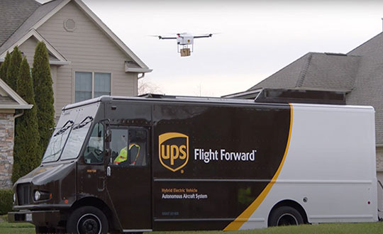
Skyward, a Verizon company, and UPS Flight Forward will collaborate to deliver retail products with drones connected to Verizon 4G LTE, as well as testing and integrating 5G for delivery.
“We will need the ability to manage and support multiple drones, flying simultaneously, dispatched from a centralized location, operating in a secure and safe environment,” said Carol B. Tomé, CEO of UPS. “To do this at scale, alongside Verizon and Skyward, we’ll need the power of 5G.”
“We’re just beginning to see how the power of 5G Ultra Wideband will transform the way businesses operate,” said Rima Qureshi, chief strategy officer at Verizon. “By partnering with UPS and other innovative companies, we can learn from each other’s expertise and collaborate to create solutions that help move the world forward.”
Photo: Verizon
In 2020, Verizon, UPS Flight Forward and Skyward started testing 4G LTE in delivery drones to demonstrate cellular reliability and performance at altitude.
“The low latency of 5G and edge compute is ideal for monitoring air traffic in and out of a busy logistics hub, especially those using mixed fleets of autonomous vehicles like drones, trucks and planes,” said Mariah Scott, Skyward President. “This year, we’ll be taking the collaboration with UPS further by testing 5G Ultra Wideband integrations to connect the sky.”
UPS has operated more than 3,800 successful drone delivery flights since the creation of UPS Flight Forward, its drone delivery company, certified by the Federal Aviation Administration in 2019. But in 2020, drone delivery emerged as much more than rapid delivery of essential healthcare items — during the global pandemic it provided high-risk seniors a rapid and contactless delivery option to remain healthy at home.
“Using Verizon’s 5G and Skyward, we’ll be able to transform the delivery experience — more personal, more on-demand and with the same safety, efficiency and reliability our customers trust today,” said Bala Ganesh, vice president, Advanced Technology Group at UPS.
Advanced AI, robotics and autonomous vehicle services on Sprint’s dedicated IoT network will adapt to the real world using highly accurate, detailed and constantly refreshed maps.
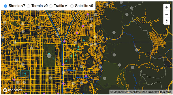
Sprint and Mapbox are launching precision mapping technology with Curiosity IoT, allowing automated services that run on Sprint’s dedicated internet of things (IoT) network to move around the ever-changing world with pinpoint accuracy.
Smart machines, from drones to autonomous delivery carts, will be able to make fast location and routing decisions using highly detailed, accurate maps that are updated as the environment changes.
Sprint made the announcement this week at the Consumer Electronics Show being held in Las Vegas.
High Accuracy and Precise Detail with Live Maps. Mapbox offers what it calls a “live map”, a map built not from traditional data surveys months or years before, but from data collected from hundreds of millions of location-enabled sensors that feed back information about the world in real time.
Mapbox uses artificial intelligence (AI) to turn those massive data flows into a picture of real time transit paths that can be used for precise, up-to-date routing.
Image: Mapbox
Through its relationship with Sprint, Mapbox will leverage the inherent advantages of Curiosity IoT with 5G to take mapping to the next level. The network’s extreme bandwidth and low latency will allow Mapbox to collect higher volumes of richer data from the sensors, including high resolution video.
That data can be processed to identify and detect changes in the physical environment. Those changes are then incorporated into updated maps which can be distributed at scale to a wide variety of smart machines. The result is more accurate, more up-to-date maps that reflect the world in real time.
“Smart machine-based services need to be able to make immediate mobility decisions similar to the way a driver might react to construction, traffic or other obstacles on a street,” said Ivo Rook, senior vice president, IoT and product development at Sprint. “The launch of Mapbox’s precision mapping technology allows all intelligent machines to move at a level of precision never seen before. Our fully dedicated Curiosity IoT network and operating system — soon to be powered by Sprint’s mobile 5G connectivity makes this possible. From autonomous vehicles to advanced AI-based machines, precision mapping is a big step forward in making smart service models a reality for the immediate economy.”
“As maps guide new smart machines on IoT networks, you remove the human in the middle that used to compensate for differences between the map and the real world. Precision mapping services need to reflect the world as it is, at that precise moment so that those smart machines can travel safely and efficiently,” said Eric Gundersen, CEO of Mapbox. “Sprint’s Curiosity IoT network with mobile 5G provides platform services that make that real with high bandwidth, edge computing for object detection and data processing and super low latency.”
Curiosity IoT with 5G. Sprint 5G and Curiosity will create the new standard in IoT which features device data intelligence, over-the-air device management and chip-to-cloud security, the companies said.
When coupled with Sprint mobile 5G technology, Curiosity IoT’s dedicated, distributed and virtualized IoT core network is capable of supporting artificial intelligence, robotics, edge computing, autonomous vehicles and other IoT systems requiring extreme low-latency and high-bandwidth.
Hagai Zyss, CEO of Autotalks. (Photo: Daniel Danilov)
Autotalks’ second-generation chipsets have been selected by Harman International to provide the vehicle-to-everything (V2X) chipset for the Harman telematics platform. The platform will be showcased at the Consumer Electronics Show, taking place Jan. 8-11 in Las Vegas.
With V2X, all vehicles share location, speed and trajectory, giving drivers warnings of on-road dangers. Autotalks’ second-generation chipsets are mass-market ready and support both DSRC and C-V2X direct communications (PC5 protocol).
Harman is a wholly-owned subsidiary of Samsung Electronics Co. Ltd., focused on connected technologies for automotive, consumer and enterprise markets.
Harman will showcase a connectivity display of its telematics platform with C-V2X capabilities. The live demonstration will show a vehicle communicating with a motorcycle using C-V2X direct communications (the Autotalks chipset is used in both).
Harman’s solution consists of a modular telematics control unit (TEC) accommodating a cellular network access device (NAD) beside Autotalks’ second-generation chipset providing C-V2X capabilities. Autotalks C-V2X capabilities consist of a 3GPP compliant PC5 modem, with dual antenna and diversity for both transmission and reception, as well as an optimized closed-loop remote antenna solution for the highest radio performance.
“Autotalks is proud to work with Harman on their TCU with our secure and deployment-ready C-V2X solution,” said Hagai Zyss, CEO of Autotalks. “We are excited to have our chipset inside Harman’s telematics platform and to demonstrate the flexibility and maturity of our global V2X solution which has been chosen for series production by leading automakers.”
“Together with Harman, we will achieve deployment readiness before the mass-commercialization of C-V2X in China and elsewhere,” Zyss said.
“We are pleased to showcase Autotalks’ C-V2X capabilities in our Telematics platform at CES 2019,” said Mike Peters, president, Connected Car Division at Harman. “The Autotalks chipset provides us with the flexibility, security and performance needed in today’s worldwide market for telematics and V2X.”
Autotalks’ V2X chipset is now available for customer and partner demonstrations.
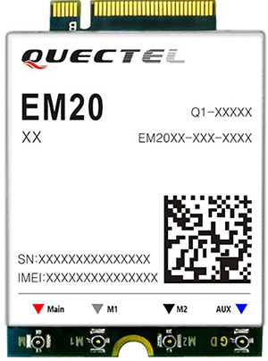
Quectel Wireless Solutions has launched the EM20, an LTE Advanced Category 20 module with location.
The EM20 will debut at Quectel Stand #2115 during the Consumer Electronic Show taking place Jan. 8-11 in Las Vegas.
EM20 offers the maximum LTE throughput of 2.0-Gbps downlink and is optimized specially for Laptop, PC and high-speed industrial internet of things (IoT) applications, the company said.
The EM20 features Qualcomm IZat location technology Gen8C Lite (GPS, GLONASS, BeiDou, Galileo and QZSS). The integrated GNSS greatly simplifies product design, and provides quicker, more accurate and more dependable positioning capability, Quectel added.
Based on Qualcomm’s SDX24 chipset and fully compliant with 3GPP R13 specification, EM20 supports LTE wireless technologies such as up to 7 Carrier Aggregation (CA), 4×4 MIMO technology, 256-QAM as well as LAA (LTE Assistant Access) and CBRS (Citizen Broadband Radio System).
The new module supports FDD LTE frequency bands of B1/B2/B3/B4/B5/B7/B8/ B12/B13/B14/B17/B18/B19/B20/B25/B26/B28/B29/B30/B66 and TDD LTE bands of B38/39/B40/B41/B42/B43/B46 (LAA)/B48 (CBRS). This ensures that IoT devices with EM20 inside can operate on networks of nearly all the mainstream carriers worldwide.
Designed in M.2 form factor and measuring 42.0×30.0×2.3mm, EM20 is compatible with Quectel’s broad portfolio of LTE Advanced products including Cat 16 module EM16 and future 5G modules, which allow for smooth migration between different categories and to next-generation connectivity.
The EM20 is designed for ultra-high-speed laptop, PC, router, industrial gateway, in-vehicle video surveillance system, cloud-based 4K IP-camera and similar applications that require high throughput and low latency.
Antenova Ltd. has developed a new positioning antenna that it says can pinpoint a location to within centimeters in the GNSS bands. Antenova is a manufacturer of antennas and RF antenna modules for machine-to-machine and the internet of things.
Antenova will be showing samples of the Raptor antenna at the Consumer Electronics Show, being held Jan. 8-11 in Las Vegas, in booth #2220 in the Westgate hall.
The Raptor antenna utilizes the L2 1200-MHz satellite band that recently became available for civilian use.
The addition of the L2 frequency band combines multi-band satellite signal reception and GNSS correction data. This helps to mitigate position errors, greatly improving accuracy, especially in urban areas, the company said.
As well as improving tracking, the L2 band is beneficial for UAVs, drones, autonomous vehicles, agriculture, grid mapping and other emerging applications, Antenova added.
The antenna is the latest addition to Antenova’s lamiiANT range of rigid FR4 antennas which are designed for easy insertion onto a printed circuit board (PCB).
The antenna itself is very small. It is a GPS single-feed antenna in surface mount (SMD) form, measuring 16.0 x 8.0 x 1.6 millimeters, suitable for small PCBs within all kinds of small electronic devices.
“This is an outstanding antenna, because it achieves the same precision as a much larger, heavier ceramic patch antenna, but in a very compact SMD part,” said Colin Newman, CEO of Antenova. “A ceramic antenna would need to be 35 x 35 millimeters to achieve a similar level of accuracy and performance.” Raptor is supplied in tape and reel for ease in high-volume manufacturing applications.
If a passenger-carrying drone could cost about the same as a regular passenger car, like those used by taxi and Uber drivers, then the economics might work. So it’s interesting that an outfit in the United Kingdom — Autonomous Flight — is talking about building passenger-carrying drones for around $25,000.
Autonomous Flight says has a prototype up and running, testing the concept in Southern England; testing with passengers is expected to get underway this year. The YS6 is battery-powered with multiple redundant systems for safety and is designed to fly at 70 mph, with a range of 80 miles at 1,500 ft.
This happens to meet a design goal of covering a distance from Heathrow Airport to Charing Cross train station in 12 minutes, a journey that would normally take around an hour by car in London traffic. There are similar “hops” that could save a massive amount of time in almost every city in the world.
But don’t hold your breath. It could take more than five years to get regulatory approval for the vehicle and for the initial routes over cities — never mind the time needed to get this particular concept into large-scale production to achieve the target price. But it’s nevertheless a good sign with good prospects for the future.
Drone Recovery System
While the U.S. Federal Aviation Administration (FAA) considers the regulations for drone flights over people, in the meantime several applications have been developed for people-overflight with drones equipped with parachutes.
Presumably, a drone would be safer if lowered by parachute in the event of equipment failure, but apparently such applications that rely on parachutes for risk mitigation have all been turned down by FAA. University of Alabama and Virginia Tech research has indicated a 70 percent chance of significant injury or death when a drone the size of an 8.85-pound DJI Inspire 2 fails and falls onto people.
Indemnis in Anchorage, Alaska, has been working with the FAA and other interested stakeholders to draft the regulatory standard for flight over people and has now gone on to develop its Nexus ballistic drone recovery system, which it plans to have on the market by next summer.
With a retail price of between $1,700 and $2,500, the system is expected to satisfy these coming FAA regulations for UAS flight over people and in urban areas for Part 107 commercial operations, but would seem to be quite expensive for smaller recreational drones.
The system is scalable for drones from eight pounds to “several thousand” pounds. The Nexus system is designed to automatically deploy within 30 milliseconds of detecting a failure on the drone or of entering unrecoverable flight, and the system is capable of determining normal flight or a failure to within six feet of vertical movement.
According to Indemnis, more than 10,000 requests for flight over people have been received by the FAA in the last 14 months, but all those that rely on parachutes for risk mitigation have been refused. This is apparently because conventional parachute systems have a tendency to become tangled with the aircraft or manual deployment is required. It is also said that current quadcopter drone safety systems — which cut power to an engine to prevent tumbling and which slow descent by adding power to the remaining engines — are inadequate for flying over people.
The Nexus system automatically detects failure, cuts engine power, and deploys an aircraft parachute within 30 milliseconds, slowing vertical speed to around 7 mph. This should be slow enough to allow the operator to catch up with the vehicle before it hits the ground. However, reducing vertical speed is only half the solution, as a vehicle under parachute will still travel horizontally due to wind velocity. So Indemnis is testing their parachute system with an airbag on a 33.29-pound DJI M600 drone. The airbag turns the drone “into a giant pillow” once the chute deploys.
The expected FAA standard is anticipated to require 45 tests in two failure modes — critical motor failure and full motor failure — at full flight speed, hover, and in automatic and manual deployment scenarios. Tests with a DJI Inspire 2 cutting one motor, two motors or four motors have pitched the drone violently just before it enters a slow roll — at 60 mph, it will roll quickly and violently.
This drone safety and recovery system is expected to be on the market within the next few years, following release of the projected FAA standards.
GoPro Karma hits the dust
In what would seem to be an unusual turn of events in a rapidly expanding market, GoPro has decided to exit the UAS vehicle business. GoPro cameras are still a favorite on a wide range of UAVs, but the company has chosen to get out of the business of making end-item unmanned vehicles, despite reaching second place in market share in 2017 for its price range.
At the Consumer Electronics Show (CES) Jan. 9-12 in Las Vegas, GoPro explained that its decision was based on inadequate returns versus the investment required to support their single-product UAS business.
However, Karma’s demise was apparently brought on not only by an expensive initial product recall, but also by the apparent additional financial pressure of poor Hero5 camera sales.
Nevertheless, GoPro still feels that the “action-camera” market has the legs to sustain growth, so it’s likely UAV manufacturers will not have to go looking for another reliable video camera source any time soon.
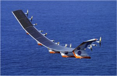
Joint venture for solar HALE UAS
The solar-powered Helios in flight.
In late 1990s/early 2000s, NASA contracted with AeroVironment to develop a high-altitude solar-powered UAS for NASA’s Environmental Research Aircraft and Sensor Technology, or ERAST, program.
In August 2001, the Helios prototype reached a world-record altitude of 96,863 ft., and in 2002 the Pathfinder Plus prototype provided from 65,000 feet high-definition television (HDTV) signals; third-generation (3G) mobile voice, video and data; and high-speed internet.
AeroVironment has now formed a joint venture with Japanese SoftBank Corporation to develop a solar-powered high-altitude long-endurance (HALE) UAS for commercial operations that may include applications such as high-altitude pseudo-satellites.
The joint venture — known as HAPSMobile — is a Japanese corporation in which AeroVironment holds minority ownership but is still able to directly exploit commercial and military opportunities outside Japan.
Summary
It’s encouraging to see another airborne taxi initiative joining the folks who were demonstrating prototypes in Dubai back last September. If the market is there, more entrants should help make this option a reality.
It’s also good news that a company already has a drone recovery system in the works that could reduce the potential for injury in the event one falls out of the sky. This might start to reverse adverse public opinion about drones and help the FAA move forward with regulations allowing wider usage.
Meanwhile, it’s sad but true that new industries inevitably see some entrants pull back and even leave in the early stages. It’s fortunate that popular drone camera supplier GoPro still has the ability to retrench and fall back on its existing business.
Finally, the promise of high-altitude solar-powered drones would seem to be still alive. If it could be possible to hang TV and other comms systems on these high-altitude loitering vehicles, there might be a much less expensive way of getting transmitters into very high altitude orbits without the cost of a space launch. Then many areas around the world could benefit from low-cost signal distribution that might not otherwise work commercially.
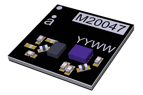
Antenova Ltd., manufacturer of antennas and RF antenna modules, has launched a new compact, all-in-one active GNSS antenna, part number M20047-1, at the Consumer Electronics Show (CES) show, Jan. 9-12, in Las Vegas.
The M20047-1 antenna adds another option to the company’s existing range of positioning antennas and modules.
It operates in the 1559–1609 MHz bands, and offers designers a useful, space-saving option for small tracking devices.
It’s key features are the active components, the built-in LNA and filter, which act to boost the signal to the GNSS processor in environments where there is a restricted view of the sky and line-of-sight to the horizon is difficult. With the LNA and filtering already built into the antenna, designers will not need to add them, and can save space on their PCB.
The M20047-1 is a very low profile rigid FR4 antenna measuring 7.0 x 7.0 x 1.1 millimeters, making it suitable for use in small tracking devices. It is suitable for tracking all kinds of moving objects, telematics and wearable sports devices.
The M20047-1 antenna is named Active Sinica and is an alternative to Antenova’s existing Sinica antenna, part no SR4G008, which is marketed for accurate positioning.
Antenova’s antennas are specifically designed for easy integration; however, the company provides full engineering support to help customers with all aspects of antenna testing, tuning and integration.
With the successful launch of newest BeiDou-3 navigation satellites, Beidou’s pace of globalization is quickening. As a provider of China’s domestic GNSS core products, Unicore Communications brought its full range of products to the Consumer Electronics Show (CES), which took place Jan. 9-12 in Las Vegas.
Unicore’s exhibits are targeting intelligent drive and the internet of things (IoT).
For intelligent drive, Unicore is showcasing its UM482 high-precision GNSS module, which is designed for high-end L3 self-driving and robots.
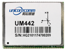
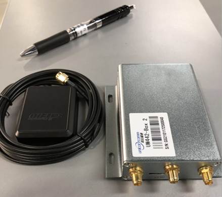
Unicore also is introducing a cost-effective low-power GNSS module — UM442 — which is suitable for L2 ADAS applications and community-based GNSS navigation and maps.
UM442 is a cost-efficient high-precision real-time kinematic (RTK) and heading module that can simultaneously track GPS, BDS, GLONASS and Galileo. It also supports SBAS and QZSS.
Based on high-performance data-sharing technology and the simplified operation system of the Nebulas II chip, the UGypsophila RTK algorithm dramatically optimizes matrix processing. Therefore, the UM442 can track many more satellites and shorten the initialization time to 5 seconds.
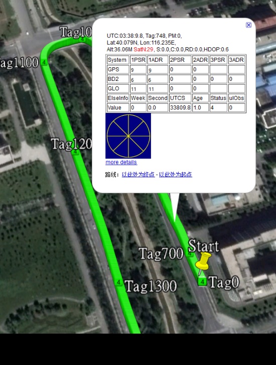
Satellite view during a UM442 road test using the UGypsophila RTK algorithm. UM442 achieves centimeter-level RTK positioning using a low-cost ceramic antenna.
With on-board MEMS and the U-Fusion integrated navigation algorithm, UM442 can achieve accurate and reliable positioning even in the most challenging environments such as urban canyons and tunnels.
UM442 also provides attitude information such as rolling angle and pitching angle, which is suitable for many new applications such as community-based navigation maps and ADAS. Even with a low-cost ceramic antenna, the UM442 can achieve centimeter-level RTK positioning, as well as a 0.2-degree/1-meter baseline heading accuracy.
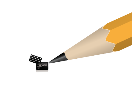
At CES, Unicore plans to introduce BeiDou products into the large volume market of consumer electronics. Ufirebird is an ultra-small, ultra-low-power multi-GNSS positioning system-on-chip (SoC), using 28-nm technology. The chip supports BDS, GPS, GLONASS and Galileo signals, and the software can be extended to support WAAS/QZSS/EGNOS/MSAS/GANGAN enhanced signals.
Unicore’s UFirebird-UC6226 low-power GNSS SoC is designed for mobile devices.
Two packaging methods are available: WLCSP and QFN40. For WLCSP packaging, the chip size is only 1.73 x 2.87 mm, and for QFN40 packaging, the chip is AEC-Q100 compliant, aimed for highly reliable automotive-grade applications.
UC6226 is equipped with a built-in sensor hub capable of providing access for multiple sensors for fusion positioning. It supports Wi-Fi, Bluetooth, GNSS hybrid positioning, and better than 1-m differential positioning accuracy.
Compared with Unicore’s previous generation GNSS SoC, UC6226 has reduced power consumption by 60%. The minimum tracking power consumption is lowered to 18 mW, significantly improving battery endurance.
With a built-in anti-jamming module, LNA and -162dB sensitivity, UC6226 can maintain accurate and precise positioning under complex environments.
UC6226 has been successfully applied by China’s bicycle sharing companies. In addition, the chip will be used in intelligent watches, smartphones, smart cameras and many other IoT devices requiring smaller size, lower power consumption.
Renesas will use NovAtel’s high-performance SPAN tightly coupled GNSS and inertial navigation system (INS) technologies with GNSS correction services for live autonomous vehicles and advanced driver assistance systems (ADAS) demonstrations throughout CES.
SPAN GNSS+INS products provide position, orientation and time solutions that are critical for autonomous applications.
NovAtel’s assured positioning technology not only delivers solutions based on signals from satellite constellations but also uses vehicle behavior modelling, inertial sensor integration and GNSS correction signals to improve accuracy and significantly reduce interruptions in availability.
Image: NovAtel
Renesas relies on NovAtel products to provide high integrity and accurate positioning for autonomous driving, ADAS, connected car feature demonstrations and automotive solutions that will be showcased at CES 2018.
With the commitment to ensure autonomous vehicles have assured positioning solution, a team of engineers formed the Safety Critical Systems Group at NovAtel to meet the exceptional performance and safety requirements of autonomous vehicles at the necessary production volumes and price point required.
Since its formation, the group has made many positive partnerships in the automotive industry.
NovAtel and Renesas are currently collaborating on implementing NovAtel’s high-performance GNSS+INS positioning solution with the Renesas R-Car H3 system-on-chip (SoC). The R-Car H3 is compliant with the ISO 26262 functional safety standard for automotive applications, which aligns with NovAtel’s automotive strategy.
NovAtel has a long history providing industry leading high-precision GNSS solutions that are high quality and reliable. As an ISO 9001 certified company, NovAtel is also developing an extensive product line of receivers, antennas, correction signals, positioning algorithms, sensor fusion solutions and systems that fulfill specific safety requirements of the automotive industry such as ISO 26262.
A V2X test system developed by Spirent and Tata Elxsi has been adopted by CAICT, a scientific research institute directly under the Ministry of Industry and Information Technology of China.
V2X, or “vehicle to everything,” includes vehicle to vehicle (V2V) and vehicle to infrastructure (V2I) connected technology as well as vehicles to pedestrians, devices or transportation grids.
Tata Elxsi, based in Bangalore, India, is a design and technology services provider for product engineering in industries including broadcast, communications and automotive.
The next-generation test system provides a flexible, scalable and comprehensive test environment for testing and performance benchmarking of V2X applications, in various stages of the development cycle, from early research up to pre-production.
The China Academy of Information and Communications Technology (CAICT) in Beijing.
Using a combination of Tata Elxsi’s patent-pending V2X Emulator software and Spirent’s advanced solutions for GNSS and radio channel simulation, the integrated V2X test bed offers the ability to bring real-world traffic scenarios into the lab, significantly reducing costs and time associated with extensive field testing.
Various driving scenarios can be emulated under a variety of terrain, wireless channel and atmospheric conditions. The V2X test bed, which supports both WAVE-DSRC (U.S., Asia) and ITS-G5 (Europe) standards, offers a comprehensive platform for both functional and performance assessment of V2V and V2I/I2V safety applications, V2X security testing and test report generation.
“V2X technology is gaining tremendous interest among global OEMs and tier-1 companies for delivering safer driving experience,” said Nitin Pai, senior vice president of marketing, Tata Elxsi. “With China being the largest automotive market in the world, this latest win with CAICT in China is significant for us and automotive companies targeting this market.”
The V2X Test System enables multi-standards compliance testing using a single solution. The system has the capability to emulate more than 100 onboard units (OBU) and roadside units (RSUs) on a single hardware, enabling repeatable testing of complex scenarios from early development stages without the high risks and costs associated with live vehicle testing.
“V2X communication will contribute significantly to making the autonomous car a safe and secure reality,” said Peter Tan, Greater China and East Asia, Spirent. “The U.S. DOT’s [Department of Transportation] newly issued regulation proposal mandating V2V communication for light vehicles is another confirmation of this widely accepted fact. With test solutions for conformance, functionality and performance developed in partnership with Tata Elxsi, Spirent is proud to help our customers ensure that their devices meet all conformance functionality and performance requirements to master these major changes ahead.”
Tata Elxsi is showcasing the V2X Test System along with an array of other automotive solutions covering integrated e-cockpit, infotainment, ADAS, autonomous vehicle technology and telematics at its booth 6223 at CES 2017, Las Vegas.
NovAtel Inc. is showcasing its high precision positioning technology as part of AutonomouStuff’s “Roadmap to Autonomy” exhibit at the 2017 Consumer Electronics Show (CES), Jan. 3-8 in Las Vegas. The exhibit is located at the MGM Grand in the Skyline Terrace Suite.
AutonomouStuff provides research and development platforms for the safe and reliable testing of automation technologies.
It uses NovAtel’s exceptionally robust SPAN GNSS + Inertial (INS) technology to provide the highly precise, continuous 3D positioning necessary to evaluate robotic and autonomous solutions for autonomous applications.
NovAtel’s SPAN technology combines a high-performance Global Navigation Satellite System (GNSS) receiver with an Inertial Measurement Unit (IMU) to deliver deeply-coupled centimeter-level positioning. SPAN provides robustness against short GNSS outages, using IMU updates to bridge the positioning solution. SPAN also provides high data rate position, velocity and attitude (pitch, roll, heading) updates to capture the full real-time motion profile of a vehicle. Widely deployed in the automotive R&D space, SPAN supports applications ranging from autonomous navigation to V2X systems, where it is utilized to provide a source of vehicle ground truth.
As a committed technology partner, NovAtel has worked closely with AutonomouStuff to optimize SPAN for AutonomouStuff’s vehicle perception kits. As a result of these efforts, AutonomouStuff is able to offer three different levels of positioning performance — “good, better, best” — based on the grade of IMU selected.
“We are always excited to work with the team at NovAtel and cannot wait to show off their ‘good, better, best’ SPAN GNSS options for autonomy in our suite at CES,” said AutonomouStuff CEO Bobby Hambrick. “Their solutions are a significant piece of autonomous research and development. With three kit options, there is something for everybody. We’ve done the work for you, allowing you to choose which kit is best for you based on your accuracy needs and price range.”
The collaboration with AutonomouStuff is reflective of NovAtel’s commitment to the development of fully autonomous vehicles for a wide range of industries. In May 2016, NovAtel announced the formation of a new Safety Critical Systems (SCS) Group, tasked with developing functionally safe GNSS positioning products that will meet the exceptional performance and safety requirements of autonomous vehicles.
“Our team made significant progress in 2016 towards product definition, GNSS integrity for automotive applications, and corporate TS 16949 compliance,” said Jonathan Auld, Director of the SCS Group at NovAtel. “As the world leader in high precision GNSS technology for more than 20 years, NovAtel is leveraging its extensive experience developing safety critical systems for the aviation industry to meet the future safety thresholds required for driverless cars.”
AutonomouStuff and NovAtel representatives will be available in the MGM Grand Skyline Suite during the CES to answer customer questions. To set up a meeting with the NovAtel SCS team at CES 2017, attendees can contact Allan MacAulay, Business Development Manager, SCS ([email protected]).
Excelfore, a provider of cloud solutions for intelligent transportation, will launch its comprehensive suite of secure cloud and connectivity solutions at CES 2016, the Consumer Electronics Show that will be held in Las Vegas this week.
Excelfore provides an end-to-end intelligent transportation framework to the automotive industry using a cloud solutions platform along with in-vehicle connectivity technologies.
Excelfore will demonstrate solutions during CES 2016 in two locations: at the Excelfore Suite (MGM Grand, Las Vegas, Nevada (Jan. 6-8), and at GenIVI Showcase at Trump International (Jan. 6-7).
ESync enables full vehicle over-the-air update of all vehicle components for the Headunit, multiple Electronic Control Units (ECU) and Telematics units. ESync updates the firmware components (FOTA), and software components (SOTA), including OS, kernel, kernel, drivers and applications.
Excelfore provides a cloud-based solution for connected car services. (Image: Excelfore)
Excelfore leverages its patented machine-to-machine (M2M) distributed architecture to support cloud-to-vehicle connectivity and multiple in-vehicle networks including LIN, CAN, FlexRay and Ethernet. New advanced security features include enhanced Hash functions, multiple-levels of encryptions, content-delivery network (CDN) integration and end-to-end security from the cloud to the vehicle-components.
“Connected cars are revolutionizing the automotive industry,” said Erich Geiger, former CEO of Harman/Becker Automotive Systems. “Excelfore’s EMatics and ESync platform with their advanced security and scalability will help accelerate adoption of innovative solutions for the automotive industry.”
“By continuing to deliver to the automotive industry over the last several years, our cloud platform has architecture has evolved into a sophisticated offering with advanced security and scalability,” said Shrinath Acharya, CEO of Excelfore. “Within our product framework, we also offer data analytics and monetization by integrating with third-party services. Our platform enables fast and cost-effective deployment solutions for OEMs and Tier-1s.”
The Excelfore team has delivered OEM programs (US, European, and Japanese Tier-1s and OEMs) and aftermarket automotive solutions to millions of vehicles.
Highlights of ESync
Tailored for automotive headunit and electronic control units (ECUs)
Updates headunits, ECUs, telematics units (TU), and IoT edge devices, including cameras
Updates using any communication link (over the air, other networks)
Ease of implementation of the cloud platform for SOTA/FOTA deployment
Key features of the OTA updater
Full campaign management capability
Secure administration
Creation and delivery of packages for faster transmission and updates
Complete, differential and incremental software updates
Patented adaptive compression and M2M technology
Highlights of EMatics
Fleet Monitoring: Access a fleet from anywhere in the world at anytime. Quickly access vehicle information including location, driver, fuel and battery voltage. Monitor vehicles closely when needed using high frequency tracking.
Automated Service Scheduling: Automatically get timely reminders on upcoming services, and schedule vehicle servicing by notifying preferred vendors.
Fuel Management: Get detailed fuel data for an entire fleet including usage, consumption and mileage trends.
Driver Rating: See who the most fuel-efficient drivers are. Get insights on how to improve driving behavior to reduce fuel usage and costs.
Vehicle Travel History: Get detailed trip information including distance, duration, idling time along with date and time of trips. Easily differentiate personal versus business trips and automate reporting.
Vehicle Safety: Set geo-boundaries and curfew periods. Get notified instantly when any vehicle violates curfews.