The C-130 Hercules aircraft is used to rapidly drop cargo to provide relief after disasters or troops into battle zones. (Image: USAF Devin Doskey- 341st Missile Wing Public Affairs)
GPS Innovation Alliance (GPSIA) member companies are leaders in technology, transforming the digital and physical world around us. With countless essential applications, GPSIA members improve the industries that feed, build, move and connect communities across the globe. In times of need, the GPS industry is proud to rise to the occasion, whether through agriculture technologies, surveying equipment, navigation systems, essential communications tools, or humanitarian relief efforts. Simply put, GPSIA members are continually investing in lifesaving services at home and abroad.
Take, for example, the urgent need for humanitarian relief created by the ongoing war in Ukraine. Trimble has stood united to support the many affected and displaced Ukrainians; in addition to contributing through the Trimble Foundation to relief efforts in Ukraine and neighboring countries, Trimble also has provided GPS signal corrections to Ukrainian farmers at no cost, supplied 3D scanners for surveying damaged buildings, and worked closely with The HALO Trust to support demining activities in Ukraine by providing funding and commercial surveying systems to assist in precision mapping of landmines and unexploded ordnances.
Lockheed Martin’s C-130 Hercules aircraft has assisted essential humanitarian relief across the globe. Since its inaugural flight in 1954, this aircraft has enabled aid delivery, natural disaster relief, medevac services, search and rescue and more. Now equipped with GPS technology, the C-130 fleet has provided aid across the globe for decades — with L3Harris’ missionization solutions often at work to maximize the C-130’s utility. Similarly, Collins Aerospace’s state-of-the-art navigational technology has provided essential support to U.S. Coast Guard helicopters, with avionics upgrades that help pilots save time in emergencies and enhance situational awareness.
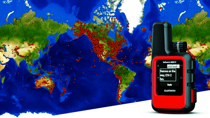
Garmin inReach devices can send and receive messages, navigate routes, track and share journeys and can trigger an SOS if needed. (Image: Garmin)
More broadly, Garmin inReach satellite communication devices have helped more than 10,000 individuals access emergency services, providing critical communications in natural disasters and humanitarian emergencies. In 2022, a powerful underwater volcanic eruption and tsunami devastated the island nation of Tonga, severing traditional communications channels for several weeks. Roy Neyman, a sailor equipped with this Garmin device, set up a communication center at a local restaurant to allow other residents to reach family and friends. Over two weeks, Tonga residents sent about 1,600 messages to loved ones around the world, offering peace of mind in the face of unthinkable destruction. Similarly, Apple recently launched an “Emergency SOS” service, which led to one of the first successful rescue efforts of two people who had driven off a highway in the Angeles National Forest.
CalAmp’s Fusion routers enable lifesaving emergency services to more than 400,000 residents in Oakland, California. Equipped with GPS, LTE and WiFi technology, these routers help Oakland Fire first responders quickly locate emergencies and access additional resources, such as building layouts or fire records, to provide the best possible emergency response. CalAmp’s technology provides an essential service to residents of Oakland and can be adapted to meet the changing needs of the community.
As the world of agriculture has come to depend on GPS technology, John Deere’s GPS-based agricultural services have helped farmers become more efficient. In turn, this has allowed farmers to harvest more crops for the masses and meet the ever-growing demand for food. With the annual growth in food demand estimated to be 1.4% over the next decade, John Deere’s critical investment in food banks in Mexico and training for farmers in Africa will help to ensure that all communities are able to access the food they need.
Across industries and government, GPS technology makes for a safer, more connected world. GPSIA is proud of its members’ dedication to global humanitarian efforts as well as critical services close to home. By constantly innovating, GPSIA member companies are creating technologies that provide critical services for everyday emergencies, natural disasters, and humanitarian crises across the globe.
Collins Aerospace has introduced NavHub-200M, a vehicle navigation system for the international market compatible with military code (M-code) receiver technology. The NavHub-200M is not controlled by the International Traffic in Arms Regulations (ITAR).
Collins Aerospace made the announcement at Eursatory 2022, taking place June 13-17 in Parsis.
NavHub-200M’s message formats and signal modulation techniques ensure faster and more accurate performance for ground vehicles on the connected battlespace, the company said.
NavHub-200M provides assured positioning, navigation and timing (APNT) capabilities while improving overall resistance to existing and emerging threats to GPS, such as jamming and spoofing.
“With GPS-based Selective Availability Anti-Spoofing Module (SAASM) receivers set to become obsolete, it is critical that M-Code receiver technology is made available to ground forces around the world as quickly as possible so they can trust that the signals they receive in a fast-moving, hostile environment are accurate and actionable,” said Ryan Bunge, vice president and general manager, Communication, Navigation and Guidance Solutions for Collins Aerospace. “Our NavHub-200M provides an improved resistance to jamming and interference, as well as advanced security features to prevent unauthorized access or exploitation.”
NavHub-200M also includes the open interface standards and sensor-fusion capabilities required for a GNSS upgrade path, such as that for Europe’s Galileo constellation, as well as the ability to interface with key vehicle sensors such as the inertial measurement unit (IMU) and odometer, among others.
Collins, a leader in APNT solutions for ground platforms, has delivered more than 10,000 navigation systems to military armed forced around the world.
Attendees at Eurosatory can learn more by visiting Collins Aerospace at booth number C523.
In the decades since the U.S. GPS became fully operational, GPS has become a highly innovative, successful and increasingly ubiquitous technology critical to applications and services touching the lives of almost every American today and for decades to come. As GPS-enabled technologies have become an irreplaceable part of our national infrastructure, growing more deeply ingrained each year, GPS is a success story of what can happen when government-backed R&D, paired with a light-touch regulatory approach, is turned loose in the private sector.
At the GPS Innovation Alliance (GPSIA), our member companies and affiliates are driving this innovation forward. While we use their products every day now, they’re also focused on inventing the future. Several key features are necessary to this continued success: a stable and predictable spectrum environment; a regulatory framework that fosters innovation and balances the fundamental technical needs of navigation systems; and appropriate, established interference protections where necessary.
Regulators must take care not to fundamentally depart from the longstanding approach to spectrum policy that has enabled the GPS technologies and services that underpin our economy. The prize on the other side of a well-calibrated policy is the next generation of GPS-enabled applications and products, which, as a GPS enthusiast first and foremost, I get a front row seat to our members building every day. These innovations span land, sea and space, unlocking opportunity for their U.S. government partners and consumers alike.
Innovations on Land, at Sea and in Space
On Earth, GPS-based products and services are getting even better at improving our everyday lives, helping farmers, builders, drivers and hobbyists work more efficiently and providing the critical inputs for everything from trucks to cell phones.
Take GPSIA member Trimble’s recently introduced R750 modular GNSS receiver, a connected base station used in both civil construction and agriculture that provides improved base-station performance and gives contractors, surveyors and farmers more reliable and precise positioning in the field. John Deere is likewise helping build next-generation precision agriculture technology with its new autonomous tractors, which will use GPS signals to ensure optimal plowing, planting and harvesting by adapting to real-time data analytics on soil conditions and other factors.
Garmin, a household name in GPS consumer products,continues to enhance satellite location and communication technologies for increased safety and user awareness, recently launching its inReach Mini 2 compact device that offers up to 30 days of battery life, integrated location and situational awareness technologies, and two-way texting and SOS capabilities.
Elsewhere, CalAmp recently celebrated two years of partnership between their LoJack Stolen Vehicle Recovery System and BMW Group Italy, the first step in a larger plan toward a GPS-based security solution for BMW’s full product range, while Apple continues to build revolutionary consumer tech, such as their GPS-enabled Apple Watch that can track workouts, activity, elevation and time, all without connection to an actual iPhone.
The ubiquity of GPS is particularly critical at sea. Collins Aerospace, for example, just launched Artemis Elite, the first–ever military underwater navigation system (MUNS) with M-code technology, that improves GPS signals’ precise positioning, navigation and timing (PNT) capabilities, making them more resistant to threats of jamming and spoofing. Garmin is also improving the consumer boating experience with its suite of OnDeck products, which pair onboard sensors and GPS to create a remote monitoring and management solution giving boaters 24/7 access to critical and timely information about their vessels.
Of course, GPSIA members are driving the effort to modernize the GPS satellite constellation itself. Lockheed Martin is building the next generation GPS III satellites and follow-on GPS IIIF satellites that will improve antijamming capabilities and geolocation accuracy for GPS-enabled devices, while L3Harris is building critical inputs on these satellites, such as their advanced navigation and timing payloads.
Our companies are also leading the way to help nations operate in space, providing critical GPS applications including guidance systems for crewed vehicles; the management, tracking, and control of communication satellite constellations; and monitoring the Earth from space.
Raytheon, for example, announced this month that it installed the first global aircrew strategic network terminal (ASNT) for the U.S. Air Force to enable protected communication capabilities for aircrews, while Lockheed Martinis the primary contractor in a cutting-edge project from the Space Development Agency to improve U.S. missile tracking and defense through a layer of multi-orbit satellites speaking to one another and sharing location data in real time.
Looking across GPSIA’s member companies, it’s clear that we live on a globe propelled by GPS. We should continue to give them the tools — and protect the regulatory framework — that has allowed them to do what they do best, which is bring us products that transform our daily lives for the better and innovate new technologies and services.
The Airbus A350 can now be equipped with the Collins Aerospace GLU-2100 multi-mode receiver. (Photo: pablorebo1984/iStock/Getty Images Plus/Getty Images)
The Collins Aerospace GLU-2100 multi-mode receiver (MMR) has received approval by Airbus, making it available as line-fit and retrofit on Airbus A320, A330 and A350 aircraft. This a major step toward Collins offering next-generation GNSS to the commercial aviation marketplace.
An MMR assists pilots in positioning, navigating and landing an aircraft. Building on the GNSS capabilities of previous MMRs, the GLU-2100 provides a satellite-based augmentation system (SBAS) and ground-based augmentation system (GBAS). This supports the integrity of the aircraft position, as well as the accuracy and availability of demanding aircraft operations such as landing in low visibility conditions.
The GLU-2100 MMR ensures that commercial aircraft can meet flight zone global mandates, while also proofing the technology by providing a solid foundation for future growth. It includes the flexible hardware baseline necessary to implement future GNSS capabilities, such as multi-frequency and multi-constellation (MFMC), and GBAS Category II/III via software-only update.
Acquisition of FlightAware tracking platform
In August, Collins Aerospace signed a definitive agreement to acquire privately held FlightAware, a digital aviation company providing global flight-tracking solutions, predictive technology, analytics and decision-making tools.
Closure of the acquisition is subject to the completion of customary conditions and regulatory approvals. Following closing, FlightAware will join Collins’ Information Management Services portfolio within the company’s Avionics strategic business unit. Financial terms of the agreement were not disclosed.
Based in Houston, Texas, with approximately 130 employees, FlightAware was founded in 2005 and is a provider of real-time and historical flight information and insights to the global aviation community. FlightAware serves all segments of the aviation marketplace through applications and data services that provide comprehensive information about the current and predicted movement of aircraft.
Through the collection, interpretation and enrichment of hundreds of sources of data, FlightAware transforms millions of raw flight data elements and delivers them as coherent, easy-to-consume flight stories. The company has a proprietary terrestrial ADS-B network with tens of thousands of receivers spanning seven continents in 200 countries and territories.
The United States Army has awarded Collins Aerospace a Phase III contract to build the second generation of its Mounted Assured Position Navigation and Timing System (MAPS).
The MAPS program adds anti-jamming capability for soldiers in GPS-contested environments. In 2019, MAPS Gen I units were installed on Stryker vehicles of the 2nd Cavalry Regiment in Germany.
Phase 3 of the MAPS Gen II program “begins combat platform integration in preparation for low-rate initial production,” according to an Oct. 7 Army press release.
MAPS Gen II includes M-code GPS receivers, provided by BAE Systems, along with anti-jamming antennas, sensor fusion and inertial measurement units to deliver assured PNT to soldiers.
MAPS Gen II is part of the Army’s goal to accelerate the development and fielding of modernized soldier capabilities.
“Less than a year after we equipped the first generation of MAPS in Europe we’re already pushing forward with the development of Gen II,” said Willie Nelson, director of the the Assured Positioning, Navigation and Timing (APNT) Cross-Functional Team (CFT). “This award comes less than a month after our Mounted APNT requirement was approved. The timing could not be better.”
MAPS Gen I includes A and B kits, consisting of cable and mounts to use on a vehicle and a military GPS paired with non-radio frequency technologies.
The Phase III Other Transaction Authority contract covers product maturation and begins combat platform integration, clearing the path to low rate initial production.
Army Stryker ground combat vehicle. (Photo: Karolis Kavolelis / Shutterstock.com)
The MAPS GEN II is comprised of the NavHub-100 PNT Distribution Device, the Multi-Sensor Antenna System (MSAS-100) and an optional speed sensor. The NavHub-100 works in concert with the MSAS-100 to produce a trusted A-PNT solution that can be distributed through serial interface, Victory Ethernet and RF distribution to multiple client systems.
MAPS GEN II supports the U.S. Army PNT Reference Architecture by leveraging modular technologies from across Collins’ A-PNT portfolio and industry. This scalable architecture builds upon the modular open system architecture (MOSA) standards and includes the All Source Positioning and Navigation (ASPN) generic message definition to support plug-and-play sensor integration and the Future Airborne Capability Environment (FACE) to host portable software capabilities.
The MAPS GEN II system not only supports direct replacement of the Defense Advanced GPS Receiver (DAGR) on military platforms, it also provides exceptional A-PNT performance in GPS-contested and GPS-denied environments.
In January, BAE Systems announced its intent to buy the Collins Aerospace Military GPS division. In April, Raytheon finalized its merger with United Technologies Corp. (UTC) to officially form Raytheon Technologies Corp. The U.S. Department of Justice approved the Raytheon/UTC merger in March, but only on the condition the companies divest UTC’s military GPS and large space-based optical systems businesses, as well as Raytheon’s military airborne radios business.
Collins Aerospace’s military GPS business will be integrated into BAE Systems’ Electronic Systems sector.
“This partnership will enable us to build on our market leadership and bring new discriminating capabilities to our customers, including the U.S. Department of Defense and its allies,” said Greg Wild, director of Military GPS. “We’re excited to be joining the BAE Systems family. They appreciate our legacy of innovation and will provide opportunities for continued business growth and success.”
Based in Cedar Rapids and Coralville, Iowa, the military GPS business has a workforce of approximately 700 employees. The business designs and produces advanced, hardened and secure GPS products with a range of form factors, including products designed for space-constrained and harsh environments.
Collins Aerospace’s Mike Shepherd discusses the company’s MPE-M Type II GPS receiver at ION GNSS+ 2019. According to the company, it is now accepting orders for the receiver, which received security certification in the spring.
SMC awards multiple rapid prototyping agreements for joint modernized GPS handheld device; four demonstrations to be held
The Defense Advanced GPS Receiver (DAGR) in use in 2011. (Photo: U.S. Army)
On June 26, the United States Space Force’s Space and Missile Systems Center awarded three separate rapid prototyping agreements to Collins Aerospace, Raytheon Intelligence & Space and the Technology Advancement Group for a total of $41.1 million.
The firm-fixed price agreements are for the development of a basic working prototype of the joint modernized GPS handheld device. The contract provides the government with innovative solutions demonstrated via hardware and software prototype development.
The purpose of this rapid prototyping effort is to produce a joint modernized handheld smaller in size with low power consumption, increased military-code capability, and improved anti-jamming and anti-spoofing capabilities compared to the equipment now used by the military.
4 demonstrations coming
This is the second competitive objective under the current Phase I strategy and is the result of a down-select from five to three vendors. It builds off the first objective of Phase I, which focused on mock-ups and drawings.
These agreements provide for four demonstrations to be held with Army and Marine Corps representatives. The demonstrations give the end users an early opportunity to provide feedback and the ability to influence the final design — ultimately making for a more seamless transition to operations.
“This is the first major update to the military’s GPS handheld device in more than 15 years,” said Col. Clifford Sulham, User Products Division chief. “The advanced capabilities of this device will allow our airmen, soldiers, sailors and Marines to conduct operations in GPS-challenged environments.”
BAE Systems Inc. has reached definitive agreements for the proposed acquisitions of Collins Aerospace’s military GPS business and Raytheon’s Airborne Tactical Radios (ATR) business.
The proposed acquisitions are structured as asset transactions with associated tax benefits, and they remain subject to customary closing adjustments. The asset purchase agreement for the Collins military GPS business calls for cash of $1.925 billion, with an expected tax benefit of approximately $365 million. For Raytheon’s ATR business, the purchase agreement calls for cash of $275 million, with an expected tax benefit of approximately $50 million.
“As militaries around the world increasingly operate in contested environments, the industry-leading, battle-tested products of these two businesses will complement and extend our existing portfolio of solutions we offer our customers,” said Jerry DeMuro, CEO of BAE Systems, Inc. “This unique opportunity to acquire critical radio and GPS capabilities strengthens our position as a leading provider of defense electronics and communications systems, and further supports our alignment with the modernization priorities of the U.S. military and its partners.”
These proposed acquisitions are subject to the successful closure of the Raytheon-UTC transaction, as well as the satisfaction of other customary closing conditions, including receipt of the required U.S. regulatory approvals. Upon closure, both business lines would be integrated into the company’s Electronic Systems sector.
“These are strong businesses with talented employees who share our focus on quality and technology innovation,” said Tom Arseneault, president and COO of BAE Systems Inc. “We are confident of a smooth transition that will accelerate our future together and look forward to welcoming these new employees to the BAE Systems team once the transactions are approved.”
Collins’ Military GPS Business
Based in Cedar Rapids, Iowa, Collins’ military GPS business is a longstanding provider of mission critical military GPS receiver solutions and has been a pioneer in military GPS receiver markets for over 40 years. Today, it designs and produces advanced, hardened and secure GPS products to include M-Code, anti-jamming, and anti-spoofing technologies. The business has an installed base of over 1.5 million devices on approximately 280 platform types around the world, including ground, airborne, and weapon systems.
Given the requirement for ubiquitous, secure geo-positioning in contested battlefields, this technology offering will continue to be critical to the U.S. military and partners worldwide. For example, the business is currently developing the next generation of M-Code GPS technologies for the U.S. military, which will advance our collective position to address the priority growth area of precision guided munitions.
Raytheon’s Airborne Tactical Radios Business
Raytheon’s ATR business is a leading provider of airborne tactical radio solutions. Based in Fort Wayne, Indiana, and Largo, Florida, the ATR business designs, manufactures, and supplies a wide array of mission-critical communication systems to the U.S. Department of Defense, allied governments, and large defense aircraft manufacturers. The business has leveraged its innovative technologies to develop secure communications solutions that are installed on a broad range of military airborne platforms.
Coupled with the Electronic Systems sector of BAE Systems, Inc., Raytheon’s ATR business will enhance our positions in airborne communications with broad spectrum, multi-band, multi-channel radios including battle proven, robust, anti-jam, and encryption capabilities. The ATR business brings both complementary waveform expertise and a long trusted partnership with the U.S. Army.
These businesses will be excellent strategic fits with the strong BAE Systems Electronic Systems sector, and our combined capabilities will benefit our customers and all of our stakeholders.
Collins Aerospace is one of the world’s largest suppliers of aerospace and defense products, and joins founding-member companies John Deere, Garmin and Trimble as well as 11 national organizations who make up GPSIA’s affiliates program.
Collins will further bolster the Alliance’s goal of enhancing GPS innovation, creativity and entrepreneurship.
“We are excited to welcome Collins Aerospace as the newest member of the GPS Innovation Alliance,” said GPSIA Executive Director J. David Grossman. “As one of the leading aerospace companies in the world, Collins has a long and deep history with GPS technology, beginning with the first GPS signal ever received from the roof of their facilities in Cedar Rapids, Iowa. We look forward to working with Collins Aerospace as the newest member of GPSIA and are confident that they will be a valuable addition in our efforts to heighten awareness of the economic importance and societal benefits of GPS.”
“GPS technology is vital to Collins Aerospace, enabling us to achieve innovative solutions for the aerospace and defense industries,” said Frank Zane, associate director of Business Development, Position, Navigation, Timing (PNT), Collins Aerospace. “We are thrilled to join the GPS Innovation Alliance in their long-standing efforts to ensure the continuous availability, accuracy, reliability, and resiliency of the GPS constellation.”
The GPS Innovation Alliance was founded by Deere & Company, Garmin International, Inc. and Trimble Inc. The alliance recognizes the ever-increasing importance of GPS and other GNSS technologies to the global economy and infrastructure and is firmly committed to furthering GPS innovation, creativity and entrepreneurship.
GPS signals are by far the single most widely used and most accurate source of navigation, positioning and timing (PNT), and this capability is deeply integrated into every aspect of our society. In particular, the timing service provided by GPS, while virtually unknown to the general public, is essential for a variety of digital operations — from performing financial transactions to operating cell phone networks to running the internet.
Of course, GPS — originally developed to guide nuclear submarines — is now vital to most military missions, and the system’s vulnerabilities are a source of great concern.
GPS has been remarkably reliable over the past quarter century. Solar flares are rare, multipath can be largely mitigated, and obstructed line-of-sight to the satellites is an acute problem only in certain environments, such as urban canyons.
The most serious intentional threats to GPS are spoofing and jamming. Jamming is more widespread — it is more easily accomplished intentionally and it also occurs unintentionally. In the defense sphere, intentional jamming is a regular occurrence. It is expected as a routine aspect of electronic warfare operations to disrupt and deceive, typically just before the shooting begins. Unintentional jamming includes recently re-emerging concern about potential interference by ultra-wideband devices.
Experts at NovAtel, Collins Aerospace, L3Harris Technologies and Honeywell address the challenges posed by jamming and the relative effectiveness of various anti-jamming approaches.
NovAtel
Tackling Jamming on Multiple Levels
Disruption by jamming of GPS’s PNT data “is occurring with a growing regularity,” said Dean Kemp, Defense Segment manager at NovAtel, part of Hexagon’s Positioning Intelligence division. The problem will only increase, given our reliance on GNSS and increasing demand for precision. In the military sphere, electronic warfare in Syria, as well as jamming in Ukraine, Korea, and Finland, “have shown that modern, high-power equipment is routinely being used to disrupt the military.”
In the civilian sphere, interference is a growing issue because of cheap and effective jammers available via the internet. People use these so-called personal privacy devices to defeat vehicle tracking devices for purposes ranging from avoiding supervision all the way to hijacking vehicles.
GNSS signals are vulnerable because the received power is so small that receivers can be disabled with an incident power in the picowatt (10-12 W) range. “Jammers come in many different forms,” Kemp said, “from low-power civil devices to complex and powerful military-grade electronic warfare systems that can disable civilian receivers from a few hundred meters to hundreds of kilometers.”
Situational Awareness. Users can fail to recognize that their GPS is being jammed, Kemp said. Beyond defending against possible jamming scenarios, it is also necessary to “identify, find, and characterize the source of interference and to provide this information to the user so that it can be used appropriately.” In the defense field, this is known as situational awareness.
Emerging jamming threats, Kemp explained, can be understood within the context of cyber and information warfare using the Cyber Electromagnetic Activities (CEMA) layered approach. It recognizes a cognitive layer — a human decision based on PNT data; a virtual layer, in which PNT data are used to inform or support networked systems; and a physical layer, the hardware used to provide and protect PNT data.
Therefore, effective anti-jamming requires that:
users understand the system’s vulnerabilities and identify when they are being jammed, so that they can resort to traditional means for positioning and navigation (but not timing)
PNT data be protected and verified before being trusted
on the physical level, there be a multi-layered and heterogeneous approach that provides assured PNT information in the presence of jamming and spoofing without quantifiable loss of accuracy.
By combining these considerations at each layer, “they form a unified view on capability,” Kemp said.
Spoofing with Pokémon. Jamming threats are evolving, employed by both civilian and state actors. Worse, these threats are augmented by spoofing. While spoofing is harder to achieve than jamming, it is potentially more concerning. “Spoofing the receiver by rebroadcasting the GNSS signals or by generating them from a simulator has become a regular occurrence,” Kemp said.
Spoofing came to public attention in 2016 when enterprising programmers designed location-deception apps to hack the Pokémon Go mobile game. Instances have since been reported worldwide. Because early spoofing demonstrations were conducted against simple GPS L1 C/A-code receivers, it was initially hoped that spoofing could be defeated by using dual- or multi-frequency receivers.
However, it has been demonstrated that multi-frequency receivers using commercially available components can also be spoofed, “at least when the receiver is using multiple frequencies of GPS,” Kemp noted. “Adding further GNSS signals will help, but the best defensive measure is to employ, if authorized, an encrypted military signal.”
Coverage Improvement Factor. Typically, the effectiveness of an anti-jam system is assessed on the basis of the jamming to signal ratio (J/S) figure in decibels, which depends on variables such as the receiver’s front-end RF bandwidth, the signal type being tracked (C/A versus P(Y) code), the signal tracking threshold of the receiver, the receiver platform dynamics, the choice of receiver oscillator, the interference type and antenna characteristics.
Difference in how manufacturers calculate J/S led to the invention of the coverage improvement factor (CIF), adopted by the GPS Joint Project Office. “CIF gives a single number that describes the effectiveness of an anti-jam system for a particular jammer scenario, given that space vehicle positions vary by elevation and azimuth,” Kemp said.
However, the use of CIF to assess the anti-jam performance is a highly technical process and the results are usually classified. He discussed current approaches to anti-jamming.
Multi-element, controlled reception pattern antennas (CRPA), which pass the good signal to the receiver while nulling out the interference, are the first line of defense. “The system can dynamically change the gain pattern of the antenna so that as the platform and jammers move, the gain pattern adapts so that nulling continues effectively.”
The use of multiple constellations and frequencies can be an effective tactic to mitigate interference, “but relies on the jammer not covering the bands of interest.”
“Obtaining actionable data on interference is almost as important as mitigation,” because it enables users to modify plans. However, “interference effects can be difficult to diagnose and complicated to track down.”
Monitoring automatic gain control can indicate jamming.
“Coupling a GNSS receiver with a robust inertial measurement unit (IMU) will provide a higher level of protection for GNSS signals due to the IMU providing reliable position, velocity and attitude even through short periods when satellite signals are blocked or unavailable.” However, IMUs are liable to drift, resulting in degraded performance.
There are many approaches to designing anti-jam systems. They must be balanced against user requirements, which vary significantly. “A layered approach is the best form of defense against jamming and spoofing,” Kemp said, starting with protecting the incoming GPS signal. “One of the highest levels of protection is from an anti-jam antenna system paired with a GNSS receiver that is tightly coupled with an IMU.”
Finally, given that jamming attacks are now to be expected on the battlefield, it is critical to train users on the best response.
Collins Aerospace
Artist’s concept: Collins Aerospace
A Potent Triumvirate of Tools
While sources of deliberate jamming are on the rise, the vast adoption of GPS means that “even the non-deliberate sources of jamming will have an asymmetric impact on end users,” said Sai Kalyanaraman, Ph.D. and Technical Fellow at Collins Aerospace. Challenges posed by jamming depend on the receiver, mission and performance needs, while the source of unintentional jamming could be “something as simple as a TV antenna that is transmitting harmonics into the GNSS band.”
Kalyanaraman outlined viable approaches to interference mitigation and anti-jamming:
Integration with inertial navigation systems (INS) can provide the platform’s attitude, which is required for beam forming. This, in turn, is required for some of the CRPA GNSS Anti-jam signal processing modes. It can also alert the user of jamming when the INS position diverges dramatically from that provided by the GPS receiver.
Use of multiple frequencies is a form of robust design against interference.
For authorized users, M-code will provide additional limited capabilities against jammers.
Integration of GNSS with other PNT sensors to help address GNSS-denied environments.
GNSS signals have the advantage that the true signal is well under the noise floor; therefore, “as long as you can characterize the noise floor adequately from the receiver design/installation perspective, anything that shows up above the noise floor typically does not belong in that slice of the spectrum,” Kalyanaraman said. Combining a CRPA, a platform orientation sensor (like an INS), and a GPS/GNSS receiver, “you have a fairly potent triumvirate of tools that you can use to help mitigate the impacts of jamming and potentially spoofing.”
Collins produces multiple variants of its digital integrated GPS anti-jam receivers (DIGAR). “Depending on which variety you choose, you can essentially have a receive apparatus that can perform basic nulling all the way up to beam-forming and direction finding and help provide resiliency against high jamming signal levels and other threats that emulate a GNSS-like signal in space,” Kalyanaraman said.
L3Harris
L3Harris develops gun-hardened anti-jam solutions for the M1156 Precision Guidance Kit Modernization program. The kit turns 155-mm artillery shells into smart weapons. Here, soldiers test the kit for accuracy. (Credit: U.S. Army/Spc. Robert Porter)
Field Tests Verify PNT Reliability
Dealing with deliberate and unintentional interference with GPS requires agreeing on the level of enhancements required, reducing the time and cost needed to integrate them into systems of systems, and “centralizing PNT generation and distribution functions on a platform to reduce user equipment redundancies and increase the leverage of future PNT enhancements,” said Dave Duggan, president of the Precision Engagement Sector at L3Harris Technologies.
The increase in interference “creates a cascading negative effect to PNT client mission systems,” Duggan said, including the systems of systems for sensing, maneuver and fires [military-speak for the use of weapon systems].” The capability of anti-jam countermeasures “scales across a range of performance, size, weight, power and cost points and can be tailored to a given threat space, improving the performance of even legacy user equipment.”
Spoofing, which inhibits receivers from forming a solution or, worse, tricks them into passing misleading PNT solutions to other systems, is a bigger challenge than jamming because it can result in aborted missions and loss of life and usually requires new receivers, Duggan said.
Duggan defines a reliable anti-jam/anti-spoof capability as one that “provides a PNT solution with a high level of confidence in its accuracy, authenticity and integrity for their applications and anticipated threat environments — all at a reasonable cost/performance point.” Confidence in the solution requires “extensive analysis, threat modeling, simulation and testing of the anti-jam/anti-spoof capability.” For this reason, “L3Harris has worked extensively in developing simulation and testing environments of the highest fidelity and continues to participate in numerous live field test events to establish that foundation.”
L3Harris develops and produces digital anti-jam antenna electronics for U.S. and allied end use.
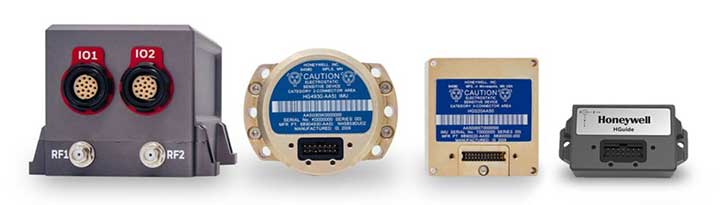
Honeywell
Honewell’s HGuide micro-electro-mechanical system (MEMS) inertial measurement units (IMUs) and INS are designed to be integrated with GNSS receivers. (Photo: Honeywell)
Integrating GNSS with Inertial
Heightened awareness of intentional and inadvertent jamming threats has less to do with new types of threats and more to do with the increased importance of precise PNT coupled with more frequent instances of jamming, according to Chris Lund, senior director, HGuide Navigation and Sensors at Honeywell Aerospace.
“As applications become more reliant on highly accurate and reliable position and timing information provided by navigation systems, the consequences associated with the data not being available or not being correct quickly escalate,” Lund said.
The best way to measure the impact of a jamming threat and the capabilities of countermeasures is “to determine in actual real-world use cases whether the desired application outcome can still successfully be achieved,” Lund said.
The most promising approach to anti-jamming is integration of GNSS receivers with inertial navigation systems (INS) and other PNT systems. “Given the complementary aspects of many of the available approaches in the anti-jamming toolkit, it’s often best to leverage however many tools are available and needed to allow the application to achieve its desired outcome,” Lund said.
On Sept. 19, in conjunction with the ION GNSS+ conference, GPS World hosted its annual Leadership Awards dinner. Five honorees — chosen by a panel of GNSS experts — were recognized for their outstanding recent contribution or achievement in four categories: Satellites, Signals, Services and Products.
SATELLITES AWARD: Presented by Johnathan Caldwell (left) to Mark Crews, both of Lockheed Martin. Crews accepted on behalf of Tim Hartman. (Photo: GPS World)
Satellites Award
TIM HARTMAN: Satellites Award winner
Tim Hartman, Chief Engineer, Military Space Programs, Lockheed Martin
Hartman was recognized for serving as the program manager for GPS IIRM and GPS III Space Segments. Tim’s leadership and program dedication helped support the U.S. Air Force’s decision to declare GPS III ready for launch on Oct. 17, 2017.
On Aug. 22, Lockheed Martin Space celebrated the successful launch of the second of up to 32 next-generation GPS III/IIIF satellites that the U.S. Air Force contracted the company to design and build. Lockheed Martin’s commitment to positioning, navigation and timing can be found in the exemplary performance of the 18 Lockheed Martin-built GPS IIR and IIRM satellites that are a proud part of today’s 31-satellite GPS constellation. The company also is proud to support the Air Force with its continued sustainment of the current GPS Operational Control Segment.
SIGNALS AWARD: Presented by Joe Rolli of L3Harris (left) to Ramsey Faragher. (Photo: GPS World)
Signals Award
Ramsey Faragher, Founder and CEO, Focal Point Positioning
Focal Point Positioning’s new supercorrelator approach to indoor and urban GNSS signal processing could revolutionize smartphone-based GNSS. New signal processing methods for the correlation stage of a GNSS receiver enable several seconds of coherent integration while the receiver is undergoing dynamic motions. This improves accuracy and integrity, and provides anti-spoofing and spoofer-localization capabilities — without hardware changes or requiring access to encrypted signals.
L3Harris Technologies is an agile global aerospace and defense technology innovator, delivering end-to-end solutions that meet customers’ mission-critical needs. The company provides advanced defense and commercial technologies across air, land, sea, space and cyber domains. L3Harris has approximately $17 billion in annual revenue and 50,000 employees, with customers in 130 countries.
SERVICES AWARD: Presented by Mike Shepherd of Collins Aerospace (back) to Simon Banville (front left) and Denis Laurichesse. (Photo: GPS World)
Services Award
Denis Laurichesse, Navigation Systems Department Expert, Centre National d’Études Spatiales (CNES)
Simon Banville, Senior Geodetic Engineer, Natural Resources Canada (NRCan)
Laurichesse and Banville demonstrated instantaneous, centimeter-level, multi-frequency precise point positioning (PPP). Their work shows PPP might become, within a few years, a practical alternative to real-time kinematic (RTK) for a wide range of applications.
Collins Aerospace Systems, a unit of United Technologies Corp., is a leader in technologically advanced and intelligent solutions for the global aerospace and defense industry. Created in 2018 by bringing together UTC Aerospace Systems and Rockwell Collins, Collins Aerospace has the capabilities, comprehensive portfolio and expertise to solve customers’ toughest challenges and meet the demands of a rapidly evolving global market.
PRODUCTS AWARD: Accepted by Paul Alves (left) from presenter Jeff Martin of Spirent Federal Systems. (Photo: GPS World)
Products Award
Paul Alves, P.Eng, Ph.D., Technology Manager — Correction Services, NovAtel, part of Hexagon
Alves was recognized for his work on localization of interference sources for GNSS users leveraging the Interference Tool Kit. With the ITK, users can detect and mitigate adversarial jamming of GNSS signals, as well as unintentional interference from external sources.
Spirent has more than 30 years of experience delivering the world’s best test equipment. Spirent’s test solutions for GPS and GNSS, critical infrastructure SCADA vulnerabilities, Internet L3-L7 common vulnerabilities and exposures, and mobile vulnerabilities allow the world to communicate and collaborate faster. Spirent Federal Systems is a wholly owned subsidiary of Spirent Communications and was established to offer the world’s leading simulation equipment to U.S. government customers, armed services, education institutions, and prime contractors. Spirent Federal’s SimMNSA was the first to be granted Security Approval by the Global Positioning System Directorate.
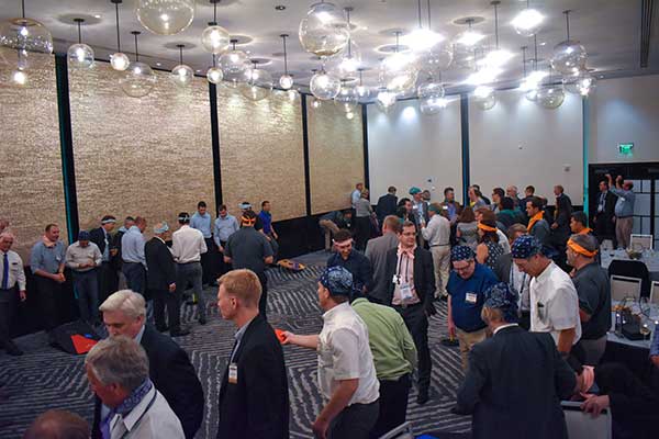
PNT CHAMPS: The L3Harris team earned the most total points in all six games, and took home a trophy each. (Photo: GPS World)
PNT Games
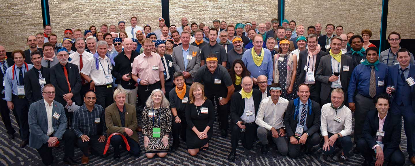
After dinner, guests broke into teams to test their personal positioning, navigation and timing skills, precisely determined by their ability to toss rings and throw horseshoes under time pressure. Each team rotated through yard games such as ladder toss, ring toss, corn hole and horseshoes to prove who was the most accurate and resilient. The L3Harris team took home the first-place prize.
RAINBOW CONNECTION: Taking on giant pong are members of the rainbow bandana team, (from left) Sanjeev Gunawardena, Thomas Pany, Steffen Thoelert and André Hauschild. (Photo: GPS World)ORGANIZED CHAOS: Wearing different-colored bandanas, teams cheer on their team members and fight for every point. (Photo: GPS World)After all the awards were given, everyone got together for a memorable group photo. (Photo: GPS World)