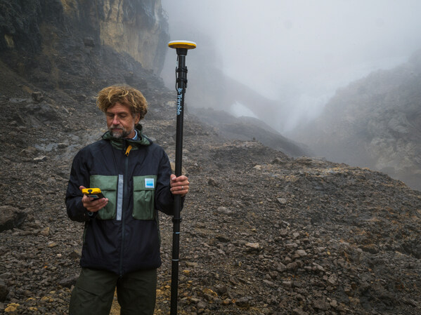
Data provides baseline measurement for tracking change at one of Earth’s last tropical ice fields in Puncak Jaya, Papua, Indonesia.
Trimble is supporting Project Pressure by providing advanced GNSS positioning technology and research funding for the nonprofit organization’s latest expedition to map the disappearing tropical glaciers of Puncak Jaya in Papua, Indonesia.
Project Pressure has released a centimeter-accurate, 3D model of the receding ice, created using Trimble positioning technology and drone-based photogrammetry. The model establishes a scientific baseline for calculating the rate of glacier recession and projecting the timeline of disappearance.
Puncak Jaya, the highest peak in Oceania and one of the Seven Summits, is expected to be the first of the seven continental peaks to lose its glaciers as global temperatures rise.
Puncak Jaya has the only snow in Indonesia. (Credit: Enda Kaban, CC BY-SA 4.0)
Local communities use the data to make informed choices about crop selection and prepare for expected water shortages caused by the loss of vital reservoirs.
This expedition marks the third successful outing in Project Pressure’s “Melting Topics”series, which focuses on mapping equatorial glaciers. Trimble provides its GNSS mapping technology and research funding from the Trimble Foundation Fund to support Project Pressure in gathering critical data in some of the world’s most remote and hostile environments.
“Mapping these glaciers before they disappear is of critical importance to establish a baseline to track the glacial regression and for the local communities to understand what is happening with their water source, allowing them to adapt to a changing climate,” said Eliot Jones, senior manager, strategy and partner development at Trimble. “Through a combination of precision technology, detailed project planning and rigorous science, the models created by Project Pressure are shared for scientific study and provide a visual reference for future generations.”
Precision under pressure in hostile terrain
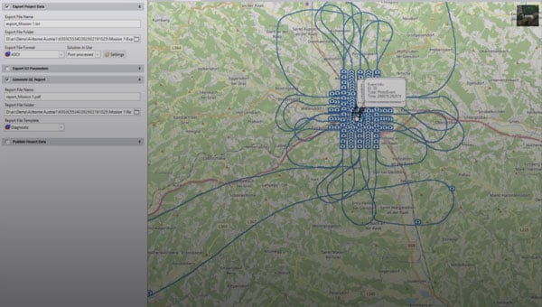
Mapping glaciers at altitudes exceeding 4,800 meters (15,000 feet) presents extreme logistical and environmental challenges. Near-constant cloud cover and heavy rainfall in Papua often render satellite imagery unusable, making ground-based georeferencing essential.
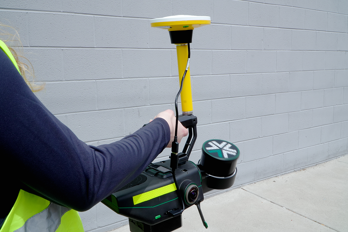
The expedition team installed precise geolocation reference points directly on the glacial surface at multiple locations. Using the Trimble Catalyst DA2 GNSS system and Trimble TDC600 handheld, researchers captured the exact coordinates of those points with centimeter-level accuracy. Drone imagery was then processed against the Trimble coordinates to produce a scientifically reliable 3D model of the glacier.
“Trimble makes incredibly complex technology feel simple in the field,” said Klaus Thymann, scientist and lead explorer. “When you’re standing on a glacier in freezing conditions, wearing thick gloves and surrounded by clouds, you don’t have time to fight with equipment. With Trimble, I can capture centimeter-accurate readings and the interface is so intuitive that even someone with no prior training can help collect data. That kind of reliability and simplicity is critical when you’re working in some of the most remote and challenging environments in the world.”
This approach builds on methods developed during Project Pressure’s 2024 expedition to the Rwenzori Mountains in Uganda, which also used Trimble technology.
The lightweight Trimble Catalyst DA2 GNSS system was critical for the expedition, which required helicopter access to Basecamp, followed by a trek to the launch point.
A roundup of recent products in the GNSS and inertial positioning industry from the January-February 2026 issue of GPS World magazine.
Autonomous
1. Delivery Drones
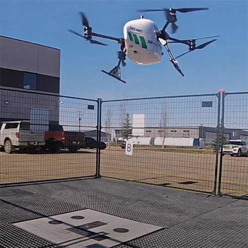
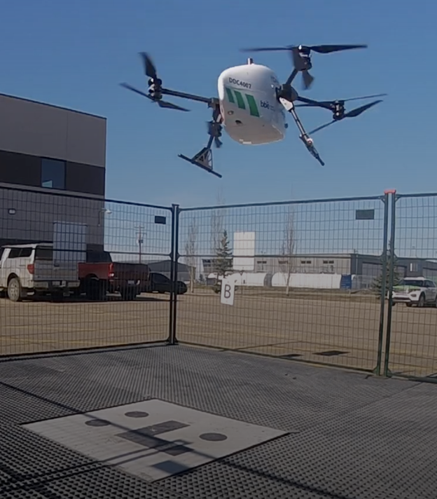
Volatus deploys medical supplies in Canada
Image: Trimble
Volatus Aerospace has integrated the Trimble PX-1 RTX solution into its commercial delivery drone service to achieve accurate and robust positioning and heading. The Trimble module provides Volatus’ clients with a turnkey solution for highly accurate aerial data acquisition and fully remote drone operations in real-world missions, including beyond visual line of sight (BVLOS). The PX-1 RTX uses Trimble’s CenterPoint RTX corrections along with compact, high-performance GNSS-inertial hardware to deliver real-time, centimeter-level positioning and highly precise inertial-derived true heading measurements. This technology reduces operational risks associated with poor sensor performance or magnetic interference by providing enhanced positioning redundancy.
For border protection and long-range surveillance missions
Image: CopterPIX
The ERE95 Mini by CopterPIX operational platform is fully capable of GNSS-denied missions and integrates a long-range, anti-jamming communication system supporting distances of more than 20 km. It has an endurance of 2 hours and can carry up to 5 kg of payload for up to 1 hour. It also has integrated daylight and thermal imaging for advanced surveillance. With a fully foldable frame, the platform collapses into a backpack-sized kit, making it suitable for rapid mobility and field operations. Its modular “puzzle” architecture allows quick adaptation of SDR modules, optical payloads, and navigation solutions, enabling mission-specific configurations. To support rapid field deployment, the ERE95 Mini features a mechanical and electrical quick-connect interface, allowing operators to switch payloads in seconds and maintain continuous operational readiness across all missions.
Integrated into long-endurance unmanned aircraft system
Image: AeroVironment
AeroVironment has integrated its visual navigation system (VNS) kit with the Puma Long Endurance (LE) small unmanned aircraft system, delivering GNSS-denied navigation capability. The VNS kit uses advanced computer vision and onboard processing to deliver precise, GNSS-independent navigation. Using a suite of downward-facing sensors, cameras and onboard computing, the VNS kit performs visual inertial odometry to capture and analyze terrain imagery, estimating true aircraft position in real time. The system fuses continuous visual data from the cameras with motion inputs from onboard inertial sensors to calculate precise position, velocity and orientation — allowing the aircraft to know where it is and where it is going when GNSS is not available. It automatically transitions between GNSS-enabled and GNSS-denied modes with zero pilot input, ensuring uninterrupted mission continuity in contested environments.
Low power, small footprint setup for close-airspace awareness
Photo: MatrixSpace
The Portable 360 Radar is a rugged, easily transportable radar kit that delivers reliable close-airspace awareness with panoramic coverage for rapid-response counter-drone operations, from safeguarding stadiums and large public gatherings to border security and battlespaces. The MatrixSpace platform unifies threat awareness across multiple networked Portable 360 Radar systems and other sensors, without compromising local operation. By combining AI edge processing with MatrixSpace AiCloud Enterprise software, central command centers get an enhanced common operating picture and deep airspace activity analytics to assure public safety.
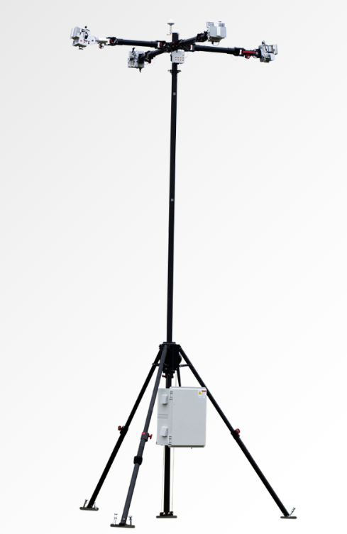
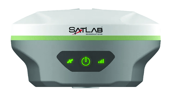
The SatLab SL8 Laser RTK GNSS receiver combines dual cameras, GNSS, an IMU and visible laser technology to make surveying faster and easier. With non-contact measurement, image-assisted targeting, CAD live-view stakeout, and a built-in LoRa radio. It ensures smooth, reliable work even in complex or GNSS-limited environments. The SL8 achieves 2 cm accuracy within 10 meters and enables efficient data collection across bridges, tunnels, riverbanks, and other sites where traditional GNSS methods are restricted. It features image-assisted targeting through SatSurv software, displaying laser points directly on real-time images for quick and precise aiming. Its automotive-grade IMU requires no manual calibration or initialization and enhances measurement accuracy by up to 40% in GNSS-challenged areas. A built-in multi-protocol LoRa transceiver provides stable transmission beyond 15 km and compatibility with multiple RTK brands. The integrated CAD and visual stakeout functions combine live imagery with CAD data, allowing users to visualize target points on site and increase layout efficiency by up to 50%.
A complete precision mapping solution for the utility and critical infrastructure industries worldwide is the goal of a partnership between ProStar Holdings and Tersus GNSS. The partnership will integrate Tersus’s survey-grade GNSS receivers with ProStar’s PointMan Underground Utility Mapping Software, providing an affordable, field-ready solution. The partnership will use ProStar’s LinQD open API integration platform, which is designed to enable seamless interoperability between emerging technologies and legacy systems, creating a robust global ecosystem for geospatial intelligence, uniting equipment manufacturers and service providers under the initiative.
The MVP S1 RTK-SLAM handheld 3D laser scanner uses GNSS through an AI-driven RTK-SLAM workflow, as well as lidar data with imagery from dual 48-megapixel panoramic cameras. The combination provides survey-grade results in both GNSS-denied and open environments. The system achieves centimeter-level accuracy outdoors and maintains performance indoors or underground through SLAM processing. TimeSync 3.0 synchronizes the hardware, aligning sensor data at the microsecond level and supporting consistent datasets and reliable post-processing. A mobile application provides users with real-time feedback, including previews of colorized point clouds while scanning, as well as basic scan reports on site. This feature helps operators verify data completeness and quality before leaving the field, reducing the need for repeat visits. The MVP S1 supports 3D gaussian splatting (3DGS), enabling creation of textured, photorealistic 3D models. This capability is useful for building information modeling, construction progress monitoring, underground surveys, forestry analysis and industrial site documentation.
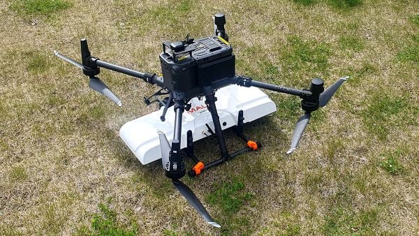
The MALÅ GeoDrone 600 and Zond Aero 600 NG are two new high-resolution ground-penetrating radar (GPR) systems for UAVs. They significantly enhance high-resolution subsurface investigations with drones, supporting applications in engineering surveys, utility mapping, archaeology, environmental studies and geophysical research. They enable surveyors to capture consistent, high-quality subsurface data in areas difficult, slow or unsafe to access with traditional ground instruments. Operating at 600 MHz, the antennas offer a balance between penetration depth and fine near-surface resolution. Typical penetration from the drone is up to 2 meters, depending on surface conditions, while SPH Engineering’s True Terrain Following ensures stable antenna height to maintain data quality and repeatability.
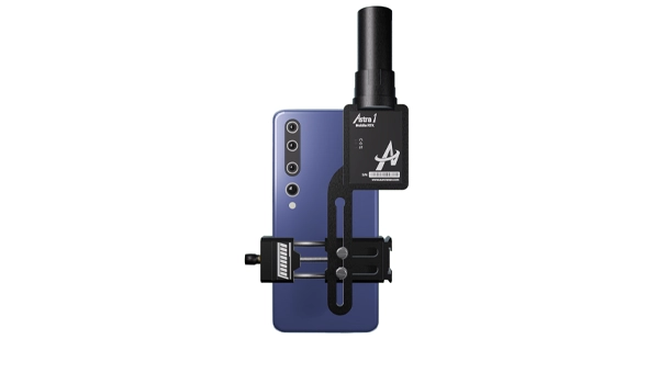
For high-precision surveying, photo surveys and 3D modeling
Image: Aurora Navigation
The Astra1 Mobile Visual RTK is a professional-grade GNSS receiver engineered to redefine high-precision mobile data acquisition. It is built to meet the demand for highly portable, reliable, high-precision tools that simplify complex field operations. At 60 grams, the Astra1 is an ultra-compact solution designed to deliver reliable, centimeter-level positioning and advanced 3D mapping capabilities through seamless integration with a smartphone and the proprietary Anypos App. Accuracy is RTK 8mm+1PPM horizontally, 15mm+1PPM vertically, photo survey <4 cm (2-15 m distance). The Astra1 allows users to capture photos with precise RTK coordinates, enabling the creation of accurate 3D models for detailed construction verification and digital twinning applications.
The AR588MA is a 5G-advanced (5G-A) automotive-grade cellular module that integrates dual-band GNSS supporting both L1 and L5 bands with up to 30 Hz output. Based on MediaTek’s latest-generation MT2739 platform, the AR588MA supports 5G-A communication technology and complies with the 3GPP R18 standard protocol. It features both NB-NTN and NR-NTN satellite communication capabilities and supports dual-SIM dual-active (DSDA) technology, offering improved stability and reliability on cellular connections. It also includes intelligent driving scenario recognition. Designed in compliance with the AEC-Q104 Grade 2 automotive standard, it delivers fast, stable connectivity and reliable security for in-vehicle communication and benefits on-roof applications, such as smart antennas for automotive, with higher-temperature support.
A firmware upgrade to the Xsens Sirius and Xsens Avior IMUs delivers centimeter-level vertical displacement measurements for marine stabilization and control systems. The new Heave feature enables real-time stabilization and wave compensation in a wide range of marine applications. Marine engineers can access comprehensive motion data — roll, pitch, yaw and heave — from a single compact sensor, eliminating the need for external processing or oversized tactical-grade systems while maintaining the precision required for offshore platforms, vessels, docking systems, marine robots, buoys and surveying equipment.
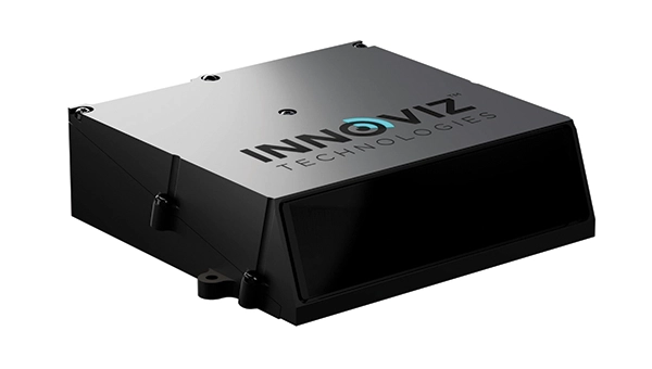
The InnovizThree is fully colored long-range lidar with camera that creates a compact sensor-fusion module designed to reduce OEM integration complexity. The solution combines lidar and RGB sensing in a single compact perception module, purpose-built for behind-the-windshield installations, drones, micro-robotics and humanoids. The consolidation of an RGB camera inside InnovizThree reinforces Innoviz’s commitment to scalable, OEM-friendly sensor-fusion perception solutions designed for series production and long-term deployment, with the potential to enable faster deployment and cost savings. The RGB sensing capabilities are factory-aligned with the lidar, enabling precise and consistent visual-to-lidar geometry across production units. This alignment, combined with hardware-synchronized capture, will enable reliable multi-modal sensor-fusion data correlation while reducing calibration effort during vehicle integration.
High-integrity GNSS integration for autonomous driving
Image: Getty Images / iStock / FlashMovie
Swift Navigation is collaborating with Nvidia to enable a scalable, cost-effective approach to autonomous driving by integrating the Nvidia Drive AGX platform with Swift’s globally referenced, centimeter-accurate GNSS positioning. Swift Navigation offloads absolute localization to the GNSS sensor stack using its Swift Automotive Suite. The suite is a complete, modular software solution for safe, high-integrity precise vehicle localization that combines the centimeter-level Skylark Precise Positioning Service with the Starling positioning engine, software that fuses raw GNSS data and corrections with IMU and wheel odometry to deliver high-integrity, centimeter-accurate positioning (PVT). By using Swift’s high-precision stack for lane-level positioning, the vehicle’s optical sensors focus on obstacle detection and safety, lowering system cost and complexity.
Sinclair’s new SM 5G Family Tier features the SM714 and SM2601 series antennas. The multi-band, multi-port antennas are engineered to deliver superior connectivity, reliability and versatility for GNSS and other mission-critical wireless transportation applications. The SM714 is a 4-in-1 low-profile customizable transit antenna that combines 5G/LTE, Wi-Fi and tri-band GNSS coverage in a single compact form. Supporting 617–5925 MHz, it enables seamless operation across all major 5G and LTE bands. It is suitable for vehicles, fleet systems and connected mobility applications requiring a discreet, high-performance solution. The SM2601D is a 5-in-1 low-profile customizable antenna that features five independent ports: one for PTC (219–223 MHz), one for Wi-Fi (2400–6000 MHz), one for GNSS, and two full-band cellular ports (694–2700 MHz) that support diversity and MIMO operation for multi-radio systems. This dual-cell configuration offers greater throughput, flexibility, and redundancy in complex communication environments.
High-precision depth sensing and real-time velocity measurement
Image: Voyant Photonics
New versions of the Carbon lidar platform add 32-line and 64-line variants for compact, cost-sensitive and compute-limited systems. The new models complement existing 128-line configurations and are optimized for industrial autonomy, robotics, drones and smart infrastructure applications. They offer lower data rates and simplified integration while maintaining core FMCW advantages including velocity measurement, interference immunity and high dynamic range. With line resolutions spanning 32, 64 and 128, original equipment manufacturers and system integrators can tailor performance, bandwidth and compute load to specific use cases, from robotics and automated guided vehicles to drones and embedded edge platforms. The Carbon family’s silicon-photonics architecture integrates beam steering and coherent detection on a single photonic chip. The new variants include high-precision depth sensing and real-time velocity measurement, exceptional ambient light immunity and compact design for industrial and mobile environments.
For automotive track and varied environment testing
Image: VBOX
The NTRIP Base Station from VBOX Automotive combines a multi-constellation, multi-frequency GNSS engine with a built-in networked transport of RTCM via internet protocol (NTRIP) server. The equipment transmits real-time kinematic corrections over radio and cellular or Wi-Fi networks, supporting accurate real-time positioning across wider areas in varied environments compared to traditional radio-only systems. The base station launches in three models, with specifications designed to fit users’ needs. All systems combine quad-constellation, dual-frequency GNSS technology with built-in cellular and Wi-Fi connectivity. Compatible with VBOX 4, VBOX 3iS and external GNSS rovers, the new NTRIP Base Station supports both MSM4 and MSM7 RTCM formats, has up to 24 hours of battery life and is rated to IP67 to handle the demands of long outdoor test sessions. Models include Internal GNSS antenna and 2.4 GHz radio (quick to deploy for short-range applications, for temporary or mobile testing); Internal GNSS antenna, no radio (compact and simple, suitable for NTRIP or semi-permanent installations with external high-power radio masts); and External GNSS antenna, no radio (optimized for permanent installations with tripod-mounted antennas for maximum satellite visibility, supporting NTRIP or external radio).
The Trimble module provides Volatus’ clients with a turnkey solution for highly-accurate aerial data acquisition and fully-remote drone operations in real-world missions, including beyond visual line of sight (BVLOS).
The Trimble PX-1 RTX uses Trimble’s CenterPoint RTX corrections along with compact, high-performance GNSS-inertial hardware to deliver real-time, centimeter-level positioning and highly precise inertial-derived true heading measurements. This technology reduces operational risks associated with poor sensor performance or magnetic interference by providing enhanced positioning redundancy.
Volatus must meet strict guidelines addressing airspace entry and exit, altitude and speed, and communication and remote identification when taking off from and landing at the Edmonton International Airport in Alberta, Canada. The flight corridor approved by Transport Canada and Nav Canada requires them to land and takeoff with precision, while staying at 50-feet altitude when crossing airplane arrival routes.
Trimble PX-1 RTX’s precise positioning capabilities address crucial accuracy challenges for takeoff and landing, while supporting an exact flight altitude and positioning within the flight corridor. This capability enaables Volatus to remain compliant with the controlled airspace authorization from Nav Canada, a non-profit that operates the country’s civil air navigation system.
The Trimble PX-1 RTX solution is available through Trimble sales channels.
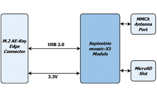
The M.2 card GW16160 is the first Septentrio-based product from Gateworks, a U.S.-based manufacturer of single-board computers. The GW16160 provides reliable high-accuracy positioning powered by the mosaic-X5 GNSS module, a high-quality positioning solution for autonomous robots, UAVs and industrial mission-critical applications. The GW16160 allows engineers to integrate high-accuracy GNSS into edge systems without bulky external receivers or complex RF design. This ultra-low power card features an M.2 A/E-Key interface with USB 2.0 connectivity for plug-and-play integration.
The Trimble RTX-NMA (Navigation Message Authentication) mitigates spoofing attacks on GPS and BeiDou signals. RTX-NMA leverages the Trimble RTX correction service and enhances the security and integrity of GNSS navigation messages for all Trimble ProPoint receivers. Used in conjunction with Galileo OSNMA, users now have three constellations protected from spoofing attacks. Trimble RTX-NMA seeks to detect both fake GNSS signals and faulty ephemeris data through real-time authentication that ensures navigation messages from multiple RTX reference station receivers are genuine and trustworthy. It also encompasses faulty ephemeris detection, preventing unreliable data from being included in the correction stream. Enhanced security through advanced cryptographic techniques like AES encryption, and stream authentication, take it a step further. Trimble RTX-NMA is compatible with various Trimble GNSS receivers using firmware version 6.40 or greater.
Trimble has provided advanced geospatial equipment to Fresno State’s Geomatics Engineering Program in collaboration with California Surveying & Drafting Supply, a Cansel company (CSDS). The equipment is designed to facilitate experiential learning in optical surveying, photogrammetry, GIS, GNSS and scanning workflows, helping to equip geomatics students with the skills needed for future careers. As part of this collaboration, Fresno State will open a Trimble Technology Lab on campus in 2026 as a place for students to get hands-on experience and training.
As the nation’s first four-year, nationally accredited geomatics program and California’s only Accreditation Board for Engineering and Technology-accredited four-year offering, Fresno State has long been a hub for training the geospatial professionals who power land surveying companies throughout the Western U.S., including entities like Caltrans and PG&E. CSDS, with its expertise in bridging academic needs with industry solutions, was instrumental in bringing Trimble on board to expand the program’s equipment inventory, foster innovation and ensure the program’s sustainability as a talent pipeline for California’s geospatial industry.
“This strategic alliance is key to revitalizing and aligning educational offerings with the cutting-edge tools that define the profession,” said Tom Cardenas, senior vice president at CSDS. “Beyond offering students a hands-on learning approach, this project establishes a scalable model for addressing the surveyor shortage through industry and education collaboration. It’s a clear commitment to reshaping the future of geospatial education in California.”
The Bureau of Labor Statistics reports a significant decline from 56,200 employed surveyors in the U.S. in 2010 to 47,770 in 2020. In California, where more than 2,000 surveyors depend on advanced technologies to support a booming construction and utility sector, the shortage poses a tangible threat to projects ranging from highway expansions to renewable energy installations.
“Fresno State is a critical pipeline for California’s geospatial workforce. The collaboration with CSDS and Trimble amplifies our collective mission to align educational offerings with the state-of-the-art tools that meet the demands of a rapidly evolving industry,” said Bryan Gibert, director of sales enablement at Trimble. “This collaboration is about creating an ecosystem that draws in talent and prepares them for immediate impact.”
The equipment includes Trimble GNSS base receivers, data collectors and network capabilities; Trimble S7 robotic total stations; Trimble DiNi digital levels; Trimble X9 3D laser scanners with T10x tablets; and licenses for Trimble Business Center, Trimble RealWorks and other highly technical software such as Trimble’s aerial photogrammetry module for TBC and Trimble eCognition. Trimble also outfitted Fresno State’s Geomatics Engineering program with several C5 mechanical total stations for a complete, turnkey solution. Both Trimble and CSDS provide configuration, calibration and on-site training for the technology.
“We emphasize hands-on training in our facility, complete with high-end computers, advanced distance learning tech and collaborative research projects with local agencies like CSDS,” said Scott Peterson, associate professor and program coordinator of the Geomatics Engineering Program at Fresno State. “While we had solid foundations from previous industry partnerships, we needed to expand with Trimble technologies to align our geomatics education with what the overwhelming majority of California professionals use every day. This turnkey solution, from GNSS to scanners and software, prepares our students for real-world challenges across geomatics and construction, leveraging our control network for practical training.”
Trimble has launched its data collector portfolio. The suite includes the Trimble TSC710 data collector, the Trimble TSC510 controller and the Trimble T110 tablet, built for advanced functionality and integration across field operations.
When used with Trimble Connect, a common data environment and collaboration platform, or Trimble WorksManager civil site management cloud software, users can exchange data between the office and jobsite in near real-time to improve operations.
As the physical interface between Trimble hardware and software, the data collectors translate the physical world into an accurate digital representation and back. They enable connected workflows through Trimble Connect and Trimble WorksManager, giving users real-time access to a single source of truth for all project data. Combined with Trimble field software, users can unlock productivity and efficiency gains with quality control capabilities that help reduce project errors and downtime.
The devices are part of an integrated technology ecosystem of Trimble hardware and software, enabling a single source of truth for all project data. The approach enhances collaboration for professionals in surveying and mapping, construction, utilities, mining, oil and gas and public safety and forensics.
“Trimble is dedicated to pushing the boundaries of what’s possible in the field,” said Boris Skopljak, vice president of geospatial at Trimble. “This new data collector portfolio empowers our customers with the tools they need to be productive and stay connected in any environment.”
The portfolio includes:
Trimble TSC710 data collector — Ideal for working with large model data files on a construction site, the TSC710 features a 7-inch touchscreen, a full keyboard and a Qualcomm processor that is faster and uses less battery power than the TSC7. The TSC710 runs on a Google Mobile Services-certified Android 14 operating system. Built for maximizing productivity around connected workflows, the TSC710 is equipped with 5G WWAN support and all-day battery life. The TSC710 has a narrowed neck and is 150 grams lighter than its predecessor.
Trimble TSC510 controller — Engineered to boost field efficiency and optimize workflows, the TSC510 is a robust handheld device with an IP68 rating, compared with IP65 for the TSC5, that enables continuous operation with an all-day battery and a Qualcomm processor up to three times faster than the TSC5, with twice the memory and storage. The TSC510 features a 5-inch screen and runs Android 14. With updated WWAN and Bluetooth modules, teams stay connected for smooth data exchange and real-time project updates.
Trimble T110 tablet — The T110 maximizes field productivity with an Intel 14th-generation Core Ultra 7 processor, built to handle demanding projects and large datasets, including point clouds and imagery. Its rugged design ensures reliable performance in demanding environments. The T110 combines features of the Trimble T10x and Trimble T100 into a single field tablet, including a powerful processor, swappable batteries, 4G LTE WWAN and a Trimble Empower bay enabling communication with Trimble field devices.
Availability
The Trimble data collector portfolio is available now through Trimble’s global network of dealers.
The demand for autonomy is accelerating across industries, reshaping how systems are being developed and deployed.
For UAVs, the push for precision is driven by emerging use cases, such as package delivery, medical transport and complex route navigation in urban environments, all of which require centimeter-level accuracy in positioning and landing.
Importance of Correction Services
Trimble is expanding its Centerpoint RTX positioning technology from agriculture and surveying applications into the rapidly growing autonomous markets of UAVs, robotics and vehicles.
CenterPoint RTX is a global correction service that delivers centimeter-level positioning accuracy, engineered to ensure reliable and precise positioning anywhere around the world.
RTX employs a fixed, stable datum to ensure consistent and reliable performance. The system supports all major satellite constellations and frequencies, offering users a robust and flexible positioning system. The service can be accessed through either L-band satellite signals or a standard internet connection, eliminating the need for local base stations and making high-precision positioning far more scalable and accessible.
This level of reliability is crucial for emerging applications such as drone delivery.
“When you start talking about package delivery, operators need robust positioning,” explained Joe Hutton, director of inertial technology and airborne products at Trimble Applanix. “One reason is what we call ‘the last meter’ — drones need to be able to land or drop packages consistently within that final meter of their destination.”
Hutton noted that precision requirements are becoming even more demanding. “It’s actually getting smaller than a meter now. You need that robust centimeter-level positioning to ensure the drone is in exactly the right spot for safe and accurate delivery.”
When asked about alternative positioning methods, Hutton explained why traditional RTK systems can fall short for these applications. “RTK has its traditional limitations,” he said. “You have to be within 20 km of a base station, you need to set up infrastructure, and then you face all kinds of datum issues between different base stations.”
This is where CenterPoint RTX offers a significant advantage. “You don’t get those problems with CenterPoint RTX because it’s a global correction service operating on a fixed reference datum that never changes,” Hutton explained. “If you use the same technology to survey your landing spot — say with a Trimble DA2 product using RTX — everything fits perfectly. It’s always going to be in the same datum.” He noted that this consistency has proven very popular with users because it eliminates the complex datum coordination issues inherent in RTK systems.
Beyond datum consistency, Hutton highlighted another critical consideration: signal robustness and jamming and spoofing. “While commercial drone applications typically operate outside conflict zones where intentional jamming occurs, operators still need protection against interference,” he said. “You can have radios causing jamming just inadvertently.”
Trimble’s OEM GNSS/INS systems for UAV navigation, such as Trimble PX-1, use aided inertial navigation system (INS) software that blends GPS positioning with inertial sensors using RTX corrections to offer robust position and orientation data — including precise roll, pitch and heading measurements — that can maintain accuracy even during short GNSS signal outages.
The system provides inertial-based heading, which addresses another critical challenge in drone navigation. Traditional approaches rely on magnetometers for heading determination, but these are easily influenced by nearby metal structures and electromagnetic interference. In contrast, inertial-derived heading comes directly from the IMU itself, making it immune to magnetic disturbances and far more reliable in complex environments, making it suitable for drone delivery in busy urban environments.
Trimble has released two positioning system portfolios for mobile mapping and direct georeferencing — Applanix POS LVX+ and Applanix POS AVX RTX — designed to meet evolving demands in the geospatial industry. The solutions are designed to deliver improved accuracy and efficiency for land-based and airborne mobile mapping applications.
Trimble is showcasing both portfolios at Intergeo 2025, alongside Applanix POSPac Complete advanced post-processing software introduced last week.
Both portfolios include a one-year subscription to the Trimble CenterPoint RTX correction service and Applanix POSPac Complete for desktop and cloud, which includes post-processed CenterPoint RTX. By integrating real-time and post-processed data, users can achieve global coverage without traditional GNSS base stations, avoiding complications from base stations in different local datums or epochs. Both systems achieve centimeter-level accuracy and support Trimble IonoGuard technology for advanced mitigation against ionospheric disruptions.
“By bundling both real-time and post-processed RTX into the POS LVX+ land and POS AVX RTX air solutions for mobile mapping, these ready-to-use systems simplify procurement and enable immediate deployment,” said Steve Woolven, president and general manager of Applanix at Trimble. “These portfolios enable our customers to tackle the most complex mapping projects and ensure optimal accuracy for final deliverables.”
Land-Based Systems
The POS LVX+ portfolio offers six models with several key features: a smaller, lighter and more cost-effective design with rugged components suitable for diverse users and project types; the Applanix IN-Fusion+ multi-sensor aided inertial engine that maintains performance in challenging environments like urban canyons or tree canopy; suitability for projects using lidar sensors or cameras, plus fleet management and automotive applications; and onboard and external inertial measurement units that enhance reliability and performance.
Airborne Positioning
The Applanix POS AVX RTX portfolio includes four variants for mapping at different flying heights through improved orientation accuracy. Key features include over-the-air correction technology achieving positioning, velocity and orientation accuracy up to 0.03 horizontal meters root mean square (RMS) and 0.06 vertical meters RMS without additional setup or infrastructure; robust hardware with advanced inertial measurement units (IMU) and FAA-certified antenna and cabling; and combined real-time and post-processed RTX correction data for time-critical missions, large-scale corridor mapping and projects in remote or inaccessible areas.
A redesigned software solution embedded with POSPac PP-RTX, Applanix POSPac Complete is available exclusively as an all-in-one term license that bundles essential GNSS augmentation options — single base, Applanix SmartBase post-processed VRS and POSPac PP-RTX service — into a single, transparent annual fee. This eliminates hidden costs, simplifies budgeting and ensures access to software updates, while Trimble RTX removes the need for base stations and provides global coverage.
Because Trimble RTX is embedded into the software, users around the world can attain seamless and efficient workflows with centimeter-level accuracy, even in remote or inaccessible areas, increasing productivity in their mapping process. Additional time savings are gained with the elimination of the time-consuming and challenging task of setting up and managing base stations that may be in different local datums or epochs.
“The new POSPac Complete is more than just a software update; it’s a paradigm shift in how geospatial professionals achieve high-accuracy results because of Trimble’s unique RTX factor,” said Nico Jaeger, product manager at Trimble. “By integrating the power of PP-RTX directly into the software, we’ve eliminated the logistical headaches of base stations and streamlined the entire workflow, making mobile mapping more accessible than ever before. Altogether, it helps new and experienced users to produce survey-grade results with unprecedented speed and simplicity, truly representing the next generation of geospatial processing software.”
Additional features in the new POSPac Complete include:
Modernized user interface: A new look and feel with a background map and a streamlined project wizard for easier and more efficient workflows, and a better user experience.
Trimble IonoGuard: Trimble’s latest technology that detects and mitigates the effects of ionospheric scintillation, which is especially important during the solar activity peaks, supported in single base and PP-RTX processing modes.
Optional add-on features available for purchase:
Camera QC tools: The robust successor to CalQC, providing rapid IMU to camera boresight calibration for single-head and multi-head (oblique) camera constellations with minimal user interaction.
Lidar QC tools: Trimble’s leading software application for IMU to lidar boresight calibration and trajectory adjustment using SLAM techniques is now enhanced with support for automatic ground control point (GCP) detection, the RIEGL lidar native file format and reduced RAM requirements for faster processing.
The POSPac Complete solution will be available in November 2025 through the Trimble sales channels. For more information or to request a demo, click here.
GNSS spoofing has become a regular occurrence with the potential for severe consequences when precise and reliable positioning is critical. Legacy GNSS signals are the primary target for bad actors, as most precise positioning relies on these signals, and it’s constantly getting easier and cheaper for people to fake the message. To combat this, Trimble has introduced Trimble RTX-NMA (Navigation Message Authentication), the first solution on the market to mitigate spoofing attacks on the GPS and BeiDou satellite constellations. Trimble RTX-NMA leverages the Trimble RTX correction service and enhances the security and integrity of GNSS navigation messages for all Trimble ProPoint receivers. Used in conjunction with Galileo OSNMA, users now have three constellations protected from spoofing attacks.
Trimble RTX-NMA seeks to detect both fake GNSS signals and faulty ephemeris data through real-time authentication that ensures navigation messages from multiple RTX reference station receivers are genuine and trustworthy. It also encompasses faulty ephemeris detection, preventing unreliable data from being included in the correction stream. Enhanced security through advanced cryptographic techniques like AES encryption, and stream authentication, take it a step further. Trimble RTX-NMA is also compatible with various Trimble GNSS receivers using firmware version 6.40 or greater, making it a versatile solution for a wide range of applications without a subscription. With these features, Trimble RTX-NMA offers increased reliability, enhanced security, and improved integrity — an added layer of defense against potential threats such as spoofing.
As reliance on GNSS continues to grow, ensuring the security and integrity of navigation data becomes paramount. Trimble RTX-NMA represents a significant step forward in addressing these challenges, offering a robust and effective solution for enhancing GNSS security.
Exyn has integrated the Trimble DA2 GNSS System, an RTK-capable GNSS receiver, with the Exyn Nexys autonomous mapping platform, bringing centimeter-level geospatial accuracy to SLAM-based mobile 3D mapping.
The new capability enables users to pair Exyn Nexys’ lidar-based SLAM mapping with high-precision RTK corrections, allowing teams to georeference and anchor point clouds directly in the field without relying on ground control points or post-processing workflows. The result is faster, safer, and more accurate decision-making for industries including mining, construction and critical infrastructure inspection. Intelligently combining RTK and SLAM delivers highly accurate and robust point clouds — even in challenging environments.
When paired with the real-time colorization, users gain an added layer of visual context, enabling photorealistic mapping and the extraction of immersive georeferenced 360° imagery for enhanced situational awareness and analysis.
deliver real-time, centimeter-accurate global positioning
seamlessly integrate underground and surface-level scans into unified, georeferenced datasets
accelerate project timelines by reducing dependency on traditional ground control setups
improve accuracy and alignment for as-builting, volumetric measurements, construction progress tracking / QA, and mine planning.
This enhancement is particularly useful for hybrid environments where teams operate in both GPS-available and GPS-denied zones. The Nexys with DA-2 enabled RTK allows for seamless transitions between these areas while maintaining global coordinate consistency, so Exyn Nexys can serve as a true end-to-end solution for autonomous 3D data capture.
The Trimble DA2 GNSS and Exyn Nexys integration kit is available immediately for plug-and-play compatibility.
Trimble and InvenSense, a TDK group company, will work together to deliver an advanced navigation solution that combines the Trimble ProPoint Go engine and Trimble RTX correction service with TDK’s SmartAutomotiveinertial measurement units (IMUs) module from InvenSense.
The solution is expected to provide greater accuracy and reliability in positioning and navigation across various automotive and IoT applications.
The Trimble ProPoint Go positioning engine is designed to deliver high-accuracy position and orientation data by utilizing internationally accessible Trimble correction services. With quad-frequency GNSS signal support and Trimble ProPoint Go’s first-in-market Automotive Safety Integrity Level-C (ASIL-C) certified correction data, this positioning ecosystem helps companies enhance their automated driving capabilities with a focus on safety. It also helps drive accuracy for IoT applications such as field robotics.
TDK IMUs integrate a triaxal accelerometer and a triaxal gyroscope in a compact six-axis motion sensor to detect the linear acceleration and angular velocity of vehicles and objects with superior level of accuracy. With its proprietary six-axis and MEMS fabrication platform, TDK inertial sensors enhance applications possibilities thanks to their high-performance, small-size and low-power features.
“Together with TDK we are bringing the power of high-accuracy and precise positioning along with state-of-the art ASIL-certified sensors to help our customers build innovative solutions for automotive and IoT markets,” said Olivier Casabianca, vice president, advanced positioning at Trimble. “As we continue to expand our positioning services with TDK and other tier one companies, we are powering the connected world while ensuring the safety and accuracy of connected systems.”
Positioning Solutions Built for the Connected World Key benefits of the ProPoint Go positioning engine and RTX correction with TDK’s modules include:
Accuracy. The synergy between the two solutions delivers superior positioning accuracy under all conditions: open sky, urban canyons and indoor, even in harsh environments and among wide temperature variations.
Reliability. Customers can rely on consistent and dependable orientation and navigation data, crucial for applications such as autonomous vehicles, drones and industrial machinery.
Versatility. The integrated solution is adaptable to a wide range of applications, such as automotive positioning, advanced driver-assistance systems (ADAS), cellular vehicle-to-everything (C-V2X), field robotics and unmanned aerial vehicles (UAVs).
“Inertial and positioning data have become critical in enabling automation, improving efficiency and monitoring conditions,” said Stefano Zanella, automotive motion VP and general manager, TDK. “Building on almost a decade of collaboration with Trimble, we are delighted to take our efforts to the next level: by offering an integrated solution, we empower customers to accelerate deployment, streamline integration and maximize the value of this transformative technology.”
The TDK automotive safety IMU components, developed as SEooC according to ISO 26262, are suitable for applications with requirements up to ASIL-D. In addition to its six-axis solution, TDK provides quality-managed solutions that also include a three-axis magnetometer in a nine-axis solution.