Septentrio, a designer and manufacturer of GNSS solutions, has awarded the Katholieke Universiteit Leuven (KU Leuven) Ecochallenge team — the winners of the Galileo Masters (Flanders Challenge) of the European Satellite Navigation Competition (ESNC) — with an AsteRx-m UAS receiver for its proposal to use high-precision high-reliability Galileo receivers to modernize inland waterway transport by introducing autonomous technology for the vessels.
The judging panel were impressed with the proposal from the KU Leuven Ecochallenge team to use high-quality Galileo receivers to improve the safety and efficiency on autonomous and existing vessels, which can be retrofitted with the solution.
The ambitious proposal offers a pragmatic step towards rejuvenating inland waterways as a viable ecological alternative for freight transportation, Septentrio said in a news release.
The KU Leuven team also participated in Ecorace Challenge organized by the Flemish Waterways Agency and was both the overall winner in the cargo category as well as being voted the most innovative vessel in 2016.
The AsteRx-m receiver board won by KU Leuven Ecochallenge team is a GNSS solution for applications in autonomous and unmanned vehicles, such as drones. The AsteRx-m UAS offers centimeter-level accuracy at 700 mW using L1/L2 GPS and GLONASS RTK.
The AsteRx-m OEM Board by Septentrio.
“As traffic continues to increase, exploiting inland waterways has been identified as a critical development for easing the pressure on road networks,” said Jan van Hees, director of business development at Septentrio. “High-precision high-reliability positioning technology using GNSS is an essential element of the development. The KU Leuven team have demonstrated an innovative autonomous small vessel prototype already to move cargo safely and efficiently on the Flemish waterways, and we look forward to continued collaboration as they further develop this technology for bigger ships.”
“The team is very pleased with their performance winning the Septentrio Prize and the Ecorace Challenge together in the same year,” said Geert Waeyenbergh of KU Leuven, who mentored the KU Leuven Ecochallenge team. “The received AsteRx-m will further help research and development of better ships going into the future.”
The European Satellite Navigation Competition (ESNC) — the largest international competition for the commercial use of satellite navigation — is once again in search of outstanding ideas and business models for accelerating Galileo applications.
Renowned institutions and regional partners are set to award prizes worth a total of more than €1 million in more than 20 categories.
Submissions are due June 30.
Innovation Network for Satellite Navigation
Satellite navigation is indispensable when it comes to accurate, reliable and continuous localization, according to the ESNC. This technology is fundamental to a variety of current trends, including multimodal logistics, the Internet of Things (IoT) and machine-to-machine (M2M) communication, unmanned aerial vehicles (UAVs) and smart cities.
First held in 2004, the ESNC has evolved into the leading innovation scouting mechanism in terms of Galileo-related applications across Europe and beyond. Moreover, the ESNC promotes the transformation of groundbreaking business ideas into market-ready products and new ventures.
Each year, the competition offers advantages to more than 400 business ideas. It has awarded prizes to more than 300 winners, which represent just a fraction of the 3,700 innovative concepts submitted by 11,000 participants. Through its network — including the ESA Business Incubation Centres, other incubators across Europe and the new E-GNSS Accelerator co-funded by the European Commission — the ESNC plays a decisive role in the realization of promising ideas by supporting the foundation of startups and creating high-tech jobs.
One of the main objectives of the ESNC is fostering the European space sector’s competitiveness globally by boosting the development of commercial space applications, especially for startups, SMEs and young entrepreneurs. Advancing Europe’s space programs and meeting user needs, especially when it comes to space data access to encourage alternative business models and technological progress, represent major goals of this strategy.
The involvement of the pan-European spirit within the EU Space Strategy is realized in the ESNC by engaging multiple regions across Europe with their own dedicated prizes.
“The investment in space technologies and applications as well as the support of forward-thinking entrepreneurs and startups ensure Europe’s increased competitiveness,” said Elżbieta Bieńkowska, commissioner for internal market, industry, entrepreneurship and SMEs. “To achieve this ultimate goal, the European Satellite Navigation Competition (ESNC) and the Copernicus Masters are a proven platform for trendsetting technologies and business models based on Galileo and Copernicus to implement the new EU Space Strategy.”
Within this context, this year’s ESNC patronage taken over by Markku Markkula, president of the European Committee of the Regions (CoR), sets the tone for the innovation competition’s pan-European mission of uniting the European regions and cities through the support of space-related businesses and future-oriented entrepreneurs, increasing the market and user uptake of Galileo.
“The European Committee of the Regions attaches great importance to the new opportunities linked to the involvement of European regions in innovation networks, such as the European Satellite Navigation Competition,” Markkula said. “I have therefore gladly taken on the role of patron for the ESNC as of 2017.”
E-GNSS Accelerator
As the high-tech platform for pioneering satellite navigation applications, the ESNC is now additionally equipped with the new E-GNSS Accelerator. This program is a unique opportunity for entrepreneurs and startups to accelerate their business case on a broad scale and bring their products and services to market.
The E-GNSS Accelerator will run for three years and will directly support the winners of the ESNC 2017, 2018 and 2019. Thereby, the participants await even more prizes, services and three further business incubations worth an additional value of EUR 500,000.
ESNC Partners
In the ESNC 2017, special prizes are to be offered in partnership with the following institutions: the European GNSS Agency (GSA), the European Space Agency (ESA), the German Aerospace Center (DLR), and the German Federal Ministry of Transport and Digital Infrastructure (BMVI).
Prototypes can also be entered into the GNSS Living Lab Challenge.
The University Challenge, meanwhile, is explicitly designed for students and research associates.
In addition, participants choose from this year’s confirmed partner regions: Asia, Austria, Baden-Württemberg / Germany, Basque Country / Spain, Bavaria / Germany, Catalonia / Spain, Estonia, France, Hesse / Germany, Ireland, Madrid / Spain, The Netherlands, Norway, Poland, Romania, United Kingdom, and the Valencian Community / Spain.
Stay tuned for more updates on additional ESNC regions.
Obtain more information at the official website, www.esnc.eu, comprising all relevant information on prizes, partners, and terms of participation involved in the ESNC.
Prizes for the Best Applications
This year’s winners will take home prizes worth a more than EUR 1 million and be welcomed into the ESNC’s leading innovation network for global satellite navigation systems.
Along with cash, the various prize categories offer primarily technical, business-related and legal support in realizing the winning business models. A jury of international experts from the realms of research and industry will also evaluate the winners of all the categories to select an overall winner, who will be revealed at the festive Awards Ceremony in early November 2017.
Furthermore, three additional incubations, supported by the European Commission, will be awarded in front of a high-ranking audience.
Those who enter the ESNC also stand to benefit greatly from the opportunity to work closely with leading institutions and regional partners. The ESNC is geared towards individuals and teams from companies, research facilities and universities around the world.
Awards Ceremony and Space Conference
A partner program, the Copernicus Masters (Earth observation), also kicked off on April 5 in Brussels.
The Awards Ceremony for both the ESNC and the Copernicus Masters takes place in early November. The event brings together industry, politics, entrepreneurship and research to showcase the most disruptive space applications and discuss trendsetting developments in the satellite downstream sector and its various application fields.
Modern tower cranes can reach a height of more than 200 meters. They operate in a complicated, chaotic and constantly changing environment. This creates obstacles for the crane operator: poor visibility and dead angles — places the operator can’t see.
Aiming to solve the problem is the Augmented Crane Navigation System (ACNS) project, which provides innovative intelligent operation of tower cranes on construction sites through the integration of highly accurate navigation receivers and a powerful processor unit.
Polish researcher Piotr Krystek took home the DLR Special Prize from the European Satellite Navigation Competition (ESNC) for the ACNS, which is designed to increase efficiency and safety at construction sites.
Using the ACNS, the position of the crane elements can be determined and oriented using four to five low-cost yet highly precise Galileo or GNSS receivers. The central processor calculates the best possible route for load management. In addition to the position values of the various satellite navigation receivers, the digital model of the physical structure or Building Information Model (BIM) is used. Using a head-up display, the visualization is projected directly onto the crane operator’s field of view to enable easy and precise navigation.
The ACNS has a modular design and can be mounted on the crane easily; this includes the retrofitting of existing cranes.
The project is still in the concept phase. To implement the idea, the market must be explored and feasibility studies carried out with cranes in collaboration with crane manufacturers, Krystek said.
The ACNS also could be transferred to other construction machinery and commercial vehicles, Krystek said. As one of the leading economic sectors, the construction industry can benefit immensely from GNSS-based solutions.
Krystek was inspired to pursue the project because of the tower cranes visible from his window in Krakow — along with the availability of low-cost RTK receivers. He is also inspired by the trend to automate everything that can be automated, such as self-driving cars.
The project, Drones2GNSS, also took home the Special Prize offered by the European GNSS Agency (GSA).
Space Geomatica Ltd.’s Tripolitsiotis Achilles joined with Panagiotis Partsinevelos, SenseLab Research, Technical University of Crete, to develop Drones2GNSS.
In the tracking procedure, the engineer with the surveying pole might move around, yet the UAV tracks in real time and provides the GNSS coordinates.
Drones2GNSS includes a prototype drone equipped with a highly accurate GNSS receiver and a camera/laser measuring system that retrieves the coordinates of custom surveying poles featuring Wi-Fi, a prism and a target marker.
The team’s image processing algorithms and error correction techniques provide real-time, centimeter-level coordinate estimation and can simultaneously measure multiple moving surveying poles.
The processing is performed on-board the UAV without any ground-based hardware. In this way, Drones2GNSS provides a fast, reliable, cost-effective alternative for absolute coordinate positioning in obstructed environments where GNSS fails. It can cover multiple targets, including cars, people and vessels.
It also offers a basis for other related challenges, including UAV GNSS networks, indoor positioning and error mitigation.
“Although Galileo Initial Services are expected to enhance the accuracy of existing solutions, Drones2GNSS proposes an off-the-shelf application that uses European GNSS (Galileo, EGNOS) as the primary means of positioning,” Tripolitsiotis said. “As GNSS signals are degraded in obstructed environments by skyscrapers, vegetation and geomorphology, our project proposes using drones as intermediate carriers of high-precision GNSS signals that can then transfer the geolocation accuracy to the ground.”
Drones2GNSS relies heavily on multi-constellation GNSS signal, which is where Galileo will make the difference. “As current constellations like GPS and GLONASS have proven inefficient in confronting the aforementioned surveying problem, the sector continues to rely on traditional surveying techniques,” Tripolitsiotis said. “However, with the launch of the Galileo era and the utilization of the Drones2GNSS approach, we can now provide surveying engineers a cost effective, accurate and fast positioning solution.”
On March 4, Raytheon successfully passed the first formal qualification test milestone for the U.S. Air Force’s GPS Next Generation Operational Control System (GPS OCX). The new system offers significant improvements to the GPS on which the U.S. military and millions of civilians rely, including enhanced availability, accuracy and security.
The event was the Configuration Item Qualification Test (CIQT) milestone for the Launch and Checkout System (LCS). The system provides launch and early orbit checkout capabilities for the modernized GPS III satellites and implements 77 percent of the cybersecurity capabilities for the overall OCX program. The testing was successfully conducted in a representative operational environment with a government-provided GPS III satellite simulator.
The LCS CIQT Run-for-Record was completed more than one month ahead of the plan established in mid-2015, clearing the way for LCS to proceed toward the Factory Qualification Test, the next major qualification event. The FQT test will be at the integrated system level and will take place this summer.
GPS OCX is being developed by Raytheon under contract to the U.S. Air Force Space and Missile Systems Center, which is replacing the current GPS operational control system. The OCX Launch and Checkout System provides an early delivery of a large subset of the overall OCX capability, and will support the GPS III satellite launches.
Congressmen Seek Delay to NDGPS Closings
Four U.S. congressman sent a letter to the Department of Transportation, asking the DoT to delay shutting down Nationwide Differential GPS (NDGPS) sites, a proposal that was posted in the Federal Register.
The congressmen are asking for a delay until the “administration has decided upon and implemented a resilient national positioning, navigation and timing (PNT) architecture.”
“We do not dispute,” they wrote, “the administration’s determination that NDGPS is sufficiently like the Wide Area Augmentation system (WAAS) in its phenomenology and services such that it provides only an incremental benefit to the nation’s PNT architecture. However, some or all of the 62 NDGPS sites (and associated equipment) proposed for elimination could play an important role in achieving the PNT architecture America needs.
“Ceasing transmissions, decommissioning, and disposing of them before we are assured they are not useful to future systems is against our national interest and would not be the best use of government assets and funds.”
Signers were John Garamendi of California, Peter DeFazio of Oregon, Frank Lobiondo of New Jersey, and Walter B. Jones of North Carolina. Read the full text of the letter.
IRNSS Completing
At press time, India was expected to put into orbit its seventh and final navigation satellite on April 28, thus completing the Indian Regional Navigation Satellite System (IRNSS).
IRNSS-1G is expected to launch aboard a Polar Satellite Launch Vehicle (PSLV) rocket from India’s spaceport at Sriharikota in Andhra Pradesh.
IRNSS is designed to provide accurate position information service to users across the country and region, up to an area of 1,500 kilometers.
Jamming on the Borderline
South Korea issued a warning in late March after detecting satellite signal disruptions that appeared to be coming from North Korea. The capital city of Seoul appeared to be the target.
Officials said North Korea discharged a large amount of radio waves to jam GPS signals in the region.
“We’ve detected signs that North Korea has been sending radio waves to the capital area since a month ago to disrupt GPS signals,” a senior government official said, speaking on condition of anonymity. “North Korea had been sending test waves since last month, but today, they discharged the largest amount.”
The disruptions could cause mobile phones to malfunction and affect planes and ships that rely on GPS for navigation. No damage has so far been reported in the military or among civilians, officials said.
Since 2010, GPS disruptions have occurred three times in South Korea, and all have been blamed on the North.
Southern Counter. On April 7, the U.S. State Department confirmed the jamming in a public communique, stating the the jamming was causing signal disruptions to airplanes, ships, and buoys in the area “surrounding Gyeonggi and Gangwon provinces out to about 100 nautical miles.” On April 8, the South Korean government said it would “beef up its system to protect GPS signals” but did not explain how.
South Korea is developing an eLoran system, which would be far more difficult to jam than GPS.
A Long March-3A carrier rocket carrying the 22nd BeiDou satellite lifts off March 30.
22 BeiDou
China launched the 22nd BeiDou satellite into orbit on March 29. BeiDou-22 (or BeiDou-2 I6) was launched at 20:11 UTC (4:11 local time) by a Long March-3A rocket from the Xichang Satellite Launch Center.
China launched the 21st BeiDou satellite on Feb. 1, the second in a series of BeiDou launches scheduled for 2016. The BeiDou constellation is planned to be completed in 2020.
The new satellite, the sixth BeiDou-2 IGSO, will be used to replenish the current operating regional system.
The satellite, after entering its designed work orbit and finishing in-orbit testing, will join others already in orbit and improve the stability of the system, preparing for BDS to offer global coverage.
After landing in French Guiana, the 13th and 14th Galileo satellites, still within their canisters, were unloaded to be taken by road to the Guiana Space Centre. (Photo: ESA)
Next Pair Prepped for Galileo
The latest pair of navigation satellites has reached Europe’s Spaceport in French Guiana, according to the European Space Agency (ESA). This starts a new Galileo launch campaign that will culminate in a May 24 launch of the 13th and 14th satellites in the constellation.
A second launch is planned for this fall, with four satellites carried aloft on a customized Ariane 5 for the first time, bringing the count to 18 Galileo satellites in orbit by the end of the year.
The pair of satellites left ESA’s technical centre in Noordwijk, the Netherlands, on April 4, cocooned within protective air-conditioned containers. They were then driven to Luxembourg Airport, where they were loaded aboard a Boeing 747 cargo jet for a dawn takeoff the following morning.
The satellites touched down at Cayenne — Félix Eboué Airport in French Guiana at 11:15 a.m. local time on Tuesday. Still within their canisters, they were driven to the Guiana Space Centre and unboxed that evening within the cleanroom environment of the centre’s S1A payload preparation building. A fit check is scheduled next, to ensure the satellites can be attached to the dispenser.
ESNC 2016
The largest international competition for the commercial use of satellite navigation once again seeks outstanding ideas and business models, with prizes worth a total of €1 million in more than 25 categories.
The deadline for submissions to the European Satellite Navigation Competition (ESNC) is June 30. The official website provides all relevant information on prizes, partners, and terms of participation. The ESNC is geared toward individuals and teams from companies, research facilities and universities around the world.
The European Satellite Navigation Competition (ESNC) — the largest international competition for the commercial use of satellite navigation — is once again looking for outstanding ideas and business models. Renowned institutions and regional partners are set to award prizes worth a total of €1 million in more than 25 categories.
The deadline for submissions is June 30.
“In our modern, data-driven economy, satellite navigation is a crucial technology that facilitates constant and reliable object localisation — the bedrock of the Internet of Things,” states an ESNC press release. “Since 2004, the ESNC has evolved into a leading fixture in the New Space Economy by provided a public innovation platform for turning promising ideas into market-ready products.
“Each year, the competition unveils new trends and more than 500 business ideas. It has already awarded prizes to more than 270 winners over the years, which represent just a fraction of the nearly 3,500 innovative concepts submitted by over 10,000 total participants.
“Through a one-of-a-kind network that includes the ESA Business Incubation Centres and other incubators across Europe, the ESNC plays a decisive role in the realization of these ideas by supporting the foundation of startups and creating high-tech jobs.”
The unmanned aerial vehicle (UAV) trend has also emerged in the ideas submitted to the ESNC, which selected a drone application — Poseidron — as its overall winner for the first time in 2015. Developed by the Spanish startup Sincratech Aeronautics, this multicopter is equipped with infrared cameras and uses the European positioning service EGNOS to save lives at sea.
The Poseidron concept UAV.
This year’s winners will take home prizes worth a total of €1 million and be welcomed into the ESNC’s leading innovation network for global satellite navigation systems. Along with cash, the various prize categories on offer primarily include technical, business-related, and legal support in realising the winning business models.
A jury of international experts from the realms of research and industry will also evaluate the winners of all the categories to select an overall winner, who will be revealed at the annual awards ceremony.
Those who enter the ESNC also stand to benefit greatly from the opportunity to work closely with leading institutions and regional partners. The ESNC is geared towards individuals and teams from companies, research facilities, and universities around the world. Those interested can enter the competition from 1 April to 30 June 2016 at www.esnc.eu.
In ESNC 2016, prizes are sponsored by the following partner regions and institutions: the European Space Agency (ESA), the German Aerospace Center (DLR), the German Federal Ministry of Transport and Digital Infrastructure (BMVI), and the Horizon 2020 project BELS. Prototypes can also be entered into the GNSS Living Lab Challenge.
The University Challenge, meanwhile, is explicitly designed for students and university research assistants. This year’s confirmed partner regions are: Asia, Austria, Baden-Württemberg, Bavaria, the Czech Republic, Flanders, France, Galicia, Hesse, Ireland, Israel, Lithuania, Madrid, the Netherlands, Norway, Poland, Romania, Sweden, Switzerland, the United Kingdom and Valencia.
The official website offers all the relevant information on the prizes, partners, and terms of participation involved in the ESNC.
ESNC and Copernicus Masters Info Day is scheduled for June 2 at the European Space Solutions conference in The Hague. Those interested will also have further opportunities to meet the ESNC’s organisers and their partners at numerous regional kickoff events across Europe in April and May.
Scientists will now wear safety trackers from a Belgium start-up company while working in Antarctica.
Antarctica is the coldest, windiest and harshest location on Earth. Temperatures can reach –90°C during winter and go down to –20ºC during summer. Winds can reach 250 km/h and visibility can sink to almost zero during whiteouts. With the potential for rapid changes in weather, all outdoor activities must always be done with the greatest care.
Carrying a SticknTrack location tracker in the pocket from Sensolus, a start-up company from ESA’s Business Incubation Centre in Flanders, will help to keep the researchers safe. The same sensors will also be used to track skidoos, sledges and other equipment used.
StickNTrack’s developers took third place in the 2014 European Satellite Navigation Competition (ESNC), after taking first in the Flanders regional competition. It also won the European Space Agency’s Innovation Award. The product debuted in August 2015.
The Belgian Polar Secretariat, Sigfox and Sensolus announced an agreement in January to connect the 2016 Belgian Antarctic Research Expedition to the global Sigfox Internet of Things network.
“This partnership will allow us to test technology that could be useful for the safety of our operations in Antarctica,” said Rachid Touzani, director of the Belgian Polar Secretariat.
The expedition includes specialists in glaciology, climatology and geomorphology in charge of various Belgian and international scientific projects. They are hosted at Belgium’s Princess Elisabeth Research Station, 200 kilometers inland in the 2.7 million square kilometers region of Antarctica known as Queen Maud Land.
The station — designed, built and operated by the International Polar Foundation — is the first polar base that combines eco-friendly construction materials, clean and efficient energy use, optimization of the station’s energy consumption and clever waste management. It can support up to 40 people during the brief Antarctic summer of November to February.
The team members will work within 40 kilometers of the base and, for the first, 45 GPS-based Sensolus trackers connected to the Sigfox network will allow realtime tracking of their movements, in the often-extreme weather conditions.
Sigfox ultra-narrow-band communications will secure the link to two antennas at the base station. The information will also be sent to Belgium.
“Having our extremely battery-efficient StickNTrack GPS trackers at the Princess Elisabeth station is very exciting,” said Sensolus CEO Kristoff van Rattinghe. “We strongly believe that sustaining missions like this is the kind of real innovation we can achieve with the Internet of Things. And this is only possible through strong collaborations like the one set up for this mission.”
The first results on the contribution of the Sensolus and Sigfox technology to the expedition will be released in March.
Building Radar GmbH — providing a global, satellite-based online database for new construction projects — has been named this year’s overall winner of the international Earth observation competition Copernicus Masters.
Thorsten Rudolph (Anwendungszentrum GmbH Oberpfaffenhofen), Dr Josef Aschbacher (European Space Agency), Paul Indinger (Building Radar GmbH) and Ulrike Daniels (Anwendungszentrum GmbH Oberpfaffenhofen). (Photo: Anna Kreuz)
Founded in Munich by Paul Indinger, Leopold Neuerburg, and Artem Ostankov in 2014, the start-up came out on top in the competition’s European Space Imaging High-Res Urban Challenge and went on to edge out the winners of seven other categories for the grand prize. The Building Radar online platform, which already contains more than a million construction projects and over 200,000 company profiles, uses a custom-developed algorithm to identify new building projects around the world. Its customers include companies active in the new construction and maintenance sectors. With building project leads accounting for some EUR 72 billion in revenue each year, Building Radar makes it possible to verify online search results and track changes in projects by means of satellite imagery. The platform thus enables its users to monitor many different construction endeavours while providing much greater cost-efficiency than its competitors thanks to its innovative data research methods.
The Copernicus Masters’ EUR 20,000 grand prize was presented to Building Radar’s managing director, Paul Indinger, by Dr Josef Aschbacher, Head of Programme Planning & Coordination within the European Space Agency’s Earth Observation Programmes Directorate. “Building Radar’s innovative combination of Earth observation data including Sentinel-2 optical data, machine learning, and data mining has created an all-new service for the construction industry,” Aschbacher stated. “It also clearly demonstrates both the usefulness Copernicus provides to a wide range of sectors and the Copernicus Masters ability to discover market-oriented applications of Earth observation data.”
Since 2011, the Copernicus Masters has recognised each year’s best ideas for making innovative use of such data. The 2015 edition received more than 200 entries from close to 50 countries around the world. The applications submitted this year offer a fantastic glimpse of the next generation of Earth observation services along the entire value chain.
“Through the Copernicus Masters, we’re aiding visionary companies in bringing their innovations to market. Working with the European Space Agency and its ESA incubation programme (ESA BIC) has enabled us to assemble an ideal platform for providing these projects with long-term support,” explains Thorsten Rudolph, CEO of competition organiser Anwendungszentrum GmbH Oberpfaffenhofen. “We’re proud to have witnessed a constant rise in the start-ups involved in commercialising Earth observation services since the Copernicus Masters was initiated in 2011 and are confident that the number will continue to grow with the launch of further Sentinel satellites. Meanwhile, it’s great to hear that we’ll have the chance to support Building Radar further at ESA BIC Bavaria follow its big win in this year’s competition.”
Much of the international Earth observation industry came together at the ddb Forum in Berlin on Tuesday for the 2015 Copernicus Masters Awards Ceremony. Along with the overall winner, those who emerged victorious in nine topic-specific categories took home prizes worth more than EUR 300,000 in total. These included cash, consulting, data packages, and other assistance designed to help the winners refine their ideas for an eventual market launch at one of Europe’s 11 ESA Business Incubation Centres.
As in the previous year, the awards ceremony was held in parallel with the Satellite Masters Conference. This afforded the winners the opportunity to introduce their ideas to the international Earth observation and navigation community and discuss innovations in space-based technologies and services.
The Winners
Since 2011 more than 700 participants submitted their innovative solution for business and society based on Earth observation to the Copernicus Masters. Many of the ideas submitted in previous years have been implemented and successfully launched into the market. Within the last five years, 40 winners have been awarded within the competition.
University Challenge
Foresight Crops – Insect Swarm Prediction Modelling, submitted by Dr Oluropo Ogundipe from University of Nottingham, United Kingdom.
ESA APP Challenge
Wave – The City Assistant, submitted by Patrick Wolowicz from subzero.eu software, Austria.
DLR Energy & Environmental Challenge
Beehive Locations – Monitoring Habitats with Satellite Data, submitted by Deepak Bhatia from Poland.
T-Systems Big Data Challenge
ImageQuerying – Real-time Image Analysis and Querying, submitted by Dr Dirk Tiede and Team from the Department of Geoinformatics – Z_GIS, University of Salzburg, Austria.
Smart Cities and Intelligent Transport Challenge by the Satellite Applications Catapult
eXude – Flood Monitor and Drain Effectiveness, submitted by Steve Lee from Stevenson Astrosat Ltd., United Kingdom.
NCMA Spatio-Temporal Data Visualisation Challenge
CybEarth – First-Person Visualisation of EO Data, submitted by Asst Prof Panagiotis Partsinevelos and Team from SenseLab, Technical University of Crete, Greece.
CLOUDEO – The Going Live Challenge
Crop Analytics – The Future of Farmland Diagnostics, submitted by Nicolas Ackermann and Team from Gamaya SA, Switzerland.
European Space Imaging High-Res Urban Challenge and Copernicus Master
Building Radar – Construction Detection and Monitoring, submitted by Paul Indinger and Team from Building Radar GmbH, Germany.
GEO Illustration Challenge
Two Halves Of One Heart, submitted by Dieter Pikulski from Germany.
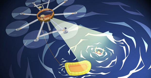
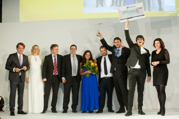
A UAV project, POSEIDRON, took top honors in the 2015 European Satellite Navigation Competition, which recognizes the year’s best innovations in commercial applications of satellite technology. POSEIDRON won over the international jury of experts with its remote-controlled multicopter built to support maritime search-and-rescue services — and took home the grand prize ahead of the European Satellite Navigation Competition’s 29 other winners.
The award ceremony took place during the Satellite Masters Conference. The ceremony was held at the ddb forum in Berlin Oct. 20. The awards ceremony was held in conjunction with the Copernicus Masters awards for Earth observation.
Thorsten Rudolph, Ulrike Daniels (both Anwendungszentrum GmbH), David Argiles (ValSpace Consortium), Rudesindo Hernando Meliá, Maria Dolores Albiol Simo, Manuel Pedreira Gimenez, Jorge Esteve Ripollés and Enrique Martínez Asensi (all Sincratech Aeronautics) and Dorothee Bär (German Federal Ministry of Transport and Digital Infrastructure (BMVI)). (Photo: Anna Kreuz)
Enrique Martínez Asensi and his winning team hope to see Poseidron save lives far out at sea when people fall overboard or are involved in shipwrecks that occur during illegal immigration. Custom-developed by Sincratech Aeronautics — a start-up based in Valencia, Spain — POSEIDRON can be launched from ships or platforms under virtually any weather conditions. The multicopter uses thermal cameras and the European positioning service EGNOS to quickly locate people in the water and transmit an alarm to rescue teams along with precise information. Capable of carrying up to 70 kilogrammes, it can also transport a dinghy and deploy it as soon as casualties are found. This is what makes POSEIDRON both faster and more cost-effective than other rescue systems, which in turn significantly increases the chances of survival — particularly in cold waters.
In addition to winning the ESNC’s EUR 20,000 grand prize, the innovative project will now have the chance to enter a 12-month incubation programme at one of five Science Parks in Valencia as part of the region’s prize.
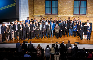
The ESNC set a new participation record this year, with 515 innovations entered by companies from more than 40 different countries around the world. The competition more than matched the successes of past editions in increasing its overall figures to 272 winners awarded and 3,343 ideas received from more than 10,000 participants throughout its 12 years in existence.
“Time synchronization and reliable positioning information are essential to today’s digital economy: Without corresponding satellite-based services, the development of these and other innovations — including the Internet of Things, machine-to-machine communication, and Industry 4.0 — would not be possible,” explained Thorsten Rudolph, CEO of ESNC initiator and organiser Anwendungszentrum GmbH Oberpfaffenhofen. “As the ideas submitted to this year’s ESNC have shown to impressive effect, it is these forward-thinking technologies in particular that present a great deal of potential waiting to be unleashed by high-tech start-ups.”
Under the patronage of the German Federal Ministry of Transport and Digital Infrastructure (BMVI), the ESNC presented prizes valued at approximately EUR 1 million in total at its festive Awards Ceremony.
The competition’s jury of 240 renowned experts selected both the overall victor and 30 other regional and special prize winners. With their innovations in areas such as connected mobility, smart cities, tourism and environmental protection, these entrants demonstrated how fundamental precise satellite navigation signals are to Europe’s digital society.
2015 Winners
Overall Winner
Loles Albiol Simó, Rudesindo Hernando Meliá, Jorge Esteve Ripollés, Manuel Pedreira Giménez, Enrique Martinez Asensi :: OVERALL WINNER – Valencian Community / Spain POSEIDRON: Remotely Piloted Aircraft System for Search and Rescue and Environmental Defence
Special Prize Winners
Rafael Olmedo, Juan Domingo, Laura Concepción :: GSA
KYNEO: The Open Navigation Platform for the GNSS of Things (Read more abut this prize here.)
Su Zhenzhong, Tonio Gsell, Alexander Wolf :: ESA
RTKNAV – A Low-Cost, Compact, User-Friendly, Centimetre-Accurate, Real-Time Navigation Solution
Dariusz Tanajewski, Grzegorz Grunwald :: DLR
Mobile Underwater Positioning System (MUPS)
Jukka Talvi, Joni Jämsä, Kalle Arola, Jukka-Pekka Alanissi, Antti Koponen :: BMVI/BMWi
HALI – Always Green Traffic Signals for Emergency Vehicles
Prof Dr Nick van de Giesen, Dr Eugenio Realini :: University Challenge
GNSS Monitoring of Precipitable Water Vapour over East Africa Using Low-Cost Receivers
Jasper Ettema, Sabine Ettema :: GNSS Living Lab
Position-Based Assistance in Case of Sudden Cardiac Arrest
Regional winners
Suresh Babu Mandalanka :: Asia
GeoKey – A Locking System That Uses Geographic Locations as Keys
Jasper Ettema, Sabine Ettema :: Austria
Position-Based Assistance in Case of Sudden Cardiac Arrest
Dr Walter Naumann :: Baden-Württemberg / Germany
ICARUS – A New Global Tracking Service for Small Objects
Ladislav Bartuška :: Czech Republic
Biological Protection of Airports Using Drones
Ronny Webers, Bart Lenaerts, Vincent Jorissen :: Flanders / Belgium
JobWalkr – The First Mobile App That Informs You About Job Opportunities in Your Neighbourhood
Daniel Neveux D’Agata, Laurent Kerbrat, Maïwenn Penhouët :: France
WIZAR – A new way to discover history and heritage
Alberto Gonzalez, Antonio Vazquez, Bibiano Fdz-Arruti, Aaron Nercellas, Diego Hurtado, Diego Nodar, Fernando Aguado, Franco Pérez :: Galicia / Spain
Point&Pin – Remote Localisation for Emergency Situations
Oscar Serradilla :: Gipuzkoa / Spain
Pothole Avoider
Sibylle Geiger, Jens Liebau, Nezar Mahmoud :: Hesse / Germany
Discover a Great Variety of Local Foods with the frimeo App
Aidan Flanagan, Colm Murphy :: Ireland
112GPS.com – More accurate emergency calls
Ronen Bitan, Tal Lavi :: Israel
Trailze – Complete Outdoors Experience
Dr Saulius Rudys, Mantautas Rudys :: Lithuania
Fully Camouflaged GNSS-GSM Anti-Theft System for Bicycles
Carlos Callejero Andrés, Julio Pantoja Dominguez, Ignacio Gómez Maqueda :: Madrid / Spain
VardiaN – Big Data Platform of Connected PPEs to Prevent Accidents in Hazardous Environments
Prof Dr Nick van de Giesen, Dr Eugenio Realini :: The Netherlands
GNSS Monitoring of Precipitable Water Vapour over East Africa Using Low-Cost Receivers
Thomas Jelle, Ingjard Sandhei, Åsmund Tokheim, Dag Jomar Mersland, Morten Tvenning, Iván Sánches Ortega, Robert Badnall :: Norway
MazeMap – High-quality, interactive, searchable, and linkable indoor maps
Jan Filipowiak, Radoslaw Jastrzebski, Maciej Glowacki :: Poland
Pastguide: Virtual Reality in Real Places
Florin Banica, Andreea Diana Banica :: Romania
Shared Ahead – A Truck-Sharing System
Su Zhenzhong, Tonio Gsell, Alexander Wolf :: Switzerland
RTKNAV – A Low-Cost, Compact, User-Friendly, Centimetre-Accurate, Real-Time Navigation Solution
Zoe Farrington, Andrew Richardson :: United Kingdom
REALRIDER®
Loles Albiol Simó, Rudesindo Hernando Meliá, Jorge Esteve Ripollés, Manuel Pedreira Giménez, Enrique Martinez Asensi :: Valencian Community / Spain
POSEIDRON: Remotely Piloted Aircraft System for Search and Rescue and Environmental Defence
Nicolas de Kerchove, Joel Mendez, Oscar Marí :: Wallonia / Belgium
A New Concept for a Location-based Mobile Game with an Innovative Monetisation Platform
The 2015 edition of the European Satellite Navigation Competition GSA Special Prize was awarded to Rafael Olmedo for the KYNEO project. The project develops inexpensive, flexible Galileo and EGNOS enabled modules that allow ubiquitous positioning data for applications in the Internet of Things. Other winners of the competition are listed here.
Described as an open innovation platform for the GNSS of Things, the basis of the KYNEO concept is a perceived need to be able to fast prototype applications and devices in the rapidly developing field of the Internet of Things. According to Olmedo, a variety of Internet of Things platforms are looking for positioning systems that can be flexible and adapted to a variety of situations and circumstances. To serve this objective, the product works as an open-source software for the creation of interactive electronic objects.
REMINDER: For continued undisturbed use of GPS as Internet use mushrooms, led by the booming Internet of Things, more efficient utilization of spectrum bandwidth on all sides is essential; for this, synchronization is key. Timing experts will share their views during GPS World‘s “Timing, Time Transfer and Synchronization: New Applications and Techniques” webinar sponsored by EndRun Technologies on Thursday, Oct. 29. Registration is free.
“There is a huge development community for digital electronic products out there, and our aim with KYNEO is to provide a great positioning tool for this community,” Olmedo said. “The first KYNEO products are already available to order via our website, but we will also sell via the many open hardware platforms that already serve the developer community.”
“The Internet of Things is a potentially massive global market for European GNSS programs, offering many benefits to the end users,” said GSA Executive Director Carlo des Dorides. “Open source programmes like the KYNEO project will not only prove to be competitive in their own right, but will also open doors to related services and other opportunities.”
The project was selected from a record-breaking 192 entries. Entries came from 29 different countries, with 72 entries coming from individuals and 59 from start-up companies. The award was announced during a special awards ceremony, held on the opening day of the Satellite Masters Conference in Berlin.
About the European Satellite Navigation Competition
Since 2004, the European Satellite Navigation Competition (ESNC) has been rewarding the best services, products, and business cases that utilize satellite navigation in everyday life. Over this time, ESNC has evolved into an international innovation competition — one that recognizes the best ideas in the field of satellite navigation. Entries come from a wide range of companies, research institutes, students and individuals.
“The GSA Special Prize nicely complements the Agency’s focus — getting closer to the end user and helping them benefit from European space technology,” des Dorides said. “Whether through competitions like this, or through such funding programmes and Horizon 2020 and Fundamental Elements, it’s by supporting innovative applications like KYNEO that the GSA will be able to succeed at its mission.”
Each year, the GSA Special Topic Prize awards the most promising European GNSS application idea. The winner of the GSA prize has the opportunity to realise his or her idea at a suitable EU incubation centre for six months, with the option of an additional six months based on evaluation after the first period. The award criteria is based on the uniqueness and originality of the idea, its business (and social) potential, the credibility of the corresponding team, and the application’s use of unique EGNOS/Galileo features.
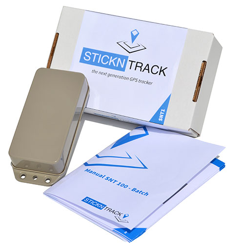
StickNTrack — an award-winning low-power tracker from Sensolus — is now active in eight European countries.
StickNTrack guards and tracks position, journeys, motion and status of any non-powered asset without the hassle of charging batteries, managing SIM cards or an intrusive installation, Sensolus said.
StickNTrack’s web-based service platform is tailored for low-power asset tracking communicating over the French-based Sigfox. Because Sigfox is an ultra low-power communication network, it significantly reduces StickNTrack’s power needs so that it consumes up to 40 times less power and lowers life-cycle costs by 50 percent compared to existing compact GPRS/GPS products, Sensolus said.
The tracker’s power can last up to five years. In the third quarter, an upgraded version will be released with extended battery lifetime up to nine years, according to Kristoff Van Rattinghe, who developed StickNTrack along with Laurence Claeys, Johan Criel and Koen Van Vlaenderen.
Users can access the StickNTrack web portal with any smartphone running Android OS or iOS. The full feature set can be accessed on a tablet or laptop. Features include interactive timelines, intuitive geofencing, email alerting and optimized energy savings.
The ruggedized, waterproof StickNTrack is 120 x 50 x 25 millimeters and weighs 255 grams. It can track assets on the water, such as yachts or buoys, providing automated logbooks, alerting users when assets enter or exit specific zones (such as harbors), and providing real-time journey information for those at home.
StickNTrack’s developers took third place in the 2014 European Satellite Navigation Competition, after taking first in the Flanders regional competition. It also won the European Space Agency’s Innovation Award.
Dubbed a “distruptive innovation” by the European Satellite Navigation Competition (ESNC), StickNTrack “opens up an abundance of new business opportunities in tracking trailers, containers, machinery, tools, bikes and more. Future accuracy and availability improvements based on GNSS will trigger additional advancements, such as by automating supply chains for packages and their delivery. Ultimately, stickNtrack is a next-generation location tracker that significantly lowers the barriers to embedding even more GNSS technology into our daily lives.”
“Every day new types of non-powered assets are being connected to our service platform,” Van Rattinghe said. In the coming years, Sigfox aims to provide global coverage.
Winners in the 30 categories will be announced in October.
The 2015 European Satellite Navigation Competition (ESNC), an international innovation competition that recognizes the best ideas in satellite navigation, will run from April 1 to June 30. Winners will be announced in October.
There are more than 20 regions participating, and the ESNC will award prizes worth a total of €1 million in 30 categories.
“Satellite navigation is an essential element of modern mobility and a key technology in particular, in the age of a data-driven economy. This is exactly where the European Satellite Navigation Competition comes in. It provides a public platform to the creative community in order to help promising ideas turn into solutions that are commercially mature and generate added value for society,” said Alexander Dobrindt, Germany’s Federal Minister of Transport and Digital Infrastructure (BMVI).
A jury of international research and industry experts will select the year’s overall champion among the winners of the categories, which comes with an additional €20,000 and access to a six-month incubation program in the champion’s preferred region.
International kick-off for the 2015 ESNC is scheduled for April 21 in London.
“As the Galileo satellite constellation continues to expand, efforts to promote corresponding applications will become increasingly important. This is where the ESNC is already playing a key role,” said Matthias Petschke, the European Commission’s director of satellite navigation programs. “As such, the Commission is definitely looking forward to seeing the creative and innovative GNSS-based applications submitted this year.”
This year’s special topic prizes are being sponsored by the European GNSS Agency (GSA), the European Space Agency (ESA), the German Aerospace Center (DLR) and the Ministry of Transport and Digital Infrastructure (BMVI) in cooperation with the German Federal Ministry for Economic Affairs and Energy (BMWi). Entrants may submit prototypes to the GNSS Living Lab Challenge, while the University Challenge specifically addresses students and research assistants.
“Those who enter the ESNC benefit in particular from our global network, which provides them with tailored support in developing their business concepts and bringing them to market,” said Thorsten Rudolph, managing director of Anwendungszentrum GmbH Oberpfaffenhofen.
All of the information on this year’s prizes, partners, and terms of participation is available at the ESNC website.
 Septentrio, a designer and manufacturer of GNSS solutions, has awarded the Katholieke Universiteit Leuven (KU Leuven) Ecochallenge team — the winners of the Galileo Masters (Flanders Challenge) of the European Satellite Navigation Competition (ESNC) — with an AsteRx-m UAS receiver for its proposal to use high-precision high-reliability Galileo receivers to modernize inland waterway transport by introducing autonomous technology for the vessels.