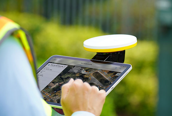
Trimble has introduced the Trimble Catalyst handle, which adds a new level of flexibility to accessing GNSS data. The lightweight, ergonomic handle provides a convenient way to carry Trimble’s Catalyst-enabled mapping and field data-collection workflows.
Users can:
choose their device, whether iOS or Android, which turns any smartphone or tablet into a Trimble-quality handheld positioning system
swap out a device at any time, whenever an upgrade is needed
adjust accuracy level as requirements change by switching the accuracy-based Catalyst subscription
affix a monopole when decimeter-level or better positions are crucial.
The Trimble TSC5 Controller boasts a 5-inch screen, keypad keypad and all-day battery. (Photo: Trimble)
Trimble has released the TSC5 Controller, a rugged, lightweight field data controller for land construction and surveying.
According to Trimble, the TSC5 Controller, built for practical, everyday tasks, combines high performance and dependability so professionals can complete tasks efficiently and accurately.
“Surveyors expect to encounter challenging environments and must rely on their equipment to perform as expected in harsh conditions,” said Ron Bisio, senior vice president, Trimble Geospatial. “The TSC5 controller is a high-value, reliable solution that land surveyors can leverage for field data collection tasks performed all day, every day.”
The controller has a 5-inch screen, keypad keypad and all-day battery for reliable field data collection. It also is resistant to shock, dust and water, and features an anti-glare screen and backlit alphanumeric keypad.
The Trimble TSC5 Controller uses an Android 10 operating system and is fully integrated with Trimble’s land and construction surveying instruments and software packages, including Trimble Access 2021 Field Software, Trimble Siteworks Software. It’s also compatible with the Trimble EMPOWER Module system, which includes the ability to add the EM100 (GNSS), EM11X family (RFID/Barcode) and EM120 (long-range radio) modules.
“Civil construction surveyors trust Trimble to provide rugged, reliable hardware that connects them to the Trimble Connected Construction ecosystem,” said Scott Crozier, vice president, Trimble Civil Construction. “The TSC5 is a great addition to our family of connected controllers, giving contractors the ability to choose the solution that best fits their needs and budget.”
The Trimble TSC5 Controller running the Trimble Access field software is now available through Trimble’s geospatial distribution partners.
The Trimble TSC5 Controller with the Siteworks SE Starter Edition. (Photo: Trimble)
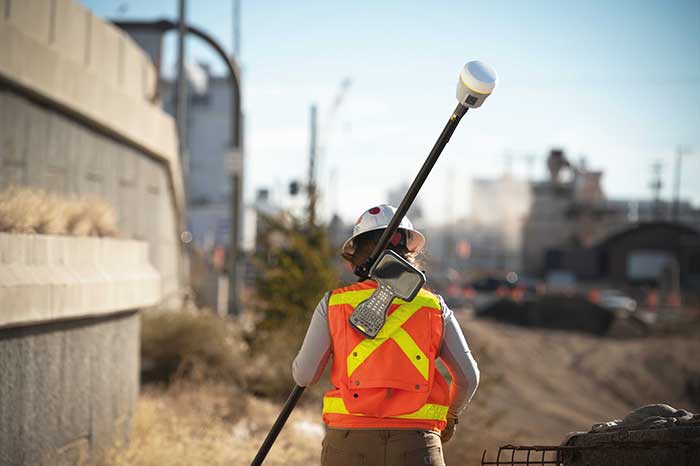
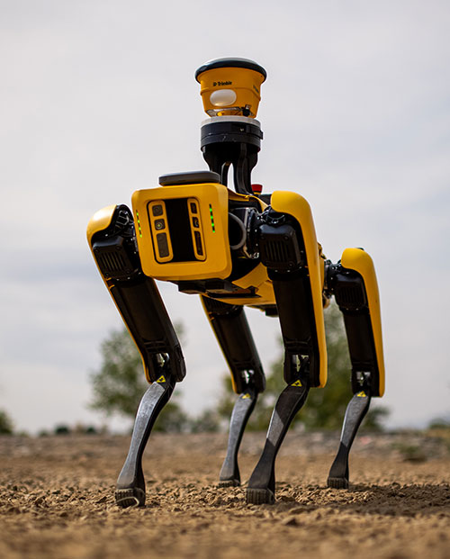
Spot, the robotic dog from Boston Dynamics, is equipped with the Trimble SPS986 smart antenna to collect data. (Photo: Trimble)
Trimble and Boston Dynamics plan to integrate a variety of data-collection technologies with the Spot (robot dog) platform for construction and other site applications.
The jointly developed solution will combine the Spot robot’s autonomous mobility with Trimble’s data-collection sensors and field control software to enable automation of repetitive tasks such as site scans, surveying and progress monitoring, while taking advantage of the robot’s unique capabilities to navigate dynamic and potentially unsafe environments.
The relationship gives Trimble exclusive rights sell and support the Spot robot with integrated scanning, total station and GNSS technologies for the construction market.
The turnkey solution will streamline operation of the robot and provide quality control for missions, enabling construction project managers to easily get a clear picture of jobsite progress on an ongoing basis. Trimble technologies integrated with the robot will enable accurate, scalable and rapid data acquisition, while Trimble’s construction collaboration platforms provide a continuous flow of information between field and office.
Mortenson, a Minneapolis builder, developer and engineering services provider, is one of the first customers to leverage the new technology combination. To eliminate jobsite waste and increase efficiency, the Mortenson team has been piloting Spot robots with the Trimble SPS986 GNSS solutions to autonomously navigate challenging exterior construction environments such as solar farms, continuously documenting site conditions.
An automated and repeatable approach to field-data capture can provide Mortenson with real-time awareness of project status, helping to accelerate project delivery. Through Trimble’s Early Experience Program, contractors such as Mortenson have advanced access to this technology for the purposes of evaluating its suitability in actual construction projects.
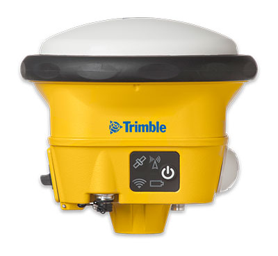
The Trimble SPS986 smart antenna. (Trimble: photo)
“Robots will play a crucial role in automated construction workflows and can augment the human workforce by handling dirty, dull and dangerous tasks,” said Martin Holmgren, general manager, Building Field Solutions at Trimble. “Our experience with early adopters like Mortenson gave us visibility into the transformative potential of an integrated solution that seamlessly marries a world-class robot with construction-specific sensors and workflows. We’re excited about this alliance and the potential to bring unprecedented improvements in safety, quality and productivity to our construction customers.”
“We believe the combination of Trimble’s experience and industry leadership in construction technologies and Boston Dynamics’ Spot can transform the way the industry operates,” said Michael Perry, vice president of business development at Boston Dynamics. “The integrated solution will enable any jobsite leader to deploy Spot and Trimble technologies to get an accurate view of construction progress through real-time data collection. With a more comprehensive view of site activity, project managers can take proactive measures to ensure on-time, on-budget and safer project delivery.”
The integrated solution is expected to be available by the second quarter of 2021 through Boston Dynamics, Trimble and select BuildingPoint and SITECH distribution partners in the U.S., Canada, the United Kingdom, the European Union, Australia, New Zealand and Japan.
Through Trimble’s Early Experience Program, select customers will have the opportunity to preview development of the solution in advance of general availability.
The new digital clinometer and attitude attribute type available in Touch GIS. (Image: Touch GIS)
Touch GIS has introduced a digital clinometer tool to assist field geologists in recording strike and dip readings.
Version 1.3 of the app also features a new “attitude” attribute type, which makes it easy to record and display these readings on the map.
“We’ve been testing these new features with a number of field geologists, and we’re excited to finally be launching it broadly,” said Joe Wilson, head of products at Touch GIS. “While Touch GIS is valuable for a wide variety of field data collection, we’ve found that it’s especially popular with geologists.”
As more and more field work is being done on mobile devices, it’s important to integrate them onto a single platform for collecting and sharing field data. Touch GIS has a mission to provide the most robust data collection featureset for mobile field mapping.
Touch GIS also features powerful file support for industry-standard types, offline mapping capabilities, and accurate drawing tools for points, lines and polygons.
Touch GIS has a free tier that allows users to explore a majority of its features. Premium subscribers can cache maps for offline use and export collected data.
New product enables collection, correction and confirmation of spatial data in the field
The new Location Mobile App Platform (LMAP) by 1Spatial enables easy and flexible spatial data collection in the field. Leveraging existing expertise in data management and data quality into a mobile app platform delivers an easy to use user interface, flexibility in integration and in-built validation based upon business rules.
LMAP can be configured to provide a solution to any number of spatial data challenges facing businesses and has been made available to offer complete integration and configuration flexibility to customers. Utilities, for instance, have geographically dispersed assets and the need for quality-driven spatial data editing via a field-based workforce.
LMAP helps guide users to capture the right data at the right time and, crucially, make sure that the data is right first time.
“We have a host of great customers and always strive to create solutions that make all parts of data collection easier,” said Sarah Gadd, product manager at 1Spatial. “We know that our clients love the reliability and power of our patented rules engine and want to bring that to the field. Simple and powerful apps tailored to our customers’ needs is our next big step in delivering spatial data quality to every stage of the data journey.”
For more information and for a demo of LMAP, join 1Spatial for a free webinar on March 10 at 2 p.m. GMT. Register here.
The New Handheld Is Designed for Data Collection for Land Surveying and Geospatial Information Systems (GIS)
Photo: Geneq
Geneq Inc. has added a new data collector to its SXPad product line. The rugged SXPad 1500 data collector features a full alphanumeric QWERTY keypad and long-range Bluetooth, and was designed to meet the rigorous IP67 standard to deal with challenging field conditions.
The SXPad 1500 and its 5-inch sunlight-readable touchscreen can be connected to any GNSS receiver or compatible robotic total station to ensure the success of all survey projects.
Driven by a 1-GHz processor and the Windows Mobile 6.5 operating system, the field collector is a high-performance device designed to provide the power needed to work with maps and large data sets in the field, as well as many software solutions.
With its integrated cellular modem and Wi-Fi standard, the SXPad 1500 offers wireless connectivity for internet access and GIS data transfer. This feature will be helpful for setting parameters and configuring the SXblue PREMIER and F90 or any real-time kinematic (RTK)-compatible GNSS receiver.
The SXPad 1500 has a GNSS internal module that delivers adequate performance for certain GIS field data collections.
Equipped with an internal memory of 1 GB (memory can be expanded to 16 GB with an SD card), the SXPad 1500 provides enough storage space for data recording. Users will benefit from its high-performance lithium battery allowing uninterrupted field operation for up to 8 hours.
New app gives field crews a fast, easy way to record information while mobile
Esri has released ArcGIS QuickCapture, a mobile app designed for rapid and at-speed field data-collection workflows.
Data can be collected from a moving vehicle with the touch of a button and sent back to the office for real-time analysis, leading to faster and more effective decision-making. The new app is designed for road inspections, aerial surveys, monitoring vegetation encroachment and more.
ArcGIS QuickCapture allows users to configure a customized interface that suits their specific project requirements, eliminating unnecessary features and options. This personalization helps users take advantage of the single-tap, big-button system to capture details and photos as they go. The app is intuitive and user-friendly, eliminating the need for extensive crew training.
The new app integrates with the user’s existing IT infrastructure and ArcGIS platform, which simplifies implementation. It uses the existing GPS and camera on smartphones and tablets, and it is compatible with iOS, Android and Windows devices.
For high-accuracy data collection workflows, QuickCapture is also compatible with external GNSS receivers.
“ArcGIS QuickCapture builds upon and enhances our existing field data collection offerings in ArcGIS,” said Ismael Chivite, senior product manager at Esri. “Field crews are demanding user experiences that are tailored to the way they work. QuickCapture is designed to capture GIS data with the tap of a button, while on the go. At-speed road asset inventories and quick damage assessments are examples of workflows where QuickCapture excels.”
MicroSurvey Software, part of Hexagon, has released its new field data-collection software platform for Android users.
FieldGenius for Android, version 1.0, is first release of the company’s new multi-platform field software built on the Android platform. It supports most popular GNSS sensors on the market today.
FieldGenius is third-party, brand-neutral data-collection software used by many surveyors. The new release builds on decades of innovation MicroSurvey has invested into the original FieldGenius software, providing users with an easy-to-use and intuitive mobile data-collection software package for the next generation.
New features include dynamic data panels synchronized with the map views. A fresh user interface provides familiarity for existing FieldGenius users while offering new tools, simplified workflows and readily available data that surveyors require at the point of work to make informed decisions in the field.
“Surveyors, dealers, and distributors from every corner of the world have been demanding an Android based version of MicroSurvey FieldGenius for years,” said Marc Veinotte, global sales and OEM manager at MicroSurvey. “This is the first release of our new multi-platform field data collection software that will provide a consistent user experience across a wide cross section of data collection devices. MicroSurvey continues its hardware neutrality strategy offering support for almost every brand of popular and upcoming GNSS receiver on the market today.”
Early adopters of FieldGenius for Android will receive additional benefits and participate in the newly created MicroSurvey Technology Innovation Group (MTIG).
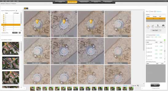
Datumate’s DatuSurvey 5.5 software offers 2D vectorized measurements and 3D point clouds models. (Screenshot: Datumate)
Datumate, a photogrammetry solution and 3D mapping software developer, has released its updated DatuSurvey 5.5 software, which offers 2D vectorized measurements and 3D point cloud models.
According to the company, with the updated software, users can now process thousands of images locally in an accelerated mode while maintaining survey-grade accuracy and professional engineering results. Organizations can also deploy Datumate’s solutions on single or multiple computers and take advantage of the accelerated and user-friendly processing of the project field data.
In addition, DatuSurvey 5.5 can process large amounts of drone imaging data locally and quickly. The software can also achieve survey-grade accuracy and geo-reference the model quickly and easily, the company added. Finally, it can plan and execute consecutive drone missions on unmapped and frequently changing areas.
According to Datumate, its team improved the geo-referencing workflow of the software when using ground control points. Users can now quickly and easily mark ground control points using zoomed-in image projections.
The company also added the ability to import coordinates to DatuFly Professional in addition to on-site or on-map mission planning. This will enable an efficient and accurate drone mission execution on specific and designated areas without depending on satellite and map source views, Datumate said.
Boundless Anywhere is a new mobile application for enterprises needing to collect and distribute location information from handheld devices and tablets, available for iOS or Android.
With Boundless Anywhere, organizations can collect data in the field and store it instantly in a database. Collected data can then be visualized on clients such as desktop GIS, web and mobile. With real-time access to location-based data, the entire organization can now accomplish work faster and more efficiently.
“Mobility is at the heart of today’s technology, and the rapid proliferation of smartphones and tablets in recent years has had a profound impact on the GIS industry,” said Anthony Calamito, chief geospatial officer at Boundless. “The ability to access all kinds of data — including location data — from the palm of our hands at any given time or place has become essential. With this extended offering, Boundless offers mobile capabilities that empower users to do more while on the move.”
With Boundless Anywhere, users of the Boundless enterprise GIS platform can collect geospatial data wherever they are and use maps to engage a community, validate data, make observations, report, respond and communicate in real-time. The new solution simplifies field collection workflows and improves the accuracy of geospatial data, saving time and money.
Users are able to capture new data and edit or delete existing data with or without an internet connection, and can sync instantly once they are back online. Updates and edits are instantly available on Boundless Exchange, where the entire team can analyze and share findings with the rest of the organization.
Key advantages:
Collaborate in real-time to make faster decisions. View mobile edits instantly on the web, making it easy to pull data into your GIS for mapping, analysis, and reporting.
Ground-truth data to improve accuracy. Take expensive transcription errors out of the equation. Mobile workflows modernize field collection away from clipboards and cameras, ensuring data collected on-location is current and accurate.
Empower responders to collect, even when offline. A good network connection is never guaranteed in the field – the Boundless Anywhere solution lets you edit GIS data in even the most remote areas and sync it when you’re back online.
GIS apps don’t have to be cumbersome. Collect GIS data and photos in a straightforward interface that’s easy to use and can turn your entire team into data collectors.
Boundless solutions are built on open GIS technology and APIs that generate actionable location intelligence across third-party apps, content services and plugins for enterprise applications.
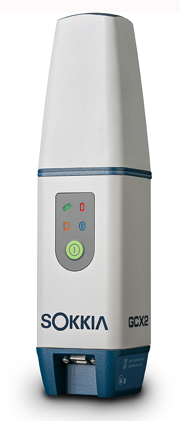
TerraGo Magic now offers advanced integration and support for the Sokkia line of GNSS receivers, including the new GCX3.
TerraGo Magic is a zero-code platform-as-a-service that enables customers to build their own custom mobile apps without writing any code by choosing from a menu of available, field-tested features.
Featuring advanced constellation tracking and longer range base to rover communication, the GCX3 offers lightweight, compact and ergonomic benefits — along with centimeter-accurate positioning — now with expanded satellite tracking capabilities.
“The GCX3 features the new second generation POST2 integrated antenna – adding BeiDou, Galileo, SBAS, QZSS, and GAGAN satellite tracking in addition to GPS and GLONASS to provide users with the best positioning availability,” said Jason Tuck, branch manager at Topcon Solutions. “With TerraGo Magic, users can build their fully customized apps, tailored for their specific industry requirements and capture high-precision data in real-time from the receiver.”
“TerraGo Magic custom apps combined with the Sokkia GCX3 receiver is a superior solution for our partners and customers in utility, energy and other industries that require high-accuracy data collection,” said John Timar, vice president of worldwide sales at TerraGo. “Our integration makes it possible to capture the full fidelity and GPS data record with a user experience and modern mobile features unmatched by legacy GPS data collectors.”
WaterOne found itself stuck in the past. The independent public utility knew that its workflow for collecting geospatial data was broken.
WaterOne serves a 272-square-mile area on the Kansas side of the Kansas City, Missouri, metropolitan area, which has a population of 420,000, 145,000 metered accounts and 2,685 miles of water pipes. The survey/geospatial staff consisted of three analysts, two editors, one programmer and one GPS collector. By 2016, less than 40 percent of the water features had been captured with GPS.
The staff was using legacy GNSS handhelds — operators had to return to the office every night and physically download their data.
Besides being time-consuming, the operators would become frustrated by the antiquated system. Sometimes the handhelds wouldn’t sync to the computer, or files for download would be hard to find. Also, the GNSS handhelds had a tiny screen, making it difficult for operators to see background data in the field. The handhelds’ limited computing power meant the entire water system couldn’t be loaded onto it.
WaterOne turned to a new workflow using Panasonic ToughPad tablet computers and Eos Positioning Systems’ Arrow 200 RTK GNSS receivers mounted on a range pole (see photo).
The Arrow 200 receiver connects to the Panasonic ToughPad via wireless Bluetooth link. The ToughPad has a Verizon SIM card for internet connectivity, used for two purposes:
Connecting to the Missouri Department of Transportation RTK network to receive RTK corrections for centimeter accuracy;
Connecting to the WaterOne ArcGIS server in real time from the field.
Whenever the field tech collects data, the data syncs up with ArcGIS server. This eliminates the task of having to physically download the data at the end of the day.
The new workflow also provides near real-time updates to WaterOne’s geospatial information system. This means that if five techs are in the field collecting data, they can each see the map updated in near real time.
The ToughPad tablets have a large, sunlight-readable 10-inch display. The large displays combined with the new data-collection software allows the field techs to view the entire GIS water system on the tablets. The field tech can now “see” all of the water system assets — pipes, valves, fittings, hydrants — around them. This significantly improves productivity over the legacy GNSS handhelds.
Street maps and aerial photos were loaded on the ToughPad to give the field techs a choice of background data to view.
The result? Compared to the 1,767 GPS points collected in 2016, the WaterOne team has collected 5,770 just in the first four months of 2017.