Figure 1. GLONASS high inclined space complex. (Image: Institute of Navigation Technology JSC)
The digital transformation of the global economy requires precise time synchronization and valid object position information. Global navigation satellite systems (GNSS) are the most accurate tool for such tasks.
This year will be 40th anniversary of the launch of the first GLONASS satellite, and we see that the quality of navigation services is driven by the characteristics of today’s satellite navigation signals.
The first fourth-generation Glonass-K2 #13L satellite is scheduled for launch in 2022. It will broadcast a full ensemble of navigation signals — both Frequency Division Multiple Access (FDMA) signals in the L1 and L2 bands and Code Division Multiple Access (CDMA) signals in the L1, L2 and L3 bands. This long-awaited launch will cap a 10-year effort and begin to provide a new platform by broadcasting all the CDMA signals through a single antenna array on the satellite’s geometric axis.
The FDMA antenna array is displaced by 0.9 m from this axis, but this arrangement is done on only two satellites. The next Glonass-K2 satellites, which will be launched beginning in 2024, will have a single antenna array for all navigation signals.
The final second-generation Glonass-M satellite, scheduled to be placed in orbit next year, will provide services by open FDMA signals in the traditional bands at 1.6 GHz and 1.25 GHz. This satellite will be the seventh Glonass-M vehicle able to broadcast GLONASS L3 CDMA signals. There are only two Glonass-K satellites broadcasting this signal now, but more satellites with such a signal will be activated by the end of testing of the GLONASS modernized ground control facility.
We expect the number of satellites able to provide this service to increase by two per year as we replace Glonass-M satellites with Glonass-K and Glonass-K2 satellites.
As of this writing, 15 satellites (62% of the constellation) are working past their guaranteed life times, limiting our ability to increase the system’s accuracy. For the last decade, the signal-in-space range error (SISRE) was 1.4 m, despite the fact that newly launched satellites provide a SISRE of about 0.8 m.
Glonass-K satellites will be launched to maintain the orbit constellation within the next three years, and the accuracy of their signals will be the same or even better. These satellites have a single antenna array for all three bands and could broadcast either FDMA or CDMA signals.
In 2022, the constellation orbits will increase to six satellites in three planes, as we aim to increase the navigation service accuracy and availability (FIGURE 1). See TABLE 1 for satellite orbit parameters. This constellation will make it possible to increase navigation accuracy in the Eastern Hemisphere by about 25% through decreasing the value of the geometric factor.
Additionally, this will greatly improve the availability of the GLONASS navigation service in difficult conditions, such as locations where current users can only receive navigation signals from satellites at least 25° above the horizon. New constellation satellites will be based on the Glonass-K platform, which has passed in-orbit qualification and proved it can provide SISRE at 0.3 m. The preliminary design proved that satellites on this platform could provide an in-orbit SISRE below 0.4 m with standard cesium on-board clocks. This signal-in-space accuracy level with valid ionospheric and tropospheric model data from the navigation signal will allow users to receive a position determination error below 2 m in the plane. Navigation services from these satellites will be provided by the CDMA signal in three frequency bands.
The new satellite will weigh about 1,000 kg and be launched into orbit from both Russian spaceports (northern Plesetsk and eastern Vostochny) by the highly reliable Soyuz-2 rocket. The first launch is scheduled for 2026.
One of GLONASS’ important tasks is to transmit the UTC (SU) national time scale to consumers. Over the past few years, significant results have been achieved in this area.
A complex of high-precision measuring instruments to compare the national coordinate timescale UTC (SU) with the GLONASS timescale was put into operation. These instruments include a transported quantum clock that provides timescale storage with an uncertainty of no more than 1 ns at an observation interval of one day, and with a transportation time of no more than 12 hours. It also provides duplex comparisons of timescales, comparing objects with the permissible uncertainty of ±1.5 ns.
Timescale storage complexes of secondary and working standards of time and frequency VET1-5 (Irkutsk), VET 1–19 (Novosibirsk), VET 1–7 (Khabarovsk) and RET1-1 (Petropavlovsk-Kamchatsky) were modernized and put into operation, providing an overall uncertainty of 3 · 10-15 and with a maximum permissible shift of the timescale of the complex relative to the national timescale UTC (SU) of ± 10 ns.
An optical ground-based frequency reference on cold strontium atoms was developed with an uncertainty of reproduction of the frequency unit and time of no more than 1 · 10-17 .
A keeper of time and frequency units was developed on the basis of a “fountain” of rubidium atoms having a frequency instability of no more than 2 · 10-16 for equipping the standards of time and frequency units and subsequent transmission of more accurate time-frequency information to precision ground and onboard equipment and GLONASS systems.
A developmental prototype of the national timescale storage complex of the Russian Federation was developed on the basis of a new generation of hydrogen keepers.
The application of the newly developed technical equipment made it possible to significantly reduce the maximum displacement of the national timescale relative to the International Coordinated Time Scale (UTC), which in 2020 was less than ± 3 ns (FIGURE 2). The UTC (SU) timescale ranks among the best national implementations of UTC, according to the International Bureau of Weights and Measures (BIMP).
Figure 2. Displacement of national timescales relative to Universal Coordinated Time (UTC). (Image: VNIIFTRI FSUE)
Many important events are coming for GLONASS users in 2022. They will improve the user characteristics and lay the foundation for further development of the system.
Sergey Karutin is general designer of the Russian GNSS program GLONASS.
Nicolay Testoedov is CEO of JSC Information Satellite Systems Reshetnev (ISS JSC), a Russian satellite manufacturing company.
Sergey Donchenko is general director of the Federal State Unitary Enterprise, Russian metrological institute of technical physics and radio engineering, VNIIFTRI FSUE.
By Yury Urlichich, first deputy director general of Roscosmos State Space Corporation Sergey Karutin, designer general of GLONASS Nikolay Testoedov, director general, Information Satellite Systems JSC
Sergey Koblov, director general, Central Research Institute of Machine Building JSC
The year 2020 heralds the end of another 10-year stage of development of the Russian GLObal NAvigation Satellite System (GLONASS). Reconstruction of our orbital constellation, started in 2006, is bearing its fruit. Today, it is hard to imagine one’s daily life without the continuous artificial radio-navigation field provided to users globally by the GLONASS orbital constellation since 2011.
GLONASS signals are employed to perform a wide range of tasks, such as
Saving lives in road accidents
Air, ground and naval traffic monitoring and control
Network synchronization of mobile cellular communications
Monitoring and enabling the energy grid, road travel, agricultural equipment operation, and more.
Our orbital constellation is built upon a base of second-generation spacecraft (SC) — Glonass-M SC — that was developed in 2003 and has demonstrated outstanding operational capacity: 14 SC are already operating well beyond their expected lifetimes, and four SC celebrate their 13th birthday in orbit this year. Activities focused on improving GLONASS accuracy have not stopped for a single day.
If we go back to 2014, the SC-based ranging offset (which specialists refer as equivalent ranging deviation) was 1.4 m. We managed to achieve 0.9 m offset on Jan. 30, 2020, and during the same week the offset did not exceed 1.15 m. Furthermore, the penultimate series-produced Glonass-M SC (Cosmos-2545), which was launched on March 30, demonstrated basic service ranging accuracy of 0.38 m on a daily interval and 0.63 m accuracy on the “best week” interval.
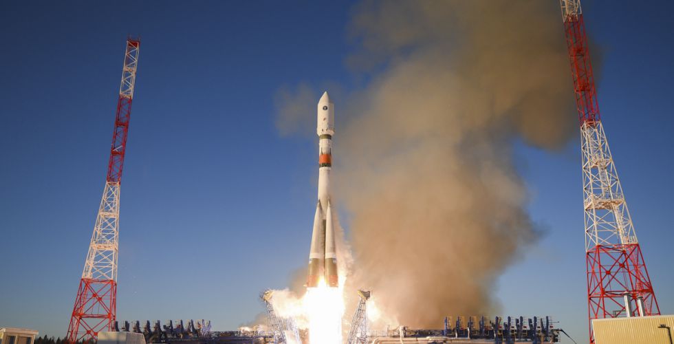
Glonass-K No. 15 was launched into orbit on Oct. 25. (Photo: Roscosmos)
It was Glonass-M SC development that enabled users around the world to gain access to the first dual-frequency navigation service, which is necessary for decreasing the effects of the ionosphere on navigation accuracy.
The third generation of GLONASS SC — Glonass-K — was successfully launched from the Plesetsk launch site on Oct. 25. This SC will provide users with a broader range of capabilities — and a more accurate and informative signal in the L3 frequency band. Further gradual rejuvenation of the GLONASS constellation will ensure the ever-improving quality of our navigation services.
Two Glonass-K2 SC are planned for the launch campaign in 2021, and all the experience accumulated during the development of third-generation GLONASS SC (Glonass-K) will be implemented in the fourth-generation SС. Glonass -K2 is a unique SC: It will provide users with five navigation signals, its accuracy will be within 0.3–0.5 m, and its assured expected lifetime will be at least 10 years.
High-Orbit Space Complex
GLONASS developers remain focused on user requirements. Recent surveys show a growing demand for high-quality navigation services in difficult conditions where the SC is visible at more than 25° above the horizon. To satisfy these needs with the implementation of new CDMA signals, development of the GLONASS High-Orbit Space Complex (HOSC) will begin in 2021. Its first SC will be launched in 2025, and complete deployment of the constellation including six SC in three or six planes will be finished by the end of 2027.
As a result, the accuracy and availability of navigation in difficult conditions will improve in the Eastern Hemisphere. But the major anticipated outcome of the HOSC implementation is assured two-fold coverage of the Northeastern segment of the globe with high-accuracy differential navigation data by GLONASS and other GNSS.
HOSC implementation will ensure 25% navigation accuracy improvement over the Eastern hemisphere. Glonass-K SC will be used as a base platform for HASC deployment due to its excellent record.
Ground Control at the Titov Main Test Space Center established a stable telemetry connection with the new satellite shortly after launch. (Photo: Roscosmos)
User Interface Harmony
One of the most important tasks for the year 2020 is harmonization of the GLONASS user interface. As we already mentioned, the signal propagation environment has a strong effect on navigation accuracy; therefore, new issues of GLONASS Interface Control Documents (ICD) are being prepared for publication.
We anticipate that GLONASS end-user accuracy improvement will be achieved through introducing additional information into reserve bits of navigation frames, including relevant parameters of an ionospheric model.
The ICD will contain operating methods with parameters of the ionospheric model and definite recommendations designed for compensation of ionospheric delays by both single-frequency and dual-frequency receivers, as well as generalized methods for compensating for tropospheric delays.
Changes in the ICD concerning FDMA and CDMA signals will ensure backward compatibility and uninterrupted operation for the existing range of user navigation equipment.
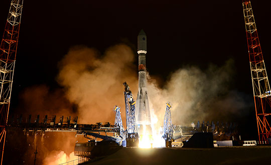
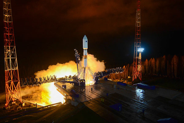
Russia launched a new-generation Glonass-K satellite, number 15, into orbit Oct. 25. Unlike its Glonass-M predecessors, Glonass-K satellites carry two types of navigation signals — frequency-separated and code-separated. The satellites emit additional code-division L2 navigation signals.
In addition to their main functions, Glonass-K satellites will transmit information from the Cospas-Sarsat international search-and-rescue system. Additional Glonass-K satellites are in production at ISS Reshetnev, all with a domestic electronic component base.
Russia’s Aerospace Forces (VKS) Space Forces launched the satellite aboard a Soyuz-2 rocket from the Plesetsk cosmodrome in the Arkhangelsk region. The launch of the carrier rocket and the maneuvering of the spacecraft into the orbit took place under normal operating conditions, according to Roscosmos.
Two minutes after the launch, the ground-based automated control complex of the Titov Main Testing Space Center acquired the Soyuz-2. On schedule, the Glonass-K satellite was injected into the target orbit by the Fregat upper stage and taken over by the ground-based facilities of the VKS Space Forces.
Photo: Roscosmos
A stable telemetric connection has been established and maintained with spacecraft. The onboard systems of the Glonass-K spacecraft are operating normally.
GLONASS consists of 28 spacecraft, with 24 active, two in reserve, and one Glonass-K undergoing flight tests. Another spacecraft is temporarily out for maintenance.
Glonass-M satellites form the basis of the system’s orbital grouping. Replacing the orbital constellation with Glonass-K spacecraft will ensure the stable operation of the Russian navigation system and increase the accuracy of its navigation determinations up to tens of centimeters.
According to Roscosmos, Glonass-K spacecraft are constructed in an unpressurized design, have a guaranteed period of active existence in orbit increased to 10 years, reduced energy consumption, and significantly lower weight.
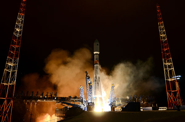
Russia has launched another GLONASS-M satellite, according to Roscosmos, the Russian State Space Corporation.
A Soyuz-2.1b launch vehicle successfully carried the satellite to its planned orbit from the Plesetsk cosmodrome. The launch took place on schedule on March 16.
Ground-based facilities of the G.S. Titov Space Forces VKS immediately took control of the satellite. A stable telemetry connection has been established and maintained with the satellite. The onboard systems of the spacecraft are operating normally.
The launch used a Fregat booster block produced by NPO Lavochkin, part of the Roscosmos State Corporation. The satellite was manufactured by ISS, also part of Roscosmos State Corporation.
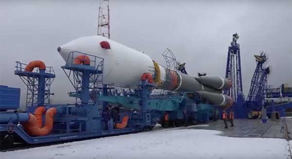
The Soyuz-2.1b launch vehicle with encapsulated GLONASS-M satellite is transported to the launchpad. (Screenshot: Russian Ministry of Defense video)
For the GLONASS constellation, a full complement of 24 satellites are set healthy. In addition, four satellites previously in the constellation are classified as spares, in maintenance or in test.
The just-launched satellite is expected to replace a currently operational GLONASS-M satellite, specifically GLONASS 735 in orbital slot 24). Of the 24 healthy satellites, one is a K1; the rest are Ms. The satellite in test is also a K1 (the first K1 to be launched).
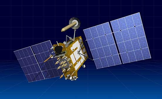
Artist’s rendering of a Glonass-K satellite. (Image: ISS-Reshetnev)
ISS-Reshetnev Company — the primary GLONASS contractor — has a backlog of orders for navigation satellites up to 2025, according to General Director Nikolay Testoyedov.
Testoyedov discussed GLONASS production on Dec. 30, 2019, at a meeting hosted by ISS-Reshetnev Company for Russia’s Science and Technical Council.
“Within the Federal Target Program, GLONASS ISS-Reshetnev Company is tasked with the production of 27 navigation satellites,” Testoyedov said. “Taking all things together, we plan to double the number of satellites launched in 2020 compared to 2019.”
The orders require production at full capacity at the company’s facilities. At any given time, about 50 satellites are in varying stages of production, including 12 ground spares. Some of them are slated for launch in 2020.
In 2019 eight satellites designed and built by the company were launched into various orbits. As of today, 104 ISS-Reshetnev-made satellites are in space, or two-thirds of Russia’s entire orbital fleet of satellites. ISS-Reshetnev also successfully completed several projects for the manufacture of satellite onboard systems and instruments, including the international ExoMars-2020 program slated to launch this year.
A joint team of experts representing ISS-Reshetnev Company and the operating organization successfully completed all procedures moving the Glonass-M satellite to its proper orbital position, and switched on its main instruments. To this date, all the required data has been received from the satellite, which allowed it to be commissioned into service.
The new Glonass-M replaced a retired satellite of the GLONASS constellation that had surpassed its designed life expectancy by seven years.
Yury Urlichich, First Deputy Director General, Roscosmos. (Photo: Roscosmos)
By Yury Urlichich, First Deputy Director General of ROSCOMOS State Space Corporation Sergey Karutin, Designer General of GLONASS Nikolay Testoedov, Director General, Information Satellite Systems
Roscosmos keeps concentrating on user needs as it did in previous years. Growing digitalization is driving a high demand for high-accuracy navigation services. Space information technologies support user needs by modern digital services, including increasing accuracy of position and velocity determination. Because of this, it is of vital importance for us to ensure that GLONASS provides continuous services and stable performance.
Figure 1. Mature Glonass-M satellites show improved cesium frequency standards performance in terms of daily stability. (Image: Roscosmos)
Performance Standard & ICD
This year, we finished drafting the GLONASS Open Service Performance Standard (GLONASS OS PS; the Russian language version is available). In 2020, the new version of the GLONASS Interface Control Document (ICD) also will be publicly available.
GLONASS OS PS serves as a high-level mainframe document specifying the values of the achieved GLONASS performance characteristics plus the significant guaranteed margin. These, coupled with the signal reception environment and a priori estimation of user equipment performance characteristics, can further be translated into the performance that an end user can expect to achieve in his specific PVT solution.
This GLONASS OS PS is a basis for certification of GLONASS services and development of lower level standards for user receiver and GLONASS-based service, as well as for development of international standards like those of the International Civil Aviation Organization (ICAO), the International Maritime Organization (IMO) and others.
Use of the unified set of performance parameters and calculation methods for all GNSS — GLONASS, GPS, Galileo and BDS — is a conventional practice. The similar standards for GPS, Galileo and BDS have been published and are regularly updated.
In fact, this GLONASS OS PS is the second one after the ICD baseline interface between GLONASS and user receiver manufacturers and the GLONASS-based services developers. The OS PS establishes the minimum performance that can be achieved by users with a high level of trust based on the system’s long-term statistical history.
Signal-in-Space. This OS PS specifies standards for the GLONASS OS Signal-in-Space (SIS) performance neglecting receiver biases, signal propagation and reception biases (in terms of performance metrics used to specify system performance, that is, taking into account the GLONASS space segment and the GLONASS ground segment contributions to the performance). It can serve as a basis for certification of the GLONASS-based services and receivers incorporating GLONASS, including those used in aviation and other user domains.
The OS PS provides an overview of the GLONASS system and an overview of the GLONASS Open Service SIS. It specifies the standards for the performance characteristics of the channel of standard accuracy used to provide the Open Service, and lists the legal reference documents.
L3 CDMA. One of the most significant tasks is the harmonization of GLONASS user interfaces with respect to new L3 CDMA signals. The requirements related to the interface between the space segment of GLONASS and the navigation user segment for radio frequency links is established by the GLONASS ICDs.
The new version of ICD for CDMA L1, L2 and L3 signals to be broadcast by new-generation Glonass-K2 satellites was issued in 2016. However, the Glonass-M satellites (## 755-758) and the Glonass-K satellites currently in orbit transmit the L3 signal as per the L3 Open Access CDMA Radionavigation Signal Interface Control Document (Edition 1) of 2011.
In order to mitigate the above-mentioned discrepancies, five reference documents (Interface Control Documents for open-access signals) have been updated and prepared for publication. In addition, flight tests to verify new ionospheric and tropospheric delay models have been scheduled.
Incorporating More Data
The new ICDs for open access and authorized signals incorporate changes related to the introduction of additional data into the spare bits of the navigation message. This additional data is to be used by user receivers for better PVT solution purposes.
The updated versions of ICDs will incorporate:
The mathematical ionospheric delay model and inclusion of the model parameter into the navigation message.
The mathematical tropospheric delay model, which does not require that any specific parameters be included into the navigation message. It only employs data on the latitude of a user receiver location and the season (i.e., winter, spring, summer, and autumn).
The attribute (or flag) to inform a user that a satellite is in the turn mode and its antenna phase center behavior is different from that when a satellite is in the sun orientation mode.
Information about the types of signals broadcast on the L1, L2, and L3 frequencies; 5-bit field, in which the first three bits denote L1, L2, and L3 CDMA signals, respectively, while the 4th and the 5th bits denote L1 and L2 FDMA signals, respectively.
A 5-bit field to be used to broadcast age of data (AOD) for time offsets in addition to the similar field used to broadcast AOD for ephemerides.
Backward Compatibility. The updated CDMA and FDMA ICDs will support the backward compatibility for the uninterrupted operation of the existing envelope of user equipment and the introduction of the ionospheric and tropospheric model parameters into the message spare capacity.
Constellation Refresh
The GLONASS constellation has been replenished steadily. Since 2013, we have been launching one to two satellites a year, and this year is not an exception. The launch on May 27 and the December launch will help sustain the nominal constellation. The Glonass-M satellites demonstrate good dynamics for the average operational life. Two satellites are well beyond their 10-year design life — their operational lifetime has exceeded 12 years. As some of the Glonass-M satellites grow older, their cesium frequency standards performance in terms of daily stability improves (see Figure 1).
Glonass-K. In 2020, the launch campaign for the Glonass-M satellites will come to its end. The Glonass-K satellites will come on stage with the first launch of Glonass-K-15 scheduled for the beginning of the next year. We are fully confident that this satellite will not disappoint our users.
A new Glonass-M navigation satellite is now aloft, preparing to join Russia’s GLONASS constellation.
The satellite launched Dec. 11 at 11:54 Moscow time aboard a Soyuz-2.1b launch vehicle from the Plesetsk cosmodrome, the Russian Ministry of Defense’s Information and Communications Department said.
The launch was initially scheduled for December 10, but was postponed for a day for technical reasons.
Glonass-M satellites form the basis of the orbital constellation of the GLONASS system. They provide navigation information and accurate time signals to land, sea, air and space consumers.
The Ministry of Defense noted that pre-launch operations and the launch of the rocket were normal. “Means of the ground-based automated spacecraft control complex of the Russian orbital group controlled the launch and flight of the rocket,” the military department said.
The Fregat booster unit was manufactured by NPO Lavochkin (part of Roscosmos State Corporation.) The Glonass-M navigation satellite was produced by ISS Reshetnev (Reshetnev Information Satellite Systems).
A GLONASS-M was launched Nov. 3 from the Plesetsk cosmodrome. (Photo: Russian Ministry of Defense)
A GLONASS-M satellite has safely entered its calculated orbit after a Nov. 3 launch, according to the Russian Ministry of Defense. The satellite is designated GLONASS-M 757.
The launch of the Soyuz-2.1B medium-range rocket took place Saturday, Nov. 3, at 23:17 Moscow time from the Plesetsk cosmodrome.
After separation from the third stage of the Soyuz-2 launch vehicle, the upper stage Frigate launched the navigation spacecraft into orbit.
The satellite will replenish the GLONASS constellation, which includes 27 satellites. One satellite is the newest model, GLONASS-K, and is undergoing flight tests. Another GLONASS-M is under maintenance.
A few minutes after launch, a steady telemetry connection was established and is being maintained with the satellite, which is functioning normally.
Another GLONASS-M satellite was launched on June 17 from Plesetsk Cosmodrome.
A Fregat booster carried satellite GLONASS-M 59 to its designated orbit, the Russian Defense Ministry said in a statement on Sunday, as reported by Russian News Agency TASS.
“The Soyuz 2.1-b carrier rocket, launched at 00:46 Moscow time from the Plesetsk space center (Arkhangelsk Region), put the Russian GLONASS-M navigational satellite into the designated orbit at the scheduled time,” the statement read.
Ground-based facilities of the Titov Main Test and Space Systems Control Centre of the Russian Space Forces have assumed control of the satellite.
Telemetry communication with the spacecraft is stable and the onboard systems function normally.
By Sergey Karutin, GLONASS designer general; Nicolay Testoedov, Director General, SC Information Satellite Systems; and Andrey Tulin, Director General, SC Russian Space Systems
This year has marked the 35th anniversary of the first GLONASS launch. During these years, the world has made great strides through high tech, and now no modern society can progress without satellite-based navigation.
Today’s urban resident can hardly do without a smartphone planning his route through traffic, determining the paid parking site location or getting a reminder of parking session completion once he has left the parking lot.
The search for the nearest pharmacy, gas station, restaurant or any other point of interest is of vital necessity today. The growing dependence of modern society on navigation signals-in-space increases the responsibilities of GNSS providers. At the same time, users long for simplicity in getting quality services. That is why this year the GLONASS team is going to set up its most ambitious program: improving the quality of the GLONASS services at a user level.
The traditional GLONASS conception of signal-in-space accuracy is now being augmented by the user level performance estimation. Due to the fact that the signal propagation environment contributes a lot to the positioning error budget, it is obvious that users need information that would reduce the influence of signal propagation path on the positioning accuracy.
Glonass-M satellites currently form the core of the GLONASS constellation, and with six ground spares now in stock, they will continue to do so for at least the next eight years. Therefore, in 2018 the new edition of L1 and L2 FDMA Interface Control Documents are to be published which will include the ionospheric and tropospheric models recommended in the recently released GLONASS CDMA Signals ICDs.
Glonass-K2 satellite (artist’s rendering).
We plan to use the spare bits within the navigation superframe of FDMA signals to transmit ionospheric parameters described in the General Description of the GLObal NAvigation Satellite System with the Code Division Multiple Access Signals ICD.
Studies being performed demonstrate up to 70 percent reduction in impact of ionospheric refraction when using the adaptive model transmitted by the three parameters: the numerical factor for the peak TEC (Total Electron Content) of F2 ionosphere layer, the solar activity index and the daily geomagnetic activity index. In the new CDMA signal message, these parameters are initially provided.
To enable the unanimity of technologies for reducing the hydrostatic component of the tropospheric delay, which accounts for 80 percent of its value, the both FDMA and CDMA Signals ICDs will include the latitudinal tropospheric model based on the preliminary set tabular values.
The preliminary design review for the technical baseline of the fourth-generation Glonass-K2 satellite has been passed this year. The new cubic arrangement of the platform enables mitigation of unmodeled forces and transition of propellant tank to the satellite’s center of mass.
This provides for the relative position constancy for the satellite’s center of mass and the satellite’s antenna phase center during the satellite’s lifetime. This platform arrangement also accommodates the whole ensemble of navigation signals (both CDMA and FDMA) on the single phased-array antenna system.
Glonass-K2 is equipped with the new atomic frequency standard composed of the legacy quantum frequency standard based on the cesium beam tube and the passive hydrogen maser. The miniature PHM with the relative daily stability of 5×10-15 will be installed onboard the satellite to be launched in 2020.
Introduction of the new satellite will enable a new constellation sustainment strategy — through the both dual launches by Angara-A5 launcher from Vostochny and single launches by Soyuz from Plesetsk — to provide on-demand replenishment of the constellation.
By 2020, when we celebrate the 25th anniversary of GLONASS full operational capability, all the efforts mentioned above will offer new quality of services to GLONASS users prioritized as per their needs.
A review of the history of the GLONASS program, its current status and an overview of the plans for the immediate future of the satellite constellation, its navigation signals and the ground support network.
English versions of the GLONASS CDMA interface control documents are now available. See Further Reading.
Richard Langley
On Oct. 12, 1982, the Soviet Union launched the first GLONASS satellite. Whether in reaction to the development of GPS or simply to fulfill the requirement for a system with similar capabilities for its armed forces, the Soviet Union began the development of the Global’naya Navigatsionnaya Sputnikovaya Sistema or Global Navigation Satellite System in 1976 just three years after the start of the GPS program. The first test satellite, code-named Kosmos 1413, was accompanied by two dummy or ballast satellites with the same approximate mass since the Soviet Union was already planning to launch three GLONASS satellites at a time with its powerful rockets to save on launch costs.
But because of launch failures and the characteristically brief lives of the satellites, a further 70 satellites were launched before a fully populated constellation of 24 functioning satellites (providing full operational capability or FOC) was achieved in early 1996. Unfortunately, the full constellation was short-lived. Russia’s economic difficulties following the dismantling of the Soviet Union hurt GLONASS. Funds were not available, and by 2002 the constellation had dropped to as few as seven satellites, with only six available during maintenance operations! But Russia’s fortunes turned around, and with support from the Russian hierarchy, GLONASS was reborn. Longer-lived satellites were launched, as many as six per year, and slowly but surely a full constellation of 24 satellites returned. And on Dec. 8, 2011, FOC was again achieved and has been subsequently more or less maintained — the system has even operated sometimes with in-orbit spares.
While GLONASS-only and survey-grade dual-system GPS/GLONASS receivers have been around for more than a decade, manufacturers took notice of GLONASS’s rebirth and began producing chips and receivers with GLONASS capability for the consumer market. In 2011, Garmin released handheld receivers supporting both GPS and GLONASS. In the same year, various cell-phone manufacturers started offering GLONASS capability with their embedded positioning modules. The early GPS/GLONASS receivers paved the way for the multi-GNSS receivers we have today, with their capability to track not just GPS and GLONASS satellites but those of the European Galileo and Chinese BeiDou systems, as well as those of the Japanese Quasi-Zenith Satellite System (not to mention the satellites of the satellite-based augmentation systems).
I documented the development of GLONASS in this column back in July 1997, and a team of authors from the Joint Stock Company Russian Space Systems discussed the plans for modernizing GLONASS in an April 2011 article. An update is overdue. So, in this article, I will briefly review the history of the GLONASS program, discuss its current status, and overview the plans for the immediate future of the satellite constellation, its navigation signals and the ground support network.
EARLY YEARS, PRESENT DAY
During the Cold War, information about GLONASS was scarce. Apart from the general characteristics of the satellite orbits and the frequencies used for transmitting the navigation signals, the Ministry of Defence of the Soviet Union revealed little else. However, sleuthing by Professor Peter Daly and his students at the University of Leeds provided some details about the signals’ structure. With the advent of glasnost and perestroika, and the eventual demise of the Soviet Union, information about GLONASS became more readily available. Eventually, the Russians released the Interface Control Document (ICD). This document, similar in structure to the Navstar GPS Space Segment/Navigation User Interfaces ICD-GPS-200, describes the system, its components, and the structure of the signal and the navigation message intended for civil use. Its latest version was published in 2016, but so far this version is only publicly available in Russian.
Satellites and Signals. Six models of GLONASS satellites (also known as Uragan, Russian for Hurricane) have been launched so far. Russia (actually the former Soviet Union) launched the first 10 satellites, called Block I, between October 1982 and May 1985. It sent up six Block IIa satellites between May 1985 and September 1986 and 12 Block IIb satellites between Apri1 1987 and May 1988, of which six were lost because of launch-vehicle-related failures. The fourth model was the Block IIv (v is the English transliteration of the Russian alphabet’s third letter). By the end of 2005, the Russians had deployed 60 Block IIvs. Each subsequent satellite generation contained equipment enhancements and also achieved longer lifetimes.
A prototype GLONASS-M (for Modernized) satellite was launched on Dec. 1, 2001, along with two Block IIvs with the first two production GLONASS-M satellites included in the triplet launches of Dec. 10, 2003, and Dec. 26, 2004. Two GLONASS-M satellites were included in the triplet launch of Dec. 25, 2005. The new design offered many improvements, including better onboard electronics, a longer lifetime, an L2 civil signal, and an improved navigation message. Like earlier versions, the GLONASS-M spacecraft still used a pressurized, hermetically sealed cylinder for the electronics.
FIGURE 1. Image from Reshetnev Information Satellite Systems, manufacturer of the GLONASS satellites, celebrating the 35th anniversary of the launch of the first GLONASS satellite in 1982 (“35 years of service to the world”).
All GLONASS satellites launched since December 2005 have been GLONASS-M satellites with the exception of two GLONASS-K1 (sometimes referred to as just GLONASS-K) satellites, launched on Feb. 26, 2011, and Nov. 30, 2014. GLONASS-K1 satellites are markedly different from their predecessors. They are lighter, use an unpressurized housing (similar to that of GPS satellites), have improved clock stability and a longer, 10-year design life. They also include, for the first time, code-division-multiple-access (CDMA) signals on a third frequency accompanying the legacy frequency-division-multiple-access signals (I’ll discuss these shortly). All of the GLONASS satellites have been manufactured by the Joint Stock Company Reshetnev Information Satellite Systems, located in Zheleznogorsk near Krasnoyarsk in central Siberia, and named after Mikhail Fyodorovich Reshetnev, the founding general director and chief designer. The Reshetnev company was formerly known as the Scientific Production Association of Applied Mechanics (Nauchno Proizvodstvennoe Ob”edinenie Prikladnoi Mekaniki or NPO PM). The Roscosmos State Corporation for Space Activities (formerly the Federal Space Agency), commonly known as Roscosmos, is the governmental body responsible for GLONASS.
FIGURE 1 includes artist’s images of the initial GLONASS, GLONASS-M and GLONASS-K1 satellites.
GLONASS satellite orbits are arrayed in three planes, separated from one another in right ascension of ascending node by 120 degrees, with eight satellites in each plane. The satellites within a plane are equally spaced, separated in argument of latitude by 45 degrees. Satellites in adjoining planes are shifted in argument of latitude by 15 degrees. The satellites are placed into nominally circular orbits with a target inclination of 64.8 degrees and semimajor axis of approximately 25,510 kilometers, giving them an orbital period of about 675.8 minutes. These satellites have ground tracks that repeat every 17 orbits or eight sidereal days. The GLONASS orbit planes are numbered 1–3 and contain orbital slots 1–8, 9–16 and 17–24, respectively.
FIGURE 2 shows the status of the constellation on Oct. 17, 2017. The orbital slot number (also called almanac slot) and frequency channel (discussed below) are given in parentheses. The recently launched GLONASS 752 was set healthy on Oct. 16, 2017, resulting in a fully operational 24-satellite constellation. All of the satellites are standard GLONASS-M satellites except for GLONASS 755, which includes a transmitter for the new third frequency, and GLONASS 701K and 702K. These last two are GLONASS-K1 satellites, with 702K operational while 701K is undergoing flight tests. The “K” isn’t part of the official GLONASS number but has been added to avoid ambiguity. A GLONASS-M satellite launched on Dec. 10, 2003, was also called GLONASS 701. Similarly, the International GNSS Service (IGS) refers to GLONASS 701K and 702K as 801 and 802, respectively. IGS also designates GLONASS 751 as GLONASS 851 to prevent confusion with Kosmos 2080, a GLONASS-IIv satellite launched on May 19, 1990, and also called GLONASS 751. And it designates GLONASS 753 as GLONASS 853 to prevent confusion with Kosmos 2140, a GLONASS-IIv satellite launched on April 14, 1991, and also called GLONASS 751.
FIGURE 2. Status of GLONASS constellation on Oct. 17, 2017. A green square identifies the location of a healthy satellite and orange, a test satellite. Orbital slot numbers and frequency channels are given in parentheses.
The satellites have been traditionally launched three at a time by Proton boosters from the Baikonur Cosmodrome near Leninsk in Kazakhstan. However, starting with the launch of the first GLONASS-K1 satellite, several GLONASS satellites have been launched singly on Soyuz rockets from the Plesetsk Cosmodrome north of Moscow.
Unlike GPS and the other GNSSs, GLONASS uses FDMA rather than CDMA for its legacy signals. Originally, the system transmitted the signals within two bands: Ll, 1602.0–1615.5 MHz, and L2, 1246.0–1256.5 MHz, at frequencies spaced by 0.5625 MHz at L1 and by 0.4375 MHz at L2:
L1k = 1602. + 0.5625k (MHz)
L2k = 1246. + 0.4375k (MHz)
This arrangement provided 25 channels, so that each satellite in the full 24-satellite constellation could be assigned a unique frequency (with the remaining channel reserved for testing). Some of the GLONASS transmissions initially caused interference to radio astronomers, who study very weak natural radio emissions in the vicinity of the GLONASS frequencies. Radio astronomers use the frequency bands of 1610.6–1613.8 and 1660–1670 MHz to observe the spectral emissions from hydroxyl radical clouds in interstellar space, and the International Telecommunication Union (ITU) has afforded them primary user status for this spectrum space. Also, ITU has allocated the 1610–1626.5-MHz band to operators of low-Earth-orbiting mobile communications satellites. As a result, the GLONASS authorities decided to reduce the number of frequencies used by the satellites and shift the bands to slightly lower frequencies.
The system now uses only 14 primary frequency channels with k values ranging from –7 to +6, including two channels for testing purposes (currently –5 and –6). (The +7 channel has also been used in the past for testing purposes.) How can 24 satellites get by with only 14 channels? The solution is for antipodal satellites — satellites in the same orbit plane separated by 180 degrees in argument of latitude — to share the same channel. This approach is quite feasible because a user at any location on Earth will never simultaneously receive the signals from such a pair of satellites. The move to the new frequency assignments started in September 1993.
Like the legacy GPS signals, the GLONASS signals include two pseudorandom noise (PRN) ranging codes: ST (for Standartnaya Tochnost or Standard Precision) and VT (for Visokaya Tochnost or High Precision) similar to the GPS C/A- and P-codes, respectively (but at half the chipping rates), modulated onto the L1 and L2 carriers.
As with GPS, GLONASS transmits the high-precision code on both L1 and L2. But, unlike the GPS satellites, the GLONASS standard-precision code has also been transmitted on the L2 frequencies beginning with the GLONASS-M satellites. (A separate civil code, L2C, has been added to the GPS L2 signal transmitted by Block IIR-M and subsequent satellites.) The GLONASS ST code is 511 chips long with a rate of 511 kilochips per second, giving a repetition interval of 1 millisecond. The VT-code is 33,554,432 chips long with a rate of 5.11 megachips per second. The code sequence is truncated to give a repetition interval of 1 second. Unlike GPS satellites, all GLONASS satellites transmit the same codes. They derive signal timing and frequencies from one of the onboard atomic frequency standards (AFSs) operating at 5 MHz. The various GLONASS satellite series since Block II through to the GLONASS-M series have three cesium AFSs on each satellite. The transmitted signals are right-hand circularly polarized, like GPS signals, and have comparable signal strengths.
Navigation Message. Like GPS and the other GNSSs, the GLONASS signals also contain navigation messages providing satellite orbit, clock and other information. Separate 50-bits-per-second navigation messages are modulo-2 added to the ST- and VT-codes. The ST-code message includes satellite clock epoch and rate offsets from GLONASS System Time; the satellite ephemeris given in terms of the satellite position, velocity and acceleration vectors at a reference epoch; and additional information such as synchronization bits, data age, satellite health, offset of GLONASS System Time from Coordinated Universal Time (UTC) as maintained by the National Metrology Institute of the Russian Federation UTC(SU) as part of the State Time and Frequency Service, and almanacs (approximate ephemerides) of all other GLONASS satellites. Note that, unlike GPS System Time, for example, GLONASS System Time has no integer offset from UTC and so leap-second jumps are added to GLONASS System Time simultaneously with those added to UTC. Note, however, that GLONASS System Time is offset by a constant three hours to match Moscow Standard Time (MSK, an abbreviation for Moscow).
The full message lasts 2.5 minutes, and is continuously repeated between ephemeris updates (nominally once every 30 minutes), but the ephemeris and clock information is repeated every 30 seconds.
The GLONASS authorities have not published, at least publicly, details of the VT-code navigation message. It is known, however, that the full message takes 12 minutes and that the ephemeris and clock information are repeated every 10 seconds.
Geodetic System. GLONASS ephemerides are referenced to the Parametry Zemli 1990 (PZ-90 or, in English translation, Parameters of the Earth 1990, PE-90) geodetic system. PZ-90 replaced the Soviet Geodetic System 1985, SGS 85, used by GLONASS until 1993. PZ-90 is a terrestrial reference system with its coordinate frame defined in the same way as that of the International Terrestrial Reference Frame (ITRF). The initial realization of PZ-90 had an accuracy of one or two meters.
However, in an effort to bring the system closer to the ITRF (and GPS’s WGS 84 geodetic reference system), two updates to PZ-90 were carried out. The first update, resulting in PZ-90.02 (referring to 2002), was adopted for GLONASS operations on Sept. 20, 2007, and brought the frame of the broadcast orbits (and hence derived receiver coordinates) closer to ITRF and WGS 84. Another realization, PZ-90.11, adopted on Dec. 31, 2013, reportedly reduced the differences to the sub-centimeter level.
TABLE 1 lists the defining constants and parameters of PZ-90.
TABLE 1. Fundamental geodetic constants and some of the parameters of the PZ-90 geodetic system as used by GLONASS.
The new GLONASS-K satellites transmit additional signals. GLONASS-K1 transmit a CDMA signal on a new L3 frequency (1202.025 MHz), and GLONASS-K2, in addition, will feature CDMA signals on the L1 and L2 frequencies.
FIGURE 3. Circular reflector array on a GLONASS-K1 satellite, surrounding navigation signal inner antenna elements. Photo from Reshetnev Information Satellite Systems.
Control Segment. Similar to GPS and other GNSSs, GLONASS requires a network of ground stations for monitoring and maintaining the satellite constellation and for determining the orbits of the satellites and behavior of their operating AFSs. The tracking network uses stations only within the territory of the former Soviet Union, supplemented with satellite laser ranging stations to help with orbit determination since all GLONASS satellites contain laser reflectors (see FIGURE 3).
Having a non-global network of tracking stations for determining the satellite orbits and AFS behavior results in slightly degraded GLONASS signal-in-space range error (SISRE). Recently, a number of tracking stations overseas have been established in conjunction with the development of the Russian satellite-based augmentation system (SBAS), the System for Differential Correction and Monitoring (SDCM). SDCM will function in a similar fashion to the Wide Area Augmentation System or WAAS, the U.S. SBAS, and the other SBASs in operation. The addition to the tracking network of the overseas SDCM stations, which already includes stations in Antarctica and South America with more stations coming, could help improve SISRE. Roscosmos also uses a global network of IGS and other tracking stations to monitor the health of the GLONASS constellation (see FIGURE 4).
FIGURE 4. Roscosmos global GLONASS satellite health monitoring network with 22 reporting stations on Oct. 18, 2017, between 13:00 and 14:00 MSK.
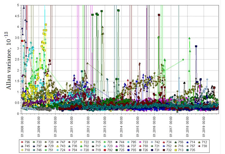
Performance. SISRE has improved over the years and is currently at the level of about 1 to 2 meters. In part, this is due to the better performance of the on-board AFSs carried by the latest GLONASS-M satellites compared to the first GLONASS-M satellites. Their relative one-day stability has improved from 10-13 to 2.4 × 10⁻¹⁴. FIGURE 5 shows a time series of recent values of SISRE determined by the Information and Analysis Center for Positioning, Navigation and Timing. These error levels can result in pseudorange-based positioning errors using GLONASS broadcast orbits and clocks about a factor of two worse than those provided by GPS — although, at any given instant, positioning accuracy will also be impacted by atmospheric effects and multipath and these could dominate the signal-in-space errors.
FIGURE 5. GLONASS daily root-mean-square signal-in-space range error in meters as determined by the Information and Analysis Center for Positioning, Navigation and Timing.
Much higher positioning accuracies can be obtained using GLONASS orbits and clocks provided by the IGS and its participating analysis centers. This is particularly true if carrier-phase measurements are used instead of or as a supplement to pseudorange measurements. A combination of appropriately weighted GPS and GLONASS measurements has shown to be beneficial in terms of availability, accuracy and efficiency, especially for high-accuracy positioning carried out using the real-time kinematic or RTK approach. Furthermore, the precise point positioning (PPP) technique, based on real-time or post-processing of dual-frequency carrier-phase measurements with precise satellite ephemeris and clock data, has demonstrated that kinematic decimeter-level accuracy is possible using GLONASS data or GLONASS data in combination with GPS data. GLONASS-only static PPP solutions over 24 hours have achieved accuracies at the millimeter level.
Users. The initial uptake of GLONASS by both civil and military users in the former Soviet Union and subsequently in Russia, not to mention outside Russia, was minimal. Prototype GLONASS-only receivers were developed for the military, and foreign GPS/GLONASS receivers were developed by several manufacturers for scientific and other advanced applications. The IGS added a set of GLONASS-tracking receivers to its network in 1998 and has continuously increased the number of such receivers since then. However, consumer use of GLONASS both within and outside Russia has only recently taken off with the development of GLONASS-only and combined GPS/GLONASS chipsets. Such chipsets are now featured in many mobile phones and in handheld GNSS receiver and vehicle navigation units.
NEW AND IMPROVED
As previously mentioned, the GLONASS-K1 satellites include a CDMA signal accompanying the legacy FDMA signals on a new L3 frequency of 1202.025 MHz. The ranging-code chipping rate for the CDMA signal is 10.23 megachips per second with a period of 1 milliseconds. It is modulated onto the carrier using quadrature phase-shift keying (QPSK), with an in-phase data channel and a quadrature pilot channel. The set of possible ranging codes consists of 31 truncated Kasami sequences. (Kasami sequences, introduced by Tadao Kasami, a noted Japanese information theorist, are binary sequences of length 2m – 1 where m is an even integer. These sequences have good cross-correlation values approaching a theoretical lower bound. The Gold codes used in GPS are a special case of Kasami codes.) The full length of these sequences is 214 – 1 = 16,383 symbols, but the ranging code is truncated to a length of N = 10,230 with a period of 1 milliseconds.
The associated navigation message symbols are transmitted at a rate of 100 bits per second with half-rate convolution coding. The so-called navigation message superframe (2 minutes long) will consist of 8 navigation frames (NFs) for 24 regular satellites in the GLONASS first modernization stage and 10 NFs (lasting 2.5 minutes) for 30 satellites in the future. Each NF (15 seconds long) includes 5 strings (3 seconds each). Every NF has a full set of ephemerides for the current satellite and part of the system almanac for three satellites. The full system almanac is broadcast in one superframe.
The lighter, unpressurized K1 satellites feature two cesium and two rubidium AFSs. The relative daily stability of one of the rubidium AFSs on a K1 satellite is reported to be 4 ×10-14. As a result, the SISRE for this satellite is about 1 meter. Plans call for adding a CDMA signal to L2 on future versions of the K1 satellites, dubbed K1+ (see below).
GLONASS-K2 Satellites. These satellites will be heavier than the K1 and K1+ satellites with greater capabilities including a CDMA signal at the GPS/Galileo L1/E1 frequency. Reshetnev ISS will initially build two K2 satellites before going into mass production. It had been planned to transition to the K2 satellites much sooner, only launching the two K1 satellites now in orbit. But apparently plans changed because of the sanctions restricting the delivery of radiation-resistant electronic components from the West.
Now, Reshetnev ISS will build an additional nine GLONASS-K1 satellites. It’s not clear how many of these might be of the K1+ variety. The GLONASS-K1 satellites will now be transition satellites between the existing GLONASS-M satellites (including the half-dozen or so that have been manufactured and stored on the ground for future launch as needed) and the future GLONASS-K2 satellites.
One of the first K2 satellites will host a passive hydrogen maser (PHM) AFS. The PHM has been under development for about a decade, and multiyear ground tests displayed a reliability and one-day stability of 5 × 10-15. It is expected to contribute to future 0.3-meter SISRE.
According to a recent report, GLONASS-K2 satellites will begin flight tests in 2018, with mass production of GLONASS-K2 satellites to begin in the 2019–2020 time frame.
Improved Tracking Networks. The development of the SDCM and its associated tracking network has already been mentioned. The SDCM network stations are equipped with combined GPS/GLONASS dual-frequency receivers, hydrogen maser atomic clocks and direct communication links for real-time data transfer. As mentioned earlier, GLONASS authorities are looking at whether additionally using the SDCM stations for GLONASS orbit and clock determination would significantly enhance the accuracy of the broadcast data.
CONCLUSION
GPS, the oldest GNSS, is continuing to modernize and will soon launch the first Block III or GPS III satellite. Already, GPS Block IIR-M and Block IIF satellites are transmitting new signals. Galileo is fielding modern satellites right from the get go, and BeiDou is about to start launching the operational version of its BeiDou-3 satellites. GLONASS is not to be outdone. It has provided useful positioning, navigation and timing services since at least 1996. While at times the service level has dropped below acceptable levels, it is now a dependable system and, with announced improvements, will be a contender in the future world of multi-GNSS.
FURTHER READING
Official GLONASS Update
“GLONASS Programme Update” by I. Revnivykh presented at the 11th Meeting of the International Committee on Global Navigation Satellite Systems, Sochi, Russia, Nov. 6–11, 2016.
In-depth Description of GLONASS
“GLONASS” by S. Revnivykh, A. Bolkunov, A. Serdyukov and O. Montenbruck, Chapter 8 in Springer Handbook of Global Navigation Satellite Systems, edited by P.J.G. Teunissen and O. Montenbruck, published by Springer International Publishing AG, Cham, Switzerland, 2017.
“GLONASS: Developing Strategies for the Future” by Y. Urlichich, V. Subbotin, G. Stupak, V. Dvorkin, A. Povalyaev and S. Karutin in GPS World, Vol. 22, No. 4, April 2011, pp. 42–49.
“GLONASS: Review and Update” by R.B. Langley in GPS World, Vol. 8, No. 7, July 1997, pp. 46–50. Correction: GPS World, Vol. 8, No. 9, Sept. 1997, p. 71. Available on line:
“GLONASS Spacecraft” by N.L. Johnson in GPS World, Vol. 5, No 11, Nov. 1994, pp. 51–58.
Another GLONASS-M satellite, designed and built by a team of Information Satellite Systems – Reshetnev Company, has been delivered to the Plesetsk cosmodrome.
Accompanied by the company’s technical team and housed in a dedicated high-technology container, it was shipped to the Yemelyanovo Airport of Krasnoyarsk and then flew to the Plesetsk cosmodrome aboard a cargo aircraft IL-76.
At the cosmodrome, ISS-Reshetnev technicians will begin preparing the satellite for its launch, which is expected to take place in late May.