Government, industry and public safety leaders call for action on PNT resiliency as threats escalate.
GPS is the invisible backbone of modern life, supporting America’s national and economic security in ways both recognized and overlooked. While other countries have developed competing systems, GPS remains far ahead of its rivals. Yet that dominance is also a vulnerability. GPS is a single point of failure, and the U.S. lacks complementary positioning, navigation and timing (PNT) solutions. A successful disruption could cost the U.S. economy $1.6 billion per day and impact everything from first responders to our energy grids.
As threats to GPS reliability mount, policymakers and industry leaders gathered on Capitol Hill to underscore the urgent need for backup systems to protect America’s PNT infrastructure.
Last month, I hosted an event on Capitol Hill called: “The Race to GPS Resiliency: What the US Can Do Today to Strengthen National Security.” It brought together senior officials from the Department of Defense (DOD), the Federal Communications Commission (FCC), Congress and industry to make the case for a layered approach to PNT resiliency. These experts examined the technical vulnerabilities of GPS, the increasing frequency of jamming and spoofing incidents, and the policy measures required to expedite the deployment of complementary technologies.
GPS: Foundational and Fragile
The first panel focused on how federal agencies are addressing growing vulnerabilities in GPS. Thomas Rondeau, Ph.D., principal director for FutureG at DOD, shared some eye-opening insights, including how a DARPA project demonstrated that, for less than $300 in parts from Amazon, one could “create a very bad day for the American military.” He called GPS disruption one of the easiest threats to develop and warned that adversaries are already exploiting this vulnerability as part of modern conflict.
From left to right: Diego Areas Munhoz, reporter, Punchbowl; Thomas Rondeau, Ph.D., principal director for FutureG, DOD; Arpan Sura, senior counsel, chief AI officer, FCC.
Rondeau shared how GPS disruption is now a feature of modern warfare, as he witnessed firsthand during his time at DARPA: “We were seeing massive loss of capabilities, and ordnance, because they were dependent on GPS. And as soon as they flew there, the tent turns on, capability goes away, we lose… assets.”
Arpan Sura, senior counsel and chief AI officer at the FCC, walked through the FCC’s process for evaluating GPS alternatives and discussed how the agency is considering complementary PNT technologies.
“National security is one of his (Chairman Carr’s) top priorities. And we recognize, as Tom mentioned, that GPS remains vulnerable to jamming and spoofing. But also, non-national security threats like solar flares, environmental risks like orbital debris. And there is heavy reliance on it in the U.S. economy,” Mr. Sura said.
Lives on the Line
From left to right: Mariam Sorond, board chair and CEO, NextNav; Adam Eldert, director of public safety for Fairfax County, Virginia.
During the second panel, the conversation shifted from global conflict zones to local communities. Adam Eldert, director of public safety for Fairfax County, Virginia, emphasized the life-saving value of resilient PNT technologies in emergency response.
“Technology should be carrying us forward, allowing us to make better decisions with the information we have to affect life-saving measures faster, get to places quicker and avoid any sort of potential problems,” said Eldert.
Mariam Sorond, CEO and president of NextNav, pointed out that GPS limitations can delay locating 911 callers and responding to active threats like a mass shooting situation she and Eldert had previously discussed. “It’s not just to save somebody’s life, but it’s also about preventing disasters.”
She then highlighted the company’s 5G-powered 3D terrestrial PNT solution, which is currently being considered by the FCC’s ongoing Notice of Inquiry on PNT and in a separate Petition for Rulemaking specific to NextNav. She explained that the company is working to address a national security challenge with a near-term, future-proof solution that delivers a widescale terrestrial PNT solution without relying on taxpayer funding.
Congressional Support
The closing panel featured Rep. Richard Hudson (R-NC), Chairman of the House Energy & Commerce Subcommittee on Communications and Technology, and former Rep. Greg Walden (R-OR), who previously chaired the full committee.
Both Hudson and Walden warned that the United States is lagging behind adversaries such as China and Russia in deploying terrestrial backup systems to GPS.
Chairman Hudson reflected on how the issue hits close to home: “I represent Fort Bragg, the largest army base in the world. We call it the epicenter of the universe. Our special forces and airborne troops that deploy out of Fort Bragg rely on GPS for almost everything they do. So, real-life scenarios with them keep me awake at night.”
Chairman Walden spoke about another high-profile case in San Diego. “[T]here was a naval exercise between two ships, and they jammed GPS… which caused some issues, ” said Walden. “It also speaks to the problem we have, in America, where, unlike China and Russia, two of our adversaries, they have terrestrial-based systems for GPS backup.”
What Comes Next
The event made clear that action is needed — and possible. Mr. Sura told the crowd that he believes the FCC’s Notice of Inquiry will help drive a conversation about a holistic approach to PNT resiliency, exploring the economics of how these systems will work, and how to foster competition in a way that will yield multiple outcomes. When asked about next steps, Mr. Sura encouraged the group to “stay tuned.”
Speakers throughout the event called for continued public-private collaboration to accelerate development of a more resilient PNT system — one that combines space-based and terrestrial technologies to safeguard national security, critical infrastructure, and public safety.
Congressman Hudson closed with a note of urgency and optimism: “It’s clear the FCC understands the urgency, and they’re conducting thorough reviews right now.”
Diane Rinaldo of Peake Advisors, which sponsored the event, is one of the country’s leading authorities on 5G, telecommunications supply chain security and privacy. She served as Acting Administrator of the National Telecommunications and Information Administration and Acting Assistant Secretary of Commerce for Communications and Information in the first Trump Administration.
A team of researchers from the University of Texas Austin (UTA) have shown the Starlink broadband constellation’s potential to serve as a backup for GPS.
Todd E. Humphreys
The researchers, led by Todd Humphreys and funded by the U.S. Army, examined the downlink signal structure of the SpaceX Starlink constellation of ultrafast broadband satellites in low-Earth-orbit (LEO), reported MIT Technology Review. The team showed that Starlink could serve as a useful backup to GPS.
For the past two years, Humphreys’ team at UT Austin’s Radionavigation Lab has been reverse-engineering signals sent from thousands of Starlink internet satellites to ground-based receivers. Humphreys told the review that regular beacon signals from the constellation, designed to help receivers connect with the satellites, could form the basis of a useful navigation system.
Title: Signal Structure of the Starlink Ku-Band Downlink
Authors: Todd E. Humphreys, Peter A. Iannucci, Zacharias Komodromos, Andrew M. Graff
Abstract: We develop a technique for blind signal identification of the Starlink downlink signal in the 10.7 to 12.7 GHz band and present a detailed picture of
the signal’s structure. Importantly, the signal characterization offered herein includes the exact values of synchronization sequences embedded in the
signal that can be exploited to produce pseudorange measurements. Such an understanding of the signal is essential to emerging efforts that seek to dual-purpose Starlink signals for positioning, navigation, and timing, despite their being designed solely for broadband internet provision.
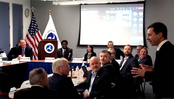
Transportation Secretary Pete Buttigieg made a surprise appearance at the DOT roundtable on complementary PNT. (Screenshot: DOT)
“If this is a problem, the government should act like it.”
Citing more than 10 years of government studies, warnings and promises, representatives from a wide variety of industries criticized the government recently for doing little to address an important national security problem.
At issue was the need for national backup capabilities for GPS and the essential positioning, navigation, and timing (PNT) signals it provides.
GPS signals are weak and easy to block or imitate. At the same time the signals are used by most technologies including networks, telecommunications, electrical grids, broadcast, mobile radios, transportation, and other critical infrastructures.
After Russia threatened to destroy all GPS satellites in 2021 in its run-up to invading Ukraine, a member of the White House National Security Council told a public meeting “GPS is still a single point of failure” for the nation.
The government was criticized for inaction at a “Complementary PNT Roundtable” hosted by the Department of Transportation (DOT) in early August. The department is the federal lead for civil GPS and PNT issues.
Eight attendees interviewed after the event reported a surprising unanimity of comments and concerns expressed by industry reps at the meeting.
Enough with the studies
A repeated theme was that the government has done enough studies to understand the problem and available technologies.
“They have been studying this for over twenty years,” one attendee observed. “The Volpe [Transportation Systems Center] report came out in 2001. And there have been lots of studies since then. All have just been refinements of those original findings.”
Another consistent theme was disdain for the idea that industry and the free market will solve the problem without government leadership and active support.
“GPS is free,” said one attendee from a company that provides PNT services. “We can and do sell to meet niche demands, but it is laughable to suggest we can ever sell enough subscriptions to be enough of a backup for GPS.”
A major telecommunications company rep echoed the sentiment. Wireless telecom is especially reliant on PNT. “We use GPS and would use Loran and low Earth orbit satellites if they were available, but we are not going to build it on our own. There is just no business case.”
“We have a big list of things we could do that would increase our resilience and/or cut costs,” said another telecom provider. “There is no big driver for most, though. No competitive pressure, no government mandates.”
Government must walk the walk
“The government has been telling us for over a decade that this is a problem,” said one attendee. “If that’s true, why aren’t they acting like it? Transportation is critical infrastructure and needs a GPS backup, for example. So why hasn’t DOT done something?” Of all the criticisms expressed, this was predominant, according to interviewees.
A 2021 Executive Order on responsible use of PNT services encouraged critical infrastructure providers to not rely on GPS.
The government needing to be a lead customer was mentioned a number of times at the event. This would help raise awareness, set an example, and signal to users the issue is important enough to act on.
Government action was also seen by users as key to creating confidence that a technology or service will be around for the long haul. This point seemed to resonate with many of the government representatives as well.
“I am not going to go to the time and expense of adopting something unless I know it is going to be around for 20 years or more. The only way I can be assured of that is if one of the biggest users is the government.”
Adversaries not idle
Of particular concern to some was that America’s adversaries have better, more resilient PNT, and are constantly working against us.
They are building PNT “…systems of systems. Space-based, ground-based, and everything in between-based. They are doing it. We need to get out in front and lead,” said one. China has been particularly active building multiple integrated PNT systems.
“Our adversaries are not stupid” and are going to try to stay in the lead. “They will try to interfere with any frequency, system, or combination of systems selected. We must test and build something that is survivable and resilient.”
“If China, Russia, and Iran had the ability to protect themselves from nuclear attack,” said one attendee, “we would be frantically trying to get the same capability. Yet those countries have backup and complementary systems for PNT, and the United States does not. And we’re not doing anything,” said a participant reflecting upon the event.
Hopeful signs
Several attendees said there were signs the event might not have been “just another government meeting.”
As part of his opening remarks, the event host, DOT Deputy Assistant Secretary Dr. Robert Hampshire, mentioned the bipartisan infrastructure law and affirmed that PNT is infrastructure. This led some to believe funding from the infrastructure legislation could be immediately available if the government decided to act.
Others were cheered by DOT Secretary Buttigieg’s cameo appearance and comments at the event. One remarked it was the first time they had heard a DOT Secretary say “PNT” in over 20 years.
Uncertain outcome
Despite the consistent messaging and potentially hopeful signs, some attendees questioned whether anything would change because of the two-and-a-half-hour event.
“There were about 120 people from industry and a wide variety of government agencies, but what was the point?” asked one. “We all told the government the same things we’ve told them before, often in writing.”
Another was concerned that the event didn’t discuss the most important questions.
“We were talking about individual systems and critical infrastructures,” this person said. “This is a strategic national security issue. We need to get the bullseye off GPS and ensure the United States can’t be blackmailed by having GPS held hostage.”
“And what if there is a major coronal mass ejection? China will come out much better than us because they have survivable PNT. The United States will become a second-rate power to China in an instant. We keep talking about the trees and ignoring the forest!”
One attendee whose company has a very active government relations program reported they hoped the event would help sway those in government still opposed to action.
“It is pretty clear to us that almost everyone in the departments who understand the issues is in favor of doing something as soon as possible. The same with Congress. But even though the National Security Council is worried about this, there are some folks in the Office of Management and Budget who have opposed action for over a decade.”
While some came away buoyed by what they saw as an action-oriented tone to the event, others doubted much would change. “It remains to be seen whether criticism from industry and threats from China and Russia are enough to get the government to finally do something.”
Dana A. Goward is President of the Resilient Navigation and Timing Foundation and serves on the President’s National Space-based Positioning, Navigation, and Timing Advisory Board.
Reading her biography, you might not think that Jennifer Wexton, U.S. Representative for Virginia’s Tenth District, would be very connected to technology issues. As an attorney and government leader, she has spent a lot of time advocating for families, veterans and federal workers.
Yet she is also co-founder of the Congressional Task Force on Digital Citizenship and has become an advocate for protecting the nation’s vital positioning, navigation and timing (PNT) services.
“We all use GPS every day whether we know it or not, and we need to ensure it stays the gold standard for satellite navigation,” she said. “But as the National Security Council said last year, it has become a single point of failure for America. So much of our critical infrastructure depends on GPS, from the navigation apps on our phones to the military to our financial and energy sectors, and it is past time that we address its critical vulnerabilities and develop and implement reliable backup technologies.”
Wexton says that she has been aware of and concerned about the issue almost since the day she took her seat in Congress.
“I am a member of the House Appropriations subcommittee that oversees funding for the Department of Transportation, and civil GPS and PNT issues fall squarely in DOT’s jurisdiction,” she said. “In 2018, Congress passed a law requiring DOT to ensure we have a backup for GPS, and we updated that law earlier this year to ensure that all appropriate types of technologies are included in this effort. I don’t know how we can be comfortable with autonomous drones and self-driving cars if we don’t have technologies in place to support and back up GPS. They are certainly available.”
The fact that her district includes a huge swath of Virginia’s high-tech corridor has added to her knowledge of the problem and range of possible solutions. In addition to many big names in technology and government contracting, several smaller companies focusing on resilient PNT have offices in her district. These include Echo Ridge, Hellen Systems, Satelles and UrsaNav. All four participated in the Department of Transportation’s Complementary PNT and GPS Backup Technologies Demonstration.
Adding to her concern are increasing threats to GPS satellites and signals. At a recent hearing with DOT Secretary Pete Buttigieg, she mentioned Russia’s anti-satellite tests and ongoing GPS jamming in Ukraine as examples.
“And that might not even be the worst of it,” she later said. “We need to be cognizant of Chinese capabilities in cyber and in space. They have shown how they can physically grab one satellite with another and toss it out of orbit.”
At the hearing, she gently prodded Secretary Buttigieg about DOT’s progress toward protecting the nation.
“…in the FY-22 Omnibus we created a program which is housed at DOT and provided $15M to help develop the needed requirements and standards and conduct additional testing. […] How’s it going?”
Buttigieg temporized saying the department was working on the Congressional tasking in the appropriation with the funding available. That tasking focused on testing and developing standards as opposed to contracting for signals to begin making one or more alternatives to GPS widely available for adoption.
Funding for such an effort has been problematic since a 2018 law required DOT to establish a timing backup for GPS. Administrations have justified inaction by saying that Congress had not funded the effort. Yet hill staff report that for several years administration representatives vigorously opposed any funding at all during annual budget development negotiations. The $15M to establish the program within DOT this fiscal year, which Wexton supported, was the first time any allocation had been made.
Rep. Wexton is also a big supporter of GPS modernization. “GPS is the gold standard for satellite navigation and America’s gift to the world,” she said. “We have to continually modernize it to support both military and civil uses. That’s a no-brainer.”
She also sees deploying alternative timing and navigation systems a step to making GPS more secure. “Unlike the Russians and Chinese, we don’t have one or more systems widely deployed domestically if GPS is unavailable for some reason. This makes GPS satellites and signals prime targets for our adversaries, terrorists, and criminals. Having one or more alternatives will create redundancy and make GPS a much less attractive target.”
Providing one or more alternatives that could be widely adopted could be a relatively inexpensive proposition for the government, certainly when compared to the cost for GPS. More than $2 billion was appropriated for GPS operations and modernization this year. Industry sources estimate that contracts for the suite of alternative PNT sources described in the 2021 DOT report would cost a small percentage of that.
Dana A. Goward is President of the Resilient Navigation and Timing Foundation.
Russia’s brutal aggression on Ukraine changed the world in a few days. Devastation and displacement in Europe already are on a scale unseen since World War II, and the risk of a catastrophe greater by orders of magnitude has not been as high since the Cuban Missile Crisis of 1962, the year I was born. Given the long production timeline of a monthly magazine, I will not venture a guess as to what the headlines will be on the day you read this.
The Russian assault has sharply raised concerns about GNSS vulnerabilities. In a March 17 bulletin, the European Union Aviation Safety Agency (EASA) warned of a GNSS outage leading to the degradation of navigation and surveillance. Reports analyzed by EASA indicate that since Feb. 24, GNSS spoofing and jamming has intensified in the Baltic Sea, neighboring states, Eastern Finland, the Black Sea and the Eastern Mediterranean. “The effects of GNSS jamming and/or possible spoofing,” the bulletin stated, “were observed by aircraft in various phases of their flights, in certain cases leading to re-routing or even to change the destination due to the inability to perform a safe landing procedure.”
Russia already has aided in the proliferation of handheld GPS jammers, the deployment of road-mobile jammers, and even development and testing of space-based jammers. Now, it could turn its substantial cyberspace hacking capability against the ground-control segments of GPS and Galileo.
When Russia tested an anti-satellite weapon on Nov. 15, 2021, the Kremlin claimed on state television that this capability “means that if NATO crosses our red line, it risks losing all 32 of its GPS satellites at once.” This threat was particularly dangerous because GPS satellites carry, as a secondary payload, the U.S. nuclear detonation detection system.
At a panel discussion about resilient GPS that I moderated at the International Wireless Communications Expo in Las Vegas on March 24, Diana Furchtgott-Roth, an adjunct professor at George Washington University and former deputy assistant secretary for Research and Technology at the U.S. Department of Transportation (DOT), titled her presentation “Russia Proves America Needs Backup GPS.” She cited the National Defense Authorization Act of 2017, the National Defense Authorization Act of 2018, and the National Timing Resilience and Security Act of 2018, which instructed DOT to provide a complement and backup for civilian GPS. The legislation required the Secretary of Transportation to put in place a backup system for GPS by the end of 2020, subject to congressional appropriations. However, she pointed out, these funds have not yet materialized.
Multiple technologies can and should be used to complement GPS. Several of them are mature and commercially available, including signals from low Earth orbit satellites and terrestrial broadcast stations.
Meanwhile, the United States should accelerate the launch schedule for GPS III satellites already produced. They provide better accuracy, anti-jamming capabilities, and opportunities for civilian connectivity that could offer critical assistance to its European allies.
the former Loran-C transmission antenna at Værlandet, Norway. (Photo: UrsaNav)
By Alan Grant and Dana Goward
In my “First Fix” editorial in the January 2022 issue of this magazine, I listed 10 questions about eLoran I had received from a PNT expert in response to an article about eLoran I wrote for the November 2022 issue. I encouraged eLoran proponents to address these questions. Two well-known authorities, neither of whom have a financial interest in the technology, stepped forward to help. Below, again, are my 10 questions about eLoran and their answers.
Alan Grant is head of Research and Development for the General Lighthouse Authorities of the United Kingdom and Ireland (GLA). He is an expert in radionavigation systems and leads the team that established the U.K.’s eLoran system, which operated from 2007 to December 31, 2015 in support of maritime users.
Dana A. Goward is president of the Resilient Navigation and Timing Foundation and a retired U.S. Coast Guard Captain. He also served in the federal Senior Executive Service as the maritime navigation authority for the United States. He has decades of experience with navigation policy and leading government policy and programs.
— Matteo Luccio, Editor-in-Chief
Accuracy specifics. While my November article stated that eLoran would have a two-dimensional accuracy of “better than 20 meters, and in many cases, better than 10 meters,” is that RMS, 95%, or some other statistic?
AG: Like any radionavigation system, the achievable accuracy will depend on several aspects, including the user’s location with respect to the broadcast stations and how error sources are modelled. The GLA eLoran service, when in operation in 2015, provided positional accuracy in the order of 8-10m (95%) to seven ports on the east coast of the UK. These ports had local reference stations to help manage temporal errors and the ports had been mapped to correct for additional secondary factors (ASF).i
DG: Others have reported greater accuracies using differential corrections.
Performance standard. GPS provides a commitment to users in a published performance standard. What specific measures of positioning accuracy, integrity and continuity would you recommend the proposed eLoran system be committed to provide (using the architecture described in the answer to Question 6)?
AG: The target performance would need to be tied to the target use cases to ensure the appropriate requirements are met. IALA provides guidance in this area for maritime services with general maritime requirements provided by the IMO within resolutions A.1046 and A.915.
Coverage. Would you recommend this eLoran positioning performance hold for the entire United States (including Alaska, Hawaii, Puerto Rico and other territories), only for the “lower 48” states, or only parts of these 48 states?
DG: The primary goal of any effort to complement and back up GPS/GNSS would be to make the nation and its citizens safer in at least two ways. First, to provide an alternative PNT source or sources in the event that signals from space were not available for any reason. Second to make GPS satellites and signals (and therefore the nation) safer by “taking the bullseye off GPS.” Having one or more alternatives will greatly reduce incentives for malicious disruption. To achieve these two goals the alternatives must be widely available and easily accessed. How widely available and easily accessed the United States or any other country wants to make such systems is a policy decision.
Current users. By number of users, the predominant common current civil uses of GNSS for positioning are consumer devices (mostly cellphones). By contribution to the U.S. economy, the predominant uses are high-precision applications. For what fraction of these uses would eLoran positioning be adequate? Could an eLoran receiver and antenna fit in today’s consumer devices?
DG: Lots of presumptions and assumptions in this question. Several overall thoughts, though. First, determining users’ real requirements can sometimes be difficult. I have a nice new full-size sedan. So, I think that is my requirement even though I could get to work almost as quickly and much less expensively if I owned a used compact car or caught the bus at the corner.
Second, GPS/GNSS will, hopefully, always be the primary source. The questions then are 1) how accurate can eLoran positioning become with additional work, and 2) how accurate does a fallback system need to be?
Durk van Willigen of Reelelektronika b.v. displays a combined GPS, GLONASS and eLoran receiver at the 2017 Munich Satellite Navigation Summit. (Photo: Reelelektronika)
Finally, as to equipment size, I recall seeing a photo of the first GPS receiver sitting on a pallet with two chairs for operators. Today, receivers are made at chip scale. Huge reductions in C-SWAP have been the growth arc for all kinds of technologies as they are implemented more and more widely.
In 2017 the Dutch company Reelektronika showcased a combination eLoran, Chayka, GNSS receiver that was only 6 cm long. This was achieved without a whole lot of investment in research and development. Who knows how low C-SWAP for eLoran receivers will go?
Future uses. Emerging civil uses of GPS for positioning include autonomous ground and air vehicles, navigation to space and in space, and lane-accurate car navigation. Which of these could be served by eLoran?
AG: The overall concept of having a mix of dissimilar position sources remains sensible for all modes. GNSS is expected to remain the primary means of position determination, with different use cases selecting different complementary systems based on their needs. eLoran may support some use cases but may not be the answer for all.
DG: Many believe GPS alone is not sufficient to serve some of the applications cited. This is the basis for language in both the European Radionavigation Plan and a U.S. Presidential Executive Order cautioning against over-reliance on GNSS. Perhaps GPS and eLoran together might be deemed sufficient. Or, perhaps a more diverse and resilient PNT architecture will give rise to additional applications such as precise positioning from 5G that will be sufficient.
Architecture. To maintain accuracy during a prolonged GPS outage, eLoran would require reference stations to calibrate time-varying propagation errors, as well as a certain number of transmitters for good nationwide geometry and for redundancy, ensuring service even if a transmitter is attacked or is taken off-line for maintenance. What architecture would you recommend to achieve this?
AG: The MarRINav projectconsidered a similar question for the UK and the project’s approach could be employed to consider this question for the United States.iv
DG: A good starting point for the United States might be the sites used by the shuttered Loran-C system. The federal government still retains custody of most of them. Also, considerable thought has been given to the questions of eLoran reference stations and integrity in the United States. PNT expert Mitch Narins, formerly of the FAA and now Strategic Synergies, advises that much of this work has been done. The FAA and Coast Guard conducted a study to deploy eLoran in the United States to support aviation non-precision approach, maritime harbor entrance and approach, and precise time and frequency users. The proposed architecture supported aviation’s demanding integrity requirement (1×10⁻⁷), maritime’s demanding accuracy requirement (8-20m), and time and frequency users’ precision requirements (100 ns/Stratum 1).
7. Infrastructure cost. What would be the cost of installing the required transmitters, power supplies, reference stations, communication links and control system for the architecture described in the answer to Question 6? Can you reference a recent and independent estimate? To a ballpark figure, what cost fixed-price contract would you accept to implement it? Similarly, what would be the annual costs for operating and maintaining this infrastructure?
AG: The MarRINav project produced a cost-benefit analysis report that addresses some of these questions, albeit aligned to the approach proposed for the UK. The documents are open source and available on the MarRINav website.
DG: To quote President Kennedy, “There are costs and risks to a program of action, but they are far less than the long-range risks and costs of comfortable inaction.”I agree with Dr. Grant that the capital costs in MarRINav are roughly transferrable to the United States. As another data point, the 2010 operating cost for Loran-C in the United States was about $36M/year. That number included several hundred employees, though. Plans to automate the system projected reducing annual costs to $15M/year in 2010 dollars.
Impact. eLoran transmitters are large and high-power. Providing positioning across the United States could require building some of them from scratch or significantly reconstructing old Loran sites. What issues — such as environmental, aviation safety and security — would this raise, and how would you recommend they be addressed?
DG: These issues would be dealt with the same way they are for any construction project. eLoran transmission sites are essentially the same as commercial AM radio stations. Reusing sites still owned by the government could make the process even easier. Compared to the cost and difficulty of putting PNT assets in orbit, these challenges should be relatively easy to overcome.
Receivers. Assuming all the above were achieved, it would accomplish nothing unless eLoran receivers were widely purchased, installed and used. How much would that cost? Who would pay? Should we assume that “if we build it, they will come”?
AG: This is a valid concern and has different answers depending on the planned use case and the level of national/international standardization required. Within the maritime sector, the IMO has approved a multi-system receiver performance standard that supports the use of all GNSS and terrestrial systems within one device, rather than having a separate eLoran receiver.
DG: I completely agree — adoption and use are absolutely key. Fortunately, government leaders have a wide variety of levers to influence adoption and use. These range from education and encouragement to regulation, legislation, and subsidies.
Alternatives. Given the widespread development of other positioning technologies over the past decade, much has changed since the earlier recommendations for eLoran. How do we know that eLoran is the right investment — or even a needed part of the solution or needed system in a system of systems — for the future of U.S. PNT?
AG: The MarRINav project researched and compiled details of different positioning, navigation and timing technologies supporting maritime navigation, within Deliverable D4. The recommended system-of-systems approach recognized that there was no one-fit-all solution, rather it sought to allow for a scalable solution that reflects users moving from location to location and between systems. It considered global, regional and local solutions, recognizing the cost vs. usable coverage tradeoff for each. The proposed solution of GNSS, supported by eLoran in combination with VDES R-Mode and radar absolute positioning, was deemed as the most appropriate mix for the UK, given geographical and political constraints. The approach can be ported to investigate the appropriate options for the United States.
DG: The U.S. Department of Transportation’s January 2021 report to Congress has findings similar to those in MarRINav. It described a system of systems that included fiber, satellites and terrestrial broadcast. The department subsequently said that a critical factor for a terrestrial broadcast system would be the coverage area per unit of required infrastructure. Of the systems discussed, eLoran met this criterion best. This recent finding is consistent with numerous other government reports, two previous government announcements that it would build eLoran, two recommendations from the President’s National Space-based Positioning, Navigation, and Timing Advisory Board and the technology’s on-going use around the world. Likely someday there will be something to replace GPS and other legacy technologies. We must work with the combination of technologies we have now until that day arrives.
Common Threats
Common threats to GNSS and eLoran could include the following:
1. Cyber attacks. Given that GPS’s OCX is said to be the most cybersecure system built by the U.S. Department of Defense, how would eLoran’s control system be even more cybersecure than OCX, to avoid a common cyber-vulnerability?
AG: Cybersecurity is a key concern and one that any navigation and safety of life system must consider. I will leave manufacturers of each system to comment on how secure they are. However, if we consider signal interference and data manipulation within this category, then using a stronger signal at a different frequency to GNSS provides some protection against jamming. While any radio signal can be jammed, the perpetrator would need more power and physically larger equipment to jam at lower frequencies.
DG: Yes, the security of control systems is very important and must be included in the design up front. Authentication and security of signals, and the cybersecurity of receivers must be as well. This is especially true for complementary systems for GPS since GPS signals are so open and vulnerable, and so many receivers are largely unprotected. We will have the opportunity to do better with a new system and avoid the huge expenses of OCX, the new GPS control system.
Additionally, let us not forget that cybersecurity is needed for much more than control systems. Signals and receivers need to be much more secure than civil GPS is right now. A new system, be it eLoran or another technology, will be able to build cybersecurity in from the beginning.
Physical attacks. Given concerns about possible physical attacks on GPS satellites, which move at multiple km/sec 20,000 km from Earth, would it not be easier to physically attack eLoran transmitters, which are stationary, terrestrial, in remote locations, and hundreds of feet tall and require massive power sources?
AG: We should not lose sight that any ground infrastructure can be attacked, regardless of whether it is a satellite uplink station or part of a terrestrial communications or positioning system. Careful selection of the transmitter location, along with suitable site security options should help deter the attack and mitigate the impact where possible.
DG: Every physical asset and every signal is vulnerable to some degree to attack by a host of malicious actors, and damage by a variety of natural occurrences. The key to resilience and making PNT sources less attractive targets is to have diverse sources with the smallest number of common failure modes.
Space weather. GPS is potentially vulnerable to severe space weather that could damage satellites or temporarily hinder signal propagation from space to Earth. However, severe space weather could also damage the power grid upon which megawatt eLoran transmitters rely. How would eLoran service be protected from the effects of severe space weather, such as a Carrington Event?
AG: Space weather has the potential to affect all radio broadcasts. Depending on the type of event it can affect performance several different ways, including ionospheric scintillation, applying forces to satellites or disrupting power networks. The aim is to use systems where the underlying failure modes are as different as possible. Using a combination of satellite and terrestrial signals, at different frequencies, with local power generation where possible can help mitigate the impact. Whether it’s possible to mitigate all the implications of a Carrington type event is not clear and perhaps one for the experts.
DG: With the available warnings about solar events, it is conceivable that both GNSS and terrestrial systems could be powered off or otherwise secured for such an event to minimize damage. A new-build terrestrial system could also be constructed with surviving a Carrington Event in mind. And, of course, terrestrial systems will be easier to access, repair, and replace than those in space. As for other possible issues with the power grid, generators, uninterruptable power supplies, and other backup methods can easily be installed. Before 2010, several U.S. Loran-C transmitters were in such remote locations, they never had grid power and were always powered by generators.
The appropriation for fiscal year 2022 enacted this month included $15M for “Position navigation and timing [PNT] technologies and global positioning system [GPS] backup” in the Department of Transportation (DOT) budget. At first glance, this might seem like a small but important step toward establishment of the system or systems President Bush mandated in 2004, the Obama administration promised in 2015, and called for by law in 2018.
Make no mistake, having the issue mentioned in the act is a very positive step. Unfortunately, a careful read of the report that came with the appropriations act shows the funds are not for solving, but for continuing to admire, the problem.
Here’s what the appropriation report says (in italics) and what it means. This is based on our reading of the text and conversations with hill insiders who said they had a tough battle with the administration to get any funding or mention of PNT or “GPS backup” in the budget at all.
“The agreement provides $15,000,000 to establish a program…” – This is not really a lot of funding for any federal effort. It is enough to hire several people, set up an office, and maybe do a few studies.
Notice that the appropriation language talks about “[leading] to wide adoption of multiple technologies.” It makes no mention of establishing any systems or signals.
Theoretically, this might be done by following the path in the Trump administration’s 2020 Executive Order on responsible use of PNT. The order addresses critical infrastructure and encourages such users to protect themselves with alternate PNT services they find on their own.
DOT might try this with all users to achieve “wide adoption,” though there are many obstacles. Principal among these is that GPS is free while commercial services are not. Providers of alternative PNT services have long recognized that it is impossible for them to compete with free GPS and argued that the government needs to be the customer.
“…Funding will enable, among other things…” An interesting turn of phrase that seems to say, ‘you must do all of this, but if you have any money left over you can do other things.’ This is pretty much a throw-away phrase since, with this worklist, they won’t have money left over for anything else. In fact, they will probably come up short.
“…the development of safety-critical PNT requirements and standards…” In other words, study the problem some more. Developing requirements and standards is important, but it doesn’t provide anything for the United States to use when Putin jams GPS or there is a huge solar storm.
“…vulnerability and performance testing…” Again, more study and little to no progress implementing solutions.
“…certification protocols for safety-critical functions”… Still more study.
“…the procurement of services as deemed appropriate by the Department…” Some might see this as a ray of hope. It could, conceivably, allow DOT to contract for PNT signals from space, fiber, or terrestrial broadcast and move toward establishing one or more systems. Unfortunately, $15M isn’t much for such an effort, even if DOT didn’t have to also create an office and do all the required studies and standards. In this context “services” almost certainly means contracted staff to help with administration and hiring think tanks.
“…and user adoption models in order to facilitate the responsible use of resilient PNT services to meet Federal requirements for widespread adoption.”
Since there are no “federal requirements for widespread adoption” to meet, this seems like another throwaway phrase that someone thought sounded actiony and proactive.
Additionally, we are not sure what a “user adoption model” is.
The best translation we can come up with is “DOT must figure out how to get Americans to adopt alternate PNT services that are either expensive or haven’t been invented yet. All in the absence of a government mandate for them to do so.”
Most in the PNT community have long recognized the need to “get the bullseye off of GPS” by making it a less attractive target, while at the same time protecting the nation against a wide variety of threats to satellites and signals. For them, the language in this year’s appropriation bill can be discouraging.
Yet there is some reason for hope. At least the problem was discussed in the bill, and some money was put toward it, regardless of how flawed the underlying assumptions and mandated actions might be.
Maybe we should all take comfort in the old Hollywood maxim – “It doesn’t matter what they say as long as they are still talking about you.” Let’s all keep the conversation going.
The trial for the U.S. Department of Homeland Security showcases the precise, resilient timing capabilities of NextNav’s TerraPoiNT service in the event GPS is unavailable.
NextNav has successfully demonstrated the timing precision and resilience of its terrestrial positioning, navigation and timing (PNT) system, TerraPoiNT, in a recent evaluation by the Science and Technology Directorate of the Department of Homeland Security (DHS S&T).
The trial tested the timing redundancy of the TerraPoiNT system in a number of scenarios, including instances of GPS outages, spoofing and jamming. It validates TerraPoiNT’s capabilities as a terrestrial, GPS-free network capable of powering critical national infrastructure in the event of GPS failure.
During a simulated 72-hour GPS outage, the TerraPoiNT service was able to deliver a timing accuracy better than 50 nanosecond in urban and semi-urban environments, successfully meeting timing requirements for various applications including 5G networks, the synchronization of the power grid, and more.
In addition, TerraPoiNT provided precise timing and redundancy utilizing two alternate absolute timing sources — atomic clock (Cesium/Rb) and LEO satellite (Satelles).
“GPS is critical infrastructure, but it has its limitations,” said Ganesh Pattabiraman, co-founder and CEO of NextNav. “In working with DHS S&T, we’ve validated that TerraPoiNT can serve as an important backup to GPS and ensure the resilience and continuity of our nation’s most critical systems, including next-generation telecommunications networks, financial services, and power grids.”
Satelles STL
STL from Satelles was one of two alternate absolute timing sources for the trial. Available today on a global basis, STL is a service that provides alternative PNT independent of GPS, supporting PNT-reliant applications such as 5G communications networks, high-frequency trading in financial markets, and electrical grids throughout the United States and around the world.
“Satelles applauds NextNav for conducting a successful field demonstration of its resilient PNT service, and we were delighted to have played an instrumental part in the exhibition,” said Christina Riley, vice president of Commercial PNT.
NextNav’s selection of STL to help demonstrate their own technology’s operation in the absence of GPS was a natural fit. That’s because earlier this year the U.S. National Institute of Standards and Technology (NIST) confirmed STL as an accurate and reliable source for the wide-area delivery of Coordinated Universal Time independent of GPS/GNSS.
Previous TerraPoiNT evaluations
The successful trial builds on recent evaluations of TerraPoiNT conducted by independent bodies. Earlier this year, the Department of Transportation (DOT) evaluated 11 alternate PNT solutions, in which each was rigorously tested across applications and scenarios. As a result of the evaluation, the DOT named TerraPoiNT the best and only performing solution across all PNT categories.
Spartacus. In June, NextNav entered into a definitive merger agreement with Spartacus Acquisition Corporation in a transaction that would result in NextNav being listed on the Nasdaq. The transaction is expected to close late in the third quarter of 2021 or early in the fourth quarter of 2021, subject to satisfaction of customary closing conditions.
The stated goal of a recently published RAND study was to answer a question from Congress about what should be done to back up and complement the nation’s GPS. One of its findings was that the government should consider investing in a national timing network.
Yet the study’s report emphasizes the wrong things, according to some. So much so that it is working against establishment of a timing network to reinforce GPS.
Report Misleading
“The main thrust of the study’s report is that we don’t need another GPS-like, system,” said Pat Diamond. “That has always been fairly obvious. I don’t know anyone who has ever advocated for duplicating GPS.” Diamond is CEO and founder of a network company and is a member of the president’s National Space-based Positioning, Navigation, and Timing (PNT) Advisory Board.
“By pounding so hard on the ‘don’t duplicate GPS’ drum, RAND hides its more important findings,” he said. “The public message comes across as there is no need to do anything.”
Diamond thinks the study should have better highlighted the things the federal government should do. “That is really the question Congress wanted answered,” he said.
RAND’s study supports four federal initiatives that “… appear to be cost-effective or close to cost-effective.” Included are a “timing-only” GPS-backup and support of high performance “geographically limited” systems.
Timing Essential, GPS Backup Needed
Cover: NSTAC
GPS timing signals are used in a wide variety of technologies including cell phones, IT networks, digital broadcast, first responders’ hand-held radios, and to synchronize electrical grids. Yet these signals from space are weak and easily disrupted.
A timing backup for GPS is also a long-standing recommendation of the president’s National Space-based PNT Advisory Board.
“There are few things more important to tech infrastructure today and tomorrow than timing,” according to Marc Weiss who was a lead researcher at the National Institutes of Standards and Technology for 35 years.
The RAND study was a cost-benefit analysis, which some have argued was not the best approach.
“Cost-benefit is always tricky,” says Greg Winfree, Director of the Texas Transportation Institute. “There are always a lot of assumptions. Small changes to any of the inputs can radically change the outcomes.” Winfree led civil PNT efforts during the Obama administration as an official at the Department of Transportation (DOT).
“One of my big concerns is that GPS is so important to so many things in America, that it is one of the most attractive targets for our adversaries. At least one alternate PNT that most people can access takes the bullseye off GPS,” Winfree said.
Scott Pace, director of the Space Policy Institute at George Washington University (GWU) agrees a diversity of PNT sources is important. At a recent GWU event, Pace commented having an alternative to GPS will contribute to national security and improve global stability. It will “lower the pressure on us to escalate and respond” should GPS satellites be damaged, or services disrupted. Pace was the Executive Secretary of the National Space Council in the Trump administration.
In the book The Russia Trap, author George Beebe has similar concerns, citing the lack of a backup for GPS as a technology resilience gap. Russia, China, and Iran all have terrestrial backups for PNT signals from space while the United States does not. Beebe says this is a weakness that can be exploited and could lead to an escalating series of exchanges resulting in all-out war.
Government Investment in Location Services
The RAND study suggestion for the government to invest in highly accurate PNT services in some limited geographic areas cited emergency responders’ needs for precise location. Federal investment will likely be required, it says, as commercial entities cannot make a business case everywhere service is needed.
GWU economics professor Diana Furchtgott-Roth has written that the federal government needs to provide a complement to GPS. She served as a Deputy Assistant Secretary at DOT from 2019 to 2021 leading civil PNT issues for the government.
“Without federal participation, commercial providers won’t ensure adequate resilient services for everyone. Some sectors, such as finance, will have it, but others won’t. This is a matter of national and homeland security. The RAND report did not emphasize this sufficiently.”
Questionable Timing and Motivation
“This is a particularly bad time for a confused message,” said a congressional staff member speaking about the RAND study. “Congress mandated a timing backup for GPS in 2018, though the project was never funded. There is real momentum this year to provide that funding, but the way this study reads works against that.”
Others see the structure of the study’s report and the timing of its release as a deliberate effort to derail budget negotiations. One retired Department of Homeland Security (DHS) official sees a pattern but is at a loss to explain the motivations behind it.
“RAND’s study was completed in 2019, and it was used as the basis for a DHS report to Congress in April 2020. But DHS didn’t tell Congress about RAND’s findings on a timing network and other actions the government should take,” they said.
“The study being made public now saying ‘do not back up GPS’ smells like a deliberate attempt to derail funding for the timing system. Something two presidential advisory boards, telecom leaders, RAND and so many others agree is needed.”
“Why would someone want to do that?” they asked. “Why would they want to keep America’s PNT so much weaker than China’s, Russia’s, and those of other countries?”
The official portrait of HRH The Duke of Edinburgh as Master of Trinity House. (Image: Trinity House)
Prince Philip, technology advocate, championed both GPS and alternative navigation methods during his lifetime.
Prince Philip — the Duke of Edinburgh and husband of Queen Elizabeth II of the United Kingdom — died on April 9 at Windsor Castle in England. He was 99. His funeral will take place April 17.
As the Master of Trinity House, Prince Philip was the U.K.’s authority for lighthouses in England, Wales, the Channel Islands and Gibraltar. Trinity House is also responsible for the provision and maintenance of other navigational aids, such as light vessels, buoys and maritime radio/satellite communication systems.
In its extensive coverage of his death, the BBC aired a radio program in its World Service that mentioned the prince’s knowledge and concern about GPS. “As Master of Trinity House, he was infuriated that people didn’t understand what would happen if GPS were shut down,” said the narrator.
Real Admiral Sir Jeremy de Halpert was Prince Philip’s deputy master at Trinity House. “ Prince Philip from the very beginning understood that it was a single point of failure,” de Halpert told the BBC. “GPS can be jammed very easily… He encouraged us to move ahead and make sure the country has a failsafe backup, which we have done, and it is now operational,” he said.
Below is the section of the documentary where the prince’s support for GPS and a GPS backup is discussed.
GPS World thanks Innovation editor Richard Langley for sharing the material.
In separate letters to the Office of Management and Budget (OMB) and new Secretary of Transportation Buttigieg, influential members of Congress have urged the Biden administration to take prompt action and establish a backup timing capability for GPS.
Danger and Benefits, Solution in Hand
On March 1, Republican representatives Sam Graves and Bob Gibbs wrote to the acting OMB director citing the dangers of not having a backup, and the benefits one would bring. Graves is the ranking member of the House Transportation and Infrastructure Committee.
Calling backup timing for GPS “important telecommunications infrastructure,” they said the capability is essential. Without a backup “… it is not a question of if our transportation, financial, and telecommunications infrastructure systems will fail, it is a question of when.”
After describing some of the threats to GPS, they observed that America will suffer from an outage more than many of its adversaries. Russia and China were cited as examples of nations that already have terrestrial backup systems for space-based PNT.
The letter to OMB also cited the benefits to safety, autonomous and intelligent transportation systems, along with “5G & Future Telecommunications.” GPS interference has led to a near crash of a commercial passenger aircraft, drone accidents, and allowed white-hat hackers to force cars off the road. The letter also referenced a report by the Alliance for Telecommunications Industry Solutions (ATIS) calling for a national timing solution to complement GPS. Such a solution would “…allow faster 5G implementation and enable it to reach more Americans.”
Graves and Gibbs also mentioned the Department of Transportation’s (DOT) January report to Congress on its GPS Backup Technology Demonstration. The report called for an architecture that included signals from space in the L band, terrestrial broadcasts in the Ultra High Frequency and Low Frequency spectra, and a fiber backbone to synchronize and feed precise time to terrestrial transmitters.
Studies and Broken Promises
By contrast, a letter signed by Democratic House members focused on decades of administration studies, a broken promise, and failure to follow the law.
Transportation and Infrastructure Committee Chair Peter Defazio, along with Representatives Garamendi and Carbajal, wrote to DOT Secretary Buttigieg on Feb. 25. The letter noted that the need for a GPS backup was first identified in a 2001 DOT report. Since then, “…there have been over 18 studies and recommendations by the Federal Government calling for a land-based, wireless nationwide backup system.” Also mentioned were comments in 2014 by DHS officials calling the nation’s over-dependence on GPS “a single point of failure” for critical infrastructure.
Congress was encouraged in 2015 when the Obama administration said it would establish an eLoran timing system and follow it with a broader approach to GPS vulnerability. “This well-reasoned approach gave Congress encouragement that this national security problem would finally be addressed.”
“However, in 2018, after no additional action was taken, Congress took responsibility to codify the commitments outlined in the 2015 letter, and on a nearly unanimous bipartisan basis in both Houses, passed the National Timing Resilience and Security Act (NTRSA) to implement the land-based timing back-up system.”
The letter also notes that Congress further nudged the administration on this issue in last year’s appropriations. The act for 2021 provided funding for six new DOT staff positions to support the project and directed the department to make the hires.
Timing and Positioning
Observers say that it is almost certain the capabilities implemented to satisfy the terrestrial timing requirement in NTRSA will also provide a positioning capability independent of GPS.
NTRSA requires DOT to “… incorporate the recommendations from any GPS back-up demonstration program” into the solution set. The combination of technologies recommended by the demonstration report will provide users one or more terrestrial services from which location can be derived.
Also, mobile devices must know their locations to use wireless timing signals. Location information independent of space-based signals is needed to provide these users resilient timing service.
Senate poised to join House this week and override Trump’s veto
The U. S. Congress, especially the Armed Services Committees, have long been concerned about GPS and positioning, navigation, and timing (PNT) issues. Over the last two decades Congressional hearings, demands for reports, and investigations have dealt with acquisition, contingency plans for when space is not available, deliberate interference, and a host of other issues.
While these all evidenced Congress’ interest and concern, they were relatively passive measures.
The NDAA for 2021 seems to finalize Congress’ transition from an interested observer, mostly on the sidelines, to an active player in national PNT issues and policy.
This began to change in 2018 with passage of the National Timing Resilience and Security Act. It requires the Department of Transportation to establish a terrestrial timing system to backup GPS signals.
Then in 2019, Congress appropriated money for a GPS Backup Technology Demonstration. And the National Defense Authorization Act (NDAA) for 2020 required the Air Force to develop a prototype multi-GNSS receiver as part of its resiliency efforts.
The NDAA for 2021 seems to finalize Congress’ transition from an interested observer, mostly on the sidelines, to an active player in national PNT issues and policy.
Capitol Hill observers say this is the result of several things that have come to a head over the last year. Taken together, they have convinced many legislators that GPS is under threat and PNT issues are not being taken seriously enough by the executive branch. These include increased jamming and spoofing (especially by China and Russia), full implementation of China’s BeiDou system and its marketing to other nations as a superior alternative to GPS, the Federal Communications Commission’s (FCC) decision on Ligado Networks, and the Pentagon’s failure to respond to combatant commanders’ Joint Urgent Operational Needs Statements for non-GPS PNT.
Photo: Andrea Izzotti/Shutterstock.com
Here are some of the provisions of the 2021 NDAA of interest to the PNT community.
Military Multi-GNSS Receiver Prototype
The 2018 NDAA required the Defense Department to incorporate Europe’s Galileo and Japan’s QZSS satellite navigation signals into military user equipment. The idea was to make it more resilient to disruption. Also required was an investigation into using non-allied signals.
Apparently not satisfied with progress on this project, Congress mandated a project to develop a prototype multi-GNSS receiver as part of the 2020 NDAA.
The 2021 NDAA seems to indicate the Congress is still not happy. It withholds 20% of the funding for the Office of the Secretary of the Air Force until such time as the department certifies the prototype project is underway and provides briefings to the Senate and House Armed Services Committees.
Resilient Survivable PNT
Language in the 2021 NDAA also seems to show Congress is impatient with the Pentagon’s lack of responsiveness to combatant commanders’ requests for non-GPS PNT systems.
Section 1611 of the Act is entitled “Resilient and Survivable Positioning, Navigation, and Timing Capabilities.” It requires development, integration, and deployment of these capabilities for combatant commanders within two years. This, it says, is “… consistent with the timescale applicable to joint urgent operational needs statements…”
The act says the new PNT capabilities shall “generate resilient and survivable alternative positioning, navigation, and timing signals” and “process resilient survivable data provided by signals of opportunity and on-board sensor systems.”
The act also reverses the Defense Department’s 2018 PNT Strategy’s plan for future systems to be classified and for military use only. It directs the department to work with the National Security Council, Departments of Transportation, Homeland Security and others “to enable civilian and commercial adoption of technologies and capabilities for resilient and survivable alternative positioning, navigation, and timing capabilities to complement the global positioning system.”
To help ensure prompt action on this, the act requires a report to Congress within six months and authorizes the department to reprogram funds from other areas to finance the effort.
Responding to FCC’s Decision on Ligado Networks
By far the most PNT-related text in the 2021 NDAA includes a host of measures responding to FCC Order 20-48 approving an application by Ligado Networks. An order which the executive branch is on record as strongly opposing saying it will degrade GPS service for many.
Senator Jim Inhofe, chair of the Senate Armed Services Committee, has regularly expressed outrage at the FCC’s decision and has called for its reversal.
Among its provisions the act:
Requires the Department of Defense to estimate and report to Congress the cost of damage to department systems as a result of the FCC order.
Prohibits using department funds to upgrade or modify military equipment to make it resilient to interference caused by broadcasts in the spectrum allocated (the FCC order requires this to be funded by Ligado)
Prohibits contracting with any entity using the frequency bands allocated to Ligado unless the Secretary of Defense certifies the use will not interfere with GPS services
Requires the Secretary of Defense to contract with the National Academies of Sciences, Engineering, and Medicine for an independent technical review of the FCC order.