On Nov. 25, 2015, President Obama signed the National Defense Authorization Act (NDAA) for Fiscal Year 2016, after vetoing a previous version. The enacted NDAA complies with the two-year budget agreement, which called for a reduction in defense spending.
The act reduces the GPS IIF line item by $2 million, citing “unjustified support growth” from the U.S. House of Representatives Committee on Appropriations, but otherwise recommends full funding for the Air Force GPS program ($936.775 million).
The NDAA also includes three GPS-related policy provisions: Reporting Requirement (Section 1621), Oversight Council (Section 1603), and M-Code Equipage (Section 1605).
New Space Law Mentions PNT Coordination Office
On Nov. 25, the president also signed the U.S. Commercial Space Launch Competitiveness Act. Title III of the act codifies the support that the Department of Commerce (DOC) provides to the National Coordination Office for Space-Based PNT.
Specifically, it tasks DOC’s Office of Space Commerce “to provide support to federal government organizations working on Space-Based Positioning, Navigation, and Timing policy, including the National Coordination Office for Space-Based Position, Navigation, and Timing.”
Senator Franken Reintroduces GPS Data Privacy Bill
On Nov. 10, Sen. Al Franken (D-MN) reintroduced the Location Privacy Protection Act, which he also introduced during the 112th and 113th Congresses. According to the Senator, “The Location Privacy Protection Act of 2015 closes legal loopholes that allow stalking applications to exist on smartphones.
Sen. Franken’s bill fixes this problem by requiring companies to get customers’ permission before collecting their location data or sharing it with third parties.” The bill joins several others in the 114th Congress that address geolocation privacy issues, including the Geolocation Privacy and Surveillance Act (“GPS Act”) and the Online Communications and Geolocation Protection Act.
The summaries here are from the GPS Bulletin, which is available through the gps.gov website.
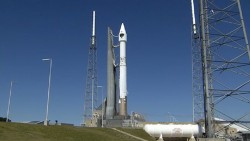
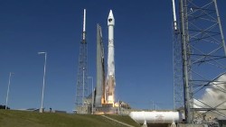
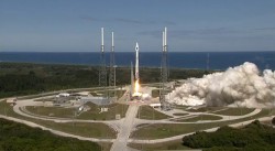
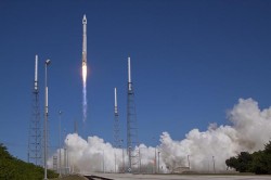
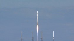
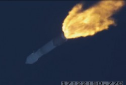
The U.S. Air Force successfully launched its 11th and next-to-last Boeing-built Global Positioning System GPS IIF series satellite aboard a United Launch Alliance Atlas V 401 launch vehicle from Space Launch Complex 41, Cape Canaveral Air Force Station, Fla., on Oct. 31 at 12:13 p.m. EDT (9:13 a.m. PDT).
GPS IIF satellites provide improved signals to support both the warfighter and the growing civilian needs of a global economy. Featuring a new operational third civil signal — L5 — that benefits commercial aviation and safety-of-life applications, the GPS IIF series provides improved accuracy through advanced atomic clocks, a longer design life than previous GPS satellites on orbit.The GPS constellation is healthy, stable and robust with two GPS IIAs, 12 GPS IIRs, seven GPS IIR-Ms and 10 GPS IIF satellites on orbit providing precise global positioning, navigation, and timing services to users around the globe.
Colonel Steven P. Whitney.
“The successful outcome of today’s mission is due to the tremendous commitment of a world class team focused on mission success,” said Col. Steve Whitney, director of the Space and Missile Systems Center’s (SMC) GPS Directorate. “I am pleased to say it’s truly an honor and privilege to be part of a mission that plays such a critical role in our nation’s infrastructure. To the men and women of SMC, the 45th, 50th, 310th Space Wings, Boeing, United Launch Alliance, The Aerospace Corporation, GPS IIF and the Atlas V launch teams, thank you!”
“The GPS IIF satellites play a key role in our modernization effort to provide new space-based capabilities for users around the globe and for decades to come,” said Lt. Gen. Samuel Greaves, SMC commander and Air Force Program Officer for Space. “The successful outcome of today’s mission is due to the tremendous commitment of a world-class team focused on mission success.”
“As the nation’s premier gateway to space, we are proud to be part of the team providing GPS and its capabilities to the world,” said Brig. Gen. Wayne Monteith, 45th Space Wing (Patrick Air Force Base, Fla.) commander, who served as the Launch Decision Authority. “GPS IIF-11 was the 16th launch this year for the wing. Our team diligently prepared for this important mission through a series of rigorous rehearsals, readiness reviews and pre-operational checkouts. Together, with the Space and Missile Systems Center and our industry partners, we make up one team delivering assured space launch and combat capabilities for the nation.”
The integrated team is now preparing GPS IIF-12, the last model of the series, scheduled for launch on Feb. 3, 2016. An airmen-led processing team at Cape Canaveral has processed every launch of the series since GPS IIF-1 launched there in May 2010.
Operated by Air Force Space Command’s 50th Space Wing at Schriever Air Force Base, east of Colorado Springs, Colo., the GPS constellation provides precise positioning, navigation and timing services worldwide as a free service provided by the U.S. Air Force, seven days a week, 24-hours a day.
Major General David Thompson announces a 24-hour delay for the launch of the eleventh GPS-IIF satellite.
Major General David Thompson, Vice Commander, U.S. Air Force Space Command, announced this morning that the GPS IIF launch scheduled for today will be delayed for 24 hours due to a water deluge suppression system at the launch site. Launch should only be delayed for 24 hours.
The water deluge suppression system is a launch site safety issue. Officials made the call on Thursday evening to postpone the launch to correct a leak discovered in a ground support equipment valve for the launch pad water suppression system. The valve will require repair or replacement.
The 19-minute launch window on Saturday extends from 12:13 to 12:32 p.m. EDT (1613-1632 GMT).
A United Launch Alliance Atlas V 401 will launch the GPS IIF-11 mission for the U.S. Air Force on Saturday, Oct. 31, from Space Launch Complex-41 at Cape Canaveral Air Force Station, Fla.
GPS IIF-11 is the second to last of the Block IIF satellites, incorporating improvements to provide greater accuracy, increased signals, and enhanced performance for users.
The GPS IIF satellites deliver second civil signal (L2C) for dual-frequency equipment, and a new third civil signal (L5) to support commercial aviation and safety-of-life applications. The next generation of GPS satellites is GPS III.
GPS IIF-11 will be the third GPS mission ULA launches in 2015. GPS IIF-9 launched on a Delta IV in March, and GPS IIF-10 launched in July. This mission will be ULA’s 11th in 2015 and 102nd since the company was founded in 2006.
A quality assurance team from the 45th Launch Group off-loads a GPS IIF-12 satellite from a C-17 Globemaster III on Cape Canaveral Air Force Station, Fla., Oct. 8. (U.S. Air Force photo/James Rainier)
The last Air Force GPS IIF in a block of 12 satellites was delivered to Cape Canaveral Air Force Station, Florida, from Boeing’s manufacturing facility in El Segundo, Calif., Oct. 8 via a C-17 Globemaster III.
A crowd from the government and industry partnership, who will complete the satellite’s final assembly, gathered on the Cape’s “Skid Strip” to watch the off-loading of the satellite they will prepare to launch aboard a United Launch Alliance rocket in 2016.
“This GPS IIF-12 satellite represents the end of a legacy as it will be the last of the 61 GPS satellites processed here at (Cape Canaveral Air Force Station),” said Brig. Gen. Wayne Monteith, the 45th Space Wing commander. “This culminates an incredible 27-year legacy at our Area 59 Satellite Processing Facility. We are the nation’s premier gateway to space and are humbled to be a part of the team that provides GPS and its capabilities to the world.”
Although there have been other models of GPS launched into space, the Airmen-led processing team at Area 59 is particularly proud to begin preparations to send the last IIF block satellite into orbit. They’ve been behind every launch of the series since the first GPS IIF launched here in May 2010.
“Our combined team’s objective is 100 percent mission success each and every time,” said Col. Eric Krystkowiak, the 45th Launch Group commander. “My Airmen work, in partnership, with Boeing and the system program office at the Space and Missile Systems Center throughout the final stages of satellite processing prior to launch. From spacecraft containerization, shipment from California, the arrival at the Cape Canaveral Air Force Station Landing Strip, final checkouts, fueling and encapsulation, the team is laser focused on identifying and mitigating any issues that could potentially jeopardize mission success.”
The Boeing-assembled GPS IIF 12 that arrived at the Cape Canaveral will undergo a series of prelaunch preparations, checks and rehearsals. These included functional checkout of the spacecraft, compatibility testing, battery installation, fueling, mating to the payload adapter and obtaining a final flight weight.
Members of the quality assurance team range from young military officers to career enlisted troops and seasoned civilians.
“Mission assurance at the launch base is executed with our ‘triad’ of professionals,” Krystkowiak said. “Our mission assurance technicians are enlisted personnel with many years of experience in missile maintenance who are fully engaged and observe the contractor’s work with the satellite. They bring their hands-on experience, strict technical compliance and discipline to the satellite processing realm. Beside them are our company grade officers and civilian engineers who bring their engineering rigor and innovative ideas into the process. Lastly are our Aerospace Corporation partners who provide invaluable experience and legacy system insight to the team with their continuity of satellite processing. Many of these members have been here at the Cape since GPS first launched in 1989 and achieved full operational capability in 1995.”
A field program manager for the team interfaces with 45th SW leadership, the Air Force SMC and the contracted partners throughout the months in between the satellite’s delivery and its launch.
The Evolved Expendable Launch vehicle is used to launch GPS satellites from Cape Canveral into nearly 11,000-mile circular orbits. While circling the Earth, GPS satellites transmit extremely accurate timing data on multiple L-band frequencies. Design life across the satellite blocks range from 7.5 to 12 years, but many are lasting more than 20 years, with the oldest vehicle turning 25 in November.
The GPS Master Control Station, operated by the 50th SW’s 2nd Space Operations Squadron at Schriever Air Force Base, Colo., is responsible for monitoring and controlling the GPS as a 24-satellite system, consisting of six orbital planes, with a minimum of four satellites per plane. There are currently 39 vehicles in the GPS constellation.
Half of the GPS constellation now transmits the new civil signal, L2C. In a matter of weeks, that number will crest into the majority of the constellation when IIF-10 is set active and operational to users. By the end of the year or early 2016, look for 18 usable satellites transmitting L2C. That could be considered a nominal initial operating capability (IOC), though it is unlikely to be declared as such by the Air Force. We can anticipate a full operating capability (FOC) within five years. Many high-precision GPS receivers currently embody L2C signal processing capability.
As Oscar Colombo, research scientist at NASA, noted in a recent CANSPACE contributed note, “This seems like a moment to start seriously thinking about using L2C as much as possible.”
This month’s newsletter presents an amalgam, a panel discussion in virtual print, on several aspects and viewpoints stimulated by his posting,
Some readers may want to peruse this U.S. government bulletin for a general description of L2C; others who feel sufficiently informed may skip directly two paragraphs down to “Three issues might be in the way of that being a practical proposition.”
“L2C is the second civilian GPS signal, designed specifically to meet commercial needs. Its name refers to the radio frequency used by the signal (1227 MHz, or L2) and the fact that it is for civilian use. There are also two military signals at the L2 frequency. When combined with L1 C/A in a dual-frequency receiver, L2C enables ionospheric correction, a technique that boosts accuracy. Civilians with dual-frequency GPS receivers enjoy the same accuracy as the military (or better). For professional users with existing dual-frequency operations, L2C delivers faster signal acquisition, enhanced reliability, and greater operating range. L2C broadcasts at a higher effective power than the legacy L1 C/A signal, making it easier to receive under trees and even indoors. The Commerce Department estimates L2C could generate $5.8 billion in economic productivity benefits through the year 2030. The first GPS IIR(M) satellite featuring L2C launched in 2005. Every GPS satellite fielded since then has included an L2C transmitter.”
Oscar Colombo’s CANSPACE note continues:
“Three issues might be in the way of that [using L2C as much as possible] being a practical proposition, and I would appreciate comments on some or all of them:
“(1) The fact that the new L2C navigation code (CNAV) is being transmitted, but flagged as pre-operational by the USAF, indicating that this organization is not yet ready to guarantee its fitness for use.
“(2) The quarter-wave phase difference with the heritage signal L2.
This one is important to know when fixing the ambiguities of differential observations (double differences and first order differences between satellites) combining L2C data from IIR-M and IIF satellites with those with only L2 (IIR and IIA). Some high-end commercial receivers correct for this phase difference, some don’t. The latest RTCM document I’ve seen that touched on this issue came out in 2013 (RTCM Standard 10403.2, Paragraph 3.1.8, Table 3.1-5), and listed the choices , at that time, by nine leading manufacturers on this matter. The list does not include all of present-day manufacturers of high-end receivers, a list that changes over time.
“(3) There is no proper place for L2C in files in the widely used Rinex 2.11 format.
In principle, this can be taken care of by using data files in the Rinex 3 format. However, the use of Rinex 3, that has some major departures from 2.11, is not universal yet.
“Does anyone know of an up-to-date, reliable and comprehensive list of receiver manufacturers showing those that correct and those that do not correct for the quarter-wave phase shift?”
GPS World contributing editors Eric Gakstatter (Geospatial Solutions) and Don Jewell (Defense) had a private conversation about the above, which I now make public.
Don Jewell: “I can address this from a policy and operational perspective but you [Eric] have a better feel for the users perspective.
“With two more successful IIF launches there will then be 18 L2C SVs broadcasting that signal, and that is considered by the government to be nominal IOC, an initial operating capability. Regardless of where you are on the Earth, shy of 60 deg N and 60 deg S, you should always have at least one or more L2C SVs in view.
“We are probably looking at 2023 (8 more years) before the L2 carrier phase is in jeopardy of shifting without notice. If indeed that ever happens.
“So from an operational and providers (HQ AFSPC, 50SW and 2SOPS) perspective, certainly the L2C signal should be useful and reliable. Just not normally guaranteed until FOC or full operational capability is declared, usually with 24 SVs broadcasting L2C. With no premature losses that will be halfway through the GPS III launch schedule ~ 2019-20.
“Schedules are dynamic and always subject to change of course.”
[Editor’s note: The L2 carrier isn’t going to go away or shifting to another frequency. What might go away is the P(Y) modulation on the L2 carrier if the DoD considers the P(Y) signals redundant once the M-code is fully embraced. If the P(Y) signal on L2 is no longer transmitted, then civil receivers currently using the P(Y) signal to obtain L2 carrier-phase measurements will no longer be able to do this.]
Eric Gakstatter replied, “I’ve heard that some manufacturers say they are taking advantage of L2C when there are IIRM or IIFs in view and maybe some of the receivers I’m using are doing so. I’ve not paid attention to it.
“It could be helpful in areas where users are trying to work in difficult environments such as near and under tree canopy.
“In the case of RTK, I would think the reference station would have to broadcast L2C data.”
A CANSPACE reader provided the following useful reference, which although it dates from 2012, still contains much immutable data: “The most recent view on the situation I have with L2C can be found here.”
This links to the presentation slides from an American Geophysical Union 2012 Fall Meeting paper, “The Effects of L2C Signal Tracking on High-Precision Carrier Phase GPS Positioning: Implication for the Next Generation of GNSS Systems,” by Frederick Blume, Henry Beglund, and Lou Estey of UNAVCO, a non-profit university-governed consortium, facilitates geoscience research and education using geodesy.
Oscar Colombo and other CANSPACE subscribers have contributed several further notes t the L2C discussion string. To read them, it’s possible to access the archives here.
Or you can more simply and elegantly subscribe to CANSPACE; see instructions here.
Last month, Richard Langley and Oliver Montenbruck jointly communicated the following interesting aspect of the U.S. Federal Radionavigation Plan to CANSPACE readers:
“in the new version of the FRP is a new phrasing of the earlier statement on guaranteed availability of the P(Y) signal only up to 2020:
“The [U.S. Government (USG)] commits to maintaining the existing GPS L1 C/A, L1 P(Y), L2C, and L2 P(Y) signal characteristics that enable codeless and semi-codeless GPS access until at least two years after there are 24 operational satellites broadcasting L5. Barring a national security requirement, the USG does not intend to change these signal characteristics before then. Twenty-four satellites broadcasting the L5 signal is estimated to occur in 2024. This will allow for the orderly and systematic transition of users of semi-codeless and codeless receiving equipment to the use of equipment using modernized civil-coded signals. Note that it is expected that 24 operational satellites broadcasting L2C will be available by 2018, enabling transition to that signal at this earlier date. Civilian users of GPS are encouraged to start their planning for transition now.”
Finally, Richard Langley notes that “I have a student looking into which Precise Point Positioning engines can currently process L2C observables, but his report is not yet available. Also, we are looking into adding an optional L2C processing capability to the University of New Brunswick PPP software, GAPS (GPS Analysis and Positioning Software), but that’s a month or so away.”
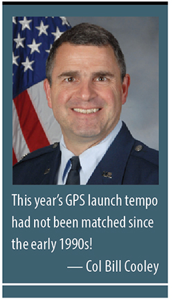
By Colonel William T. “Bill” Cooley, U.S. Air Force, Director, Global Positioning System
Last year in my “Directions” article, I emphasized the commitment made by the U.S. government to ensure GPS signals are available to all users, and I shared some of our excitement in the GPS Directorate regarding the modernized capabilities we are developing and fielding. This year I’d like to share with you progress we’ve made in the past 12 months, provide an update on the modernization initiatives, and challenge civil users and receiver companies to innovate and accelerate these modernized capabilities for users worldwide.
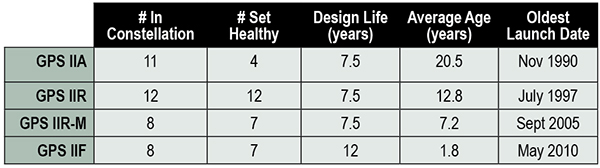
This past year has been productive for the GPS program. The most visible progress was the addition of four new Boeing-built GPS IIF satellites to the GPS constellation, bringing the total number of available satellites from 36 to 39 (SVN-33 was safely disposed in October 2014, or the number would be 40). These additions also reduced the average age of the satellites on orbit from 11.1 to 10.3 years. This year’s GPS launch tempo had not been matched since the early 1990s! Table 1 lists the current satellites in the constellation by block.
TABLE 1. GPS constellation as of October 31, 2014.
Perhaps the most exciting aspect of the GPS satellite constellation is the ever-improving performance. As I mentioned last year, the 2008 Standard Positioning Service (SPS) Performance Standard, issued by the Office of the Secretary of Defense, codifies our commitment to civil users. Among other attributes that make GPS the “gold standard” for positioning, navigation, and timing (PNT), the SPS requires a signal-in-space (SIS) user range error (URE) of 4.0 meters or less for every healthy satellite. The SIS URE is the difference between a GPS satellite’s navigation message (for example, ephemeris data and satellite clock correction data) versus the truth (for example, satellite transmit antenna location and satellite clock offset from GPS time). While the commitment of the U.S. government is four meters or less, the actual average performance over the past year has been 0.68 meters and in the past quarter has been an impressive 0.63 meters!
While this is admirable, continued modernization efforts will allow us even better performance. A significant contributor to the errors experienced by GPS receivers are ionospheric delays that can be eliminated only with knowing the characteristics of the ionosphere (free electron density in the region roughly 100-1,000 kilometers above the Earth’s surface) or by using two signals at different known frequencies. While systems like Federal Aviation Administration Wide Area Augmentation System (WAAS) and the U.S. Coast Guard National Differential GPS (NDGPS) provide a modeled approximation of the ionosphere, the new L2C and L5 civil signals on the GPS IIR-M, GPS IIF, and soon-to-launch GPS III satellites enable GPS receivers to directly measure and eliminate the ionospheric delays altogether — thereby delivering on the GPS modernization program first announced in 1999. These new signals began pre-operational Civil Navigation (CNAV) message broadcast on 28 April 2014 (with the L2C signal set “healthy” and L5 set “unhealthy” until sufficient monitoring capability is established).
With CNAV now on the air, civil users should take advantage of it. My challenge to commercial receiver companies and innovators is to incorporate the modernized signals in future receivers and continue to improve user experience and GPS performance. Currently 14 L2C-broadcasting satellites are in the constellation, and by early 2016 we expect to have 19 on-orbit and transmitting L2C (7 GPS IIR-Ms and 12 GPS IIFs). GPS modernization is well on its way from a signal-in-space perspective; receiver manufacturers and innovators must bring new, improved products and solutions to users.
Less visible but real progress modernizing the GPS Enterprise is underway with the next generation of GPS satellites, ground control, and user equipment segments. The first GPS III satellite and the newly developed navigation payload have been delayed approximately two years from the original planned delivery of the completed GPS III satellite of October 2014. But in September of this year, the GPS III navigation payload was shipped from Exelis (the payload subcontractor) in Clifton, New Jersey, to Lockheed Martin’s (GPS III prime contractor) facility in Waterton, Colorado. There, it completed the payload-level thermal vacuum testing at the end of October, a key step toward payload and eventually satellite vehicle delivery. The first GPS III satellite is now 87% complete and the program is making solid progress.
The GPS Next-Generation Operational Control System (OCX), with Raytheon as the prime contractor, experienced significant challenges in development but can also claim measurable progress this year. Complex cyber-security requirements and their implementation drove a significant number of these challenges, but are essential to provide civil and military GPS users with a secure and resilient command and control system. These and other challenges resulted in significant cost and schedule overruns and a two-year delay to the program, which drove an update to the development plan. The revised OCX plan reflects the complexity of implementing these unique cyber requirements and accounts for planned improvements to Raytheon’s systems engineering and software development approach. The plan establishes a schedule meeting GPS III’s projected first-launch date.
Despite its challenges, OCX development completed four end-to-end space-to-ground launch readiness exercises with GPS III, as well as entered the formal integration and test phase. The new monitoring station receivers are entering qualification test, and the first production receiver is on track to be delivered in spring of 2015. OCX is on track to provide robust PNT services, improvements in URE accuracy, enable access to new military and civil signals, and provide cyber security for the GPS ground control.
Our development of Military GPS User Equipment (MGUE) is another area where we have made important strides this past year. We started the year by developing a commercial market-based acquisition approach that will accelerate delivery of MGUE systems by years. In this effort, we want to establish a race to a certified marketplace where the U.S. government serves as the race official while our industry partners set their own pace to deliver capability. Our goal is to increase speed of delivery to the warfighter while capitalizing on industry’s ability to innovate.
Our MGUE team of government and industry partners (Rockwell Collins, Raytheon, and L3) successfully completed major system design reviews demonstrating a readiness to define the process of security and compatibility certification. Additionally, the team participated in the GYPSY Juliett multi-service, multi-nation PNT demonstration hosted by the U.S. Strategic Command this past summer. While we battled the elements through two hurricanes, the team successfully demonstrated the capability of M-Code receiver cards in an operational demonstration. Our goal is to enable full operational testing with four lead platforms in summer 2016.
While many risks and challenges to GPS modernization still lie ahead of us, the persistent effort by the GPS team has produced important progress in 2014 across the space, ground, and user equipment segments.
A civilian GPS user recently thanked me for providing the incredibly useful utility free to everyone around the globe. Although my impulsive response was to say simply, “You’re welcome,” I’d like to provide a more thoughtful and thorough reply that recognizes those responsible for GPS.
There are two key groups to thank for GPS: the first is the men and women across the United States government and industry who develop, field, and operate the GPS Enterprise. Among this group are satellite factory technicians, software engineers improving the ground segment, receiver designers, program office engineers, and satellite operators continuously monitoring the constellation, updating each GPS satellite’s clock correction and ephemeris data 24/7. This team works with an unwavering passion for this mission that inspires me every day.
The second group responsible for GPS is the American taxpayer who, through Congress, funds the GPS Enterprise every year.The U.S. financial commitment to GPS is not just for U.S. security or the well documented positive impact GPS has on the American economy, but for the benefit of the entire world as a global utility. GPS is the gold standard for PNT because American taxpayers continuously provide fiscal support so the GPS Enterprise’s men and women can design, produce, field, and maintain the global utility that we all have come to depend on.
Thank you for supporting this enterprise, and know that the GPS team works hard to ensure those resources are spent wisely to provide continuously improving, predictable, and dependable performance from the Global Positioning System.
Colonel William T. Cooley is director, Global Positioning Systems (GPS) Directorate, Space and Missile Systems Center, Air Force Space Command, Los Angeles Air Force Base, California.
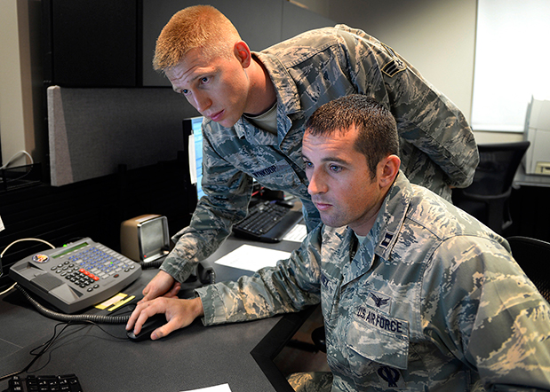
Capt. Jared Delaney, 19th Space Operations Squadron satellite vehicle operator, right, and Senior Airman Bryan Wynkoop, 19 SOPS satellite system operator, monitor telemetry during the GPS SVN-69 launch Oct. 29, 2014 at Schriever Air Force Base, Colo. (U.S. Air Force photo/Dennis Rogers).
The following story by Scott Prater appeared in the Schriever Sentinel, a weekly newspaper published by the Colorado Springs Military Newspaper Group. See http://www.schriever.af.mil/units/publicaffairs/ for further information.
By Scott Prater Schriever Sentinel
11/19/2014 – SCHRIEVER AIR FORCE BASE, Colo. — It’s been a busy year for members of the 19th Space Operations Squadron. As operators of the GPS launch and early orbit, anomaly-resolution and disposal system, 19 SOPS members executed a historically high number of satellite launches (four), and disposed of a legacy GPS vehicle, all within the past 10 months.
“The last time we launched four vehicles in one year was 1993,” said Maj. Kimberly Adams, 19 SOPS LADO flight commander. “We’re looking forward to a more normal [operations] tempo, in the coming year.”
Tensions were high Oct. 29 during the lift-off and early-orbit of SVN-69, a GPS Block IIF vehicle, when a CBS news crew captured film footage of the event on the operations floor here.
“That was out of the ordinary for sure,” Adams said. “Compound that anxiety with the knowledge that we had just completed final configuration of a GPS vehicle disposal not 48 hours prior and you can understand the type of month October was for us and our 2nd Space Operations Squadron teammates.”
Senior Airman Bryan Wynkoop, 19 SOPS satellite system operator, wouldn’t change a thing about the past few months of 2014.
“It’s exciting,” he said. “This sure beats working a regular job. The drama and importance of what’s taking place here is exactly what I signed up for.”
Adams and Wynkoop are Air Force Reservists, as are all 19 SOPS members. The squadron falls under the Air Force’s 310th Space Wing, headquartered at Schriever AFB, and works in partnership with 2 SOPS, the 50th Space Wing unit responsible for commanding and controlling the GPS constellation.
Adams says 19 SOPS was stood up precisely to conduct GPS launches, manage anomalies and process disposals.
“We start preparing for launch about 90 days out,” Adams said. “With so many launches so close together, we often began preparations for one launch before the previous one was off the pad.”
Their partnership with 2 SOPS has proved beneficial for both squadrons.
“This most recent launch was my seventh and Airman Wynkoop’s sixth,” said Adams, who is in her fifth year at 19 SOPS. “Active-duty Airmen typically reside on station for roughly three years, so oftentimes our 2 SOPS teammates are looking to us to provide continuity and experience.”
That continuity became crucial during disposal operations for SVN-33. It had been more than two years since the two squadrons had disposed of a vehicle and Wynkoop was one of the few Airmen at Schriever who was familiar with the operation’s intricacies.
“These events don’t happen often, so to have played a role in two huge events was something special for all of us who were here,” he said.
Less than 48 hours after SVN-33 had been fully configured for disposal, SVN-69 was standing on the launch pad at Cape Canaveral, Florida.
Adams, Wynkoop and their fellow 19 SOPS operators’ day started eight hours prior to the launch.
“Wynkoop had to set up communications links with our antenna at the Cape so we could get telemetry data from the satellite,” Adams said. “Once the rocket lifted off, I was performing communications checks and verifying that we were meeting all of our requirements.”
Then they waited.
Three and half hours after launch, SVN-69 separated from its booster rocket.
“At that point we obtained an initial state of health from the satellite to ensure everything was OK and then we started commanding,” Adams said.
Wynkoop explained that though he and his teammates are actually studying telemetry data through their monitors on the operations floor, it’s easy to envision what’s happening in space.
“The vehicle is spinning once it separates from the booster,” he said. “We then issue commands to slow the spin and deploy the vehicle’s solar arrays, antennas and other critical components. Later, we get the vehicle in a condition known as sun safe. Shortly after, the vehicle acquires Earth and is in a stable orbit in the GPS slot where it’s supposed to be.”
Now, it’s up to 2 SOPS to command and control the satellite, one of 39 on orbit. The squadron expects to receive satellite control authority of the spacecraft later this month and the next GPS launch is scheduled for March 2015.
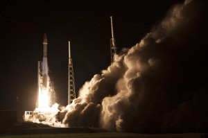
The U.S. Air Force launched the eighth GPS IIF satellite from Cape Canaveral Air Force Station in Florida today at 1:21 Eastern Time, as scheduled. An Atlas V 401 carried the GPS satellite aloft.
GPS IIF-8 is one of the next-generation GPS satellites, incorporating various improvements to provide greater accuracy, increased signals, and enhanced performance for users. With this eighth satellite now launched, only four more Block IIF satellites remain to be placed into orbit. Three are in storage awaiting launch, and one is in production.
“I’m delighted with the outcome of today’s launch. Thanks to the men and women of SMC, the 45th, 50th and 310th Space Wings; Boeing; ULA; the Aerospace Corporation; and the GPS IIF and Atlas V launch teams ceaseless efforts, commitment, dedication, and focus on mission success, we successfully launched the fourth GPS IIF space vehicle this year,” said Col. Bill Cooley, director of Space and Missile Systems Center’s Global Positioning Systems Directorate. “Today’s launch demonstrates our commitment to users around the globe that GPS is the gold standard for position navigation and timing and will continue to deliver capabilities for the foreseeable future,” he said.
After launch, the mission entered a coast phase that lasts about three hours. Following a short second burn of the RL10 engine, the Centaur second stage will deliver the Boeing-built GPS IIF-8 satellite to semi-synchronous orbit over the southern ocean north of Antarctica. Separation takes place about 3 hours, 24 minutes after liftoff.
GPS IIF-8 is the United Launch Alliance‘s fourth GPS launch this year. The mission marks ULA’s 89th mission launched since the company was founded in 2006.
GPS IIF-8 (SVN-69/PRN-03) will replace SVN-51 in the E plane slot 1. SVN-51 will be re-phased from E1 to an auxiliary node at E7 somewhere around SVN-54 currently on station at E4, according to the Air Force Second Space Operations Squadron (2 SOPS). SVN-38/PRN-08 will be taken out of the operational constellation prior to SVN-69 payload initialization and sent to Launch, Anomaly Resolution and Disposal Operations (LADO). PRN-08 will be assigned initially to SVN-49 and set to test.
SVN-38 was launched on November 5, 1997, successfully serving nearly 17 years, 9.5 years beyond its designed service life, due to the diligent efforts of the men and women of the U.S. Air Force. SVN-51 will remain in an auxiliary node once it completes its re-phase journey. The SVN-51 re-phase will take about six months after the initial burn occurs.
The Air Force is set to launch the eighth GPS IIF satellite from Cape Canaveral Air Force Station in Florida on October 29. The 18-minute launch window opens at 1:21 p.m. EDT.
An Atlas V 401 will launch the GPS IIF-8 mission for the U.S. Air Force.
As described by the Air Force, GPS IIF-8 is one of the next-generation GPS satellites, incorporating various improvements to provide greater accuracy, increased signals, and enhanced performance for users.
GPS IIF-8 will be United Launch Alliance’s fourth GPS launch of 2014 and the 12th of the year. The mission will mark ULA’s 89th mission launched since the company was founded in 2006.
To keep up to speed with updates to the launch countdown, dial the ULA launch hotline at 1-877-852-4321 or join the conversation at www.facebook.com/ulalaunch and twitter.com/ulalaunch; look for the #GPSIIF8 hashtag.
The Air Force Second Space Operations Squadron (2 SOPS) indicates that IIF-8, SVN-69/PRN-03, will replace SVN-51 in the E plane slot 1. SVN-51 will be re-phased from E1 to an auxiliary node at E7 somewhere around SVN-54 currently on station at E4. SVN-38/PRN-08 will be taken out of the operational constellation prior to SVN-69 payload initialization and sent to Launch, Anomaly Resolution and Disposal Operations (LADO). PRN-08 will be assigned initially to SVN-49 and set to test.
SVN-38 was launched on November 5, 1997, successfully serving nearly 17 years, 9.5 years beyond its designed service life, due to the diligent efforts of the men and women of the U.S. Air Force. SVN-51 will remain in an auxiliary node once it completes its re-phase journey. The SVN-51 re-phase will take about six months after the initial burn occurs.
Col. William Cooley, Director, U.S.A.F. Global Positioning Systems Directorate.
Colonel William “Wild Bill” Cooley, director of the GPS Directorate at Space and Missile Systems Center, discusses CNAV signals, GPS IIF launches, and the OCX with Defense Editor Don Jewell.
There is probably no busier United States Air Force officer than Colonel William “Wild Bill” Cooley, Ph.D., the director of the GPS Directorate at Space and Missile Systems Center (SMC), Air Force Space Command (AFSPC), Los Angeles AFB, California. He is the driving force for all things dealing with acquisition and development for GPS. Currently, he is juggling so many objects, it is amazing that he is not totally overwhelmed. Consider the issues with the Next-Generation Operational Control System (OCX), GPS IIF, GPS III, and military government user equipment (MGUE), plus a plethora of classified endeavors we can’t even discuss here. He is one busy man, but even with all that, he found time to sit down and answer a few questions in an effort to bring us all up to speed on GPS and PNT.
Don Jewell (DJ): One of the hot topics at all the symposia lately, here and abroad, has been the broadcasting of additional civilian navigation signals and messages. The U.S. Department of Transportation (DOT) originally objected and sent a strongly worded and probably unadvisable letter to General Shelton (AFSPC/CC) on the matter, but sanity prevailed, and the GPS navigation signals on L2C- and L5C-capable satellites began broadcasting with full navigation messages on April 28. However, we understand DOT still insists some restrictions be put in place for the L5C signal. Can you provide us with an update and a status on that program? Plus, what can users expect in the way of improved accuracy and signal availability?
Colonel “Wild Bill” William Cooley (WBC): As of April 28, the civil navigation message (CNAV) broadcast was implemented on all operational GPS satellites capable of transmitting the L2C and L5 signals. Currently, seven GPS IIR-M satellites broadcast L2C, and six GPS IIF satellites broadcast L2C and L5. On average, users may expect at least one L2C-broadcasting satellite to be in view at all times.
The CNAV message content now includes the minimum message set needed to support the positioning, navigation, and timing mission, namely Broadcast Message Types (MT) 10, 11, 30, and 33, which contain information about the satellites’ position, clock, health, and corrections, in lieu of the previously transmitted MT-0 placeholder or default message.
The Air Force intends to broadcast L2C messages with the health bit set healthy and L5 messages with the health bits set unhealthy until sufficient monitoring capabilities are available for the L5 signal. We expect the accuracy to be slightly less than the Legacy Navigation Message (LNAV) because we are only updating the satellites two times each week. The accuracy should improve to be slightly better than LNAV beginning this December, when we begin updating the CNAV message on each satellite daily.
DJ: The M-code (military code) and MNAV (military navigation) signals are also being broadcast on M-code-capable satellites. So, the same questions apply: what can our warfighters and government users expect as far as M-code availability and accuracy? What can you say about the multiple messaging capabilities both on the civilian and military (CNAV and MNAV) signals?
WBC: Like the civil CNAV message, the modernized military-data message MNAV will enable military users to take advantage of all of the performance improvements offered by a modernized military signal. We can expect continued accuracy improvements as newer satellites replace aging satellites.
MNAV broadcast testing will continue occasionally in support of developmental test events for the next-generation military GPS receiver cards.
DJ: I know we can get in sensitive territory here in a hurry, but since we are discussing the military signals, can you give us an update on the long-running MGUE and M-code program? When can government users expect to see an actual signal and a receiver with M-code chips and/or modules that utilize the military only signals? Plus — and here’s where we have to be careful — what can you say about the security, availability, and accuracy of the military signal?
WBC: The M-code-capable military receiver (MGUE) modules in development have successfully acquired and tracked M-code during live-sky tests, and we have many more tests scheduled. MGUE is expected to begin fielding by 2017, at which point at least 18 M-code-capable GPS satellites are expected to be on orbit, providing global four-in-view coverage of full M-code capabilities.
In the meantime, the most recent GPS IIF satellite launches have raised the total number of M-code-capable modernized GPS spacecraft to 14 (seven GPS IIR-M and seven GPS IIF). This provides four or more M-code satellites in view globally at least 50 percent of the time, and at least one M-code satellite in view continuously. This increasing M-code satellite signal coverage will enable effective, realistic, developmental and operational testing of MGUE receivers.
The new GPS III block of satellites will provide an M-code signal with greater security, and higher power, comparable availability, and accuracy when compared with the GPS IIF satellites, allowing users to operate closer to jammers and under trees, as well as with greater resistance to jamming and spoofing. Also OCX will offer significantly improved crypto protection and cyber security.
DJ: Recently, the U.S. Air Force successfully launched the fifth, sixth, and seventh SVs in the GPS IIF family of satellites in less than seven months. Quite a feat! Congratulations are in order for that milestone. However, in the past, the checkout times averaged approximately 30 days. In fact, speed in initializing the IIF SVs and declaring them operational seemed to be an unofficial goal. On GPS IIF-5, however, the rapid checkout timelines have been extended considerably. Can you enlighten us concerning the checkout program and what the government hopes to achieve?
WBC: There are three key dates with regard to checkout timelines: completion of on-orbit checkout, the transfer of Satellite Control Authority (SCA), and the Operational Acceptance of the vehicle. Measured from launch, the nominal on-orbit checkout timeline is 21 days. The nominal checkout for SCA transfer is 28 days. For the IIF-5 mission, the on-orbit checkout occurred in six days and the SCA in 11 days, a record for the IIF program!
The operational acceptance was completed 60 days later, following an on-orbit observation validating a requirement to see if the vehicle works as expected without receiving any commands from the ground segment in that time period.
This may explain the perceived extended checkout, which is in reality a delayed operational acceptance.
The average time to SCA transfer for the first four vehicles is 42 days. The average is inflated due to a long checkout of the first GPS IIF space vehicle, which took 88 days. From IIF-2 to the present, the average SCA transfer time has been 21 days.
Using SCA transfer time makes the most sense, because that is the time it took the SPO to go through the entire process (to include meetings and documentation) to hand over the vehicle.
DJ: Can you give us a status update on the entire GPS IIF family of satellites? How are the SVs faring in orbit, and are the clocks proving to be as stable and accurate as forecast?
WBC: The first seven of 12 GPS IIF satellites are currently on-orbit and meeting all mission requirements. Of the remaining satellites, one is being prepared for launch in October 2014, one is being prepared for shipment to Cape Canaveral AFS, two are in storage, and one is completing production. The oldest satellite is now four years old. The legacy GPS satellites have remained operational well past their design lives, demonstrating the high-quality engineering and mission-assurance practices used on this program. The clocks are improving the overall accuracy of the constellation with the best-ever day (measured in Signal-in-Space User Range Error) in June 2013 of 46.6 centimeters and the best week in April 2014 of 64.6 centimeters.
DJ: What exactly do the IIFs mean to the GPS modernization program, for the average user and for the GPS constellation and program as a whole?
WBC: The 12 Boeing-built GPS IIF satellites will provide improved signals that will enhance the precise global positioning, navigation, and timing (PNT) services supporting both the warfighter and the growing civilian needs of our global economy. The next-generation satellites will provide improved accuracy through advanced atomic clocks, a longer design life than previous GPS satellites, and a new operational third civil signal (L5) that benefits commercial aviation and safety-of-life applications. It will also continue to deploy the modernized capabilities that began with the modernized GPS IIR satellites, including a more robust military signal.
The anomalies that we have seen on orbit have been resolved either through rework at the factory or through modifications in flight software.
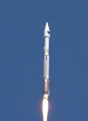
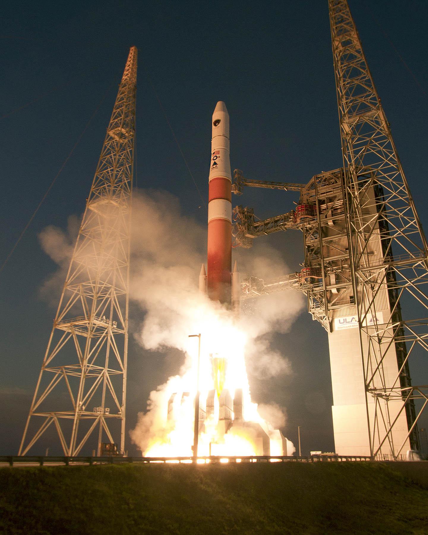
GPS IIF Launch. The seventh of the follow-on generation, rising August 1.
DJ: Bill, that’s comforting, but what about the clocks on the IIF SVs? There were serious problems with the Cesium clocks on the first couple of launches. Are the operators now able to utilize or activate either the Rubidium or the Cesium atomic reference systems?
WBC: Don, the answer is yes. The system has triple redundancy with two Rubidium frequency standard clocks and one Cesium frequency standard.
DJ: What about signal strength and stability on the IIF birds?
WBC: In addition to an increased number of signals, GPS IIF provides more than the legacy power levels, and all signals on GPS IIF meet stability requirements. For reference, the GPS IIR-M series introduced one new L1 and two new L2 signals, while GPS IIF introduced the new L5 signal. All of these signals are part of the GPS IIF navigation payload and provide information including GPS date and time, satellite health, satellite ephemeris (for individual satellite positioning), and almanac information (for information on other satellites in the constellation).
The L1 frequency carries the L1 C/A code for civil users, and the L1 P (Y) code and L1 M-code for military users. The L2 frequency carries the first modernized civil signal, L2C, and the L2 P (Y) code and L2 M-code for military users. Finally, the L5 frequency carries the newest modernized civil signal.
Modernized GPS civil signals provide dual-frequency signals to all GPS users, enabling ionospheric corrections that greatly improve the accuracy. The new L5 signal will be used for safety-of-life applications, including aviation. In addition to an increased number of signals, GPS IIF provides more than the legacy power levels, and all signals on GPS IIF meet stability requirements.
DJ: Let’s move to the ground segment. OCX, the next-generation GPS Command and Control (C2) system, has literally moved to the right on the schedule timeline for every month it has been in existence since it was awarded in 2010. The end date just keeps getting farther and farther away. OCX is also currently exceeding the original contract budget by a large margin.
What’s the problem? Is OCX more difficult or complicated than originally planned? Is there any good news to report to users on OCX? What can users expect in the future?
Just so our readers know, just what is it that OCX brings to the GPS arena that cannot be provided by the current Architecture Evolution Plan (AEP) C2 system? Why do we need OCX? And in your opinion is it still a viable option? Are there contingency plans?
My apologies — that is about eight questions in one, but hopefully you can bring us up to speed on OCX.
WBC: Actually, the primary drivers of schedule delays for OCX are related to:
issues with the integration and testing of Block 0 on the cyber-hardened infrastructure; and
the concurrent systems engineering approach for Block 1 and Block 2, which drove a high rate of rework and inefficient staffing.
The OCX program is a pathfinder for many of the U.S. Air Force’s and Department of Defense’s most rigorous Information Assurance (IA) and Cyber Security requirements, which have turned out to be more complex to implement than anticipated.
OCX is a challenged program, but there is progress to report. Raytheon completed a hardware compatibility and integration test with the non-flight test bed of the Lockheed Martin GPS III space vehicle. This test validated the network infrastructure’s ability to communicate between the Lockheed Martin Launch and Checkout Capability and the Raytheon Launch and Checkout System, sending commands to the full-sized, functional satellite prototype test bed.
In addition, Raytheon and Lockheed Martin completed the third of five planned launch and early orbit exercises to demonstrate launch readiness. This exercise used new installments of the Raytheon OCX software and network infrastructure to demonstrate space-ground communications for initial acquisition, orbit-raising maneuver planning and execution, and basic anomaly detection and resolution.
Another recent accomplishment was the merging of the Cyber Security hardware and software baseline with the Block 0, Launch and Checkout System, mission applications. The completion of this merge allowed the program to enter formal integration and test activities, which are ongoing.
The full capabilities of OCX provide more than a dozen new capabilities for the GPS mission. OCX enables the full capabilities of the modernized navigation signals: adding L2C and L5 for civil users, M-code secure signal for military users, an internationally compatible L1C, as well as worldwide monitoring of these modern signals for quality and integrity.
OCX enables operation of the new GPS III satellites. As we discussed previously, OCX will provide the USAF’s most rigorous cyber-security capabilities, built in from the OCX foundation.
Raytheon just completed implementation of a program re-plan, which implemented lessons learned to date to correct many of the development challenges encountered, and created a lower risk schedule for delivery. With these changes, the program remains a viable and important component of the modernized GPS enterprise.
DJ: With that in mind, when do you currently plan on having the first GPS III OCX-controlled launch? Original schedules called for a late 2014 date, then it was 2015, and now we are hearing 2016 or as late as 2018 for OCX. Are there viable alternatives, and if so, can you tell us what they are and if they are being pursued?
WBC: OCX and GPS III are synchronized to support launch of the first vehicle in the second half of 2016, conditioned upon launch manifest availability. Contingency plans are being developed, but will only be implemented if warranted by the risk.
DJ: Now, Bill, I am not asking you to blow your own horn here, but frankly we have heard nothing but good reports from SMC and the GPS Directorate since you arrived about 14 months ago. That is a short period of time, but evidently you have made your presence felt and have had a major impact on the GPS program overall. What have you done differently that seems to work so well? To what do you ascribe your success so far?
WBC: Thank you, Don. I’m very happy to hear the reports are positive, but the credit goes to the men and women of the GPS Directorate, our federally funded Research and Development Center personnel, and our contractors. My job is to continually assess the challenges and barriers that slow modernization. I help resolve the challenges or get additional resources if needed to enable the team to accomplish their important mission.
I am incredibly fortunate in that the GPS team is passionate about our mission to maintain the Gold Standard for position, navigation, and timing (PNT) for the world. The entire directorate understands the critical role we play for civilian and military users worldwide, and that knowledge motivates and energizes us every day!
I’m the luckiest colonel in the Air Force because I get to work alongside this terrific team of government and contractor professionals on one of the most important missions in the U.S. Air Force.
DJ: Obviously you are proud of your team, and you know what it means to be a great leader. In closing, do you have any final comments?
WBC: Don, just that the GPS Directorate and our contractor team, along with our partners at the 2nd Space Operations Squadron (2SOPS) who fly the GPS constellation 24/7, take our job seriously and understand the important mission we have: to provide reliable and precise position, navigation, and timing services for America’s warfighters, our allies, and civilian users around the globe. GPS is the Gold Standard for space-based PNT today, and we are modernizing to ensure GPS is the Gold Standard for the future.
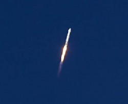
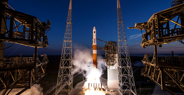
The GPS IIF-6 satellite was launched May 16. Photo credit: United Launch Alliance.
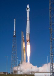
The Air Force is set to launch the seventh GPS IIF satellite this Friday.
An Atlas V 401 will launch the GPS IIF-7 mission for the U.S. Air Force on Friday, August 1, from Space Launch Complex (SLC)-41 at Cape Canaveral Air Force Station, Florida. The 18-minute launch window opens at 11:23 p.m. EDT.
A live webcast of the launch will begin at 11:03 p.m. EDT. To keep up to speed with updates to the launch countdown, dial the ULA launch hotline at 1-877-852-4321 or join the Facebook conversation and follow UA on Twitter using the hashtag #GPSIIF7.
GPS IIF-7 is one of the next-generation GPS satellites, incorporating various improvements to provide greater accuracy, increased signals, and enhanced performance for users.
The Air Force Second Space Operations Squadron indicates that IIF-7, SVN-68/PRN-3, will replace SVN-43 in the F plane slot 3 (F3). SVN-43 will be re-phased from F3 to the F2F slot to replace SVN-26. SVN-33 will be taken out of the operational constellation the day after SVN-68 launch and sent to Launch, Anomaly and Disposal Operations (LADO).
SVN-33 was launched on April 9, 1996, successfully serving over 17.5 years, 10.5 years beyond its design life. SVN-26 will back-up SVN-43 once it completes its re-phase journey.
I’ve written this many, many times in the past eight years that I’ve written for GPS World magazine, but I have to write it again — this is an exciting time for GNSS!
For me, high-precision GNSS is particularly exciting. I’ve been traveling like crazy, and involved in a number of really fun projects that incorporate high-precision GNSS. Of course, on these various projects I usually incorporate many types of technologies that support GNSS, such as computing, communications, power, and mechanical.
Along those lines, I find myself more and more frequently setting up custom RTK bases for companies because they’re getting cheaper and cheaper, regardless of the fact that there are an increasing number of publicly available real-time kinematic (RTK) base stations. Setting one up doesn’t just involve plugging power into a RTK base receiver and hitting the on/off switch. As I mentioned above, setting up an RTK base involves several different types of technologies. Sometimes, I set up a desktop computer next to the RTK base to act as a server to manage the RTK GNSS base and communications (both network and RTK communications) equipment.
In your mind, when you think of a desktop computer, you probably envision something that occupies 2-3 square feet (~one square meter) of desktop space, along with a keyboard and monitor. So, a consideration when deploying an RTK base is finding desk space somewhere in the user’s office to accommodate the desktop PC and other equipment.
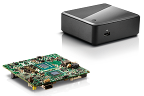
Recently, I took a different approach. I found (actually, my client found) an incredibly small computer to be our server. Just as high-precision GNSS receivers are getting smaller and smaller, so are computers. The Intel Mini-PC measures 4 inches x 4 inches (10.16 x 10.16 centimeters) and has no hard disk. It uses solid-state drive (SSD) memory for storage. SSD technology is still somewhat expensive ($1+ per gigabyte), but it is small compared to a classical disk drive, and doesn’t have any moving parts. Furthermore, the Mini-PC has ethernet ports: when we connect a network cable to it, we could access the Mini-PC via Remote Desktop. That meant we didn’t need a keyboard or monitor. The Mini-PC had all the power we needed, and we could load any sort of control software on it because it runs the standard Windows 7 (or 8) operating system. Last but not least, the Mini-PC costs only $149. However, you need to add memory, SSD, and so on, so the real cost is ~$400 depending on your configuration. While not cheaper than similarly performing “boxes” available, it’s certainly one of the smallest.
Intel Mini-PC Measuring 4″ x 4″
In fact, it’s so small that we stuffed it inside a 14” x 12” electronics enclosure box along with the RTK GNSS base and other network equipment, and hung it out of sight on a closet wall. No desktop space required. Without stretching your mind much, you can see where desktop computing is headed; very small and inexpensive enough to be dedicated to specific tasks. Think about this and then consider the Internet of Things concept. It’s very exciting.
More RTK on Mobile Devices
Later this week I’ll be experimenting with RTK on mobile devices with the CRTN (California Real Time Network), a collection of 330 RTK bases located throughout California. I’ll be using a Panasonic ToughPad running ArcGIS Mobile (and maybe ArcPad) and an iPad using a cloud-based mapping service. The latter is particularly interesting because there are lots of cloud-based GIS data collection apps on the market and under development. Specifically, there’s a lot of subscription-based, cloud-based software. The challenge is that they are even less geodesy-intelligent than the “professional grade” GIS data collection software on the market. In other words, they read coordinates (NMEA format) from GNSS receivers and feed them directly into their app. No datum transformations are provided, neither horizontal nor vertical. That’s going to be a problem.
FCC Levies Record Fine Against Chinese Supplier of GPS and Mobile Phone Jammers
The Federal Communications Commission (FCC) announced that it plans to issue the largest fine in its history against C.T.S. Technology Co., Limited, a Chinese electronics manufacturer and online retailer, for allegedly marketing 285 models of signal jamming devices to U.S. consumers for more than two years. The FCC plans to levy a $34.9 million fine against CTS. The FCC reported that CTS sold 10 high-powered signal jammers to undercover FCC personnel.
The FCC is asking people to report the sale or use of an illegal jammer by contacting the FCC Enforcement Bureau through the FCC online complaint portal, or by calling 1-888-CALL-FCC (or 1-888-225-5322). To voluntarily relinquish a signal jammer, e-mail [email protected]. Additional information, including the FCC Consumer Alert on the jamming prohibitions and the FCC Enforcement Advisory to retailers regarding the marketing of illegal signal jammers, is available at www.fcc.gov/jammers.
You can view the FCC enforcement action against C.T.S. here.
Satellite Launch Pads are Warming Up
Two GPS Block IIF satellites, one launched in February and one launched in May, were set healthy in the past three weeks, making a total of six IIF GPS satellites in orbit broadcasting on three civil frequencies; L1, L2C, L5.
On July 31, the seventh GPS IIF satellite is scheduled for launch, followed by an October 2014 scheduled launch of the eighth GPS IIF satellite.
On June 14, Russia launched a GLONASS-M satellite. It has not been set healthy yet. There are a total of 24 healthy GLONASS satellites in orbit. You can check the current status of GLONASS satellites here.
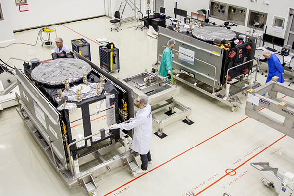
On August 22, Europe is scheduled to launch the first two Galileo FOC (Full Operational Capability) satellites to add to the four test satellites in orbit that will be integrated into the final operational constellation. A second pair of Galileo satellites is scheduled for launch in November 2014. These are projected dates and subject to slippage.
Galileo Satellites in the Clean Room
Live Webinar from the Esri International User Conference on July 17
In a GPS World first, we’ll be producing a live Webinar from the Esri International User Conference next month on Thursday, July 17 @ 10 am Pacific Time in the exhibit hall at the San Diego Convention Center. Of course, the webinar will be focus on one of the hottest topics, high-precision GNSS on mobile devices; from iPads to Android tablets to smartphones.
Tune in or join us live from the exhibit hall floor! Register here.