Tag: Greece

  • Greece nano satellite MICE-1 supports maritime commuications

    Greece nano satellite MICE-1 supports maritime commuications

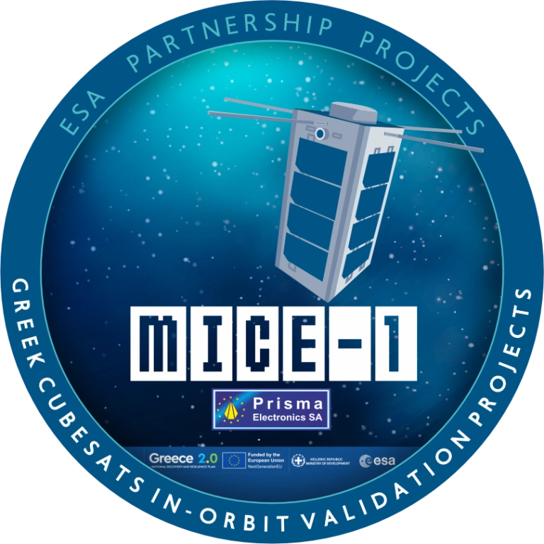
    Greece now has its own internet of things (IoT) nano satellite in space, the MICE-1 (Maritime Identification and Communications systEm). MICE-1 was launched Nov. 28 aboard a Falcon 9 rocket from Vandenberg Space Force Base in California, as part of the Transporter-15 mission by SpaceX.

    MICE-1 is the first Greek nanosatellite specifically designed for maritime and IoT communication applications. Developed at the Prisma Electronics facilities in Alexandroupolis, it aims to bring Greek shipping — and critical operational infrastructures in natural disaster scenarios — closer to the capabilities of space.

    MICE-1 will collect and process shipping and environmental data in real time using artificial intelligence and advanced encryption techniques to ensure secure data transmission and analysis. It also paves the way for Greece’s presence in the field of space applications.

    With real-time data collection and secure, two-way communication, MICE-1 contributes to reducing environmental footprint and promoting green technologies in shipping.

    MICE-1 is a 3U CubeSat nanosatellite equipped with an AIS receiver to record, identify and track ship signals, as well as an S-band IoT communication system. The satellite’s objective is to establish direct communication with ships equipped with LAROS technology — Prisma Electronics’ innovative platform that facilitates the operational monitoring and optimisation of ocean-going vessels.

    MICE-1 enables LAROS to leverage the capabilities of space, providing new tools for sustainable and efficient shipping. The company will also use the nanosatellite to optimize and evaluate the artificial intelligence algorithms it has developed, with the aim of assessing functionality impairment, predicting behaviour and managing telemetry in line with high cybersecurity standards.

    A team of specialized engineers from Prisma Electronics participated in development of the nanosatellite in close collaboration with the European Space Agency. Operation of the main ground station was supported in collaboration with Democritus University of Thrace.

    To meet the requirements of the mission, Prisma Electronics collaborated with international partners in the space sector, including SpaceX, Exolaunch, EnduroSat and IC-Space.

    Prisma Electronics is already planning the next phase: the development of a comprehensive satellite IoT network for use in shipping, environmental monitoring and civil protection. The MICE-1 mission demonstrates that Greece is not just observing international space developments, but actively contributing to shaping them.

    Carried out under the supervision of the European Space Agency (ESA), the mission is part of the Ministry of Digital Governance’s national IOD/IOV CubeSat nanosatellite programme, which forms part of the Greece 2.0 initiative. This programme is funded by the European Union’s Recovery and Resilience Facility (RRF).

  • Mapping marvel: Mapping Earth’s wildfires

    Mapping marvel: Mapping Earth’s wildfires

    Image: FrankRamspott/E+/Getty Images
    Image: FrankRamspott/E+/Getty Images

    It is no secret that the world has been burning for months. Devastating wildfires have encompassed Greece, Canada, the United States, and other parts of the world. These wildfires have incinerated entire communities, taken lives, and has had disastrous environmental effects. This wildfire outbreak can be attributed to several factors, but mainly the global climate crisis.

    Why are these wildfires a monumental problem?  

    Widespread wildfires displace of thousands of people from their homes, raze entire communities and cities, wipe out farmland and other essential resources, create horrific air pollution that causes inflammation of lung tissue and increases vulnerability to infectionsand many other devastating effects. 

    Image: NASA
    Image: NASA

    As reported by NASA, July has been the hottest month on record since the 1880’s. This has caused extreme dry conditions that are ideal for wildfire outbreaks, among other natural disasters. 

    Image: Screenshot of BBC video
    Image: NASA

    Flames engulfed parts of Hawaii the morning of Wednesday, August 9, which destroyed a centuries-old town and killing at least 106 people as of August 16. The wildfires took natives and tourists on the island by surprise. Residents and tourists were forced to evacuate the area – including some who reportedly jumped into the ocean to escape the flames. The National Weather Service stated the combination of high winds and low humidity is what caused the dangerous fire conditions across the island. The devastating fire left behind burned-out cars on once busy streets and smoking piles of debris where historic buildings once stood.  

    Image: Screenshot of BBC video
    Image: Screenshot of BBC video

    The Greece wildfires swept across the island of Rhodes, Corfu and Evia in July, creating thick clouds of smoke and forcing thousands of people the evacuate. These fires were caused by several human imposed factors such as campfires, arson and sheer negligence. However, the deadly heatwave that scorched Europe this summer — caused by carbon emissions — has not helped prevent the start and spread of these wildfires.  

    Image: VichienPetchmai/iStock/Getty Images Plus/Getty Images
    Image: VichienPetchmai/iStock/Getty Images Plus/Getty Images

    The Air Quality Index (AQI) measures the density of five pollutants: ground-level ozone, particulates, carbon monoxide, nitrogen dioxide, and sulfur dioxide. It was originally established by the Environmental Protection Agency to communicate the cleanliness of the air Americans are breathing every day. The index runs from zero to 500 — the higher the number the more polluted the air is. Effects of air pollution can range from mild symptoms, such as eye and throat irritation, to serious ones such as heart and respiratory issues. Pollution can cause inflammation of the lung tissue and increase the vulnerability to infections. 

    During wildfires, fine particles in the soot, ash and dust can fill the air. The AQI identifies the concentration of particles smaller in diameter than 2.5 μM. When these particles are inhaled, the tiny specks can increase the risk of heart attacks, cancer, and respiratory infections — especially in children and older adults. 

    Image: NASA
    Image: NASA

    Based on data from the Canadian Interagency Forest Fire Centre, there are 1037 active fires in Canada: 652 are out of control, 161 are being held in place, and 224 are under control as of August 23. Many of these fires were caused by lightning; however, with above-average temperatures this year and dry conditions, wildfires have been breaking out in Canada since May.  

  • The world is on fire: Wildfires rage in Greece

    The world is on fire: Wildfires rage in Greece

    One month after fire blazed through the Greek island of Rhodes in July 2023, more fires have ripped through Greece amid a heatwave in southern Europe, reported the European Space Agency (ESA).

    A Copernicus Sentinel-2 image (Figure 1) shows the ongoing blaze near Alexandroupoli in the Evros region of northeast Greece – close to the Türkiye border.

    The satellite image is a blend between a natural color and a shortwave infrared composite to highlight the fire front, which was approximately 70 km long as of August 23. The fire has produced a plume of smoke that stretched 1,600 km southwest towards Tunisia. Burned areas can be seen in the image in dark brown.

    Figure 1. (Image: ESA)
    Figure 1. (Image: ESA)

    The Copernicus Sentinel-2 mission is based on a constellation of two identical satellites, each carrying a wide swath high-resolution multispectral imager with 13 spectral bands for monitoring changes in the Earth’s land and vegetation.

    In response to the fires, the Copernicus Emergency Mapping Service has been activated in North Attica, Rodopi, Euboea Island, the Sterea Ellada Region, and East Macedonia. The service uses satellite observations to help civil protection authorities and the international humanitarian community respond efficiently to emergencies.

    Greece has experienced daily outbreaks of dozens of fires over the past week as gale-force winds and hot, dry summer conditions combined to whip up flames and hamper firefighting efforts. On August 26, firefighters tackled 122 fires, including 75 that broke out in the 24 hours between August 25 and August 26, the fire department (formally the Hellenic Fire Service) said.

    Scientists have warned that climate change and land-use changes are projected to make wildfires more frequent and intense. In response, the ESA has reopened its World Fire Atlas, which provides a detailed analysis and map of wildfires across the globe.

    The causes of Greece’s two largest fires have not yet been determined. For some of the smaller blazes, officials have said arson or negligence is suspected, and several people have been arrested, reported NBC News.

  • The world is on fire: ESA maps global wildfires

    The world is on fire: ESA maps global wildfires

    Image: ESA
    Image: ESA

    Wildfires have recently spread across Greece, Italy, Spain, Portugal, Algeria, Tunisia and Canada, causing mass environmental and economic damage as well as human casualties. Scientists have warned that wildfires are becoming more frequent and more widespread.

    In response, an upgraded version of the World Fire Atlas from the European Space Agency (ESA) is now available. The atlas provides a detailed analysis and map of wildfires across the globe.

    Rising global temperatures and the increased extreme weather has led to a surge in the number of wildfires rapidly consuming extensive areas of vegetation and forested lands.

    Considering the severe wildfires, ESA has reopened its World Fire Atlas which offers an insight into the distribution of individual fires taking place at a global scale.

    Through its interactive dashboard, users can compare the frequency of fires between countries as well as analyze the evolution of each wildfire taking place over time. The atlas was first available in 2019 and it supported both European civil protection agencies and firefighters.

    The dashboard uses night-time data from the sea and land surface temperature radiometer (SLSTR) on board the Copernicus Sentinel-3A satellite. Working like a thermometer in the sky, the sensor measures thermal infrared radiation to take the temperature of Earth’s land surfaces which is used to detect the fires.

    Data from the Copernicus Sentinel-3B satellite will be added to the atlas in December.

    Over the previous seven years, data from the World Fire Atlas show a substantial number of fires detected in Portugal, Italy, Greece, France and Spain.

    Data also shows that Canada has experienced 11,598 fires during the first seven months of this year alone. This is a 705% increase compared to fires detected over the same period of the previous six years. Canada is currently battling the country’s worst wildfire season on record, with more than 10 million ha of land burned, which is said to increase in the coming weeks.

  • Greece selects Safran Patroller for tactical UAV fleet

    Greece selects Safran Patroller for tactical UAV fleet


    Image: Safran Electronics  & Defense
    Image: Safran Electronics & Defense

    Safran Electronics & Defense has been selected by the Greek army (officially called the Hellenic Armed Forces) to enhance its tactical UAV fleet by incorporating four Patroller tactical UAVs. NATO‘s Support and Procurement Agency (NSPA) facilitated the contract on behalf of the Greek army during the Paris Air Show 2023.

    Set to be implemented by 2024, the Patrollers will operate alongside Greece’s current fleet of 16 Sperwer tactical unmanned aircraft from Sagem, a French defense company. Greece also requested three ground stations.

    The Patroller achieved a milestone in February 2023 when it became the first tactical UAV system officially certified to NATO airworthiness standard STANAG 4671.

    Equipped with multiple sensors designed for intelligence missions, the Patroller UAV serves the needs of armies and homeland security forces. With an autonomy of more than 15 hours, the Patroller UAV also features a high payload capacity — allowing the integration of various specialized sensors and weapons, which enables it to meet diverse operational requirements.

  • REFAG 2022 abstract submission and registration opens

    REFAG 2022 abstract submission and registration opens

    REFAG 2022 logo

    The IAG International Symposium on Reference Frames for Applications in Geosciences (REFAG 2022), which is organized by the Aristotle University of Thessaloniki under the scientific coordination of Commission 1 of the International Association of Geodesy, will be held in Thessaloniki, Greece on October 17-20.

    REFAG 2022  aims to address today’s theoretical concepts of reference systems and their practical implementation by space geodetic techniques and their combinations, underlying limiting factors, systematic errors and novel approaches for future improvements. The symposium welcomes contributions in all aspects of geodetic reference frames and their applications in Earth science studies, satellite navigation, and also other key areas of geomatics and geospatial information systems.

    The scientific program of the symposium covers all topics related to the activities of IAG Commission 1 and its subgroups, including also other initiatives and projects which endorse the role of geodetic reference frames towards scientific exploration, sustainable development, land administration, disaster risk reduction and climate monitoring.

    The deadline for abstract submissions for the symposium will be until July 20. Accepted abstracts will be notified by e-mail to the corresponding author by July 30. The submission form and submission information can be found at https://www.refag2022.org/abstract-submission/abstract-general-information/.

    Early bird registration is available for REFAG 2022 until July 25. Registration information can be found here.

  • Honeywell SAR technology to improve emergency response in Greece

    Honeywell has signed an agreement with the Greek Ministry of Maritime Affairs and Insular Policy to upgrade Greece’s search-and-rescue operations using next-generation, satellite-based tracking technology.

    Under the agreement, Honeywell will provide the Hellenic Center of Mission Control with eight satellite antennas, three rescue control systems and computer equipment, as well as installation, customization, training and technical support services for seven years.

    Using satellite signals, Honeywell’s technology can precisely locate emergency distress beacons and coordinate the deployment of rapid response teams, the company said.

    The technology incorporates the COSPAS-SARSAT system, an international satellite-based program for distress alert detection and information distribution.

    “By leveraging a network of ground-based antennas and medium earth orbit satellites, we can more precisely locate distress signals from emergency beacons,” said Mehrez Hached, director of business development for Honeywell’s Global Tracking and Search and Rescue business. “This Honeywell solution will help the Greek National Search and Rescue Coordination Center and the Hellenic Coast Guard save lives by quickly identifying aircraft, ships and people in distress regardless of how remote their location.”

    Honeywell will install the satellite antennas on sites operated by the Hellenic Air Force and deploy management and surveillance equipment to the Hellenic Coast Guard Headquarters in Piraeus, Greece.

    Honeywell’s search and rescue solutions are part of the company’s Safety and Productivity Solutions business. Honeywell provides fixed antennas, terminals, consoles and software applications to quickly locate missing assets on land or at sea and minimize emergency response times.

    The company’s software offerings include SARMaster Search, a full-featured incident management application used by frontline operators to coordinate rescue operations, which has helped save tens of thousands of lives.

    Honeywell’s tracking technology was incorporated into the European Space Agency’s Galileo search-and-rescue program, a pan-European program designed to dramatically reduce emergency response times using geo-positioning satellites.

  • EU initiative achieves greater airport safety with 3D GNSS

    EU initiative achieves greater airport safety with 3D GNSS

    The European Union (EU) project BLUEGNSS has been developing GNSS applications in selected European airports to increase safety and airport accessibility, according to the European Commission’s Community Research and Development Information Service (CORDIS).

    BLUEGNSS’s focus has been on advancing the adoption of the Galileo system in Greece, Italy, Cyprus and Malta. The four countries together form the Blue Med functional airspace block (FAB): airspace in which air traffic is managed irrespective of national boundaries. Blue Med is one of the nine FABs formed in Europe to reduce the fragmentation of the European air traffic network.

    Three-dimensional GNSS approaches are being designed for 11 airports in the Blue Med FAB: four each in Greece and Italy, two in Cyprus and one in Malta.

    The primary aim is to harmonize the implementation of required navigation performance approaches among the four countries, CORDIS said. This will enable aircraft to fly along precise flight paths with greater accuracy, and will make it possible to pinpoint aircraft position with precision and integrity.

    Three new procedures. So far, substantial progress has been made towards safety and airport accessibility in the target countries. Since the beginning of 2018, three new GNSS procedures have been validated for Italian airports Cuneo, Lamezia and Parma, followed by another two for Larnaca and Paphos in Cyprus.

    The poor weather conditions under which the Cyprus GNSS approaches were validated served to demonstrate the benefits of GNSS vertical guidance. Since its launch in 2016, BLUEGNSS has designed and validated 14 GNSS procedures.

    Augmented performance of Galileo has been achieved through the European Geostationary Navigation Overlay Service (EGNOS). EGNOS is a satellite-based augmentation system that improves GNSS positioning. Its three satellites and network of more than 39 reference stations in 24 countries enable it to provide greater accuracy than Galileo alone.

    EGNOS’s safety advantages and lower investment costs greatly benefit small and regional airports, which usually can’t afford the high costs of installing and maintaining ground-based navigation aids.

    For this reason, BLUEGNSS has promoted its use in this geographically challenging Mediterranean region.

    “The southeast Mediterranean region lacks full EGNOS coverage,” said GNSS expert Patrizio Vanni of ENAV S.p.A., project coordinator and Italy’s air navigation service provider. “To make things even more challenging, each airport involved in the project presents a very different operational environment.”

    The project hasn’t only focused on designing and validating GNSS approaches at airports where no such procedures have been available up to now. It has also provided the necessary training and monitoring to support implementation by the Blue Med FAB countries.

    Now close to completion, BLUEGNSS (Promoting EGNSS Operational Adoption in Blue Med FAB) is the first project of its kind to be coordinated at FAB level. It may serve as a catalyst to spread required navigation performance approach know-how in the region and beyond, to the whole of Europe.

    (Photo: EU)