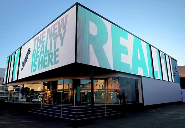
HERE Technologies and Amazon Web Services (AWS) have entered a cloud infrastructure agreement aimed at advancing the development of software-defined vehicles (SDVs). This partnership combines HERE’s mapping solutions with AWS technologies to accelerate the creation of advanced driver assistance systems (ADAS), automated driving (AD) and new digital car experiences.
The collaboration leverages HERE’s expertise in location technology and AWS’s cloud capabilities to address the growing importance of live mapping in modern vehicles. These data-intensive operations can now be supported and scaled more efficiently using AWS, potentially reducing development times and accelerating innovation in the automotive industry.
HERE has been utilizing AWS for its core cloud infrastructure, data platform and AI/ML model deployment for nearly a decade. This expanded collaboration allows HERE to offer automakers a comprehensive set of cloud-native tools and technologies, enhancing various aspects of vehicle functionality, from improved active safety features to optimized infotainment systems.
Key developments
A key development from this partnership is SceneXtract, a solution that streamlines the process of creating simulation-ready scenes for testing ADAS and AD systems. By combining HERE HD Live Map data with AWS’s natural language processing and generative AI services, automotive developers can more efficiently prepare simulations, potentially accelerating the development and deployment of advanced driving technologies.
Beyond the automotive sector, HERE and AWS are collaborating on transportation and logistics solutions. These new offerings, built on AWS infrastructure, aim to help enterprise customers optimize fulfillment, improve supply chain visibility, and support sustainability goals.
On Jan. 6, HERE Technologies, a location data platform, announced its collaboration with Amazon Web Services (AWS), a leading cloud platform. This collaboration will deliver improved performance for indoor and outdoor positioning capabilities, enabling AWS third-party developers to track and manage internet-of-things (IoT) devices.
HERE Positioning enables developers to switch between different localizing technologies, and it does rely exclusively rely on GNSS for the location of a device or application. This is being integrated with the AWS IoT Core Device Location feature, which makes it possible for developers to track and manage IoT devices without relying on GNSS/GPS hardware.
The integration of the two platforms makes devices and applications location-aware globally with a high-level of positioning accuracy and data security.
HERE Positioning maintains a global database of more than 200 million Cell-ID and 5.6 billion Wi-Fi access point locations, which is updated and populated through machine learning algorithms. It supports a variety of device types, regardless of operating system, using Wi-Fi and cellular networks.
Drivers will now be able to enter what3words addresses directly into their in-car systems, allowing them to navigate to any destination
Image: HERE
HERE and what3words have partnered up to offer the next generation of precision in-car navigation. OEMs using HERE Technologies can now include what3words as an in-car navigation feature, with drivers of enabled vehicles able to navigate to any precise 3-meter square using a what3words address.
HERE is the world’s leading navigation platform with its map data services found in 150 million vehicles worldwide. The platform offers products designed to use the latest location content, such as road networks, buildings and traffic systems. The addition of what3words address entry means that drivers can experience the smartest mapping systems, alongside the break-through address system.
what3words is an innovative addressing system which has divided the world into a grid of 3-meter squares and given each square a unique combination of three words: a what3words address. For example, HERE’s Chicago office can be found at ///memory.traps.lease. what3words enables people to easily convey locations as specific as building entrances or parking spots and it provides easy location references in places with no street addresses, such as beaches, parks and remote hiking trails.
Drivers can input a what3words address directly into their car head unit or connected car app, just as they would a street address or point of interest. Millions of what3words addresses are being used over the world, with drivers finding them in booking confirmations, guidebooks, website contact pages or in messages sent by friends.
Drivers can also discover what3words addresses on the free what3words app or the online map. what3words’ technology has been adopted by global car companies, logistics providers and mobility apps, including Mercedes-Benz, Tata Motors, DB Schenker, Hermes and Cabify.
“HERE is the richest, most accurate and freshest mapping system on the market and it now comes with the easiest way to communicate a location,” Chris Sheldrick, CEO and co-founder of what3words said. “Using a traditional address in a vehicle can be a bad experience. They are clunky and lengthy to type, and even a voice assistant will often mishear you. Once the address is accepted, it won’t take you to a precise location, such as the specific entrance you need, it’ll route you to where the pin drops — which is often the centre of the building.
By using what3words, drivers need simply to enter three words and know they will arrive at that precise 3-metre square. We are seeing increasing demand from automakers and mobility services. Now that we are embedded in HERE, we can enable our address system simply and easily in both new and legacy vehicles.”
“Our partnership with what3words is a solid example of how HERE continues to innovate in the area of navigation,” said Jørgen Behrens, senior vice president and chief product officer at HERE Technologies. “Automotive OEMs and Tier 1 suppliers can now provide the what3words service to their customers with the help of HERE Professional Services instead of having to integrate it themselves. This will allow drivers to navigate easily in dense, urban environments with non-standard addressing schemes or seamlessly get to any location, be it a local pub or a trailhead.”
Incorporating this new feature is easily done for both new and existing clients, with what3words available as an add-on to HERE’s core navigation products.
Microsoft Azure customers now have access to HERE Location Services within its self-hosted Azure environments. HERE is providing a new set of application programming interfaces (APIs) for developers to build location-aware applications.
Microsoft Azure is a cloud computing service for building, testing, deploying and managing applications and services through Microsoft-managed data centers.
According to HERE, HERE Location Services such as Routing, Geocoding and Map Tiles APIs offer developers useful tools while ensuring high performance for an application’s most critical processes.
Software developers rely on the accuracy and scale of HERE Location Services to incorporate core location-oriented components into the enterprise-grade applications they build and manage, the company said.
The HERE Location Services available for self-hosting in Azure Virtual Machine environments are:
Routing – provides access to and use of global, real-time and historical traffic information.
Forward Geocoder and Reverse Geocoder – provides comprehensive coverage in 196 countries and several territories with a high-precision mapping of geo-coordinates or addresses.
Map Tiles– shows fresh day-time map tiles in multiple styles (for example, base and aerial) including rendered live-traffic tiles for flow overlay.
Applications for HERE Location Services include the following.
Fleet management and emergency services
Create safe and efficient routing solutions for multiple vehicle types
Provide the most efficient routing options based on real-time traffic conditions
Seamless mobility
Provide routing options for pedestrians and public transportation
Help cities run more smoothly with improved traffic flow and transportation network usage
Business intelligence:
Understand trends and behavior of citizens in relation to their location and mobility patterns
Understand shifting market dynamics to inform real-estate investments
Verify insurance claims and authenticate transactions
HERE Location Services are available to Azure customers who want to manage and deliver highly available location-based services. The self-hosted architecture ensures maximum availability and resiliency for Azure customers running critical business applications that rely on “always-on” location services.
“Location anchors our connected world and HERE Location Services enable industries to solve complex challenges while delivering valuable new products and experiences,” said Mithun Dhar, General Manager, Developer Relations at HERE Technologies. “Demands on business require flexibility in software architecture, and HERE is proud to offer robust and high-quality location services to customers operating across public cloud, self-hosted or hybrid environments.”
HERE Location Services are also available as Serverless Functions on the Azure Marketplace. For the latest Azure developer content, go to HERE | Azure Marketplace.
The company also announces that HERE Navigation On-Demand is OEM-ready with APCOA as partner
HERE Technologies has introduced at CES 2020 its High Definition Global Navigation Satellite System (HD GNSS) positioning, a cloud-based solution that enables mass-market devices to achieve sub-meter accuracy across the globe.
CES 2020, the massive annual consumer electronics show, is taking place Jan. 7-10 in Las Vegas. Here’s booth is at Central Plaza, Tech East.
HD GNSS enables new user experiences with lane-level navigation, augmented and virtual reality. It combines precise point positioning (PPP) and real-time kinematic (RTK) positioning methods, allowing for fast convergence time, high availability and global coverage.
It also supports off-the-shelf mobile devices and internet of things (IoT) trackers equipped with dual frequency chipsets such as the Broadcom BCM47765 and BCM47755.
Photo: HERE
More mass-market devices and vehicles are being equipped with dual-frequency GNSS receivers. With the HD GNSS service, the receivers enable high-precision positioning, HERE said, a capability that was cost and geographically prohibitive less than two years ago.
HERE HD GNSS accelerates chipset, hardware and software makers’ ability to offer a step change in what can be delivered to consumers in new product capabilities, features and user experiences, the company said.
HERE HD GNSS data delivery is optimized for mobile devices, requires no additional hardware and comes equipped with spoofing detection and phone sensor integration. It provides global coverage (including China and Japan), with single-frequency mobile device support in the future.
HERE is also working across a partner ecosystem — including reference station operators, chipset manufacturers, module makers, hardware vendors, mobile network operators and system integrators — to jointly improve the positioning accuracy to centimeter levels, and in more challenging environments such as urban canyons.
Automotive use cases
Autonomous driving. For safety, it’s critical that automated vehicles are designed with high levels of redundancy in positioning systems. If an automated vehicle gets caught in bad weather conditions which are degrading optical sensor operations, <0.2m positioning accuracy available via HD GNSS increases safety and operation time in autonomous mode.
Assisted driving. In case of an obstacle on the road, HD GNSS combined with HERE HD maps provide obstacle indication and avoidance functionality.
Mobile device use cases
Road lane guidance and improved ETAs on mobile devices. If a driver is unfamiliar with the roadway, HERE HD GNSS, combined with precision HERE map data, shows the driver the correct lane and path to navigate to the destination fast and safely.
Improved gaming and augmented reality experience. Location-based games are growing and widely popular, however they currently rely on less accurate positioning technologies that inhibit next generation use cases. HERE HD GNSS bring exciting opportunities to design the next version of games with sub-meter positional accuracy.
HERE Navigation On-Demand is OEM-ready with APCOA as partner
HERE Navigation On-Demand is now available for integration in OEM infotainment programs. APCOA Parking is the first non-automotive company to use the Service Package SDK to make its parking services available on HERE Navigation On-Demand.
HERE Technologies’ software-as-a-service solution HERE Navigation On-Demand is available for integration in OEM infotainment programs. With HERE Navigation On-Demand, OEMs and Tier 1 vendors get to deliver both connected services and expandable navigation experiences on both embedded and mobile platforms.
The connected solution cuts development and lifecycle costs by offering cutting-edge, off-the-shelf functionalities while enabling OEMs and Tier 1 vendors to use an SDK to build their own features or integrate third party services.
As a software-as-a-service offering, HERE Navigation On-Demand enables OEMs to remotely configure and monitor the deployed navigation solution making it possible to update and upgrade the experience anytime, even after the sale of the vehicle.
OEMs can further offer any functionality as a subscription option and thus generate new, recurring revenue streams. The end-user accesses the navigation experience through client software which downloads the Service Packages from the cloud.
The highly modular Service Packages include map data, software features, UX elements and references to Cloud Service APIs. Smart caching of these Service Packages ensures that HERE Navigation On-Demand also works offline.
Alexa, Amazon’s cloud-based voice service, is pre-integrated into HERE Navigation On-Demand, making it faster and easier for automakers to deliver an intuitive, voice-first navigation experience to customers in the car.
Members of the public often turn to GPS World and Geospatial Solutions for help when their personal device gives them incorrect mapping information.
GPS.gov has set up a page that points users to the correct place to report problems, by walking them through a series of steps.
As our readers know, the problem isn’t with the satellites, but in the mapping software used by the devices and apps. Links are provided to mapping companies Google, Waze, TomTom, HERE, OpenStreetMap, Garmin and Apple.
A: Similar to airplanes with an autopilot feature, the key issues that must be addressed in autonomous vehicles are redundancy and reliability of systems and appropriate, timely signals to the operator. One key area where this is required is the location of the vehicle. Autonomous location systems have to take into account areas where GPS works fine — but may suffer from an outage — and where GPS does not work, such as in urban canyons.
Jane Macfarlane Chief Scientist, Head of Research HERE
A: Autonomous vehicles face two key challenges. The first is enabling the vehicle to see beyond its sensors. Autonomous vehicles are composed of two functions: sensing the local environment and controlling the vehicle to operate in the sensed environment. This model must be extended to include the larger environment using cloud-delivered map information informed by a connected vehicle fleet. The second is building intelligence that allows autonomous vehicles to share the road safely with human drivers.
A: The development of autonomous vehicle sensors, artificial intelligence and software is advancing rapidly. Technology is being tested in open-road environments — and in bad weather. Component costs are falling as technology companies and automakers eye specific rollout dates. What could slow this developing industry is bad press, and the resulting government regulation, from a high-profile cyber security breach or an incident like a partially autonomous car getting into a fatal crash.
Europe has leapt forward in the ragged advance toward autonomous road travel. The Declaration of Amsterdam, “Cooperation in the field of connected and automated driving,” signed April 14 by the 28 transport ministers of the European Union member states, lays out a strong vision of road future. The language shows some pretty steely resolve to see a driverless ground transport infrastructure materialize, and soon.
Overall, the ministers and the considerable might of assembled European government foresee “the development of mobility as a service.” Not as something that individuals undertake for themselves, but something that society (or corporations in society’s service) provides. Whether paid for by use or by taxes, travel may soon resemble healthcare.
All the usual compelling reasons are cited — safety, efficiency, reduced congestion — but the declaration offers a few more that aren’t heard as frequently:
The transition towards a zero-emissions society and the circular economy.
Benefit to the aging population (something everyone can relate to since we’re all headed that direction).
Improved mobility in rural areas.
The ministers acknowledge that ahead lie challenges aplenty, and not just the technological sort. “There are important questions to be answered regarding security, social inclusion, use of data, privacy, liability, ethics, public support and” — here’s the thorniest of all, in my view — “the co-existence of connected and automated vehicles with manually controlled vehicles.”
Three thoughts lifted from conversation with Jane Macfarlane, chief scientist at HERE:
The ecosystem hasn’t formed yet and nobody exactly knows what it looks like.
The map is critical to that vision. We have to go much deeper into the representation of sensor data and the environment. GNSS is at the absolute core of that.
Trust is key in a vehicle that’s controlling itself.
Whatever the new ecosystem turns out to be, this little red number may be an endangered species there. Alternately, networks or reserves for private driving may develop, much like civil aviation in the shadow of modern airline transport.
Down the road a piece, a brave new world awaits us.
In what was 2015’s largest location-industry deal, three German luxury auto manufacturers completed the purchase of HERE. But that wasn’t the only recent acquisition as location-based services provider TeleCommunication Systems, or TCS, was bought by Comtech Telecommunication Corp. Both deals indicate the growing, and continued growth, of location services going forward into 2016.
Three German automakers are now in the location business following the finalization of a $2.8 billion deal to buy Nokia’s HERE digital mapping company last week. Audi, BMW and Daimler are now equal owners of HERE following quick regulatory approval.
While some say there was much Nokia-driven hype about who was bidding on HERE, including Uber and Baidu, ultimately others breathed a sigh of relief that automotive companies, not Google, bought the digital mapping pioneer.
The deal, which was originally announced in early August, shows the continued value of accurate maps to the automotive industry as it transitions for connected to autonomous vehicles. In addition, the number of big suitors interested in HERE shows the rise in the potential and real market for location-based services in both smartphones and connected vehicles.
Many of the early suitors balked at HERE’s early price tag, estimated to be more than $4 billion. Uber, which some felt would be a good match for HERE because of their autonomous vehicle intentions, decided to go in another direction, buying mapping company deCarta.
While it’s too early to analyze the consequences of the deal, some analysts say it will be interesting to see if the new owners keep the mapping giant neutral to not alienate future clients.
It remains to be seen whether its competitor, TomTom, which also has been talked about as an acquisition target, should stay as an independent company or form its own consortium.
Nokia purchased HERE, the former Navteq, for $8 billion in 2007. The sale of HERE is part of Nokia’s transformation as it completes its $16.6 billion acquisition of Alcatel-Lucent, which is expected to close early next year.
In another big deal since our last column, Annapolis, Md.-based TeleCommunication Systems was acquired by Comtech Telecommunication Corp. for $430.8 million deal. The deal is expected to close in March 2016.
TCS was one of the first companies to do it all in the consumer location space, buying entities in automotive navigation and also making inroads in the fleet management and indoor positioning/9-1-1 space. The company most recently was developing location technology for mobile, or m-health markets.
Cyber Security Big Connected Vehicle Concern in 2015
As we review the past year, one of the biggest connected vehicle trends in 2015 was when cyber security became real for the automakers, said Jon Allen, Booz Allen Commercial Solutions principal.
“Just as automakers are increasingly demonstrating the power of automation, their momentum is challenged by researchers showing they really can hack into vehicles. While there are engineering challenges ahead to realize the full potential of autonomy, the priority in automotive is to protect the trust of customers and regulators as autonomous capabilities are further developed,” he said. “That puts cyber at the top of the agenda.”
2016, OEMs will need to further embrace a security mindset, Allen said. “These [cyber risk] issues are solved by designing, engineering and testing your vehicle to meet defined standards. But cyber risk has an outside variable you can’t control: cyber threat actors. This means you’re not just engineering a solution — you’re fighting an adversary,” he said.
Allen said that automakers need to identify a single leader to champion vehicle cyber security, supporting them up with an integrated, cross-functional team. “That includes experts from safety, privacy, IT, legal, engineering, manufacturing, customer service and supply chain,” he said.
Autonomous vehicles tout a safety record that far surpasses today’s cars, but a cyber incident has potential to reverse that claim, Allen said. The “doomsday” scenario is attacking multiple vehicles over the air to “brick” multiple platforms, but this may be an unlikely near-term scenario, he said.
“The near-term attacks will be motivated by money. That’s why many of the largest hacks were designed to exploit personal and financial information,” Allen said.
At a Colorado Space Roundup meeting in Denver last week, Thad Allen, former Coast Guard commandant and now executive vice president at Booz Allen Hamilton, said that there won’t be a “cyber Pearl Harbor” as the government and civilian entities should have had plenty of warning it was coming. Allen, who was in Denver working on the GPS Operational Control System, or OCX, also said that it would be catastrophic if the GPS infrastructure was compromised.
“If someone does something to disrupt GPS, it will affect everyone,” said Allen, who oversaw the Hurricane Katrina and Deepwater Horizon oil spill operations.
Indoor Positioning’s Big Story in 2015: Consumer Appliances?
While there were several significant tests and infrastructure rollouts, at least one analyst says the rise of indoor positioning in consumer appliances was huge. Bruce Krulwich, Grizzly Analytics founder, said that such companies as Move ‘n See are putting location chips into electronic devices.
Move ‘n See also has a camera robot, called Pixio, which follows a person moving around a sports field or other indoor site. “What’s huge about this is not the product itself — it’s hard to tell whether it will appeal to the masses or only a niche market–but I believe that it’s the first in a new trend of electronic products that enhance their capabilities by incorporating indoor location technology,” he said.
In other location news:
CalAmp Corp. said it made a $113 million offer for LoJack Corp., which is a pioneer in car theft-recovery using location technology. According to published reports, CalAmp has made three cash offers for Lojack in the past 14 months. LoJack’s car recovery systems use location technology, which seems to be a great fit for CalAmp, which offers fleet tracking software.
It’s been a good run. After eight-and-a-half years, this is my last Wireless LBS Insider column. Many thanks to Alan Cameron and Tracy Cozzens, both seasoned journalists, who steered me on the right course over the years. I will be at CES in a freelance role next month and will continue to operate my autonomous vehicle conference, Driverless.
Volvo Cars has chosen HERE to power connected navigation for the next-generation in-car control system for new and future Volvo models as part of a multi-year agreement between the two companies.
Volvo’s in-car system, Sensus, offers customers a fully connected experience and incorporates advanced maps and services enabled by the HERE location cloud to provide drivers with smart guidance in and out of the car.
The first model featuring the new Sensus system is the XC90, Volvo’s luxury SUV that started shipping earlier this year.
Omnitracs LLC has added Omnitracs Navigation to its portfolio of solutions. Omnitracs Navigation uses Big Data collected from more than 250,000 customers contributing more than four billion data points. The company terms Omnitracs Navigation the “next generation of navigation solutions” — it provides critical information to drivers through a user-friendly interface, with fast, near real-time updates and extensive fleet configuration options.
Omnitracs Navigation delivers critical information drivers need in a meaningful and distraction-free way, enabling them to be time efficient, stress free and safe while navigating.
Omnitracs Navigation provides fleets and drivers with the following features:
Data Publishing — All of the data is stored onboard with Omnitracs as the data publisher. Updates are sent to the unit automatically as the data changes so that the unit is always current. By leveraging traditional data (such as posted speed and traffic light locations) combined with real-time data (including current traffic and weather conditions), and Big Data (how a particular road is used at a certain time, and “black spot” high frequency accident zones), Omnitracs Navigation delivers a more consistent, predictable and accurate plan for maximizing the road network.
Actionable Data — Data is pulled from Omnitracs telematics units to build statistical models that create an enhanced, truck-preferred network that is constantly pushing new and actionable data to drivers. More than turn-by-turn instructions, the tool is constantly updated to ensure that drivers have a better and safer navigation experience.
Driver Community — Omnitracs Navigation has a closed-loop feedback mechanism, which brings driver feedback into the data-editing process and gives them an opportunity to improve their navigation experience, along with the navigation experience of fellow drivers. The loop is closed by informing the driver of how his or her feedback was used, leading to improved driver satisfaction and retention by acting as the driver’s trusted advisor.
“Navigation has evolved with the advent of smartphones and GPS devices, and the days of folded paper road maps are gone,” said Rick Turek, chief navigation scientist at Omnitracs. “However, we know that current and hybrid systems aren’t yet perfected and still struggle in keeping data current. Imagine not knowing that a new road has opened up or that a road’s name has changed; these are the types of things that can easily frustrate drivers. Omnitracs Navigation is the next-generation navigational solution that delivers current and actionable data so that drivers can do their jobs more safely and efficiently.”
Omnitracs Navigation leverages the proven technologies of HERE and INRIX. HERE Map Content contributes rich, automotive-grade data that enables large semi fleets to navigate across the U.S. and Canada. Through this partnership, Omnitracs provides precise turn-by-turn navigation, as well as enhanced resource tracking and route optimization.
INRIX will provide real-time traffic and historic traffic profiles, along with travel time and incident alerts, for every major road type including highways, arterials and city streets. INRIX combines information from connected vehicles and other public and private sources to provide accurate real-time traffic that covers more than five million miles in 42 countries. Omnitracs Navigation will launch with INRIX Traffic XD Profiles, followed by real-time traffic and incidents.
It has been an interesting month for developments in location. Nokia is looking for a buyer for HERE, the mapping and navigation business that once set the industry gold standard. While carriers are planning how they will comply with new FCC mandates for locating indoor E911 calls, the commercial indoor location market has moved beyond “emerging” and is well underway. It is a confusing ecosystem for buyers of indoor location solutions. And there is yet another mega-entry into the connected vehicle market, Alibaba and China’s SAIC Motor.
With the likely merger of Nokia and Alcatel-Lucent, Nokia has started looking for a buyer for its digital map and LBS division. The mapping industry has changed dramatically since Nokia purchased the mapping leader Navteq in 2007. Google has become a mapping juggernaut, and less accurate free maps have become serviceable for many types of uses. In fall 2014, Nokia took a EUR1.2-billion impairment charge on HERE’s book value and now estimates the fair value for HERE at EUR2 billion. Possible buyers include Google, Microsoft, Apple and Uber, all companies with deep pockets and hardy appetites.
Indoor Location Market Is Messy. The indoor location market is pulling away from the station, as technology is ready and there are applications and use cases primed to get started. Unfortunately, the market is chaotic, teaming with companies offering solutions with various levels of accuracy, infrastructure requirements and cost. An ideal indoor location technology would provide at least 3-meter accuracy, be cost effective and fully universal, working anywhere on all devices. It doesn’t exist, but the competing technologies, all with trade-offs, will find applications that fit. For instance, the precision required in locating an apartment in the case of an E911 emergency call differs greatly from the pinpoint accuracy need by an app that directs a shopper to Lucky Charms cereal on an aisle crowded with boxes.
One Size Doesn’t Fit All. There is more to an indoor location technology than accuracy. “Accuracy is important, but so is universality, the ability to work everywhere and in all phones. So is cost, in terms of the investment required from a site deploying the technology,” asserts Bruce Krulwich of Grizzly Analytics. “Universal technologies can win in the market even if they’re less accurate, and technologies with cheaper infrastructure can win even if they’re less accurate than those with expensive infrastructure. High-end systems can deliver sub-meter accuracy to those willing to pay for it.” Grizzly Analytics just completed a comprehensive report on the indoor location market.
Test First. Each of the numerous companies vying for the indoor location market makes claims regarding accuracy, availability/coverage, latency and battery usage. Judicious companies that invest in indoor location systems would be wise to test the claims of vendors. “Making a fair comparison among different indoor location offerings is complex, and nuances in how the testing is performed need to be controlled to ensure an apple-to-apple comparison,” asserted Khaled Dessouky of ComVerity. “It is important to use an unbiased methodology that relates to your use cases.” Dessouky managed the neutral test bed for the FCC’s Communications Security, Reliability and Interoperability Council (CSRIC) for indoor E911 calls.
Quuppa. An interesting highly accurate offering comes from Quuppa, a Finnish company with a bunch of high caliber researchers spun off from Nokia. Like some others, they are using Bluetooth Low Energy (BLE) beacons, but add angle of arrival (AOA) algorithms that pump up the precision, which they self-report to be 30 centimeters to 1 meter. With this performance, Quuppa has been used in sports to track hockey pucks and athletes’ movements during game play for coaching, player load monitoring and infotainment that can be broadcast during the game. The use of this type of high-precision location in health care settings is compelling. Patient flow management, security and critical asset tracking can be improved with precise positioning technology. Quuppa is a system that likely wouldn’t be used in apps that locate a coffee shop at a mall, but for uses that demand high performance and can spare some expense, it is compelling.
And Yet Another Mega Entry. The number of companies vying for a piece of the connected-car market keeps expanding and getting more international. E-commerce giant Alibaba and SAIC Motor, China’s popular car maker, together set up a $160 million fund to develop “car on the Internet.” Alibaba will be leveraging its communications, entertainment, map and cloud-computing services. The company joins a group that includes Google, Apple, Baidu and Uber in challenging auto makers.