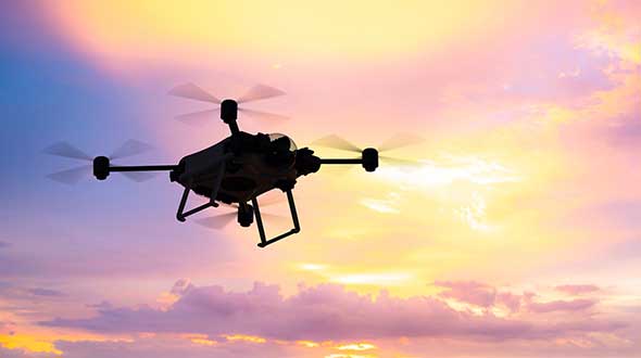
Auterion, an open-source drone software platform provider, has partnered with C2 Group — a program, project and construction management firm — to power the use of drones for inspection, mapping and disaster response across the utilities and critical infrastructure industries.
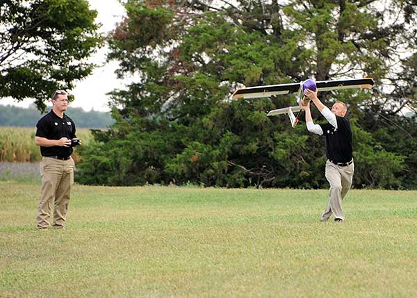
The collaboration has been formed after C2 Group conducted extensive testing of the Vantage Robotics Vesper drone powered by Auterion to inspect power lines at its UAS testing ground and assess viability within the utilities space.
Auterion and C2 Group have seen a shift in the utility industry to move away from drones manufactured overseas to focus on the adoption of U.S.-made products such as the Vesper, a Blue sUAS-certified product used by the U.S. military.
Features on the Vesper that the utilities industry can use include high-quality sensors and thermal capabilities, while its stability and lightweight design make it rapidly deployable.
Utilizing the data security, quality and flexibility enabled by Auterion across multiple UAS manufacturers means C2 Group pilots can be trained on one flight platform but fly any drone associated with it; reducing the training time and increasing overall productivity. Further productivity measures are achieved with Auterion’s Suite used to identify pilot efficiencies and its Simulator to augment pilot training. At the same time C2, with its industry knowledge having worked with multiple major utilities in the US, is providing insight that is helping to shape Auterion’s roadmap for new sensors and airframes into the future.
Brandon Del Priore, CTO at C2 Group, said: “We are proud to partner with Auterion to bring some of the best technology developed in the US to our clients in the utilities and critical infrastructure industries. When safety, data security, and data quality matter most, C2 Group will be there to offer customers the same US-made hardware and software used by the DoD’s Defense Innovation Unit and the US military. The open source ecosystem is helping to drive a better footprint within the marketplace and a better level of compatibility for US made products.”
Cynthia Huang, VP Enterprise Business Development at Auterion, said: “With DJI added to the entity list, we’re seeing enterprise drone operators accelerate their search for alternatives. Auterion’s open source software ecosystem provides more options, more solutions, and faster development timelines to the needs being identified today and companies are embracing the power of our approach. We are excited to partner with C2 Group to bring US made solutions and the advantages of open source to their customers.”
For more information, visit www.auterion.com/enterprise
Why do we keep hearing about unmanned aircraft all the time, almost everywhere? Fortunately, the buzz has gone beyond next-door neighbors flying dangerously close to your roof or hovering annoyingly around a living room window, and incidents of UAV incursions shutting down airports seem to be getting fewer — improved enforcement and higher penalties may be slowing down these incidents.
Now, UAV users are taking on productive, innovative tasks that couldn’t previously be done, or finishing projects surprisingly quickly and more affordably than ever before, with drones built or adapted for new applications. And equipment manufacturers are creating new sensors customized for use on drones.
Commercial, integrated GNSS/inertial sensors are available that have extremely high performance — previously only available with expensive mil-spec electronics — but in lightweight, small packages, supported by real-time kinematic (RTK), precise point positioning (PPP) corrections or post-processed kinematic (PPK). UAVs carry still, video and multi-spectral cameras generating automatically geocoded outputs, ready for post processing into multi-layered formats — virtually everything a customer could ever dream of having. And lidar sensors enable drones to build accurate models of everything they overfly.
Drones originated largely with military forces. Originally used for forward intelligence gathering, UAV tasks have multiplied and substantially expanded in scope.
Commercial industries were quick to realize the benefits. Before drones, the cost of many tasks done manually would be prohibitive and too time-intensive. Fast, affordable data collection now allows us to quickly tackle and solve many problems.
UAVs can pre-survey large, previously inaccessible tracts of difficult terrain, collect detailed visual representations of entire cities, monitor and support crop growth, or even survey underwater terrain using lidar. UAVs provide crop-growing support by flying autonomous patterns and spraying fields with pesticides or fertilizer. They also are being called into service to spray villages with disinfectant to control the spread of coronavirus, and to survey England’s beaches to monitor coastal erosion.
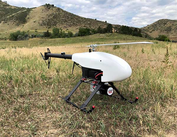
Lidar USA is partnering with Innoflight Technology, a manufacturer specializing in UAV systems for surveying, mapping and inspection.
As a result of the partnership, Lidar USA is offering the Galaxy 950 platform to carry any of its sensors while consistently providing flight times over 30 minutes.
Based in Somerville, Alabama, Lidar USA specializes in the design and integration of economical lidar sensors.
Innoflight and Lidar USA’s partnership is another step for both companies to offer turn-key solutions focused on quickly and safely acquiring high-quality data.
Innoflight designed the Galaxy 950 to simplify the flying aspect of remote sensing with UAVs. The helicopter includes a parachute, automatic takeoff and landing, and extended visual-line-of-sight capabilities to maximize productive time.
For corridor/electric utility line projects, the Galaxy 950 pairs well with the recently announced CL-90 by Teledyne Optech. As the first integration partner of the new compact lidar system, Lidar USA is offering maximum productivity at UAV flight ceilings while achieving improved canopy penetration and exceptional downward point density.
“Lidar USA and Innoflight Technology are both committed to customer success, and this partnership provides the whole package for lidar mapping solutions with UAV,” said Jeff Fagerman, CEO of Lidar USA. “Innoflight’s Galaxy 950 offers exceptional performance in safety, flight duration, and ease of use, which is what our customers need for their projects.”
The Galaxy 950 is now available from Lidar USA as an integrated package with any of their scanning systems.
From growing crops to making movies, unmanned aerial vehicles (UAVs) are changing the way we work. UAVs — managed by unmanned aerial systems, or UAS — range from small indoor inspection units to giant Predator drones. They are streamlining how we manage mines and plants, deliver packages, and keep people safe. Read on to find out the latest in this skyrocketing market.
The unmanned aerial system (UAS) industry is in great shape! In the United States., the Federal Aviation Administration (FAA) appears to be helping commercial operations get off the ground, at least for those wishing to fly small unmanned aerial vehicles (UAVs).
Things are certainly hopping for unmanned aircraft in agriculture, mining and construction, facility inspection, newsgathering, movies and promotion. Package delivery is on the way, and, of course, defense is cooking with new innovations. Everywhere you look, a specialized drone or new application seems to appear that has good prospects for success.
One helpful aspect of today’s landscape for UAS operators in the U.S. is the FAA’s supportive approach to small UAS (sUAS) for commercial activities. After providing a regulatory framework with Part 107 rules, albeit with quite a few caveats that require a written waiver application, qualified drone operators are now able to fly their drones in many places — as long as they are below 400 feet, well away from airports, and nowhere near any restricted airspace.
Pilot qualification courses and proficiency testing are both readily available — at 676 commercial facilities across the U.S. according to the FAA website — and a successful online application process should result in a remote pilot’s certificate.
With a drone registered with the FAA, you can use the FAA’s B4UFLY mobile app to check if it’s safe to operate where you intend to. If it is, you can get approval in real time using the FAA’s Low Altitude Authorization and Notification Capability (LAANC) system. The FAA qualified LAANC to clear commercial drone operations, and the service is now provided by a large number of independent UAS service providers.
With the regulatory and approval path in place, it’s now possible for companies and individuals to earn a living with turn-key drone operations, providing services for many applications that have blossomed. There’s work to do beforehand, but it’s less arduous than for manned flight operations.
Let’s look at a few of the applications benefiting from the automation, enhancement and remote operations provided by UAVs as well as their on-board sensor suites and after-flight processing:
agriculture
mining and construction
facility inspection
newsgathering, movies and promotion
package delivery
defense
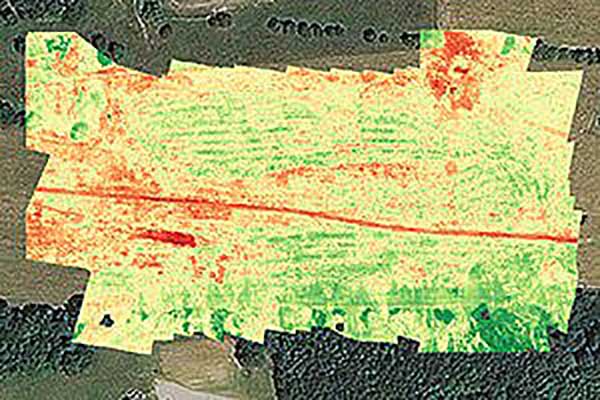
Crop health analysis: Precisionhawk’s software PrecisionAnalytics—Agriculture automatically generates georeferenced orthomosaics from data collected with drone sensors. (Map: PrecisionHawk)
Agriculture
Agriculture has readily adopted UAVs to monitor, control and improve overall crop growth rates — a part of what is known as precision agriculture. Drones carrying optical, thermal and laser scanning payloads gather stacks of information about the condition and rates of growth in fields. The information is then fed into various analysis tools. A picture emerges over time that indicates the health of crops. This enables farmers to generate a formulas for the nutrient and weed-reduction chemicals used for spraying at various times of the year. It’s a customized “prescription” for each growing area.
Continuing UAV overflights during the growing cycle monitor the effects of growing conditions and the effectiveness of treatments, providing more feedback that lead to even further improvements.
Smaller tech-savvy farms might run their own programs, supported by local agrochemical suppliers that may provide analysis services or sell analysis tools.
However, there has been a real growth in the number of companies that supply an entire turn-key package — supplying and flying drones, gathering data, running analyses and providing written and graphic output to support the farming operation.
Unmanned aircraft are truly an integral part of this approach, which might only have been possible because of semi-autonomous UAS and the evolution of compact sensors: UAV-mounted infrared, high-precision optical and lidar.
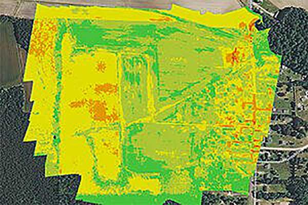
A sample prescription map. (Map: PrecisionHawk)
Mining and Construction
Any mine site is a busy — even chaotic — place to conduct a commercial business.
Drones provide a way for mining operations to:
quickly collect information to enable volume calculations;
provide relatively inexpensive site surveys; and
manage traffic and set up daily road layouts.
In effect, drones enable more rapid control of a complex and dynamic undertaking. Additionally, they improve safety. Ground surveyors no longer need to dodge huge operating machines and tumbling ore, or scramble around difficult terrain.
An autonomous drone can gather timely, georeferenced imagery that can be turned into a precise 3D model of the site. Site managers can have immediate access to details of the UAV survey. They can see the extent of existing deposits and know where to support further mineral exploration, receive estimates of stockpiles and tailing volumes, ensure that personnel and equipment are in the correct locations, and compare aerial video and photography day by day to check progress and for record-keeping. Drones can carry a wide variety of imaging and sensor packages including visual, infrared, hyperspectral, lidar, sonar and radar.
It’s also quicker. For instance, using the senseFly eBee fixed-wing drone, a full aerial survey of an 88-hectare site took four to five hours, with about half of that time spent placing control points. To achieve the same level of detail, terrestrial surveying would take a single surveyor two to three weeks.
Construction Operations. The construction sector uses the same drone data-capture techniques for site details, off-line analysis and results tabulation to manage operations of complex work sites. Compared to mining, change can be more intensive during a construction project, so drone surveys might be repeated more often.
Surveying and GIS. Using drones is an industry unto itself, with high-precision RTK GNSS in the air and on the ground, and specialized analysis tools for high-accuracy applications. The speed of data gathering is the principal benefit to an industry that continues to be essential in many sectors. Lower precision GIS for asset tracking and the like could become a subset of the applications and tools already discussed.
Facility inspection. Outdoor and indoor facility inspection is definitely benefiting from the automation that suitably equipped drones and customized analysis tools can bring to both regular and infrequent inspection tasks. The number of regular complex refinery inspections can be significantly reduced. Inspections will no longer interfere with production and will improve safety for inspection staff. For instance, flame stacks that burn off excess gases can be prone to failure, so regular inspection is essential. Using a drone for the task is clearly much safer than using personnel.
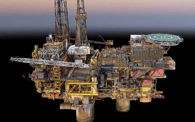
An offshore oil and gas construction platform vents gases to relieve pressure. Flame stacks such as these require regular inspection. (Photo: Oil and Gas Photographer/Shutterstock.com)
BVLOS for Pipelines and Rail
Automated pipeline and railway track inspection have both become possible as drones are used over much greater distances, thanks to beyond visual line of sight (BVLOS) operational approvals by the FAA.
For BVLOS, users first need a validated sense-and-avoid technology on the drone. Also required is proven radio telemetry with uninterrupted command-and-control of the vehicle during flight, and an independent ground-monitoring system that confirms how the drone maneuvers throughout the flight.
In the case of a BVLOS flight this summer along the Trans-Alaska oil pipeline, a Perimeter UAV manufactured by Skyfront flew about 4 miles, maintaining a constant above-ground altitude of 400 feet with multiple ascents and descents of 1,000 feet on 45-degree slopes. The long-range hybrid multicopter drone was equipped with Iris Automation’s computer vision collision-avoidance system and was monitored by
Launching a UAV for a BVLOS flight are (at left) Travis Balthazor, UAS flight operations manager, and Mike Kuni, UAS flight instructor/pilot, both of Kansas State University Polytechnic Campus. (Photo: KDOT, Division of Aviation)
Echodyne radars along the pipeline path, providing airspace situational awareness.
Another BVLOS operation built on the achievements of the Trans-Alaska pipeline trial has been authorized to fly a nine-mile linear inspection of power lines in rural Kansas.
Once again, the Iris Automation system will provide collision avoidance, but this drone also has an independent automated avoidance capability. This gives the drone the self-contained ability to fly around obstacles, so no ground radar or visual tracking is required.
Relieving the requirement for radar tracking or visual observers makes many new operations affordable. Previously, FAA Part 107 BVLOS waivers have all required visual observers or ground-based radar tracking — requirements that are not only expensive, but also restrict where flights are possible.
BVLOS operations like these demonstrate the cost-effectiveness of the technical solution, making long-duration, long-distance inspection using drones feasible.
Indoor inspection is becoming possible with specialized drones that circumvent the need to expose inspection staff to especially difficult facility environments, which in the past also required production shut-down to protect them. Thermal and visual sensors on swivel mounts enable protected inspection drones to fly into tight spaces — or even back out of tricky situations — and make visual records that may otherwise be virtually impossible.
Searching and recording inside containment vessels at the failed Fukushima nuclear facility may have been significantly advanced by using inspection drones.
Newsgathering, Movies and Promotion
All those panoramic, overhead, moving shots you see on the news, in movies and in ads used to be taken from a manned helicopter or fixed-wing aircraft. Now they are mostly taken by multi-copter drones with high-resolution cameras. This makes cinematography and newsgathering much more affordable, making these fields accessible by smaller operations. In the past, only large media groups could afford to rent a helicopter. And, of course, it’s much quicker to bring a UAV onto an incident site, operated by a crew on the ground.
You’ll need FAA approval to use a drone for commercial newsgathering purposes, or find a suitable qualified UAV and operator. After gaining FAA qualifications, news people are also taking on the job, buying and flying the equipment and managing the video-processing software themselves.
Others using drones for similar purposes are movie makers, producers of TV commercials and real estate agents, to name a few.
Delivery by Drone
The ultimate objective of many internet suppliers is to deliver goods that were just ordered within minutes of the order being placed. This is a pretty big objective. It requires a whole network of “fulfillment centers” in and around many cities, a massive purchasing and goods movement capability to keep these centers stocked, and a system that delivers to the end-customer. Currently, we mostly have manned panel trucks of various flavors handling that last step of the delivery process, with real people reading the notes we put on the porch about where to leave our package if we’re out.
Order and Receive. The next wave of delivery changes are expected to include drones carrying your package from the fulfillment center to your backyard. Amazon is looking for approval to begin trials with its larger 88-pound MK-27 Prime Air delivery drone, initially in sparsely populated areas. The MK-27 is equipped with intelligent sense-and-avoid capability, flying around any obstacles it encounters in flight and even during delivery.
UPS is also hoping to get to qualification of its own UAS delivery system by the end of this year, to the same standards that manned aircraft delivery systems are certificated.
Medical Deliveries. Many other trials are underway, especially involving medical deliveries and support. In Africa, trials are underway in Ghana, Malawi and Rwanda. UPS recently proposed a medical supplies delivery service using drones in North Carolina. Many companies that claim expertise in medical deliveries are operating drones.
Food on the Fly. Restaurant food delivery services have seen an upsurge in popularity. It seems likely that soon you’ll be able to order and receive lunch really quickly by drone food delivery services. Ground robot food deliveries at George Mason University are already a huge hit! Uber-Eats is experimenting with drone food deliveries, and 17 drone delivery routes have already been approved in an industrial park in Shanghai.
Meanwhile, Bell has flown its autonomous pod transport (APT) 70 near its base in Fort Worth, Texas, for the first time. The APT 70 can carry a 70-pound package load at over 100 mph, far faster and farther than existing drone delivery systems.
Bell is aiming for package delivery and critical medical transport for disaster relief for APT type drones. It is also participating in the NASA SOI program along with General Atomics’ SkyGuardian.
Drones are a new tool. The UAS industry will continue to change and adapt these products and this technology in as-yet-unthought-of ways. It’s an exciting time, and right now, there seems to be no end in sight.
For a look at drones in the defense industry, see Murfin’s article “Defense in front of UAV development,” published in September’s Professional OEM + UAV newsletter.
Few commercial UAV operations would be able to inspect transmissions lines, pipelines or train tracks without beyond visual line-of-sight (BVLOS) capability, but these key pieces of infrastructure often situate close to or transit across population centers. Further, many population centers have airports and low-level air traffic. Any tools to keep drones away from air traffic during BVLOS operations will significantly inspection companies. We review three promising solutions here.
Pipeline Inspection
Kongsberg Geospatial in Ottawa, Canada has developed location visualization software tools that are used for air-traffic control, command and control, and air defense applications. The company has several decades of experience in these applications. Its IRIS software was used to support recent UAV oil pipeline inspection operations in Nigeria, providing safety critical airspace deconfliction, supervised by the Nigerian Civil Aviation Authority (NCAA).
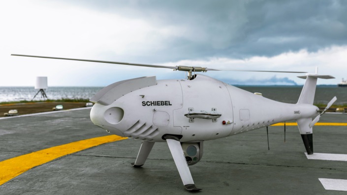
The pipeline project was undertaken by Aerial Robotix, a UAS services provider in Nigeria, who used adapted Kongsberg software in its control center to demonstrate safe BVLOS operations, and was then able to obtain the necessary permits. A Schiebel Camcopter S-100 UAV with a 200-kilometer BVLOS capability was used for flight inspection, operating both day and night, with real time high-definition payload imagery sent back to the control station.
Camcopter S-100 prior to BVLOS pipeline inspection flight in Nigeria. (Photo: Schiebel)
Nigeria has a major problem with gasoline theft from pipelines similar to those lines inspected during this project. Recently, 105 people perished in a blast from a ruptured pipe 30 miles north of the city of Umuahia, possibly during scavenging for leaking fuel. It has been claimed that the pipeline had been ruptured by saboteurs earlier, and for the following six weeks villagers had been collecting fuel. Pipeline vandalism is common in Nigeria, even given the risk of fire or explosion, or the risk of prosecution, or even the possibility of being shot on sight.
Unmanned Companion Fighter Aircraft
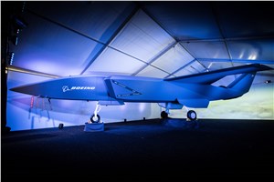
Boeing just unveiled a concept UAV which is apparently aimed at providing an airborne team-partner for manned aircraft.The concept was introduced at the Australian International Airshow by the Australian Minister for Defense, the Hon. Christopher Pyne MP. The project is slated for a significant R&D investment by the Australian Government and Boeing Australia.
Boeing Airpower Teaming System. (Photo: Boeing Company)Boeing Airpower Teaming System. (Photo: Boeing Company)
The concept model has fighter aircraft lines with a projected 2,000-mile range, autonomous capability, and significant intelligence, surveillance and reconnaissance sensor capability. Flying alongside manned fighter/attack aircraft with artificial intelligence simplifying control, the Airpower Teaming System is designed as a low-cost force multiplier.
The concept includes a pitch for international collaboration offering significant customization so countries can add local content, a key element for any aircraft program designed for off-shore sales.
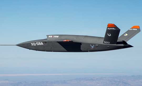
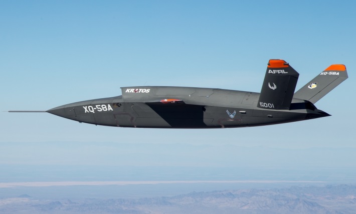
XQ-58A demonstrator in flight. (Photo: U.S. Air Force)
A day or so after the Airshow (maybe not wanting to be upstaged by Boeing’s announcement?) a release showed up about the first flight of the previously secret XQ-58A Valkyrie demonstrator. This is apparently a program by the US Air Force Research Laboratory (AFRL) partnered with Kratos Unmanned Aerial Systems to develop a UAS which looks to have very similar capabilities to that of the Boeing concept, perhaps at a significantly further advanced stage, with a much more mil-spec UAV sounding name.
The AFRL indicated that the XQ-58A is part of a Low Cost Attritable Aircraft Technology (LCAAT) (guess that means they don’t much mind losing a few) effort to come up with low-cost force multipliers which can be built quickly using commercial technology and operating from unprepared runways.
(From the Air Force: “The thought is to develop an inexpensive, configurable and producible on demand air vehicle. A number of military applications can be envisioned for an air vehicle with such a capability. One potential application is to use hundreds or thousands of such units in a campaign to overwhelm an enemy’s air defenses and “punch a hole” to enable higher value, less replaceable [aircraft] to engage or monitor enemy systems. Another potential application is to augment the capabilities of high-value intelligence, surveillance and reconnaissance, systems which may be limited in a specific campaign by distances, quantities, or threats. For all applications, the weapon system is expected to be an air vehicle that would return to base or to a separate location to be recovered. However, because of the mission and because of the low cost, the air vehicle would be attritable, meaning the Air Force would expect and could afford to lose many of the assets.”)
The current program took 2½ years to get to this flying prototype, which still seems pretty lengthy in terms of today’s commercial UAVs. The first flight from Yuma Proving Grounds in Arizona lasted an hour and a quarter and all went as expected. Five test flights are planned to check out functionality, aerodynamics, and launch and recovery systems. Kratos is perhaps better known for its family of target drones which have been in use by the US and internationally for some time.
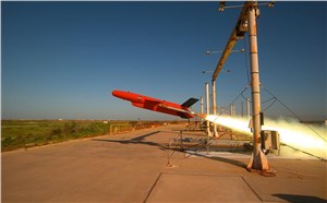
Kratos BQM-177 Navy drone declared operational. (Photo: Naval Air Systems Command)
Kratos Defense & Security Solutions, Inc. announced in early March that its BQM-177A Subsonic Aerial Target (SSAT) has achieved Initial Operational Capability as reported by the US Navy. A Navy statement said “The first site the BQM-177A will be operated from is Pt Mugu, California. The target is capable of speeds in excess of 0.9 Mach and a sea-skimming altitude as low as 10 feet which provides sea-skimming anti-ship cruise missile threat emulation for the US Navy.”
Parachute System for DJI Phantom 4
Recent testing of the descent rate of a Phantom 4 equipped with a SafeAir parachute system indicated that this UAV/parachute combination may well meet the FAA’s recently published draft rules for flight over people. The parachute system uses on-board indicators to trigger parachute deployment. ParaZero (manufacturer of the SafeAir UAV parachute system) has developed standards, and promises to provide customers with certification data to support waiver applications for flight over people.
Wrap-up
So now we have intuitive software using terrain data and sensor inputs which can provide a visual overlay to supports BVLOS flights, concepts designs and prototypes to support the ‘Loyal Wingman’ approach – flying UAVs alongside existing defense aircraft as force multipliers – and advances towards UAV flight over people using certified parachute safety systems. Just a flavor of the flurry of recent new developments in the world of unmanned aircraft.
As part of a framework agreement with Dubai Petroleum, Cyberhawk was appointed to inspect more than 350 risers on 63 offshore platforms. The inspection took one month to complete, followed by the production of more than 90 detailed engineering inspection reports.
Photo: Cyberhawk
The rationale behind Dubai Petroleum’s use of UAVs was to quickly complete detailed inspections of all their risers. Risers are traditionally a difficult area of an offshore platform to inspect; in the under deck and the splash zone, options for access, such as abseiling or scaffolding, are limited, extremely time consuming and very expensive.
Using UAVs as a scanning tool, the high-quality reports produced by the Cyberhawk team allowed the client to plan contact-based inspections or repairs. With a full inspection completed on all risers, defects can be tracked over time to understand their long-term degradation.
Daily reports were produced to notify Dubai Petroleum of potentially serious defects, with detailed inspection reports then produced by Cyberhawk’s experienced oil and gas inspection team.
On the same project, an additional three elevated flare stacks and 24 bridges were inspected, maximizing the value of the mobilization.
Image: Cyberhawk
“Having worked with Cyberhawk in the past, we understand and appreciate the potential on offer from UAV inspections,” said Dubai Petroleum’s asset integrity manager. “This confidence led us to use UAVs in a new area within our business; this risers survey project. The campaign was a great success and we are pleased with the outcome. The speed and efficiency with which this project was completed has proven that the scope and application of UAV inspection can be expanded for our requirements, and we look forward to continuing our relationship with Cyberhawk in the future.”
Measure, a U.S. provider of drone services to enterprise customers, has added turnkey wind farm inspection capabilities to its portfolio of aerial data collection solutions.
Wind farm operators can outsource preventive maintenance inspections to Measure’s drone pilots and data analysts for fast, accurate, safe and timely problem identification. The service helps avert critical turbine failures and efficiency losses while reducing repair downtime and its associated revenue impact.
The company’s drone inspection solution has already been used to successfully examine more than 400 MW of wind farms. The package spans all inspection and reporting functions, including state-of-the-art drone equipment, safe and insured flights by experienced drone pilots, efficient data processing that pinpoints both blade damage and severity, and damage reports and analytics available through a secure online portal.
Dry Lake Wind Power Project, Arizona (Photo: U.S. DOE)
Measure’s new wind farm inspection solution expands the company’s services to the renewable energy sector, which also include a robust suite of drone inspection solutions for solar plants that was announced in July.
The suite includes solar-panel inspections, drone-based site overview and maintenance, site shading and terrain analysis, thermal inverter scans, tracker misalignment detection and vegetation management analysis.
Benefits of Measure’s drone-based blade and tower inspections include:
75% faster inspections than other methods, averaging 30 minutes or less per turbine compared to as much as two hours for manned inspections. This reduces excessive time commitments and allows large wind farms to be inspected more frequently. It also reduces labor costs for inspection and frees employees for other tasks.
Decreased injury risk in the field, with no threat of falls to inspectors climbing turbine structures or blades.
Better defect and damage detection because drones get closer to turbine blades than ground cameras, capturing clearer images. Undetected defects on the blades can result in continuous efficiency losses as high as 6% and associated revenue loss of up to $10,000 annually per turbine.
Maximized turbine availability and revenue generation through early problem detection that helps prevent critical failures and associated downtime for repairs.
Actionable data, including classified damage reports and historical portfolio analysis documenting turbine defects, failure rates and efficiency losses over time. Damage reports can be customized to display only the information needed by blade repair technicians with a few clicks.
“Many wind farms don’t inspect their turbines on a preventive maintenance basis, and those that do use ground crews with conventional cameras and zoom lenses. Under both conditions, there is a risk of failing to detect turbine damage or structural defects on blades that can worsen over time and lead to a catastrophic failure,” said Harjeet Johal, Measure vice president of energy infrastructure and a 10-year veteran of the renewable energy industry with a Ph.D. in electrical engineering. “Our drone-based inspections provide multiple advantages that can help wind farm operators operate at peak capacity.”
“Our global wind portfolio is currently 1,033 MW with 877 MW in the U.S. alone. Knowing the health of our wind assets is essential for us to provide reliable power to our customers,” said Adam Brown, U.S. Drone Program Lead at The AES Corporation, a Fortune 200 global power company. “Using drones to inspect the blades and towers makes it safer for our people as they can stay firmly on the ground while still being able to inspect, at scale, hundreds of wind turbines to ensure they have the highest availability.”
Hurricane Harvey is the first major catastrophe in which drones have been used on a large scale by both government and commercial operators, said Ken Long, an analyst at the Freedonia Group.
UAVs are also likely to find widespread use if Hurricane Irma either directly strikes or skirts the east coast of Florida early next week, as current projections show.
In addition to helping keep emergency workers safe by allowing them to look for people trapped by floodwaters and inspect damage in high-risk areas, drone use can speed up the recovery process. Drones can be flown over structures such as fuel tanks, power lines and railroad tracks before they can be reached by land, enabling government agencies and utilities to identify what is in most urgent need of repair.
They also allow insurance adjusters to more quickly process claims, enabling rebuilding efforts to get underway faster. Farmers Insurance reports that an insurance inspector using a drone can complete up to eight times the number of home inspections each day than he or she otherwise would be able to do.
When Hurricane Harvey first made landfall in Texas on Aug. 25, the Federal Aviation Administration (FAA) set up a temporary but extensive no-fly zone over Houston and nearby areas to help protect first responders in helicopters and other manned aircraft. This flight ban included all drone operations except those specifically approved by the FAA.
https://youtu.be/XRdUV4WqnDE
In the 10 days that followed Hurricane Harvey, the FAA issued more than 100 separate authorizations for drone use in the Houston area, according to the Wall Street Journal. Some of the applications for drone use were reviewed and approved by the FAA within hours, an unusually fast turnaround time for an agency that typically takes days or weeks to make decisions.
With the exception of a handful of flights conducted by media firms, all of the approved operations were for drones used in conjunction with, or on behalf of, government agencies. Drones were used to inspect bridges, roadways and power lines; assess the condition of oil refineries and water plants; and survey coastal damage.
As the flood waters continued to recede and flight restrictions were eased or lifted, insurance companies — including Allstate, Farmers Insurance, Travelers and USAA — began to use drones to assess property damage and speed claims processing.
However, drone use by insurance companies and other commercial users is limited by FAA rules that do not allow them to be flown above 400 feet, outside the visual line of sight of the operator, or above people not directly involved in their operation, unless a waiver is granted.
These regulations could change with a 2018 FAA reauthorization bill being considered by Congress.
“The demonstrated usefulness of drones in Hurricane Harvey response and recovery efforts could well influence the content of that legislation,” Long said.
Even if the current FAA regulations remain in place, U.S. commercial drone demand will expand rapidly from what is currently an extremely small market base, according to the Freedonia Group’s Drones (UAVs) study. “Non-military government use of drones will also climb at a robust rate through 2020,” Long said.
Both commercial and non-military government market gains will be fueled by further improvements in drone designs, making them more capable and easier to operate, customized for use in specific applications and cost-saving.
Honeywell has launched its first commercial unmanned aerial vehicle (UAV) inspection service — the Honeywell InView inspection service — to help industrial customers improve critical structure inspections while helping increase employees’ safety from many of the risks associated with these often-dangerous working conditions.
Intel Falcon 8+ octocopter drone.
The Honeywell InView inspection service will combine the proven performance of the Intel Falcon 8+ UAV system and Honeywell’s expertise in the aerospace and industrial industries with data-driven software customized to the needs of the utility, energy, infrastructure, and oil and gas industries, the company said.
The Honeywell InView inspection service package, which includes the components of the UAV, pilot app and customizable web portal, helps customers organize and create standards around their routine and crisis-response inspections.
For example, the Honeywell InView inspection service can help utility customers create routine inspections of transmission and distribution systems that generate data that can be stored, searched and accessed from in the office and out in the field on demand.
“This collaboration combines Intel’s advanced commercial Intel Falcon 8+ UAV system with Honeywell’s leadership in aerospace safety and connectivity to deliver solutions that deliver reliable, efficient and actionable information to utility and industrial customers,” said Carl Esposito, president, Electronic Solutions, Honeywell Aerospace. “Through our extensive industrial experience, our customers will also gain access to Honeywell’s customized software and data solutions that will help them log, analyze, and eventually predict or prevent outages and structural failures, while protecting the men and women called upon to complete these crucial but high-risk jobs.”
“We are incredibly pleased to collaborate with Honeywell on this exciting new business opportunity,” said Anil Nanduri, general manager for Intel’s UAV business group. “The safety, flight precision and robust performance of the Intel Falcon 8+ system are a perfect fit for the Honeywell InView inspection service and will allow its customers to inspect, collect and analyze valuable data in a whole new way.”
With Honeywell’s InView inspection service, customers tap into Honeywell’s experience across vertical segments such as utilities, aerospace, connected building management, and oil and gas technologies.
In collaboration with Intel, Honeywell will utilize the intelligence and experiences of its diverse set of businesses to give customers a comprehensive solution and experience unrivaled in the marketplace.
“Technology, along with the Internet of Things, is enabling utilities around the world to modernize the management of their energy grids,” said Nitin S. Kulkarni, president, Smart Energy, Honeywell Home and Building Technologies. ” Honeywell brings together the technology that allows utilities to transform how energy is consumed in homes and buildings with software-based systems that help safely and efficiently manage complex industrial facilities and utility grids. Honeywell also has more than 100 years of experience providing dependable products and services to a variety of industries, of which Honeywell InView inspection service is the latest entry.”
Inspection Service goals
Keeping workers safe. According to the U.S. Department of Labor, utility line workers have one of the top 10 most dangerous jobs in the United States, with 21.5 annual fatalities from high-voltage lines for every 100,000 workers.
By using the inspection service, utility companies can send a UAV to perform routine inspections of substations, transmission towers and power lines while keeping boots on the ground and workers safe.
For utilities, using a UAV for inspections offers safer and more cost-effective means than existing methods using helicopters, cherry pickers, ladders and walking inspections.
Improving efficiency. Historically, inspections are siloed by organization and by individuals within organizations. Honeywell’s InView inspection service aims to create standardized inspections where customers can create operational efficiencies in the office and out in the field.
Data capture and analysis. UAVs are being touted for their data-gathering capabilities, but without analytics, more data is simply more data. Honeywell’s service can synthesize vast quantities of data to identify only what is needed and actionable, translating workers’ tacit knowledge into valuable information that provides actionable insights for business.
Connected Freight
Honeywell and Intel also recently collaborated to create a Connected Freight platform that gives shippers and logistics companies the unprecedented ability to monitor shipments of high value and perishable goods, helping prevent costly damage and loss.
The new Honeywell InView inspection service continues the work these two companies are doing to help various industries use connected devices to be more efficient and safer, and harness data in new and meaningful ways.
A manufacturer of refinery infrastructure was about to finish the assembly of a radiant box when a thumbnail-size notch was noticed in one of the pipes just before it was to be installed. The radiant box facility is used in the process of refining hydrogen under very high temperature (1,300 to 2,000°F) and pressure (45 to 360 psi).
The Elios by Flyability is a collision tolerant drone.
The notch was noticed near the end of the assembly process of the 144 40-foot-high vertical pipes composing the radiant box. The refinery owner insisted that each of the installed pipes be inspected thoroughly before moving to the final stages of testing and firing up the radiant box.
The refinery manufacturer faced a difficult problem. Made of a particular heat-resistant alloy containing 30 percent chrome, the pipes need careful treatment — contact with another alloy could damage them, which made use of scaffolding impractical. Instead, the customer turned to Industrial SkyWorks and its indoor inspection drone, Elios by Flyability.
The complexity of the location, the large number of pipes, and the fact that they could easily be mixed up required a meticulous work approach by Industrial SkyWorks. The two-man UAV crew set up a charging station just outside the building. Four flights were needed per pipe to ensure complete coverage. Using the onboard lights of the Elios, the UAV flew to the top of each pipe and descended slowly, recording video.
The Elios drone flew continuously for nearly five days in a dry and dusty environment, imaging both sides of each pipe. Once finished, the crew presented high-resolution video of each pipe to the satisfied client.
Resulting savings are estimated at 75 percent for cost and 85 percent for time, the company said. For instance, using a UAV avoided the need for workers to work at height with the associated safety procedures.
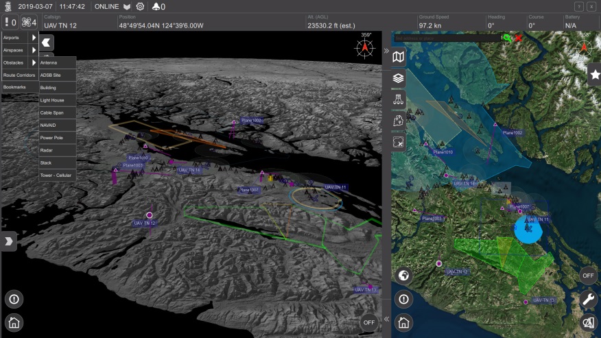
NASA’s UTM. On May 25, the Federal Aviation Administration (FAA)-designated Nevada UAS Test Site and its NASA partners flew five different unmanned aerial vehicles (UAVs) to test NASA’s Unmanned Aircraft System Traffic Management (UTM).
The flights demonstrated multiple operational scenarios, including parachute-initiated emergency supply deliveries and aerial survey operations.
The UAVs were flown beyond the pilot’s visual line of sight (BVLOS) using strategically placed visual observers and sophisticated command and control, communication and detect-and-avoid technologies.
The test is part of a three-week national campaign, which NASA is leading in close collaboration with the FAA and industry partners on a more complex version of its UTM technologies at six different UAS Test Sites around the nation.
Demonstration in France. In France, Delair-Tech flew a UAV for 30 miles, simulating powerline inspection. Delair used a regular, commercial 3G cellphone network to control the drone for the test — an innovative demonstration that long-distance drone operations can be safe and simple to achieve.
Canadian Deliveries.Drone Delivery Canada Corp. (DDC) hit a pivotal milestone toward commercializing its drone logistics platform after achieving BVLOS in test flights. Systems tested include DDC’s FLYTE management system, avoidance technology and communications platform.
During flights in Alberta, DDC’s Mission Control Centre in Toronto, 2,500 kilometers away, successfully monitored and record telemetry in real time. DDC could become the first drone logistics-compliant operator approved by Transport Canada.
DJI and Datumate have begun offering a drone, software and app package that fully automates and expedites site surveys.
Tailored for professional surveying jobs, the DJI-Datumate Site Survey Solution simplifies the surveying and mapping processes, while maintaining superior accuracy. Shenzhen-based DJI is the world’s top aerial-imaging company. Israel based Datumate is a leader in automated “field-to-plan” surveying solutions.
The DJI-Datumate Site Survey Solution is a comprehensive and professional package of imagery and mapping tools that help surveying, construction, inspection and infrastructure companies quickly generate a working model, site visualization, analytics and plan.
The solution includes “Triple D” bundles of DJI Drone, DatuFly tablet app for an automated and expeditious aerial photography, as well as DatuGram 3D photogrammetry software that converts aerial and ground images to high-precision, geo-referenced 2D maps and 3D models.
“New drone regulations expedite the adoption of drones in a wide range of surveying related applications,” said Paul Xu, DJI’s director of enterprise solutions. “We believe that DJI-Datumate Site Survey Solutions offer a professional and cost-effective end-to-end solution for the surveying, infrastructure-mapping and inspection markets.”
DatuFly software generates a flight and image-taking plan for the DJI Drone, based on the best practice requirements of DatuGram 3D photogrammetry, ensuring survey-grade accuracy, high quality and quick results.
“We are excited to partner with DJI to automate and digitize the entire field-to-plan process. Our mutual solution brings site visualization and analytics quickly to the office, keeping field and office work effortless and safe,” said Datumate CEO Tal Meirzon. “DJI-Datumate Site Survey Solutions are an important step forward in professional surveying, construction infrastructure-mapping and assets inspection.”
DJI-Datumate Site Survey Solutions are available globally from the DJI online store, as well as through DJI and Datumate dealers.