Tag: Malaysia

  • Aerodyne Group promotes cross-border UAV delivery service

    Aerodyne Group promotes cross-border UAV delivery service

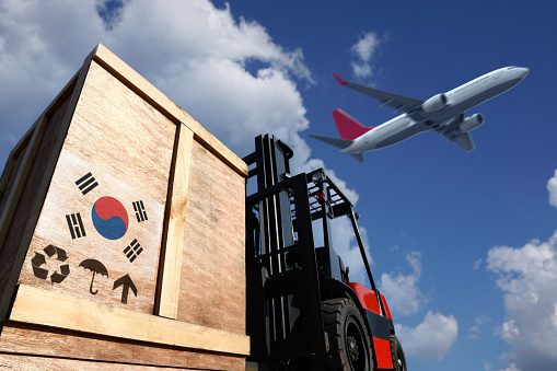
    Aerodyne Group, a UAV-based enterprise solutions provider, and Singapore-based DroneDash Technologies have partnered to initiate cross-border UAV delivery services. The collaboration is designed to advance logistics and supply chain capabilities between Malaysia and Singapore and enhance operational efficiency by offering a delivery solution that is five times faster than traditional sea freight.

    Under the partnership, UAVs will navigate through regulatory landscapes to secure necessary permits for establishing shore-to-shore operations along the Malaysia-Singapore corridor. The initiative focuses on safe navigation through congested maritime and aerial paths by offering a navigation system supported by satellite communications and 5G roaming.

    Commercial operations are expected to begin in the third quarter of 2024 with UAVs capable of carrying up to 30 kg, reaching speeds of 150 km/h within a four-hour flight span.

    The service is designed for critical deliveries such as urgent documents, high-value electronics, medical supplies and perishable foods. The UAV has features to enhance cross-border logistics, including real-time tracking and advanced security protocols, including 256-bit encryption and blockchain technology for logistical oversight.

  • Position Partners, Teleo partner on autonomous heavy equipment technology

    Position Partners, Teleo partner on autonomous heavy equipment technology

    Image: Teleo
    Image: Teleo

    Position Partners has entered an agreement to partner with Teleo, a U.S. based company building autonomous technology for heavy equipment. Under the agreement, Position Partners will offer the full Teleo remote-operated and autonomous solutions across Australia, New Zealand and Southeast Asia.

    Teleo’s system can be modified to any make and model of machine and includes the company’s proprietary software, a remote command center to operate the equipment, and a mesh network to enable two-way communication between the command center and machines.

    The system incorporates sensors, including high dynamic range cameras that deliver high-definition visibility and video footage both day and night.

    Once Teleo’s technology is integrated, users can control multiple machines, at multiple sites, from a single station.

    “With ongoing labour and skills shortages in the construction sector, there is more work to be done than there are people to do it,” Position Partners CEO Martin Nix said.

    Position Partners will offer the full Teleo solution to customers and support sales, installation and training in all countries in which the company operates including Australia, New Zealand, Singapore, Indonesia, Malaysia and the Philippines.

  • South Korea launches KASS satellite to augment GPS

    South Korea launches KASS satellite to augment GPS

    South Korea has successfully launched a precision aviation satellite Thursday by leasing space on Malaysia’s MEASAT-3d communication satellite for 15 years, reports The Korea Herald. The first satellite for the Korea Augmentation Satellite System (KASS) will improve the accuracy and reliability of GPS signals for pilots, increasing airline flight safety.

    The satellite lifted off from Guiana Space Center in Kourou in French Guiana at 6:50 a.m. Thursday (Seoul time), and successfully separated from the rocket at around 7:18 a.m. after the fairing and first stage rocket separations.

    In development since 2014, the KASS system can improve the GPS position error to 1.0 to 1.6 meters from the current 15-33 meter level in real time to ensure positioning reliability throughout the country.

    The government plans to begin a pilot service around December before its full-fledged operation next year.

    South Korea is the seventh country to have a geosynchronous satellite system officially registered with the International Civil Aviation Organization (ICAO). The others are  the United States, Russia, China, the European Union, India and Japan.

    The Korea Augmentation Satellite System will improve airline safety over Korea. (Photo: ugurhan /iStock/Getty Images Plus/Getty Images)
    The Korea Augmentation Satellite System will improve airline safety over Korea.
    (Photo: ugurhan /iStock/Getty Images Plus/Getty Images)
  • Bentley Systems named 2018 Microsoft Partner of the Year for Malaysia railway project

    Bentley Systems has received a 2018 Microsoft Partner of the Year award for helping Malaysia’s Mass Rapid Transit Corporation (MRTC) in going digital for a railway project. According to Microsoft, through this project, Bentley Systems demonstrated excellence in innovation and implementation of user solutions based on Microsoft technology.

    These awards were distributed in 39 categories, and Bentley Systems received the award in the CityNext Partner of the Year category.

    With more than 1.7 million people residing in just 94 square miles, Kuala Lumpur, Malaysia has one of the highest population densities globally. As a result, it is estimated that residents living in the Greater Klang Valley region collectively spend 280 million hours per year stuck in traffic, said Bentley Systems. The Sungai Buloh-Serdang-Putrajaya (SSP) line is the second line of MRTC’s Klang Valley Mass Rapid Transit railway project, which will create better mobility for residents and make it possible to ease traffic by an estimated 160,000 cars daily, Bentley Systems said.

    According to Bentley Systems, the SSP line is Malaysia’s largest infrastructure projects. It includes 11 interchange stations and created an estimated 130,000 job opportunities.

    “We are honored to have received this prestigious award which recognizes Bentley as a provider of cloud-based software solutions powered by Azure, for the advancement of infrastructure projects throughout the world, and specifically for Mass Rapid Transit Corporation’s outstanding Sungai Buloh-Serdang-Putrajaya line in Malaysia,” said Greg Bentley, CEO of Bentley Systems. “MRTC is going digital, harnessing Bentley and Microsoft technology to deliver one of the most ambitious infrastructure projects ever undertaken in Asia.”

    Founded in 1984, Bentley Systems provides engineers, architects, geospatial professionals, constructors, and owner-operators with comprehensive software solutions for advancing infrastructure.

  • Airbus Mobilizes Satellites to Help Locate Missing Airliner

    Airbus Defence and Space has mobilized five observation satellites to aid in the search for the missing Malaysian Airlines plane. The Boeing 777 disappeared on March 8 during a flight from Kuala Lumpur to Beijing.

    The day after the aircraft disappeared,the very high-resolution Pléaides 1A and 1B satellites, the high-resolution SPOT 5 and 6 satellites, and the synthetic aperture radar satellites TerraSAR-X were programmed to take images of the search zone. All the data collected are analyzed by Airbus Defence and Space maritime experts and provided to the Malaysian Remote Sensing Agency (MRSA).

    The Pléiades images are also transferred via CNES, and TerraSAR-X images via DLR, to the Chinese Meteorological Administration, which requested the Disaster Charter activation on March 11.

    Since Sunday, March 9, the experts of Airbus Defence and Space have been analyzing the images taken by the optical and radar satellites. The radar satellites like TerraSAR-X are able to identify layers of hydrocarbon as well as any oil slick or metallic objects floating on the sea. The resolution of the optical satellites Pléiades 1A & 1B (50 cm after resampling) and SPOT 5 and 6 allow for identification and characterization of small objects over large surfaces.