Tag: NAVCEN

  • Details of September’s CGSIC meeting released, DeLaPena to speak

    Details of September’s CGSIC meeting released, DeLaPena to speak

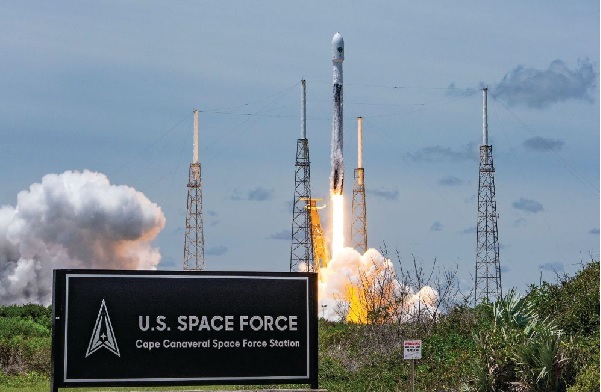
    The 62nd meeting of the U.S. government’s Civil GPS Service Interface Committee (CGSIC) will be held Sept. 19–20 in the Hyatt Regency Denver at the Colorado Convention Center, before the annual ION GNSS+ conference.

    It will be hosted by the U.S. Department of Transportation (DOT) and the U.S. Coast Guard Navigation Center (NAVCEN). DOT serves as the civil lead for GPS and chairs the CGSIC in this capacity. NAVCEN is assigned duties as Deputy Chair and Executive Secretariat for the CGSIC.

    On Sept. 19, the CGSIC subcommittees for Timing, International Information, and Survey, Mapping, and Geosciences will meet. A summary of these meetings will be presented to the CGSIC Plenary Session on Sept. 20.

    Photo:
    Cordell DeLaPena, Program Executive Officer for Military Communications and PNT Space Systems Command

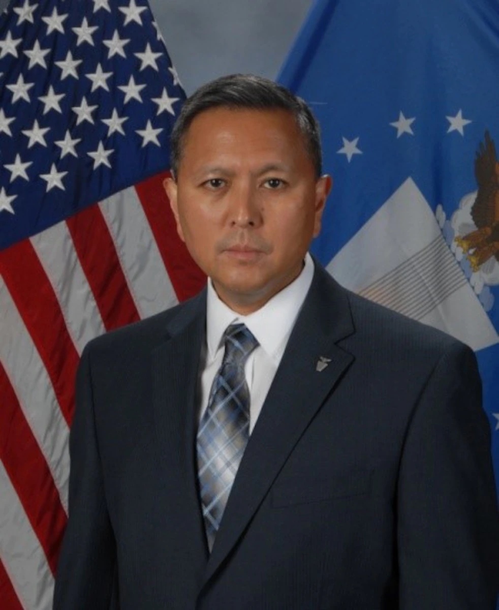
    Keynote speaker for the plenary session is Cordell DeLaPena, program executive officer for Military Communications and Positioning, Navigation, and Timing, Space Systems Command, Los Angeles Air Force Base.

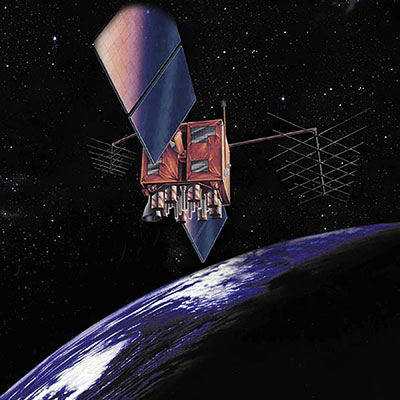
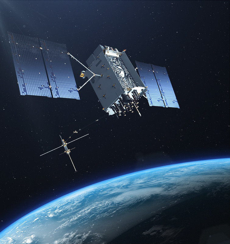
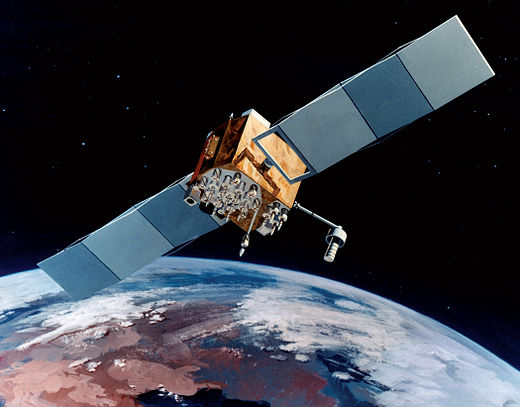
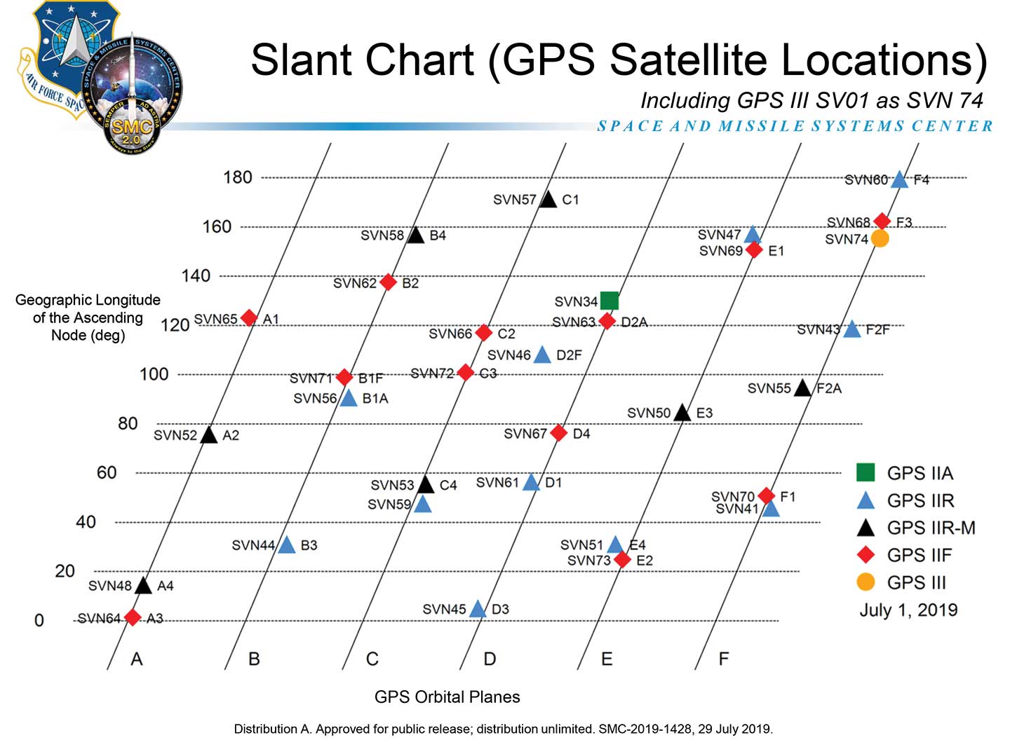
    The agendas for the CGSIC subcommittee and plenary sessions will include presentations on the operational status and modernization of the GPS constellation of satellites, U.S. space-based positioning, navigation and timing (PNT) policy, GPS augmentation systems, and information related to U.S. engagement with other international GNSS as well as a variety of interesting applications of the use of GPS.

    Several new briefings are part of the plenary session this year, including a presentation from NASA on the role of GPS in support of the next lunar mission. Also, the Department of Homeland Security will provide an update on the activities of the Office of Infrastructure Protection, Positioning, Navigation, and Timing Program Management Office.

    This year’s meeting will be live-streamed over the internet. For those who are unable to travel, the meetings can be accessed with the links below.

    The agenda for the meeting is available; all CGSIC presentations will be available there for viewing online shortly after the meeting ends. As a reminder, all CGSIC meetings are free and open to the public.

    Surveying, Mapping and Geo-Sciences Subcommittee
    Sept. 19, 9 a.m. – 12:30 p.m. MDT
    Chair: John Galetzka, NGS
    Co-Chair: Neill Winn, NPS

    https://vimeo.com/event/2298510/f73d8f14a5

    International Information Subcommittee
    2–5 p.m. MDT
    Chair: John Wilde, CEO, Spacekeys

    https://vimeo.com/732131682/cc3618c8f4

    Timing Subcommittee
    2–5 p.m. MDT
    Chair: Patricia Larkoski, The MITRE Corporation
    Co-Chair: Bijunath Patla, NIST

    https://vimeo.com/732129866/117e64cded

    Plenary Session
    Sept. 20, 9 a.m. – 5 p.m.
    Chair: Karen Van Dyke, DOT
    Deputy Chair: Cpt. Scott Calhoun, USCG

    https://vimeo.com/event/2298510/f73d8f14a5


  • Fifth GPS satellite set healthy for operational use

    Fifth GPS satellite set healthy for operational use

    The fifth GPS III satellite is now set healthy for initial operational  use, according to the U.S. Coast Guard Navigation Center (NAVCEN). GPS III 05 (SVN-78/PRN-11) was launched June 17, 2021, from Space Launch Complex-40 at Cape Canaveral Air Force Station, Florida.

    Constellation Changes

    The U.S. Space Force Second Space Operations Squadron (2 SOPS) indicates that GPSIII 05 replaced SVN-61/PRN-28 in the D plane at slot D1.

    SVN-61 is being rephased to optimize its position in the D plane, and is expected to complete its journey on or about July 14.

    SVN-44/PRN-28 was moved to GLAN 31.64 to optimize its position within B plane.

    GPS III space vehicle 05 (GPS III-SV05) launched in June 2021 from Cape Canaveral Space Force Base, Florida, aboard a SpaceX Falcon 9 launch vehicle. (Photo: SpaceX)
    GPS III space vehicle 05 (GPS III-SV05) launched in June 2021 from Cape Canaveral Space Force Base, Florida, aboard a SpaceX Falcon 9 launch vehicle. (Photo: SpaceX)
  • Enhanced NAVCEN website coming, new URLs provided

    Enhanced NAVCEN website coming, new URLs provided

    CGSIC logo

    The U.S. Coast Guard Navigation Center (NAVCEN) will transition to a new and enhanced website in the first quarter of this year. The actual transition date has yet to be determined.

    As part of the transition, the URLs will be updated across the site, including URLs linked to PDFs. URLs from the legacy site will no longer work. Any bookmarked URLs or URLs used in automatic downloading of data or products will need to be updated.

    “We have identified the below URLs as essential to your continued business,” reports Rick Hamilton, CGSIC Executive Secretariat, in a . “Please keep in mind, that while we are sending the URLs in advance, they will not be active until we launch the new website. Once the new website goes live, your URLs will be available for re-bookmarking.”

    GPS Almanacs

    Current URLs: https://navcen.uscg.gov/?pageName=gpsAlmanacs

    Replacement: https://www.navcen.uscg.gov/gps-nanus-almanacs-opsadvisories-sof

    GPS NANUs

    Current URLs: https://www.navcen.uscg.gov/?pageName=currentNanus

    Replacement: https://www.navcen.uscg.gov/sites/default/files/gps/nanu/current_nanu.nnu

    GPS Constellation Status

    Current URLs: https://navcen.uscg.gov/?Do=constellationStatus

    Replacement: https://www.navcen.uscg.gov/gps-constellation

    NAVCEN will contact users with a launch date for the new website.

    The NAVCEN team can be reached at its help address.

  • GPS satellite SVN-47 decommissioned, SVN-41 returns to broadcast almanac

    GPS satellite SVN-47 decommissioned, SVN-41 returns to broadcast almanac

    Artist's rendition of a GPS-IIR satellite in orbit. (Image: GPS.gov)
    Artist’s rendition of a GPS-IIR satellite in orbit. (Image: GPS.gov)

    The U.S. Space Force has announced the decommissioning of GPS satellite SVN-47 (PRN-22), which officially took place Jan. 18.  The satellite has been unusable since Dec. 2.

    SVN-47 was a replacement satellite in the second generation of GPS satellites (GPS-IIR), launched Dec. 21, 2003.

    The announcement was made in a Notice Advisory to NavStar Users (NANU 2022001) issued by NAVCEN, U.S. Coast Guard.

    The designation PRN-22 will be used to bring SVN-41 back in to the active constellation. After 2200 Zulu on Jan. 2o, GPS will transition SVN-41 (PRN-22) into the broadcast almanac for all satellites, and SVN-41 will resume transmitting L-band signals. The almanac transition, accomplished one satellite at a time, will require approximately 24 hours to complete.

    A second NANU emphasized that “Before, during, and after transition SVN-41 (PRN22) will remain unusable until further notice.”

    SVN-41, the sixth of the GPS-IIR satellites, was launched on Nov. 10, 2000, and set to active service a month later on Dec. 10. It was decommissioned in July 2021.

  • 61st CGSIC meeting scheduled for Sept. 21

    61st CGSIC meeting scheduled for Sept. 21

    CGSIC logo

    The U.S. Department of Transportation (DOT) and the U.S. Coast Guard Navigation Center (NAVCEN) will hold the 61st meeting of the Civil GPS Service Interface Committee (CGSIC) on Sept. 20-21.

    The meeting will be conducted at the St. Louis Union Station Hotel in St. Louis, Missouri, in conjunction with the Institute of Navigation’s 2021 ION GNSS+ conference.

    The 61st CGSIC meeting will also be broadcast live online to provide a virtual option. This is a unique opportunity for anyone in the world with access to a computer to attend these public meetings of the U.S. Civil GPS program. CGSIC meetings are free and open to the public.

    The three subcommittees of the CGSIC will meet on Sept. 20: Timing; International Information; and Surveying, Mapping, and Geosciences.

    Summaries of the subcommittee meetings will be presented to the CGSIC plenary session Sept. 21 with a keynote address by Juliana Blackwell, director of NOAA’s National Geodetic Survey (NGS).

    The CGSIC agenda in development can be found on the CGSIC section of GPS.gov.

  • US Space Force to host GPS document forum

    US Space Force to host GPS document forum

    CGSIC logo

    The U.S. Space Force will host the 2021 Public Interface Control Working Group and Open Forum in September and November. The meetings are open to the public in person and virtually on Wednesday, Sept. 29, 8:30 a.m. to 4 p.m., and Tuesday, Nov. 19, 8 a.m. to 4 p.m. (Pacific Time).

    The meeting and forums will discuss the following documents:

    The purpose of the meeting is to update the public on GPS public document revisions and collect issues and comments for analysis and possible integration into future GPS public document revisions.

    The meeting will be held in person at

    Los Angeles Air Force Base
    Great Room, -PCT Campus
    100 Sepulveda, Blvd.
    El Segundo, CA 90245

    Attendees are highly encouraged to participate virtually. It can be accessed at this link or at this link.

    • Primary Dial In: 571-200-1700, Meeting ID: 160 913 1495, Password: 813441
    • Backup Dial In: 410-874-6300, Conference PIN: 961616381

    The official public notice in the Federal Register provides further information, including how to register, submit comments and dial in on the telephone.

  • GPS satellite SVN-77/GPS III SV04 set healthy for use

    GPS satellite SVN-77/GPS III SV04 set healthy for use

    The U.S. Coast Guard Navigation Center has issued a notice that GPS satellite SVN-77 (PRN-14) was set healthy for initial use on Dec. 2 at 0131Z. This follows the U.S. Space Force announcement that the satellite, the fourth GPS III (SV04), received Operational Acceptance approval on Dec. 1.

    SVN-77 is the 23rd satellite to broadcast L2C, the second civil GPS signal at 1227.6 MHz. L2C is not yet designated as “operational” by the U.S. Space Force.

    However, the L2C signal is set to healthy, and users can utilize this signal at their own risk.

    The U.S. Air Force’s Lockheed Martin-built next generation GPS III satellite on orbit. Rendering portrays GPS III Space Vehicles (SVs) 01-10. (Artist's Rendering: Lockheed Martin)
    The U.S. Air Force’s Lockheed Martin-built next generation GPS III satellite on orbit. Rendering portrays GPS III Space Vehicles (SVs) 01-10. (Artist’s Rendering: Lockheed Martin)

    SVN-77 is the 16th satellite to begin broadcasting the third civil GPS signal, L5, specifically designed for aviation use in an internationally protected band of spectrum designated for aeronautical navigation at 1176.45 MHz. L5 continues to broadcast an unhealthy designation.

    SVN-77 is the fourth satellite broadcasting the new L1C signal at 1575.42 MHz.

    The next GPS III satellite, SVN-78, initially scheduled to launch in January, will launch no earlier than July  1, 2021.

  • GPS IIR/IIR-M satellite antenna patterns released for worldwide use

    GPS IIR/IIR-M satellite antenna patterns released for worldwide use

    Partnering with the U.S. Coast Guard Navigation Center (NAVCEN), U.S. Space Force and Lockheed Martin Space have released the GPS IIR/IIR-M satellite antenna patterns for worldwide public use.

    Additionally, the Institute of Navigation has offered a related ION journal article free to the public to accompany the antenna patterns.

    The files now available from NAVCEN include:

    The GPS Block II Replenishment (IIR) space vehicle (SV) began improving upon its baseline design in 2003 with the launch of the first Block IIR SV retrofitted with a redesigned  antenna panel. This is the Earth-facing panel providing the GPS L-band broadcast signal. The improved antenna panel includes redesigned L-band elements mounted on the SV Earth-facing structure in the same manner as the original antenna panel.

    The Earth Terrestrial Service Volume is the near-Earth region up to 3,000 km altitude. (Diagram: NAVCEN/Lockheed Martin)
    The Earth Terrestrial Service Volume is the near-Earth region up to 3,000 km altitude. (Diagram: NAVCEN/Lockheed Martin)

    Spacecraft Navigation

    The use of GPS signals for spacecraft navigation has increased in general over the last few decades. Navigation employing GPS observations for spacecraft in low-Earth orbit is now considered routine.

    However, the situation is quite different for spacecraft that fly in the Space Service Volume above the GPS constellation, including medium-Earth orbit (MEO), geostationary orbit (GEO) and high-Earth orbit (HEO) satellites, as well as missions to the Moon and beyond.

    For these spacecraft, reception of GPS transmit antenna side lobe signals is essential to improve availability and performance of on-board navigation and timing. In this context, the knowledge of the full antenna pattern (main lobe and side lobes) from the transmitting antennas of each of the GPS satellites is essential.

    These published antenna patterns and associated ION citation describe both IIR and IIR-M antenna panel versions, their broadcast signal patterns, the performance observed in factory testing, and their on-orbit performance.

    Chart: NAVCEN/Lockheed Martin
    Chart: NAVCEN/Lockheed Martin
    Chart: NAVCEN/Lockheed Martin
    Chart: NAVCEN/Lockheed Martin
    Chart: NAVCEN/Lockheed Martin
    Chart: NAVCEN/Lockheed Martin

    These patterns represent the current capability of the GPS IIR/IIR-M Space Vehicles. Receiver designers should consult the IS-GPS-200 specifications for use in receiver design and not base design on current signal performance.

    GPS technical documents are also available at the NAVCEN website and linked from the GPS.gov website.

    Legacy antenna panel on the GPS IIR satellite. (Photo: NAVCEN/Lockheed Martin)
    Legacy antenna panel on the GPS IIR satellite. (Photo: NAVCEN/Lockheed Martin)
  • NAVCEN hosts 60th CGSIC meeting virtually before ION GNSS+ 2020

    NAVCEN hosts 60th CGSIC meeting virtually before ION GNSS+ 2020

    CGSIC logo
    In previous years, the Civil GPS Service Interface Committee (CGSIC) took place right before the start of the ION GNSS+ conference.

    This year, the U.S. Department of Transportation (DOT) and the Coast Guard Navigation Center (NAVCEN) are holding the 60th meeting virtually, in collaboration with the Institute of Navigation (ION).

    The meeting will take place Sept. 21-22 online before the annual ION GNSS+ conference, which will also take place virtually because of the COVID-19 pandemic.

    All CGSIC meetings are free and open to the public. Anyone in the world with access to a computer can attend these public meetings of the U.S. Civil GPS Program.

    DOT serves as the civil lead for the GPS program and chairs the CGSIC in this capacity. NAVCEN is assigned duties as deputy chair and executive secretariat for the CGSIC.

    Subcommittees of the CGSIC for Timing, International Information, and Surveying-Mapping-Geosciences will hold meetings Sept. 21, and a summary of these meetings will be presented to the CGSIC plenary session on Sept. 22.

    The keynote speaker for this year’s plenary session will be Major General John E. Shaw, Combined Force Space Component Commander, U.S. Space Command, and Commander, Space Operations Command, U.S. Space Force.

    Presentations this year include:

    • PNT updates from various countries around the world
    • Atomic clocks for fundamental physics: time for discovery
    • Missouri Department of Agriculture land survey program
    • National PNT Policy Update from the National Space Council
    • Mobile geospatial technology’s role in tracking beetle infestation in our nation’s forests

    The full agenda is available online. CGSIC presentations will be posted online shortly after the meeting ends. Register for the meetings here.

  • New GPS SPS Performance Standard released

    New GPS SPS Performance Standard released

    CGSIC logo

    The U.S. Air Force has released the 5th Edition of the GPS Standard Positioning System (SPS) Performance Standard (PS), according to U.S. Coast Guard Navigation Center (NAVCEN) Civil GPS Service Interface Committee (CGSIC).

    With final signature by the U.S. Department of Defense, the standard was cleared for public release on April 16. This is the first update to the SPS PS since 2008 and, for the first time, includes pre-Initial Operating Capability (IOC) performance standards for new civil GPS signals L2C and L5, in addition to L1 C/A.

    The SPS PS specifies the levels of SPS performance in terms of broadcast signal parameters and GPS constellation design. According to NAVCEN, the U.S. government is committed to meeting and exceeding the minimum levels of service specified in the SPS PS.

    The document can be found at the NAVCEN website and at GPS.gov.

  • GPS constellation changes with addition of second GPS III satellite

    GPS constellation changes with addition of second GPS III satellite

    The U.S. Coast Guard has issued a Notice Advisory to Navstar Users (NANU) detailing the changes to the constellation now that the second GPS III satellite has joined.

    The U.S. Space Force Second Space Operations Squadron (2 SOPS) issued an Initial Use (USABINIT) NANU for the second of the new generation of GPS-III satellites, designated SVN-75/PRN-18.

    SVN-75 was launched on Aug. 22, 2019, and — having successfully undergone rigorous operational testing on orbit — has taken its place in the active GPS constellation with the slot and plane designation of D6.

    Constellation changes

    Artist's rendering of GPS IIF satellite. (Image:  U.S. Air Force )
    Artist’s rendering of GPS IIF satellite. (Image: U.S. Air Force )

    SVN-45/PRN-21 is being re-phased from D3 to D2F replacing SVN46. Upon its arrival, SVN-46/PRN-11 will then be moved to residual status in Launch, Anomaly and Disposal Operations (LADO).

    SVN-60/PRN-23 was decommissioned on March 2, eight and a half years beyond its expected service life. SVN-60 was the 12th GPS-IIR to go in to orbit, and began service on July 9, 2004.

    Learn more at the NAVCEN home page.

  • New NAVCEN chart shows GPS satellite locations

    New NAVCEN chart shows GPS satellite locations

    The GPS Directorate has approved a change to the Navstar GPS Control Segment to User Support Community Interfaces ICD-GPS-240 and ICD-GPS-870, reports the U.S. Coast Guard Navigation Center.

    The change removes the GPS satellite plane/slot and clock information from the Operational Advisory message. SVN/PRN, block type and NANU details will continue to be included.

    The change proposal was approved by the GPS Interface Control Working Group in December 2018.

    A depiction of the GPS constellation of satellites with slot and plane designations has been published by the U.S. Coast Guard Navigation Center as an easy-to-read graphic for use by the GPS user community.

    Chart: NAVCEN
    Chart: NAVCEN

    The chart can be found on the NAVCEN Constellation Status page and will be updated with the commissioning of new GPS satellites or upon any change in the constellation.