Tag: precision guidance

  • GPS-Guided Artillery Rounds Will Arm Dutch Howitzers

    GPS-Guided Artillery Rounds Will Arm Dutch Howitzers

    The latest variant of the Excalibur precision-guided projectile will be used by armies and be available for naval ships.
    The latest variant of the Excalibur precision-guided projectile will be used by armies and be available for naval ships.

    The Netherlands Ministry of Defense is adding Raytheon Company’s Excalibur Ib artillery rounds to its arsenal under a previously announced foreign military sales agreement, underscoring growing international interest in the precision-guided projectile.

    The Netherlands is the second Excalibur lb customer in Europe after Sweden, the U.S. government’s development partner for the 155-mm round. Deliveries are expected to begin later this year.

    “The Netherlands joins a growing list of nations acquiring this highly sophisticated artillery munition, which uses GPS guidance to provide accurate, first-round effects capability at extended ranges,” said Mark Hokeness, Raytheon’s Excalibur program director. “When fired from the Dutch PzH 2000 artillery system, Excalibur can fly up to 50 kilometers, score a direct hit and deliver lethal effects in all types of weather and battlefield conditions.”

    A Dutch Panzerhaubitze 2000 fires a round in Afghanistan. (Courtesy Dutch Ministry of Defense)
    A Dutch Panzerhaubitze 2000 (PzH 2000) fires a round in Afghanistan. (Image courtesy Dutch Ministry of Defense)

    The U.S. Army has determined Excalibur Ib is fully compatible with the PzH 2000, a self-propelled howitzer produced in Germany and fielded by several nations.

    The 
Excalibur precision-guided, extended-range projectile uses GPS guidance to provide accurate, first-round-effects capability in any environment. Excalibur’s level of precision delivers a major reduction in the time, cost and logistical burden associated with using other artillery munitions. Excalibur has been fielded by the U.S. Army, Marines and several international military forces.

    Excalibur Facts

    • Combat-proven: Nearly 770 Excalibur rounds have been fired in combat with exceptional accuracy and lethality.
    • Precise: Excalibur consistently strikes less than two meters from a precisely-located target, Raytheon said.
    • Safe: Excalibur’s precision avoids collateral damage and has been employed within 75 meters of supported troops.
    • Affordable: With its first round effects, Excalibur reduces total mission cost and time and the user’s logistics burden, according to Raytheon.
    • Evolving: Raytheon has demonstrated a dual-mode GPS/semi-active laser seeker Excalibur variant to compensate for target location error, maintain precision in GPS denied or degraded environments, and enable engagement of relocated or moving targets.
    • Navies: With Excalibur N5, navies will be able to deliver extended range, precision naval surface fires from existing 5-inch/127-mm guns.

    Excalibur Video

  • MachineryGuide Offers Smartphone Guidance for Agriculture

    MachineryGuide Offers Smartphone Guidance for Agriculture

    The MachineryGuide package with antenna, receiver and guidance software.
    The MachineryGuide package with antenna, receiver and guidance software.

    MachineryGuide is a new GPS guidance system for Android that gives farmers the ability to use their smartphones for precision guidance.

    With the help of MachineryGuide, the cultivated area and overlaps can be displayed. The guidance application helps farmers in edging along the ideal track by gearing to straight reference lines.

    With the application and an antenna from MachineryGuide, farmers can have a simple precision guidance application to improve yield growth, increasing efficiency. Also, fertilizer and pesticide use can be optimized, while machine costs and work hours can be lowered by up to 10 percent, the app designers said.

    The application is aimed at managers of small- and medium-sized farms and can be used on a smartphone or tablet. A demo can be downloaded from GooglePlay — the free version can not connect to a real GPS device, but all the functions of the program can be tested.

    MachineryGuide sells the software separately; a GNSS receiver + antenna separately; and a package bundle that includes software, GNSS receiver and antenna. The antenna is capable of receiving and processing free corrections (EGNOS, WAAS).

    MachineryGuide has been listed among the top 5 farming apps according to Agrivi. Also, Croplife considers MachineryGuide one of the 10 best agricultural apps of 2015.

  • Kairos Unveils UGV Tech for Heavy Equipment at AUVSI 2015

    Kairos Unveils UGV Tech for Heavy Equipment at AUVSI 2015

    Kairos Autonomi produces solutions that can be retrofitted or "strapped-on" to any existing optionally unmanned vehicle or vessel.
    Kairos Autonomi produces solutions that can be retrofitted or “strapped-on” to any existing optionally unmanned vehicle or vessel.

    Kairos Autonomi is displaying its latest autonomous technology designed for use with heavy equipment and machinery. Kairos’ robotic applique kits are add-on vehicle autonomy systems that provide unmanned capabilities to current manned vehicles, rendering them optionally unmanned.

    Equipped with larger gear faces, stronger actuators than its predecessors and a pathing upgrade, the Pronto4 Heavy delivers the increased torque needed to control the traction, braking, throttle and implements in heavy vehicles and equipment, as well as smarter robotic functions such as GPS path following and supervised autonomous behaviors.

    The Pronto4 Heavy Planar Robotic Applique Kit For Heavy Equipment.(PRNewsFoto/Kairos Autonomi)
    The Pronto4 Heavy Planar Robotic Applique Kit For Heavy Equipment. (PRNewsFoto/Kairos Autonomi)

    The robotic applique kit is platform independent, meaning it can be installed in any heavy vehicle or machine, rendering that vehicle optionally unmanned, which means the equipment can still operate manually as needed.

    Kairos Autonomi is exhibiting at the AUVSI Unmanned Systems 2015 show being held May 4-7 in Atlanta, Ga. (booth #1437).

    The Pronto4 Robotic Applique Kit manufactured by Kairos is used throughout the world to convert existing man-operable ground vehicles and surface vessels into unmanned systems. Applications include government or academic research and development; military training and test and evaluation; range clearance; mining; and tactical military applications.

  • U.S. Navy to Deploy Underwater Drones from Submarines

    U.S. Navy to Deploy Underwater Drones from Submarines

    remus-600-specifications-500x281
    The Remus 600 Unmanned Underwater Vehicle, made by Kongsberg Maritime, a Norwegian company.

    The U.S. Navy plans to deploy its first underwater drones from submarines later this year, according to a report by Military.com.

    The website quoted Rear Adm. Joseph Tofalo, the Navy’s director of undersea warfare, who said the deployment will include the use of the Remus 600 Unmanned Underwater Vehicles (UUVs) to perform undersea missions around the globe.

    Sailors carry a Remote Environmental Measuring Unit (REMUS) 100. (Credit: U.S. Navy)
    Sailors carry a Remote Environmental Measuring Unit (REMUS) 100. (Credit: U.S. Navy)

    “Now you are talking about a submarine CO who can essentially be in two places at the same time — with a UUV out deployed which can do dull, dirty and dangerous type missions. This allows the submarine to be doing something else at the same time,” Tofalo said. “UUVs can help us better meet our combatant command demand signal. Right now, we only meet about two-thirds of our combatant commanders’ demand signals, and having unmanned systems is a huge force multiplier.”

    The Remus 600 is a 500-pound, 3.25-meter-long UUV equipped with GPS, as well as dual-frequency side-scanning sonar technology, synthetic aperture sonar, acoustic imaging, and video cameras manufactured by Hyrdoid, a subsidiary of Kongsberg Maritime. The Remus 600 is similar to Bluefin Robotics UUVs, which were used to search for wreckage of missing Malaysia Airlines flight MH370. Other applications include hydrographic surveys, harbor security, and environmental monitoring.

    In this video, Explosive Ordnance Disposal Mobile Unit One (EODMU-1) tests the Remus 600 to locate mines using autonomous guidance and advanced sonar.


  • Tallysman GPS/GNSS Antennas Available in Australia, New Zealand

    Tallysman GPS/GNSS Antennas Available in Australia, New Zealand

    TW4421 wideband dual-feed GPS/GLONASS antenna.
    TW4421 wideband dual-feed GPS/GLONASS antenna.

    Two dual-feed GPS/GLONASS antennas from Tallysman’s GNSS antenna range are now available in Australia and New Zealand through M2M Connectivity. Tallysman is a Canada-based developer of high-performance GNSS antennas focused on the requirements for precision and multi-constellation GNSS receivers.

    Featuring a dual-feed wide-band patch element, Tallysman’s TW2410 and TW4421 antennas cover the GPS L1, GLONASS G1 and SBAS (WAAS, EGNOS and MSAS) frequency band (1574 to 1606 MHz). The dual-feed patch provides excellent circular polarized signal reception, multipath rejection and out-of-band signal rejection, according to Tallysman.

    Offering tight phase center variation (PCV), the antennas are suitable for high-accuracy applications and for use in precise point positioning (PPP) systems that require only a single frequency such as single-frequency RTK solutions, GNSS compasses and machine control.

    Suitable for precision industrial, agricultural and military applications, the dual-feed GPS/GLONASS antennas feature Tallysman’s Accutenna technology that provides superior or multipath signal rejection and precision. The TW2410 and TW4421 antennas are housed in IP67 industrial-grade weather-proof, magnet mount enclosures and come with a wide range of connector options and cable lengths.

    Tallysman is a manufacturer of high-performance, high-quality products for a wide range of GNSS applications.

  • Deadline for ION JNC Abstracts Is Wednesday

    Abstracts are due Wednesday, March 4, for the Institute of Navigation (ION) Joint Navigation Conference (JNC), scheduled for June 22-25 in Orlando, Fla.

    The ION Joint Navigation Conference, sponsored by the ION’s Military Division, is the largest U.S. military positioning, navigation and timing (PNT) conference of the year with joint service and government participation, ION said. The event will focus on technical advances in guidance, navigation and control (GN&C), with emphasis on joint development, test and support of affordable GN&C systems, logistics and integration.

    From an operational perspective, the conference will also focus on advances in battlefield applications of GPS; critical strengths and weaknesses of fielded navigation devices; warfighter PNT requirements and solutions; and navigation warfare.

    For Official Use Only (FOUO), United States only, sessions will be held June 22-24 at the Renaissance Orlando at SeaWorld, Orlando. The U.S. only classified sessions will be held June 25 at Shades of Green Walt Disney World.

    The ION JNC features more than 200 operational presentations on a diverse array of topics. Abstracts are being accepted through March 4.

  • KVH Receives $4.3M Order for Military Navigation Systems

    KVH Receives $4.3M Order for Military Navigation Systems

    The KVH TACNAV II.
    The KVH TACNAV II. Photo: KVH

    KVH Industries, Inc., has received a $4.3 million order for its TACNAV tactical navigation systems from a new customer who is a major defense contractor providing armored vehicles for an international military client. With a short delivery requirement, shipments for this order are expected to be substantially completed in the fourth quarter of 2014.

    “KVH is extremely pleased to be selected by another major defense contractor to provide the tactical navigation solution for their new armored vehicles. Providing precise navigation as well as coordination of vehicles in critical situations is an important tool that helps keep soldiers oriented wherever they operate,” said Dan Conway, executive vice president of KVH’s Guidance and Stabilization group.

    KVH’s TACNAV military vehicle navigation systems provide unjammable precision navigation, heading, and pointing data for vehicle drivers, crews, and commanders. TACNAV can also serve as a heading and position source for situational awareness.

    In October, KVH received a $19 million contract for the delivery of a new fiber optic gyro-based tactical navigation system for use by an international military customer in an armored vehicle application.

    TACNAV systems are in use by the U.S. Army and Marine Corps, as well as many allied customers including Canada, Sweden, Great Britain, France, Germany, Spain, Egypt, Botswana, Australia, New Zealand, Saudi Arabia, Taiwan, Romania, Poland, Turkey, Malaysia, Switzerland, South Korea, Singapore, Brazil, and Italy.

  • KVH Receives $19 Million Order for FOG-Based Navigation Systems

    The TACNAV 3D, by KVH Industries. Photo: KVH Industries
    The TACNAV 3D, by KVH Industries. Photo: KVH Industries

    KVH Industries, Inc., has received a $19 million contract for the delivery of a new fiber optic gyro (FOG)-based tactical navigation system for use by an international military customer in an armored vehicle application. A variant of KVH’s TACNAV FOG product and KVH’s new TACNAV 3D, the system provides continuous high-accuracy position and orientation even when GPS is lost or jammed.

    Work on the contract began in July under a letter contract, and hardware shipments for this order are expected to be made in 2015 and 2016. Program management, engineering services, and out-year support services will be provided as part of this order.

    “KVH’s TACNAV navigation solution is an important tool for U.S. and allied warfighters, providing precision navigation as well as coordination of vehicles in critical situations,” said Dan Conway, executive vice president of KVH’s Guidance and Stabilization group. “The system serves as a crucial resource for navigation and battle management, and even as a backup in GPS-denied environments, keeping soldiers safe and out of harm’s way wherever they travel. This new order reaffirms the value of KVH’s TACNAV products for international militaries, and adds to our backlog for the coming years.”

    All of KVH’s TACNAV military vehicle navigation systems provide unjammable precision navigation, heading, and pointing data for vehicle drivers, crews, and commanders. TACNAV can also serve as a heading and position source for situational awareness. The TACNAV system ordered is a FOG-based navigation and pointing solution, which is designed to ensure precise navigation data regardless of GPS availability as well as automatic “drive and calibrate” capability. It features a compact design, continuous heading and pointing data output, and a flexible architecture that allows it to function as either a standalone navigation module or as the heart of an expanded, multifunctional TACNAV system. The system is designed to integrate with Battle Management Systems (BMS) and is a vital component for effective battlefield management.

    TACNAV systems are currently in use by the U.S. Army and Marine Corps, as well as many allied customers including Canada, Sweden, Great Britain, France, Germany, Spain, Egypt, Botswana, Australia, New Zealand, Saudi Arabia, Taiwan, Romania, Poland, Turkey, Malaysia, Switzerland, South Korea, Singapore, Brazil, and Italy.

  • Northrop Grumman Finishes Tests of Handheld Precision Targeting Device

    Northrop Grumman Finishes Tests of Handheld Precision Targeting Device

    Sgt. 1st Class Justin Rotti, a combat developer from the Training and Doctrine Command Fire Cell, Fires Center of Excellence, uses a developmental handheld precision targeting device during a test at White Sands Missile Range's 500k test site. White Sands' terrain and environmental features make it well suited for testing systems of this type. (Photo Credit: John Andrew Hamilton, ATEC)
    Sgt. 1st Class Justin Rotti, a combat developer from the Training and Doctrine Command Fire Cell, Fires Center of Excellence, uses a developmental handheld precision targeting device during a test at White Sands Missile Range’s 500k test site. White Sands’ terrain and environmental features make it well suited for testing systems of this type. (Photo Credit: John Andrew Hamilton, ATEC)

    A new handheld targeting system developed by Northrop Grumman will enable soldiers to engage targets with precision munitions while providing digital connectivity to related military units. The unit has successfully completed developmental testing at White Sands Missile Range in New Mexico, the company said.

    The Hand Held Precision Targeting Device, or HHPTD, locates, acquires, designates, marks and enables rapid target engagement with precision munitions and digital connectivity to the Joint Forces engaged in conflicts. The celestial navigation technology integrated in the system delivers improved robustness despite local magnetic variations and GPS-degraded or denied environments.

    The HHPTD weighs approximately five pounds and includes a GPS receiver and internal magnetic and celestial navigation technologies, as well as an internal high-definition color day and thermal night vision sensor and an eye-safe laser rangefinder. The system is compatible with external precision azimuth and vertical angle modules and provides precision target location information with digital video output, and digital communication for target location data, plus a capability for a near infrared laser pointer.

    Master Sgt. Rod Larreau, with U.S. Army Special Forces Command (Airborne), uses a targeting device at White Sands Missile Range's (N.M) 500k Site to identify targets during a test. White Sands provided a wide range of test targets, both in the form of official target boards as well as other facilities, that could be seen from the Soldier's observation point. (Photo Credit: John Andrew Hamilton, ATEC)
    Master Sgt. Rod Larreau, with U.S. Army Special Forces Command (Airborne), uses a targeting device at White Sands Missile Range’s (N.M) 500k Site to identify targets during a test. White Sands provided a wide range of test targets, both in the form of official target boards as well as other facilities, that could be seen from the Soldier’s observation point. (Photo Credit: John Andrew Hamilton, ATEC)

    The evaluation of the HHPTD was conducted by the U.S. Army’s Rapid Equipping Force, in partnership with the Army Program Executive Office’s Project Manager, Soldier Sensors and Lasers, and demonstrated the targeting device’s effectiveness in varying terrain and temperatures, ideal conditions for enabling the accurate gauging of the technology’s capabilities.

    Northrop Grumman’s Laser Systems business unit is delivering the HHPTDs to support in-theater operations of Department of Defense personnel. “This system is a lightweight, precision targeting device that addresses the targeting accuracy needed by our warfighters to help deliver today’s precision GPS munitions in all operational environments,” said Gordon Stewart, vice president and general manager, Laser Systems business unit, Northrop Grumman. “We have been uniquely successful in producing precision targeting enhancements to our systems through the use of celestial navigation technology.”

    The goal is to reduce friendly fire and collateral damage by improving the ability of the soldiers to differentiate between enemy combatants and non-combatants operating in very close proximity to one another. 

    To best evaluate the soldier capabilities of a targeting system, soldiers at White Sands tested a variety of technologies in varying terrain and temperatures, while recording observations and data in order to help set specific, detailed development goals and objectives for the program. Meeting specified requirements is important, but including soldiers early in the evaluation process ensures acquisition professionals meet Soldiers’ needs to develop suitable equipment. 

    These “soldier touchpoints” are critical to developing equipment that soldiers trust and will use in combat. “Testing at WSMR [White Sands Missile Range] gives us a better idea of how a system will work when deployed to theater,” said one soldier involved with the test. “I was able to really get a feel for how the technologies would be employed downrange.” 

    Northrop Grumman Laser Systems has developed the HHPTD and a family of handheld laser target location systems tailored to meet mission requirements in collaboration with FLIR Systems in Goleta, California, General Dynamics GIT in Nashua, New Hampshire, and Wilcox Industries in Portsmouth, New Hampshire.

  • KVH Introduces Fiber-Optic Gyro IMUs for Demanding Applications

    KVH Introduces Fiber-Optic Gyro IMUs for Demanding Applications

    KVH_1775_IMU-W KVH Industries, Inc.
    Photo: KVH Industries, Inc.

    KVH Industries, Inc., has introduced the 1725 Inertial Measurement Unit (IMU) and the 1775 IMU, advanced sensors designed to be integrated into the most demanding stabilization, pointing, and navigation applications. These two new products complement KVH’s successful 1750 IMU and create a complete range of choices for advanced six-degrees-of-freedom (DOF) sensors with enhanced performance. All three products utilize the E•Core ThinFiber technology of KVH’s DSP-1750 fiber-optic gyro (FOG).

    “With these three products, system designers and integrators now have a high-performance solution for every application — ranging from manned and unmanned commercial and defense platforms, optical equipment stabilization systems, and pipeline inspection equipment, to autonomous vehicle control and navigation,” said Jay Napoli, KVH’s vice president of FOG/OEM sales. “This line satisfies the performance, size, and price parameters for IMUs in a way that no competitor can match due to KVH’s control over the design and manufacturing process, from creating the fiber to integrating all of the IMU components into the final design. Maintaining complete control of this process, combined with our proprietary technologies, allows KVH to offer a winning combination of innovative solutions, superior quality, and affordable options for nearly every stabilization or guidance application.”

    The 1725 IMU features a flexible user interface, with user programmable data output rates from 1 to 1000 Hz. It delivers excellent FOG performance and stability at a price comparable to competitive MEMS-based IMUs. The 1725 IMU is designed for all platforms and navigation or stabilization systems where low cost, high-performance, and high bandwidth are critical for success.

    The 1775 IMU is a premium sensor designed to deliver the highest level of performance to meet the demands of platforms requiring superior performance in the most challenging environments. Providing ease of integration for designers of high-level inertial navigation, guidance, or stabilization systems, the 1775 IMU offers a flexible interface with user-programmable data output rates from 1 to 5000 Hz. It includes three axes of magnetometers for automatic gyro bias compensation even in the presence of strong magnetic fields. The 1775 IMU is designed for sophisticated systems and applications where very high bandwidth, low latency, and extreme stability are critical.

    Like KVH’s 1750 IMU, introduced in 2012, the 1725 IMU and the 1775 IMU incorporate three axes of KVH’s DSP-1750 FOG, a tiny high-performance FOG integrated with three axes of advanced accelerometer technology. All three IMUs provide excellent shock, vibration, and thermal performance, as well as a compact form factor, KVH said.

    KVH controls the entire production process, from creating its own specially designed polarization-maintaining optical fiber to packaging its gyros together in advanced systems for inertial measurement, inertial navigation, and attitude heading reference. As a result, KVH’s open-loop fiber optic gyros offer outstanding accuracy and excellent durability at a lower cost than competing systems, the company said.

  • FlexPak-S GNSS Enclosure Delivers SAASM Positioning for Defense

    FlexPak-S GNSS Enclosure Delivers SAASM Positioning for Defense

    NovAtel's FlexPak-S GNSS SAASM enclosure.
    NovAtel’s FlexPak-S GNSS SAASM enclosure.

    NovAtel has launched the FlexPak-S GNSS SAASM enclosure. The FlexPak-S contains a NovAtel dual-frequency OEM625S receiver card integrated with L-3’s XFACTOR Selective Availability Anti Spoofing Module (SAASM) onboard. The FlexPak-S is security-approved by the GPS Directorate for operational use.

    NovAtel made the announcement at AUVSI’s Unmanned Systems 2014, being held this week in Orlando, Florida.

    When keyed by authorized defense integrators, the FlexPak-S provides centimeter-level Real Time Kinematic (RTK) Precise Positioning Service (PPS) solution by taking the raw measurements from the XFACTOR SAASM and applying them to NovAtel’s Advanced RTK algorithms. The FlexPak-S can be handled as unclassified when keyed.

    In the Standard Positioning Service (SPS) fallback mode, the FlexPak-S continues to provide centimeter-level accuracy by utilizing NovAtel’s dual-frequency civil GNSS positioning engine. FlexPak-S’ fallback mode is configurable for GPS or GPS+GLONASS. Adding GLONASS tracking increases position performance in obstructed sky conditions, which is a benefit for unmanned ground vehicles.

    FlexPak-S was developed for size-constrained environments, so it’s compact and lightweight, NovAtel said. Despite its size, the rugged GNSS enclosure has been engineered to ensure reliability, even in harsh environments. The IP67 housing is water-resistant and operates in a wide temperature range. FlexPak-S also allows for easy integration with standardized hardware connections and NovAtel’s comprehensive set of software commands. The SAASM position is provided via a dedicated communication port, as well as through NovAtel’s software command protocol, allowing for maximum flexibility. FlexPak-S uses the same form factor as the FlexPak6 design.

    “FlexPak-S is a great option for customers looking for a reliable solution in environments where size is critical, like UAV and robotics applications,” said Shane McEwen, product manager for NovAtel Enclosures. “With standard software and hardware connections, integration is simplified so there is a quicker time to market.”

    The FlexPak-S is available to order immediately.


  • Visual Intelligence Releases iOne STKA for UAV Mapping Apps

    Visual Intelligence has announced that its iOne Software Sensor Tool Kit Architecture (iOne STKA) is available for purchase or licensing by manufacturers of unmanned airborne vehicles (UAVs) who want to deliver an integrated UAV/geospatial imaging solution to customers.

    Capturing high-resolution imagery for applications in engineering, construction, urban planning, military missions and other uses is a significant emerging market for UAV manufacturers, and Visual Intelligence’s iOne STKA makes it possible to bring high-resolution geospatial sensors to UAVs, the company said. By purchasing or licensing Visual Intelligence’s geospatial imaging platform, UAV companies can meet emerging demand for geoimaging solutions that combine the benefits of UAVs with the imaging capabilities of a geoimaging platform.

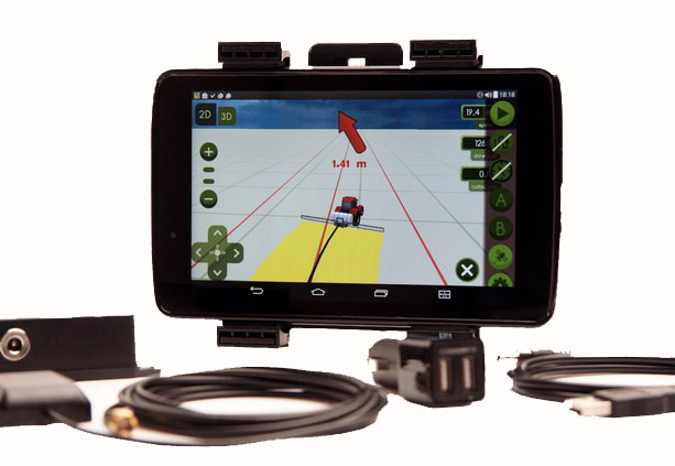
    iOne STKA provides the technology foundation to configure a variety of multi-purpose sensors, including miniaturized 2D/3D applications, for the emerging UVS and mobile/handheld markets. The iOne STKA received the Geospatial Forum 2013 World Technology Innovation in Sensors Award, is the first to be considered for NEANY’s Arrow UAV, and is field-proven by the commercial large-format 2D/oblique/3D multipurpose metric mapping systems iOne IMS, iOne Stereo, and iOne n-Oblique.

    With the iOne STKA, the same UAS/UAV sensor system architecture can be used for agricultural and forestry mapping, pipeline or corridor monitoring, utility assessments, aerial surveys, research, persistence surveillance and other metric 2D/3D professional applications. The iOne STKA is a modular multipurpose sensor platform reconfigurable for UAVs of any size. With the iOne STKA, UAV manufacturers are no longer limited to offer monolithic, single purpose DSLR type cameras. Using the iOne STKA technology, UAV end users can economically collect high-quality color or infrared NADIR, oblique, or video imagery as well as co-mount and co-register e.g., LiDAR and thermal sensors using the same system architecture.

    “By providing UAV manufacturers and end-users with one reliable and performing end-to-end standard digital sensor system solution for MANY applications, we are empowering our customers with a more efficient and standard technology foundation and paradigm to grow their business, enhance their products, and maximize their return,” said Visual Intelligence President and CEO Dr. Armando Guevara.

    At the core of the iOne STKA is Visual Intelligence’s Patented Advanced Retinal Camera Array (ARCA). Developed using open systems and object-oriented software engineering principles, the ARCA is “encapsulated” with a rich set of advanced proprietary software methods that integrate camera components. The ARCA enables the collection of different types of imagery, fused in one pass, producing low-cost, extremely accurate, high-resolution products. It also enables unprecedented array-based collection and functional scalability sensor fusion. The arrays made of these varied imaging devices perform like a single camera, producing one single metric, radiometrically and geometrically correct image, or set of co-registered and fused images; such as a Virtual Frame, of higher accuracy, resolution and quality than DSLR-based monolithic cameras.

    Adds Guevara, “UAV manufacturers can take advantage and offer bundled with the iOne sensors Visual Intelligence’s advanced computing technology for fast cloud-based basic and advanced actionable information product generation. As a fully automated solution (from the sensor to the cloud), the iOne STKA includes processing software that uses streamlined workflows and processes imagery faster with multicore/multithreaded/GPU computing technology, making it easy to quickly produce and analyze products in a device-content eCosystem environment. This technology/business model is designed to provide UAV manufacturers and users recurrent ROI.”

    UAVs built using sensors based on the iOne STKA have the following features and advantages:

    • Strong digital obsolescence resilience, extending the useable life of the system while improving operational efficiencies and reducing operating costs for an even better ROI.
    • In the field:
      • Collection scalability
      • Functional scalability
      • Sensor reconfiguration, e.g. increase collection or functionality as needed or per mission requirements.
    • Large cross-track and FOV collection through smaller aperture (ARCA enabled).
    • Ability to collect different sources of metric imagery that can be fused in one pass.
    • Sensor fusion: Ability to co-mount and co-register in a “small and tight packaging” the EO capability with any other EO or active sensor such as LiDAR, Thermal, IR, etc.

    The iOne STKA software architecture is normative across all ARCA-based products; that is, the software is the same for different array configurations or sizes. This reusable component approach yields economies of scale in the manufacturing and use of multipurpose UAV/sensor configurations.