Quectel Wireless Solutions has introduced the Quectel LR700A smart connected GNSS receiver, an all-in-one high performance quad band base station solution, capable of connecting to the cloud to deliver GNSS correction data, usable either standalone or within an RTK station network.
Available for use globally, the modular design integrates the GNSS receiver with cellular, Wi-Fi and antenna systems, while providing extension slots for Zigbee short-range communication.
Cellular connectivity makes the system highly versatile, enabling deployment anywhere without requiring existing infrastructure, ideal for establishing RTK correction services in remote locations. The integrated short-range communication capabilities make it ideal for pairing directly with nearby rovers, creating a complete RTK solution for localized high-precision applications.
The quad-band GNSS receiver enables simultaneous reception of signals from GPS, Galileo, BDS, GLONASS, QZSS and NavIC constellations across the L1, L2, L5 and E6 frequency bands. The Quectel LR700A supports 1040 channels, enabling flexible data transmission and remote management with cellular, ethernet and Wi-Fi networks. Easy monitoring and configuration over local networks are ensured via an intuitive web-based interface.
“This highly versatile product enables developers to specify an all-in-one, full-constellation receiver that supports multi-frequency tracking while offering ultra-low power consumption and a robust, industrial-grade design,” said Windy Fang, director, GNSS Product Line, Quectel Wireless Solutions. “Its power efficiency and integrated, compact design make it ideal for use cases where space and energy are constrained.”
Designed to function as a base station, the Quectel LR700A delivers precise GNSS corrections and positioning for high accuracy applications including smart agriculture and precision farming use cases, surveying and mapping, autonomous vehicles and outdoor robotics, such as lawnmowers.
The LR700A’s ultra-low power consumption makes it ideal for power constrained use cases with typical consumption of up to approximately 2.1W with ultra-wide range voltage support from 9-36V. The LR700A weighs 2.1kg, has a diameter of 220mm and height of 149mm and operates in the -40oC to +85oC temperature range. Support for local Wi-Fi web user interfaces and remote cloud configuration ensure simplified field installation.
Featuring an IP67 rated, industrial-grade design, the LR700A is resistant to shock, impact, drop, lightning and ultra-violet light damage, ensuring reliable operation and long-term durability in outdoor conditions. Certifications for CE, FCC, RoHS and REACH compliance are in progress.
A roundup of recent products in the GNSS and inertial positioning industry from the December 2024 issue of GPS World magazine.
Mapping
Photo: SPH Engineering
GPR System For terrestrial and airborne applications
The Zond Aero 500 NG is a versatile ground penetrating radar (GPR) system designed for both terrestrial and drone-mounted surveys, suitable for applications such as utility scanning, sinkhole detection, glaciology and geological studies. It operates in dual mode, allowing for ground-based and airborne surveys, enhancing data collection flexibility. Key specifications include a center frequency of 500 MHz, an operating bandwidth of 200 MHz – 900 MHz, a sampling rate of 25,600 samples per second and a scan rate of 50 scans per second, with depth penetration up to 4 meters in average soil conditions. The system features advanced electronics for real-time data collection, which can significantly improve the signal-to-noise ratio. It is compatible with DJI Matrice 300/350 UAVs for airborne applications.
Streamlined Lidar Mapping YellowScan’s Surveyor Ultra integrated with DeltaQuad Evo
Integrating YellowScan’s Surveyor Ultra with the DeltaQuad Evo platform allows users to collect high-precision, high-density data across 1,200 hectares in a single flight while simultaneously capturing lidar and RGB data.
DeltaQuad Evo’s long-range flight capabilities and efficient vertical take-off and landing (VTOL) design, paired with the Surveyor Ultra’s lidar technology, allow users to streamline their workflows to reduce time spent in the air and on post-processing tasks, making it particularly beneficial for large infrastructure projects, forestry analysis and environmental monitoring. The system can be used for surveying, construction, forestry and environmental research.
Airborne Mapping System With a ‘cross-fire’ scan pattern
The VQ-1560 III-S is a dual-channel laser scanning system designed for airborne mapping applications. Its “cross-fire” scan pattern allows for simultaneous forward and backward viewing at the edges of the swath, along with a nadir view in the center. This configuration optimizes point distribution for effective target sampling. With pulse repetition rates reaching up to 4.4 MHz, the VQ-1560 III-S can operate at altitudes of up to 1,600 m above ground level (AGL). At a lower pulse repetition rate of 560 kHz, it can function at altitudes as high as 3,900 m AGL.
The system features inertial measurement unit (IMU) and GNSS integration, with the option to include one or two high-resolution RGB/NIR cameras. It is ideal for professionals in fields such as urban planning, forestry and environmental monitoring.
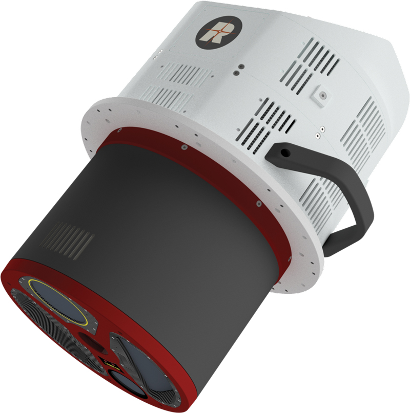
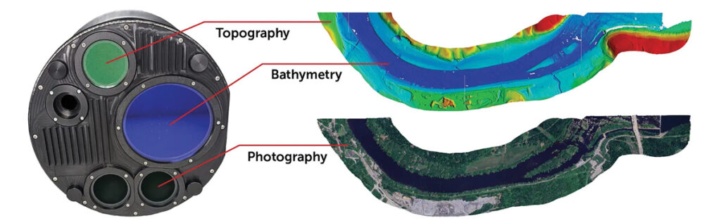
This bathymetric lidar system is designed for coastal and inland water mapping. It combines high-resolution topographic and bathymetric capabilities, allowing for seamless data collection across land and sea. It can be used for coastal zone management, environmental monitoring, infrastructure planning and more.
Fathom delivers data quickly by leveraging real-time quality control with Onboard and scalable processing with a CARIS workflow. It also includes a built-in topographic lidar and a multispectral camera for coastal surveys at a coverage of 50 km2/hour.
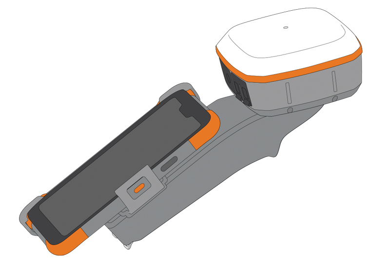
The Geode Grip is a mounting accessory featuring a specialized bracket. It allows users to securely attach smartphones directly to Juniper’s Geode GNSS receivers, offering an integrated and streamlined data collection solution.
The Geode Grip is a tool designed for professionals in surveying, mapping and geographic information systems (GIS) to enhance mobile data collection. It replaces the traditional survey pole with a handheld setup that aims to improve ergonomics. It is ideal for field projects that require precise location data and mobile data collection, such as environmental research, land surveying, agriculture and infrastructure engineering.
New Product Bundle For high-accuracy GNSS applications
Quectel Wireless Solutions has unveiled a new product bundle designed to facilitate the development of high-accuracy GNSS applications. The bundle includes the LG290P GNSS module, which is a quad-band, multi-constellation device capable of receiving signals from various satellite systems, including GPS, GLONASS, Galileo, BDS, QZSS and NavIC. The LG290P is engineered for high precision and supports RTK positioning, allowing for centimeter-level accuracy even in challenging environments. It can be used in diverse applications, such as autonomous vehicles, precision agriculture and surveying.
In addition to the LG290P module, the bundle includes options for either the YEGN103W8A geodetic antenna or the YEGD006U1A patch antenna. Both antennas are designed to operate within the same frequency bands as the GNSS module and are compliant with environmental regulations such as RoHS. This pre-integrated solution simplifies developers’ procurement and integration process by providing a one-stop solution that combines antennas with GNSS modules and RTK correction services.
Lidar Camera Payload For surveying and mapping applications
The RESEPI Ultra LITE is a lightweight payload combining lidar and camera technology for advanced surveying and mapping applications. The system integrates the XT-32 lidar scanner to offer users advanced data accuracy and point density across various operational modes.
It has a compact design with a 5MP colorization camera, making it ideal for small unmanned aerial systems (SUAS) with strict volume constraints. It can be used for aerial and ground-based applications, including utility mapping, construction volumetrics, precision agriculture, forestry, site surveying and mining. Designed for seamless integration, the system is compatible with a wide range of platforms such as Freefly, WISPR, DJI, Sony and mobile setups. Inertial Labs’ proprietary SnapFit adapters ensure quick and secure mounting to enhance the system’s adaptability.
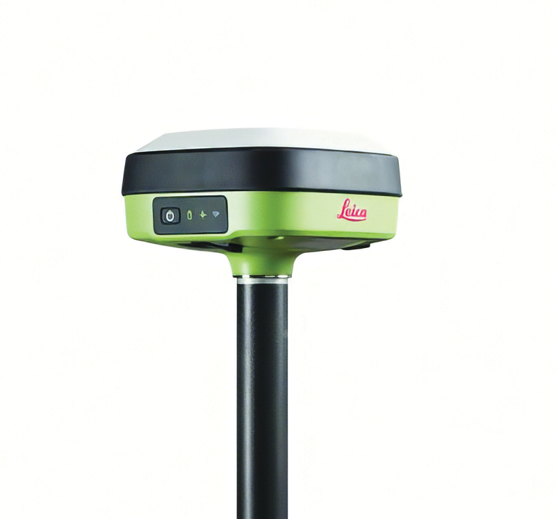
The Leica GS05 is a compact and lightweight GNSS smart antenna designed for surveying tasks, featuring calibration-free tilt compensation. This robust device allows for accurate measurements even when the survey pole is tilted up to 30°, enhancing data collection in challenging environments. Its integration with Leica Geosystems’ portfolio, including Leica Captivate software and total stations, seeks to maximize efficiency. The GS05 can function as both a base and an RTK rover, supporting single base stations and RTK networks such as Leica SmartNet.
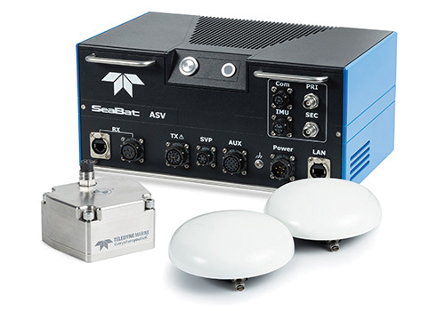
Intrepid is a GNSS/INS system integrated with the SeaBat T20-ASV processor and includes a compact IMU and two GNSS antennas, ensuring reliable and precise positioning.
It can automatically stream data to third-party software. This eliminates the need for manual sensor interfacing and reduces downtime. The Intrepid GNSS/INS benefits users in marine surveying applications by providing the precise navigation necessary for operational efficiency. Its intuitive design allows for simple configuration.
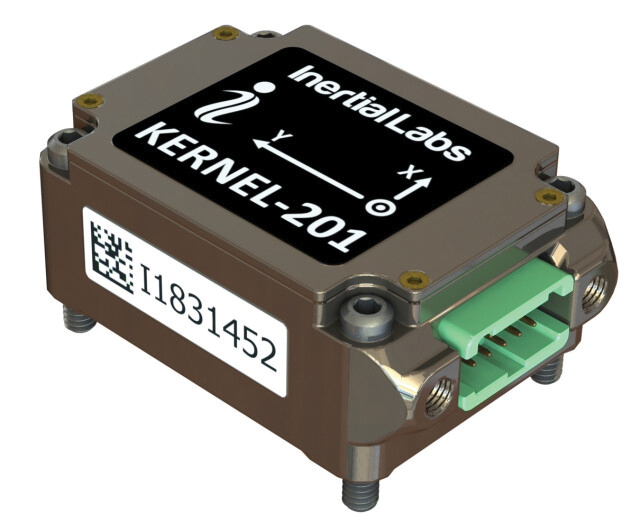
Miniature MEMS Sensor-Based IMU Can withstand high shock and vibrations
The KERNEL-201 features three-axis MEMS accelerometers and gyroscopes that offer ultra-low noise, high bandwidth and minimal latency. These characteristics make it ideal for applications such as pointing, stabilization and navigation in systems where performance and size are critical. Its volume of 0.38 cubic inches offers a high dynamic range.
Fully calibrated and temperature-compensated, the unit offers consistent, precise measurements even in challenging environments. It features an in-run bias stability of up to 0.7 deg/hr for gyroscopes and 0.005 mg for accelerometers, along with a low angular random walk (ARW) of 0.065°/√hr and velocity random walk (VRW) of 0.015 m/sec/√hr.
The unit is designed to withstand high shock and vibration while maintaining peak performance, making it suitable for a wide range of challenging applications. The KERNEL-201 can be integrated into various high-level systems, such as motion reference units (MRUs), GPS-aided inertial navigation systems (INS) and attitude and heading reference systems (AHRS). It offers continuous built-in testing (BIT), customizable communication protocols and flexible power options.
Smart Choke Antenna Offers comprehensive GNSS signal reception
The VCS6000XF full band smart choke antenna is engineered for CORS applications. It combines Tallysman Verachoke antenna elements with Septentrio’s Mosaic X5 full-band receiver to offer an integrated solution for OEM CORS systems.
The VCS6000XF offers comprehensive GNSS signal reception, including GPS/QZSS L1/L2/L5, GLONASS G1/G2/G3, Galileo E1/E5a/E5b/E6/E5 AltBoc, BeiDou B1/B2/B2a/B3, NavIC L5, SBAS and L-Band correction services.
The antenna features a 0.5 mm phase center variation and utilizes Calian’s eXtended filtering for near-band signal interference mitigation. The integrated Septentrio Mosaic X5 receiver provides capabilities such as anti-jamming, anti-spoofing, scintillation mitigation and receiver integrity by combining the antenna and receiver in the choke ring antenna.
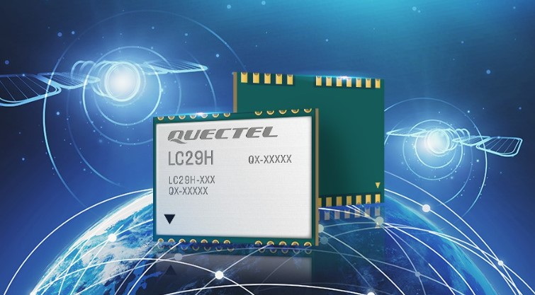
Quectel Wireless Solutions has released the LC29H, a dual-band multi-constellation GNSS module. Built using the Airoha AG3335 platform, the LC29H is available in multiple variants and optionally integrates real-time kinematic (RTK) and dead reckoning.
The LC29H series offers high performance with power efficiency to meet the market needs of high-precision positioning at the centimeter and decimeter levels. The modules are suited to an expanding market for autonomous lawn mowers, drones, precision agriculture, micro-mobility scooters and delivery robots as well as other industrial and autonomous applications.
“High-precision positioning with centimeter-level accuracy is becoming increasingly vital for many new IoT [internet of things] applications,” said Patrick Qian, Quectel CEO. “Robotics, UAV and industrial applications needing precise navigation are driving new market requirements, and we are very excited to launch our newest generation of high-precision positioning modules.”
The LC29H concurrently receives and processes signals from GPS, GLONASS, BeiDou, Galileo and QZSS. The module supports L1 and L5 dual-band signal reception, speeding up convergence time, improving positioning accuracy, and achieving fast response times even when signals are interrupted. The dual-band design significantly mitigates the multipath effect experienced near high-rise buildings or in deep urban canyons, and provides reliable positioning performance, Quectel stated.
In addition, some versions of the LC29H contain a six-axis inertial measurement unit (with three-axis accelerometer and three-axis gyroscope) and integrate RTK and dead-reckoning positioning algorithms, allowing for continuous lane-level positioning where the satellite signal is partially or completely blocked, such as underground parking lots, tunnels, urban-canyons or forests. When the satellite signal is reacquired, the LC29H combines inertial sensor data with GNSS signals, and the integrated navigation can provide fast convergence times and decimeter level positioning accuracies.
The LC29H is available in variants, each targeting different application scenarios. The LC29H(EA) is aimed at the growing market of agricultural drones as well as electricity power detection terminals, and can improve the anti-interference capability of complex systems. The LC29H(BA) is well suited to agricultural machinery and specialized vehicles, and the LC29H(DA) can enable centimeter-level accuracy in connected lawnmowers and safety helmets.
Quectel Wireless Solutions, a global IoT solutions provider, has released the LC76G module, a single-band compact GNSS module featuring fast and accurate location performance as well as ultra-low power consumption.
The LC76G is on display at Embedded World Nuremberg, Booth No 171, Hall 5, June 21- 23.
The LC76G has already entered mass production with sufficient supply to meet the needs of the global positioning market. Based on the Airoha AG3352 platform, the LC76G can concurrently receive and process signals from all four global constellations and the regional QZSS.
The LC76G module can receive signals from up to 47 satellites and achieve 1.5 m (CEP50 open-sky) positioning accuracy representing a 40% improvement over previous generations of devices.
Available in a cost-optimized version as well as a low-power version, the LC76G low-power version consumes less than 9 mA@3V with all four constellations enabled, allowing for a 72% reduction in power required compared to what was previously possible.
This makes the LC76G suitable for battery-operated devices such as wearable personal trackers, wildlife and livestock tracking, toll tags, portable container trackers and a host of traditional markets such as shared mobility and low-cost asset trackers.
Featuring an internal SAW filter and integrated LNA, the LC76G can be connected directly to a passive patch antenna and provides filtering against unwanted interference, ensuring excellent performance even while driving through dense urban canyons.
EPO and EASY improve TTFF
Integrated assisted-GNSS technology Extended Prediction Orbit (Quectel’s EPO) is supported on the LC76G module. EPO reduces the time to first fix (TTFF) with a hot start taking less than 1 second, a warm start within 2 seconds, while the cold start can obtain accurate tracking fixes within 15 seconds. The faster GNSS fixes make it possible to use accurate positioning and navigation services anytime and anywhere with a smaller power budget than previously possible.
While EPO requires manual download of predicted orbits, the LC76G also supports the Embedded Assist System (EASY), where predicted orbit information is collected directly from the satellites and provides for up to three days of accelerated fixes.
Both EPO and Easy are available for each constellation, allowing for faster TTFF and reduced dependency on any particular constellation.
Featuring an LCC form factor and an ultra-compact size of 10.1 × 9.7 ×2.4 mm, the footprint of the LC76G is compatible with other industry solutions as well as Quectel’s legacy L76 and L76-LB modules, allowing for a smooth migration of existing designs to the latest low-power GNSS technology.
In addition, Quectel offers a wide range of off-the-shelf and customized high-performance antennas which boost wireless connectivity significantly. The C76G can be combined with a selection of GNSS L1 antennas to enable various positioning requirements. Customized connector type and cable length as well as comprehensive antenna design and test support are also available.
Quectel Wireless Solutions, a supplier of IoT modules and antennas, and Point One Navigation, a provider in precision location technology, have announced the LG69T-AM, the latest addition to the LG69T GNSS Module Series. Point One’s positioning engine powers the LG69T-AM and enables centimeter-level global accuracy by integrating augmented GNSS in a module with open-source API.
The LG69T-AM GNSS module features STMicroelectronics’ Teseo V dual-band L1/L5 positioning receiver platform with 80 tracking and four fast acquisition channels compatible with GPS, GLONASS, Galileo, BeiDou, QZSS and NAVIC.
The LG69T-AM leverages Point One’s RTK and SSR technology for centimeter-level accuracy and ultra-fast convergence time. It is designed for easy integration with minimal e-BOM modification and is well-suited for mass market adoption without the need for an expensive external co-processor. Due to its small package size, light weight, and excellent power consumption, it is ideal for applications such as robotics and precision agriculture.
Embedded in the LG69T-AM is Point One’s FusionEngine and its Polaris correction service client. FusionEngine is compatible with standards-based corrections services including those based on RTCM.
Polaris is Point One’s own GNSS correction service that unlocks better than 10cm absolute accuracy with a coast-to-coast footprint in the United States and coverage across Europe. It offers a variety of connectivity options including delivery over cellular and L-band. The network is purpose-built for precision agriculture customers and includes advanced anti-jam, interference mitigation, end to end security and automatic integrity monitoring unmatched by any other provider.
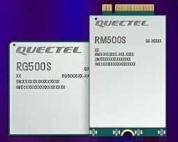
Quectel Wireless Solutions, a global supplier of modules for the internet of things (IoT), has announced the release of two new 5G New Radio (NR) module series, the RG500S and RM500S.
Based on the new Qualcomm 315 5G IoT Modem-RF System, both modules can support customers in building dedicated 5G devices for a variety of verticals including industrial IoT, retail, smart energy, private 5G networks, and many others.
The RG500S and RM500S both integrate a multi-constellation GNSS receiver, which simplifies the product design and provides accurate positioning services for users.
Utilizing the powerful Qualcomm 315 5G IoT modem, the RG500S and RM500S support extended-life software maintenance, helping create long-lasting IoT devices for the duration of their life span. Offering seamless integration, the RM500S is pin-to-pin compatible with Quectel’s LTE Cat 4 module EM05, Cat 6 module EM06, Cat 12 modules EM12-G/EM12xR-GL, Cat 16 module EM160R-GL and 5G module RM500Q, which provides more competitive 5G solutions to the IoT market. These features will help accelerate the 5G IoT market in the industrial and consumer IoT segments with use cases across robotics, automation, intelligent manufacturing, energy distribution, precision agriculture, construction, and mining.
Photo: Quectel
The RG500S and RM500S modules support 5G NR sub-6GHz bands in stand-alone mode offering backward compatibility with LTE networks. With network slicing in stand-alone mode, the two modules are able to offer end-to-end traffic isolation for critical traffic, guaranteed data rates and bandwidth, and lower latency than in non-standalone mode, which meets the demands of ultra-reliability and service-level agreements of typical industrial and enterprise scenarios.
The two modules are embedded with rich interfaces and incorporate high-speed USB 3.0/3.1, PCIe 3.0, U(SIM), RGMII and more, making them suitable for diversified industrial and consumer 5G applications such as industrial routers, robots, automation, intelligent manufacturing, smart cities, energy distribution, precision agriculture, construction and mining.
“Quectel has long been collaborating with Qualcomm Technologies to support the enablement of the 5G market in IoT,” said Patrick Qian, CEO, Quectel. “Based on the latest Qualcomm 315 5G IoT modem, the RG500S and RM500S are able to offer greater possibilities for the industrial and commercial IoT verticals. Features such as high performance and low latency as well as extended life software maintenance address the existing IoT market needs and can power a range of new 5G IoT use cases.”
“The Qualcomm 315 5G IoT modem solution was introduced to stimulate and scale the 5G IoT industry and enable the transitions needed to make 5G for IoT a reality. This solution is pin-to-pin compatible with legacy modules, which can accelerate device development and commercialization and promote growth and expansion in the 5G IoT industry. Integrating Qualcomm Technologies’ purpose-built modem into Quectel’s RG500S and RM500S modules will help deliver 5G to the IoT industry across industrial and enterprise applications,” said Jeffery Torrance, senior vice president, product management, Qualcomm Technologies.
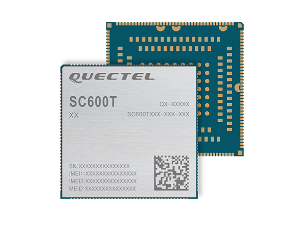
The SC600T-NA and SC600Y-NA are industrial-grade LTE Cat 6 modules with an operational and certified built-in Android 9.0 OS.
The SC600T-NA is based on the Qualcomm Snapdragon MSM8953 and supports Octa-core A53 up to 2.0 GHz, camera 24 MP and video 4K at 30 fps.
The SC600Y-NA adopts the Qualcomm Snapdragon SDM450 and Octa-core A53 up to 1.8 GHz, camera 21 and video 1080 at 60 fps.
A multi-constellation GNSS receiver is available in both modules, which is ideal for applications that require fast and accurate fixes, such as in-car video streaming and live video devices, the company said.
Both modules integrate 2 GB LPDDR3 + 16 GB eMMC flash and support WUXGA display.
With powerful engines, the two modules are fully integrated with Bluetooth, Wi-Fi capability and strong multimedia functions include support for dual LCDs and dual touch panels with independent display and operation. The modules can support a maximum of four cameras with two working simultaneously. Quick Charge 3.0 technology can facilitate various smart devices, including vending machines, smart cash registers, smart delivery machines and more.
Designed for North America, both modules work on FDD-LTE bands B2/B4/B5/B7/B12/B13/B14/B17/B25/ B26/B66/B71, TDD-LTE band B41 and WCDMA bands B2/B4/B5.
“These two modules for North America have passed another industry milestone. They will enable IoT designers, manufacturers and their customers to utilize the latest and leading LTE network technologies from America’s most awarded network,” said Patrick Qian, chairman and CEO of Quectel. “The new generation Cat 6 smart modules are critical for devices to utilize the processing power whenever needed.”
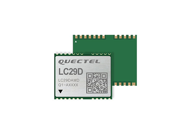
The LC29D is a sub-meter level GNSS module that integrates dead reckoning (DR) and multi-band (L1/L5) real-time kinematic (RTK) algorithm technologies with fast convergence times and reliable performance. The module supports dual-band GNSS raw data output and integrates 6-axis IMU sensor to deliver high-accuracy positioning performance in seconds.
Based on the Broadcom BCM47758 GNSS chip, the LC29D can concurrently receive signals from up to six constellations (GPS, GLONASS, Galileo, IRNSS, BeiDou and QZSS) at any given time, which maximizes the availability of sub-meter level accuracy.
Combining GNSS signals from dual-frequency bands (L1/L5) and RTK technology enables the LC29D to achieve high performance even in difficult conditions such as dense urban canyons. The module can also mitigate multipath effects in urban cities.
The LC29D offers a position update rate of up to 30Hz (fusion output), enabling dynamic applications like shared eMobility, delivery robots and precision agriculture to receive position information with lower latency. By enabling easy integration of advanced RTK multi-band algorithms, the module helps developers quickly bring their devices to market.
The high-precision module offers better performance than products in the market in positioning precision, sensitivity, time to first fix (TTFF), update rates and latency.
Embedded with 6-axis MEMS sensor, devices powered by the LC29D can quickly report motion, which enables consistent high-precision positioning capabilities when combined with the DR algorithm, even in weak-signal environments such as tunnels and underground parking structures.
According to Quectel, this paper details the challenges eMobility providers face in enabling vehicles such as eScooters and eBikes to be located in deep urban canyons. The white paper also examines why accurate location data will be vital in enabling the ride-sharing industry to comply with regulation to restrict eMobility usage on sidewalks and other areas, Quectel said.
The report also details drive test data conducted on an eScooter in San Francisco. The data demonstrates the enhanced accuracy offered by L1 and L5 plus dead reckoning capability.
Finally, the white paper discusses how the Quectel LC79D is enabling the eMobility industry to harness the fusion of different sensors in a very small footprint at low incremental cost with unparalleled accuracy, the company added.
“eMobility providers face substantial challenges when dealing with location in deep urban environments,” said Mark Murray, vice president of sales for GNSS and automotive at Quectel. “First and foremost, customers need to be able to find the vehicle and cities need to have the assurances that these eBikes and eScooters are operated in mutually agreed locations.”
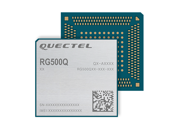
Quectel Wireless Solutions‘ RG500Q-EA 5G NR module has achieved commercial readiness and is now available to support global customers with mass deployment.
The module features the Qualcomm Snapdragon X55 5G modem. It is designed for a variety of industrial and consumer internet of things (IoT) applications, including business routers, home gateways, customer premises equipment (CPE), MiFi, industrial IoT (IIoT), industrial laptops, PDAs, video surveillance, digital signage, 4K/8K live streaming and many other bandwidth-intensive use cases.
The Quectel RG500Q-EA supports major sub-6GHz frequency bands as well as worldwide LTE-A and WCDMA network coverage, allowing customers to deploy their IoT solutions flexibly in Asia-Pacific, Europe and the Middle East.
Quectel RG500Q is a series of 5G Sub-6GHz modules optimized specially for IoT and M2M applications. Adopting the 3GPP Rel. 15 technology, it supports both 5G NSA and SA modes.
The RG500Q is provided in two variants: RG500Q-EA and RG500Q-NA. The module supports Qualcomm IZat location technology Gen9C Lite (GPS, GLONASS, BeiDou/Compass, Galileo and QZSS). The integrated GNSS receiver greatly simplifies product design and provides quicker, more accurate and more dependable positioning capability.
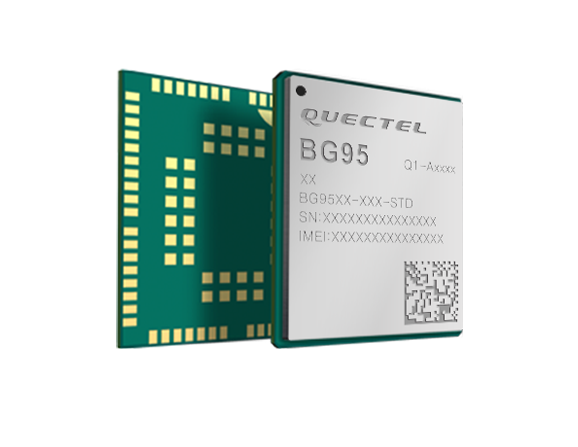
Quectel Wireless Solutions is collaborating with Microsoft and Qualcomm Technologies to integrate its new LPWA module BG95 with Microsoft’s Azure Device SDK.
The integration will provide direct and secure connections to Azure IoT Hub and provide full support for Azure device management capabilities.
Targeting global markets, the BG95 module is a cost-optimized, highly-integrated variant supporting integrated GNSS, Cat M1, Cat NB2 and EGPRS (also called EDGE). The module complies with 3GPP Release 14 and delivers improved capabilities in power consumption, data rates and hardware-based security.
The BG95 cellular module is based on the Qualcomm 9205 LTE modem, to be integrated with Microsoft’s Azure Device software development kit (SDK). As a result, customers can connect their BG95 devices to the Microsoft Azure cloud where they can build, manage and deploy internet of things (IoT) solutions at scale, significantly accelerating time to market.
By integrating RAM/flash, an ARM Cortex A7 processor supporting ThreadX, the BG95 is engineered to reduce power consumption significantly in idle mode.
By doing this, the BG95 has the potential to support decade-plus battery life, which is critical for IoT devices serving long life spans, such as asset trackers, smart meters, smart city sensors, home security and wearable trackers.
Additionally, Azure IoT is built for security. It simplifies the complexity of IoT security solutions with built-in protection at each stage of deployment (including cloud services and devices) and minimizes security weaknesses wherever they exist. Leveraging Azure IoT security features, Quectel BG95 will offer IoT devices end-to-end security capability in order to prevent potential risks.
“We’re excited for the Azure edge device ecosystem to continue to grow. Our partnership with Quectel and Qualcomm Technologies will deliver what our customers need — bringing together ultra-low power cellular modules and Azure to drive their digital transformation,” said Roanne Sones, corporate vice president at Microsoft.
“The BG95 module is the first Qualcomm 9205 platform to support IoT Plug and Play, accelerating LPWAN solution deployments like smart meters and asset trackers that connect seamlessly to our IoT Central offering,” Sones said.
“With its cutting-edge performance and power-saving capabilities, the Qualcomm 9205 LTE Modem is the gold standard for multimode IoT modules looking to offer NB-IoT, Cat-M1, GPRS, and GNSS connectivity,” said Jeffery Torrance, vice president, business development, Qualcomm Technologies, Inc. “We are proud to continue our long-standing collaboration with Quectel to jointly drive the IoT forward.”
“We are happy that the BG95-M3 has been verified on Microsoft Azure IoT Plug and Play. This validates our ability to jumpstart customers’ IoT projects with pre-tested modules and operating system combinations. Leveraging our close relationship with Microsoft and Qualcomm Technologies, we will jointly provide more integral ‘Device-Cloud’ solutions to customers,” said Doron Zhang, Chief Operation Officer, Quectel. “As one of the first wave Azure IoT PnP partners, Quectel has worked with Microsoft on LTE Mobile Broadband (MBB) modules, which have been widely adopted by top laptop OEMs. In the future, we will extend the partnership to more fields, such as Artificial Intelligence (AI) and Intelligent Edge, in order to help the Microsoft partner ecosystem connect their devices even more intelligently.”
Quectel Wireless Solutions, a global supplier of cellular and GNSS modules, debuted at CES 2020 a series of communication modules targeting the 5G connected car sector.
CES 2020, the massive annual consumer electronics show, is taking place Jan. 7-10 in Las Vegas. The three new modules are showcased at Quectel’s booth No. 2601.
Quectel’s new automotive-grade modules include the AG550Q, a new 5G New Radio (5G NR) Sub-6GHz module, the AG215S automotive EAP module, dedicated for C-V2X scenarios, and the AF50T Wi-Fi module.
All three modules are based on the Qualcomm Automotive Wireless Solutions from Qualcomm Technologies, Inc., a subsidiary of Qualcomm Incorporated. They are designed to provide multi-gigabit cloud connectivity, improved location services, and enhanced security to support the increasing requirements of connected car and autonomous driving use cases.
Image: Quectel
The AG550Q 5G NR module, supporting both NSA and SA modes, is based on the AEC-Q100 qualified Qualcomm Snapdragon Automotive 5G Platform. The module is compliant with IATF 16949 requirements, and follows automotive quality processes such as APQP and PPAP to address the demanding requirements of automotive devices.
Adopting the 3GPP Rel. 15 technology, the AG550Q supports high speeds and ultra-low latency to facilitate better security and quality-of-service for mission-critical services. The multimode 5G NR module is backward compatible with existing 4G, 3G and 2G technologies. This ensures that cars will remain connected regardless of where they travel within the network.
Supporting optional C-V2X PC5 direct communications, AG550Q provides superior performance in vehicle-to-vehicle (V2V) and vehicle-to-roadside infrastructure (V2I) communications for improved traffic efficiency and safety. Furthermore, the module supports optional Dual SIM Dual Activation (DSDA), which allows car and driver each to choose their own independent network operator subscription in order to support a variety of emerging mobility service models.
Additionally, the highly-integrated AG550Q module supports multi-constellation and multi-frequency GNSS (L1/L2/L5), as well as optional Qualcomm Dead Reckoning (QDR) 3.0 technology which provides quick and highly accurate location positioning. The module will be commonly found in telematics boxes (T-Box), telematics control units (TCU), advanced driver-assistance systems (ADAS), C-V2X (V2V, V2I, V2P) systems, on-board units (OBU), roadside units (RSU), and other automotive/traffic systems.
Quectel AG550Q module offers powerful cyber-security features, which include firmware secure boot, Trusted Execution Environment (TEE), network firewall, SELinux strong access control, TLS/SSL security protocols and more.
“We are proud to deliver global OEMs and Tier 1 suppliers the most advanced wireless connectivity available, which allow them to integrate the latest 5G technology into their next-generation car designs,” said Min Wang, vice general manager of Quectel. “Leveraging our relationship with Qualcomm Technologies and its cutting-edge chipsets, we have been able to offer auto customers secure and reliable connected car solutions. Our complete automotive portfolio ranging from LTE, C-V2X to 5G and Wi-Fi can satisfy the continuity of automakers’ future product planning.”
“As the automotive industry accelerates its adoption of cellular-based communications technology, our priority is to work with innovative partners like Quectel Wireless Solutions to meet the needs of the automotive industry as it delivers on the promises of automated mobility,” said Matt Eichenberger, senior director, business development, Qualcomm Technologies. “The hallmark of our work with partners is to engineer highly scalable cellular technology-based platform that enable automakers to reimagine the speed of innovation. This translates to more connected experiences and improved vehicle safety, as more cars are capable of communicating not only with the cloud but also with other vehicles, pedestrians and transportation infrastructure.”
Besides AG550Q, Quectel also unveiled an automotive EAP module AG215S at the show, which is dedicated to C-V2X applications, and features the Qualcomm Snapdragon 2150 platform. The module integrates powerful application processor to host an ITS stack and applications. Along with having a hardware crypto engine embedded to fulfill powerful ECDSA verification capability (with support for up to 2500 verifications/sec). AG215S supports the global, U.S., EU and China National Security Algorithm, which can greatly boost security in vehicle communications. Quectel will also provide the reference design platform with full functionality (Application Processor + Modem + Connectivity + GNSS + SW SDKs), for customers and application developers.
The Quectel AF50T Wi-Fi module targets the connected car sector and supports Wi-Fi 2.4GHz + 5GHz & BT 5.1, and 802.11a/b/g/n/ac/ax standards.
The AG550Q module is in the engineering sample stage, with the evaluation board available to reduce development time for OEMs and Tier 1 suppliers. The AG215S module will be sampling starting January 2020.