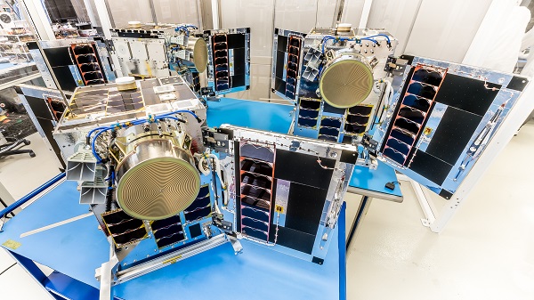
Galileo Second Generation Batch#1B satellites. (Image: ESA).
Technology multinational GMV has been awarded the NAVGUARD project by the European Commission.
NAVGUARD (Advanced Galileo PRS Resilience for EU Defence) will develop ground and space systems to detect illegal activities on GNSS frequencies and geolocate their sources. It also will build an information-management subsystem together with a user interface to provide a situational awareness picture.
The Galileo Public Regulated Service (PRS) is an encrypted navigation service for governmental authorized users and sensitive applications that require high continuity.
According to the EU Agency for the Space Programme (EUSPA), the PRS signal will ensure better continuity of service to authorized users when access to other navigation services may be degraded (resilience). In cases of malicious interference, PRS increases the likelihood of the continuous availability of the signal-in-space (robustness).
NAVGUARD is among various European Defence Fund (EDF) projects designed to sharpen the competitiveness of the European Union defense industry and strengthen the EU’s strategic autonomy. Besides navigation, the projects contracted to GMV will focus on developing missile defense system capabilities, systems for dismounted soldiers, avionics, command and control and cyber defense.
Three HawkEye 360 radio-frequency geolocation microsatellites were launched May 25. The satellites, launched aboard SpaceX Transporter-5 mission, were built by Space Flight Laboratory (SFL) of Toronto. Three SFL-built satellites for greenhouse gas monitoring were also launched.
The HawkEye 360 constellation detects and geolocates RF signals for maritime situational awareness, emergency response, national security and spectrum analysis applications.
Once Cluster 5’s on-orbit checkout is complete, the HawkEye 360 constellation will be expanded to 15 satellites, doubling capacity and revisit rates. This significantly boosts the constellation’s ability to serve global customer demand and to monitor activity across places such as Ukraine.
“Every enhanced satellite cluster we launch helps us deliver a higher density of valuable data to our government, commercial and humanitarian customers and partners – advancing our efforts to monitor global activities for a safer and more secure world,” said HawkEye 360 John Serafini. “Launch by launch, these space-based innovations are analyzing the knowns and uncovering the unknowns of the RF spectrum across the globe.”
Cluster 5 includes enhanced antenna functions introduced with Cluster 4, which allow greater flexibility in geolocating signals across a wide range of frequencies important to customers.
Cluster 4, launched April 1, has been completing checkout and moving into final formation to begin collecting data in late June. Cluster 5 is slated to achieve initial operating capability in August.
Cluster 4 on orbit. (Image: HawkEye 360)
HawkEye 360 plans to continue to grow the constellation to achieve revisit rates of about 15 minutes to support timely defense, national security and commercial applications.
SFL has now developed 15 microsatellites for HawkEye 360 of Herndon, Virginia. SFL was selected for these missions due to the importance of formation flying by multiple satellites for successful RF geolocation.
Other missions developed by SFL in the past two years include 16 communications CubeSats and three microsatellites designed for Earth observation, maritime tracking and atmospheric monitoring.
In its 24-year history, SFL has developed cubesats, nanosatellites and microsatellites that have achieved more than 191 cumulative years of operation in orbit.
Raytheon BBN-led team recently supported DARPA’s fifth OFFSET program field exercise. (Photo: Raytheon)
Raytheon Intelligence & Space, a Raytheon Technologies business, recently supported the fifth OFFensive Swarm-Enabled Tactics (OFFSET) DARPA program field exercise.
Using integrated swarm technology developed by a Raytheon BBN-led team, a single operator successfully controlled a swarm — composed of 130 physical drone platforms and 30 simulated drone platforms — both indoors and outdoors in an urban setting. Raytheon BBN provides advanced technology research and development with a focus on national security priorities.
During the exercise, the team used a combination of commercial off-the-shelf and custom-built hardware and software to deliver swarm autonomy. This enabled a single or small group of operators to direct and manage the activities of a large swarm of autonomous air and ground vehicles with minimal training.
“Controlling a drone swarm changes the way an operator or group of operators think about the drones,” said Shane Clark, Raytheon BBN OFFSET principal investigator. “Takeaways from this exercise help inform us of the inflection points between utility and manageability.”
Inexpensive Hardware
A key element of the program is the use of inexpensive hardware. Without the powerful computing and sensing capabilities available in larger more expensive platforms, Raytheon BBN needed to create a broad library of simple tactic building blocks used to create plans to accomplish mission objectives.
Raytheon BBN also designed and configured a scalable, modular and decentralized approach to manage a variety of current and future platforms and missions. Whenever possible, the drones collaborate actively to decide how to accomplish a specific mission most efficiently.
“Our software is smart enough to assign drones with the right capabilities to the appropriate set of tasks,” Clark said. “For example, if the task is to surveil a building, multiple drones will be dispatched, with each surveilling portions of the building. The software considers each platform’s sensor capabilities, and tasks drones with downward-facing cameras to surveil the roof.”
Once the drones are deployed, their collaboration allows them to understand what parts of a building have been explored and where the gaps are. They then autonomously select how to fill in those gaps.
Virtual Reality Interface
To tackle the complexities of human swarm interfaces, the Raytheon BBN team created a virtual reality interface in addition to traditional camera views. It takes feeds from all the swarm assets to create an interactive virtual view of the environment.
“You can look behind the building to access a view of drone locations, for example, and use the virtual reality environment to test and see if your mission is viable,” Clark said. “We also developed a speech interface with the operationally deployed Tactical Assault Kit, or TAK, integration capability that enables the operator to act quickly while maintaining situational awareness over many systems simultaneously.”
The Raytheon BBN-led team includes Smart Information Flow Technologies, or SIFT, and Oregon State University. The team is contracted by DARPA to demonstrate its swarm capabilities during Army Expeditionary Warrior Experiment 2022 taking place in February to March, and hosted by the Army Maneuver Battle Lab.
The HawkEye 360 constellation detects and geolocates RF signals for maritime situational awareness, emergency response, national security and spectrum analysis applications.
Cluster 3 satellites fly in formation, joining Clusters 1 and 2. (Artist’s rendering: Hawkeye 360)
HawkEye 360 Inc. announced the successful launch of its Cluster 3 radio frequency geolocation microsatellites built by Space Flight Laboratory (SFL). Carried aboard the June 30 SpaceX Transporter 2 mission, the Cluster 3 formation-flying microsatellites quickly established communication with the company’s satellite operations center. They join in orbit the HawkEye 360 Cluster 2 and Cluster 1 Pathfinder satellites.
The HawkEye 360 Constellation detects and geolocates RF signals for maritime situational awareness, emergency response, national security and spectrum analysis applications. Cluster 3 significantly expands HawkEye 360’s capacity, and is part of its second generation of advanced RF-sensing satellites.
“With the addition of our second-gen satellites, we’ll offer more frequent, timely and actionable data and insights to our government, commercial and humanitarian partners,” said CEO John Serafini.
“The increased revisit frequency and capacity Cluster 3 brings to our constellation are essential to detecting, characterizing, and understanding the continuously changing RF activity important to our clients,” said Alex Fox, Executive Vice President for Sales and Marketing.
Seven more clusters are fully funded and scheduled for launch in 2021 and 2022 to achieve collection revisits as frequent as every 20 minutes, Fox said. “Each cluster will offer new innovations to address a rapidly growing set of requirements needed by our defense, security and commerce clients. We plan on expanding the constellation past the initial 10 clusters to achieve near-persistent monitoring of global RF activity, which will drive even more value and ensure our continued dominance in the industry.”
HawkEye 360 delivers a layer of intelligence to help understand human activity on Earth. The constellation detects, characterizes and precisely geolocates these RF signals from a broad range of emitters, including VHF marine radios, UHF push-to-talk radios, maritime and land-based radar systems, L-band satellite devices and emergency beacons.
By processing and analyzing these RF data, the company delivers actionable insights for national, tactical and homeland security operations, maritime domain awareness, environmental protection and new applications in the commercial sector, the company said.
The HawkEye 360 launch brings to 20 the total number of SFL satellites placed into orbit in less than a year. The Cluster 3 satellites were built on SFL’s 30-kg Defiant microsatellite bus.
HawkEye 360 selected SFL due to the importance of formation flying by multiple satellites for successful RF geolocation. SFL is the acknowledged leader in developing and implementing high-performance attitude control systems that make it possible for relatively low-cost nanosatellites and microsatellites to fly in stable formations while in orbit.
The previous HawkEye 360 satellite clusters built by SFL were the Pathfinder launched in 2018 and Cluster 2 in January. Each Cluster is comprised of three satellites.
Other launches of SFL-built satellites in the past year include missions developed for the Norwegian Space Agency (NOSA) in Norway, the Dubai-based Mohammed Bin Rashid Space Centre (MBRSC) in the United Arab Emirates, GHGSat Inc. of Canada, Space-SI of Slovenia, and a Canada-based telecommunications company.
The GAJT-410MS provides anti-jamming to marine vessels. (Image: NovAtel)
Hexagon | NovAtel has released the GAJT-410MS in response to the increase of interference and jamming in marine environments worldwide. The GAJT-410MS is the company’s latest addition to its proven GPS Anti-Jam Technology (GAJT) for the commercial and defense marine markets.
The low size, weight and power (SWaP) variant protects civil and military operations from interference and jamming, with jammer direction-finding capabilities for enhanced situational awareness in the marine environment.
The GAJT-410MS provides dynamic protection on both GPS L1 and L2 bands, as well as Galileo E1, QZSS L1 and L2 and SBAS L1 to combat intentional and unintentional interference. If a vessel experiences jamming, the device’s direction-finding capabilities provide improved situation awareness of their RF environment to identify and locate the source of the jamming signals.
The commercial off-the-shelf, non-ITAR solution is easy to install or retrofit onto existing fleets, enabling assured PNT for continuous operations, cybersecurity and safe navigation at sea, NovAtel said.
Interference, both benign and malicious, is a challenge facing civilian and military operations. Commercial marine applications like shipping, tankers and bulk carriers are under threat from interference targeting their navigation and cybersecurity. Without assured positioning, these vessels can drift off-course and place the vessel, crew and cargo at risk.
Nearshore marine applications like survey, construction and piloting also require reliable positioning for uninterrupted operations in crowded waterways and RF environments. Interference mitigation and jammer direction-finding for advanced situation awareness ensure users acquire assured positioning, navigating and timing (PNT) while identifying and limiting risk from interference sources.
“Assured navigation and cybersecurity defenses are growing priorities for marine users as global threats from interference and jamming increase,” said David Russell, marine segment portfolio manager for Hexagon’s Autonomy & Positioning division. “The GAJT-410MS is an anti-jam solution protecting vessels from interference and jamming disruptions to ensure continuous operations wherever your application takes you. With GAJT, your position, navigation and timing are protected and assured.”
The GAJT-410MS is the latest iteration of proven, high-performance anti-jam products from NovAtel. It includes flexible mounting options, jammer presence and direction-finding capabilities for advanced situation awareness.
Drone company Parrot is partnering with Rapid Imaging, a technology provider delivering geospatial augmented reality (AR) and situational awareness solutions to government and enterprise users.
The partnership pairs Parrot ANAFI USA platform drones and the FreeFly SDK with Rapid Imaging’s SmartCam3D SDK, a geospatial augmented reality and situational awareness platform for unmanned aircraft systems.
SmartCam3D overlays geospatial data such as street vectors, road names, points of interest, polygons and other pertinent map entities onto real-time, full-motion video (FMV) provided by ANAFI USA’s 4K HDR video, 32x zoom and live video streaming capabilities. This provides mission personnel with advanced situational awareness as they perform critical drone operations.
SmartCam3D also allows end-users to interact with live drone video in the same ways they would a map display, such as dropping a pin to mark a location or geocoding a selection from the real-time video stream.
These situational awareness capabilities provide opportunities across a variety of mission sets: airborne law enforcement, insurance, industrial inspections, natural disaster response, real estate and search-and-rescue operations.
The SmartCam3D SDK is a turn-key solution for UAS platform providers seeking to enrich their offerings with geospatial augmented reality and situational awareness tools. Features include geospatial AR, allowing users to enjoy a “Google Maps” type experience but with live drone video as the background layer rather than a satellite image. Granular declutter options allow users to select the types of map entities displayed on their live video feed.
Custom GIS data integration allows users to import their own geospatial data to display. Pin-dropping allows users to mark locations within the live video with AR annotations and communicate those locations to a map display.
Also, forward- and reverse-geocoding allow professional drone pilots to designate a point in the video and immediately receive the geospatial data associated with that point (lat/long or address) or designate a location and mark the location with an AR annotation within the video display.
Finally, cross-Cuing allowing end-users to simultaneously navigate a full-motion-video display and map display.
“Leveraging Parrot ANAFI USA’s precise GPS coordinates and advanced flight features, SmartCam3D® provides first responders and military personnel with up-to-date geospatial AR overlays on live video, combining the benefits of both a 2D map display and a Full-Motion-Video display into a single operating picture.” said Jerome Bouvard, director of Strategic Partnerships, Parrot. “This new partnership will provide easy-to-comprehend data to better assist first responders into making quick and accurate decisions during high-stress missions.”
All data captured through SmartCam3D during sensitive missions is secure, as Parrot drone users must opt-in to share flight data with Parrot’s secure to store footage. Parrot ANAFI USA also features secure digital (SD) card encryption, which ensures complete protection of photos and videos if the drone or the SD card is lost.
The SmartCam3D SDK is available for Android, iOS, Linux, and Windows systems for use with ANAFI and ANAFI USA platform drones.
Congatec is offering a workload consolidation kit for vision-based situational awareness applications such as machine control and vision-based collaborative robotics.
The kit qualifies as an Intel internet of things (IoT) ready-for-production kit. It offers three virtual machines based on the hypervisor technology from Real-Time Systems.
One runs a vision-based artificial intelligence application based on the Intel OpenVino situational awareness software. The second is real-time capable and operates deterministic control software, and the third acts as an industrial IoT/Industry 4.0 gateway.
TDKC has proven capabilities in microelectronics trust and assurance, space domain awareness, and advanced visualization for enhanced situational awareness. PreTalen’s core competencies are the related practices of cyber warfare, navigational warfare, and positioning, navigation and timing (PNT) techniques and technologies in support of defense and offensive operations to counter adversaries.
Both companies are headquartered in Dayton, Ohio.
The acquisitions more than double the number of Centauri employees in the region to more than 300, supporting customers across the space, cyber and intelligence markets.
In addition, to bringing TDKC and PreTalen’s capabilities to bear for Centauri’s broader customer base, Centauri is building additional research and development labs, and secure facilities in the Dayton region to expand innovation and cutting-edge solutions for Centauri’s customers.
“Both TDKC and PreTalen have exceptional talent and share a common culture of innovation in pioneering new capabilities for the warfighter” said Dave Dzaran, CEO of Centauri. “With TDKC, we are building world-class capability to help ensure trusted microelectronics in the supply chains for the defense and intelligence communities. Their expertise in space domain awareness brings additional AI and machine learning technology to further strengthen Centauri’s existing space-related mission capabilities focused on the next generation of solutions that will serve this rapidly-evolving domain.”
“Similarly to TDKC, PreTalen’s unique skill sets relating to all aspects of the PNT architecture serve as a true differentiator on their programs,” said Dennis Kelly, president and COO of Centauri. “PreTalen has built a critical mass of the most innovative employees in both PNT and cyber, and we are excited to facilitate collaboration not only with our Dayton operations but also across the rest of our company.”
Greg Gerten, CEO of PreTalen, and Dan Schiavone and Eric Loomis, founders of TDKC, as well as both of their leadership teams, including Bruce Hart, will become a part of Centauri’s growing operations in the region.
This investment in the Dayton region comes on the heels of Centauri’s hiring of Col. Elena Oberg, former vice commander of the Air Force Research Laboratory, headquartered just outside Dayton at Wright-Patterson Air Force Base.
With the addition of TDKC and PreTalen, Centauri now has more than $475 million of annual revenues and 1,650 employees, approximately 20% of which support customers located in the Dayton market.
“I speak for all of PreTalen when I say that we are extremely excited to be joining forces with Centauri,” Gerten said. “Our team is eager to apply our core capabilities to the space and Intelligence communities, and we look forward to replicating our past success for an ever-increasing number of customers. Furthermore, Centauri’s focus on innovation meshes well with what we’ve spent 12 years building here at PreTalen, and I’m thrilled to continue our journey with their support.”
With the proliferation of jamming devices readily available, maritime vessels need to be situationally aware of GNSS interference and disruption. The threat of GNSS jamming is made even more critical in situations that require navigation through narrow straits under poor visibility, with no sea lane markers in sight.
Case in point being the British-flagged oil tanker Stena Impero, which was seized by Iran’s Revolutionary Guards while sailing through the Strait of Hormuz. Iranian Islamic Revolutionary Guard Corps stated that Stena Impero had taken a wrong route when entering the Strait of Hormuz.
This happened during a time when an advisory warning by the U.S Maritime Administration had already been released, stating that vessels operating in the Persian Gulf, Strait of Hormuz and Gulf of Oman may encounter GPS interference, bridge-to-bridge communications spoofing or other communications jamming with little to no warning.
This episode could have been avoided if better awareness of the navigation system was employed.
Jamming protection at sea. ST Engineering has developed AgilLOC Antenna Element Compact (AEC), which provides GNSS protection against three simultaneous jamming/interference sources with its adaptive nulling algorithm for the maritime sector, ensuring continuous GNSS protection to connected systems.
AgilLOC AEC was designed for easy integration with new or existing legacy systems that required uninterrupted GNSS reception. Despite its lightweight and compact design, AgilLOC AEC provides a robust response to narrow and wideband interference, the company said.
When disruption happens. In a disruption, the crew onboard can only rely on radar or cross bearings using compass, terrestrial radio navigation or even sextants.
The loss of GNSS input to the ship’s surface search radar, gyro units and electronic chart display and information system (ECDIS) will result in a lack of GNSS data for position fixing, radar over ground speed inputs, gyro speed input as well as the loss of collision avoidance capabilities on the ECDIS radar display. It is imperative that all ship’s crew are aware of the status of their GNSS reception.
Many GNSS receivers currently installed onboard vessels do not provide for jamming monitoring or mitigation. Deliberate or unintentional GNSS inference are becoming more prevalent, increasing the risk of receivers being overwhelmed by elevated levels of interferences.
Satellite navigation is essential for all maritime applications under all weather conditions. The AgilLOC AEC protects the GNSS signals for a smooth navigation and precision landing alongside with other navigational systems.
A total solar eclipse will cross the United States from coast to coast on Monday, Aug. 21 — the first solar eclipse in nearly 40 years.
Not only is this is the first eclipse in the age of social media, it is the first with a path of totality crossing the Pacific and Atlantic coasts of the U.S. since 1918.
Also, its path of totality makes landfall exclusively within the United States, making it the first such eclipse since the country’s independence in 1776.
An interactive story map from Esri, Seeing the Great American Eclipse, features a collection of eclipse data such as the amount of exposure per location, traffic analytics and more.
An estimated 1.85 to 7.4 million people will be traveling to the path of totality. The rapid population influx presents a unique challenge for national public safety agencies as well as state and local governments across the cities and towns where eclipse enthusiasts are expected to gather.
Aside from potential record-breaking traffic jams, many are anticipating a significant strain on emergency resources and infrastructure (both physical and digital).
Oregon in the Hot Seat. As the first state to experience the eclipse, Oregon is in the hot seat. It is not only one of the most populous states in the path of totality, but is expected to receive the most out-of-state visitors as well.
During this unprecedented event, government agencies are going to need real-time situational awareness of personnel; resources; and infrastructures, such as freeways, in highly populated areas. Knowing who and what are at risk is critical, but knowing where when it matters most enables a cohesive response to any situation that might arise.
In recognition of those needs, Oregon has developed the RAPTOR app (Real-time Assessment and Planning Tool for Oregon). Leveraging Esri technology, the online government resource adds the path of totality and other eclipse event layers to its situational awareness data.
RAPTOR also allows users to quickly and easily digitize information from these events and put them onto maps, providing agencies with up-to-the-moment info on everything from traffic to weather.
Harris Corporation has introduced a comprehensive solution to increase the safety of drones and other commercial unmanned aircraft systems (UAS) flying at low altitudes in the U.S. The announcement was made during Xponential 2016 being held May 2-5 at the Ernest N. Morial Convention Center in New Orleans.
Harris’ ADS-B Xtend service provides critical surveillance information to help UAS operators and airspace managers to increase safety of their operations by providing them with a real-time view of other aircraft flying at low altitudes under 500 feet.
The ADS-B tower with the Xtend antenna. (Photo: Harris Corp.)
The system supplements the FAA’s existing ADS-B network, which provides precise and reliable satellite-based surveillance for the nation’s air traffic control system. The solution features a networked, dual-band receiver and relay system that can be attached to existing structures or to mobile vehicles for roaming coverage.
ADS-B Xtend expands the benefits of the company’s existing UAS situational awareness tool, Symphony RangeVue, which provides data for higher altitude flight traffic. Symphony RangeVue puts real-time FAA aircraft tracking data, flexible background maps and weather information in the hands of UAS operators through a web-hosted platform so they can make better informed decisions.
Data from networks of ADS-B Xtend relays is fused with all FAA system derived real-time aircraft surveillance data from more than 650 ADS-B ground stations with more than 425 FAA radar systems. This unique combination of local infrastructure and NAS surveillance data makes ADS-B Xtend a comprehensive situational awareness solution for the UAS market.
“Strategically deploying ADS-B Xtend receivers will close gaps in ADS-B coverage, significantly increasing the quality and quantity of data available UAS operators,” said Ed Sayadian, president, Harris Mission Networks. “This will increase surveillance data available to UAS operators and enhance safety and efficiency. ADS-B Xtend is yet another step in our commitment to develop the most comprehensive surveillance airspace data set available.”
AeroVironment has received an order valued at $13 million for RQ-20A Puma AE small unmanned aircraft systems (UAS) and initial spares packages for the United States Marine Corps.
The Marine Corps employs the Puma AE system as the long-range solution for its small unit remote scouting system (SURSS), complementing the AeroVironment RQ-11B Raven and RQ-12A Wasp AE UAS.
The Puma AE unmanned aircraft system delivers situational awareness directly to its operator in ground, to help provide information superiority on the battlefield.
AeroVironment received the order from ADS Inc. on behalf of the U.S. Marine Corps through the Defense Logistics Agency Tailored Logistics Support program. Delivery is scheduled within 12 months.
The Puma AE weighs 13.5 pounds, operates for more than 210 minutes at a range of up to 15 kilometers, and delivers live, streaming color and infrared video as well as laser illumination from its pan-tilt-zoom Mantis i23 AE gimbaled payload.
Launched by hand and capable of landing on the ground or in fresh or salt water, the Puma AE provides portability and flexibility for infantry, littoral or maritime reconnaissance operations.