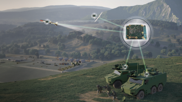
Thales has launched the TopStar Smart Receiver, a three-in-one ultra-compact solution designed to provide land forces with resilient positioning, navigation and timing capabilities, while maintaining radio communications in increasingly contested electronic warfare environments.
The TopStar Smart Receiver can be integrated into land vehicles, drones and munitions.
Key features
Dual-constellation GNSS receiver. The receiver integrates signals from military constellations, Galileo PRS and civilian GPS, and provides resistance to spoofing with enhanced accuracy and availability.
Anti-jamming function. Its adaptive controlled radiation pattern antenna (CRPA) reduces interference from jammers, and enables operation at distances up to 30 times closer than with a conventional GPS receiver.
High-performance clock. The clock ensures synchronization of tactical radios for up to 48 hours following GNSS signal loss, versus 30 minutes with conventional equipment.
Produced entirely within a sovereign European industrial base, the TopStar Smart Receiver is assembled at Thales’ site in Valence, France. The receiver is now available for testing in real-world conditions.
“Powered by cutting-edge technologies, the TopStar Smart Receiver delivers resilient, high-performance PNT capabilities for land platforms, drones and munitions,” said Florent Chauvancy, vice president of avionics and flight activities, Thales. “Innovative, reliable, competitive and compact, it ensures mission continuity in the most demanding operations, showcasing Thales’ expertise and commitment to innovation in support of the armed forces.”
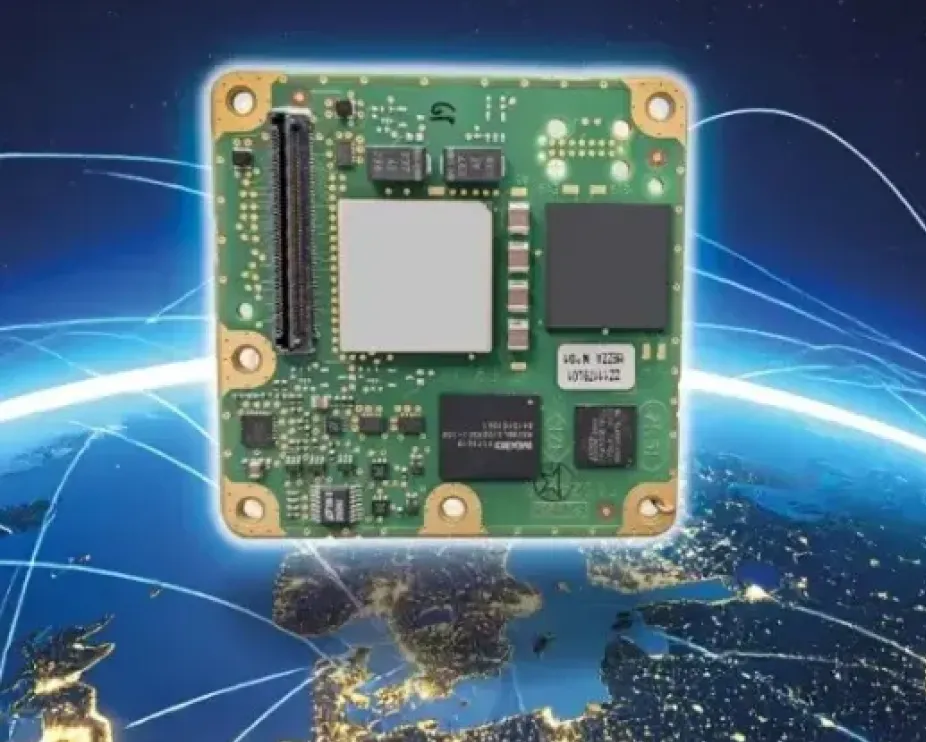
The small-form-factor Galileo OS (Open Service) or PRS (Public Regulated Service) sensors are designed to enhanced GNSS receivers and resilient multi-sensor navigation systems, ensuring safer and more reliable satellite-based navigation.
The Galileo PRS core module integrates a certified, single-chip, application-specific integrated circuit (ASIC) security module that incorporates all the necessary Galileo PRS security and navigation functions. It provides dual-frequency (E1/E6) iono-free Galileo PRS positioning, velocity and timing services. It also provides pseudorange and delta pseudorange raw data, along with GPS C/A (coarse acquisition).
The low-SWaP (size, weight and power) digital solution has been designed to work with any European GNSS receiver manufacturer seeking a standardized, easy-to-integrate Galileo module with which to develop their own GNSS receivers.
Credit: Thales
The modules can meet the requirements of a wide range of applications for manned or unmanned vehicles, combat aircraft, helicopters, high-dynamic missiles, and the navy. Their small form factor also makes them suitable for platforms with size constraints, such as ground vehicles, small drones and guided munitions.
The modules feature standardized interfaces, enabling the Galileo PRS function to be easily integrated into the host system. Furthermore, the TopStar Galileo core module can be embedded with minimum impact by using the analog RF front end of the host receiver.
The Galileo OS core module version enables the early integration of Galileo functionalities into the host system, as well as export to countries not authorized to use PRS. The PRS core module version provides an easy upgrade to Public Regulated Service capability, offering greater resilience against jamming and crucial protection against spoofing.
Thales, a European leader in resilient navigation, announced a €55 million ($63 million) investment to expand its industrial sites in Châtellerault and Valence, France. The investment, scheduled between 2025 and 2028, aims to address increasing demand for advanced navigation solutions in both civilian and military sectors and to reinforce the company’s sovereign industrial base.
The company is responding to rising threats such as GNSS jamming and spoofing by deploying a suite of resilient navigation technologies. These solutions combine precision, autonomy and security, which are critical for maintaining operational continuity in military missions and civil aviation. Thales integrates inertial navigation systems with GNSS signal reception, enabling reliable navigation even in contested environments. The TopAxyz inertial navigation system ensures autonomous capability, while the TopStar-M receiver and TopShield anti-jamming technology protect signal integrity. These advancements are supported by France’s Directorate General of Armaments under the OMEGA program for the modernization of GNSS equipment for the armed forces.
At the Châtellerault site, Thales plans to quadruple production capacity for inertial navigation systems by 2028. With six decades of expertise in laser gyroscopes, this facility is the only European supplier equipping civil aircraft and will expand its offerings for aircraft, land vehicles, ships and munitions. In Valence, mass production of TopStar-M receivers and TopShield systems is set to begin in 2026. The site will also introduce a new production line for inertial MEMS sensors, a technology that combines compact design with high performance, positioning Valence as a leader in France’s MEMS technology sector for defense. The launch will be accelerated with support from Tronics Microsystems for specialized industrial expertise.
Currently, more than 800 employees work at the two sites, with plans to hire 150 additional staff by 2028. The investment seeks to strengthen Thales’ regional presence and contribute to France’s position in the industry.
From left to right: Sylvain Loddo, director of the Galileo ground segment program at ESA, Ennio Guarino, head of the EGNOS and Galileo programs at ESA, Lionel Salmon, director of cybersecurity for information systems at Thales, and Alexandra Porez, director of cybersecurity for satellite systems at Thales. (Image: Thales)
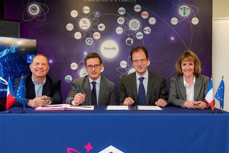
Thales and the European Space Agency (ESA) will be working together on the cybersecurity aspects of the Galileo Second Generation (G2G) program.
Under the partnership, Thales’ scalable and flexible architecture, and security equipment will enable the G2G program to strengthen its ability to detect and respond to new cyberthreats. The end-to-end solution Thales proposed will contribute to the development of greater security and resilience of satellites.
In addition, Thales Alenia Space has partnered with the ESA to design and build the G2G ground mission segment, as well as support system engineering and technical assistance activities. The company also will provide six of the 12 satellites of the constellation.
The second-generation ground mission segment is designed to generate and connect the navigation services to the Galileo satellites and to keep the satellites synchronized with a common time reference. The first version will arrive in time for the launch of the first second-generation satellites and for the validation of the system’s in-orbit capabilities. The second version will be responsible for the missions of both the first- and second-generation Galileo satellites.
The new ground mission system, which includes several major technological innovations, will provide more than four billion users worldwide with improved performance in terms of positioning, navigation and synchronization.
The TopAXYZ inertial navigation unit by Thales. (Image: Thales)
Thales and CS Group partner to offer navies a cybersecure, jam-resistant navigation system inspired by civil aviation
Thales and CS Group have partnered to offer a complete navigation system for navy surface ships. At the heart of the system is the Thales TopAxyz inertial navigation unit, which is integrated with CS Group’s real-time computer to combine high-level performance and resilience in an electronic warfare environment. The system provides high-precision pointing, gyrocompass, location and navigation functionality for all types of naval platforms, from surface combatants and submarines to autonomous vehicles.
The TopAxyz inertial navigation unit has delivered outstanding performance in the rigorous conditions of civil aviation, clocking more than 20 million hours of operation. The naval version of the unit was integrated on a French Navy vessel in less than a day by CS Group, and has already proven its operational value for maritime navigation in a sea trial.
“After proving their value on board aircraft, space launchers and French Army land vehicles, Thales inertial navigation systems are now available for naval platforms,” said Tristan Grivel, vice president business development and sales for Thales’s flight avionics business.
“CS Group has supplied real-time navigation computers, military-grade GPS receivers and other solutions to the French Navy and Naval Group for many years, explained Gilles Rigal, director of CS GROUP’s naval systems business line. “This partnership with Thales allows us to offer an innovative, robust and resilient maritime inertial navigation system for surface ships,” Rigal said.
Countering electronic warfare
In today’s constantly changing naval environment, crews need to contend with the threat of cyberattacks, electronic warfare activity and the high risk of jamming and spoofing of GPS-based radionavigation solutions. Accurate navigation data, real-time data distribution and resistance to external threats are crucial for every mission conducted by a naval vessel today.
Thales and CS Group have worked together for more than 20 years to address these issues. Drawing on their combined expertise across all the key navigation system technologies, the two companies are now proposing a new approach to maritime navigation based on more trustworthy and reliable navigation data.
The TopAxyz inertial unit uses accurate, reliable navigation information that is independent of sea state and vessel location, combined with a function that detects attempts to spoof GPS signals. The navigation data calculated by TopAxyz is distributed in real time by the NDDS (Navigation Data Distribution System) developed by CS Group’s onboard computer.
The computer uses the latest technological advances in cybersecurity, guaranteeing the best level of resilience to attacks. Its architecture offers three key advantages: safer navigation, reduced costs and integration risks, ease of use and simplified maintenance of the system. No calibration is required during the service life of the system, reducing the total cost of ownership.
The new maritime navigation system are now available, and are being manufactured at the companies’ production and integration facilities in Châtellerault and Aix-en-Provence in France.
The world is moving quickly toward 5G communication networks and devices to reach better performance with exponentially higher data speeds and greater reliability. However, these systems require the right combination of hardware, signal and software compatibility to work, and operating standards vary depending on the environment and the required transmission speed.
With these variables in play, global telecom, defense, and critical infrastructure organizations are in the process of thoroughly testing the functionality of this new technology on their particular systems in the appropriate operating environment before deploying 5G.
The fifth-generation technology standard for telecommunications is here, and it is already being tested and deployed in locations worldwide. This informative webinar will provide updates on the testing and implementation of 5G infrastructures, highlighting use cases in automotive and other mission-critical applications.
Panelists will discuss key factors for the successful implementation of 5G, the testing requirements needed to ensure consistent operations, and resilient positioning, navigation and timing (PNT) technologies that can help ensure accurate, continuous operations for critical applications during interference or signal loss.
What: Orolia Presents: GPS World Webinar, “Resilient PNT for a 5G World” When: May 20 at 1 p.m. EDT Where: Online, Register here
Confirmed panelists:
Lisa Perdue, Product Line Director, Simulation, Orolia
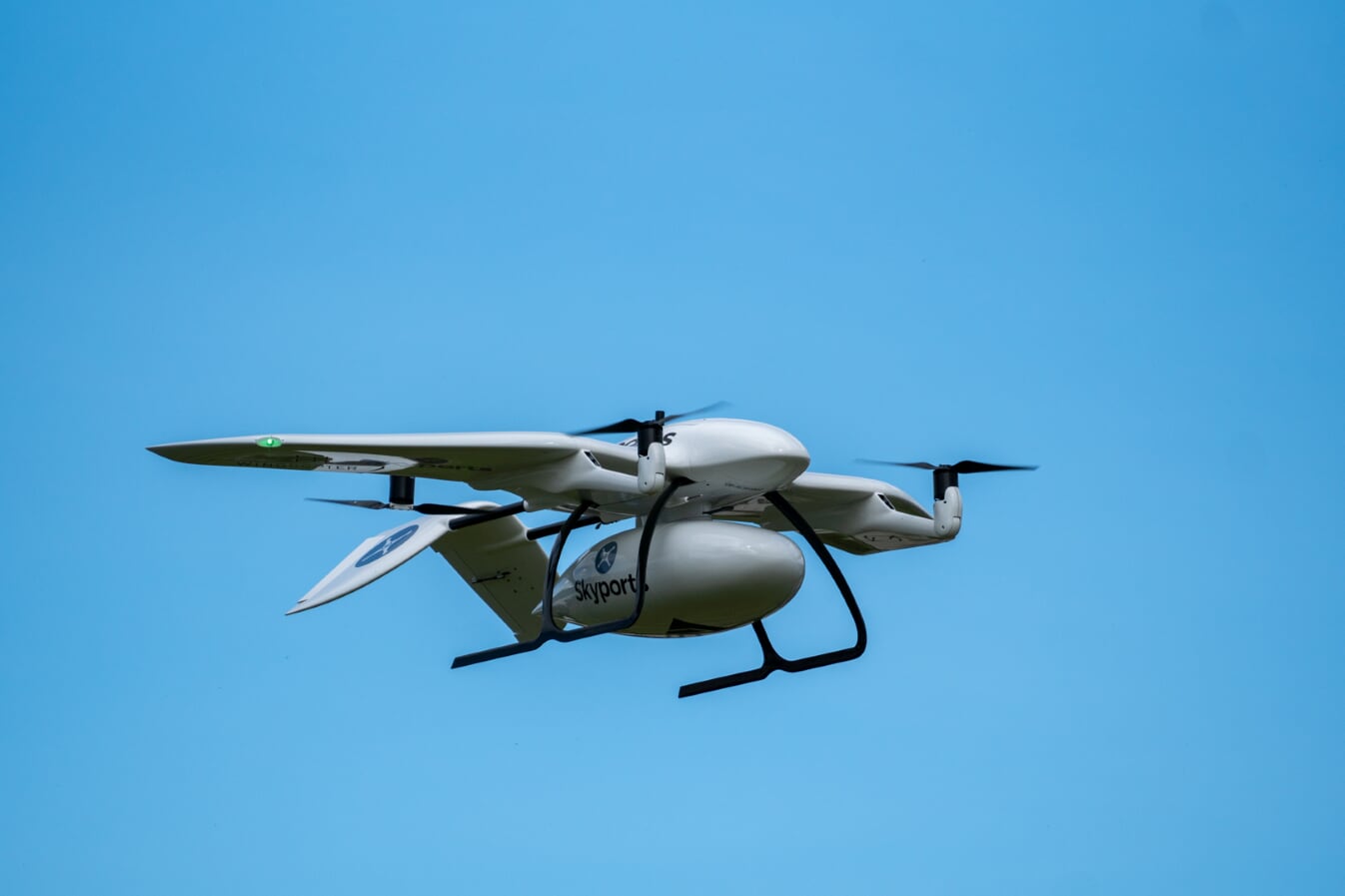
Skyports’ delivery drone, manufactured by Wingcopter, takes flight. (Photo: Wingcopter)
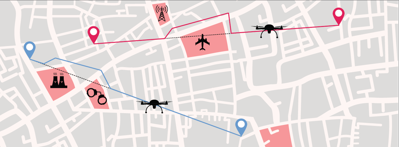
Skyports and Thales are partnering to conduct a drone delivery trial for the National Health Service (NHS) to support the United Kingdom’s COVID-19 response.
The trial, being conducted in Scotland, aims to prove the feasibility of delivering urgent medical cargo, such as COVID-19 test kits and Personal Protective Equipment (PPE), between remote medical facilities by delivery drone. The trial is backed by Argyll and Bute Health and Social Care Partnership (HSCP) — the integrated partnership of NHS Highland and Argyll and Bute Council directed by the local Integration Joint Board.
U.K. drone delivery provider Skyports will conduct the trial and operate the flights using delivery drones supplied by unmanned aircraft-maker Wingcopter, because of its proven capability through numerous delivery operations around the world. The trial flights will be planned through Thales’ drone operations management platform, SOARIZON, which offers digital tools to maintain compliant and safe drone flying operations.
Based at Lorn and Islands Hospital in Oban, the trial will consist of two-way flights between the hospital and Mull and Iona Community Hospital in Craignure 10 miles (16km) away on the Isle of Mull.
As COVID-19 testing rapidly gathers pace in the U.K., the proposed delivery service will help to ensure that isolated communities have access to tests, delivered in a fast and efficient way. Currently, the majority of medical supplies and specimens are transported between the laboratory at Lorn and Islands Hospital, surrounding general practitioners’ surgeries and other healthcare settings by sea and road, a long and complicated journey.
The service would cut delivery times from up to six hours one way by ground transport and ferry, to 15 minutes for on-demand delivery by drone. The speed would contribute to keeping front line medical and delivery personnel safe.
Answering the call from government and Argyll and Bute HSCP, in response to the COVID-19 crisis, the trial is the result of rapid mobilization from industry as well as the Civil Aviation Authority (CAA), local government, NHS Scotland and the U.K. Department for Transport (DFT). Argyll and Bute HSCP has been at the forefront of exploring with Skyports the use of unmanned aircraft technology, building on preliminary work with the Scottish government on the possibility of drone use by the public-sector emergency services in Scotland.
The two-week trial represents a crucial milestone for unmanned aviation in the U.K. Under current rules, drones must always be flown within visual line of sight of the remote pilot. To undertake these more extended flights (beyond visual line of sight, or BVLOS), the project team has been in close consultation with the CAA.
Through this trial, the alliance aims to prove the long-term, sustainable viability of such services; bringing together regulation, government and industry to unlock the transformational potential of drones for society when used in a safe, secure and controlled way.f this new service.”
Thales and Skyports are also working together within the CAA Regulatory Sandbox programme, exploring how regulatory approvals can be granted for more widespread BVLOS drone operations in the U.K.
Once the trial has been successfully completed, the team will continue to work closely with the CAA and the NHS to make services available in Scotland and across the U.K. to provide access to this innovative technology to a wide range of organisations, in particular a number of other NHS Boards and Trusts.
Protective radome housing for the Galileo ground station on desolate Jan Mayen Island in the Norwegian Arctic. The site is housing a Galileo Sensor Station plus satellite link to pass data back to the Galileo ground system. (Photo: ESA/Fermin Alvarez Lopez)
CGI has signed an agreement with Thales Alenia Space France to enhance and maintain security software for the Galileo satellite navigation system.
Valued at approximately 14 million euros, the contract will last until the end of 2020. CGI experts are working on this strategic project from Rotterdam and Toulouse.
CGI will improve the functionality, robustness and reliability of Galileo’s ground infrastructure, as well as enhance and maintain software for its Public Regulated Service Key Management Facility (PKMF).
The Public Regulated Service (PRS) is one of the key features that distinguishes Galileo from other satellite navigation systems. It ensures that only government-authorized entities have access to Galileo’s secure PRS signal that meets strict security standards in areas such as defense, law enforcement and customs.
“We look forward to working with CGI to ensure the highest level of security for Galileo, along with an efficient, high performance infrastructure,” said Guillermo Salgado, Galileo ground mission and EGNOS programs director, Thales Alenia Space France. “CGI’s significant space and security experience, combined with its local presence and global resources, gives us access to the experts we need to launch and operate one of the world’s most advanced satellite navigation systems.”
“CGI has strong legacy in space, and we continue to support space clients across the globe, actively managing their business and national interests while positioning CGI as a trusted space leader,” said Dirk de Groot, who leads CGI’s business unit in the Netherlands.
CGI has more than 40 years of experience in the space domain and delivers complex, mission-critical space software systems across Europe, Asia and North America, supporting programs from satellite navigation, communications and operations, to space-enabled applications.
Thales is leading the SESAR Joint Undertaking to research and develop new services for safe, efficient and secure access to airspace for drones.
The SESAR Joint Undertaking (SESAR JU) supports the European Commission’s U-space initiative by researching and developing new services for safe, efficient and secure access to airspace for an expected increase in drone use.
The Geosafe project is part of the founding services for the development of drones operation. Thales will manage the project, supported by Aeromapper, AirMap, Atechsys, Airmarine and SPH Engineering.
The 280 flight tests with 16 different drones will be conducted in France, Germany and Latvia. These tests will explore all possible situations that an automated drone will face in urban and rural areas.
By securing the flight pattern of drones to avoid determined zones, geofencing solutions are key safety enablers. Geofencing ensures that drones don’t fly in protected perimeters around critical infrastructures, such as power plants or airports.
The objectives of Geosafe are to establish state-of-the-art geofencing solutions regarding U-space regulation and to propose improvements and recommendations for future geofencing system definition.
Geosafe will be based on a one-year-long flight-test campaign, assessing a number of commercially available geofencing solutions so that it can propose an improved geofencing system and technological improvements for automated drones.
Thales designs systems ensuring high security and safety levels for future air mobility. As the leader of the project, Thales will organize all tests and provide recommendations for the European geofencing system.
“Thales is playing a leading role in shaping the autonomous world,” said Christian Bardot, Thales VP in charge of Helicopter and UAV Avionics Business. “Together with SESAR JU and the Geosafe partners, we will strengthen the foundations of drones’ safe and secure operations, unleashing the potential of this tremendous market.”
Bell Helicopter unveiled a full-scale vertical-takeoff-and-landing (VTOL) air taxi vehicle during CES 2019, held in Las Vegas.
The air taxi, named Bell Nexus, is powered by a hybrid-electric propulsion system and features Bell’s signature powered lift concept incorporating six tilting ducted fans designed to safely and efficiently carry passengers.
Bell Nexus means the nexus of transport and technology and of comfort and convenience. Nexus captures the long-sought-after vision of quick air travel with a unique in-flight experience, keeping passengers connected to their lives and saving valuable time.
The Nexus team consists of Bell, Safran, EPS, Thales, Moog and Garmin, who are collaborating on Bell’s VTOL aircraft and on-demand mobility solutions. Bell is leading the design, development and production of the VTOL systems; Safran is providing the hybrid propulsion and drive systems; EPS is providing the energy storage systems; Thales is providing the Flight Control Computer (FCC) hardware and software; Moog is developing the flight control actuation systems; and Garmin is integrating the avionics and the vehicle management computer (VMC).
Autonomous Pod Transport (APT). Alongside the debut of Bell Nexus, Bell will feature the Autonomous Pod Transport (APT). The APT family varies in payload capability that can serve many mission sets such as medical, law enforcement, offshore missions and on-demand delivery services. Bell is expanding into a new industry to show the full spectrum of our capabilities and the real-world challenges APT will address, Bell said in a press release.
Future Flight Controls. Bell’s Future Flight Controls simulator was a new experience for CES participants this year. Bell is actively collecting data to help shape the future flight controls of aviation. Data from the simulators will be used to determine what actions and interfaces are intuitive to the average potential operator and what prior experiences and abilities contribute to these opinions.
Urban air travel is coming closer to the masses through recent advancements in technology and software. The critical last step is designing a flight-control ecosystem that allows individuals to safely and efficiently operate urban air vehicles.
In 2018, Bell provided the world a glimpse into the air-taxi passenger experience, and this year, attendees could see the full vision.
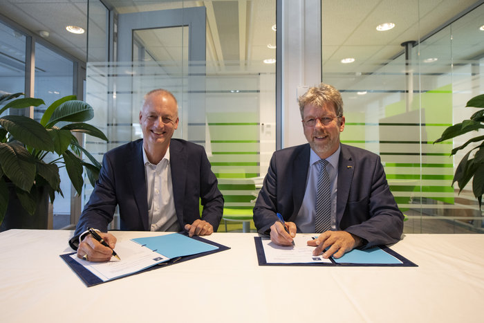
The European Space Agency has awarded a new framework contract and two new work orders to Thales Alenia Space in France to upgrade the Galileo Mission Segment, the element of the worldwide Galileo ground segment dedicated to delivering navigation services. Included are upgrades to the Galileo Security Monitoring Centre (GSMC) near Paris, and implementation of a second GSMC in Spain, near Madrid.
ESA Director of Navigation Paul Verhoef signed the contract with Thales Alenia Space Senior Vice President of Sales Martin van Schaik on Oct. 17 at ESA’s ESTEC technical centre in Noordwijk, the Netherlands.
“Galileo has already proven to be the highest performing satellite navigation system in the world, even before the constellation is complete,” Verhoef said. “This achievement is the result of the close collaboration between the public sector — the European Commission, the European GNSS Agency and ESA — and our industrial partners throughout Europe.
Contract signing: van Schaik (left) and Verhoef. (Photo: ESA)
“Today I am very happy to announce a continued relationship with Thales Alenia Space in one of the most complex parts of the system, namely the Ground Mission Segment, and thank them for their commitment to the programme.”
The constellation in orbit is only one element of the overall satellite navigation system – the tip of the Galileo iceberg. At the same time as the satellites were being built, tested and launched, a global ground segment was put in place.
Complex System
Establishing Galileo’s ground segment was among the most complex developments ever undertaken by ESA, having to fulfil strict levels of performance, security and safety.
In 2017, responsibility for operating the Galileo ground segment was passed to ESA’s partner organization, the European GNSS Agency (GSA). Nevertheless, ESA continues to be in charge of the maintenance, development and evolution of the ground segment, as well as the development of the space segment.
GSMC upgrade and construction. The first work order contracts Thales Alenia Space as prime contractor to undertake all necessary activities to upgrade the Galileo Mission Segment and the GSMC as part of Galileo’s exploitation phase.
This work includes upgrading Galileo’s system architecture to provide more accurate navigation products for broadcast by Galileo satellites, updating obsolescent elements in the current system, and improving operability linked to the provision of services and enhanced robustness.
This work order also includes the construction of additional uplink stations – tasked with uplinking the latest navigation messages to the Galileo constellation — at the existing Galileo ground station sites of Papeete in French Polynesia and Svalbard in Norway.
A new sensor station — providing a ground-based measurement of Galileo signal quality and precise satellite position — will also be installed at Wallis Island in the Pacific.
Galileo’s Nouméa ground station’s Sensor Station and Uplink Station. (Photo: ESA)
The work order will also augment the capabilities for implementation of the Public Regulated Service (PRS), the single most accurate and secure class of Galileo signals. Encrypted PRS signals will be made available only to authorised governmental users through approved national authorities.
Together, the two GSMCs will ensure the security of the overall Galileo system and manage PRS access and operations.
Security monitoring. The second work order contracts Thales Alenia Space as prime contractor to implement security monitoring functions for Galileo operational assets — including the control centres, service facilities and ground stations.
The integration, qualification, deployment and migration into operational services of the various upgraded segments will be undertaken over the next three years.
ESA has issued these work orders in its role of undertaking the design and development of future upgrades and the technical development of infrastructure as well as overseeing Galileo’s deployment, on behalf of the European Union, Galileo’s owner.
The European GNSS Agency (GSA) has officially launched the equipment for dual frequency Galileo, GPS and EGNOS project (EDG²E) with a consortium led by Thales. The four-year project intends to develop a dual-frequency multi-constellation receiver, enabling enhanced navigation capabilities, support standardization and certification preparation, and facilitate the expected increase in air traffic, both in Europe and globally.
The prototype EDG²E receiver use GPS and Galileo signals as well as those from the European SBAS multi-constellation EGNOS. The project aims to achieve a prototype demonstration by 2021. At the end of the EDG²E project, the first SBAS dual-frequency GPS+Galileo receivers for aviation will be ready for final development and use in the aviation sector and in other safety-critical applications. Fully achieved receivers are foreseen to be installed in commercial aircraft by 2025.
EGNOS, certified for use in aviation since February 2011, is developing its own next generation, called EGNOS V3, to further enhance performance by complementing both the EU Galileo and the US GPS satellite navigation constellations.
“EGNOS v3 will provide aviation users with an increased quality of services, better accuracy and extended coverage area among other key performance indicators” said Jean-Marc Pieplu, GSA head of the EGNOS Services Programme. “Fundamental Element Programme is a medium that supports development of terminals and antennae fostering use of E-GNSS in all domains. In this perspective,EDG²E is an important step for GSA as it will contribute to availability of high technology products on the aviation market, taking benefit of Dual Frequency Multi Constellation feature offered by EGNOS v3.”
The consortium includes Thales, Thales Alenia Space and ATR, as well as contributions from Dassault Aviation and the French Civil Aviation Authority.
Feature image courtesy of the European Space Agency (ESA).