The Department of Homeland Security’s Science and Technology Directorate has released a new tool designed to help protect critical infrastructure that relies on GNSS: The GNSS Test Vector Suite and Distribution Methodology.
The GNSS Test Vector Suite and Distribution Methodology, now available on GitHub, is designed to help infrastructure operators assess and improve the resilience of their positioning, navigation and timing (PNT) systems. These systems are essential for sectors such as energy, transportation and telecommunications, and are vulnerable to disruptions from natural events, technical failures or cyber threats.
The tool suite provides standardized test scenarios and simulated data, allowing users to evaluate how their equipment responds to challenges such as signal interference or spoofing. By generating and converting simulated data into signals that mimic real-world GNSS systems, the tool enables independent testing of devices and systems for conformity to resilience standards.
“Accurate and precise Positioning, Navigation, and Timing information is vital to the nation’s critical infrastructure and is the backbone of the many services we depend on daily, from keeping our lights on to ensuring planes land safely,” said Julie Brewer, DHS acting under secretary for science and technology. “This new toolset gives people responsible for safeguarding these systems a way to independently test and strengthen them, ensuring our nation’s infrastructure is more secure against potential disruptions.”
The release of the GNSS Test Vector Suite supports Executive Order 13905, which seeks to protect essential PNT services across critical industries.
GNSS is like opium. Highly addictive, pleasing to the user, but laced with peril when you’re hooked. GPS World readers are well aware of the vulnerabilities, and probably aware of the serious concerns governmental bodies have about our reliance upon it. Here, we consider not so much how it can fail as what the impact of failure is on society, and what mitigations exist to minimize those impacts.
Impact on society
The most commonly cited causes of GNSS failure are jamming (unintentional and intentional) and spoofing. Less well appreciated are solar weather, satellite system errors, receiver system errors and, most importantly, cybersecurity-related errors. Any of these can cause a significant disruption to how society functions today.
The U.S. Department of Homeland Security identified that 15 out of the 18 Critical National Infrastructure sectors were vulnerable to GNSS failure: communications, emergency services, information technology, banking and finance, healthcare and public health, energy (electric, oil and gas), nuclear, dams, chemical, critical manufacturing, defense industrial base, postal and shipping, transportation, government facilities, and commercial facilities.
The threat is real and present. Conflicted areas are routinely jammed and spoofed. Even in peace, GNSS is fragile. In the past year, GNSS interference led to a runway at DFW airport being closed, a 33-hour GNSS outage in the Denver metro area, and even a recent Melbourne Formula One race had to be stopped for 40 minutes due to GNSS data problems.
Mitigations
In most cases, no alternate references are in place, and without them, it is difficult to know that the GNSS data being received is wrong. The ship Stena Impero, for example, was seized by Iran for being in its territorial waters. It is thought to have been victim to spoofing that led it there, but proving it is difficult.
Alternate references exist at low cost, but they generally divide “PNT” into “PN” and “T”, and whether on land, at sea or in the air. On land, most requirements are related to “T” because most applications, such as broadcast facilities and data centers, don’t move, and even when they do, there are enough landmarks available to at least make a sanity check. At sea and in the air, by contrast, motion is the reason we are there, there are few landmarks to confirm location, hence “PN” dominates.
For “T”, armageddon clocks can provide holdover for brief interruptions. However, they must be sufficiently tested to ensure that they succeed. In the Denver incident, radio systems had rubidium clocks for backup, but they drifted too far during the outage to be useable, whereas cellular networks, with alternate terrestrial timing sources, continued to work. Terrestrial time distribution systems over existing IP infrastructure, which Hoptroff supplies, work well globally, but are restricted to land-based time synchronization applications.
For “PN” and “T”, in air, sea and land, low-Earth orbit satellite services such as Satelles, Starlink and OneWeb provide global solutions. Their signals are much stronger than GNSS and therefore are much harder to jam or spoof, but they remain susceptible to interferences such as space weather, which destroyed 40 Starlink satellites on launch last year. However, as the Denver incident shows, until you test the solution, you never really know what might go wrong. eLoran terrestrial wireless solutions are very effective but limited in reach to within a few thousand miles of terrestrial transmitters. Such systems are being installed in South Korea and Saudi Arabia due to their proximity to hostile neighbors. They are likely to be installed in North America and Europe within the next decade.
What all these solutions have in common is that, while they are not expensive, they are not free, and are only available under license. Sovereign GNSS providers have, to date, provided PNT signals at no cost to the consumer. It must be accepted in the new landscape, not just that PNT is no longer free, but also that the supplier can choose its customers. Sovereign GNSS access could be restricted at the whim of a president. Private services are already selective — Starlink chose to provide the Ukraine with service during the current conflict, but it has no obligation to continue to do so.
Get on with the risk register
One of the biggest problems with preparing alternatives to GNSS is that the risk is ignored until it has started to have an impact on business and society. This can be addressed by ensuring that resilient PNT is on corporate and institutional risk registers. It is starting to happen now that governments have started to raise concerns. However, we have a way to go before inclusion on risk registers is a foregone conclusion.
The Department of Homeland Security (DHS) Science and Technology Directorate (S&T) has announced plans for a new testing program to evaluate how well GPS systems perform against spoofing and disruption exploits.
DHS S&T’s 2024 GPS Testing for Critical Infrastructure (GET-CI) event is scheduled for Fall 2024. It will allow critical infrastructure owners and operators (CI O&O) and GPS equipment manufacturers to identify any weaknesses in their equipment.
“Accurate and precise positioning, navigation and timing (PNT) information is vital to the nation’s critical infrastructure,” said Dimitri Kusnezov, DHS under secretary for science and technology. “The GET-CI test series are part of the S&T PNT Program’s collaborative efforts designed to help industry partners test and evaluate their technologies to become more resilient against PNT disruptions.”
Typical commercial testing and data collection occurs in a closed environment. This DHS S&T test will provide an “opportunity for CI O&O and manufacturers of commercial GPS receivers used in critical infrastructure to perform equipment evaluations in a rarely available live-sky spoofing and jamming environment,” said DHS.
The testing event also aims to create a live-sky GPS environment primarily for fixed infrastructure applications but will also support some ground-based mobile applications, according to DHS.
DHS is calling on commercial, academic and civil society organizations to submit applications by October 20, 2023, to participate in the testing event next year.
For submission instructions and further information, see the Request for Information for Participation (RFIP) announcement on SAM.gov.
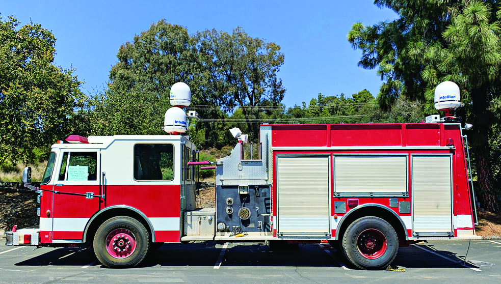
NASA-JPL prototype of POINTER base units on a first responder vehicle. The magneto-quasistatic fields they generate can be detected through walls, where legacy indoor positioning technologies fail. (Image: Jet Propulsion Laboratory)
A tragedy in 1999 spurred development of an entirely new type of positioning and location technology. “This project started with the Worchester, Massachusetts, warehouse fire,” said William Stout, program manager for the Department of Homeland Security (DHS) Science and Technology Directorate (S&T). “Six firefighters went in to clear an abandoned warehouse that was on fire to make sure there wasn’t anybody in there, and they got trapped. The team couldn’t find them because they had no idea where they were, and they ended up perishing.
That is what got DHS started with developing a first responder location tracking technology, Stout said.
“Over the years from that point on, we investigated many different technologies. My predecessor referred to most of these as ‘cocktail solutions’ because they would try to merge different types of technologies — for example, GPS and inertial — but none of these panned out.”
Enter Magnetoquasistatics Research
This lack of progress changed in 2012 when they connected with Darmindra Arumugam, group supervisor, senior research technologist and program manager at NASA’s Jet Propulsion Laboratory (JPL). Caltech manages JPL for NASA. In a complete departure from traditional radio signal-based positioning technologies, Arumugam and his team had been researching magnetoquasistatics (M/QS). This is the foundation for the POINTER System.
The system consists of fixed or portable transmitters, for instance, a base unit and controller that can be mounted on a first responder vehicle outside of a building. The first responders carry a small receiver that the base can locate with two characteristics: the field’s strength (for ranging) and its unique pattern (for lack of a better term) for direction (receivers send position info back to the controller via ISM band LoRa). The controller registers and displays the position of each receiver.
Why Magnetic Fields?
Ranging can be done in many modes, Arumugam said, and not all are based on just the amplitude of the propagating wave. With traditional radio signal ranging, to compute a precise position, techniques mostly use multiple sources of signals, for trilateration or multilateration, as GNSS does. However, signals can be perturbed by objects in their path, or experience multipath (signals bouncing off objects), which is a pronounced challenge for indoor environments.
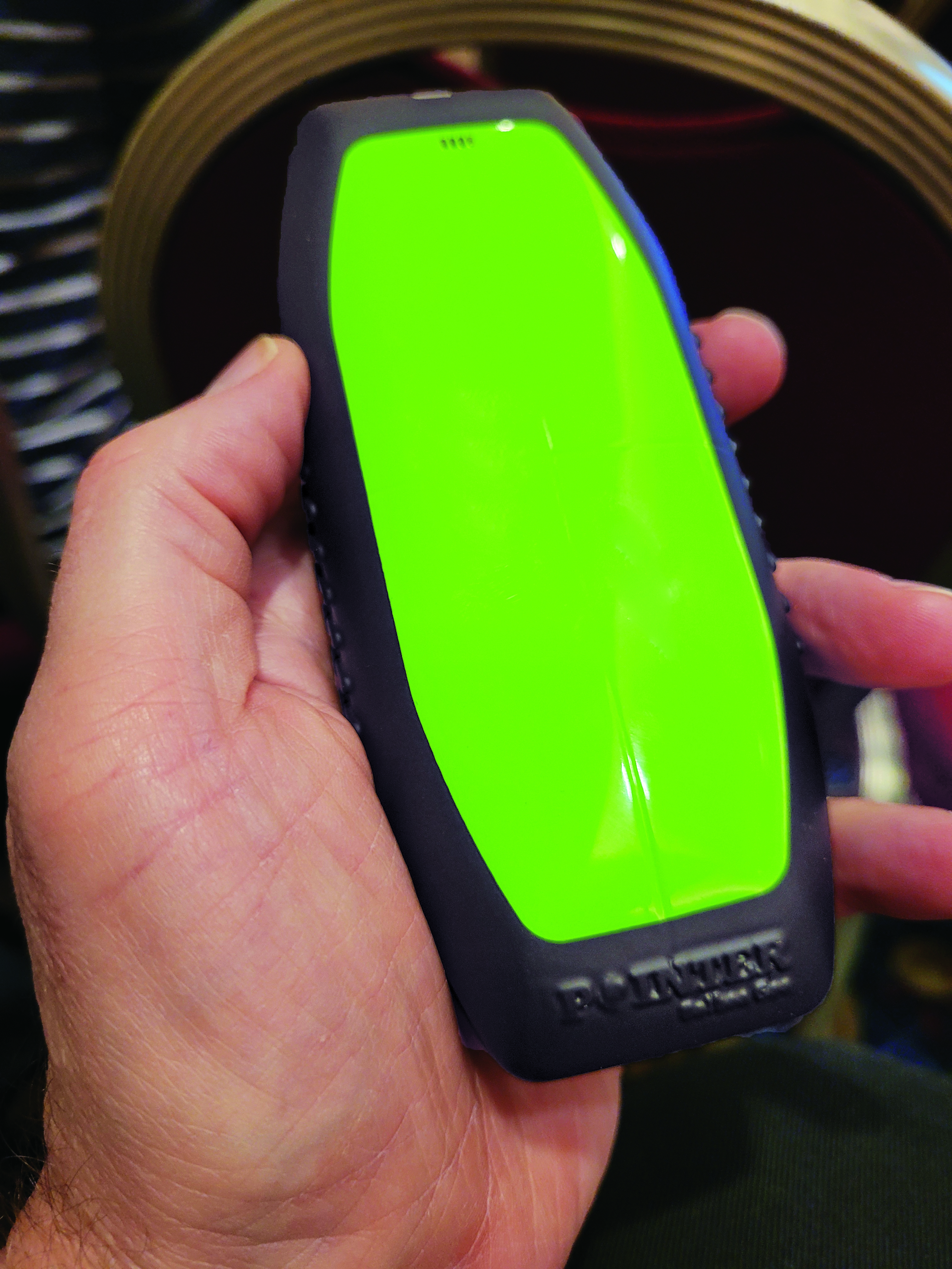
The portable POINTER receivers can be clipped by first responders to their belt, harness, or personal protective equipment, reporting their position in a building, and viewable by an incident commander on a laptop. (Image: Gavin Schrock)
POINTER does not employ radio signals in the fashion of traditional ranging solutions such as GNSS, ultra-wide band (UWB), and various beacon systems for indoor positioning. However, Arumugam said POINTER does generate a radio signal.
“The key difference is that we are detecting the field in a regime where there is no radio propagation mode. Therefore, it is more accurate to refer to this as a quasi-static field, as opposed to a radio propagating wave,” Arumugam said.
Arumugam said Earth’s magnetic field is a good example of this. “It penetrates structures very well, we can measure it 100 kilometers beneath the surface, far above the surface, inside buildings, underwater and so on,” he said. “POINTER uses the kind of the features that you see in Earth’s magnetic field — we are generating quasi-static magnetic fields.
“The term quasi-static highlights the fact that we are trying to keep the physics of the field stationary for all purposes but apply some slow time variation so that it’s really quasi-static to optimize the benefits from both,” Arumugam said. “We get the best of the behaviors of static fields in terms of penetration and non-line-of-sight capability, but also optimize for signal-to-noise by making this a quasi-static signal as opposed to a perfectly static one.”
JPL developed for DHS S&T prototypes that the two organizations tested jointly. Both transmitters and receivers employ an array of three coils, oriented at right angles for x, y and z. The resultant transmitted field carries distinct patterns from these three axes. Distance is detected from field strength, and direction is determined by detecting the pattern of the field relative to the three axes. A key strength of POINTER is that it can achieve ranging and direction from a single base station.
However, Arumugam noted that multiple bases could be beneficial for certain situations.
“The technique as originally developed requires only one transmitter. However, we find that there’s only so much you can get out of a magnetic field, and certain types of structures and materials will perturb that field, causing error.” The second transmitter is not only a backup, but it also helps reduce errors.
POINTER
Geolocation Inc. was spun out from Caltech to license and commercialize POINTER, said Joseph Boystack, executive chairman and co-founder. “We stepped in and executed an exclusive worldwide license for every field of use on this technology in late 2020 from JPL. They had established a proof of concept, and begun testing the technology in the field.”
For the initial commercial version, Balboa Geo made significant improvements over the JPL prototype system. It developed two transmitters that can be deployed on a fixed-mounted basis (buildings, vehicles, ships, etc.) or be portable housed inside a ruggedized, military specification (MIL-STD) case, with a built-in dual antenna GNSS receiver (to position and orient the transmitter).
“If you have an incident involving first responders, military or industrial applications, these remotely configured transmitters can be quickly and easily deployed,” Boystack said. “Also very important, because it only needs to depend on the field generated by the transmitter, we’re not dependent upon other large, fixed infrastructure such as satellites, towers or beacons, and can work in degraded environments where most other position, navigation and timing techniques fail.”
The self-contained receivers are only about the size of a smartphone. The orientation of the receiver is important to determine the “xyz” axis relative to the generated field, thus providing highly accurate three-dimensional position and navigation data. For instance, Balboa Geo’s receiver can be clipped to a first responder’s belt, harness, or personal protective equipment. Similarly, for fixed assets or moving assets such as warehouse systems or robotics, the orientation would be known.
The POINTER system will generate real-time data that can be easily visualized at the job site or event by the incident commander or manager on a laptop or a tablet. The data is interoperable and may be ingested in third-party software applications.
This version meets DHS STS’s original expectations, and subsequent versions will build on it. “S&T relies on experienced emergency response and preparedness professionals to guide our research and development. The First Responder Resource Group is made up of hundreds of state and local volunteers,” Stout said. “We initially looked at tracking firefighters in some of the most common scenarios: two-story house fires.”
While POINTER technology has the potential for much longer ranges and precisions, the current version, Arumugam said, certainly meets the specifications for this initial application. “The current systems can operate up to about 75 meters in range from the transmitter. So, if a transmitter is placed about 10 meters outside the building, say on the fire truck, you can penetrate up to about 65 meters inside the structure. That covers many one, two, maybe three-story structures. Position accuracies can be one meter or less. In principle, you could get to a centimeter, but that’s not required for this technology to be the lifesaver it presently needs to be.”
JPL continues research and development to extend range and increase precision to enable DHS S&T to deploy this technology to ever broader safety-of-life applications where legacy technologies fall short or are completely impractical. Balboa Geo is conducting field and lab tests for many more applications across multiple industries including energy, construction, maritime, mining, the internet of things and more.
Nearly 50 years ago, in December 1973, the Defense Systems Acquisition Review Council approved the Navstar Global Positioning System for entry into Phase I of development. Since then, through its development, deployment and continuing modernization, GPS has grown into a complex program. It is operated by the Department of Defense based on legislation from Congress, executive orders from the White House, and policies established jointly with the Department of Transportation. It supports U.S. military missions as well as myriad scientific, commercial and consumer applications around the planet. Of course, the last category, with its billions of users, now dwarfs all the other ones combined.
The GPS program, with an annual budget of nearly $2 billion and no user fees, is a gift from U.S. taxpayers to the world. It has staff in Washington, D.C.; at the Pentagon in Arlington, Virginia; at Schriever Space Force Base, Colorado; at the Space Systems Command at Los Angeles Air Force Base, California; at Cape Canaveral, Florida; at the U.S. Coast Guard Navigation Center in Alexandria, Virginia; and at GPS ground antennas in additional locations around the world. From the White House to Congress to aerospace companies, from military officers to civilian civil servants, from policy makers to engineers, from the East Coast to the West Coast to remote islands in the Pacific, Indian and Atlantic Oceans, GPS is a vast enterprise — most of which is little known even to people in the industry and virtually unknown to the public.
The Global Positioning System is a vast and mostly unknown enterprise. This section — the first in an occasional series of authoritative reference pieces in this magazine — aims to clarify who does what to maintain GPS as a fantastic global utility. The relevant missions of agencies or units are in italics.
After I researched and drafted the piece, I asked the experts listed below to review it and provide corrections and additions. While grateful for their substantial feedback, I take sole responsibility for any remaining errors or omissions.
Thank you to the following experts:
Harold W. Martin III, Director, Space-Based Positioning, Navigation & Timing, National Coordination Office
Michael J. Dunn, Capability Area Integrator for PNT, Space Systems Command, United States Space Force
Lt. Col. Robert O. Wray, Commander, 2nd Space Operations Squadron, United States Space Force
Scott R. Calhoun, Commanding Officer, Navigation Center, United States Coast Guard
Paul Benshoof, Technical Director, 746th Test Squadron (AFMC), Central Inertial and GPS Test Facility
Bernard Gruber, Senior Director, Northrop Grumman
Please return to this page periodically to read corrections and updates to this special section. If you spot any significant inaccuracies or omissions, please bring them to my attention by writing to me at [email protected].
The free resources are intended to advance the design of PNT systems and increase resilience of critical infrastructure to PNT disruptions.
The GPS Whitelist Development Guide presents a software assurance approach to addressing potential vulnerabilities and increasing reliability of GPS receivers. The guide addresses data-related requirements in the Resilient PNT Conformance Framework, which provides guidance for defining expected behaviors in resilient PNT equipment.
“We hope this guide and related resources will help industry advance towards a cybersecurity-based approach to PNT resilience,” said S&T Technical Manager Ernest Wong.
Originally released in March 2021 as open source on GitHub, the PNT Integrity Library provides users with a method to verify the integrity of the received GPS data. The update includes:
A compliance check on Interface Control Document (ICD) IS-GPS-200, which is a formal means of establishing, defining and controlling communication between the GPS space and other user systems; and
A Do-It-Yourself (DIY) Toolkit, which describes how a perspective end-user of the PNT Integrity Library can assemble a demonstrational toolkit with commercial-off-the-shelf (COTS) hardware.
“Since GPS signals can be jammed or spoofed, critical infrastructure systems should not be designed with the assumption that GPS data will always be available or will always be accurate,” said S&T Project Manager Brannan Villee. “Application of these tools will provide increased security against GPS disruptions. However, DHS also recommends a holistic defense strategy that considers the integrity of the PNT data from its reception through its use in the supported system.”
PNT services, such as GPS, are a national critical function that enable many applications within the critical infrastructure sectors. However, “The increasing reliance on GPS for military, civil and commercial applications makes the system vulnerable,” according to Space Policy Directive-7 (SPD-7), issued Jan. 15. “GPS users must plan for potential signal loss and take reasonable steps to verify or authenticate the integrity of the received GPS data and ranging signal, especially in applications where even small degradations can result in loss of life.”
The PNT Integrity Library and Epsilon Algorithm Suite address this issue by providing users a method to verify the integrity of the received GPS data. “We are excited to release these resources to the PNT community to improve resiliency against potential GPS signal loss,” said DHS S&T PNT Program Manager Brannan Villee.
“Since GPS signals can be jammed or spoofed, critical infrastructure systems should not be designed with the assumption that GPS data will always be available or will always be accurate,” said Jim Platt, chief of Strategic Defense Initiatives at the Cybersecurity and Information Security Agency (CISA) National Risk Management Center. “Application of these tools will provide increased security against GPS disruptions. However, DHS also recommends a holistic defense strategy that considers the integrity of the PNT data from its reception through its use in the supported system.”
The PNT Integrity Library and Epsilon Algorithm Suite are open source and available free of charge. To view more details, visit the DHS S&T PNT Program.
Coalition gives voice to PNT companies seeking open-market approach to backing up GPS/GNSS for critical infrastructure
Several GNSS and positioning, navigation and timing (PNT) companies have joined forces to create a new lobbying group, the Open PNT Industry Alliance. Founding companies include InfiniDome, Iridium Communications, Jackson Labs Technologies, NAVSYS Corporation, NextNav, OPNT, Orolia, Qulsar, Satelles and Seven Solutions.
In the United States, the coalition believes the Executive Order on “Strengthening National Resilience Through Responsible Use of Positioning, Navigation, and Timing Services,” issued in February 2020 begins the process for a national alternative PNT policy.
The report was criticized by some lawmakers for inaccuracies and lack of depth, but several companies whose solutions were referenced in the report defended it, and have now joined in creating this new alliance.
The alliance expects to support similar initiatives in other countries.
The coalition is designed to fortify economic and national security by supporting government efforts to accelerate the implementation of backup PNT capabilities for critical infrastructure. Other companies sharing these views are invited to join the alliance.
The Open PNT Industry Alliance will be introduced in an Orolia PNT Coffee Talk webinar on Thursday, Dec. 17, at 10 a.m. EST.
A serious problem facing nations around the world is that GPS and other GNSS are susceptible to inadvertent disruptions and deliberate attacks. Such incidents have the potential to impair or incapacitate communications networks, transportation systems, energy production and distribution platforms, financial services operations and other types of critical infrastructure.
With the scope, complexity and severity of disruptions and attacks evolving continuously, the combination of wide-ranging PNT solutions and emerging technologies offers superior protection to current threats by providing a backup to GPS/GNSS and improving national resilience.
“Multiple forms of alternative PNT deliver the broadest possible range of operational and performance characteristics to meet the diverse needs of applications across all industry sectors, plus they can better adapt to future threats than a single technology with its inherent vulnerabilities,” said Michael O’Connor, CEO of Satelles. “The mission of the Open PNT Industry Alliance is to promote open-market concepts that preserve industry’s long-term ability to harness its inventive talent to protect GPS/GNSS with multiple solutions that are technologically advanced, commercially viable, and based on a sustainable long-term funding framework.”
The Open PNT Industry Alliance will share its expertise with governments to aid their efforts to set policies, define regulations, and enact laws that achieve their national resilience objectives while preserving competition in the open market. A principal purpose of the coalition is to stimulate and capitalize on the collective intellect of industry in a collaboration between the public sector and private sector.
“The ingenuity of the private sector is spurred by competition and public and private investment, and this will drive the emergence of multiple GPS/GNSS alternatives that are cost-effective and evolve according to threat profiles, technological innovations, and market dynamics,” said Jean-Yves Courtois, CEO of Orolia. “Similarly, unbridled innovation will address new and still evolving use cases not supported by GPS/GNSS.”
The coalition will work closely with governments as they consider plans for regulation of critical infrastructure sectors and funding for alternative PNT. Legislators and policymakers can best pursue national interest through a multi-technology approach to PNT resilience, the coalition stated in a press release. The coalition will advocate for the establishment of a robust and self-sustaining funding framework that allows for the development and adoption of multiple sources of PNT that meet the needs of various sectors and industries.
“We believe a multi-technology approach to PNT resilience not only meets a more diverse set of critical infrastructure needs but also ensures a more robust approach to security by providing multi-layer resilience,” said Ganesh Pattabiraman, CEO of NextNav. “Delivering alternative PNT capabilities on an equal footing with GPS will require government policies and funding that ensure these solutions are cost-effective for critical infrastructure providers and sustainable over the long term.”
Members of Congress were not pleased with the new U.S. Department of Homeland Security (DHS) report on positioning, navigation and timing (PNT), saying the long-delayed report contained numerous errors and failed to address many of the things Congress had required.
On the April 8, DHS submitted to Congress the brief, 26-page report on the nation’s PNT requirements. It took more than three years to produce and was delivered more than two years late.
In comparison, just two weeks earlier a team of eight British organizations sponsored by the European Space Agency (ESA) issued a 1,174-page report on the PNT needs of maritime commerce. The report from the Maritime Resilience and Integrity of Navigation (MarRINav) project was produced in less than a year.
House Transportation Committee Chair Peter DeFazio (D-OR), Armed Services Readiness Subcommittee Chair John Garamendi (D-CA) and Representative Alex Mooney (R-WV) expressed their disappointment this week in a letter to DHS Acting Secretary Chad Wolf. In addition to outlining their concerns, it asked that the report be retracted, rewritten and resubmitted within six months.
While the letter did not specifically mention the contrast between the DHS and British efforts, it did use the MarRINav report as a reference. And it was clear that the disparity in length and quality of the reports accentuated the disappointment for those who had hoped for a better product from DHS.
The letter asked that the report be retracted, rewritten and resubmitted within six months.
Factual errors
Factual errors in the DHS report, according to the letter, included getting the mandated timing for financial systems wrong, and mischaracterizing coverage areas and capabilities of various technologies including several that had been recently demonstrated for the Department of Transportation (DOT).
The letter also observed that DHS focused on commercial PNT users to the detriment of most Americans. It failed to consider the needs of public service organizations, governmental entities, and individual citizens in its analysis.
The lawmakers contend the report did not recognize that PNT provided by GPS is frequently a safety-of-life service and a public good that must be reinforced to protect economic vitality and national security.
Suspending operations, subscribing are flawed options
Two of the solutions to temporary GPS disruptions suggested in the DHS report are for users to suspend operations until the disruption is over, and to have purchased commercial PNT services as backups in advance of a disruption.
Suspending operations for emergency services and other critical functions is unacceptable, say the congressmen. And commercial PNT services to provide needed wide area PNT backups are not available.
Even if they were available, questions of affordability for the many non-profit and public entities that needed them, whether it would be more cost effective for the federal government to support such services, and similar issues would need to be addressed before the department could make a recommendation.
Suspending operations for emergency services and other critical functions is unacceptable.
No national backup
The letter also observed that the department has discounted the value of a national backup system, a position that seems to conflict with both longstanding and recent presidential policy. Having a backup for GPS has been policy since President Bush established the requirement in 2004. President Trump’s recent Responsible Use of PNT Executive Order called for a national research program on non-space-based PNT and “…mandates the Department of Commerce make available a GNSS independent source of Coordinated Universal Time for all users.”
DHS’ recommendation against a national backup also differs from the Europe/UK MarRINav report. In addition to calling for improvements to be made by commercial entities such as port and ship operators, MarRINav identifies the need for “terrestrial and sovereign” eLoran and VHF DES Ranging mode systems to support reliable maritime commerce. Establishing such systems will require support by the national government.
Most members of industry agree that some government involvement is needed. A CEO of one of the companies demonstrating its backup technology for DOT observed that the market would never solve the problem on its own.
“We have tried for 16 years to figure out a business case, and it’s just not there,” the CEO said. “GPS is too good and it’s free. You can’t compete with that. If America is going to have one or more new wide-area capabilities that most people can use — not just niche solutions for high-demand, well-heeled customers — the government is going to have to prime the pump.”
DHS did propose some efforts that resonated with the Congressmen, such as encouraging use of GPS receivers that resist spoofing and jamming. The lawmakers described these as “necessary but grossly insufficient” before requesting the report be withdrawn and redone.
DHS’ “Report on Positioning, Navigation, and Timing (PNT) Backup and Complementary Capabilities to the Global Positioning System (GPS)” is available here.
The letter from Congressmen DeFazio and Garamendi is available here.
The Maritime Resilience and Integrity of Navigation (MarRINav) project report is available here.
The U.S. Department of Homeland Security (DHS) Science and Technology Directorate (S&T) is hosting the 2020 GPS Equipment Testing for Critical Infrastructure (GET-CI) event. This event will take place during the summer of 2020.
The revised the due date for responses is May 8, 2020. Visit this site for more information.
S&T’s GET-CI events are a series of annual evaluation events intended for manufacturers of commercial GPS equipment used in critical infrastructure as well as critical infrastructure owners and operators.
DHS S&T recognizes the importance of accurate and precise position, navigation and timing (PNT) information to critical infrastructure and has a dedicated multi-year program to address GPS vulnerabilities in critical infrastructure, with a multi-pronged approach of conducting vulnerability and impact assessments, developing mitigations, exploring complementary timing technologies, and engaging with industry through outreach events and meetings.
Through these sustained efforts, the goal of the program is to increase the resiliency of critical infrastructure to GPS vulnerabilities in the near-term future.
Examples of measures that can be taken to enhance resiliency can be found in a DHS issued set of best practices released via ICS-CERT, titled “Improving the Operation and Development of Global Positioning System (GPS) Equipment Used by Critical Infrastructure.”
The U.S. Department of Homeland Security (DHS) has released a memorandum about a GPS rollover event coming in April 2019.
The memorandum, U.S. Owners and Operators Using GPS to Obtain Time, is intended to provide an understanding of the possible effects of the April 6, 2019, GPS Week Number Rollover on Coordinated Universal Time (UTC) derived from GPS devices.
DHS recommends that critical infrastructure and other owners and operators prepare for the rollover. They should:
investigate and understand their possible dependencies on GPS for obtaining UTC;
contact the GPS manufacturers of devices they use to obtain UTC;
understand the manufacturers’ preparedness for the ollover;
understand actions required by CI and other owners and operators to ensure proper operation through the ollover, and
ensure that the firmware of such devices is up to date.
The memorandum is sponsored by the Department of Homeland Security’s National Cybersecurity and Communications Integration Center in coordination with the Department of Homeland Security’s Science and Technology Directorate, the Department of Homeland Security’s National Protection and Programs Directorate Office of Infrastructure Protection and the National Coordination Office for Space-Based Positioning, Navigation and Timing.
GPS World discussed in-depth the previous rollover event in an Innovation column.
In the wake of last month’s Expert Advice column on eLoran — “The Low Cost of Protecting America” by Dana Goward of the Resilient Navigation and Timing Foundation — come several positive comments and encouraging developments. Rather than rehearse all the arguments why we should care about this, I’ll repeat the one word that I heard most often in GNSS circles in 2013: jamming. Followed closely by: spoofing.
“I have been advocating strongly for reconsideration of the government’s domestic Loran decision for the last year or so,” writes one reader positioned on Washington’s Beltway, “and specifically working within the Department of Defense (DoD) to ensure it is aware of international developments for eLoran in the UK and South Korea, and the possibilities inherent in other former Loran chains.
“The DoD is beginning to recognize the value of eLoran as a complement to GPS, not only for international missions, but in cooperation with the departments of Transportation and Homeland Security for domestic critical infrastructure.”
Last fall, Don Jewell’s Defense PNT newsletter on the same subject drew this reply from another well-known expert:
“One of the key short-term actions is to prevent the decommissioned [Loran] sites from being sold off for subdivisions. These sites are a national treasure with unique properties: soil conductivity, water content, metal content, and more that are hugely important in siting low-frequency positioning systems. Those long-gone engineers of the 1940s and ’50s knew this and chose accordingly.”
Before last month’s issue appeared but after it had gone to press, President Obama signed the National Defense Authorization Act (NDAA) for 2014. It contained several favorable New Year’s auguries for positioners, navigators, and timers.The act evinced an acute awareness of the vulnerability of space systems to disruption. The act is also a law governing the land. Through it Congress requires the administration to, among other things, explain biennially in its “Space Protection Strategy” report exactly how, in the event space systems are disrupted, DOD and the intelligence community “plan to provide necessary national security capabilities through alternative space, airborne, or ground systems.”
Since said administration acted early in its first term to decommission Loran-C, the congressional directive is pointed.
The next big thing coming up on the GNSS international horizon takes place in Rotterdam, the Netherlands, April 15–17: the European Navigation Conference, ENC-GNSS 2014. It includes a track session on “eLoran and other Low-Frequency Systems,” and I’ll be there with pencil sharpened.
Brad Parkinson will give the ENC keynote, and he is on record as one of an august group of Institute for Defense Analyses experts who unanimously recommended that the existing Loran-C be greatly updated and modernized to eLoran. We should hear more from him on this subject amid the wharves, waterways, and docks of Europe’s largest port (world’s third busiest).
There’s barely room left to report the successful tests of Enhanced Differential Loran (eDLoran) by Dutch specialists Reelektronika: absolute accuracy of 5 meters in the North Sea and in the Rotterdam Europort harbor area.