Tag: Ukraine

  • UK’s Watchkeeper drone program nears the end:  What went wrong and what’s to come

    UK’s Watchkeeper drone program nears the end: What went wrong and what’s to come

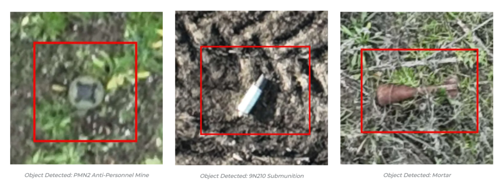
    We usually look for what’s new, with innovative drones emerging and gaining traction in commercial and military applications, but this month, news of the termination of a leading UAV program has sparked interest.

    The British Army’s Watchkeeper drone program has long been the subject of criticism over development delays, cost overruns and poor performance. Recent reports that the Watchkeeper fleet could be retired as early as 2025 — though that timeline may now slip to 2027 — have renewed scrutiny of the troubled effort. Perhaps a review of the story behind this drone adventure may be in order.

    The UK has been involved with drone operations going back into the 1960s, giving this military force deep experience and expertise in the field. Political support has enabled significant investment over time. When the Watchkeeper program was rolling in 2004-05, the US was moving toward the MQ-9 Reaper project, and military forces around the world were building their own mil-spec UAVs, mostly for surveillance to support military ground operations.

    At that time, few commercial drones existed beyond radio-controlled model aircraft flown by hobbyists. The idea was growing in China at that time for DJI and quad-copters, so these multi-use UAVs eventually emerged, and have led to a multitude of outfits elsewhere also making commercially available drones.

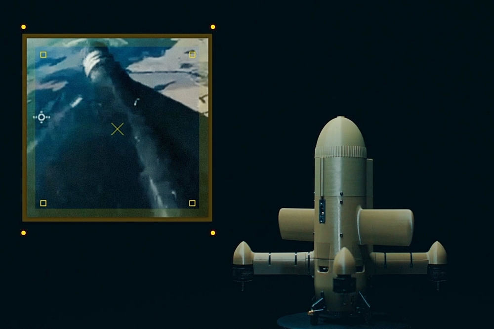
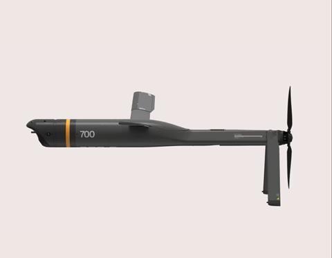
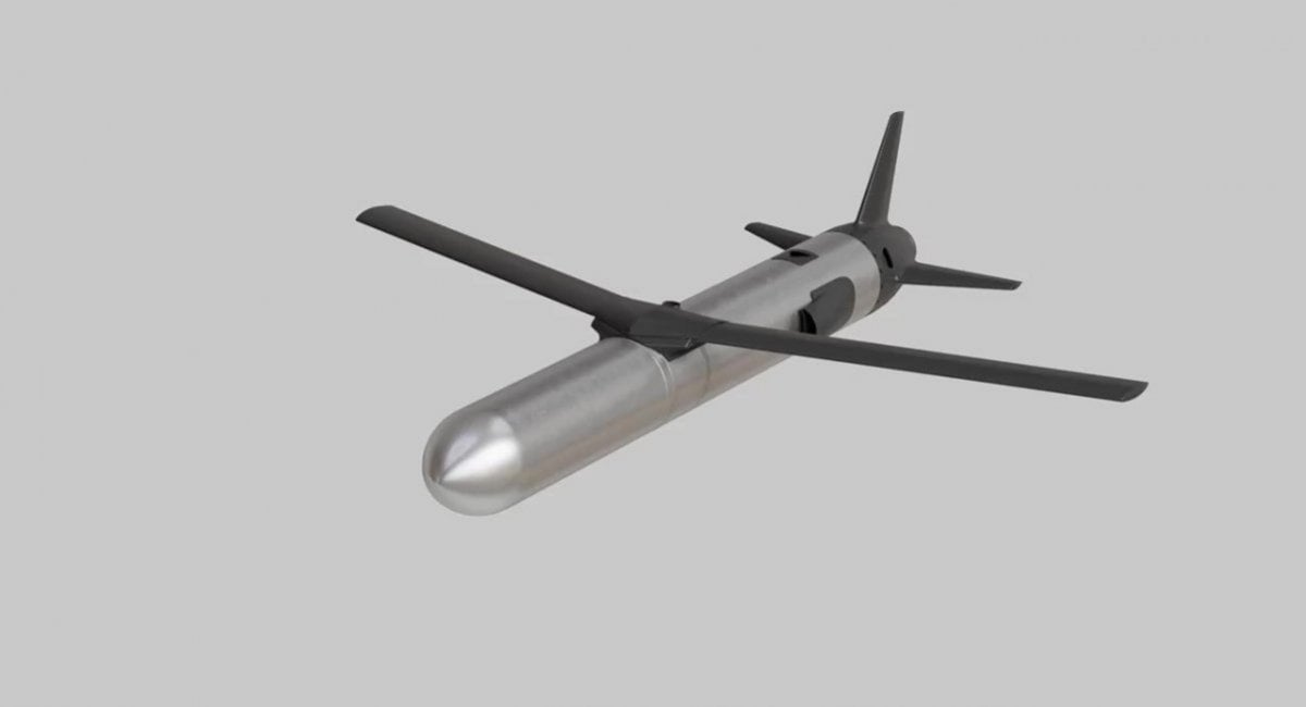
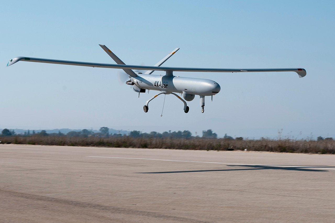
    When the Watchkeeper program took shape in 2004, developing a custom platform was essentially the only way for the UK to obtain a medium-altitude ISTAR intelligence, surveillance, target acquisition and reconnaissance (ISTAR) drone tailored to its requirements. The Ministry of Defence identified Israel-based Elbit Systems, which produced the Hermes 450 military drone, as a close match. The program was built around an extensively modified version of that aircraft, with the goal of bringing production to the UK

    Hermes 450 (Photo: Nehemia Gershuni-Aylho)
    Hermes 450 (Photo: Nehemia Gershuni-Aylho)
    Watchkeeper-X export version (Photo: U-tacS)
    Watchkeeper-X export version (Photo: U-tacS)

    In 2005, the U.K. Ministry of Defence awarded a £775 million contract to U-TacS, a joint venture between Thales UK and Elbit Systems, for the design, manufacture and support of 54 Watchkeeper WK-450 drones. The modifications involved making the UAV all-weather capable, including Thales integrated radar/GPS system for automated landing and take-off (Magic-ATOLS), Thales MASTER SAR/GMTI radar, dual electro-optical/IR cameras, laser designator, and tweaks to the Line-of-Sight radio system, with a satellite link option. Nevertheless, the range of the radio limits operation to within less than 100 miles of the mobile base-station, but it did provide a high-bandwidth, secure, direct, unobstructed wireless link for control and real-time video and targeting data back from the vehicle.

    Cost overruns and delays pushed the first flight to 2008 in Israel. Production of the WK-450 was then established at Thales UK, formerly Racal Electronics. The technology transfer between the two companies, separated by more than 2,000 miles, operating across different corporate cultures and exchanging proprietary material, proved more difficult and time-consuming than anticipated.

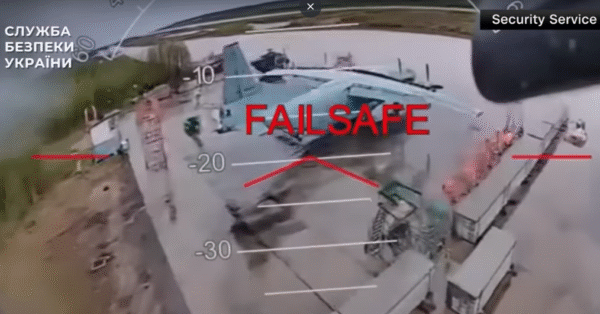
    The program delivered its first aircraft in 2014. Four drone systems flew in Afghanistan during the British troop withdrawal, logging a total of just 140 flight hours. Performance fell short of expectations, particularly the system’s all-weather capability, which proved inadequate in Afghan conditions. The U.S. military encountered similar challenges with sand contamination of helicopters and fixed-wing aircraft during early operations in Iraq and Afghanistan.

    As time rolled by, Watchkeeper found some use in Cyprus and in the UK, mostly for training, but problems continued. Between 2014 and 2022 eight vehicles crashed, and most have presumably been written off. Others have apparently experienced unplanned ‘contact with ground’ in more recent times. Faith in the now pretty old drone system has waned with the British forces — even recent political pressure to hand over the remaining fleet to Ukraine has been rebuffed by the Army — maybe too many problems with which to coach Ukraine troops. Watchkeeper is apparently now dismantled for the UK, along with the whole £1 billion investment. But not without gaining a lot of knowledge and operational experience, however an expensive lesson none the less.

    The UK has operated MQ-9A Reapers in Afghanistan, Iraq and Syria for more than 18 years, but after the Royal Air Force’s success with this US drone, these too have been retired in favor of the new MQ-9B Protector. The Protector has been customized and brought up to civilian certification standards by the manufacturer General Atomics. There have been similar sad programs with many ground, marine, and air projects around the world, but this has been such a visible and unhappy tale, it’s sad to see it end, but it’s probably a good thing so that other newer, more promising projects can get funding and become successful.

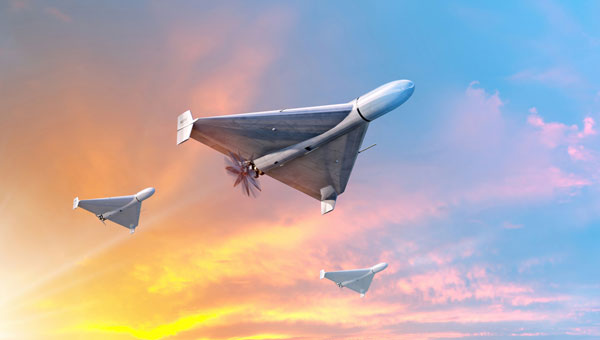
    Almost in the same breath, another UK company has already been supplying unmanned cargo aircraft to Ukrainian forces for more than three years. Windracer ULTRA is a twin-prop aircraft that can lift 330 lb for up to 620 miles, with 10 hours of endurance at a ceiling of up to 13,000ft. A newer version can reportedly travel twice as far with more payload.

    In Ukraine, the drone has been supplying front-line troop emplacements on a regular basis. The UK has been using ULTRA for surveillance and parachute drop re-supply, middle-mile parcel and cargo delivery to remote destinations, and for aerial surveys in Antarctica and elsewhere.

    So, a commercial start-up got there on its own, no direct government funding other than contracted support, and apparently no JV with another company!  So does 100% government funded development work better than setting up on your own, borrowing a bunch of cash, and doing it yourself? Mil-spec stuff is special with a limited market, so it’s unlikely that governments will ever be able to pick up finished products that fulfil all needs, but as the U.S. is proving with its bulk buy of off-the-shelf small one-way UAVs, these can meet many requirements.

  • Safe Pro unveils new algorithms for GPS-denied drone operations for U.S. Army

    Safe Pro unveils new algorithms for GPS-denied drone operations for U.S. Army

    The latest generation of Safe Pro’s AI technology will be presented at U.S. Army exercise at Fort Hood, Texas

    Safe Pro Group, a developer of artificial intelligence (AI)-enabled defense and security solutions,  has deployed upgraded AI algorithms to its patented Safe Pro Object Threat Detection (SPOTD) technology for drone operations in GPS-denied environments.

    The newly enhanced SPOTD capabilities will be prominently featured at the upcoming U.S. Army 2026 Concept Focused Warfighter Experiment (CFWE) technology demonstration taking place at Fort Hood, Texas.

    Operating on the Amazon Web Services (AWS) Cloud or at the Edge, SPOTD is Safe Pro’s patented rapid battlefield image analysis platform designed to identify and map small explosive threats such as landmines and ambush drones detected in videos collected from virtually any drone.

    The ability for SPOTD to rapidly detect threats and create 2D/3D models from drones flying in GPS-denied environments was developed after real-world exercises in Ukraine at the request of end users. The integration of these new algorithms further enhances the value of SPOTD as a situational awareness tool for use in a wide array of military reconnaissance and planning operations.

    SPOTD enhancements include:

    • Ability to process any drone video data: Turning video clips into 2D and 3D models with AI-trained explosive threat detections
    • Enhanced operational robustness: Operating capability in GPS and GPS/GNSS denied environments
    • Terrain modeling: Threat and terrain mapping in support of unmanned ground vehicles (UGVs) route planning
    • Rapid mapping-only mode: Mapping for intelligence, surveillance and reconnaissance (ISR) and missions that do not require AI-powered threat detections
    • Accelerated processing: Up to 10x reduction in processing time powered by Safe Pro’s proprietary geospatial AI algorithms.

    Powering the company’s SPOTD technology is Safe Pro’s unique real-world datasets, which include high-resolution drone imagery and GPS-tagged geospatial data encompassing more than 2.2 million drone images analyzed to date, and 41,400+ threats identified across 11,400 hectares (28,000+ acres).

  • NASA preps Mars helicopter as war shapes defense tech future

    NASA preps Mars helicopter as war shapes defense tech future

    It’s always good news when we hear about NASA’s “out-of-this-world” next steps toward building a replacement for Ingenuity, the small Mars helicopter-drone. With 72 flights over 1,004 days, Ingenuity outlived NASA’s expectation of just 30 operational days on Mars. It ended up serving as a trailblazer for the SUV-sized Perseverance rover as it worked its way around Jezero Crater. Built with a large number of smartphone components, it’s actually amazing that this thing survived for so long, given the radiation environment on the surface of Mars, along with the harsh temperature extremes of daytime 32°F to nighttime minus 130°F. How a Samsung S5 phone battery survived, operating so far outside its design temperature range, is hard to fathom.

    NASA’s 20-year plan for future Mars exploration now looks to take advantage of the huge expansion of the envelope for exploration that the small 30-day Mars helicopter brought to the Perseverance mission: “Enhanced mobility systems will enable exploration of challenging terrains and increased operational range. Aerial mobility technologies will facilitate access to previously unreachable areas on Mars.”

    NASA drone flies over ‘Mars Hill’ in Death Valley during recent navigation tests (Photo: NASA/JPL)
    NASA drone flies over Mars Hill in Death Valley during recent navigation tests. (Photo: NASA/JPL)

    So now NASA is working on the next Mars rover mission and on improvements for its accompanying airborne support. A team recently took three commercial drones into Death Valley to work on overcoming navigation problems that Ingenuity encountered on Mars flying over “bland” terrain with few visual features for its optical navigation system. Sand dunes without features on Mars messed with Ingenuity’s navigation solution, including on its 72nd flight.

    Death Valley and Mesquite Flats Sand Dunes were two places the NASA team visited to test improved navigation algorithms installed on existing commercial drones, and they found some improvements by adding camera filters. The new software helped find landing spots in cluttered terrain.

    But now new initiatives are seeking ways to get crewed flights to Mars in the next couple of years, well ahead of NASA’s timetable, which doesn’t move to anything crewed until around 2030. NASA still seems to prefer to pursue landers to gather much more data on Mars before risking crewed flights. Robotic dogs are also being investigated that can traverse rugged uphill areas that landers cannot access, as well as a winged glider the size of a small school bus.


    Meanwhile, the never-ending Russia-Ukraine war rages on, dominated by drone attacks from both sides. Russia is increasingly using Iranian Shahed or the equivalent Russian-produced Geran-2 one-way drones, while Ukraine intercepts them with low-end modified commercial drones. This stalemate has $20,000 Geran-2 drones being brought down by high-speed interceptor drones built for $2,000 to $6,000 — in other words, the cost of attrition might determine the victor.

    Russian Geran-3 jet-powered drone downed by Ukraine. (Photo: DIU)
    Russian Geran-3 jet-powered drone downed by Ukraine. (Photo: DIU)

    However, Russia has now introduced a jet-powered Geran-3 model that flies at up to 230 mph, which Ukraine has apparently been able to bring down.

    As we well know, Ukraine not only regularly receives Western military equipment but also civilian drones in large numbers. But an industrial capability has also been created in Ukraine to design, develop and build high volumes of drones. So it’s not surprising that Ukraine has revealed its own interceptor drone known as Sting.

    STING interceptor drone and imagery striking a Shahed drone. (Photo: Wild Hornets Group)
    STING interceptor drone and imagery striking a Shahed drone. (Photo: Wild Hornets Group)

    Nevertheless, Sting has four rotor props and should be no match for a Geran-3 flying at top speed, even though Sting is claimed to be capable of 215 mph. The Russian jet-powered drone also apparently comes with anti-jam capabilities and a satellite navigation system, but Russia has yet to field these new drones in large numbers. Of course, Ukraine says it has already developed jet-powered interceptor drones — so the step up to the next level of technology should happen for both sides, but of course, costs increase for both sides, which neither can really afford.


    Defense has always affected the speed of development for any technology — government funding and oversight are major incentives for new companies to emerge and for new technologies to be developed. Anduril Industries has recently emerged as a new entrant to the U.S. industrial defense complex, specializing in autonomous systems. Anduril’s products include unmanned aircraft systems and counter-UAS, and they have made big strides in both areas.

    Anduril is a relatively new company, initially founded in 2017, so its products are fresh off the drawing board and its product improvement experience is at best eight years. The big U.S. defense contractors have fielded and corrected decades of problems in their high-tech systems, so new generations come with hard-learned design and build understanding. The advantage for Anduril is that they are not bound by the restrictions of a long-established industrial heritage, but this can also mean they may still have a way to go in learned experience.

    Nevertheless, in high technology, much is new technology and new software and new approaches to build. So it takes effort to not only make this stuff work but also to make it work reliably.

    Altius — 33lb warhead attack drone. (Photo: Anduril)
    Altius — 33lb warhead attack drone. (Photo: Anduril)

    Anduril builds lots of test articles and rapidly evolves the design through rigorous internal and real-world testing. So it’s not uncommon to see test failures — this is how improvements are developed.

    Recent U.S. defense tests that saw crashes at Eglin Air Force Base in Florida drew a lot of bad press, given that the Altius drone had already been battle-tested in Ukraine. However, if the approach of lower cost, high volume and attritable drones is the one we have chosen, it may take a little more time to get maturity into the beast.


    Navigation testing for NASA’s next Mars drone, jet-powered attack drones, and evolving interceptor defenses and drones from a new player on the U.S. defense scene — a pretty wide range of unmanned aircraft applications.

  • UK identifies issues in addressing PNT resilience

    UK identifies issues in addressing PNT resilience

    The United Kingdom has issued a summary of input it requested on positioning, navigation and timing (PNT) technologies. The UK deems PNT resilience critical for the UK’s economy.

    The 2023 Government Policy Framework for Greater PNT Resilience included an action to “develop a PNT growth policy, including R&D programmes, standards and testing, to drive innovation for PNT based productivity.”

    After a call for evidence, the UK Department for Science, Innovation & Technology received 128 responses from business, industry, academics and the public. These views on opportunities and challenges for the UK’s PNT industry are gathered in a document available online.

    Key themes identified

    • A viable market exists for GNSS-independent PNT, with respondents citing applications in defense and critical infrastructure.
    • Awareness of GNSS vulnerabilities in end users and critical infrastructure sectors is low.
    • Potential opportunities in GNSS-independent PNT and other technologies include eLoran, LEO-PNT, 5G, quantum PNT, inertial systems, and applications for GNSS-denied environments.
    • Short-term challenges include funding constraints and a lack of legislation and standards.
    • Long-term challenges include scalability, lack of sovereign manufacturing capability, and insufficient planning .
    • The industry is experiencing a skills shortage, especially in engineering, with a limited talent pipeline and lack of dedicated training opportunities.

    In all, 128 responses were received from businesses (sellers and users of PNT), academics, industry bodies and the public. Respondents could select multiple sectors when describing their background; the defense sector was selected most frequently (39 responses), followed by space (35 responses), aviation and drones (28 responses), maritime (28 responses) and communications (27 responses).

    Responses will be used, along with wider research, to inform future government policy interventions to support the UK PNT sector.

  • Plane carrying EU president hit by alleged Russian GPS jamming

    Plane carrying EU president hit by alleged Russian GPS jamming

    A plane carrying the European Commission President Ursula von der Leyen was targeted by GPS jamming while attempting to land at Plovdiv International Airport in Bulgaria on Aug. 31, according to a European Commission spokesperson.

    Bulgarian authorities suspect Russia was responsible for the interference, European Commission Deputy Chief Spokesperson Arianna Podestà told CNN.

    The Kremlin has denied the allegation. Spokesperson Dmitry Peskov told The Financial Times, which first reported the story, that the information was incorrect.

    The plane landed safely despite the GPS disruption, with pilots reportedly using paper maps to navigate, according to a source familiar with the situation.

    Von der Leyen was traveling as part of a seven-country tour of the European Union’s frontline states to rally support for Ukraine. The incident occurred as her charter flight approached the southern Bulgarian airport during her diplomatic mission to reinforce the bloc’s commitment to defending against Russian aggression.

    Podestà told CNN that the incident highlighted the urgency of von der Leyen’s current trip to frontline member states, where she has witnessed daily threats from Russia and its proxies. The spokesperson noted it remained unclear whether attackers specifically targeted the flight or if it was caught in broader GPS interference operations.

    Expert Insights: Searching for Resilience

    This latest incident comes amid a dramatic surge in GPS jamming and spoofing attacks across the region since Russia’s invasion of Ukraine, creating an increasingly challenging environment for critical navigation systems.

    European Commission President Ursula von der Leyen’s current tour through Poland, Bulgaria, Finland, Estonia, Lithuania, Latvia and Romania takes her directly through many of the continent’s GPS disruption hot spots. These nations have experienced some of the most severe interference with GNSS, making the timing of her defense-focused diplomatic mission particularly significant.

    According to GPS World Editorial Advisory Board Member Mitch Narins, the current crisis represents the culmination of concerns that have been raised for more than twenty years. “Concerns and warnings regarding interference to GNSS have been raised for over two decades,” Narins explains. “Despite these concerns, attempts to install and upgrade alternative or complementary PNT systems on the ground and in aircraft have failed and resulted solely in increased investment in satellites and their signals, all of which are extremely low-power by design and vulnerable to interference.”

    “Regrettably, the substantial financial resources required to fund these satellite projects have pushed for discontinuance of resilient ground-based alternatives and to consider them ‘cost offsets,’” he notes. The economic incentives have favored satellite constellation expansion over diversification, despite the vulnerabilities of space-based systems.

    When it comes to alternative options, Narins explains, “For the cost of building and launching a single GNSS medium-Earth orbit (MEO) satellite, one could fund the replacement or installation and operation of many resilient ground-based systems for many years.”

    The current approach to PNT systems represents a departure from fundamental systems engineering principles, according to Narins. “When initiating a customer need analysis, a systems engineer does not begin with the solution and work backwards,” he emphasizes.

    Instead, the focus should be on meeting actual requirements: PNT systems must “always” provide the accuracy, availability, integrity and continuity of services necessary to support safety, security and economic well-being across thousands of use cases spanning every critical infrastructure sector.

    “Therefore, resilience must be a critical part of a PNT system’s performance if it is to be considered a potential solution,” Narins said. Rather than pursuing interoperability between GNSS constellations — which still leaves users dependent on inherently weak satellite signals — the industry should have prioritized diverse solutions from the outset.

    He added, “This is not a simple problem with a single, simple solution, but it is time to start thinking about resilience first and leaving the identification of solutions to a proper system engineering process.”

    New Ways to Counter EW Threats

    The dangerous GPS jamming of the plane carrying carrying European Commission President Ursula von der Leyen can be alleviated with advanced technology, according to Michael Biercuk, CEO of Q-CTRL, developers of quantum-based navigation systems:

    “The incident regarding the European Commission President’s plane has raised GPS denial from inconvenience to a strategic security threat. This is why we’ve focused our quantum tech development efforts on building resilient quantum navigation systems truly immune to jamming and spoofing. This technology is not science fiction – it has been validated in flight to outperform the best existing GPS backups by up to 100X. Through our partnerships with Airbus, Lockheed Martin, and others we’re ready to help build resilience for European transport, defense and commerce.”

    Chris Shaw, CEO and co-founder of Advanced Navigation also spoke on the incident, commenting “The answers to the GPS crisis are already here,” said Chris Shaw, CEO and co-founder of Advanced Navigation, which specializes in anti-electronic warfare navigation technology. “The problem isn’t innovation, it’s stagnation. GPS alone can no longer be treated as a reliable source of truth. What’s needed is a resilient architecture — inertial-centered and fused with multiple sensors — that keeps systems operating even when signals are denied or manipulated.

    “The reality is that adversaries are moving at the speed of code, while government procurement still runs at the speed of bureaucracy. That gap is a national security risk. Unless governments adopt a new model of rapid integration and real-time collaboration with industry, they will continue to be outpaced.

    “This isn’t optional. Survivability in GPS-contested environments depends on prompt deployment of inertial navigation. The companies pushing this forward aren’t just keeping up, they’re rewriting the playbook — and the cost of delay is measured in mission failure and compromised sovereignty.

    “Ukraine has shown what’s possible. By demanding real-time software updates and rapid hardware upgrades in close collaboration with industry, its forces are reshaping autonomy, navigation, drone swarms and integrated defense systems at an unprecedented pace — allowing them to outpace adversaries.

    “So why aren’t we applying this model more broadly beyond the battlefield? The solutions exist, with inertial navigation at the core. The real question is whether we’ll act before the cost of delay becomes irreversible.”

    The GPS Collapse isn’t fiction — it’s a warning of what happens when action is delayed.

  • Parrot shows off Anafi UKR micro UAV for defense at Paris Air Show

    Parrot shows off Anafi UKR micro UAV for defense at Paris Air Show

    Parrot has unveiled the Anafi UKR (Ukraine) range of compact defense micro-UAV drones at the Paris Air Show. The micro-UAVs are built to meet the critical demands of field operations, from defense theaters to public safety missions.

    Developed for defense forces operating in high-threat environments, AnafiUKR brings together embedded AI, optical navigation, and full offline autonomy in a sub-1 kg format. Building on this foundation, Anafi UKR GOV adapts the platform’s capabilities to the needs of law enforcement, first responders and government agencies, ensuring the same level of resilience, tactical awareness, hardened cyber-resilience, and total data sovereignty.

    “ANAFI UKR was born from the urgent need to defend a nation’s sovereignty and freedom. We’ve taken what we learned in high-intensity, GNSS-denied conflict zones, where drones are jammed, spoofed, and hunted, and turned it into a platform that public agencies can rely on. It’s the most advanced micro-UAV we’ve ever built: sovereign, powerful, and radically easy to use. When national security and civil protection overlap, as they increasingly do, agencies need tools that don’t compromise. ANAFI UKR is our response: the best of tactical autonomy, delivered in a micro-UAV that combines intuitive operation with advanced tactical capabilities.”

    Henri Seydoux, founder and CEO of Parrot

    Anafi UKR GOV is based on Parrot’s defense-grade micro-UAV deployed by several European, North American and NATO allied forces since mid-2024. Designed to remain fully operational in GNSS-denied environments and hostile electromagnetic conditions, the system integrates advanced optical navigation, anti-spoofing with frequency hopping military radio, and hardened cybersecurity architecture , all tested in live electronic warfare scenarios.

    Anafi UKR and Anafi UKR GOV are both in full production and commercially available. Deliveries are ongoing to defense and institutional clients, and the systems are now open to order for all eligible public safety agencies, law enforcement units, and government users worldwide.

  • Russian jamming creates ‘Bermuda Triangle’ in Baltic

    Russian jamming creates ‘Bermuda Triangle’ in Baltic

    Russian jamming of GPS signals is suspected to be the cause behind a new “Bermuda Triangle” of navigation confusion in the eastern Baltic Sea.

    In the Gulf of Finland, ships are disappearing from radar and Russian fighter jets are traveling through NATO airspace, according to Danwatch, a Danish news outlet.

    Ship monitoring service MarineTraffic shows the position of ships in completely different places than their actual positions, currently on land east of coastal city Primorsk, Russia.

    Experts say that not only is GPS being disrupted, but hackers are also manipulating navigation data. They blame Russia for its hybrid activities and attacks, which it carries out both from its mainland territory and from the Kaliningrad enclave, located between Poland and Lithuania.

    Screenshot of MarineTraffic now shows boats traveling in a circle inland from the Baltic Sea.
    Screenshot of MarineTraffic taken June 4, 2025, shows ships traveling in a circle on land, well east of the Baltic Sea.

    Romania also has issues with Russian jamming and spoofing activities. The website Defense Romania quotes Gen. Gheorghiță Vlad, chief of the Romanian Defense Staff, who said jamming and spoofing has occurred on the Black Sea weekly since the start of Russia’s war with Ukraine. Also, Romanian defense forces have discovered 122 floating mines in the sea.

  • Drones at War: Ukraine’s bold attack shows future warfare era

    Drones at War: Ukraine’s bold attack shows future warfare era

    On June 1, 117 drones rose up from wooden boxes inside Russia and attacked bombers parked on runways at military bases. The attack — dubbed Operation Spider Web — startled the world with its audacity.

    Approximately 41 planes were struck at four military bases, including the Belaya Air Base in Siberia hundreds of miles from Ukraine’s borders. In all, the attack destroyed a third of the bombers Russia uses as strategic cruise-missile carriers to destroy targets in Ukraine.

    The drones were smuggled into Russia via commercial trucking transportation.

    According to an analysis by Michael C. Horowitz for the Council on Foreign Relations, the strikes “once again demonstrated Ukraine’s ability to be at the cutting edge of technology and tactics. Ukraine has consistently and successfully leveraged and integrated everything from old military technology and off-the-shelf commercial systems to artificial intelligence (AI) for its military operations. This has been a difference maker in the war since its early days, giving Ukraine new and unexpected vectors to attack Russian forces and territory.”

    The analysis, by Michael C. Horowitz, calls this a new era for warfare — the era of precise mass. “The combination of AI and autonomous weapons, precision guidance, and commercial manufacturing mean that low-cost precision strikes are now accessible to almost any state or militant group,” Horowitz writes.

    Horowitz described the era of precise mass in a feature in Foreign Affairs magazine, November/December 2024.

    The attack demonstrates that countries can be at risk to drone attacks even deep inside its borders, and precision strikes the capability of any actor. Low-cost off-the-shelf drones can be readily used, along with open-source autopilot software and AI code. Drones can supplement or even replace traditional artillery or expensive cruise missiles.

    Read the full analysis here.

  • Ukraine’s Ruta missile to get EW-immune navigation system

    Ukraine’s Ruta missile to get EW-immune navigation system

    The Ruta OWA drone — actively used by Ukrainian forces for strikes at ranges up to 300 km — is being improved with a new visual navigation system, tested in combat conditions.

    The Ruta, manufactured by Destinus, is essentially a miniature cruise missile. It is often referred to as a “missile drone.” It will receive a new navigation system enabling high-precision strikes in GPS-denied contested environments, especially those from enemy electronic warfare (EW) countermeasures.

    The new navigation and guidance system will be provided by Spanish company UAV Navigation, part of Grupo Oesía, which entered an agreement with the Ukrainian Destinus on May 13.

    The agreement will focus on Ruta in its first phase. Ruta is the first low-cost missile (LCM) drone developed by Destinus designed to operate in highly contested scenarios. The system incorporates an advanced guidance, navigation and control system, developed by UAV Navigation-Grupo Oesía, which has been validated in real-world combat conditions, including GNSS-denied environments or under jamming and spoofing attacks.

    Ruta offers autonomous flight capabilities, target-referenced navigation, terminal optical guidance, and coordinated swarm operations, enabling the execution of complex synchronized attack maneuvers to saturate or deceive defense systems. The platform flies at a cruising speed of Mach 0.8, has a range of up to 500 km, and a terminal impact accuracy of 15 square meters.

  • Zephr.xyz to enhance GNSS resilience for US military operations

    Zephr.xyz to enhance GNSS resilience for US military operations

    The Air Force Research Laboratory selected Zephr.xyz — a company specializing in augmented position, navigation and timing technologies — to receive a $1.74 million Small Business Innovation Research Direct-to-Phase II contract. Under the contract, Zephr.xyz aims to develop a system for real-time detection of GPS/GNSS jamming and spoofing in contested environments while also geolocating the sources of these attacks.

    The company’s Networked GNSS technology, which converts standard mobile phones into a high-fidelity GNSS receiver network, will undergo extensive testing in Ukraine and various U.S. military exercises. Following these trials, the system is set to be integrated with the Department of Defense’s Tactical Assault Kit and the Department of Homeland Security’s Team Awareness Kit.

    Zephr.xyz has conducted field research in conflict zones in Ukraine and Israel, revealing limitations in current GNSS interference detection and localization techniques. The company’s solution aims to address these challenges by leveraging distributed mobile devices to create a decentralized sensor network. This network collects raw GNSS measurements to identify electronic attack indicators, which are processed in real time for detection and classification.

    The technology also aims to enhance positioning accuracy on TAK devices by integrating GNSS measurements from multiple devices with Position, Velocity, Attitude and Timing data. Zephr.xyz plans to make its detection and classification capabilities available as a software development kit, enabling mobile applications to alert users and improve positioning accuracy in electronic warfare scenarios.

  • Is Russia behind new GPS interference in Bulgaria?

    Is Russia behind new GPS interference in Bulgaria?

    On Dec. 12, 2024, the European Union decided to include Bulgaria and Romania in the Schengen visa-free zone. On the same day, Bulgaria’s capital, Sofia, began experiencing interference with GPS signals. The interference, as reflected in aviation ADS-B systems and reported on GPSJam.org, continued through the new year and is ongoing as of this writing. 

    While these two events may be entirely unrelated, Vladimir Putin has a history of using GPS jamming and spoofing to show his displeasure with his neighbors growing closer to the West.

    • On Dec. 15, 2023, Poland activated a U.S. Aegis anti-missile system near its border with Kaliningrad, Russia. On the same day, Russia began jamming and spoofing GPS signals in northern Poland and parts of the Baltic. That interference persists to this day.

    The interference in Sofia may be contributing to a prolonged Bulgarian political crisis. Politicians there have been struggling to form a new government since elections in October. Dec. 10 saw the beginning of a new attempt. Interference with GPS can undermine overall confidence in government systems and institutions — another of Putin’s goals for neighbors with whom he is displeased.

    Another, though less likely, impact may be on Bulgaria’s electrical service. On Dec. 25, 2024, 20,000 households in western Bulgaria (Sofia is in the far west) lost electrical power and the outage continued for days. Many grid operators use GPS timing to help manage their systems. While press reports put the outages down to heavy snow and fallen trees, increased difficulty managing the grid might also be a factor.

    Bulgaria’s GPS interference appears to be coming from somewhere in Sofia, not from Russian territory, as is the case in the Baltic. Yet Russia may still be involved, at least in a supporting role.

    On Dec. 11, the news outlet Balken Insight reported on five Bulgarians being tried by the United Kingdom as Russian spies. It also said the Bulgarian interim prime minister was being urged to investigate alleged links between the case and top officials in Sofia.

    GPS interference in Sofia, Bulgaria, began on dec. 12, 2024, and has continued at varying intensities. (Photo: GPSJam.org)
    GPS interference in Sofia, Bulgaria, began on Dec. 12, 2024, and has continued at varying intensities. (Photo: GPSJam.org)
  • Recent advancements in unmanned systems

    Recent advancements in unmanned systems

    Unmanned surface vessels (USVs) are becoming a reality for many sea-going countries around the world. Belgium and The Netherlands have partnered to acquire a proven autonomous mine-clearing solution supplied by Exail Technologies in Paris, France.

    A nearly $60 million contract awarded in July 2024 by NATO will allow Exail to deliver several hundred K-STER underwater vessels, which can find and destroy both floating and anchored mines.

    Equipped with a shaped charge, the unmanned underwater vehicle (UUV) is launched from a safe distance by a minesweeping ship, currently undergoing sea trials – the Oostende new generation minesweeper. Similar to the Kamikaze aerial drone, it autonomously seeks out a mine at a predetermined location and destroys it.

    Photo:
    K-STER UUV encounters. (Photo: Exail)

    Meanwhile, as the war in Ukraine continues, drone warfare continues to evolve. Ukraine has developed electronic warfare systems that have progressed from merely jamming control signals and GNSS navigation to actually spoofing GNSS guidance. These systems overcome direct satellite signals with a stronger signal, providing gradually changing guidance to the drone, ultimately steering it back toward Russian-friendly Belarus.

    Several recent intense Russian drone attacks were with tens — and even hundreds — of Iranian Shahed attack dones. 151 were spotted in November alone, 148 of which were Shahid drones that carry an 88 lb explosive warhead. On November 26, the Ukrainian Air Force reported that Russia attacked with 188 Shahed drones along with a few Iskander-M ballistic missiles. Ukraine responded with aircraft, helicopters, shells fired from fixed ground installations, and signals designed to jam drone electronics and guidance systems. Around 80 attacking drones succumbed to these Ukrainian defenses.

    In addition, electronic GNSS spoofing of more than 90 drones diverted them from their targets – this implies a widespread array of electronic resources that intercepted in-flight drones coming from Russia. Diverted from their planned tracks to their targets, these drones will crash when they eventually run out of fuel. In a large number of cases, the ground defense systems were able to steer the attackers toward Russian-friendly Belarus, where they also crashed when fuel was exhausted. So perhaps less than 50% of this specific attack resulted in the use of precious Ukrainian ordinance, a good sign for future defense capabilities.

    Meanwhile, on the other side of the “Pond” (Atlantic Ocean), British and U.S. forces at bases in Southern England have been dealing with an uninvited invasion of overflying drones, somewhat similar to reported incursions over airforce bases (AFB) in the U.S., such as Langley AFB.

    RAF Lakenheath is a joint UK/US base used by the US 48th Fighter Wing and is thought to also house NATO’s nuclear weapons – this base is one of four that is thought to have been harassed by drone overflights. Other UK bases which now also have heightened security include RAF Lakenheath, RAF Mildenhall, and RAF Feltwell in the Southeast and RAF Fairford in Southwest England. We might speculate that the drones could be collecting Video and maybe Lidar information on assets on the ground, but surely this has already been gained by spy satellites belonging to Russia and China, the principal suspects for these incursions — so what exactly could be the intent?

    The incursions were happening at the same time that Ukraine was using UK Storm Shadow missiles against Russia. Some speculate that this might be a demonstration of capability by Russia, indicating an ability to quickly, without any opposition, gather a number of drones and fly them over UK NATO bases. Whilst unarmed for this demonstration, in the future, they could wreak havoc on aircraft and personnel. A number of criminal investigations are apparently underway to determine who was responsible.